Southeast Alaska
Through Southeast Alaska by Ferry
Of all my travel pages, this one describes the earliest trip,
to Southeast Alaska in 1993.
A friend and I each had a voucher from Northwest Airlines.
This was after they were no longer Northwest Orient,
but well before they were purchased by Delta.
The vouchers were each good for a return flight to any
Northwest destination in North America.
Fairbanks would have been the longest possible trip,
but Juneau, the second-farthest, seemed more interesting.
We could even break the outbound trip at Seattle,
pick up a rental car, and drive to my aunt's place in
east Oregon for several days, before returning to our
northward trek.
Our casual planning told us that Juneau's airport is quite
close to downtown, and a national forest campground at the
Mendenhall Glacier is quite close to the airport and
downtown.
Well, more or less.
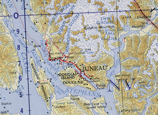
Portion of map NO-7-8 from the Perry Castañeda Library Map Collection at the University of Texas.
the Equinox
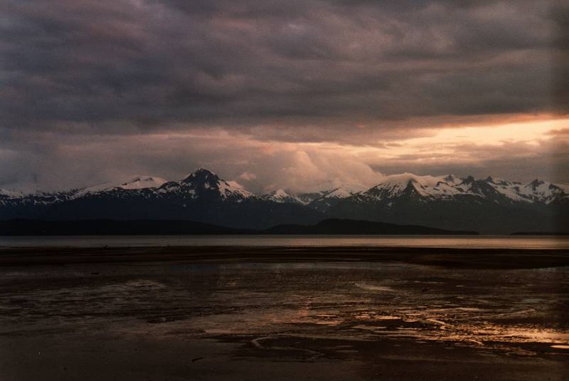
As I found on my return to Alaska, people there can be rather casual about distances. But it is possible to fly into the Juneau airport and walk to the National Forest campground at the Mendenhall Glacier. It's a little over 4 miles or 6.5 kilometers from the airport to the campground. And, 8 miles or 13 kilometers from the airport to central Juneau.
Juneau is a small city, with just about 32,000 people, versus Fairbanks with 31,000 and "Los Anchorage" with 288,000, almost 40% of the state's population. The Fairbanks airport has one 8,860-foot runway, plus a parallel seaplane landing area on the Gastineau Channel.
The Tlingit people originally called the glacier Sitaantaago (or "the Glacier behind the Town"), and Aak'wtaaksit (or "the Glacier Behind the Little Lake"). The first of those tells us that, yes, it is just behind the town. But the Tlingit town. Downtown Juneau is about twelve miles southeast.
Well, one of many good things about Alaska is that hitchhiking is common — safe and supported by the locals.
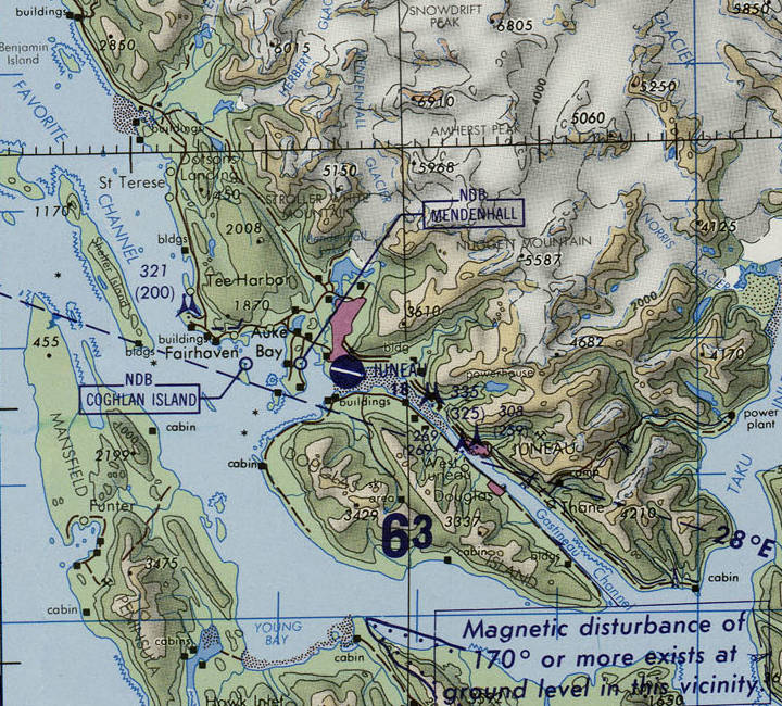
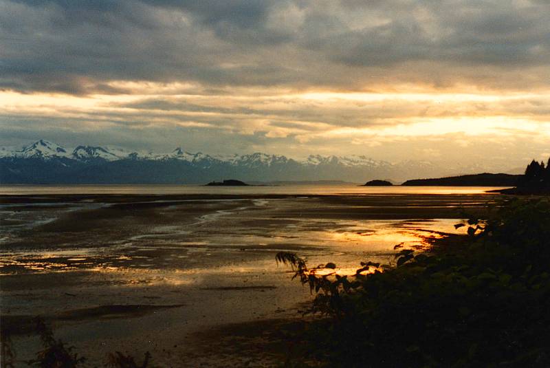
Downtown Juneau, the state capital and the businesses, is well southeast of the airport, along the Gastineau Channel between the mainland and Douglas Island. The large purple area between the airport and the lake at the base of the glacier is part of the municipality of Juneau, but it's a residential area, not densely settled. Portion of map TPC D-12D from the Perry Castañeda Library Map Collection at the University of Texas.
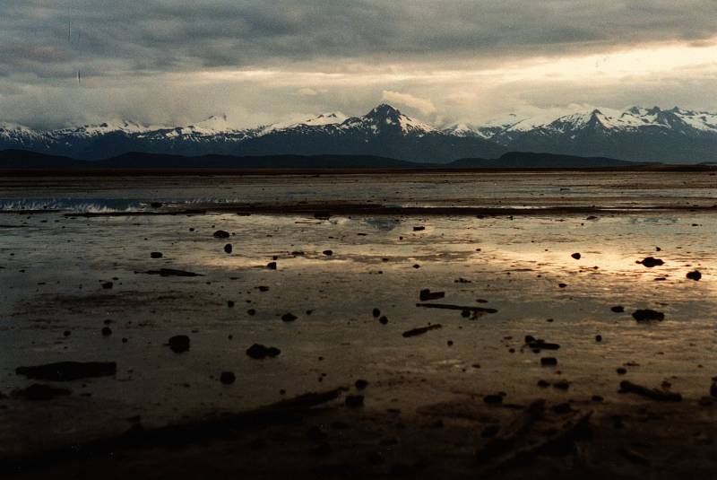
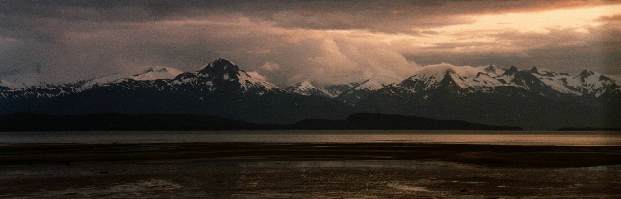
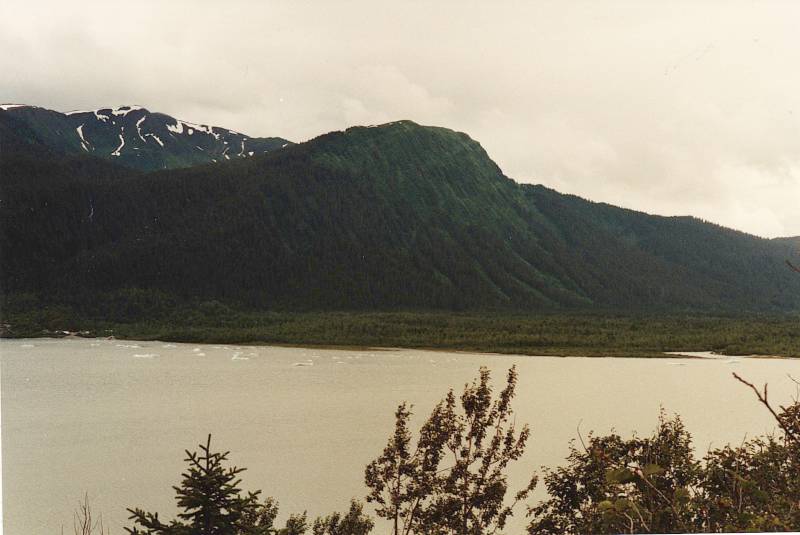
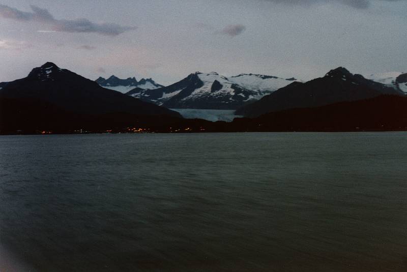
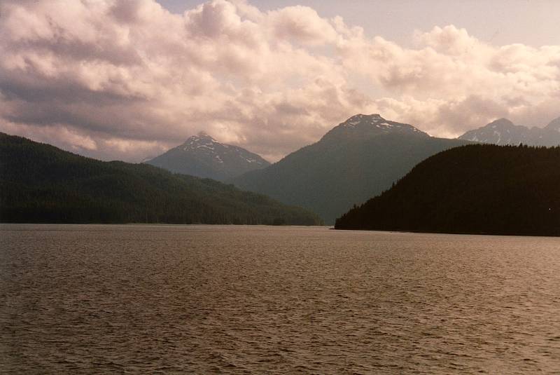
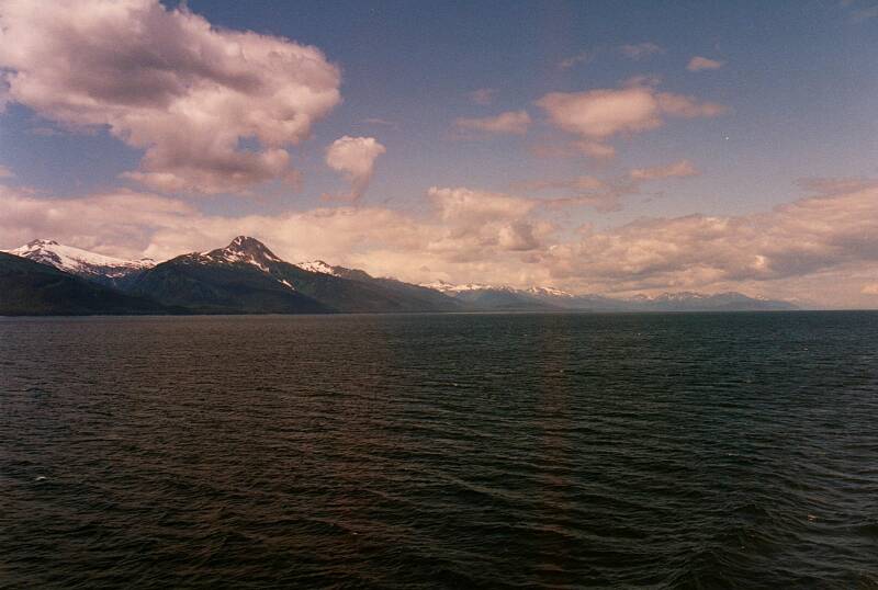
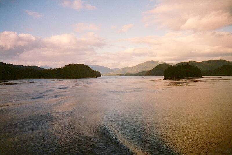
Lynn Canal is a channel leading inland from the ocean. It is the largest and deepest fjord in North America outside Greenland, about 140 kilometers long and over 600 meters deep.
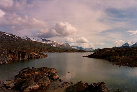
Lynn Canal is divided into channels by large islands. Here we're looking over the Favorite Channel and a low-lying island and the rest of Lynn Canal to the Chilkat Range.
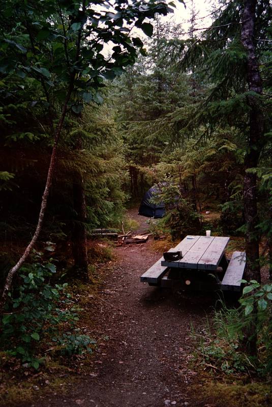
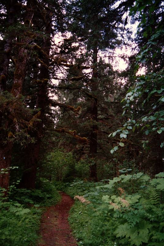
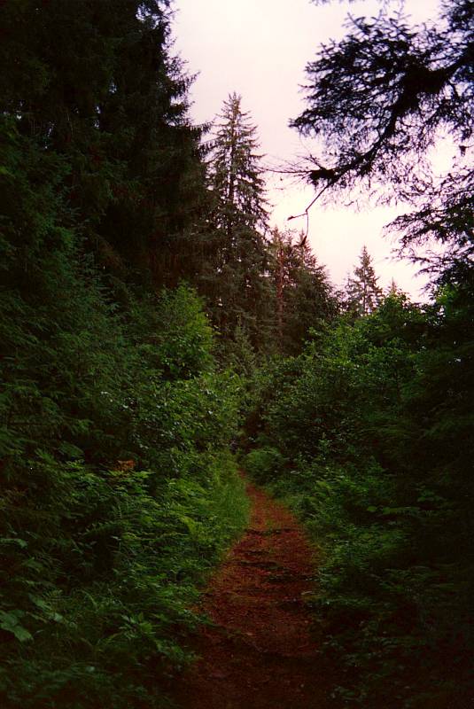
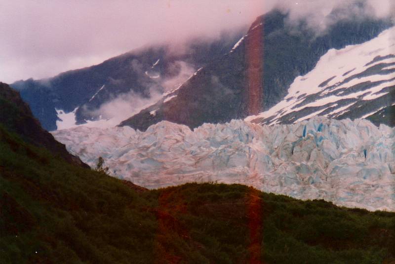
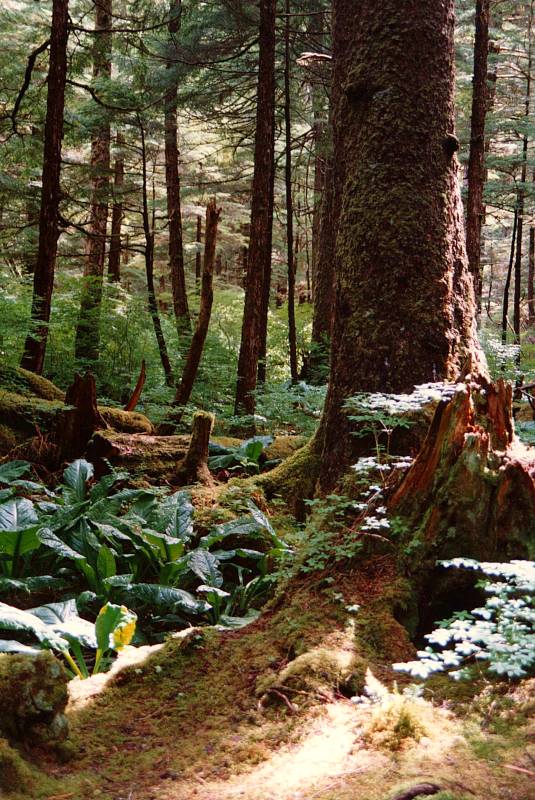
We camped at the Mendenhall Campgrounds. It's part of the Tongass National Forest system, was created by Theodore Roosevelt. The Tongass is a temperate rain forest which covering some 68,000 km2 including most of Southeast Alaska.
Paths lead up to the Mendenhall Glacier.
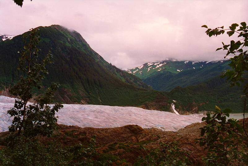
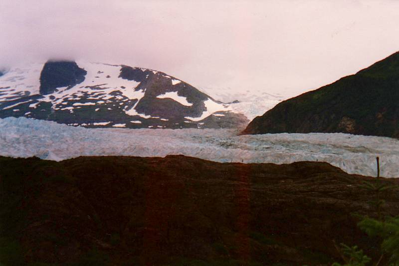
The Mendenhall Glacier flows down out of the Juneau Icefield, the fifth largest icefield in North America.
Fishing
We had taken collapsible fishing poles, and went out the next day to a sporting goods store to buy fishing licenses. And, fishing maps.
The regulations are complex, as to who — Native people, Alaskan residents, and visitors — can take which species from which bodies of water. It's especially complicated for salmon, as they usually return to the stream where they were born, or at least one very close. The rules restrict who can take which salmon species within so many feet of the mouth of each stream. So, you need a map showing which salmon streams are which.
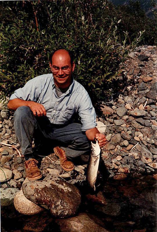
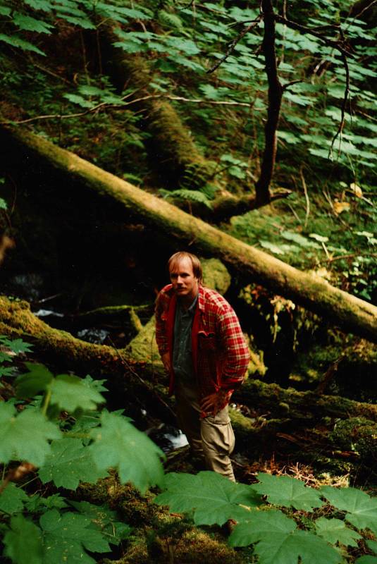
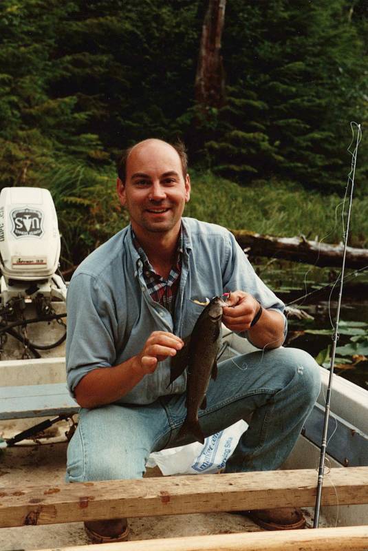
Here my friend John has caught a trout or similar.
The Salmonidae, Latin for salmon-ish, are a family of fish that includes salmon, trout, char, and others. They're predators, feeding on insects, small crustaceans, and smaller fish.
That's lacustrine, fluvial, potamodromous, and anadromous, respectively, for the ichthyology enthusiasts.
The Salmonidae differ widely in habitat and reproductive strategy. Some live entirely in lakes, other entirely in streams. Some live most of their lives in lakes, but spawn in streams. Most of the salmon species spawn in freshwater streams, but live much of their lives in the ocean.
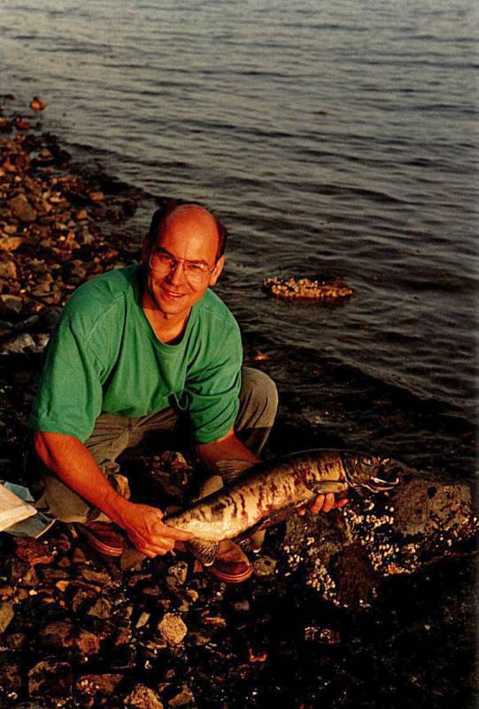
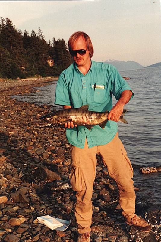
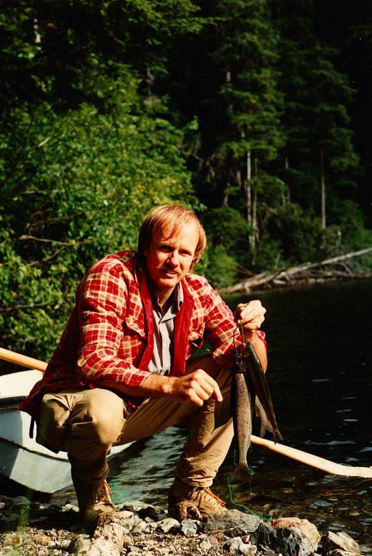
Toward the end of the trip we were back in the Juneau area. Here, John has caught a salmon.
It was man against beast. Cagey placement of a carefully selected fly to entice a fish obsessed with finding the stream where it was spawned.
I also caught a salmon. This one had almost beached itself, weakly trying to swim through too-shallow water. I was casting the lure just past it, then dragging it across the salmon's barely awash head and back. It paid no attention.
I noticed a gash. It seemed to have taken a propeller strike to the head.
I became frustrated and simply dropped my rod, jumped in, and grabbed the salmon. John ran up the shoreline to ask a ranger if my unorthodox capture, which I was holding underwater, was allowed. He pointed back to me, explaining that we were uncertain of the precise species, and I had a non-resident fishing license. Oh, and I had grabbed it by hand.
"Um, yeah, put it on your daily catch list."
And thus was born the legend of Salmon Hand.
Among the Tlingit, no other food resource is as revered as salmon. However, eating nothing but "beach food" is considered a contemptable sign of poverty among the Tlingit. A Tlingit shaman or ixht' and his family was required to avoid eating any food gathered from the beach. Tlingit men would avoid eating beach food before battles or other strenuous activities in the belief that it would weaken them spiritually and perhaps even physically.
So, at the time, I didn't advertise how I caught that salmon.
Salmon eggs hatch in the high latitude freshwater streams. The young fish stay for six months to three years in those streams. Those still surviving, about 10% of the hatched fry, then migrate downstream to the ocean. Their body chemistry changes as they move from fresh to brackish water and on to the salt water of the ocean.
After one to five years in the open ocean, they return to their birth streams. They undergo more physical changes on the way back, darkening from their light silver color and possibly growing a hump or changing the shape of their mouth.
They all die within a few days or weeks of spawning.
To Juneau, for the Ferry to Sitka
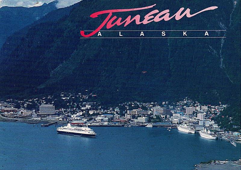
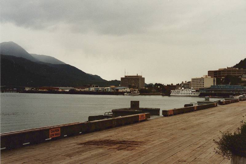
We got a ride to downtown Juneau, to find a ferry to Sitka. Here's a postcard view. Downtown is on a narrow shore between steep 1100–1200 meter mountains and the Gastineau Channel.
Roads run north and south along the shore from Juneau, dead-ending after several miles in both directions. There is no road connection to anywhere else. There have been plans to extend the road another 51 miles to the north, where it would be a shorter ferry trip to Haines and Skagway and connections to the North American highway network. Estimated costs for that extension have risen from $350 million in 2007 to $491 million more recently, over $15,340 per Juneau citizen.
The city's power comes from a hydroelectric plant 45 kilometers to the south, accessible only by boat or seaplane. The plant is driven by water flowing down from two lakes up in the mountains, tapped from the bottom of their beds. There is no connection out to an external grid.
A postcard looking the other way shows the bridge across the narrow Gastineau Channel to Douglas Island.
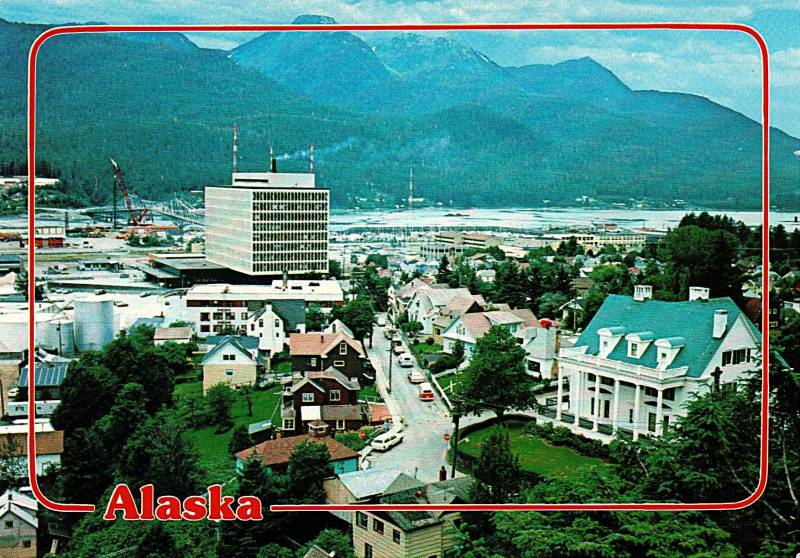
The A'akw Kwáan and Taku tribes lived here along the Gastineau Channel for thousands of years. The Russians did not settle here, but some Tlingit arranged for an Orthodox priest to come in the mid 1800s.
A gold mining village was established in 1880, and it slowly grew. The current economy is based mostly on government first, tourism second.
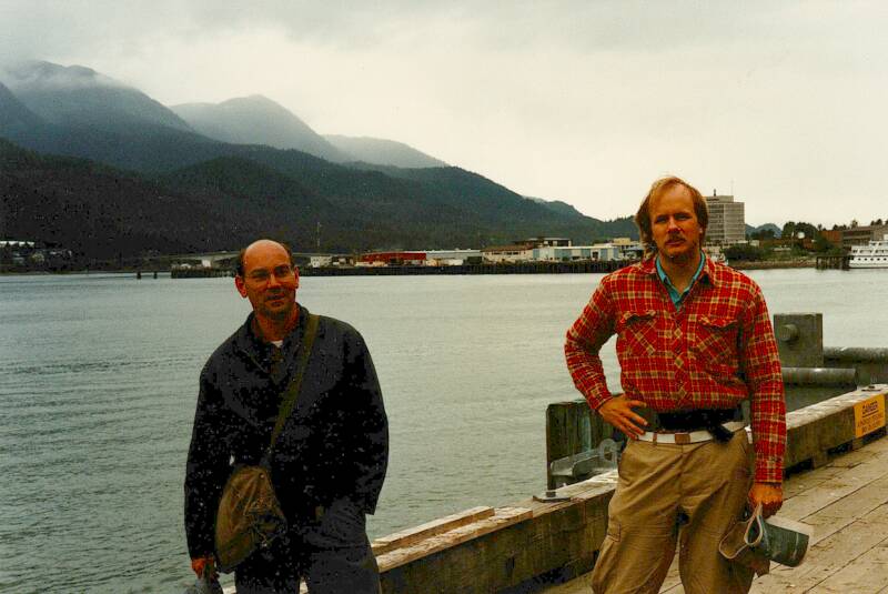
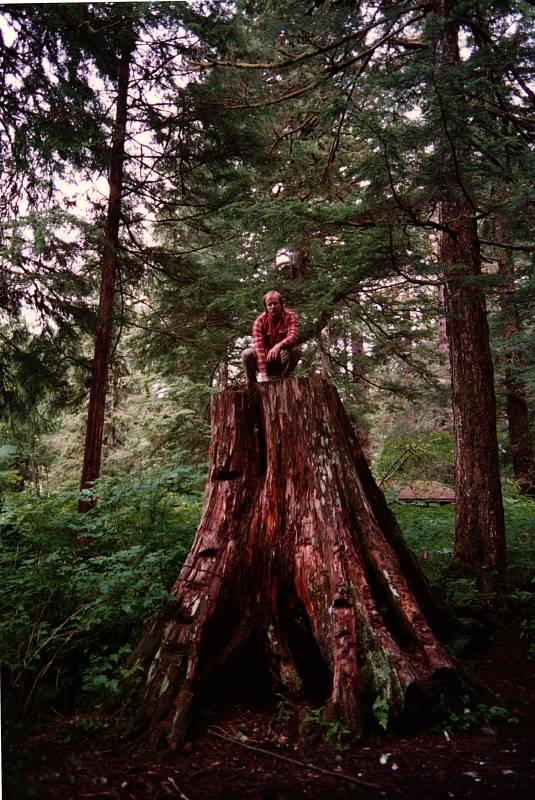
Here we are at the dock in Juneau, John on the left and me on the right.
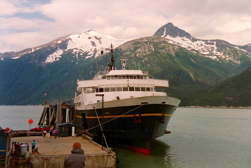
By Ferry to Sitka
The Alaska Marine Highway System connects the communities of Southeast Alaska, with a link south to Bellingham, Washington. Another segment in the west connects the Alaska Peninsula to the first few Aleutian Islands.
The Chilkoot Motorship Lines was founded in 1948 in Haines, using a converted LCT Mk6. That is, version six of a series of Landing Craft, Tank designs, an amphibious assault craft used to land tanks on beachheads. The Mk6 was built in 1943 and 1944 for Allied service in World War II.
The Alaska territorial government bought the Chilkoot Motorship Lines in 1951. re-christening the original LCT as the M/V Chilkoot.
The Alaska Marine Highway System or AMHS was established in 1959 after Alaska became a state. It now operates 3,500 miles of routes through 32 terminals, from as far south as Bellingham, Washington, to as far west as Dutch Harbor at Unalaska in the Aleutian Islands. The ferry system is part of the U.S. Federal Highway System.
While some people prefer to travel Southeast Alaska by ferry, many boaters purchase trawler yachts for sale and cruise the entire coast. Trawlers offer the kind of durability and interior accommodations needed to cruise in Alaskan waters.
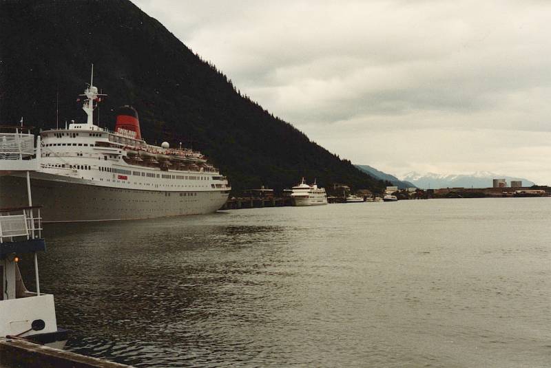
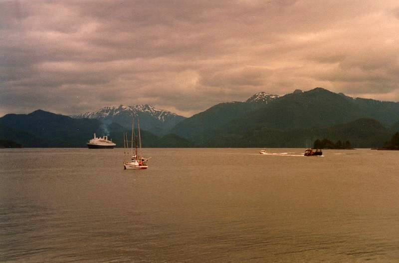
Below is the M/V Taku, built in 1963. It was a mainline ferry, serving the larger communities on the Inside Passage. It was the largest of the three AMHS vessels that could serve the communities of Hoonah and Kake.
M/V Taku — 107 meters in length with a 22.5 meter beam, able to carry 69 vehicles and 370 passengers. Its two diesel engines could move it at 16.5 knots
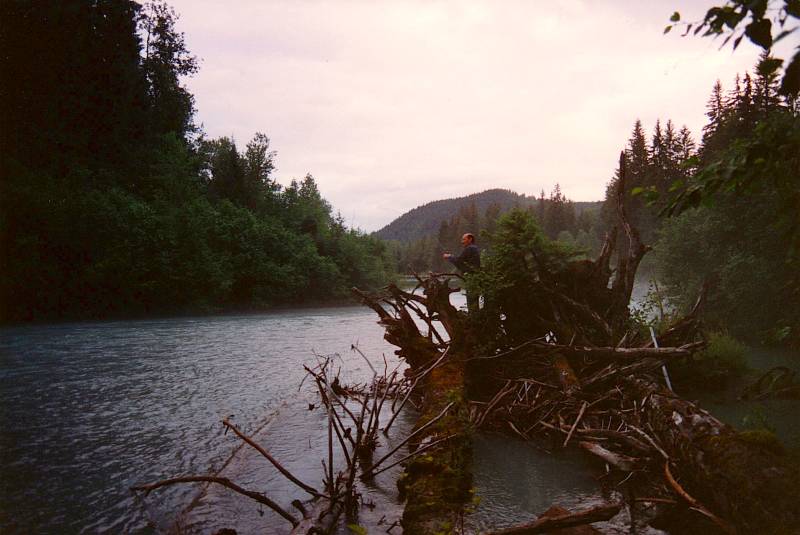
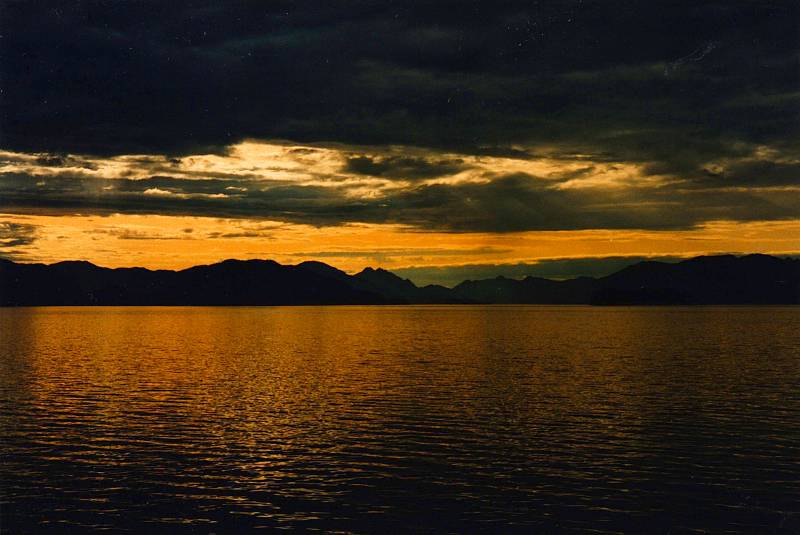
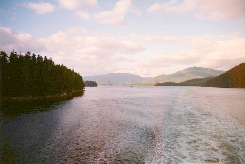
We just spread out bedding and camped on the deck. Below, we're passing the north end of Juneau, where the airport is. Beyond that, the Mendenhall Glacier flows down from the Juneau Icefield extending through the border into British Columbia. We were there in early July, near the Summer Solstice, so it never got completely dark.
Russian America
Russian explorers in 1732 were the first Europeans to see the coast of Alaska. Ivan Fedorov led that expedition along the Bering Strait where the Asian and Alaskan coasts are the closest. In 1741 Vitus Bering and Aleksei Chirikov led an expedition that landed in southern Alaska in 1741. There were legends that a Russian expedition in 1648 had been carried across the straight to Alaska. But in 1725 there was still a debate over whether Siberia and North America were connected, and Tsar Peter I called for what became the 1732 expedition.
Fire and Feces:Traces of Beringia
in today's Alaska
Of course, as early as 32,000 years ago people had simply walking from Asia to Alaska through Beringia, the broad land bridge exposed when sea levels dropped.
So, the Russians of the mid 18th century CE were the second wave of Eurasians to Alaska.
Orkney IslandsEuropean empires usually had state sponsored exploration and territorial settlement. Britain had the Hudson's Bay Company, a trading company based in a house-sized structure in the Orkney Islands north of Scotland. The British crown gave the company control over a vast area of North America, making it the de facto government over all the territory draining into Hudson's Bay, much of today's Canada.
Oddly, Russia did not — Imperial Russia's purely capitalistic expeditions and trading companies found, settled (very lightly), and exploited Alaska, which eventually became the most socialistic part of the U.S. For some reason many people think it's the complete opposite.
Amazon
ASIN: 0061939897
Amazon
ASIN: 1481068717
Sarah Palin
introduced heavy taxation rates in 2007.
They were passed by the state legislature later that
year, before she abandoned the governorship mid-term
to focus on appearing in "reality" TV shows.
Petroleum businesses are taxed at up to 50% of profits.
Plus, the state also claims 12.5% of all oil and then sells
that same oil back to the companies that extracted it
for additional revenue.
If you can manage to get official Alaskan residency,
you get a cut of all these seized profits.
The state's handout is an annual check to all residents.
The government seizes profits from business and
redistributes the money, rewarding people for doing nothing.
Lenin
would be proud!
Хорошая
работа,
товарищи!
Grigory Ivanovich Shelikhov and Ivan Larionovich Golikov founded the Shelikhov-Golikov Company in 1783. Several other Russian companies were operating in Alaska in the 1780s. Shelikhov petitioned the Russian government in Saint Petersburg for exclusive control. Catherine the Great granted the Shelikhov-Golikov company a monopoly, but only over the territory they already controlled. They became the first state-protected trading company, but only in this limited way.
The Shelikhov-Golikov Company became the Russian-American Company or RAC in 1799, with its new charter defined in 1799 by the new Tsar, Pavel I Petrovich. (and maybe not literally Петрович or son-of-Peter, as Catherine always hinted that he was really fathered by her lover, Sergei Saltykov) Under this charter, one-third of the profits went to the Tsar.
Now the RAC had monopolistic control over trade, and the Russian Orthodox church controlled religion, throughout the Aleutian Islands and on the North American mainland south to 50° N.
The RAC became Russia's first joint stock company, under the direct authority of the Imperial Russian Ministry of Commerce. Its initial stockholders were replaced by the nobility and aristocracy in Saint Petersburg.
The company built settlements in today's Alaska, California, and Hawaii.
The main purpose of the RAC was to hunt sea otters for their fur, considered the finest in the world. Of course it's a cold and wet business hunting sea otters in the waters around the Aleutian Islands. So the purpose was to get someone to hunt the otters.
So, while the population of the Russian colonies peaked at around 4,000, the number of actual Russians rarely exceeded 500. Most were Aleuts out the Alaska Peninsula and the island, Tlingits and other Native Alaskans in the Southeast. The Russian traders violently oppressed the Natives into conditions near slavery, while Old World diseases killed 80% or more of the local population.
Russian family names and given names are still very common in Aleutian and especially around Sitka in Southeastern Alaska. Most of those people belong to the Russian Orthodox church. However, most of the people with these names and faith are of Native descent.
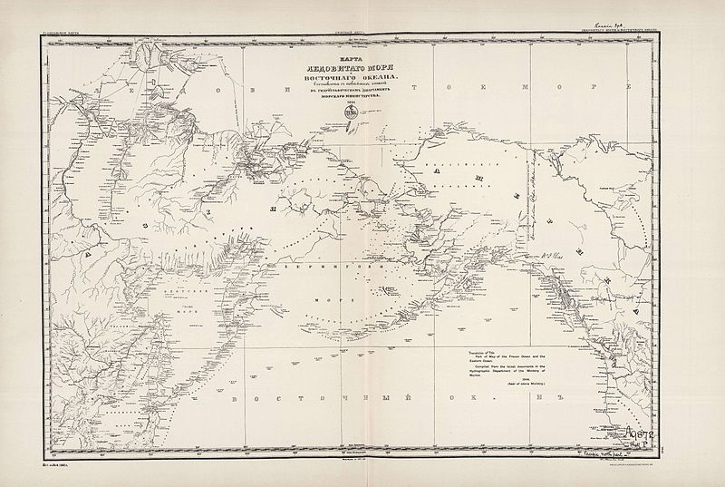
1844 map of Русскаяа Америка, Russian America.
The Alaska colonies were rarely profitable. Alaska was just across the Bering Strait from Russian territory, but Russia itself was based about a third of the way around the world in Saint Petersburg.
The Trans-Siberian Railway wasn't completed until 1916, just in time for the October Revolution of 1917, the assassination of the Imperial family, and the establishment of the Soviet Union. The Suez Canal didn't open until 1869.
Travel between the capital and Russian Alaska was by sailing ship by way of the extreme south. From Saint Petersburg out through the Baltic Sea, south through the length of the Atlantic Ocean, then either to the east around the southern tip of Africa, or a little less long to the west around the tip of South American.
Via either of those routes, it was an awfully long trip. Supplies came at an enormous cost.
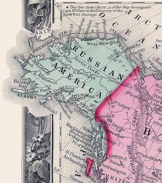
1860 map of Russian America.
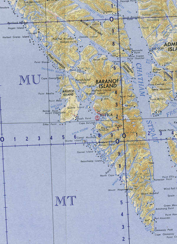
The Russians established Форт Архангела Михаила or Fort Arkhangela Mikhaila six miles north of today's Sitka. It's at the end of the north road, very close to where we camped.
The Russians had paid one Tlingit group for the land. But while they were away in 1802, a different Tlingit group attacked and destroyed the settlement.
The Russians returned by ship and founded Ново-Архангельск or Novo-Arkhangel'sk. It was the capital of Russian America until Russia sold Alaska to the U.S. in 1867. It was renamed Sitka, derived from Sheet'ká, a contraction of the Tlingit place name Shee At'iká.
Portion of map NO-7-8 from the Perry Castañeda Library Map Collection at the University of Texas.
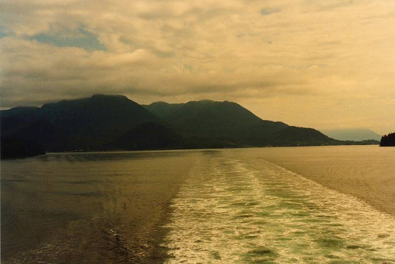
Our ferry had to make its way around Baranof Island from the Chatham Strait to the side facing the northern Pacific. It goes around the north, through the Peril Strait then through a series of more narrow straits separating Baranof from Chichagof Island to its north and Kruzof Island to its west.
The Russian colony came to depend more and more on American supply ships. The US ships could simply sail up the coast, Russian ships had to travel half-way around the world.
Imperial Russia was not doing well economically. It had lost the Crimean War of 1853–1856 to an alliance of the Ottoman Empire, the UK, France, and Sardinia. British Columbia was between Russia's Alaska and California colonies, with the threat of British aggression that Russia wouldn't know about until it was long over. Plus, zealous over-hunting of the sea otters had largely eliminated the Russian colony's reason for existence.
Soon after the Union defeated the pro-slavery Confederacy in the U.S. Civil War, Russian Tsar Aleksandr II instructed the Russian minister to the US to enter negotiations with US Secretary of State William H. Seward.
The U.S. Senate approved the purchase of Alaska in 1867, at a cost of US$ 0.02 per acre.
Below is a map of the region around Sitka. The town is on the main island of Baranof. The airport is across a narrow strait to the small Japonski island, a name the Russians gave it because of some Japanese fishermen who were stranded there in 1805. The Russians returned them to Hokkaido, the northernmost of the main Japanese islands.
We got a ride to the campground at the state park at the north end of the road, marked "ruins" here, the site of Fort Arkhangela Mikhaila.
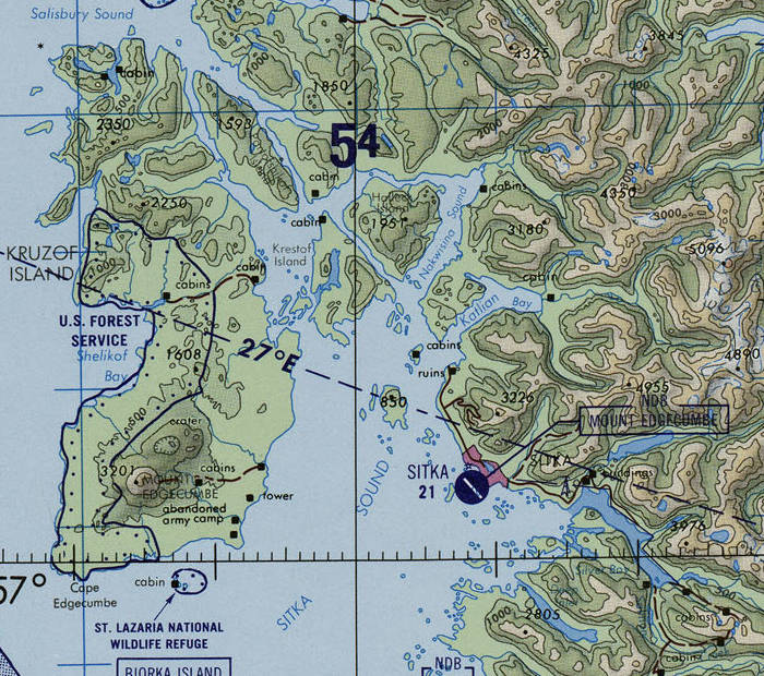
Portion of map TPC D-12D from the Perry Castañeda Library Map Collection at the University of Texas.
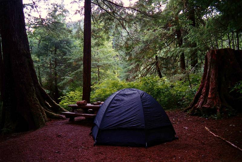
Here's our camp site at the Old Sitka State Historic Park, at the end of the road north out of Sitka.
The Tongass is part of the temperate rain forest of coastal North America, Kamchatka, and Hokkaido.
For the Tlingit, the water is light and open, their primary means of transportation, and the source of most of their food.
The forest is dark and forbidding. Moving into the forest means traveling uphill and clear trails are uncommon. Dangers lurk in the forest — bears, falling trees, becoming mired in the wet muskeg.
The ideal Tligit situation is warm, hard, and dry, like a traditional house made of solid red cedar with a blazing fire. The cool, soft, damp forest is the opposite.
Above is an Arctic grayling I caught, and below is John with another.
We had picked up a cheap rental car from Rent-a-Wreck to get us between our campsite at the far north end of the road and town. There wasn't much traffic with which to hitch. The town of Sitka sites at the middle of 14 miles of road, from the ferry port and the state park at the north end to Silver Bay at the south end.
A small side road leads inland for a short distance south of Sitka, climbing to end at a lake. The Forest Service had a boat there which you could use.
The Arctic grayling is a freshwater fish of the Salmonidae family, which includes salmon and trout. The great Swedish zoologist Carl Linnaeus named it Thymallus arcticus, for the faint smell of the herb thyme which emanates from its flesh. They're found along the Arctic coast of Siberia and across Alaska and Canada. Their large, sail-like dorsal fins are distinctive.
Shelikhov had built a school to teach the natives to read and write Russian, and he also brought in the first resident missionaries and clergymen. They translated the Russian Orthodox liturgies and texts into a Cyrillic-based form of the Native languages. The missionaries quickly took the Native side in all disputes.
The Russian missionaries followed the lead of Francis Xavier in Asia, placing value on local cultures and indigenous leadership.
The approach gained the loyalty of the indigenous population. It also generated a new and autonomous form of indigenous identity, which empowered native tradition to survive within the ostensibly "Russian" Orthodox traditions. This has spread into the interior where the Russians never ventured, involving Athabascan and Yup'ik groups. The merger of local culture and Orthodox Christian beliefs has persisted to today.
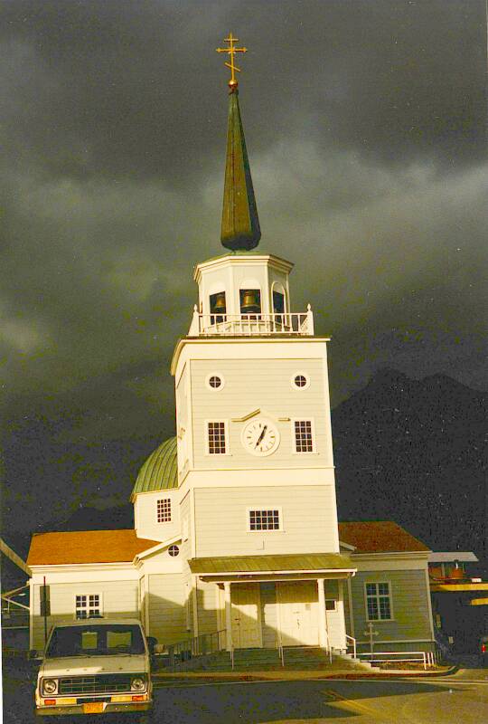
The Cathedral of Saint Michael was built in 1848. It was completely destroyed by fire in 1966, and rebuilt to its original appearance. Many of the original icons, some dating to the 1600s, were rescued and placed in the new cathedral.
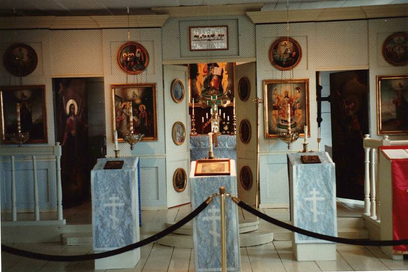
The iconostasis of an Orthodox church divides the nave from the altar area. An iconostasis is built and decorated following a a very specific design.
The most prominent row of icons about eye level across the iconostasis is called the worship row. The icon to the right of the central door shows the saint or the event to which the church is dedicated. Here, Saint Michael. The icon to the left typically shows the Παναγία or Panagia, a specific pose of Mary with the infant Jesus.
If there are icons on the central doors leading to the altar, typically they show the Annunciation at the top, then the four gospel writers below that. Here, I think the Annunciation is the large one to the left of the central door.
Amazon
ASIN: 0913836990
Above the central door is the traditional place for the Communion of the Apostles. Here, it's the Last Supper, with a silver cover through which the faces show. This replaces a large icon which was lost in the fire.
Larger churches may have four rows of icons spanning the entire iconostasis above the doors. The first is the Δέησης or Deësis (or prayer or supplication) row, with Christ in Majesty or Χριστός Παντοκράτωρ or Khristos Pantocrator at the center. He is flanked by the Virgin Mary and John the Baptist, with archangels Michael and Gabriel flanking them, and other saints spreading to either side.
The second row up would show the great liturgical feasts, twelve or so depending on the size of the iconostasis.
Amazon 0892368454
Amazon 0881415030
The third row up would show the Virgin of the Sign at the center, Mary with both hands raised in prayer, with a circle on her breast showing Jesus with his right hand raised in blessing. Old Testament prophets then extend out on either side.
The top row would show the icon of the Hospitality of Abraham at the center, with the three angels who visited Abraham. Then the Old Testament patriarchs from Adam to Moses would extend out on either side.
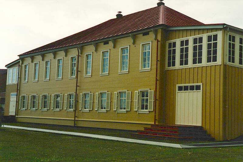
The Russian Bishop's House is one of the oldest surviving buildings of Russian America. It's a log structure built in 1841–1843, sheathed in clapboarding around 1851. This was the home and administrative center of Ivan Veniaminov, the first Bishop of Alaska, later canonized as Innocent of Alaska.
He was from Irkutsk province in Siberia, and married and went into the church there. In 1823 he was sent to Unalaska in the Aleutian Islands. He traveled between the islands by canoe, mastering six of the local dialects. He devised a Cyrillic-based alphabet for the Unangan dialect of Aleut, the most widely used, and translated parts of the Bible into Unangan.
In 1834 he was transferred to Sitka, where he learned the Tlingit language and customs. Theirs is a complex hunter-gatherer culture based on semi-sedentary management of fisheries in an area with rich resources. Their culture originated around 10,000 years ago near the mouths of the Nass and Skeen rivers. They live throughout today's Southeast Alaska, and inland into the southern Yukon. Today his translations and scholarly works on Aleut dialects and the Tlingit and Alutiiq languages are online.
He returned permanently to Russia in 1853, taking up residence in Yakutsk. The number of Orthodox worshipers had nearly doubled during his time in Alaska. In 1867 he was appointed Metropolitan of Moscow.
North to the Yukon
From Sitka we got back on a Marine Highway ferry, traveling north to Skagway. We picked up another Rent-a-Wreck car there, and drove north into the Yukon.