Normandy — D-Day — 6 June 1944
Utah Beach
D-Day and Utah Beach
We are visiting the landing beaches and battlefields of the D-Day invasion of June 6, 1944. We started by flying to Brussels, renting a car and driving to Sainte-Mère-Église and finding a place to stay. So far we have been exploring the town of Sainte-Mère-Église and its immediate surroundings, including some German bunkers and artillery batteries covering the coastline designated Utah Beach by the Allies. Now we will go to that beach.
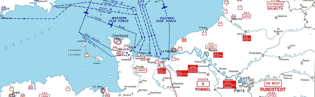
The Allies had convinced the Germans that they would land at the Pas de Calais or "Step of Calais", near the city of Calais. That's the narrowest part of the English Channel or La Manche as it's known on its southern side. Meanwhile, Operation Overlord was planned for the beaches of Normandy, well to the west of Calais and across a much wider channel of water.
Looking back at the scale of the invasion, there might not have been enough room to maneuver the huge invasion fleet in the relatively narrow area between Calais and Dover!
The landings would take place on the beaches between Cherbourg and Le Havre, well between either of those large and fortified cities.
Details of a U.S. military map of the D-Day plans.
Full resolution version
at Wikipedia.
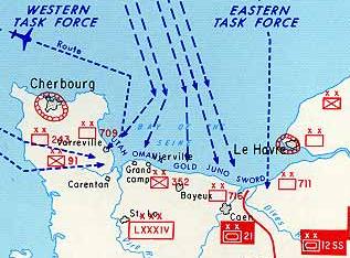
The beaches were assigned code names: UTAH, OMAHA, GOLD, JUNO, and SWORD, from west to east. The names were fairly arbitrary, beyond Utah and Omaha being American place names and U.S. forces were to take the first two, while British and Canadian forces would take the other three. Utah Beach was on the roughly north-south coast of the Cotentin Peninsula. The Douve River empties into a fairly large estuary in the "southwest corner" of the Norman coastline, just northeast of Carentan as seen on the above map. Just to the estuary's east are high cliffs around Pointe du Hoc, then it's back to beaches and the other four landing areas continuing to the east toward Caen.
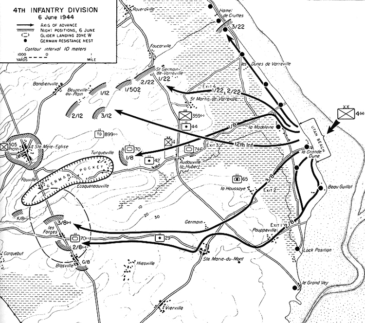
The map above is just a detail from an overall map of the plans, showing just Normandy itself. Below is a map showing Utah Beach, and the action of the U.S. 4th Infantry Division through the evening of 6 June 1944. Notice the many German fortifications along the beach, shown as solid black circles. Not included on this map are the significant German artillery positions well inland but well within range of the beach, including Azeville, shown in detail on the Sainte-Mère-Église page, and many entrenched mobile guns including those at Brécourt Manor.
U.S. military map of Utah Beach and Sainte-Mère-Église.
Indicated on the map above, and more clearly on the map below, the terrain at Utah Beach started at the water line with a very shallow sandy beach. Coupled with the large tides in this area, the water line at Utah Beach moves by a kilometer or more. We saw this large variation, and it shows up in my pictures below.
Then there are grass-stabilized dunes varying around 10 to 15 meters in height. Immediately behind this largely linear ridge-shaped dune was a low-lying area intentionally flooded by the Germans for defensive purposes. It would be crucial to find the exits, marked on the map above, to move inland along roads and get beyond the flooded areas.
The map below shows the planned landings, along about 2 kilometers of beach starting slightly to the north of the village of la Madeleine. However, unexpected tidal currents shifted the landing force entirely to the south of la Madeleine, requiring some quick reconnaissance and adjustment of plans to find appropriate causeways to move beyond the initial 500-1000 meters from the high-water line and across the flooded areas.
The whole landing front shifted to the south — to the left as seen in this map — with landing sectors designated Uncle Red and Tare Green shifted to the left but remaining in order.
This error ended up as a good thing — the road known as Exit 2 was used much more heavily than planned, and it was less heavily fortified than the other exits.
Brigadier General T.R. Roosevelt Jr was the highest ranking officer and oldest soldier in the landing forces. He was the assistant commander of the 4th Infantry Division. He is famous for moving inland off the beach to do his own reconnaissance, and then announcing "We'll start the war from here!" Roosevelt stayed on the beach to personally greet and direct every regiment to their new objectives, inspiring them with his calmness, confidence, and humor, despite the German artillery rounds landing nearby, He was later awarded the Congressional Medal of Honor for his action on D-Day.
The maps above and below show the intentionally flooded areas with dashed lines. Some roads are on slightly raised berms and served as exit routes. Those areas are flat and relatively low, but they are above sea level. Without Germans pumping water into them, they're just low flat fields.
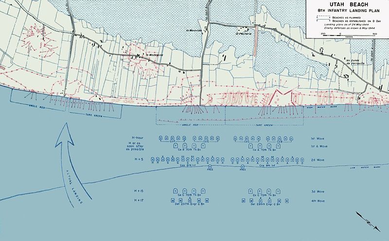
U.S. military map of the 8th Infantry Division landing plan on Utah Beach on D-Day. Full resolution available at Wikipedia.
Amazon
ASIN: 0811733777
Amazon
ASIN: 0750930136
Below is a map showing the beach obstacles known before the landings. Notice the classification marking — TOP SECRET — BIGOT. "BIGOT" was a code word used for information about Operation Overlord. To be cleared for access to this information was inevitably referred to among those in the know as "being BIGOTed".
The map below shows the original countryside, including fence lines and hedge rows. Some of that area was flooded, as indicated on the landing plan above.
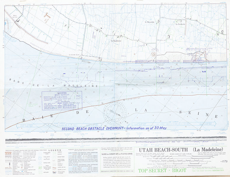
U.S. military map of obstacles for the D-Day landing on Utah Beach. Full resolution available at Wikipedia.
|
Landing wave |
Time in BDST (British Double Summer Time) and relative to H-Hour | Event | |
| — | 00:48 | H - 05:42 | Paratroopers of the 101st Airborne Division are dropped inland, around Sainte-Mère-Église. Drops continued 00:48 - 01:40. |
| — | 01:51 | H - 04:39 | Paratroopers of the 82nd Airborne Division are dropped inland, around Sainte-Mère-Église. Drops continued 01:51 - 02:42. These airborne drops were followed by glider landings with support troops and anti-tank guns. |
| — | 04:30 | H - 02:00 | A raiding party armed only with knives swims ashore at Îles Saint-Marcouf, 6.5 kilometers off the coast, to silence the anticipated German observation post before it can raise an alarm over the approaching invasion fleet. However, it turned out to be unoccupied. |
| 1st | 06:30 | H | 20 LCVPs, Higgins Boats or standard landing craft, each with a 30-man assault team from the 8th Infantry Regiment. |
| 2nd | 06:32 | H + 00:02 | 32 LCVPs, each with a 30-man assault team. This included some combat engineers and eight naval demolition teams to clear away underwater obstacles. |
| 3rd | 06:15 | H + 00:15 | 8 LCVPs, with tanks bearing bulldozer blades. |
| 4th | 06:17 | H + 00:17 | Mostly detachments of the 237th and 299th Engineer Combat Battalions, to clear the obstacles between the low-water and high-water lines. |
By early afternoon, elements of the 4th Infantry Division had moved inland and linked up with elements of the 101st Airborne Division. By the end of D-Day, 23,250 troops and 1,700 vehicles had been safely landed on Utah Beach. Casualties were relatively light on Utah Beach. However, this was due in part to the inland actions of the 13,000 Airborne troops who suffered heavy losses. The 101st Airborne Division lost about 40% of its forces on D-Day.
Pictures From Our Visit
We went to Utah Beach a number of times, as it was a short drive from where we were staying in Sainte-Mère-Église. Yes, you need your own car and the freedom of very little advance planning to really enjoy and get a lot out of this area. Seriously. Check out Europcar.
Then just drive to Normandy, wander into town, and start asking about rooms. It's not as if this were terribly difficult or, once you get there, expensive.
Once you've found a place to stay, drive over to Utah Beach. Everything is wide open and publicly accessible from the waterline back through the main initial dune line. German fortifications lie all along the beach. You might want to have some background information from web sites like bunkertours.co.uk, atlantikwall.org.uk, and atlantikwall.co.uk, where you can find as many details as I can imagine anyone wanting about precisely what type of fortification a given ruin is, and whether it is a standard representative of that type or somehow just a little bit unusual.
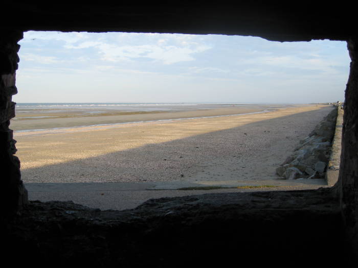
View from a bunker overlooking Utah Beach.
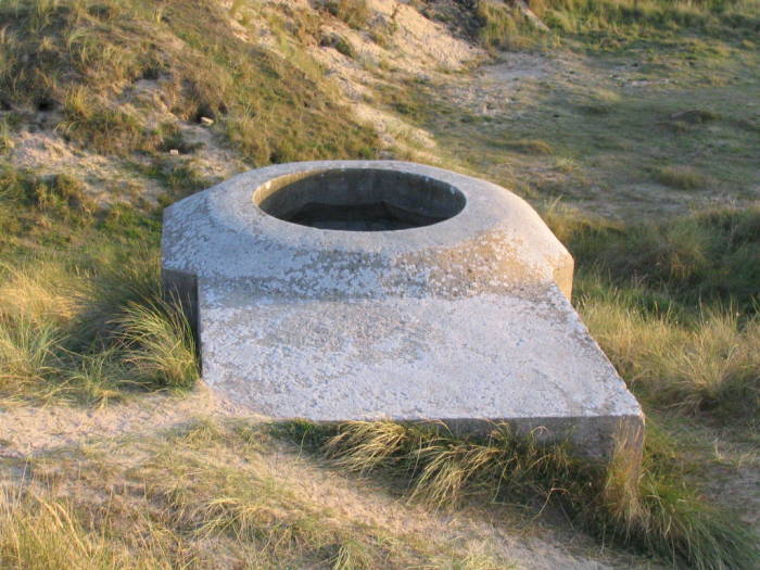
German machine gun post.
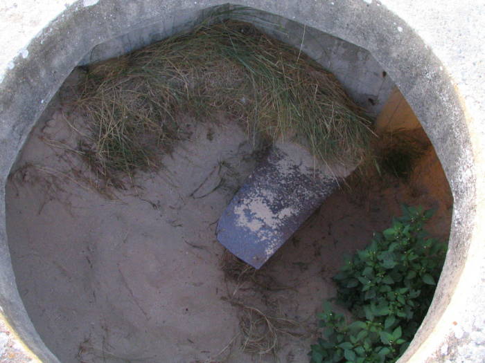
Inside that machine gun post.
Those detailed web sites describe things down the scale of individual machine gun posts like the above — its precise location and an indication of which of the many varieties of designs it is.
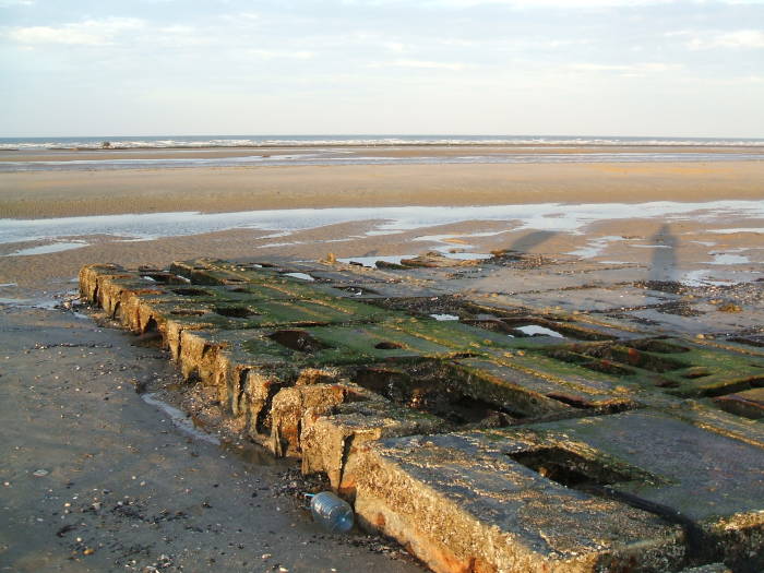
Erwin Rommel was known as "The Desert Fox", the famous German armored commander in North Africa earlier in the war. He had then been assigned the command of this part of Germany's "Atlantic Wall", the fortifications of the coastlines in anticipation of Allied invasion.
Rommelin France
Rommel really had a thing for reinforced concrete.
The small post shown above is of reinforced concrete. There would have been a steel ring around the opening, a track for traversing the gun. Otherwise, like most of the ruins, this is pretty much the way it was in 1944.
Large bunkers, like the one shown below, can appear on the IGN maps as a structure just above the high-water line. The first picture below is a view out the gun port. That opening is the large square one at the center of the bunker as seen in the second picture.
The guns traversed on an arc of rails toward the rear of that wedge-shaped room. The result was that the muzzle of the gun did not move much at all while the breech swung around to sweep an angle of almost ninety degrees. Each bunker was responsible for some wedge-shaped area of fire, and the many bunkers and their overlapping fields of fire provided more than complete coverage of the beach.
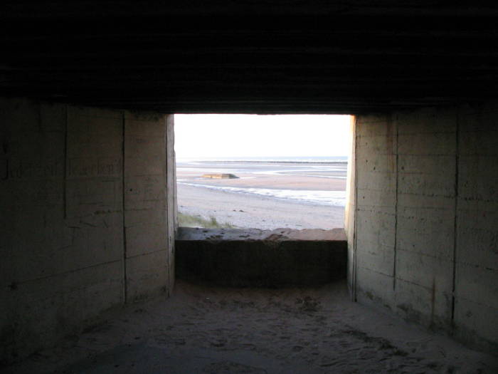
View from a larger bunker overlooking Utah Beach.
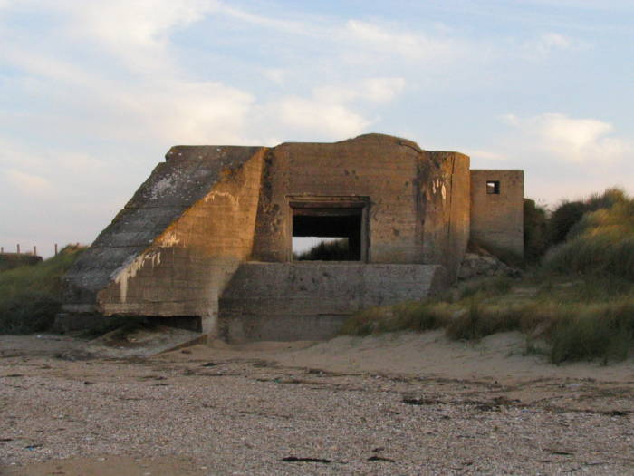
That larger bunker.
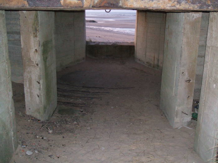
Another view of the bunker interior.
Above is another view from further back in the bunker, almost out the opposite side. Just past the last rectangular support columns you can see some of the steel traversing rails through the sand that blows through these ruins.
A heavy steel frame held the door leading further into the bunker. The Germans spent a few years fortifying this part of France, pouring lots of concrete.
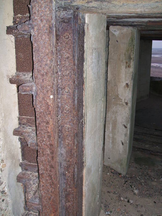
Rommel's reinforced concrete and steel. He loved the stuff.
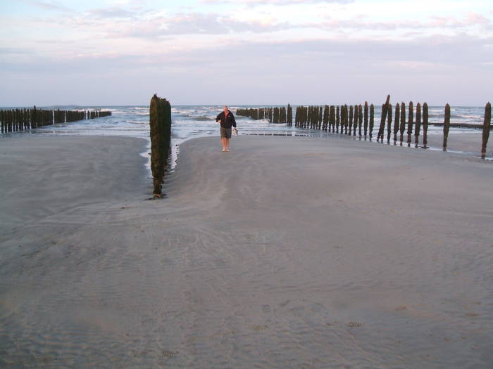
Below are a couple of pictures showing how wide the beach can be at low tide. You can see from the shadows that this visit was just before sunset.
Tidal bulges follow the sun and moon. Each is a pair of bulges, one on the side of Earth closest to that body (that is, where the sun or moon appears to be directly overhead), and one on the opposite side. Those solar and lunar bulges combine in complicated ways, made far more complicated yet by the submarine topology, currents, and so on, and vary on top of that with weather patterns. Low barometric pressure, most extreme within storms, literally sucks the ocean into that area and can make high tides unusually higher.
The tidal bulge caused by the sun will lead to high tides at noon and midnight, low tides at sunrise and sunset. The tidal bulge caused by the moon does the same thing, except that now the extremes happen when the moon rises and sets.
Twice a month the Sun and Moon are either roughly together in the sky (the New Moon) or roughly opposite (the Full Moon). That causes what's called a spring tide, a name that refers to the water "springing" or jumping unusually high and not to the season following winter.
We happened to be there around the Full Moon, making it a spring tide and thus about as much variation as you ever see. This was accidentally appropriate, as D-Day was timed to take advantage of a full Moon spring tide. The criteria were:
- Full Moon for good illumination all night, for the parachute landings and for navigation of the fleet.
- Extreme low tide at Sun rise (and simultaneous Moon set) to fully expose German obstacles on the beaches as the landing began.
- Swiftly rising extreme high tide to assist moving the landing forward.
- Acceptable weather.
The first three criteria would be met roughly monthly with two to three day periods, but the requirement for acceptable weather limited the choices to just a few of those per year. The landings were planned for June. If they could not go then, the next chances were in July and August, and then they would have to wait until the next year.
Concrete fortifications.
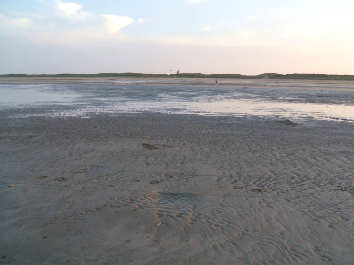
Looking across Utah Beach, about a kilometer wide at low tide.
As it was, the landing was scheduled for the 5th of June. Weather in May was good, but it deteriorated in early June. The weather on the 4th included low clouds that would hide targets from aircraft and high winds and seas that would prevent landing. The fleet had already taken to sea in the Channel, but it had to either weather out the storm or seek shelter on the south coast of Britain overnight on the 4th/5th.
The weather on the 5th looked marginal, but Eisenhower's chief meteorologist forecast at least a brief improvement on the 6th. Eisenhower decided to launch. The BBC's nightly French service broadcast of apparently nonsensical messages, coded messages to the French Resistance, included ones telling the Resistance to begin their sabotage operations. "Les carottes sont cuites" (The carrots are cooked), "Les dés sont jetés" (The dice have been thrown), and so on. Meanwhile, the weather happened to be worse in France than over the Channel, lulling the Germans into complacency.
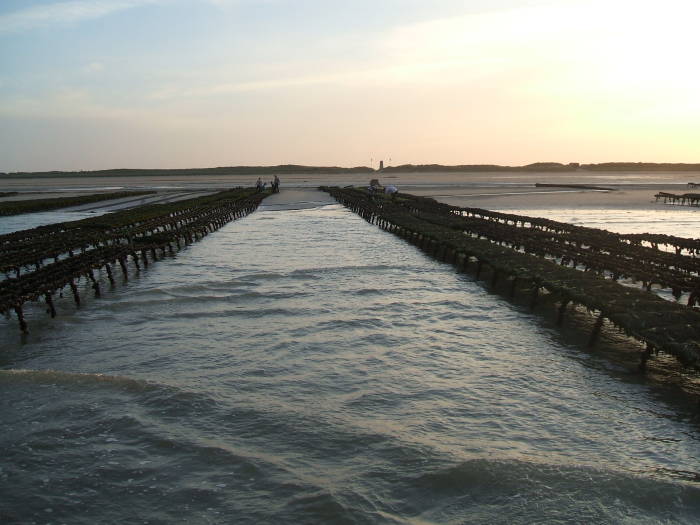
Because of English Channel currents and the underwater topology and who knows what else, the tides along the coast of Normandy and northern Brittany are unusually large. Utah Beach slopes very gently. The result is a large distance between the low-water and high-water lines, typically a kilometer or more.
We walked down the beach toward where we saw a large excavator working on something out at the water line. Some sort of low structure, hard to see at a distance. German obstacles still being cleared out? We walked out to have a look.
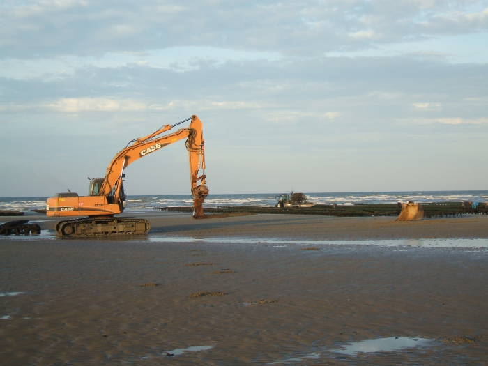
What is this excavator doing down by the water line?
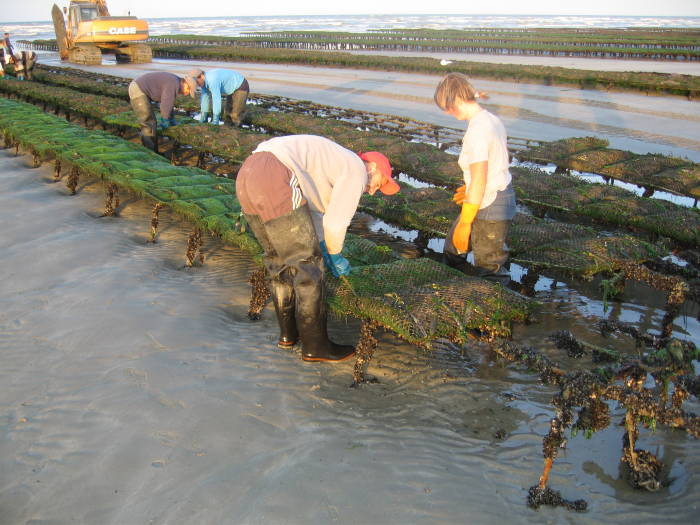
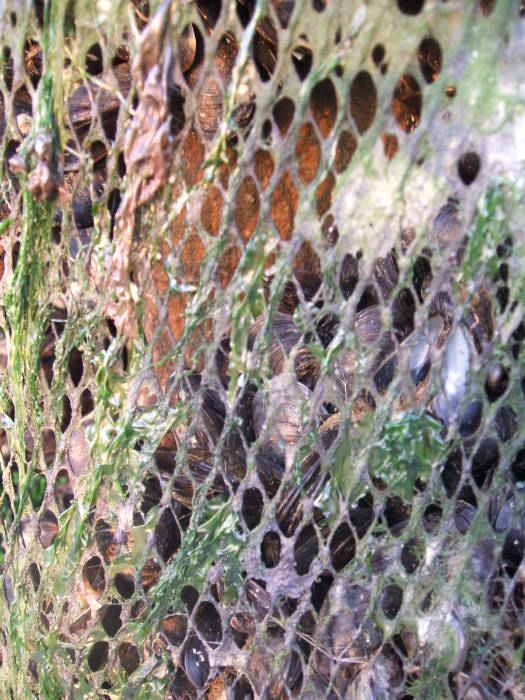
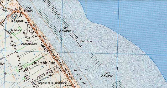
Turn the oyster bags once a month!
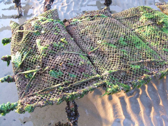
Oyster bags are shock-corded to metal frames in the oyster farm.
It was a parc á huîtres, an oyster farm. There are a number of these along Utah Beach, they only become visible during unusually low tides. The oysters are grown in mesh bags fastened to steel frames with rubber shock cords. Once a month, workers quickly unfasten the bags, flip them over, and fasten them back down. The excavator is there to re-seat any frames that have started to come loose.
They have to work quickly to turn (or later, to collect) the oysters. They are only exposed for a short time during the most extreme low tides. Most of the month they aren't visible above water at all.
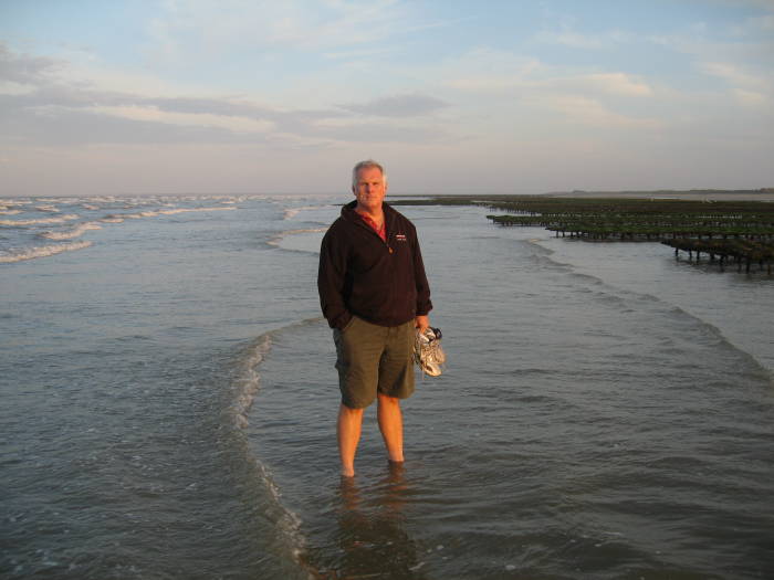
Jeff at the low-water line.
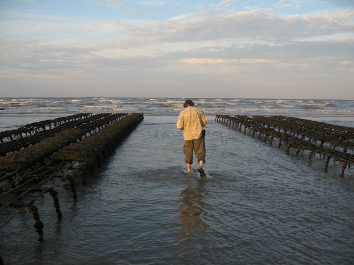
Bob wades in between the oyster racks as the tide comes in.
Looking in across Utah Beach from the low-water line as the tide comes in.
The above picture shows how wide the beach is, and how far it is from the low-water line to the top of the beach and the dunes (and the German fortifications). It's about a kilometer wide in this area.
The oyster frames are home to all sorts of "volunteer" sealife, including mussels or moules. Yes, mussels also grow very well here, and they are also farmed, as seen below.
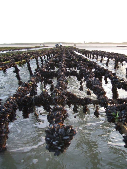
Unused oyster frames.
Regardez les moules!
Les moules-poles.
Les moules-poles.

Les moules-poles.
There are many closely-spaced rows of what first appear to be fuzzy utility poles. Examined closely, you see that they are covered with mesh, similar to the oyster bags but a finer mesh. Inside that are the mussels.
There is no maintenance to the mussel poles — just stick them in at low tide, let the water wash back and forth and bring them nutrients for their filter feeding, and harvest them when they're ready.
Les moules.
Jeff wades ashore between les moules-poles as the tide comes in.
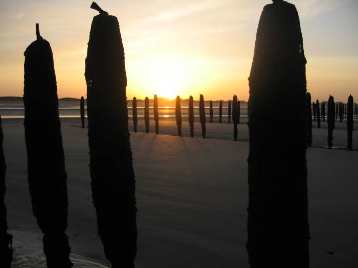
Sunset over the mussel poles on Utah Beach.
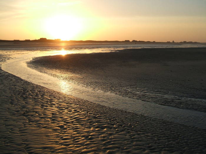
Sunset over Utah Beach.
Sunset over Utah Beach.
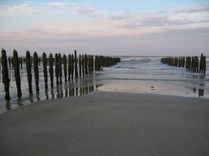
One evening after a day of exploring the area, including Utah Beach, we went "around the corner" of the Douve estuary and to Grandcamps-Maisy, between that estuary and Pointe du Hoc. The beach there between Utah Beach and Omaha Beach is similarly gentle sloping, with an even wider variation between the low-water and high-water lines, a few kilometers.
Grandcamps-Maisy is a small town with narrow streets. Once you find your way to the waterfront, you find a few places you can get dinner looking out over the water.
This was a fine place to have moules-frîtes, a steamed pot of those mussels with a plate of fries.
Sunset over Utah Beach.
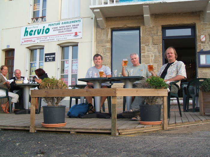
Relaxing after a day of tourism, at a bistro in Grandcamps-Maisy. L-R: Tim, Jeff, and Bob.
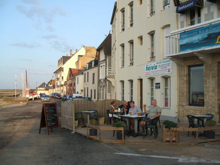
The Grandcamps-Maisy waterfront.
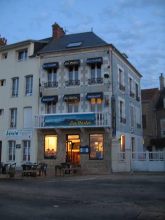
Night falls in Grandcamps-Maisy.
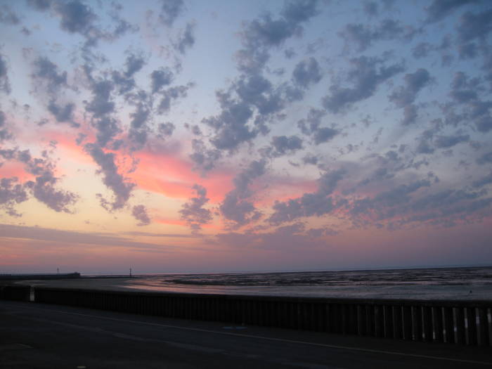
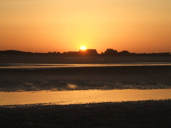
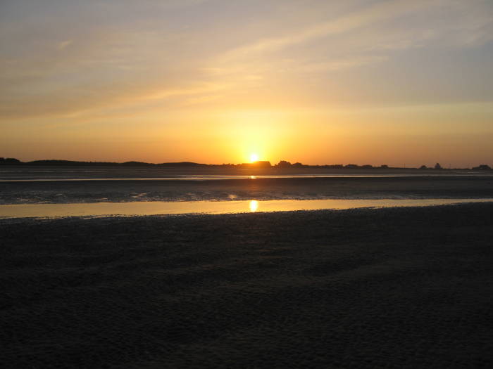
Sunset over the Douve estuary and Utah Beach as seen from that table in Grandcamps-Maisy.
The sun sets over Utah Beach, it starts to get dark, and the water slowly returns as the tide comes in.
It's time to head back to Sainte-Mère-Église and review our maps and prepare for the next day.
We will return to Utah Beach to hike along the beach and then turn inland to Sainte-Mère-Église along the path followed by some of the American forces.
Meanwhile, we reviewed our maps for what we had done this day. See the small detail below from the IGN map # 1312 E. The light blue dotted region is the area underwater at high tide and exposed at low tide. The low-water line, the edge of the darker blue always submerged area, is marked "[0]". The blue lines are a 1-kilometer grid. The waterline changes by at least a kilometer in this part of Utah Beach.
Small detail from IGN map # 1312 E, Ste-Mère-Église / Utah Beach, 1:25,000 scale. ISBN 3 282111 311245.