West Coast Walk Along the Cliffs of Orkney's Mainland Coast
The West Coast of Orkney's Mainland
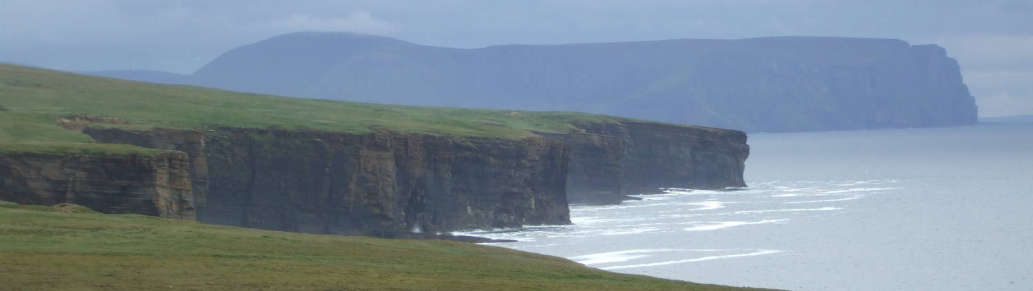
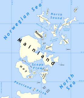
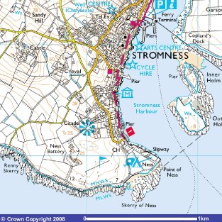
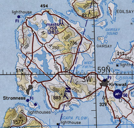
The Orkney Islands, or more simply just Orkney, are a group of islands off the northern coast of Scotland. The largest of them is called Mainland, from the Old Norse name Meginland. Mainland's west coast is mostly dramatic cliffs up to 120 meters high, constantly eroded by the waves pounding in from the North Atlantic. Let's take a nice walk from the Neolithic settlement of Skara Brae south along the cliff tops to Stromness. It's about 20 kilometers by the route described here, allow yourself at least seven to eight hours to cover the distance.
Yes, the island is named "Mainland". You leave the mainland of Europe and cross the English Channel to reach the island of Britain. Then when you're all the way at the north end of Britain, that seems like the Scottish mainland as you cross the Pentland Firth to Orkney. And within those islands, the large central one seems like a mainland in comparison. Everything is relative...
Amazon
ASIN: 1780272642
Amazon
ASIN: 184158696X
History of Orkney
Orkney has a long history of human settlement. There are minor remains of human occupation going back to between 6500 and 7000 BC, and structures have been found going back to 3500 BC.
Construction was relatively easy for these Neolithic people as the local sandstone readily splits into useful sheets or plates. Some of their sites have been especially well preserved by burial under drifting sand blown by the stiff winds off the North Atlantic.
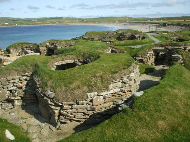
Skara Brae was a community of several homes and a common building occupied from about 3000 to 2500 BC on the west coast of Mainland, the main island of Orkney.
The Neolithic people left when environmental changes came, and the Pictish people settled Orkney with the coming of the Iron Age, which lasted from about 800 BC through the 400s in Britain. The Picts left brochs, or strongly built round towers or fortified buildings, and underground dwellings such as one near Kirkwall. After the Roman invasion of southern Britain, a group of 11 British leaders submitted to the Roman Emperor Claudius in 43 AD in Colchester. However, the Romans had little to do with Scotland and built Hadrian's Wall well to the south of the Scottish border to keep those troublesome Picts from invading further to the south.
Celtic missionaries arrived around 565 AD, companions of Saint Columba and from the Hebrides off Scotland's west coast.
The Vikings were raiding the area by that time, making Orkney their headquarters by the 800s. Harold Hårfagre, or "Fair Hair", subdued the remaining locals and organized the raiders and annexed Orkney and Shetland to Norway in 875. Orkney and Shetland were formally Norse until 1468 when the Norwegian king Christian I pledged Orkney and Shetland to James III of Scotland as dowry for his daughter Margaret. Culturally, Orkney was Norse until at least 1800. Many of the place names and local geographic terms are Norse, or Norn, the local dialect evolved from Old Norse.
Starting in the early 1900s, through World War I and World War II the huge and well protected natural harbor of Scapa Flow was a primary naval base. The Royal Navy only moved out in 1956.
Operational Navigation Chart ONC E-1, 1:1,000,000 scale.
Tactical Pilotage Chart TPC D-1C, 1:500,000 scale.
Logistics
I got to Orkney by taking a bus and ferry. I took the bus north from Inverness, riding almost four hours up the far northeast coast of Scotland to Thurso, and just beyond that to Thurso's harbor of Scrabster. A ferry crosses from there to Orkney.
The main ferry is the M/V Hamnavoe, named after the Norse name for the port now known as Stromness. Stromness is on Mainland, the main island of Orkney. The island's name is corrupted from the Norse name Meginland.
As for the town formerly known as Hamnavoe, in Old Norse that name meant peaceful (or safe) harbor. The newer name, Stromness, is also derived from Norse, strom referring to the strong tides ripping past the ness (which would be point in English) forming the southwest tip of the harbor. The current place name "Point of Ness" mixes languages oddly, effectively meaning "The Point of The Point".
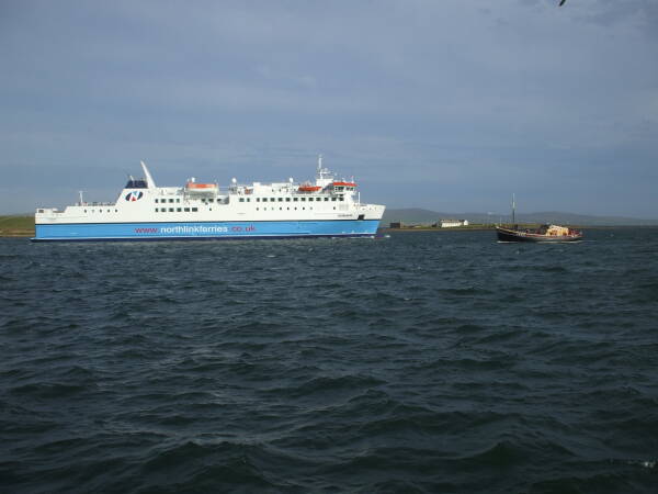
M/V Hamnavoe leaving Stromness harbor for Thurso.
Stromness is the second largest town in Orkney, after the capital town of Kirkwall. About 2,200 people live in Stromness. It's an old town, with its narrow streets lined with old stone houses and used mostly by pedestrian traffic.
The Hudson Bay Company, a private company effectively given full control of much of today's Canada and a little of the northern United States, was based in one of those small stone houses.
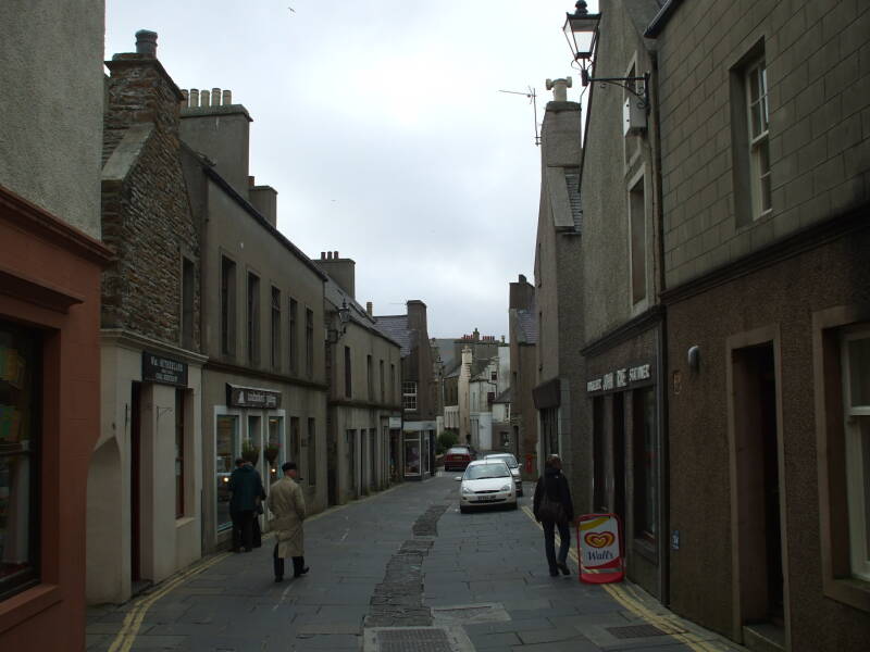
Victoria Street, the main street in Stromness.
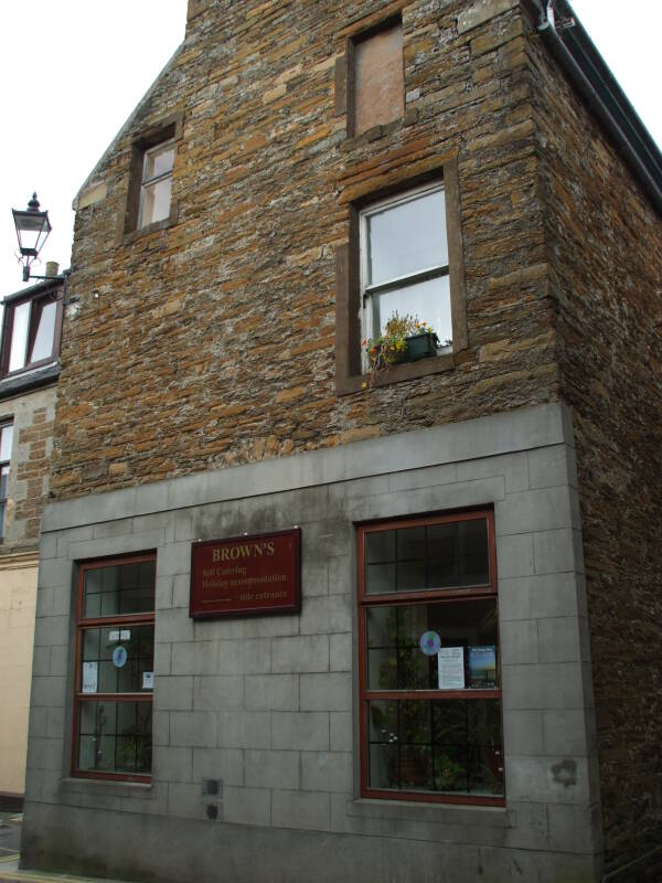
I stayed at
Brown's Hostel,
seen in the first picture below:
45-47 Victoria Street
Stromness, Orkney, KW16 3BS
+44-(0)1856-850-661
+44-(0)1856-851-780 fax
brownshostel.co.uk
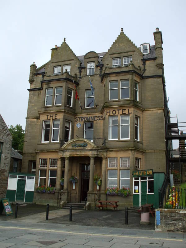
The Stromness Hotel.
In the second picture above you see the Stromness Hotel, the headquarters of OSDEF or Orkney and Shetland Defense back during World War II, and today with more upscale lodging. The Flattie Bar, behind the green door on the right side of the hotel and named for a type of small local fishing boat, is a popular gathering place.
Amazon
ASIN: 0319466922
Amazon
ASIN: 0319228126
You will want something like the Ordnance Survey Explorer map #463, Orkney — West Mainland (Stromness & Graemsay) for navigation details. It's at 1:25,000 scale. Or the 1:50,000 Landranger map #6, Orkney (Mainland).
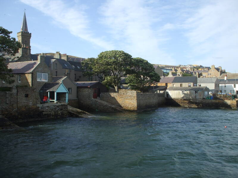
Here you see the waterfront of Stromness south of the ferry pier on a sunny day.
Getting to the Hike, and Skara Brae
Stock up, get some food and water to take along on your walk.
There are a couple of grocers' shops near the north end of Victoria Street, between Brown's Hostel and the Stromness Hotel. Stromness is easy to find your way around, there's largely just the one main north-south street. Ask wherever you're staying for directions to the shops.
Bere is a form of barley grown in small areas of Orkney and Shetland. It may have been brought to Orkney at least by the 800s, by the Vikings, possibly even earlier.
The bus station in Stromness is at the ferry pier. Check the schedules there and figure out how to get to Skara Brae in the morning.
You will be looking for a bus that passes Skara Brae and continues on through Twatt and beyond to the northwest corner of Mainland.
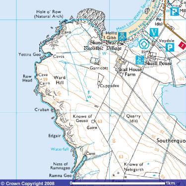
You want to get out of the bus at Skara Brae and Skaill House. Definitely tour Skara Brae before starting the walk south.
Here you see some of the dwellings of the Neolithic settlement, occupied roughly 3100–2500 BC.
From Skara Brae you will follow the west coast of the island. Navigation is pretty straightforward — Walk south along the coast, then around the southwest tip of Mainland to Stromness harbor.
There isn't a lot of traffic on the path. Orkney is lightly settled and lightly visited. In many areas you don't see a distinct path. Common sense and some knowledge of the general path can get you through. A detailed Ordnance Survey map at 1:50,000, or better yet, 1:25,000, is a great help.
You will notice that many Norse geographical terms are routinely used in Orkney.
| Norse | English |
| ness, taing | point |
| nev, nevi | headland |
| geo | steep-sided bay |
| noust | proportionally wider bay |
| skerry | rocks just at or above sea level, possibly including free-standing sea stacks |
| holm | small island |
| -ay | suffix indicating a larger island |
Skara Brae to the Broch of Borwick
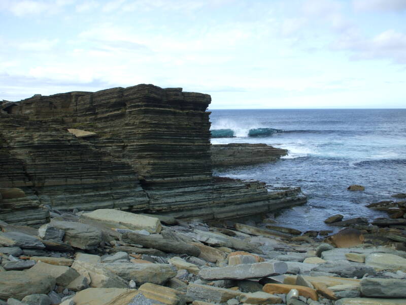
The islands are mostly Devonian age sandstone formed some 420–360 million years ago. In many places the stone can easily be split into thin sheets. The Neolithic people who lived at Skara Brae and those who built the many impressive megalithic structures took advantage of this, building their homes and sacred structures from thin stone panels.
Here you are heading around the skerries at the south end of Skaill Bay, leaving Skara Brae and heading south on the West Coast Walk.
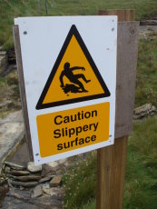
You quickly come to a point where you see the need for caution on this walk.
Seriously. Be careful.
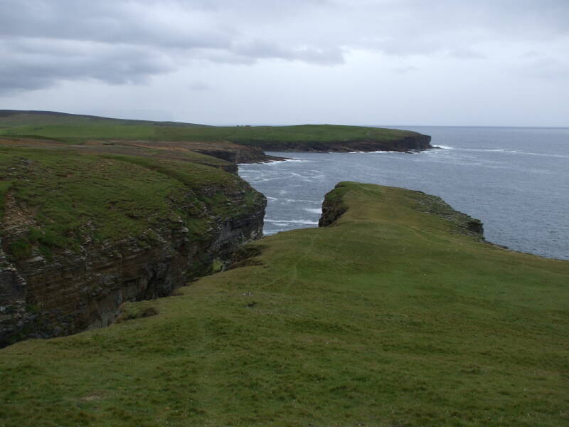
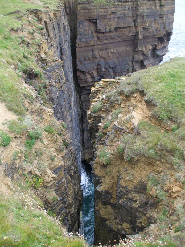
You will be walking on a path that's ill-defined at best, non-existent as far as you can tell in places, and running along the tops of cliffs up to 120 meters high. You will be walking on lush grass well moistened by rain and battered by wind coming in off the North Atlantic. The next land west of here is northern North America, so the weather isn't always mild.
It would be very possible to lose your footing and slide right off into a dramatic geo or simply off a cliff.
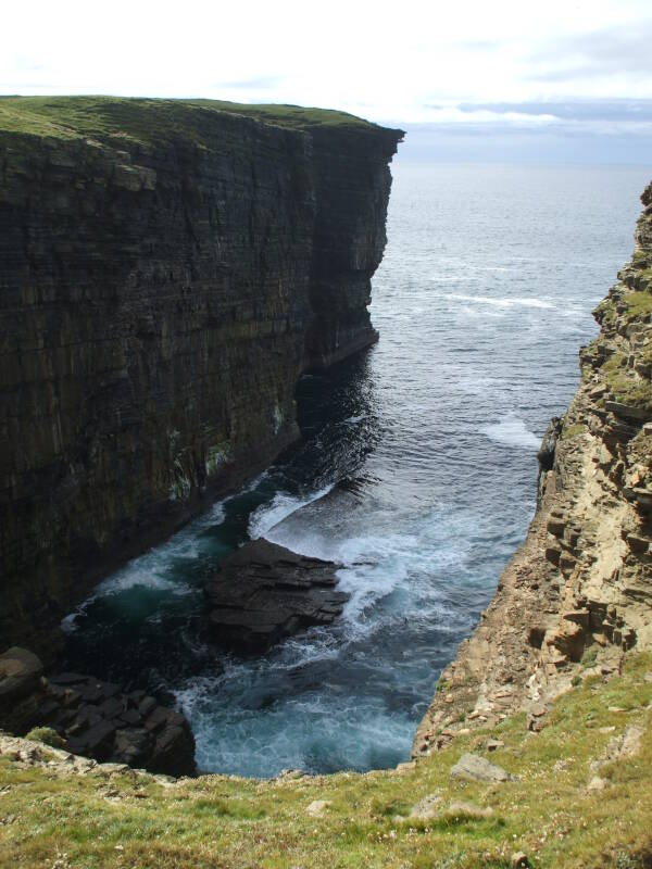
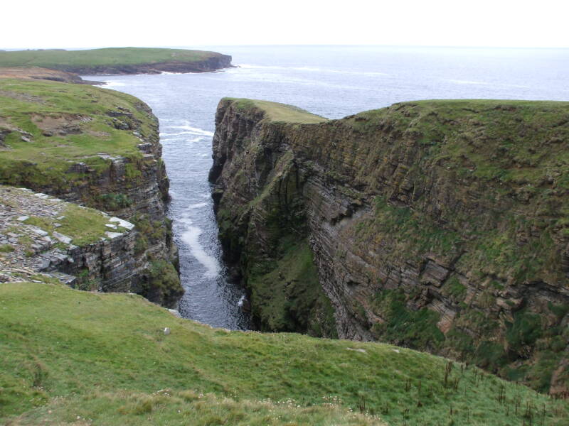
This is the relatively small (really!) Yettna Geo, around HY 223 187. See my page about the U.K. National Grid system for details on the standard U.K. map coordinates.
Ah, here's a clearly defined stretch of path.
Right along the edge of the geo.
Be careful.
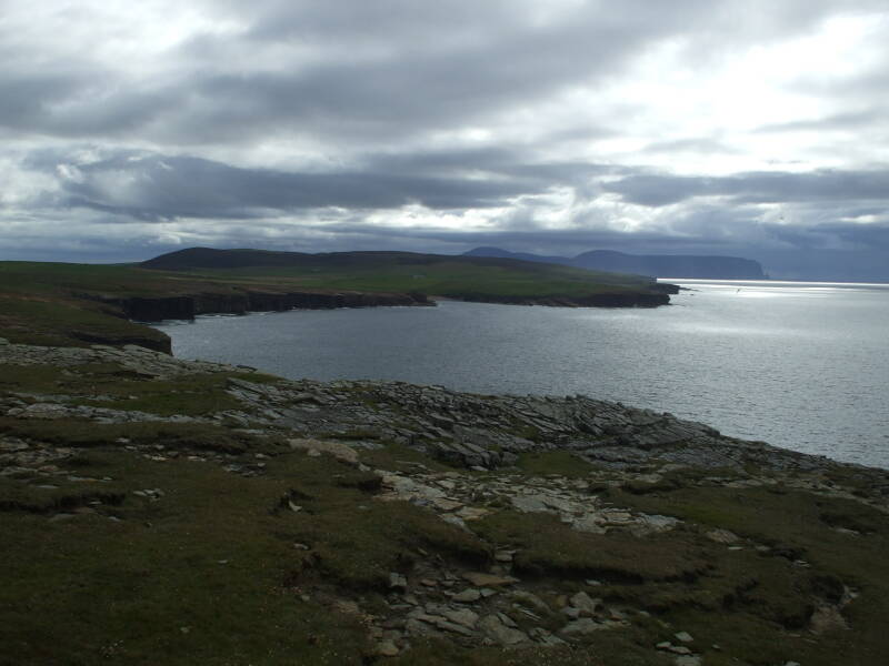
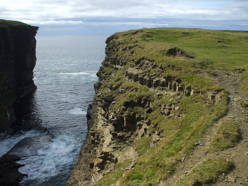
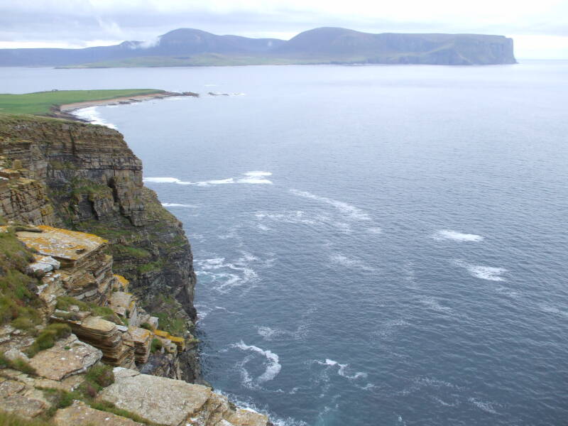
The weather has cleared, and you can see far to the south. The landmass in the distance is the island of Hoy, about 15 kilometers south of this vantage point just north of Ramna Geo.
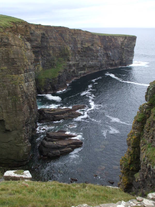
Here is the long and narrow Ramna Geo, the longest geo on Orkney, about 300 meters from its opening to the cave at its back. The back rim of Ramna Geo is about 50 meters above sea level.
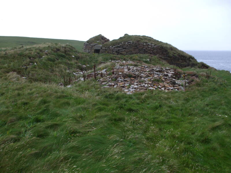
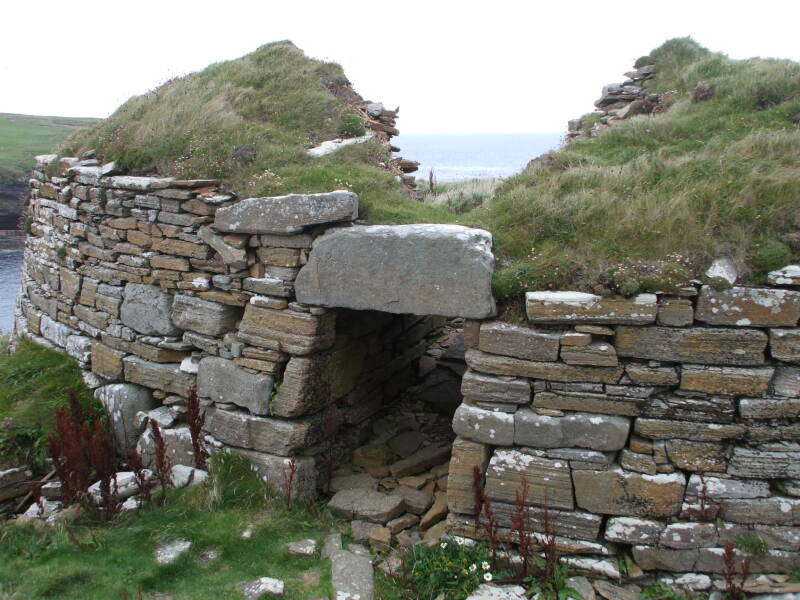
Broch of Borwick
The brochs are drystone construction — carefully fitted stone laid up without any mortar. They're typically round, with hollow walls.
What's not known, or at least has been the subject of continuing argument amongst archaeologists, is their origin and purpose.
The Broch of Borwick is one of these Pictish structures from the Iron Age.
It's at HY 224 168, overlooking the Noust of Borwick.
Antiquarians of the 1800s believed that the brochs were defensive structures providing refuge for the local communities and their livestock. They were thought to have been built by the Picts or the later Danes and Norse adventurers.
From the 1930s until about 1960 it was believed that they were basically castles built by immigrants to northern Scotland and the islands, people who had been pushed out of central or even southern Britain by Belgic tribes invading south-eastern England in the second century BC, followed by the invading Romans starting in 43 AD. These castles were thought to be where local landowners exercised power or control over a local community.
By the 1960s it was thought that the builders were from a hybrid culture combining the native Hebridians with a small percentage of immigrants from the south.
Amazon
ASIN: B01N1XMI13
Amazon
ASIN: 1784914339
Then, by the 1970s, the "diffusionist" theories had largely been discarded in favor of indigenous development. Radiocarbon dates were starting to show broch construction happening from about 100 BC to 100 AD.
By the 1980s the theories of defense and exercise of power from a castle like structure had been discarded due to a lack of evidence. Defense did not seem to be a standard criteria for their siting. The more recent theories hold that they might have been "stately homes" of their time, prestigious homes of more wealthy or powerful families. There doesn't seem to be specific evidence for that theory, either, it has come from a search for plausible explanations.
Many of the brochs on Orkney, like the Broch of Borwick, overlook the water. Often they're at the edge of a high cliff, like here.
The current theories are that many brochs were fairly tall, generally with a ground floor and a second floor above that, sometimes with yet another level above that. They are thought to have been topped with a conical roof made from the local driftwood or bog material.
Yesnaby
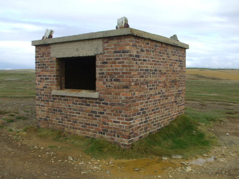
Yesnaby is the name of an area of the coast. It is the one place along your walk where you encounter pavement. A side lane from the B 9056 road ends at a parking area by some World War II fortifications.
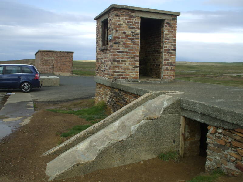
What remains are some small brick structures around HY 220 161, observation posts overlooking the sea to the west of Orkney.
Keep in mind that you are only about three kilometers south of your starting point at Skara Brae, and the West Coast Walk continues south to a point about seven kilometers south in a straight line, about twice that for the route you will follow. Then it turns east for another three to four kilometers. Be aware that the rugged form of the coastline and its cliffs means that you won't be walking along any straight lines — the path along the cliff tops necessarily curves back and forth along the geos and nesses.
This is your last chance to bail out and hitch a ride back to Stromness.
But if you continue south, you will see some of the most spectacular scenery along the Orkney coast.
Yesnaby through the Cliffs of Blackcraig
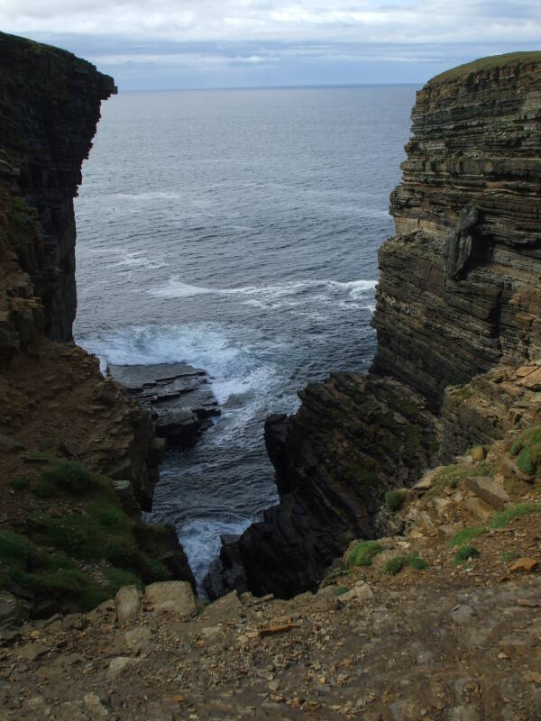
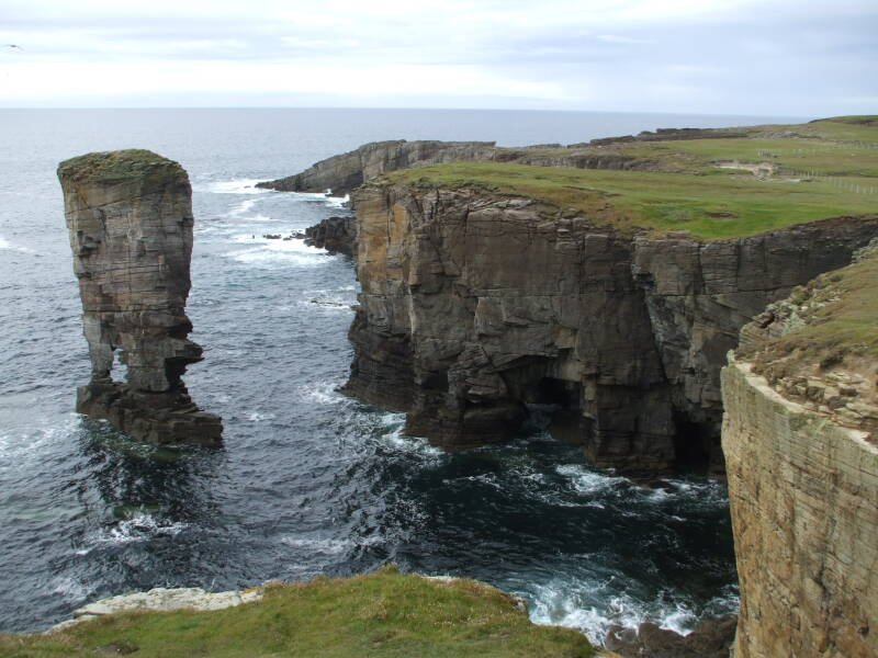
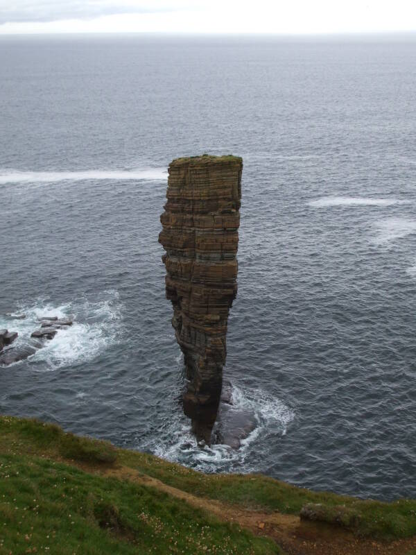
This shows how a sea stack is formed.
A deep geo was cut deeper and deeper by the waves coming in off the North Atlantic. They eventually cut through the narrow outer wall of the geo. The sea stack is almost completely disconnected from the cliff. Only a small rock bridge remains.
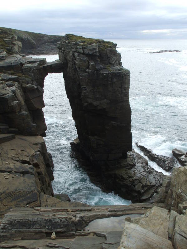
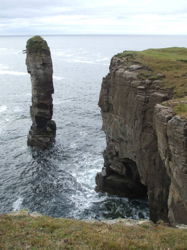
Garthna Geo is a free-standing sea stack with a small arched base. The World War II fortifications at Yesnaby are visible in the distance.
Further south you approach the high cliffs of Blackcraig, up to 100 to 120 meters high.
You see the Blackcraig cliffs in the immediate distance, and the island of Hoy in the distance. Hoy has the highest sea cliffs in the UK, up to 350 meters.
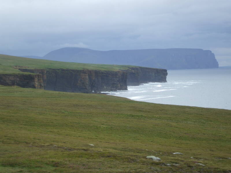
In North mythology, Hoy is the location of Hjaðningavíg, the never-ending battle between Hedin and Högni.
As you pass the Bight of Mousland around HY 217 125, and at Skora Skerry around HY 219 109, the Blackcraig cliffs and sea stacks are at least 100 meters high.
The Home Stretch
You finally come around the last bend, the Blackcraig cliffs drop away and you're at the southwest corner of Mainland, looking down on Hoy Sound, the entrance from the North Atlantic to Scapa Flow.
Whew.
Finally.
From here it's relatively easy. You still have a few kilometers before you get back to Stromness, but it's easy walking, the last kilometer or two along a paved path or road, depending on the route you take.
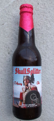
Time to stop at the locally popular Flattie Bar at the Stromness Hotel, for a refreshing beverage.
Maybe a Skullsplitter, named after Thorfinn "Skullsplitter" Hausakluif, the 7th Viking Earl of Orkney around 950 AD. It's a local product from Orkney Brewery, an 8.5% abv "wee heavy" Scottish ale.