Into the Yukon
From Russian America to the Yukon
In 1993 my friend John and I each had a voucher from
Delta Airlines, good for anywhere in the continental U.S.
and Canada.
Fairbanks, Alaska was the farthest place we could go.
Juneau, however, seemed more interesting.
We started our trip around Juneau,
then went to Sitka by ferry.
Sitka, formerly
Ново-Архангельск
or Novo-Arkhangel'sk,
had been the capital of Russian America
until Russia sold Alaska to the U.S. in 1867.
This page joins our trip on an overnight ferry of the
Alaska Marine Highway System —
leaving Sitka, stopping in Hoonah and Juneau,
and then continuing north to Haines and Skagway.
At Skagway we will rent a car and drive inland,
crossing the Canadian border and continuing north into the
Yukon Territory
along the route of the Klondike Gold Rush of 1896-1899.
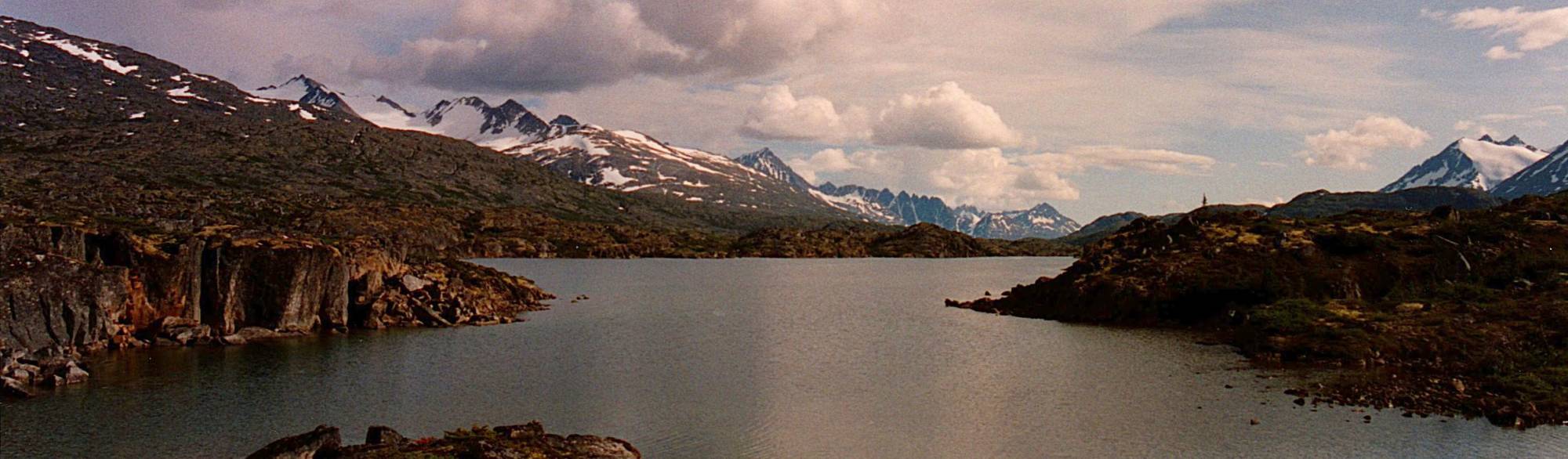
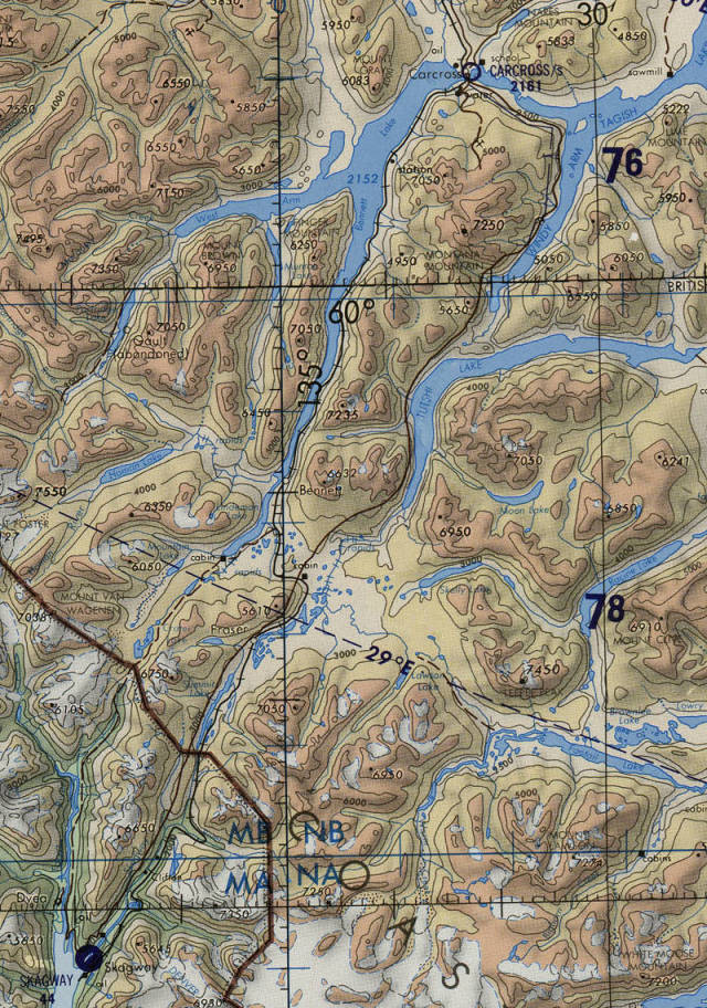
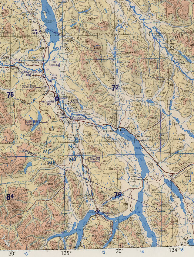
We will camp near Carcross,
where a network of lakes seen in the below map
turns into the Yukon River.
That flows through Whitehorse, then generally west for
3,190 kilometers through the Yukon Territory and
then Alaska to the Bering Sea.
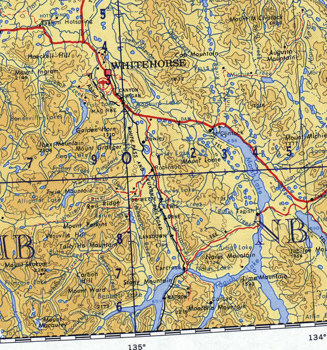
Detail of map NP-7-8 from the Perry Castañeda Library Map Collection at the University of Texas, Austin.
Amazon
ASIN: 1786574586
Amazon
ASIN: 1602233152
We were traveling through Southeast Alaska, also called the Panhandle. Travel between here and "mainland" Alaska is by air, by infrequent long-distance ferry, or driving several hundred kilometers from Skagway or Haines through Canada.
We're in the Inside Passage, a network of passages through the archipelago lining the coast from Seattle, Washington, up the British Columbia coast and Southeast Alaska. The route is protected from harsh weather on the open ocean, and accesses the numerous small communities along the way. The passage extends about 800 kilometers through Southeast Alaska, with over 1,100 islands formed by the coastal mountain range sloping down into the Pacific Ocean.
June 6, 1944D-Day: The Normandy landing beaches
The Chilkoot Motorship Lines was founded in 1948 in Haines. It used a converted LCT Mk6. That is, version six of a series of Landing Craft, Tank designs, an amphibious assault craft used to land tanks on beachheads. The Mk6 was built in 1943 and 1944 for Allied service in World War II.
The ferry operation starting in 1948 in Alaska connected Tee Harbor, north of Juneau, to Haines and Skagway once a week.
Amazon
ASIN: B007FNZW6W
Our trip north from Sitka took us around the north end of Baranof Island to stop at Hoonah on Chichagof Island, which has the highest population of bears per square mile of any place on Earth.
"Hoonah" is the official United States Postal Service spelling of the Tlingit name Xunaa, meaning "in the lee of the north wind." The year-round population is about 800, and like almost every community in the Southeast, there's a road for a few kilometers in each direction, but no land connections. Access is limited to the ferry and floatplanes.
The Alaska territorial government bought the Chilkoot Motorship Lines in 1951. The original LCT was christened the M/V Chilkoot. They replaced it in 1957 with the M/V Chilkat, which had been purpose-built as a ferry. The Chilkat stayed in service until 1988.

The Alaska Marine Highway System or AMHS was established in 1959 after Alaska became a state. It now operates 3,500 miles of routes through 32 terminals, from as far south as Bellingham, Washington, to as far west as Dutch Harbor at Unalaska in the Aleutian Islands. The ferry system is part of the U.S. Federal Highway System.
One good thing about ferries is that they can operate in rain and fog. Southeast Alaska is largely covered by the Tongass National Forest, part of a temperate rain forest.
Sitka gets an average of 2,201 mm of rain per year, Juneau gets 2,341 mm. Both average 235 to 240 days each year with precipitation.
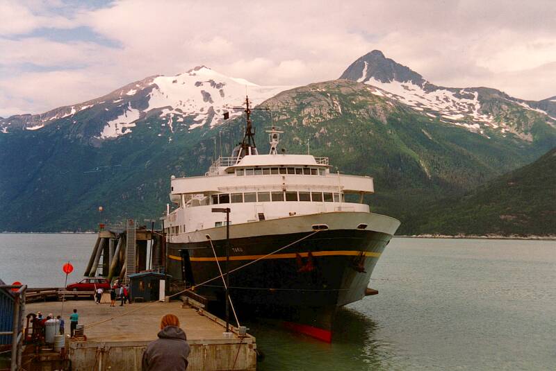
We rode the M/V Taku from Sitka to Skagway. The Taku was built in 1963. It was a mainline ferry, serving the larger communities on the Inside Passage. It was the largest of the three AMHS vessels that could serve the communities of Hoonah and Kake — 107 meters in length with a 22.5 meter beam, able to carry 69 vehicles and 370 passengers. Its two diesel engines could move it at 16.5 knots
Ferriesin Greece
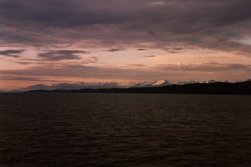
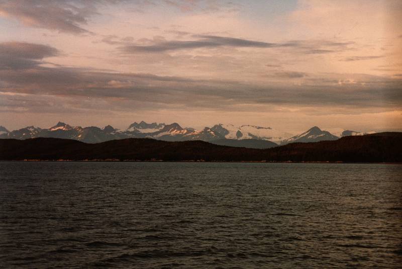
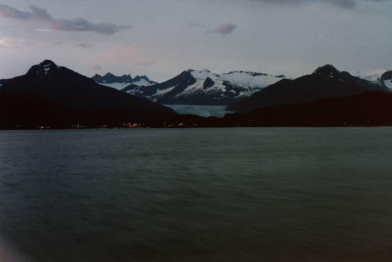
We just spread out bedding and camped on the deck. Below, we're passing the north end of Juneau, where the airport is. Beyond that, the Mendenhall Glacier flows down from the Juneau Icefield extending through the border into British Columbia. We were there in early July, near the Summer Solstice, so it never got completely dark. Juneau is at 58.32° N and we were headed for the Yukon, above 60° N.
The Mendenhall Glacier was originally known to the Tlingit as Sitaantaago or "The Glacier Behind the Town", or Aak'wtaaksit or "The Glacier Behind the Little Lake".
We continued north through the night, entering the Lynn Canal, the northernmost fjord along the Inside Passage. It's about 140 kilometers long, and at over 610 meters deep, the deepest fjord in North American outside Greenland.
Traveling inland, it splits into the Chilkat Inlet and the Chilkoot Inlet. The ferry goes up the Chilkat Inlet first, stopping at Haines, and then looping back to the Chilkoot Inlet and terminating at Skagway.
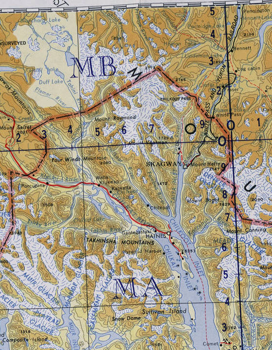
Detail of map NO-7-8 from the Perry Castañeda Library Map Collection at the University of Texas, Austin.
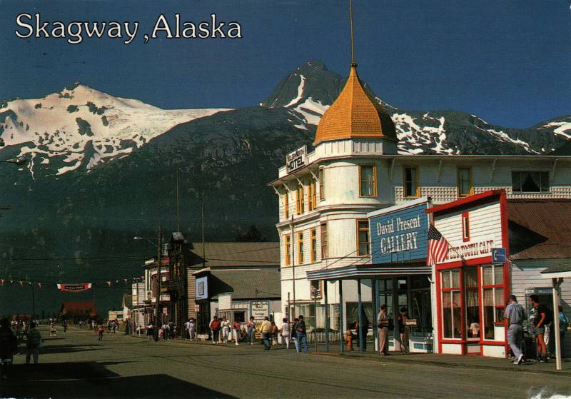
We have arrived in Skagway!
Its name comes from shɢagéi, which literally means beautiful woman in Tlingit. The ɢ is a voiced uvular stop. Tlingit has a large repertoire of phonemes, many of them quite uncommon in other languages.
Then because Shɢagéi is the nickname of Kanagoo, a mythical woman who transformed herself to stone and now causes the strong winds to blow up the Lynn Canal fjord, for the Tlingit the name is a metaphor for rough seas in the Taiya Inlet caused by strong north winds. That's a lot to pack into two syllables, uvular stops or not.
The Taku stayed in ferry service until 2015. The AMHS sold it to a Dubai firm, and by 2018 it was pulled up onto a beach in India to be scrapped.
Other things have changed since our visit. The town's population has risen from about 700 when we were there to over 1,200. The cruise ships visiting Skagway are more numerous, and much larger. About a million tourists now visit Skagway every year, three-quarters of them on cruise ships. The port can now accommodate four large cruise ships at once.
Here's a postcard view looking down the main street to the docks.
North from Skagway
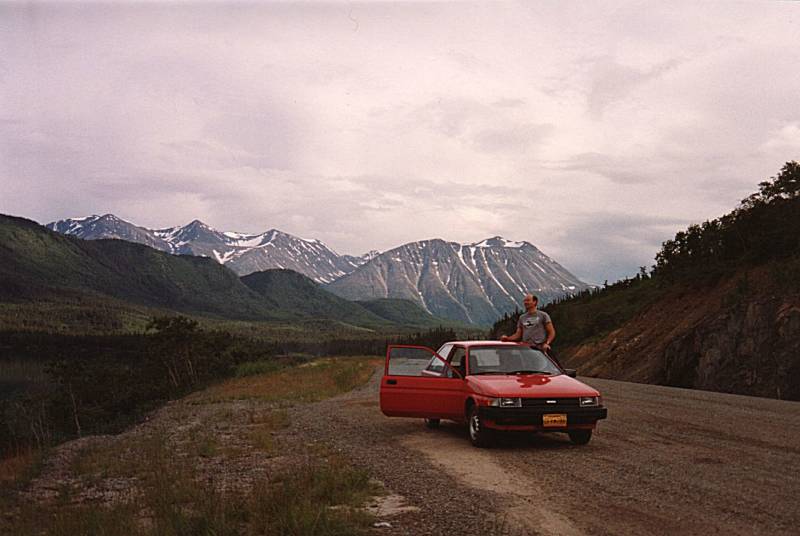
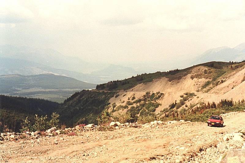
Rent-A-WreckWe rented a car at Skagway. At the time there was a Rent-A-Wreck outlet there.
We got a cheap and sturdy rental car and drove northeast, gaining elevation quickly and soon crossing into Canada at an elevation of about 3,000 feet or 915 meters.
Haines and Skagway have road connections to the outside; Haines to the northwest, and Skagway to the northeast. Both roads lead through the thin northwestern tip of British Columbia and on into the Yukon Territory. The only other place in Southeast Alaska with a road connection to the outside is Hyder, a community of about 90 people at the extreme south-eastern tip of the panhandle. It's right on the border, at the end of a short narrow road from Stewart, British Columbia.
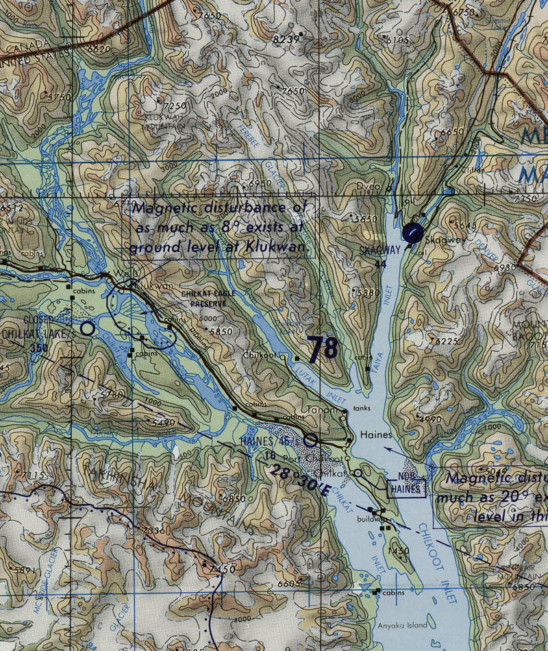
Detail of TPC D-12D from the Perry Castañeda Library Map Collection at the University of Texas, Austin.
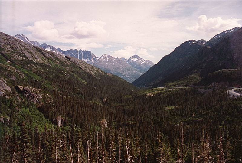
The Klondike Highway leaves Skagway to the north-northeast, up a glacial valley from Taiya Inlet, which opens into Chilkoot Inlet, which opens into Lynn Canal.
The road winds some to gain 873 meters elevation in 23 km and reach White Pass. The Chilkoot native people controlled the area and Europeans did not know about the pass until 1887, when Keish or Skookum Jim Mason revealed it.
The native people had known of the gold nuggets to be found in streams, but they didn't find the soft metal useful. They were interested in the copper deposits, as that metal is useful for tools. But by the late 1800s, they were well aware of the Europeans' intense interest in gold and the material wealth it could bring.
Skookum Jim was one of the discoverers of the gold deposit on a tributary of the Klondike River on August 16, 1896. He very likely made the discovery himself, but his sister, her American husband, and their nephew had the non-indigenous American brother-in-law make the claim. That way it would be honored by the Canadian government.
The Klondike Gold Rush began immediately, and all the land along the creeks was claimed by the end of August.
The real "Klondike stampede" began in July 1897, after the first of the early prospectors in the Klondike arrived in Seattle and San Francisco. The US happened to be at the depths of a recession, unemployment caused by the Panic of 1893 and the Panic of 1896, and a series of bank failures. Dreams of instant wealth took hold.
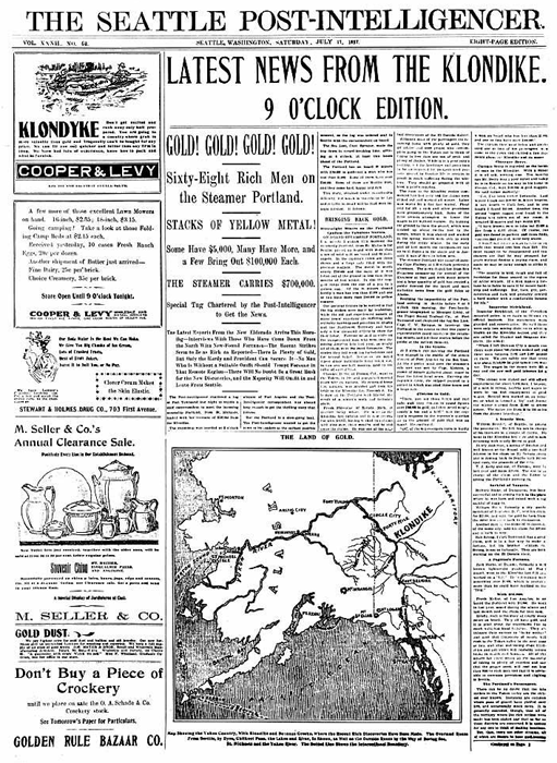
Seattle Post-Intelligencer for 17 July 1897.
About 100,000 people tried to reach the Klondike. The Canadian authorities would only let them cross the border if they had a year's supply of food, in order to limit the starvation.
We had a few days' supply of food, and planned to fish and visit a grocery store in Carcross. The one-year rule is long rescinded.
A year's supply of food, plus other supplies and equipment, meant that each would-be Klondike prospector had about a ton of material to carry up and over the pass. Most carried their supplies themselves, on foot.
Most men divided their material into 30-kg packages that they could carry on their back. That required at least 30 round trips up the trail, covering a total distance of at least 4,000 km.
Some horses were available, for prices that soon became enormous while horse quality plummeted. White Pass became known as the Dead Horse Trail. Some starving would-be prospectors ate the dead horses, others went insane. The rotting bodies of prospectors along the trail didn't help matters.
The Chilkoot Trail leading up from Dyea, near Skagway, was higher and steeper, but more men used it.
Once they reached the lakes, the prospectors built boats or rafts. They still had 800 kilometers to go, downstream through the lakes and down the Yukon River. The forests around the lakes were soon mostly gone, cut down to build boats and rafts.
Aerial tramways were built along the Chilkoot Trail in 1897 and 1898. Next, a rail-tramway system was built in late 1898 to provide transport around the rapids of the Yukon River. Then, a narrow-gauge railway line was built from Skagway to today's Carcross, starting operation in 1900. All of these, of course, charged exorbitant fees. There was no Rent-A-Wreck in those days.
The two certain ways to become wealthy in the Klondike Gold Rush were to (a) be there in late summer and autumn of 1896 before any outsiders arrived, a year before the stampede, and (b) sell goods, services, and transportation to stampeding would-be prospectors, making sure to be paid in advance.
Into the Yukon
You cross the border into British Columbia at kilometer 23. The port of entry is a little further along, at Fraser, a tiny settlement of customs employees and highway maintenance workers. By now the elevation has increased to 1003 meters, or 3292 feet.
Detail of TPC D-12D from the Perry Castañeda Library Map Collection at the University of Texas, Austin.
Further along, at kilometer 79.8, you reach 60° N latitude and cross into the Yukon Territory. From there it's another 26 kilometers to Carcross.
The road follows the shores of some large lakes. Tutshi Lake, Tagish Lake, Bennett Lake. The lakes are fed by various rivers and glaciers, flowing into Tagish Lake which then flows into Marsh Lake. The output of Marsh Lake is the beginning of the Yukon River.
Tagish Lake is the big one. It's over 100 kilometers long with multiple arms.
We missed what came to be called the Tagish Lake Meteorite. It fell at 1643 UTC on 18 January 2000. Pictures of the fireball's trail taken from different locations, plus data from U.S. military satellites, allowed its trajectory to be calculated. Over 500 fragments weighing a little over 10 kg were collected, largely from the frozen surface of the Taku Arm of Tagish Lake. Chemical and optical analysis in addition to its trajectory eventually led to the conclusion that it probably was a fragment of 773 Irmintraud, a D-type asteroid at the outer reaches of the asteroid belt.
The meteoroid is estimated to have been 4 meters in diameter with 56 tonnes of mass before entering Earth's atmosphere. 97% of the mass ablated during entry before it exploded at an altitude of 30 to 50 kilometers, releasing about 7.1 TJ of energy, or 1.7 kT TNT equivalent.

The fragments found are described as primitive. It's material collapsed from unchanged stellar dust that may have been part of the cloud of material that created our star and solar system. The fragments contain water, not contamination from their arrival on Earth but a different isotopic makeup.
Amazon
ASIN: B000I9WWK4
Amazon
ASIN: B0070Z4M4I
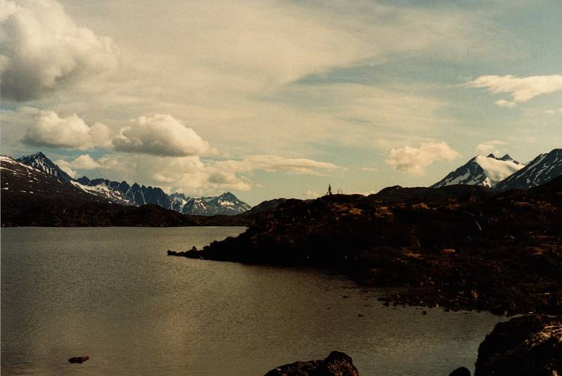
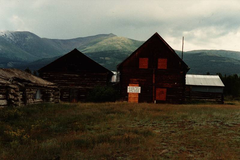
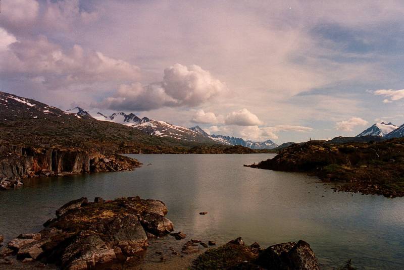
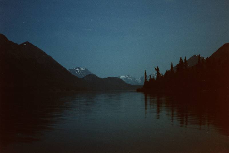
Here we are!
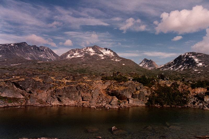
These lakes are fed by a variety of streams and glaciers. The far end of Marsh Lake, at the top of the map below, is the beginning of the Yukon River.
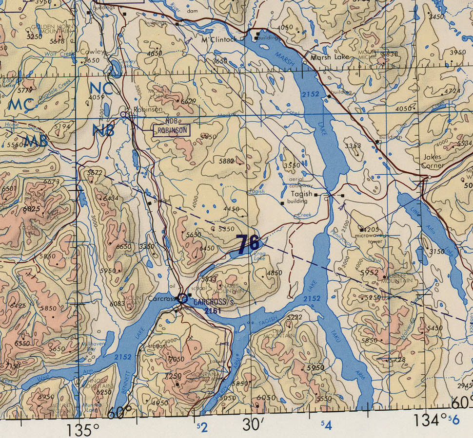
Detail of TPC D-12A from the Perry Castañeda Library Map Collection at the University of Texas, Austin.
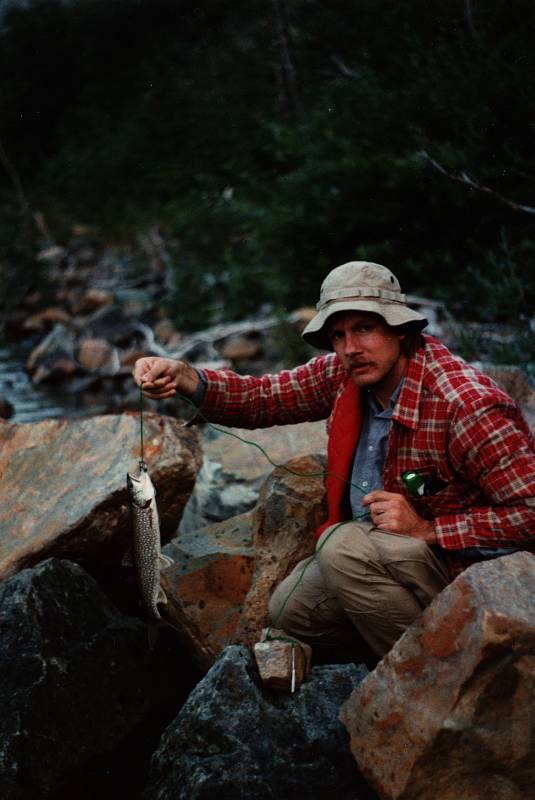
We set up camp between Carcross and the supposed settlement of Tagish, really just a bridge across the channel joining Tagish Lake to Marsh Lake.
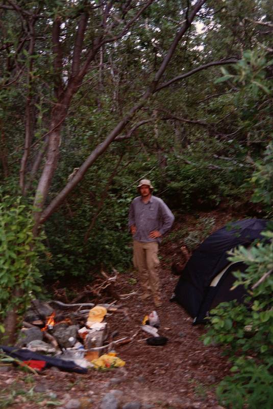
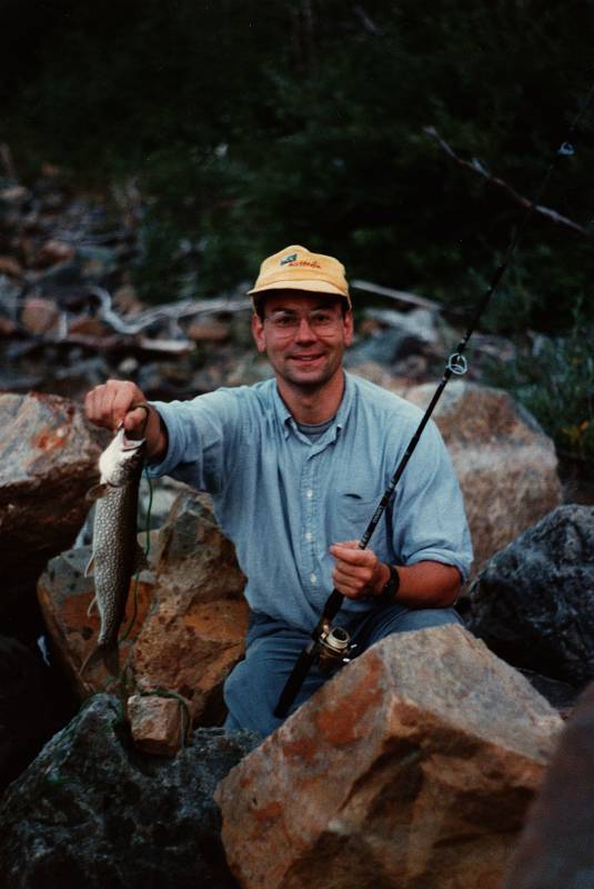
We don't have a year's supply of food, time to catch some fish.
The Klondike region has veins of gold. Volcanic action forced the gold to the surface, which was worn away by the action of streams, leaving gold nuggets and dust in deposits called placer gold. Some was along current-day creek beds, down to 5 to 10 meters below the surface. Wherever it was, the gold was unevenly distributed, meaning that striking it rich was a matter of rather poor chance.
About 100,000 people set out for the Klondike.
An estimated 30,000 to 40,000 made it up over the passes, down through the lakes and onto the Yukon River, and then on to Dawson City. Most of them arrived in 1898, two years after the original discovery, and the banks of the best creeks had all been claimed. Those who had survived the Dead Horse Trail could now try their chances against hypothermia, scurvy, dysentery, malaria, typhoid, cholera, and other delights of a hastily-built city in the subarctic.
Only about half of those, 15,000 to 20,000, became prospectors.
Of those, no more than 4,000 actually found gold, and only a few hundred became rich.
Meanwhile, prices in Dawson City had climbed to where salt was literally worth its weight in gold in the winter of 1897. Scaling to today's values, in the following spring of 1898, eggs were US$ 84 each, and apples US$ 28 each.
In the winter of 1898-1899, gold was found at Nome on the Bering Sea coast of Alaska. Prospectors abandoned the Klondike for the Nome region in 1899, and the Stampede was over. Heavier equipment was brought in, and Klondike gold extraction peaked in 1903.
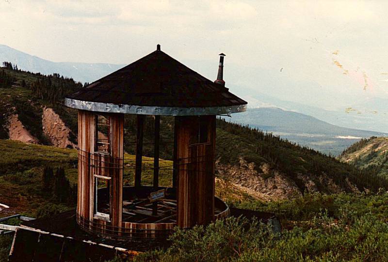
By the early 1900s people were looking for silver in the area, especially in the former settlement of Conrad, between the B.C. line and Carcross. But there was very little silver.
Mineral exploration continues today, and it continues to be an amazingly destructive and dirty operation.
The Yukon River has been polluted from mining, military installations, wastewater, and assorted dumps. The best that can be said is that it's cleaner than Russian subarctic and arctic rivers. The Yukon River Inter-Tribal Watershed Council is a cooperative effort of 70 First Nations and tribes in Alaska and Canada. It aims to restore the river and its tributaries to the point that they are safe to drink from again.
Tourism has been much more successful recently, and it's certainly far cleaner than mineral extraction.
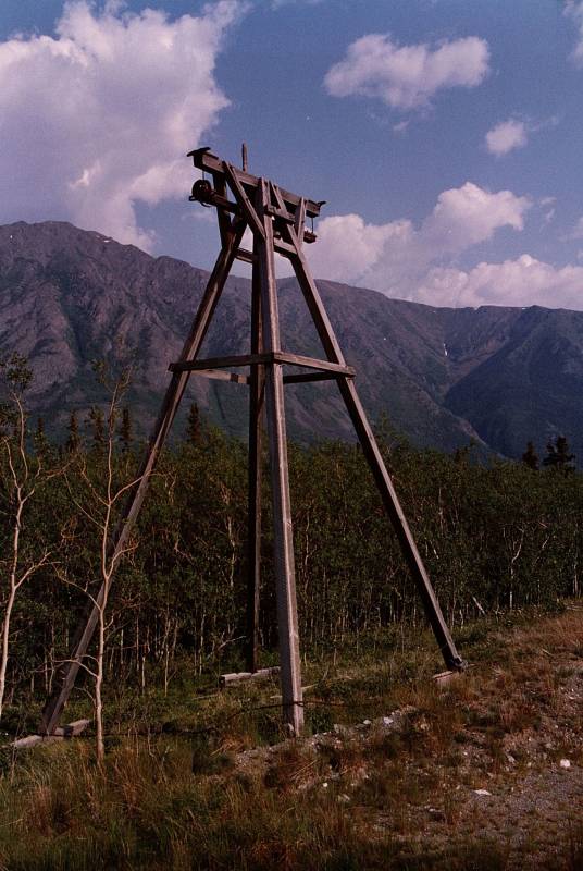
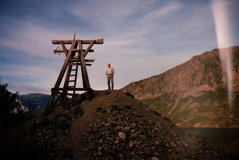
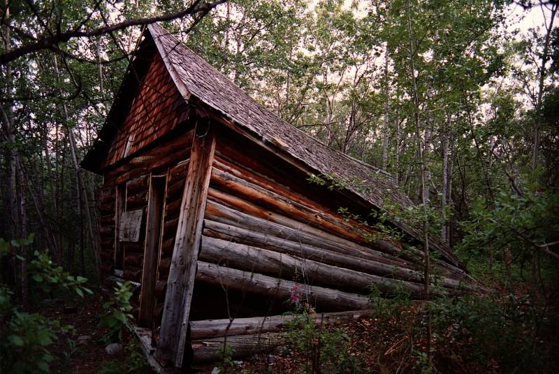
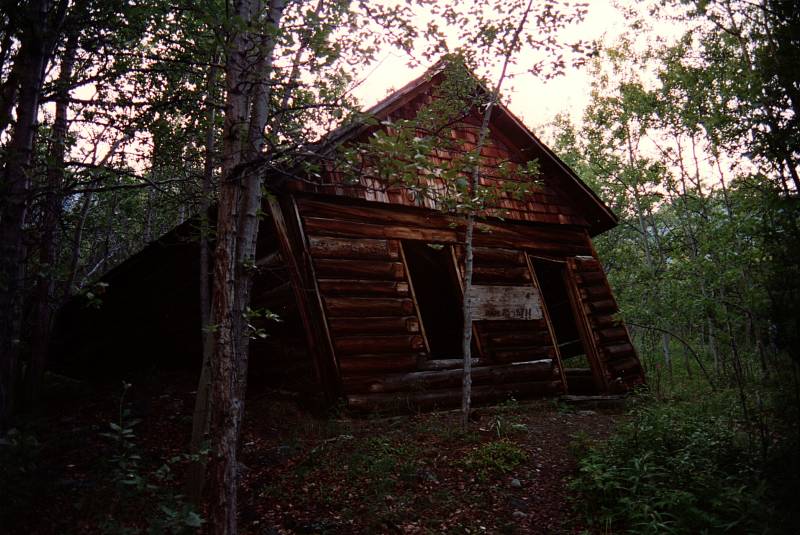
Some decaying relics of mining operations remain.
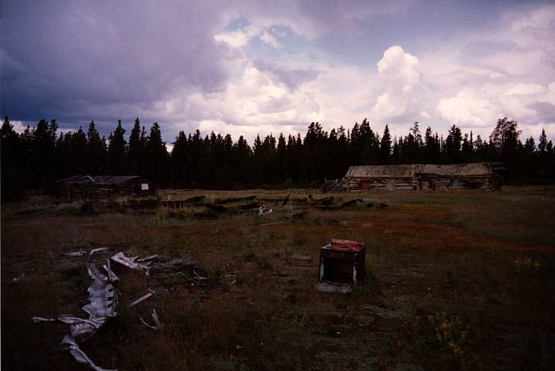
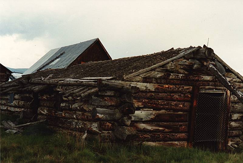
This structure, well above where we were camped, was labeled:
KARMA KAGYU SOCIETY
OF CANADA
Karma Kagyu is the second-largest lineage within the Kagyu school, one of four major schools of Tibetan Buddhism.
Carcross to Whitehorse
A narrow water channel connects Bennett Lake to Tagish Lake. Vast herds of caribou would cross here.
Artifacts have been found showing that First Nations people lived here at least 4,500 years ago, Closer to our time, the Tlingit and Tagish people had fishing and hunting camps here. The Tagish called it Naataase Heen, meaning Water Running Through the Narrows.
Europeans started building the current village in 1896, the year the gold was discovered. It became a way station on the route between the port of Skagway and the gold fields around Dawson city. They called it Caribou Crossing, and set out to kill and eat all the caribou. A recent recovery program has brought the local herd back to about 450 individuals, a tiny fraction of what it once was.
The Royal Mail set up a post office, and the Dominion Telegraph Line soon ran through a station here. The town was renamed Carcross in 1904, after repeated mail mix-ups with a Cariboo Regional District in nearby British Columbia.
Carcross was very quiet when we were there. Below you can see the crossing bridge. There used to be an old paddle-wheel steamboat pulled up beside the "downtown" buildings. It appeared on a postcard we bought, but was gone by 1993. Paddle-wheel steamboats operated on the Yukon River until the Klondike Highway was completed in the 1950s.
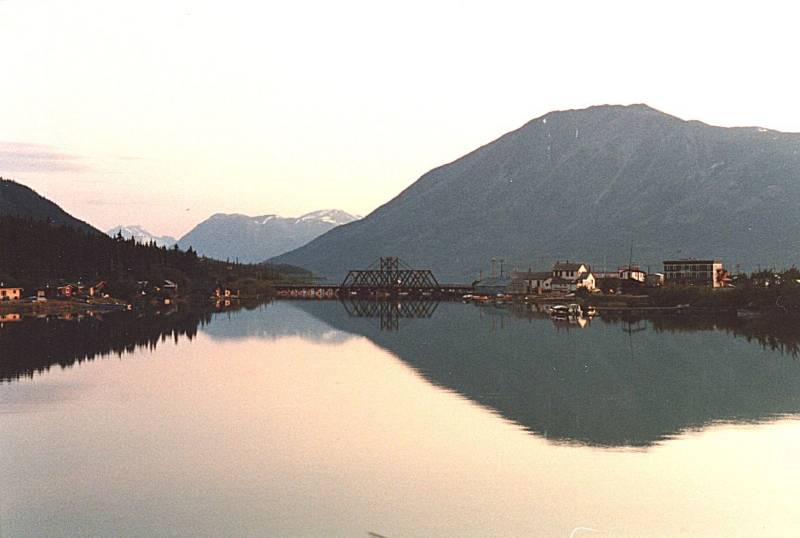
Now there's money coming in from tourism, and the population is about two and a half times what it was when we were there. Tour buses bring cruise passengers up from Skagway. The White Pass and Yukon Route narrow-gauge railroad was purchased by the Carnival cruise line, and runs six days a week. It brings cruise ship passengers from Skagway up to Carcross, and then buses can take them on to Whitehorse and even beyond to the remains of Dawson City.
Just to the north of Carcross are some sand dunes, remnants of silt from glacial lakes. The square mile of sand is now heavily touted as "the world's smallest desert", although it's much too humid for that label.
Detail of TPC D-12A from the Perry Castañeda Library Map Collection at the University of Texas, Austin.
We can take the road northeast from Carcross to Tagish and cross the bridge to join the Alaska Highway running along the north edge of Marsh Lake and continuing through Whitehorse.
The outlet of Marsh Lake is the Yukon River. It's 3,190 kilometers downstream from the north end of Marsh Lake to where the river fans out into the Yukon-Kuskokwim Delta and enters the Bering Sea. It drains an area over 25% larger than either Alberta or Texas.
The ogonek or diacritic hook on ą, ų, and į indicates a nasal form of the vowel.
The name Yukon, or ųųg han, is a contraction of the words in the Gwich'in phrase chųų gąįį han, which means White Water River and refers to the pale milky color of the water carrying the powdered minerals of glacial runoff.
The generally, but not universally, accepted source of the Yukon River is the Llewellyn Glacier at the southern end of Atlin Lake in British Columbia. Others, however, prefer Lake Lindeman at the north end of the Stampede-era Chilkoot Trail out of Dyea, Skagway's competitor.
I say, why not both? Both of these purported original sources feed into Atlin Lake. A stream called the Atlin River drains that into Tagish Lake, which is over 100 kilometers long with multiple arms one to three kilometers wide. Meanwhile, Lindeman Lake flows into Bennett Lake, which also flows into Tagish Lake. The simplest explanation is that the Yukon River comes out of this network of interconnected lakes, rather large for their elevation, which are fed by a variety of glaciers and streams. They collectively flow into the large Tagish Lake, which drains into Marsh Lake, whose output is the Yukon River. QED
Downstream from there, significant tributaries, some large, join the Yukon. However, claiming that one of them is the original source is clearly heresy.
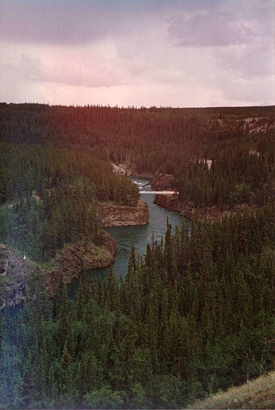
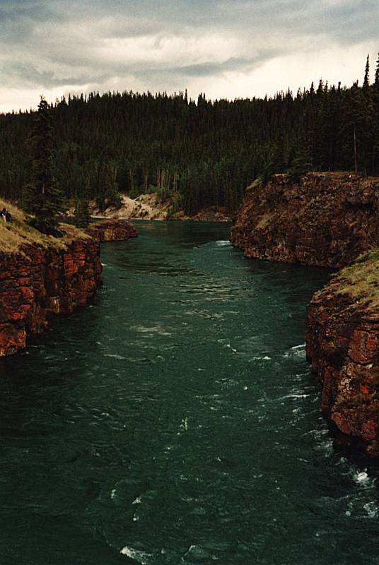
The river passes through Whitehorse and Dawson City in the Yukon, then crosses the border and runs generally west through Alaska to the Bering Sea. In that 3,190 kilometers there are only four bridges carrying vehicles, three in Yukon and only one in all of Alaska. One just below Marsh Lake (seen below), the second at Whitehorse, and the third at Carmacks.
FairbanksThen the fourth, the only bridge over the Yukon within Alaska, carries the Dawson Highway or "the Haul Road" running between Fairbanks and the oil fields on the Arctic Ocean coast.
Plus two pedestrian bridges within Whitehorse.
There's a car ferry across the Yukon River at Dawson City during the summer, it's replaced by an ice bridge once the river freezes during the winter.
The Yukon River hosts one of the longest salmon runs in the world. Chinook, Coho, and Chum salmon return to their terminal streams every year. The Chinook travel the furthest, with an estimated 35-50% going as far upstream as the Yukon and even into British Columbia.
Salmon don't eat during their spawning migration, so the Yukon River salmon must have great reserves of fat and are known for their especially rich and oily meat.
BeringiaSince Beringia flooded, the indigenous people along the Yukon River have relied upon the salmon. The number of returning adults for various species has been extremely reduced since the 1980s. Causes include effects of climate change on their food supply in the open ocean; diseases prevalent in returning adults, effects of the Pollock trawl in the Bering Sea (including salmon bycatch), and fishing along the river.
On to the Marge of Lake Lebarge
North of Whitehorse, the Yukon River widens into another lake. This one is 50 km long and from 2 to 5 km wide, with water that is always very cold.
This lake is known as Kluk-tas-si among the Tagish, Tahini-wud among the Tlingit, and Tàa'an Män among the Southern Tutchone.
The Europeans came along and promptly renamed it Lake LaBerge after a French-Canadian gold seeker from Chateauguay, Quebec.
Amazon
ASIN: 0486264726
Amazon
ASIN: B084WGCT3Y
Robert Service then corrected the European name to Lake Lebarge in his poem "The Cremation of Sam McGee". Jack London used this corrected name in his book Call of the Wild (1903).
In the late 1800s and early 1900s, steamboats trying to carry goods into the area regarded Lake Lebarge as trouble, as it was one of the last to thaw.
Although the poem was nominally fiction, it was based on Robert Service's acquaintances and experiences in the Yukon.
The Alice May was based on the Olive May, a derelict stern-wheeler belonging to the Bennett Lake & and Klondike Navigation Company, which had struck a rock and been abandoned near Tagish, near our camp.
A steamboat cremation actually happened. Doctor Sugden used the firebox of the Olive May to cremate the body of Cornelius Curtin, who had died of pneumonia. His remains were then shipped to his family for burial.
There was a boat named the Alice May that sank on Lake Lebarge, but that happened ten years after Service's poem was published.
There was a William Samuel McGee. He was a road builder who indulged in some prospecting. He was in San Francisco in 1898, when he left for the Yukon.
Service was working for the Canadian Bank of Commerce in 1904, and saw McGee's name on a form. He contacted McGee, and got permission to use his name.
| State | Joined |
| Oklahoma | 1907 |
| New Mexico | 1912 |
| Arizona | 1912 |
| Alaska | 1959 |
| Hawaii | 1959 |
McGee returned to the Lower 45 or 46 or 47 or 48 to build roads. In 1930 he went back to the Yukon. He returned with an urn he had purchased in Whitehorse. The urns, claimed to contain the ashes of Sam McGee as described in Service's poem, were being sold to tourists.
And so:
There are strange things done in the midnight sun
By the men who moil for gold;
The Arctic trails have their secret tales
That would make your blood run cold;
The Northern Lights have seen queer sights,
But the queerest they ever did see
Was that night on the marge of Lake Lebarge
I cremated Sam McGee.
Now Sam McGee was from Tennessee, where the cotton blooms and blows.
Why he left his home in the South to roam 'round the Pole, God only knows.
He was always cold, but the land of gold seemed to hold him like a spell;
Though he'd often say in his homely way that "he'd sooner live in Hell".
On a Christmas Day we were mushing our way over the Dawson trail.
Talk of your cold! Through the parka's fold it stabbed like a driven nail.
If our eyes we'd close, then the lashes froze till sometimes we couldn't see;
It wasn't much fun, but the only one to whimper was Sam McGee.
And that very night, as we lay packed tight in our robes beneath the snow,
And the dogs were fed, and the stars o'erhead were dancing heel and toe,
He turned to me, and "Cap", says he, "I'll cash in this trip, I guess;
And if I do, I'm asking that you won't refuse my last request".
Well, he seemed so low that I couldn't say no; then he says with a sort of moan:
"It's the cursed cold, and it's got right hold till I'm chilled clean through to the bone.
Yet 'tain't being dead–it's my awful dread of the icy grave that pains;
So I want you to swear that, foul or fair, you'll cremate my last remains".
A pal's last need is a thing to heed, so I swore I would not fail;
And we started on at the streak of dawn; but God! he looked ghastly pale.
He crouched on the sleigh, and he raved all day of his home in Tennessee;
And before nightfall a corpse was all that was left of Sam McGee.
There wasn't a breath in that land of death, and I hurried, horror-driven,
With a corpse half hid that I couldn't get rid, because of a promise given;
It was lashed to the sleigh, and it seemed to say: "You may tax your brawn and brains,
But you promised true, and it's up to you to cremate those last remains."
Now a promise made is a debt unpaid, and the trail has its own stern code.
In the days to come, though my lips were dumb, in my heart how I cursed that load.
In the long, long night, by the lone firelight, while the huskies, round in a ring,
Howled out their woes to the homeless snows— O God! how I loathed the thing.
And every day that quiet clay seemed to heavy and heavier grow;
And on I went, though the dogs were spent and the grub was getting low;
The trail was bad, and I felt half mad, but I swore I would not give in;
And I'd often sing to the hateful thing, and it hearkened with a grin.
Till I came to the marge of Lake Lebarge, and a derelict there lay;
It was jammed in the ice, but I saw in a trice it was called the "Alice May."
And I looked at it, and I thought a bit, and I looked at my frozen chum;
Then "Here," said I, with a sudden cry, "is my cre-ma-tor-eum."
Some planks I tore from the cabin floor, and I lit the boiler fire;
Some coal I found that was lying around, and I heaped the fuel higher;
The flames just soared, and the furnace roared—such a blaze you seldom see;
And I burrowed a hole in the glowing coal, and I stuffed in Sam McGee.
Then I made a hike, for I didn't like to hear him sizzle so;
And the heavens scowled, and the huskies howled, and the wind began to blow.
It was icy cold, but the hot sweat rolled down my cheeks, and I don't know why;
And the greasy smoke in an inky cloak went streaking down the sky.
I do not know how long in the snow I wrestled with grisly fear;
But the stars came out and they danced about ere again I ventured near;
I was sick with dread, but I bravely said: "I'll just take a peep inside.
I guess he's cooked, and it's time I looked"; ... then the door I opened wide.
And there sat Sam, looking cool and calm, in the heart of the furnace roar;
And he wore a smile you could see a mile, and he said: "Please close that door.
It's fine in here, but I greatly fear you'll let in the cold and storm—
Since I left Plumtree, down in Tennessee, it's the first time I've been warm."
There are strange things done in the midnight sun
By the men who moil for gold;
The Arctic trails have their secret tales
That would make your blood run cold;
The Northern Lights have seen queer sights,
But the queerest they ever did see
Was that night on the marge of Lake Lebarge
I cremated Sam McGee.
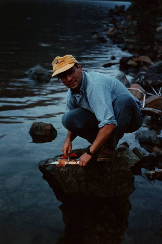
In 1999 they posted signs at Lake Lebarge with strong warnings against eating the livers of burbot, a cod-like freshwater fish that lives part of the year under ice, and against consuming lake trout more than twice per month.
Hmmm. We were pretty much living on lake trout at the time.

Toxaphene, chlorinated camphene
This was because of toxaphene contamination, and over-fishing in Lake Lebarge resulting in changes to its typical food chain.
Toxaphene is an insecticide that was used primarily for cotton in the southern United States during the late 1960s and 1970s. It was used broadly and recklessly enough to be a problem way up here in the Yukon. It's produced by reacting chlorine gas with camphene to produce a yellow to amber waxy solid.
Toxaphene was banned in the United States in 1990, and banned globally in 2001. It's a very persistent chemical that can remain in the environment for years without degrading.
The good news is that we only looked at Lake Lebarge, and got our fish out of other lakes.
This picture was taken in the middle of the night. North of 60° N it never gets completely dark during the summer months, and we were there just a couple of weeks after the summer solstice.
We drove back to Skagway and took an AMHS ferry to Juneau. We were there for a few days, and then flew back to the Lower 48.
Where next?
Another destination in Canada, or maybe another country?