Uwanabe Kofun
Uwanabe Kofun
The second kofun I visited is in an area northwest of Nara. The area, which I believe is called Sakitabira Nomi Funghun or the Saki Shield Group, has several kofun. "Saki" refers to the Saki Hills further to the northwest, and "shield" refers to the shape of the outer perimeter of the moat around a typical kofun.
This kofun group is north of the Heijō Palace area. That was the Imperial residence during the Nara period of 710 to 794. Heijō-kyō is the old name for Nara.
The structures in the palace complex were all either disassembled and moved to the new capital in Heian, or else they were destroyed by fire or other disasters. The area was used for agriculture for centuries. The Nara National Research Institute for Cultural Properties has been investigating the site since 1959. Excavation started in the 1970s, and reconstruction of some structures started in the 2000s.
| Location | 135.8072° E 34.6972° N |
| Length | 205.4 meters |
| Circle diameter | 128 meters |
| Width at base | 129.5 meters |
| Height of circle | 19.8 meters |
| Height of bottom end | 16 meters |
| Orientation | ~355° |
Take the Kintetsu train west from the Nara station to the first stop at Shin-Ōmiya. Walk north from there, crossing the bridge over the Saho River. Continue north along the highway. Cross over the pedestrian bridge to the west side of that highway and continue north. You will pass a school as the road heads out of town. It will be very obvious when you come to the southeast corner of the kofun moat.
Amazon 0915703114
Amazon 0824818520
This is a proper kofun! A definite keyhole shape, and a broad moat that goes all the way around.
Who is Buried Here?
No one knows. The Imperial Household Agency hasn't even decided who to say is buried here.
Based on a sketchy Google translation of the Japanese Wikipedia page, it seems that they plan to build a visitor's center, at which point they may say that it contains one of the consorts of the 16th Emperor, Nintoku. That includes Princess Iwa, who became Empress (and who is already the purported inhabitant of a nearby kofun), Empress Yatanohimemiko, her sister Uji no Wakiiratsume, Himuka no Kaminagahime, or Kurohime.
As Mel Brooks taught us, it's good to be the Emperor.
The Kofun
You arrive at the southeast corner of the moat. A small road leads around the south, west, and north sides. I noticed a sign at the southeast corner.
It said: ウワナベ
Katakana and HiraganaA quick look at my katakana study sheet showed that ウワナベ spells u-wa-na-be.
That's katakana, not hiragana. Hiragana is used to phonetically spell Japanese words. Katakana is used to spell foreign words. So uwanabe is not a Japanese word.
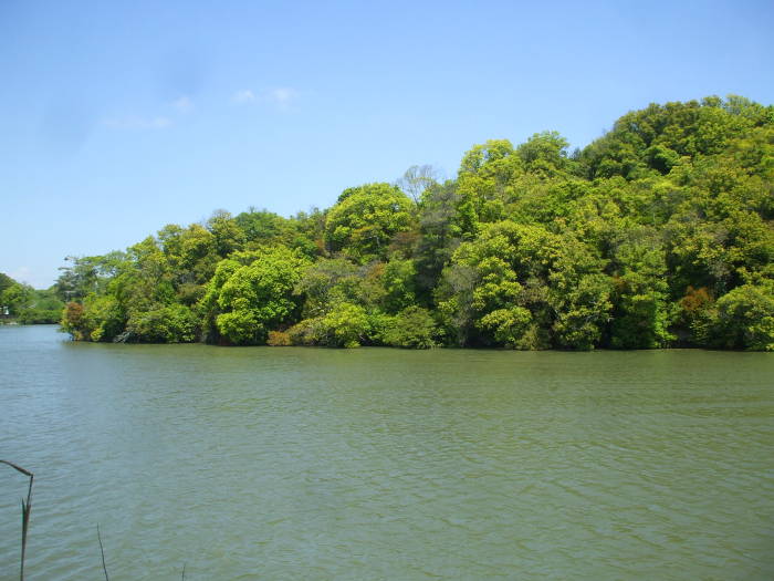
That's it, I'm out of insights. Let's walk part of the way around Uwanabe Kofun. In the first picture below I'm starting at the southeast corner next to the ウワナベ sign.
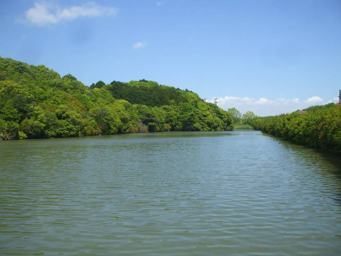
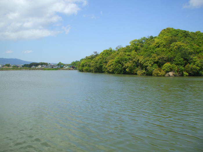
In the last picture above I'm looking across the broad rectangular bottom of the moat.
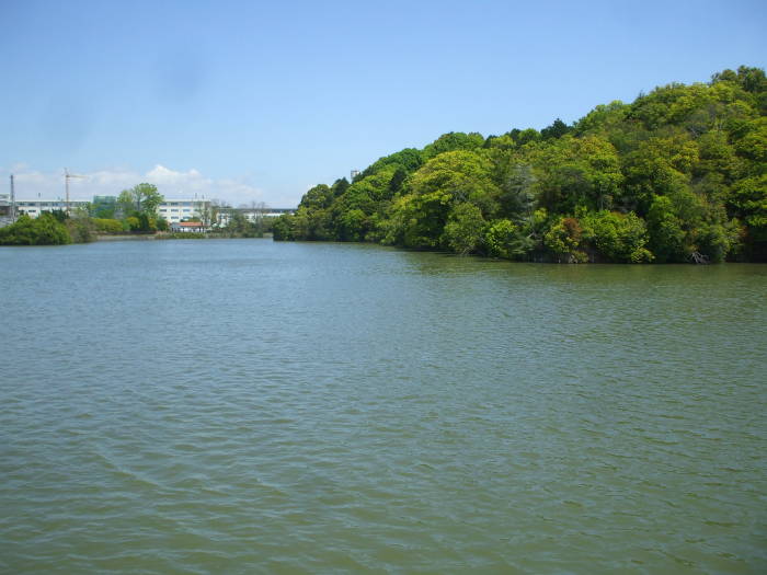
In the next two pictures below, I'm walking across the southern edge of the moat looking at the bottom end of the kofun.
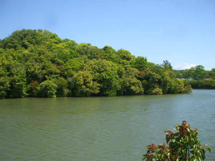
I come to the southwest corner and look north along the long west side of the moat.
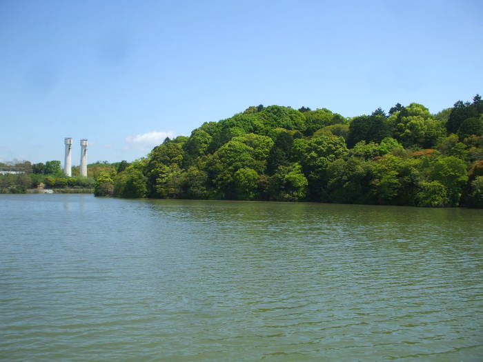
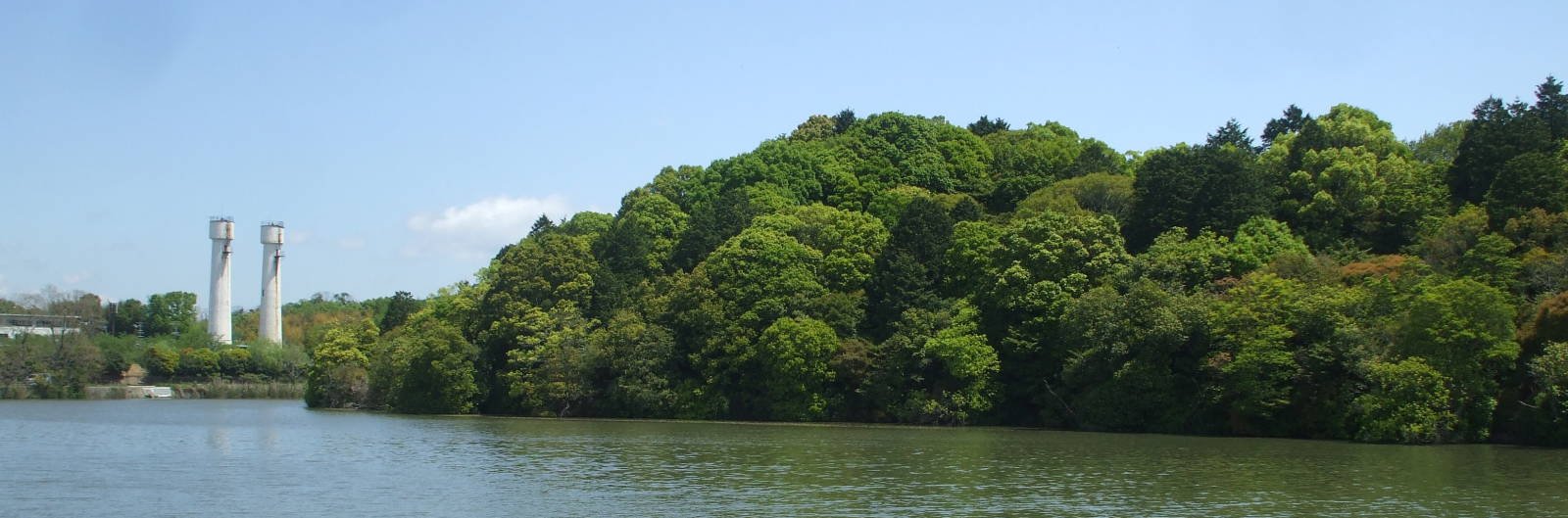
A small Japan Air Self-Defense Force is between Uwanabe and the next kofun. Those two white towers seem to be water tanks on the air base.
Where next?
From here it's a very short distance to the southeast corner of the moat around Konabe Kofun.
The above is specific to the kofun around Nara. Or maybe you want to explore other places in Japan.
Other topics in Japan:

Amazon 1839059796

Amazon 1640975438