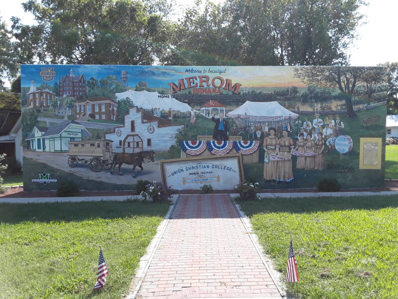
The Merom Site
Visiting Merom
The Merom Site dates from about
1000–1500 CE, it was abandoned well before
European contact.
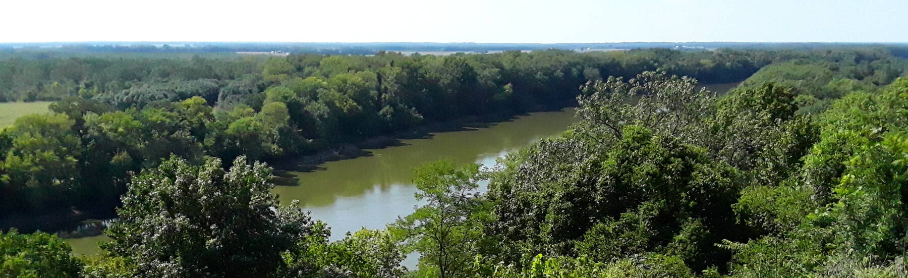
It's near the small town of Merom, on a small ridge
extending off a bluff overlooking the Wabash river
on the west edge of Indiana.
The site originally had several mound features
and some box graves.
They were visible in the late 1800s, but they have since
been obliterated by clumsy excavation followed by
years of agricultural use.
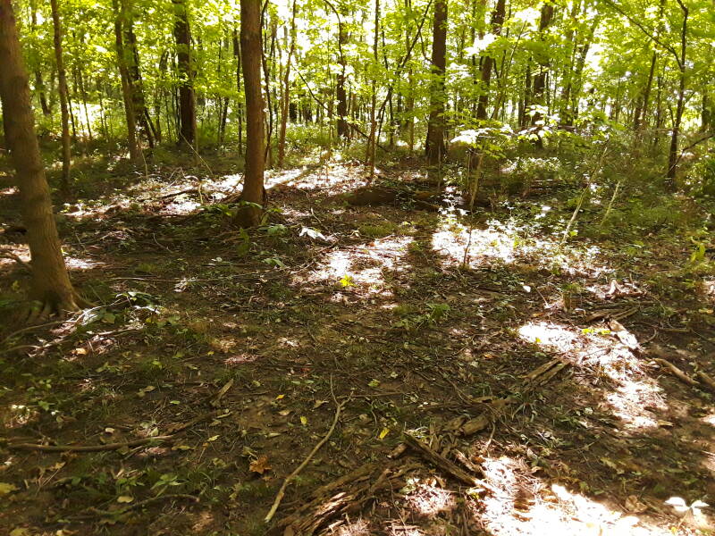
We can visit the site, a ridge now covered by trees,
but without ground-penetrating radar you can't see anything
from the time of occupation.
The small town near the site has much recent history
from an unexpected educational institution
and the 19th-20th century Chautauqua movement.
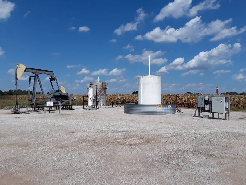
I was coming from the south, from Vincennes. That route took me through the oil country of west-central Indiana. There are some coal strip mines in the area, and several walking arm pump jacks extracting oil.
An electric motor at the right end of this one turns a crank arm with a counterweight. As the left end goes up and down, it pulls and pushes a string of rods that extend down the bore hole to the down-hole pump. Each stroke can produce five to forty liters of liquid, typically an emulsion of crude oil and water.
Approaching the small town of Merom you see the Merom Generating Station as it's the only thing extending far above the flat terrain. It's a 2-unit 1080-MW coal-fired power plant, over five kilometers east of the town of Merom across the Turtle Creek Reservoir. Like many Indiana power plants, its owner has recently paid a multimillion dollar settlement over its noxious emissions, and there are plans to retire the facility.
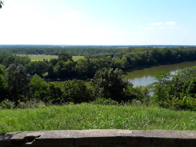
Here we are at the Merom town park, along the edge of the bluff looking over the Wabash river into Illinois. It's almost 200 feet down to the river.
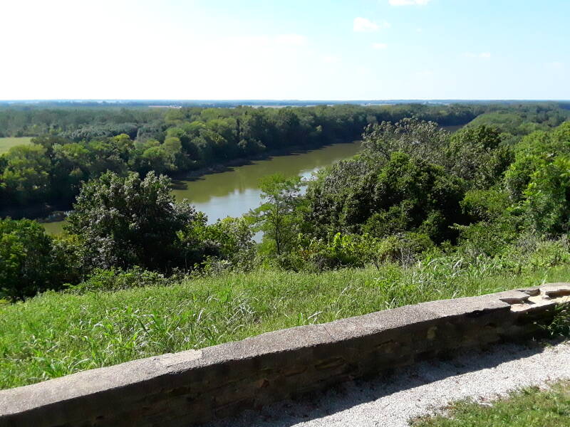
A little to the left of this view, the only thing extending above the flat Illinois terrain is the Marathon company oil refinery in Robinson, Illinois, about nine miles to the west-southwest.
Merom's post office began operation since 1818. The population was 228 at the 2010 census.
The town is named after the Battle of the Waters of Merom, a battle described in Joshua chapter 11, fought between the Israelites and a coalition of Canaanite city-states near the Waters of Merom. That's a lake ten miles north of the Sea of Galilee formed by the River Jordan. Some archaeologists say that the battle may never have taken place, with the narrative preserving memories of battles in the early Iron Age.
The National Registry of Historic Places Inventory nomination form shows that as recently as the 1970s, the site was clear of trees.
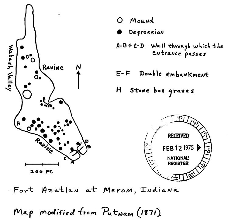
Fort Azatlan is an aboriginal hill-top "fortress" situated on top of an upland spur projecting northwestward and then northward. This projection is widest at its southeast end and narrows markedly at its northern extremity. The site is elevated over 100 feet above the Wabash River bottoms to the west and is bounded by steep ravines on every other side except the southeast. It is entered from the southeast over more or less level terrain connecting the spur to the body of the upland. The entrance to the fort passes through a protective earthen embankment which traverses the neck of the projection. A discontinuous earthen wall runs along the periphery of the spur.
Near the entrance the walls are reported to be about 1 ½ feet high and the circumference of the site to be about 2450 feet (Putnam 1871). The enclosed area is reported by Collett (1871) to be about 3 acres and by Lilly (1937) to be about 5 acres.
Putnam (1871) reported 45 more or less circular depressions, 5 mounds, and 3 stone box graves within the fort. The depressions are said to vary from 10-30 feet in diameter. One is reported to be 5 feet deep. Putnam hypothesized that most of them were house pits. The largest mound reportedly is nearly 50 feet in diameter and thought to have been 10 feet high at the most. Burials were found in the 2 mounds opened by Putnam.
Various people have conducted unsystematic excavations at the site (Collett 1871; Cox 1879; Putnam 1871). Such activities, plowing, and erosion have greatly altered its features. In 1937 Lilly reported that the mounds and depressions had almost disappeared and that the embankment were much reduced. A 1973 inspection of the site corroborates Lilly. At that time the area was covered with grass and weeds.
No satisfactory archaeological work has occurred at Fort Azatlan. Our knowledge of the site depends upon brief reports of past unsystematic explorations. These indicate that the site was utilized for defensive, habitation, and burial purposes.
The stone box graves and shell tempered pottery recovered from the site indicate a Mississippian component postdating A.D. 1000. However, at this point we are not certain whether the embankments, mounds and depressions were all constructed by the Mississippian occupants. At least some of these features may have been constructed by earlier Woodland people.
Whether single or multicomponent, the site is quite important. Not only are so-called hill-top forts uncommon in Indiana but this is the only example known from the Wabash Valley. Fort Azatlan is a unique site for the area and must be excavated if we are to adequately comprehend the settlement system of which it was a part. Excavation could provide much needed information pertaining to the functions and cultural affiliation of the site and the cultural dynamics of the area. The area in question is on the frontier of Mississippian expansion.
Fort Azatlan is one of Indiana's well known sites and should be protected.
Below is the map from the 1975 National Register paperwork, based on a work from 1871.
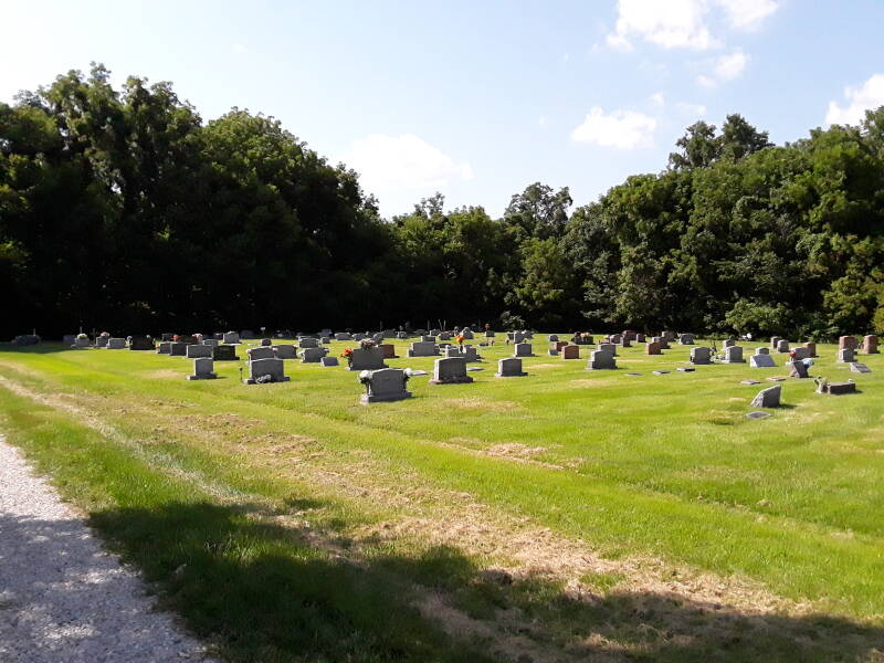
To visit the site, go to the town's cemetery. Go to its newest area, the furthest to the west, and go to the northwest corner of that. Then follow the path into the woods.
Below is a picture from 1975, part of the National Register of Historic Places nomination form. This is looking to the northeast, taken from what now is the latest extension to the local cemetery. At that time the ridge was largely open.
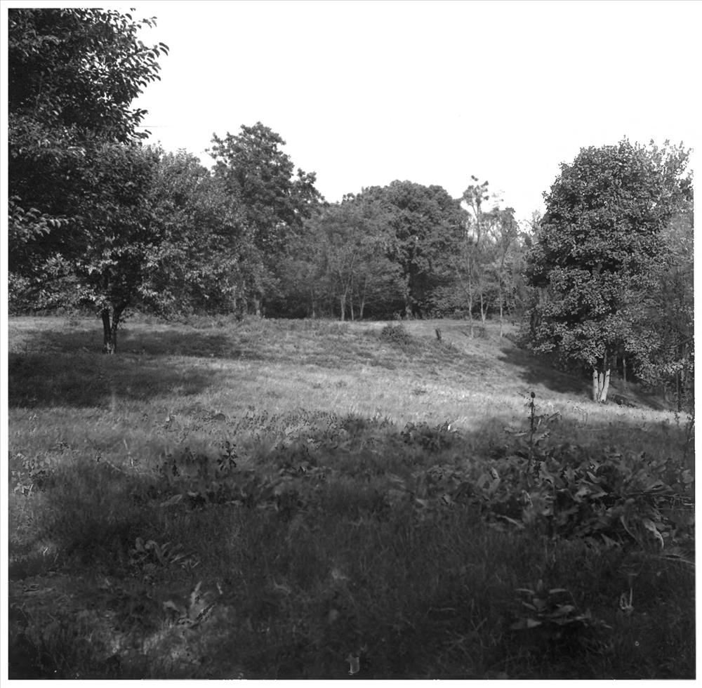
Below is a similar view today. We're looking diagonally across the western, newest section of the cemetery. The path to the site is at the far corner, at the northwestern corner of this section.
Here's the path into the woods, grown up since 1975. This area at the edge of the woods is roughly where the walls A-B and C-D were, referenced in the map from Putnum's document in 1871.
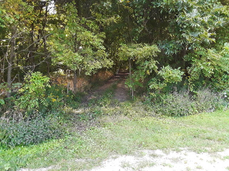
The path is a rough vehicle track at the beginning.
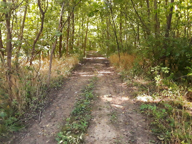
It quickly becomes less distinct as we continue to the northwest and the north.
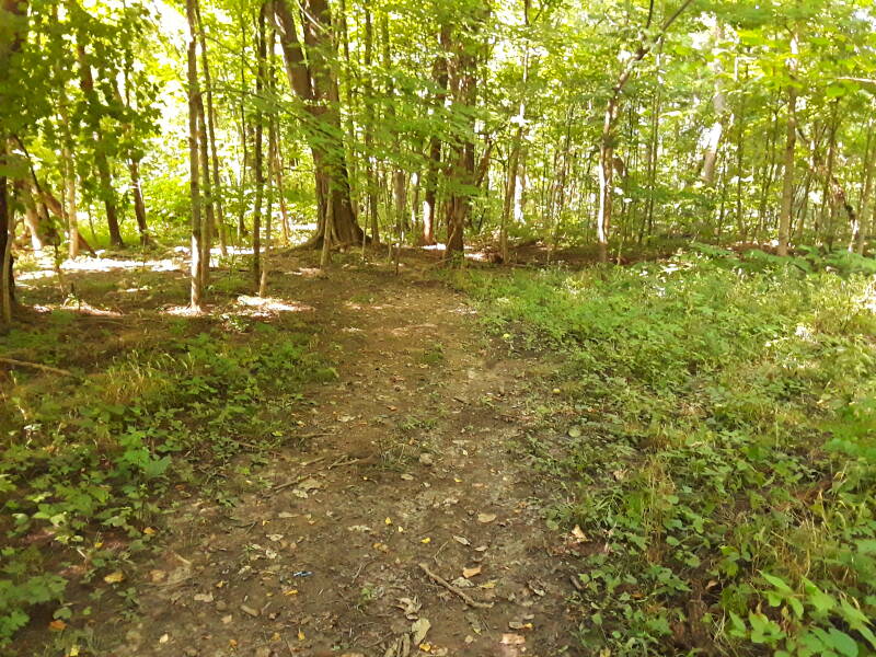
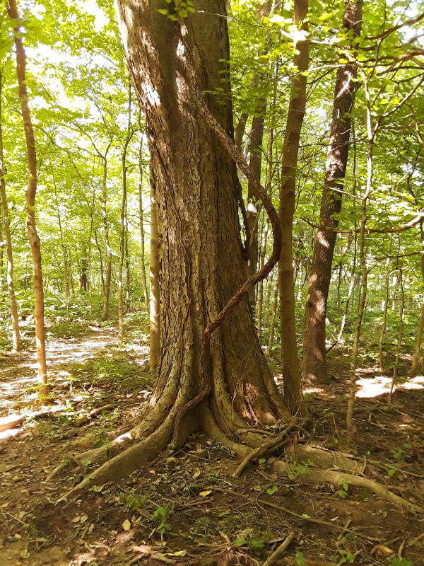
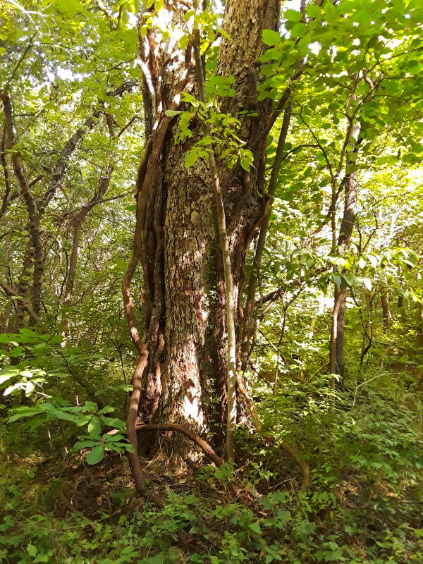
Some of the older, larger trees would have been here before the National Register document and photo of 1975.
The people living in Merom named the site "Fort Azatlan" in the late 1800s, referencing Aztlán, the ancestral home of the Aztec peoples. That was as fanciful as the purported history, which described the site's occupation as a series of degenerations through "Mound-Builders", then "an intermediate race of fishermen", and most recently, "the savage Indians".
Second Report of the Geological Survey of Indiana, 1870Stephen Williams' Fantastic Archaeology: The Wild Side of North American Prehistory describes the nineteenth century belief that the native people were primitive savages incapable of designing and creating earthworks or any other accomplishments. Of course they must have had help from advanced civilizations crossing the Atlantic from Europe, or Israel, or Egypt. The same nonsense continues today, now involving extraterrestrials.
The following is from History of Greene and Sullivan Counties, Chapter II, Professor John W. Spencer, 1884, Goodspeed Brothers, Chicago. It draws from the state geological survey of 1870.
THE HISTORICAL EARTHWORKS
The following is an extract from Indiana Geological Survey. 1870, page 237: "When first explored by the white race, this county was occupied by savage Indians, without fixed habitations, averse to labor, and delighting only in war and the chase. Their misty traditions did not reach back to a previous people or age. But numerous earthworks are found in this region of such extent as to require for their construction time and the persistent labor of many people. Situated on the river bluffs, their location combines picturesque scenery, susceptibility for defense, and convenience to transportation, water and productive lands. These are not requisites in the nomadic life of the red men, and identifies the Mound-Builders as a partially civilized, agricultural people."
SEPULCHRAL MOUNDS
"On the Hunt farm, Sections 6 and 7, Township 9, Range 10, conical knolls of loess have been artificially rounded, and used for sepulchral purposes. One of these contained at the summit, seventy feet above its base, a burial vault 'three stories high;* on each floor from five to seven human skeletons were found. On M. Drake's land, Section 19, same township, are two large mounds, one 200 feet in diameter, and eighteen feet high; the other twenty.eight feet high, covering an elliptic base 180 feet wide, and 350 feet long. The contents of the two mounds amount to nearly 30.000 cubic yards, and at present contract prices for earth work, their erection would cost $5,000. Another group on Turman's farm, Section 15, Township 8, Range 11, has been partially explored, exposing human and animal remains, pottery variously ornamented, flints, and stone implements. The 'pit-holes' accompanying these mounds and a rectangular excavation will reward future explorers."
FORT AZATLAN
"The ancient works near Merom, I have, with the citizens of that town, christened "Fort Azatlan,' in honor of the kind memories with which the people of Montezuma reverted to their old home in 'the valley of great lakes and rivers.' On three sides, the fort is defended by the precipitous banks of the river and of ravines, in front by an earth (or adobe) wall, and incloses an area of about three acres. Explorations made by a cut traversing the largest mound from northeast to southwest, discovered relics of stone and flint, shells of the Unio, Helix and Paludina, and of the river turtle, bones of many other animals, and twelve human skeletons. These last present anomalous forms of high interest to the anthropologist, and the section across the mound developed the following arrangement: At the base, ashes and mineralized bones of the Mound-Builders; near the surface, remains of the savage Indians; and, between these two, intrusive graves of an intermediate race — fishermen, who prepared vaults for their dead. The degree of civilization attained by the latter may be inferred from the faith in immortality exhibited by the deposit of food for the departed; from the careful preparation of their sepulchers, and especially from the respectful burial of children — not the habit of Mound-Builders. In illustration of the last fact, a small stone vault near the brow of the hill was opened. It contained the bones of two babes who had been tenderly laid to rest ornamented with a child's treasure of shell beads. All the mounds which have come under my notice are located so as to secure an outlook toward sunrise, confirming the belief that the fires of the sun-worshipers have blazed upon every mound capped eminence in the great valley of the continent."
At this point, the end of the extract from the state geological survey, there was a diagram based on Professor F. W. Putnum's work of 1871. The sketch included in the National Register of Historic Places registration, included above on this page, was based on that. Now it's back to Spencer's 1884 writing:
PARTICULAR DESCRIPTION
The 'fort' is situated on a plateau of loess, about 170 feet in height above low water, on the east bank of the river. On the river side, the bank, which principally consists of an outcrop of sandstone, is very steep, and forms the western line of the fortification, while deep ravines add to its strength on the other sides; the weak points being strengthened by earthworks. The general course of the work is from the north, where it is very narrow (not over fifty feet), owing to the formation of the platean, south along the river bank about 725 feet to its widest portion, which is here about 375 feet east and west. From this point it follows a deep ravine southerly about 460 foot to the entrance end of the fort. The bank traversed by the entrance road is hero much wider than at other portions, and along its outer wall, running eastward, are the remains of what was evidently once a deep ditch. The outer wall is about thirty feet wide, and is now about a foot and a half high: a depressed portion of the bank, or walk way, then runs parallel with the outer wall, and the back is then continued for about twenty feet further into the fort, but of slightly less height than the front. Through the center of these banks there are the remains of a distinct roadway about ten feet in width.
From the northeastern corner of this wide wall the line continues northwesterly about 350 feet along the western ravine to a point where there is a spring, and the ravine makes an indenture of nearly 100 feet to the southwest. The mouth of the indenture is about seventy-five feet in width, and the work is here strengthened by a double embankment. The natural line of the work follows this indenture, and then continues in about the same northerly course along the banks of the ravine, to too narrow portion of the plateau. about 550 feet to the starting point. There is but a continued line, in part natural and in part artificial, which, if measured in all its little ins and outs, would not be far from 2,450 feet. Besides the spring mentioned as in the indenture of the eastern ravine, there is another spring in the same ravine about 175 feet to the north of the first, and a third in the southwestern ravine about 125 feet to the west of the southwestern corner of the work.
ADVANTAGE OF LOCATION
Looking at all the natural advantages offered by this location, it is the one spot of the region, for several miles along the river, that would be selected to-day for the erection of a fortification in the vicinity, with the addition of the possession of a small eminence to the north, which in these days of artillery would command this fort. Having this view in mind, a careful examination was made of the eminence mentioned, to see if there had ever been an opposing or protective work there. but not the slightest indication of earthwork fortification or of mounds of habitation was discovered, though some five or six miles up the river on the Illinois side, at Hutsonville, a large group of some fifty-nine mounds of habitation were investigated. The interior of this fortification contains much of interest, and its history may yet be in part made out by a more extended examination than it was possible to make during the few days given to its exploration. On crossing the outer wall, a few low mounds are at once noticed, and all around are seen largo circular depressions. At the southern portion of the fort these depressions, of which there arc forty-five in all, are most numerous, thirty-seven of them being located near together.
These depressions vary in width from ten to twenty-five or thirty feet, and are irregularly arranged. One of the six depressions opposite the indenture of the eastern ravine is oval in shape, and is the only one that is not nearly circular; the others vary but a foot or two in their diameters.
THE DEPRESSIONS
Two of these depressions were dug into, and it was found that they were evidently once large pits that had gradually been filled by the hand of time with the accumulation of vegetable matter and soil, which had been deposited by natural action alone. In some instances, large trees are now growing in the pits, and their many roots make digging difficult. A trench was dug across one pit throwing out the soil carefully until the former bottom of the pit was reached at a depth of about five feet On the bottom, ashes and burnt clay gave evidence of an ancient fire, and at a few feet on one side several pieces of pottery, a few bones of animals and one stone arrow-head were found. A spot had evidently been struck where food had been cooked and eaten, and though there was not time to open other pits, there is no doubt but that they would tell a similar story, and the legitimate conclusion to be drawn from the facts is that those pits were the houses of the inhabitants or defenders of the fort, who were probably further protected from the elements and the arrows of assailants by a roof of logs and bark or boughs. The great number of the pits will show that they were for a definite and general purpose, and their irregular arrangement would indicate that they wore not laid out with the sole idea of acting as places of defense, though those near the walls might answer as covers from which to fire on an opposing force beyond, and the six pits near the eastern indenture, in front of three of which there are traces of two small earth walls, and the two commanding the entrance of the fort, would strengthen this view of the use of those near the embankment.
In many of the ancient fortifications that have been described by Mr. Squier and others, pits have been noticed, but they have been only very few in number, and have been considered as places for the storage of food or water. The great number in this small earthwork, with the finding that one at least was used for the purpose of cooking and eating food, is evidence that they were for some other purpose here, though some of the smaller ones may have answered for storehouses.
CONTENTS OF THE MOUND
The five small mounds were situated in various parts of the inclosure. The largest was nearly fifty feet in diameter, and was probably originally not over ten feet in height. It had been very nearly dug away in places, but about one-fifth of the lower portion had not been disturbed. From this was exhumed one nearly perfect human skeleton, and parts of several others that had been left by former excavators. This mound also contained several bones of animals, principally of deer, bear, opossum and turtles; fragments of pottery, one arrow-head, a few dint chips and a number of thick shells of unios, two of which had been bored near the hinge. From this mound a number of human bones have been taken by Dr. H. Frank Harper.
The position of all the mounds within the inclosure is such as to suggest that they were used as observatories, and it may yet be questioned whether the human and other remains found in them were placed there by the occupants of the fort, or are to be considered under the head of intrusive burials by a later race. Perhaps a further study of the bones may settle the point. That two races have buried their dead within the inclosure is made probable by the finding of an entirely different class of burials, at the extreme western point of the fortification. At this point, Dr. Harper, the year previous, had discovered three stone graves, in which he found portions of the skeletons of two adults and one child. These graves, the stones of one being still in place. were found to be made by placing thin slabs of stone on end, forming the aides and ends, the two being covered by other slabs, making a rough stone coffin in which the bodies had been placed. There was no indication of any mound having been erected, and they were placed slightly on the slope of the bank. This kind of burial is so distinct from that of the burials in the mound, that it is possible that the acts may be referred to two distinct races, who have occupied the territory successively, though they may prove to be of the same time, and simply indicate a special mode adopted for distinctive purposes.
OTHER EVIDENCES OF PREHISTORIC OCCUPANCY
In this county are frequently found other evidences of the existence of a extinct race of people, viz., stone axes, arrow and spear heads, and other stone implements of various forms and size. Having sent some of these to the Smithsonian Institution at Washington City. I was requested to make some explorations in the mounds of this county, by the Secretary. Prof. Joseph Henry, but only examined a few: went to those on the Hunt farm, but was not permitted by the owner to open them; and those on the Drake farm I found to be too large, and thought best to obtain some assistance. Examined one on Turman's farm, but did not complete the excavation of a ditch Across the largest one. A thorough examination of one of the 'pit-holes' resulted in finding a wonderful bank of ashes, in which were a great quantity of fish bones, broken bones of various animals, such as deer, buffalo; the teeth, claws and bones of the bear: the bones of the raccoon, opossum, turkey bones in abundance: the bones of the squirrel and a few of the skulls of squirrels were found whole, but were generally broken; the bones and teeth of the beaver; many pieces of the bones and shells of turtles. There was a quantity of mussel shells of various kinds, some varieties of which were not found in several miles' travel along the Wabash or any other streams in this county, that were found in abundance on White River, in Greene County. Fish bones seemed to be in the greatest abundance, particularly in certain places. A great many pieces of pottery were found, and seemed to have been made of clay, sand and mussel shells pounded fine, and forming a cement that had been dried in the sun or baked. The most of the pieces found showed that the heat applied in their preparation was not sufficient to effect the sand, or in any manner injure the shells, or the original condition of the vessels. No glazing appeared on the pottery, and yet it was a very hard, firm and durable substance, impervious to water. Some pieces were four or live inches long, and two or three inches wide, and some were of an irregular shape; at one point they seemed to show that they were parts of a wide-mouthed vessel, and evidently about two inches less in diameter at the neck than at the top. Judging from the arc described by some of those pieces, the neck of those vessels must have been at least eighteen inches in diameter, though the curvature of many pieces showed that they were parts of vessels of much smaller diameter. Several pieces showed a nice little ear, with a hole through it, about a quarter or half inch in diameter, and the edges being notched, showed that they were pieces of the rim of the vessels to which they belonged. There were also parallel lines running about in an oblique direction to their curvature: but in some of the pieces, the lines were horizontal or parallel with the tops of the vessels, when whole, which had, evidently, been made by some blunt instrument pressed into the clay, leaving little ridges between each impression of the instrument, probably about the eighth or sixteenth of an inch thick. In some of those pieces the little ridges seemed to have been crossed at right angles, with a sharper or smaller instrument.
POTTERY
Some pieces showed that the rim above was quite flaring, and the rim was ornamented by diamond shaped figures, made by those lines or ridges crossing each other obliquely. From the smoked and blocked appearance of the curved or concave sides of those pieces, and the fact that no signs of pre-marks were to be seen on the outside or convex sides, it may be readily inferred that those vessels were used for holding fire for some purpose, or little fires were made in them for a purpose which will be presented shortly. Those 'pit holes' and the rectilinear excavation were, probably, shallow excavations, with a bank around their edges and covered, by standing poles around them fastened in the center, and then covering those frames thus made with the bark of trees or the skins of animals, such as the deer or buffalo.
Merom Institute and the Merom Chautauqua
Union Christian College was founded in 1862 by the denomination then called the Christian Church, which later merged with the Congregational church, which then joined with the Evangelical and Reformed Churches to form the United Church of Christ. It served as a preparatory school and college. Union Christian College Academy provided a high school education, and the college itself provided a bachelor's degree; for the majority of its existence it offered a theological degree and also had a master's degree program.
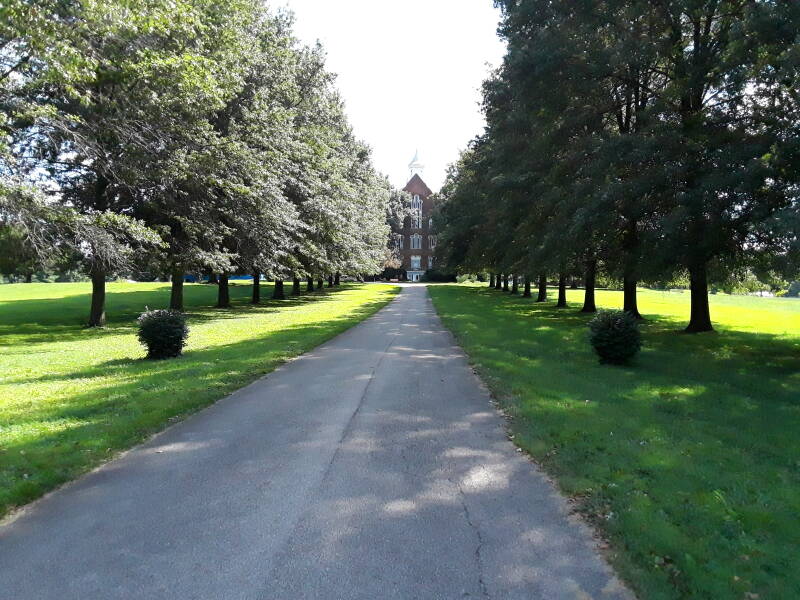
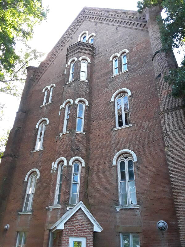
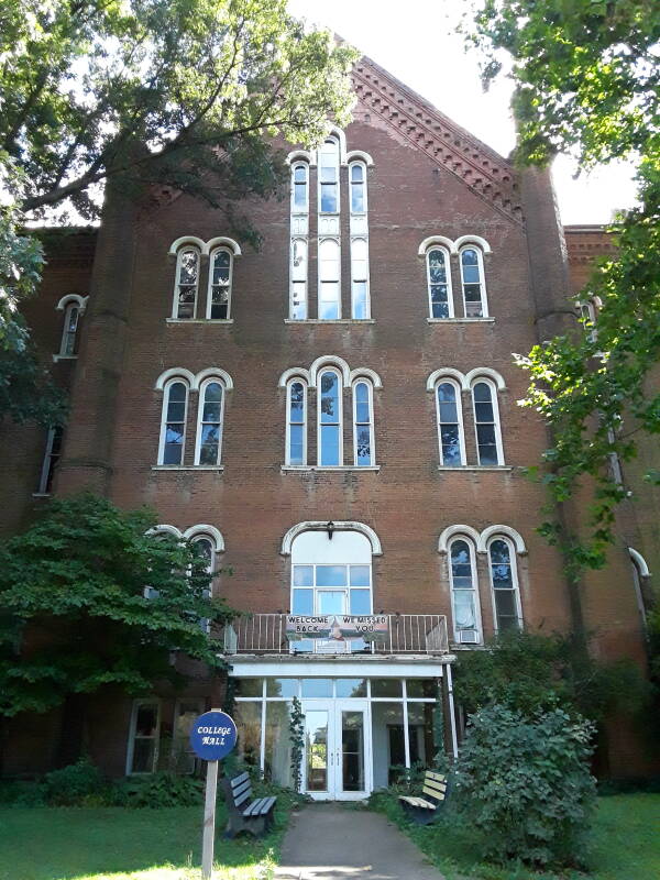
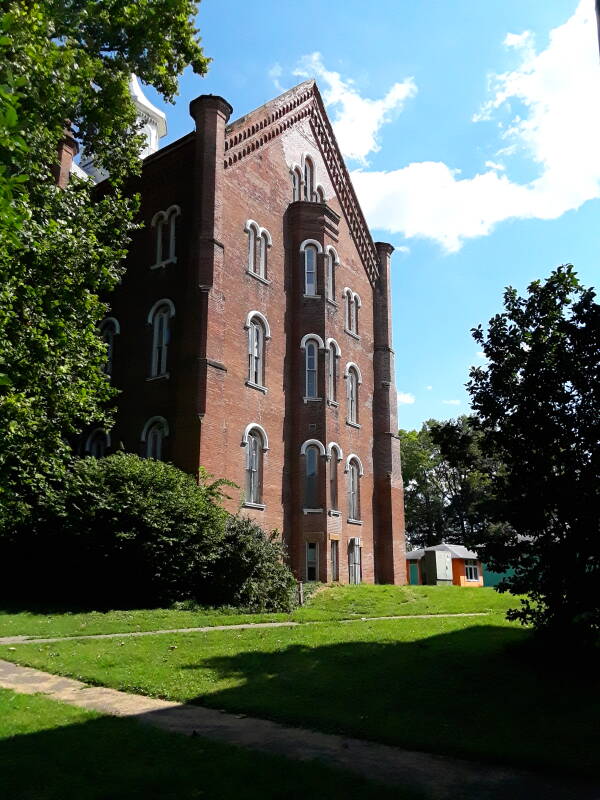
Its main building, the five-story College Hall, was completed in 1866. It contains what purports to be one of the highest spiral staircases in the world. It's 109×65 feet, and 128 feet tall to the top of its cupola. There are eight tapering octagonal chimneys at the corners of its cruciform plan,
At the time, most co-educational colleges would restrict women to studying "women's topics" such as home economics, nursing, and teaching. This was one of the first co-educational colleges that allowed women to take the same courses as men.
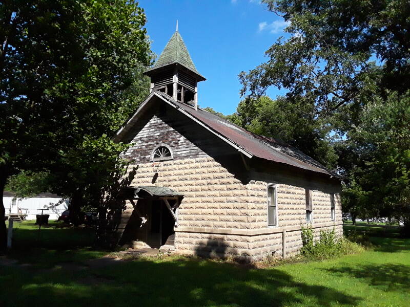
Hatten Chapel and the Gymnasium were built in 1919.
It was a very progressive school, but it didn't last. It closed in 1924 because of rising costs imposed by requirements of the State of Indiana. The campus sat empty except for summer youth camps.
In 1935 the president of the Chicago Theological Seminary launched a plan to reopen it as the Merom Institute, which was to be "a center for rural enrichment". That happened one year later.
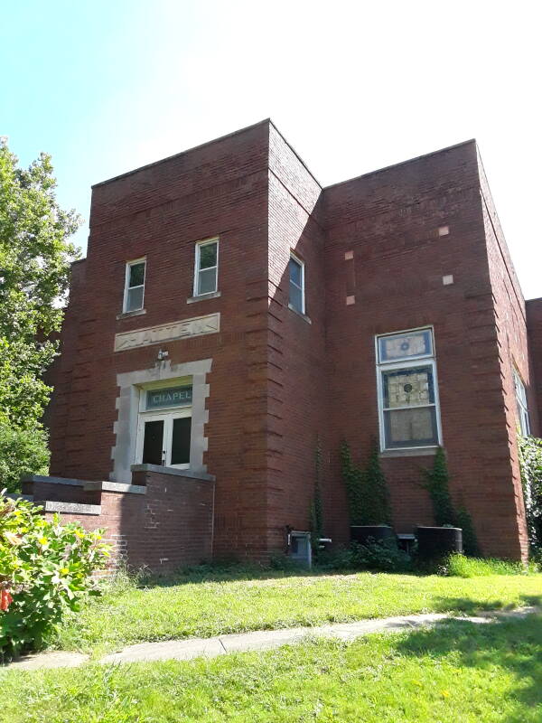
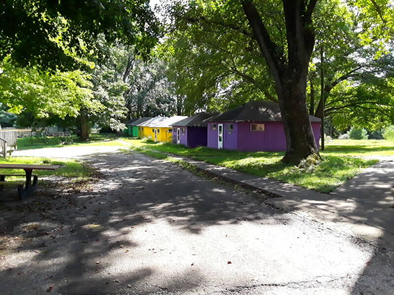
Above is Hatten Chapel. The Dining Hall and nine cabins were built in the late 1930s and early 1940s. There are four residences, one now used as a retreat house, one is the director's residence, one is a staff residence, and one stands vacant. A swimming pool was added in 1957, it is open to residents of Merom every Friday through the summer. The complex was renamed the Merom Conference Center in 1984.
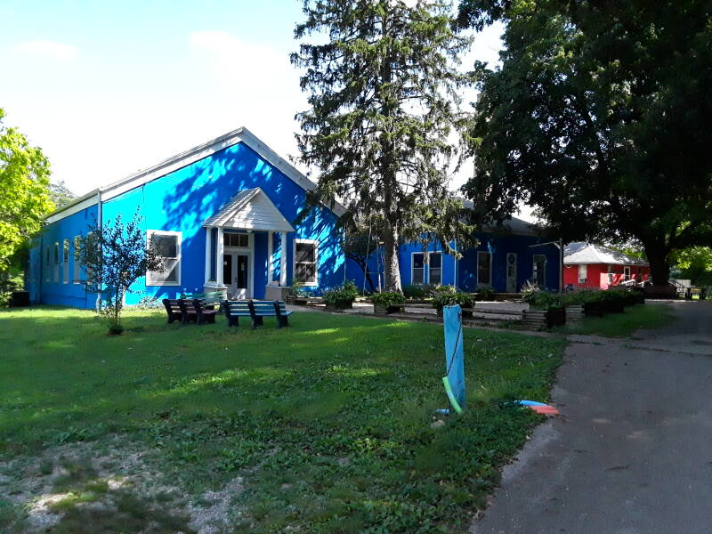
Now owned by the United Church of Christ, it functions as a camp, conference, and retreat center. The first two floors of College Hall were renovated in 1963. At the time of its induction into the National Register of Historic Places, the top three floors "remain in much the same condition as when the building was used as a college." The Outdoor Ministries Committee of the Indiana-Kentucky Conference of the UCC operates seven or more camp sessions each summer, and retreats each fall and spring.
Taft was U.S. President 1909–1913 and Chief Justice of the Supreme Court 1921–1930, Harding was U.S. President 1921–1923, Nation (1846–1911) was a radical member of the anti-alcohol temperance movement known for attacking taverns with a hatchet, and Sunday left early professional baseball to become the most influential American evangelist in the 1900s and 1910s.
The Merom Chautauqua ran from 1905 through 1936. It was organized on a national scale to bring culture to rural communities. These were 10-day religious and educational events featuring concerts, debates, plays, and lectures. Speakers included William H. Taft, Warren Harding, Carrie Nation, and Billy Sunday.
The American Chautauqua movement was a series of independent educational and social events, popular through the late 19th century into the mid 1920s. The first one was held in 1873 in Ohio on the shore of Lake Erie. One was held the next year at Chautauqua Lake in western New York state, close to Lake Erie. Within ten years it was widely copied in "Chautauqua assemblies" and "Daughter Chautauquas" across the U.S. They typically featured lectures, band music, and nondenominational Christian instruction and preaching.
A form of the Merom Chautauque continues in the 2020s. Now it's a long weekend event serving as a fundraiser for the Merom Improvement Association.