Bois Jacques and the Ardennes Forest between Bastogne and Foy
Foy and the Bois Jacques
We're visiting Normandy and southern Belgium, first visiting the landing beaches and battlefields of the D-Day invasion, and now we have come to the Ardennes Forest and the battlefields where the Battle of the Bulge raged in December and January 1945-1946.
Foy was a small village occupied by the Germans in the early stages of the Battle of the Bulge. It's just 4 kilometers to the north of Bastogne on the road to Houffalize.
US Government map of Belgium.
The American 101st Airborne Division held the Bois Jacques or Jacques Woods, up a slight rise outside Foy. Stephen Ambrose's Band of Brothers describes how its Easy Company of the 2nd Battalion, 506th Parachute Infantry Regiment led the assault to capture the town in January, 1945.
Foy is in the Ardennes Forest region, what the locals call l'Ardenne, an area of more than 11,000 square kilometers. It is largely in what today is Wallonia, the Walloons French-speaking area of southern Belgium, but it extends into France, Germany, and Luxembourg.
The area has been inhabited since prehistoric times. The first historical records we have are from the Romans, who gave the area its name of Arduenna Silva.
La Chanson de Roland or The Song of Roland is an Old French epic poem describing the Battle of Roncevaux in 778 and composed in the period of 1040 to 1115. We have copies of it from 1140-1170. The Song of Roland described Charlesmagne having a nightmare in the forest during the night before the Battle of Roncevaux Pass.
Les Quatre fils Aymon or The Four Sons of Aymon is an Old French chanson de geste or "song of heroic deeds" from the 12th century. It also describes the exploits of Charlesmagne and names many of the rivers and villages of Wallonia, including Dinant.
The trees and the associated charcoal industry, coupled with the transportation network based on the rivers, made Wallonia an industrial power through the 18th century into the early 20th century when its coal deposits had replaced charcoal. Wallonia was a contender through those centuries for the rank of second greatest industrial region in the world after England. Meanwhile much of the forests remained, but unlike coal they were treated as a renewable resource.
The Allied strategists believed that the rolling topography, numerous rivers, and dense forests made the region impenetrable for massive vehicular movement, especially so for large and heavy armored vehicles. The Ardennes had been a battleground of European forces for centuries, but those battles were fought by men on foot. Modern wars used motorized vehicles, the armored ones very large and heavy with limited mobility, and so the Ardennes was left only lightly defended.
However, the Germans made major military movements through this area once in World War One and twice in World War Two. Once early in the Second World War war beginning on 10 May 1940, when their Fall Gelb or Case Yellow plan moved armored units through the Ardennes to cut off and surround Allied units in Belgium, then pushing French and British forces back as they advanced around the Maginot Line into France in their Fall Rot or Case Red. The British and some French forces were backed all the way to the coast, called La Manche locally but the English Channel from the other side. They were evacuated at Dunkirk from 27 May to 4 June. The German forces arrived at Paris on 14 June.
The second time in that war was at the Battle of the Bulge in late 1944 into early 1945.
The American 101st Airborne Division held the Bois Jacques (Jacques Woods), part of the Ardennes Forest, just outside Foy and up a slight rise toward Bastogne.
Stephen Ambrose's Band of Brothers and the mini-series based on it describes how Easy Company, 2nd Battalion, 506th Parachute Infantry Regiment of the 101st Airborne Division spearheaded the assault to capture the town in January, 1945.
They were hit by what was thought to be the 88mm shells fired by German anti-aircraft guns, and then started the assault on the town. They lost several men in the operation, but were able to take the town and capture several German prisoners. One remaining German sniper killed a number of men after the assault before he could be discovered and taken out.

Amazon B00006CXSS

Amazon 0743216385
Here are the views looking out of the edge of the Bois Jacques. In one we are looking toward our left, across some farmland to the north of Foy.
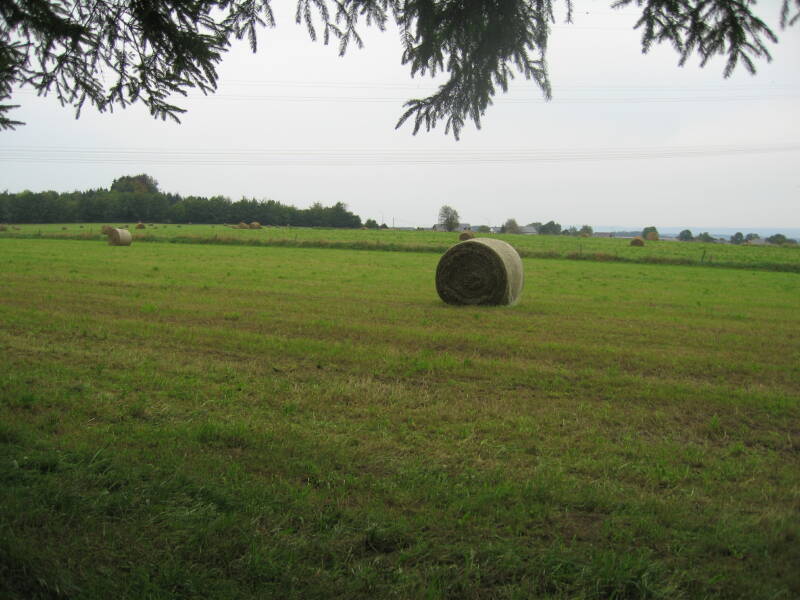
View across farmland north of Foy.
In the other we are looking more directly out of the forest and down the slight slope toward Foy. The village of Foy is down the hill, past that power line pylon. The pylon is new, the large round hay bales are new, otherwise it's pretty much the same view as in the 1940s.
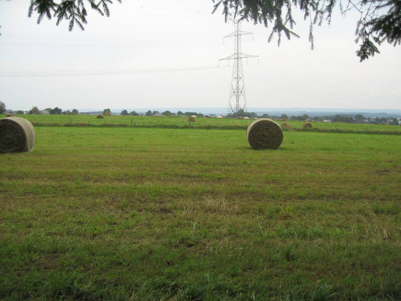
View looking toward Foy.
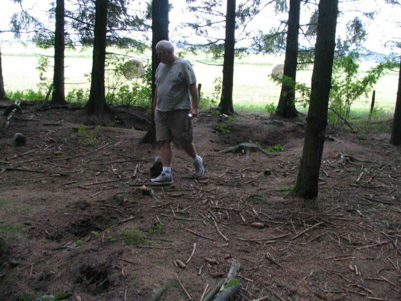
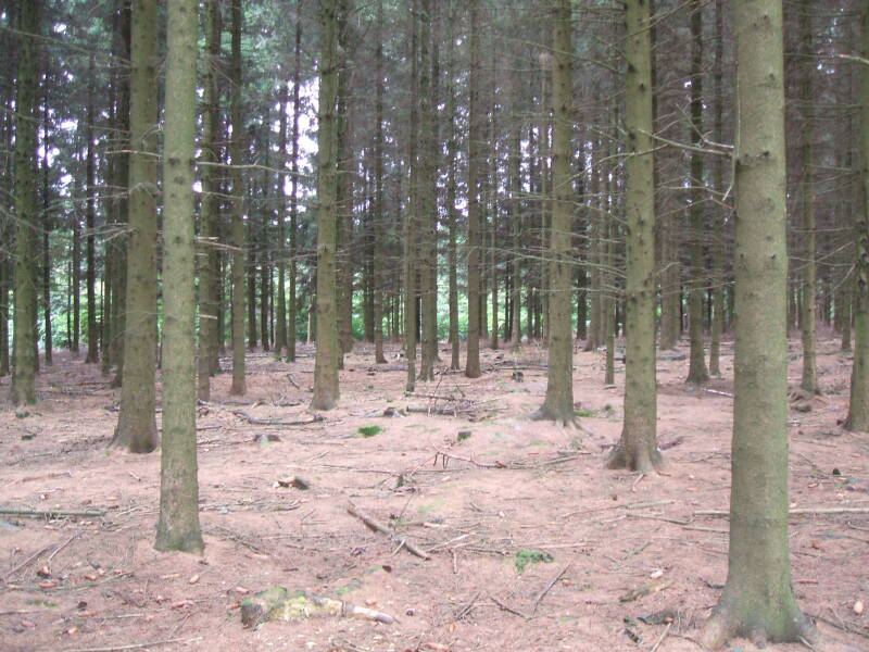
Foxholes remain in the forest. Trous de souris or trous d'homme as the locals call them.
Here Jeff is walking just inside the tree line. The open fields seen in the views above are just beyond that row of trees behind him.
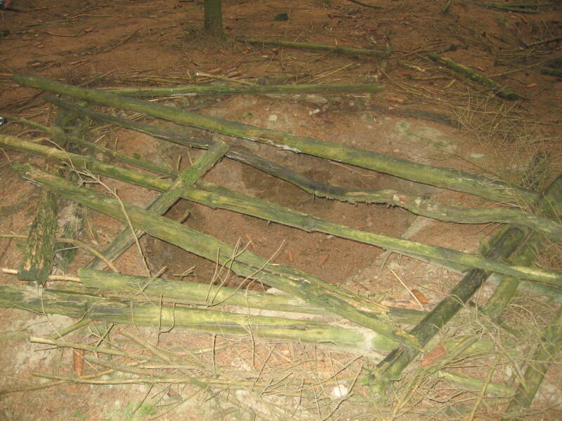
Someone has laid some downed branches over a foxhole.
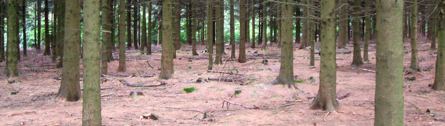
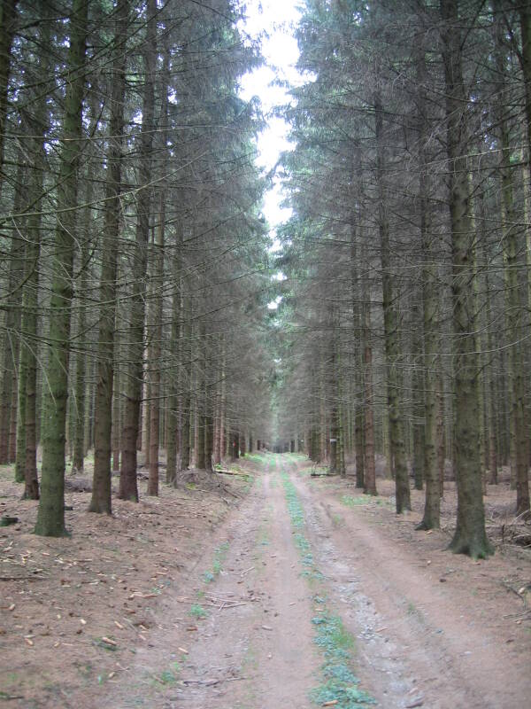
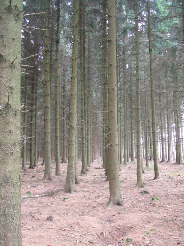
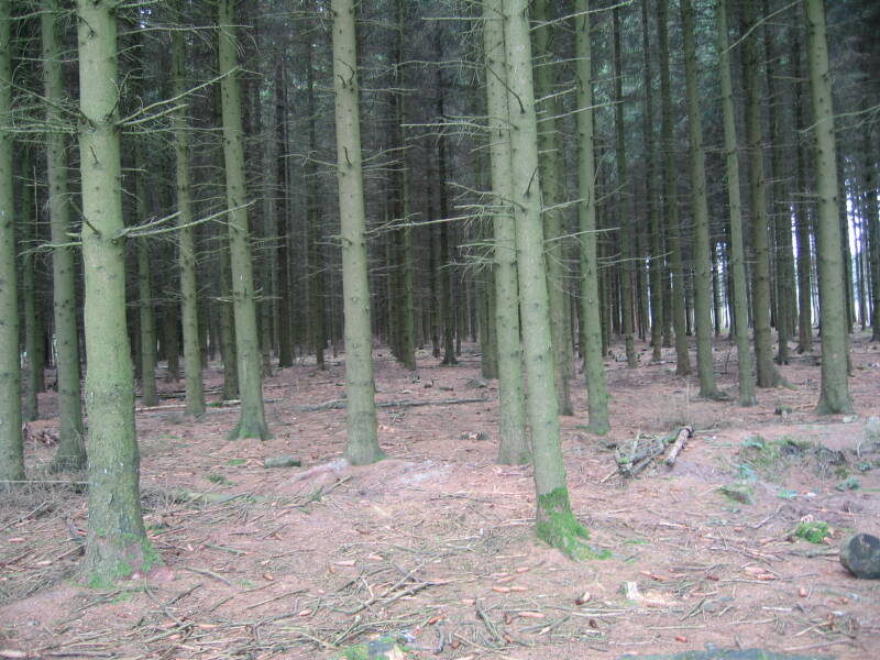
As you walk through the Bois Jacques you can see how the trees are all in straight lines.
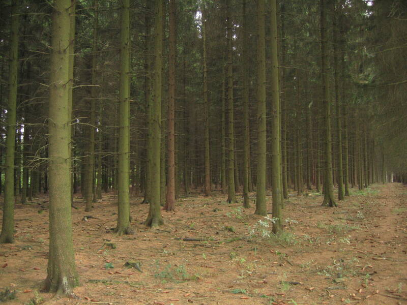
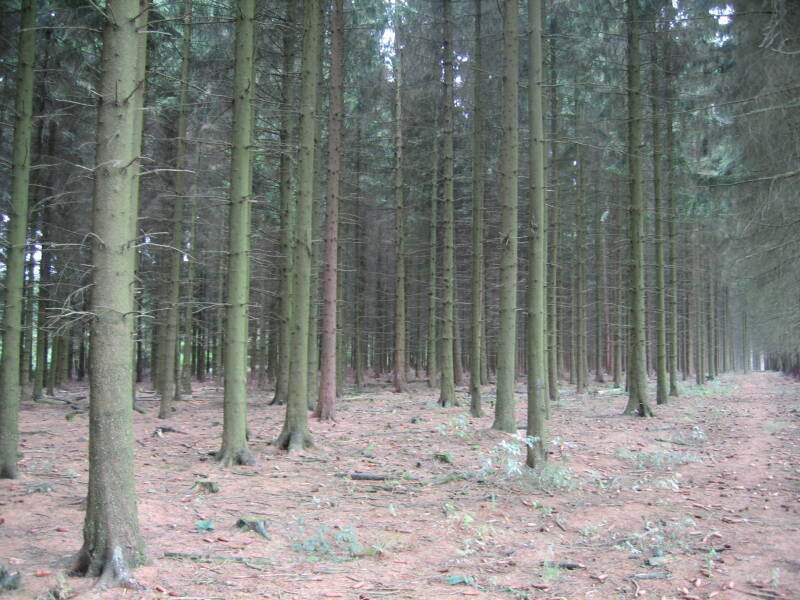
This area of Bois Jacques is regularly cut for timber and has been for many decades. Relatively fast-growing pines are replanted in rows. This gives the forest an artificial look.
I must admit that I was a skeptic at first. The Bois Jacques is obviously a farmed forest, what you see now is entirely planted trees. These are pine trees, fast growing as trees go, and so the trees you see there today probably weren't yet alive in late 1944.
However, it seems that the Bois Jacques is regularly harvested and re-planted. There are remains of foxholes and other remnants of the battle.
I would now say that while we aren't seeing the same trees, we are seeing the same forest.
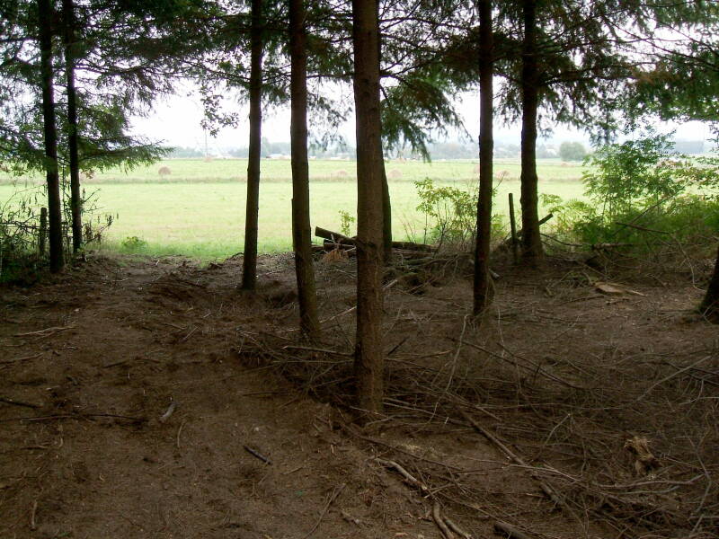
In the last picture above we are at the edge of the forest, looking out into some pasture leading down a gentle slope and overlooking Foy.
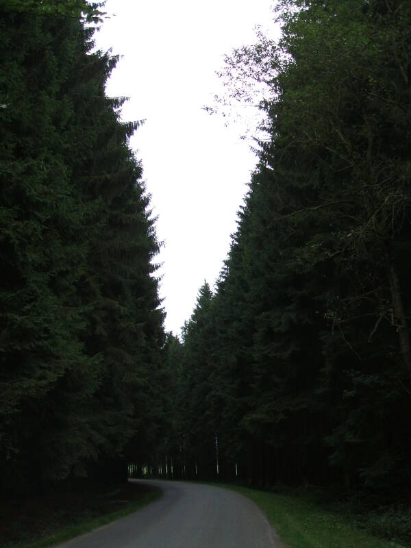
The side roads lead through the forests.
There is a German cemetery west of Foy with graves of at least 6,804 men, some of them in mass graves.
A monument to the American paratroopers was built in 2004 at the edge of the Bois Jacques south of Foy.