Central Alaska in November
Back to Central Alaska
Fairbanks around the Equinox Linux Performance Tuning
I had been to Fairbanks about
ten years before,
in late September and early October.
I had taught two Linux courses to staff of the
supercomputing center at the University of Alaska Fairbanks.
Now I had a voucher from Delta.
My travel had been constrained for a while, and the
voucher would expire soon.
By the middle of November, it would be within a month of
the Winter Solstice.
Plenty of darkness, thus better chances of seeing the aurora.
The voucher was worth enough that I could get a "Comfort Plus"
seat, meaning adequate legroom plus an adult beverage,
along with a 5-day stop in Seattle on the way back.
I had some writing work to do, I could do that during the day.
And so, I was headed back to Fairbanks.
Arriving in Fairbanks
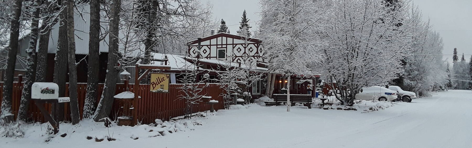
I had contacted Billie's Backpackers and reserved a bed. The Delta flights arrive at 0020, and I would have to retrieve my bag and arrange a ride. Fairbanks is a small city, and Billie's is well to the west of the center, near the university and not too far from the airport. But still, it would be after 1 AM by the time I got there.
As usual in Alaska, things are casual and informal. Billie gave me directions on how to get there, and how to let myself in to the "annex" over the garage and pick a vacant bed.
I could sleep late the next morning, then find her some time during mid to late morning to get checked in.
Amazon
ASIN: B007FNZW6W
Amazon
ASIN: 0385486804
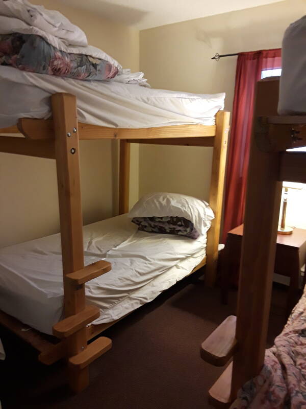
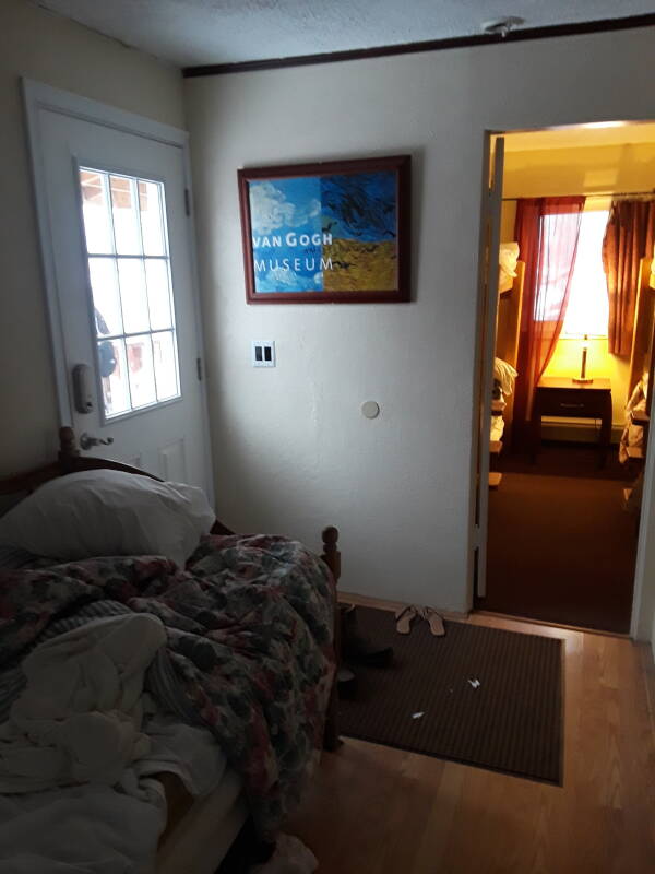
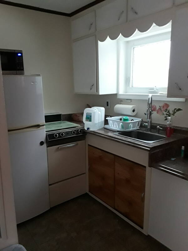
The annex has a room with two bunk beds, and another room with a daybed and kitchen.
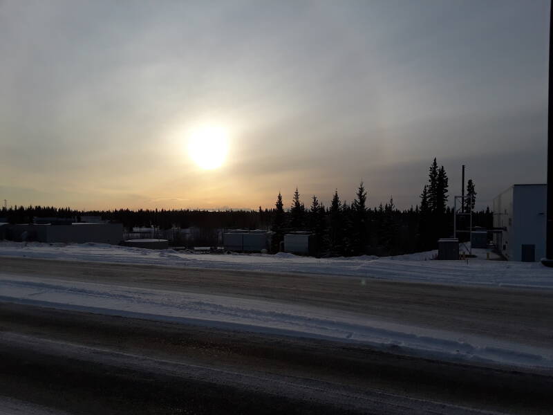
It was just barely getting light at 0840. All of Alaska other than the Aleutian island chain is in a single time zone. The Alaska Time Zone is synchronized for Juneau, at UTC–09:00. Juneau is almost as far east as you can get in Alaska. Fairbanks is really an hour to the west of Juneau, reckoning by solar noon.
Sunrise and sunset times worldwideThe result is that in the middle of November in Fairbanks, the sun is only above the horizon from 0930 to 1540. On the Winter Solstice, December 21st, it's just 1058 to 1440.
It could be worse. Nome, on the Bering Sea coast, about as far west as you can go in mainland Alaska, is still on Juneau time even though it's two hours to the west. On December 21st in Nome, the sun is only above the horizon from 1202 to 1557.
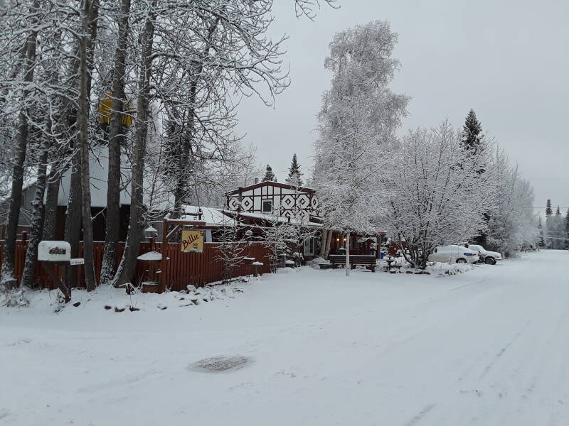
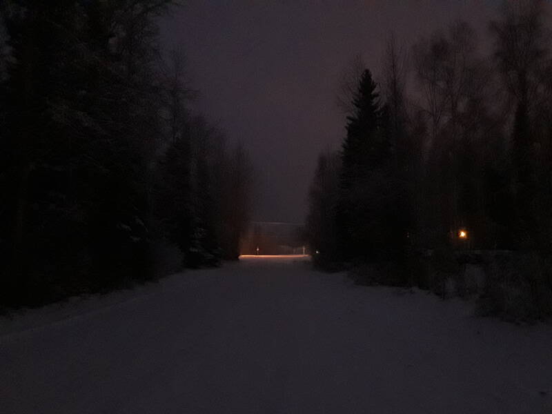
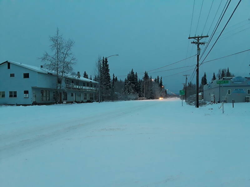
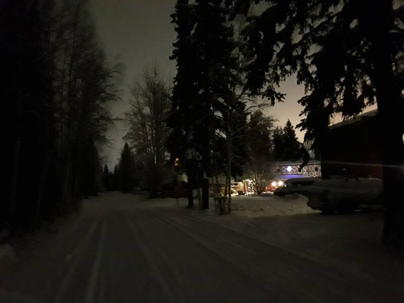
Below is the view leaving the hostel at 0915 on another day,
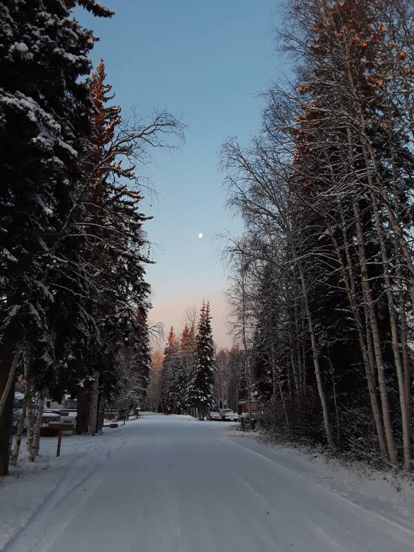
Or, the morning after arrival, having slept in, checked in, and leaving only at 1020.
Walking to College
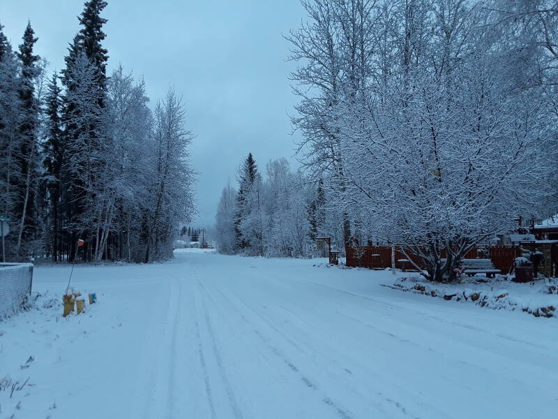
It's not quite a mile, about 1.3 km, from the hostel to the intersection of College Road and University Avenue,
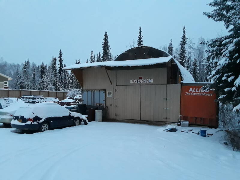
Along the way I passed a few places built partly out of shipping containers.
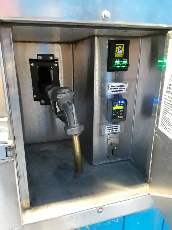
This is The Watering Hole, a water vending station. There are a lot of dry cabins around Fairbanks. Cabins with no wells. So, there are places you can fill a water tank to transport to your cabin.
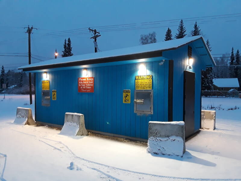
Enter your cash or credit card, but as the signs warn, take a firm grip on the nozzle before the transaction goes through. It's a high-pressure, high-volume water hose.
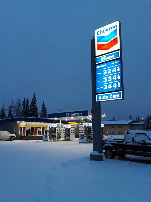
The dream Outside, as Alaskans call the Lower 48 U.S. states, is that Alaska is a capitalist utopia with nearly free gasoline.
The reality is that Alaska is startlingly socialist, and gasoline costs at least as much it does in larger cities Outside, much more than in smaller cities. Alaska produces crude oil, but it has to be transported down to California, refined, transported back to the Alaskan coast, and then trucked into the interior.
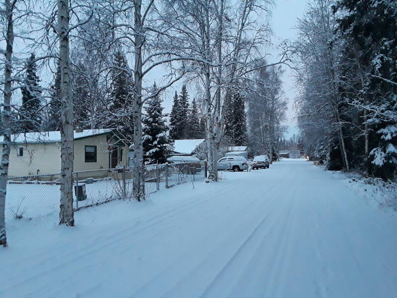
I'm coming back into College on a warmer afternoon, when pavement is showing through the snow on College Road.
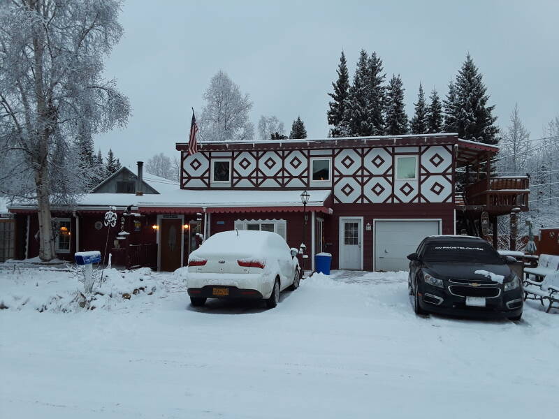
It was relatively warm when I arrived, with a high around –4°C or 25 °F. The recent snow had stuck to the trees. The temperature dropped over the next two days, and the continuing snow was very dry powder.
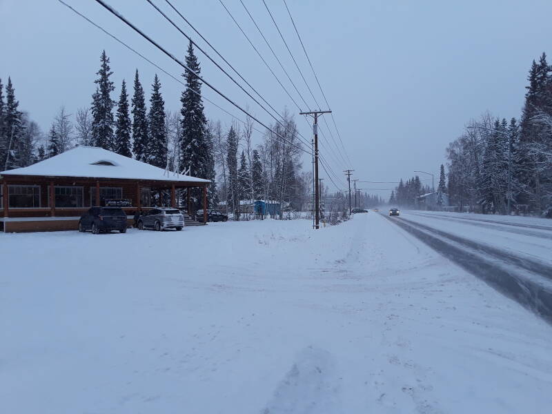
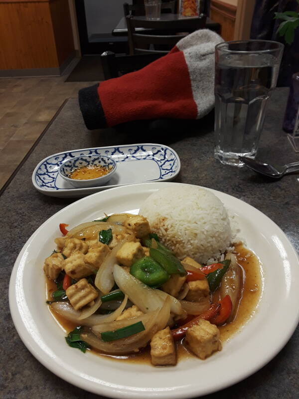
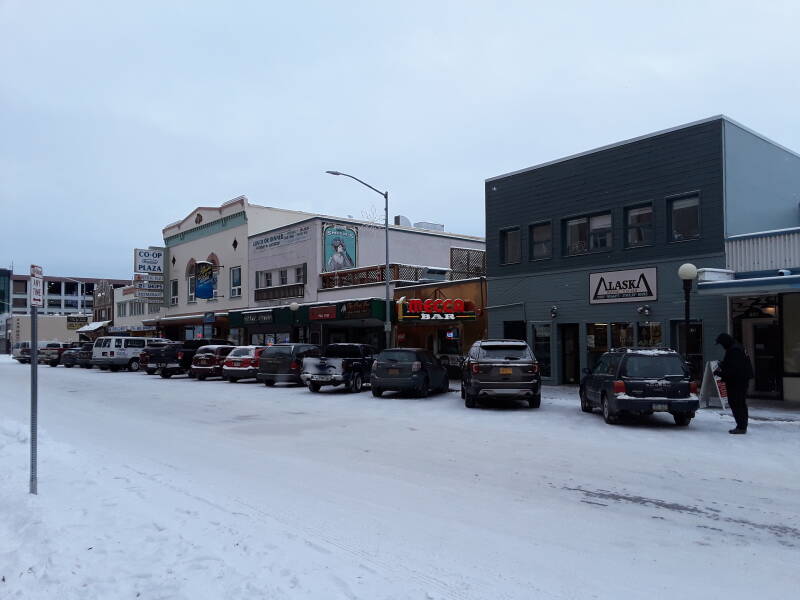
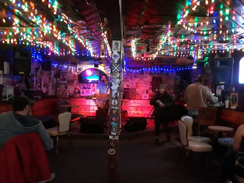
I had several meals at the Pad Thai restaurant, at right, and went to The Marlin, at left, for live music most nights.
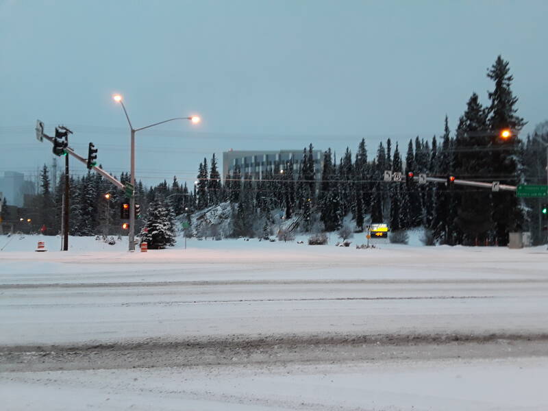
Here I am at the big intersection in College. I had followed College Road, which runs from Fairbanks to College, to the intersection where it crosses University Avenue.
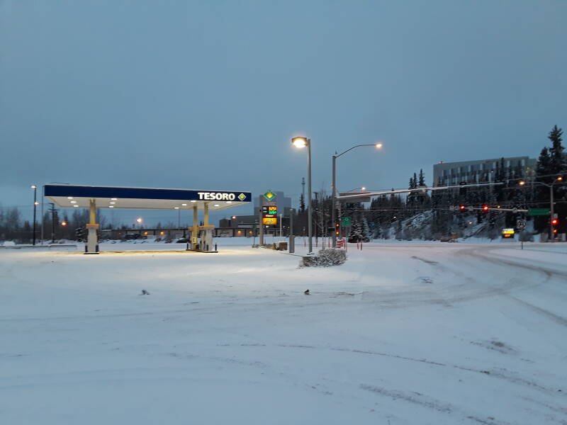
UAF or the University of Alaska Fairbanks, is ahead, on west on College and up the hill to the right.
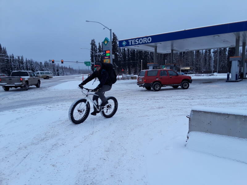
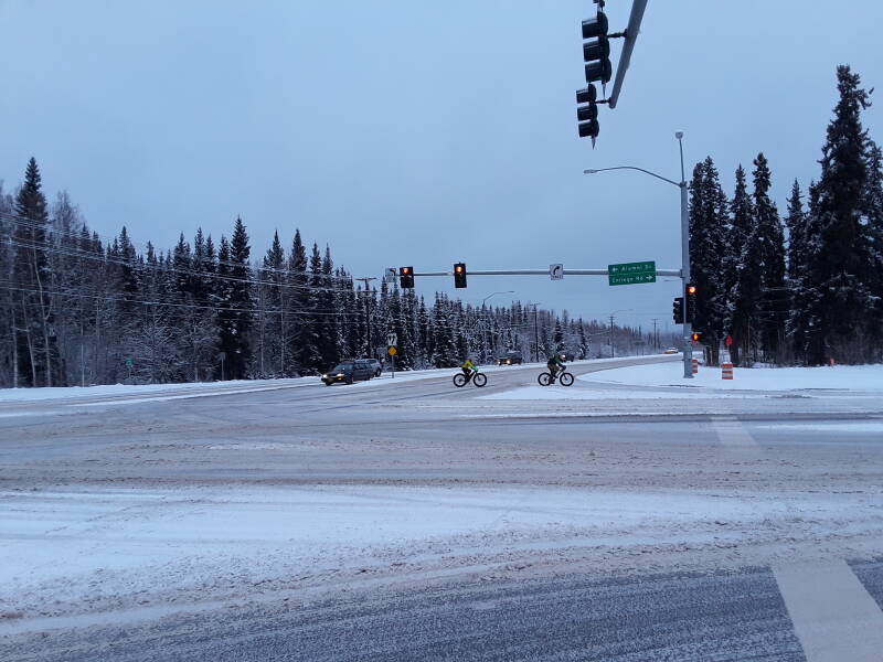
New snowfall plus temperatures significantly below freezing slightly slow, but do not truly hinder, bicycle traffic.
Looking north, more bicyclists cross University Avenue.
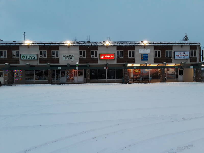
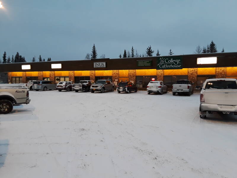
College Coffeehouse is in an L-shaped strip mall behind the Tesoro station at the intersection. I spent a lot of time there.
I often started the day at the Little Owl coffee shop on College Road close to Billie's.
In the afternoon, up to the university campus, or take a bus into downtown Fairbanks. In the evening, live music at the Marlin.
I noticed a large number of physical therapy and related businesses around Fairbanks. Also massage, tai chi, and associated activities.
I think it's related to patterns of opioid use. 80% of the world's opioid supply is consumed in the U.S., but relatively little of that in Alaska.
Alaska's opioid use is in the bottom half of U.S. states. The high end of opioid use is dominated by the former Confederacy and the Midwest.
Bahn Thai has multiple locations around Fairbanks. One in the strip mall with College Coffeehouse.
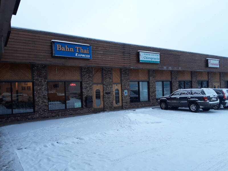
It's real Thai. You order from an English menu, but the bill arrives in Thai.
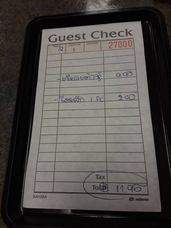
For some historical reasons, Thai restaurants became entrenched in the Fairbanks area. Fairbanks itself has a population of 30,900, and College including UAF adds another 13,000. Today there are many Thai restaurants in the Fairbanks–College area.
Apparently one Thai family ended up in Fairbanks, maybe connected to the nearby military bases. They opened multiple restaurants. Then, because of that success, another Thai family came and opened multiple restaurants.
Weather
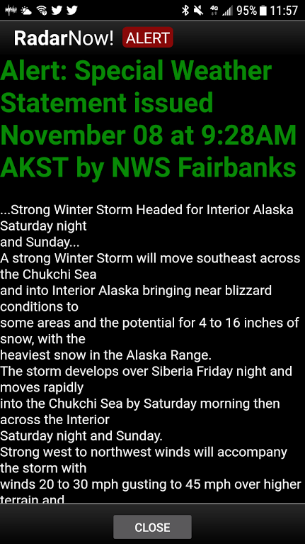
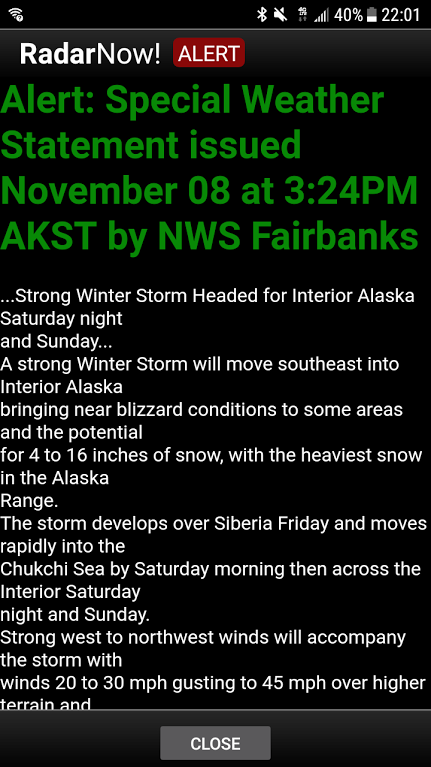
Weather alerts in central Alaska are fun. Strong storms cross the Chukchi Sea and bring near blizzard conditions.
Into Fairbanks
Native people had been through the area since the end of the last ice age. Europeans only arrived in the 19th century. Historians think that Russian traders from Nulato, a trading post along the Yukon river relatively close to the Bering Sea coast, may have passed through the Tanana river valley in the mid 1800s. Also, fur traders with the Hudsons Bay Company may have been here around the same time. But neither of those left any records.
The first documented non-native explorers came through here in 1885, as U.S. Army surveyors mapped the Tanana and Chena rivers.
Visitingthe Yukon
The Klondike Gold Rush started in mid 1897. It was hard to get to the gold field. Some prospectors traveled by ship up the west coast of North America, then switched to paddlewheel steamships up the Yukon river.
E.T. Barnette planned to set up a trading post at what was then called Tanacross, where the Valdez–Eagle trail cross the Tanana River. He hired a steamship and set off up the Yukon River. They turned off into the Tanana, and ran into low water. They turned off that onto the Chena, thinking that it might provide a way around the shallows. But only about 15 miles up the Chena brought them to impassably shallow water.
The steamship captain didn't want to return downstream with a heavy load, so he dumped Barnette and his cargo and left in the lightened steamship.
An irate Barnette built a cabin and sold some goods to a couple of local prospectors. Before long, one of them discovered gold nearby. Barnette's cabin became the origin of Fairbanks.
Barnette became the mayor of the new town. He named it after Charles W. Fairbanks, the senior Senator from Indiana, in the hopes of getting more financial support from the national government. Fairbanks the Senator went on to be U.S. Vice President under President Theodore Roosevelt.
Barnette's first action as mayor was to write to Washington D.C., asking for assistance. He then made sure to grant long-term contracts for city services to members of his family. He gave his brother-in-law a twenty-five-year contract to provide electricity, steam heat, and drinking water to the city.
The Washington–Alaska Military Cable and Telegraph System was expanded from Eagle to Nome in 1903, passing through Fairbanks.
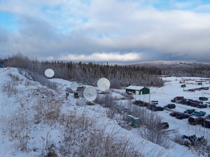
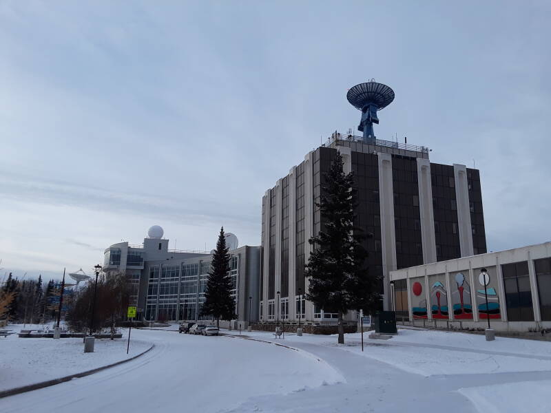
Meanwhile, here is the home of some of Fairbanks' current telecommunications infrastructure. Local TV broadcast stations carry the major networks.
Geosynchronous satellites are close to the horizon at this latitude. On top of that, Central Alaska is well outside the center of the downlink beamwidth. Put simply, satellite TV signals are much weaker, and need larger antennas that are more sensitive. DishTV dishes are about three feet in diameter, about twice the size used Outside. Unmarked dishes about four feet in diameter are more common.
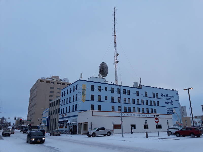
The U.S. Army Signal Corps built a radio telegraph tower in Fairbanks in 1908, replacing the cable telegraphy connection via Valdez to Seattle. The 54-meter tower was the tallest structure in Fairbanks for decades.
Warren Harding, who until 2017 was the most corrupt U.S. President ever.
A railway link to Anchorage was finished in 1923.
U.S. President Warren Harding was anxious to escape the attention focused on the many scandals of his administration. He was also in rapidly declining health. He left Washington in June of 1923 on what he called his Voyage of Understanding, to include 18 speeches and a much larger number of informal talks. He and his physician believed that getting away from Washington would relieve his stress. He was reporting chest pains radiating down his left arm before leaving Washington.
Harding became the first U.S. President to visit Alaska. He hoped that the completed railroad would allow World War I veterans from Alaska to return home, and that it would encourage impoverished workers from the lower 48 states to relocate to Alaska in search of employment.
On July 15, 1923, south of Fairbanks in Nenana, Harding drove in the golden spike ceremonially completing the Alaska Railroad.
Harding's party continued to Fairbanks for two days, then returned to Anchorage via the newly opened railroad and sailed south.
Harding visited Vancouver, British Columbia, on his way back, making him the first U.S. President to visit Canada while in office. He continued by ship by Seattle, then south through Portland to San Francisco by train. In San Francisco he developed a respiratory illness thought to be pneumonia.
Harding died suddenly one evening at the hotel. His widow refused to allow an autopsy, but naval medical consultants who had examined him in San Francisco concluded that it had been a heart attack. Recent attempts to diagnose his problems from the reports of the time have concluded that he had shown symptoms of cardiac insufficiency with congestive heart failure over several preceding weeks, including all of his western trip. But some continue to speculate that he was poisoned, perhaps by his wife in retaliation for his serial infidelity.
His widow returned to Washington and briefly lived in the White House with newly sworn in President Calvin Coolidge and his wife. For a month, Mrs Harding collected and burned most of President Harding's documents and correspondence, both official and unofficial. She explained that this was to protect his legacy. The papers that survived her burning were collected and kept away from public access by the Harding Memorial Association in his hometown of Marion, Ohio.
Construction on the Alaska Highway or the ALCAN Highway was completed in the fall of 1942, and regular military traffic began in 1943. It was opened to public use in 1948. Its official end is at Delta Junction, about 160 km southeast of Fairbanks, where it connects to the Richardson Highway between Fairbanks and Valdez.
The Northwest Staging Route used during World War II was a chain of airports, ending at Fairbanks. Then, in the summer of 1942, negotiations between the U.S. and the Soviet Union led to an extension of the Lend-Lease to the USSR. USAAF crews flew aircraft along the Northwest Staging Route from Great Falls, Montana, via Edmonton to Ladd Field at Fairbanks. Soviet pilots based in Fairbanks then took over, flying on to Nome and then across the Bering Sea to the Soviet Union.
In 1959 Alaska became the 49th U.S. state.
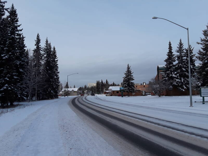
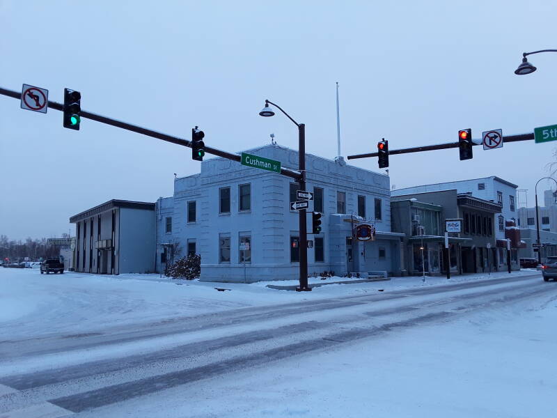
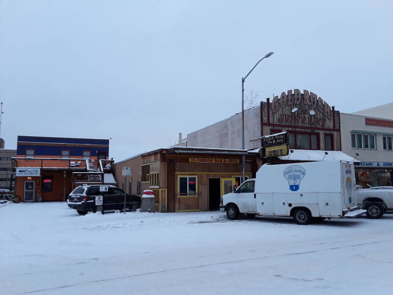
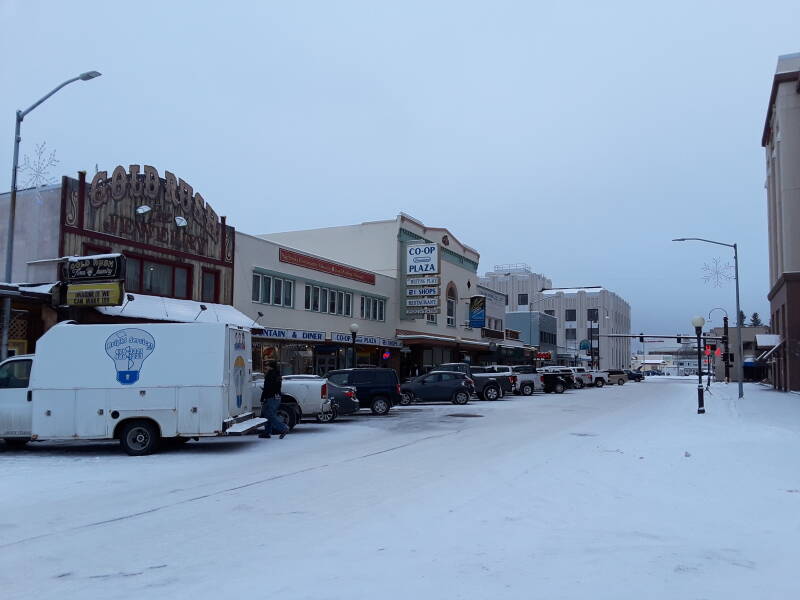
Here we're looking down Second Avenue, one of the main streets in downtown Fairbanks.
In 1968 an Atlantic Richfield drilling crew struck oil near Prudhoe Bay on the Arctic coast. Construction on the Trans-Alaska Pipeline started in early 1974. Tens of thousands of construction workers arrived, and the number of area businesses doubled between 1973 and 1976.
In 1975 the Fairbanks Police Department estimated that between 40 and 175 prostitutes were working in the city of 15,000 people. By 1976 the overcrowding and drunken mayhem in downtown Fairbanks had driven businesses out of the center and into new malls built around the perimeter. Pipeline construction ended in 1977, making Fairbanks much quieter and less prosperous.
Fairbanks remains somewhat lawless. Its rates of violent and property crimes is significantly higher than Alaska's average, which itself is significantly higher than the U.S. average. The per-capita rate of murder in Fairbanks is about twice that Outside, and the rate for rape is about three times as high.
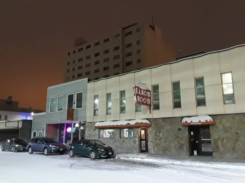
The Mecca bar hosts Athabaskan versions of Charles Bukowski.
Amazon
ASIN: 0872860744
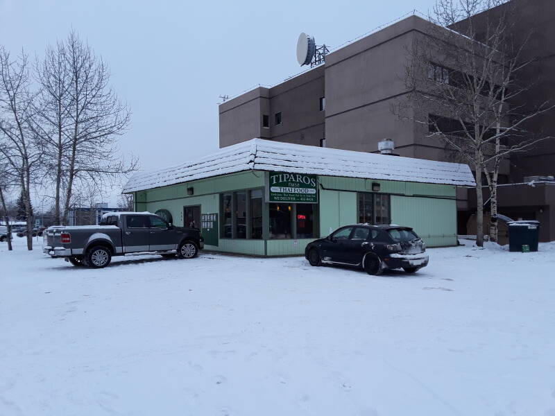
One of the multiple Thai restaurant cartels, or juntas, or zaibatsu, or whatever, has an output near the center of Fairbanks.
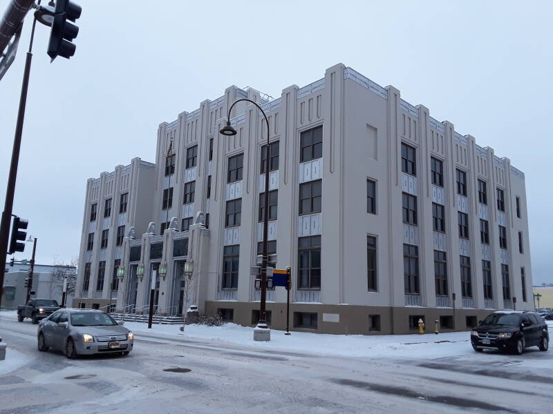
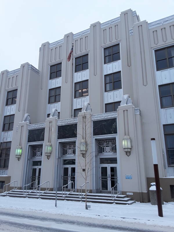
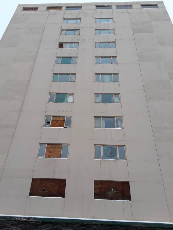
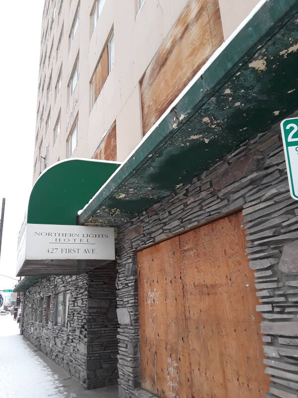
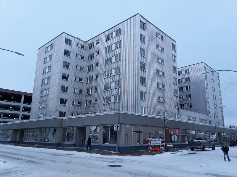
The Polaris Building has been the tallest building in Fairbanks since its completion in 1952.
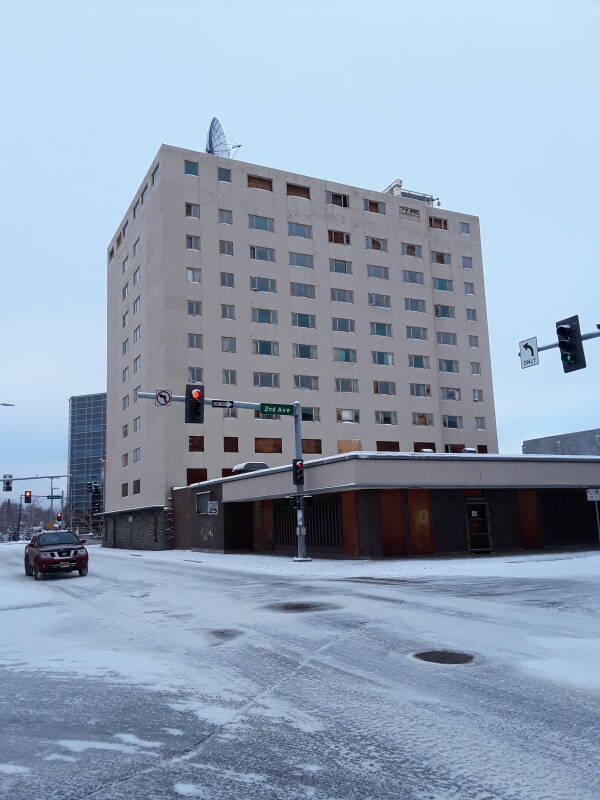
Unfortunately, the Polaris Building was abandoned some time before 2001. The defunct Anchorage-based Northern Lights Hotel chain was its last occupant.
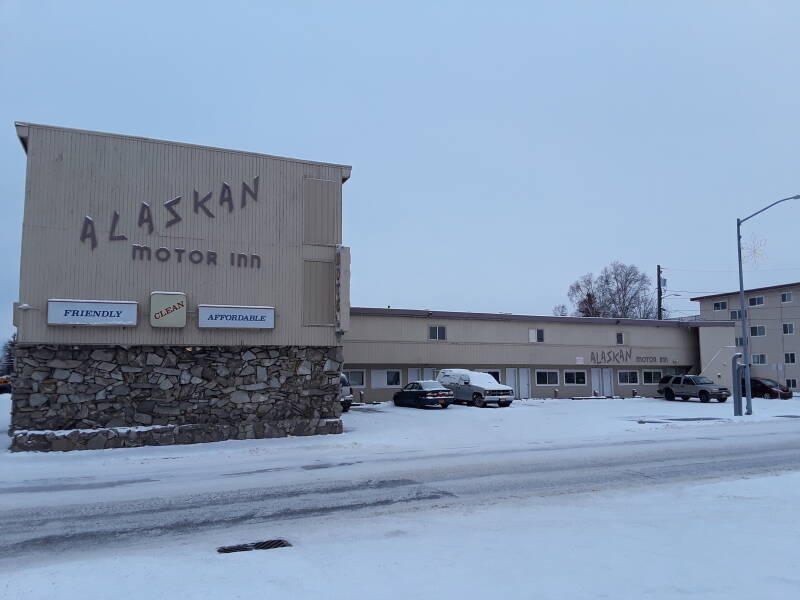
The Alaskan Motor Inn, however, is still operating.
As is what appears to be an electromagnetically shielded hotel just across the street.
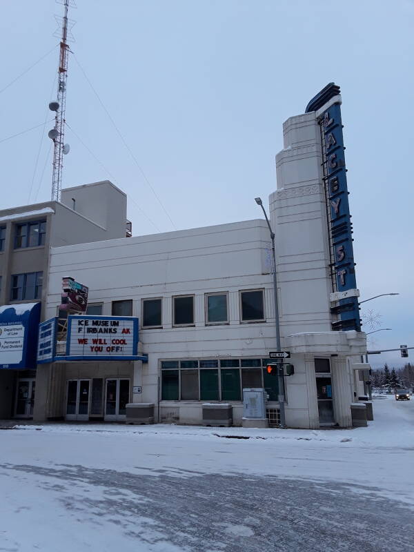
The center of downtown has an ice museum.
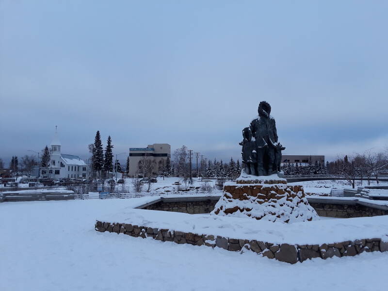
This twenty-five-foot statue of Alaska's First Family is right downtown, looking across the Chena river.
In July 1967, Fairbanks received almost twice the average monthly total of rain. Then, in the following month of August, much more rain fell. In the period 11–13 August, 8.7 cm or 3.42 inches of rain fell. A total of 15.7 cm or 6.2 inches of rain fell in the month of August, versus the average 5.6 cm or 2.2 inches.
The Chena river rose, and rose. There was a general evacuation toward the high ground of UAF.
The Civil Defense director expected 700 to 800 people to take shelter at the university. Between 7,000 and 8,000 arrived. Fairbanks' power plant was flooded, so the university's power plant was the remaining source of electricity.
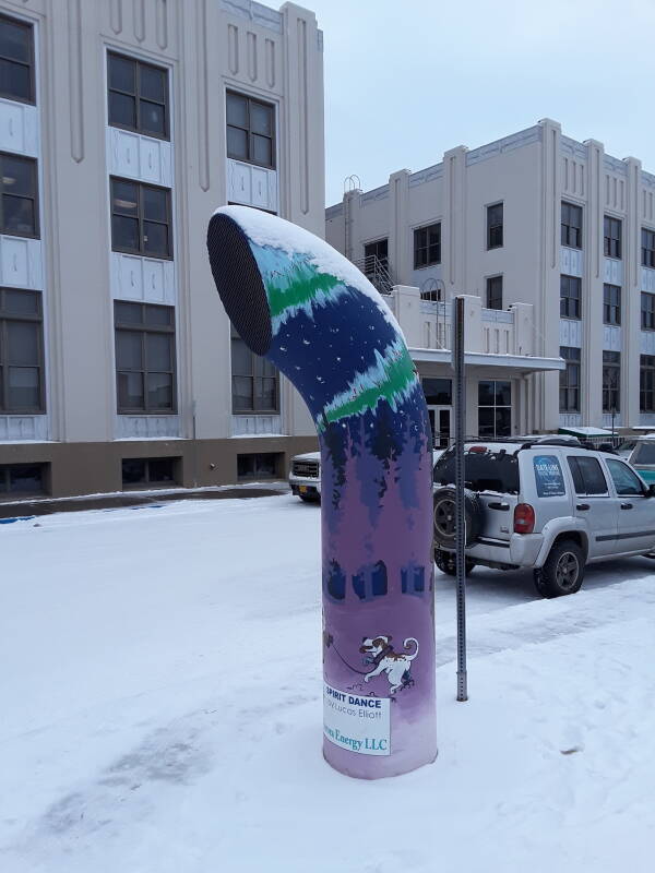
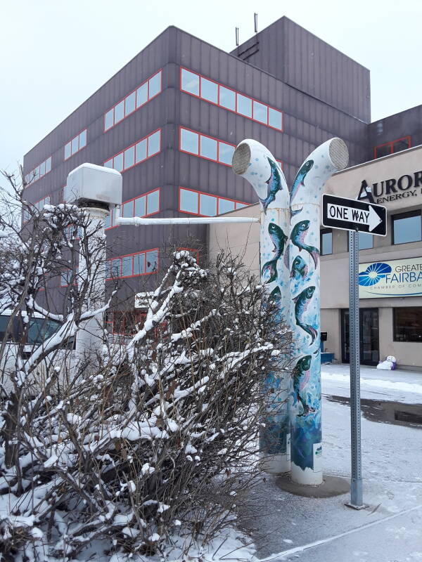
Utilidors run under downtown's streets and sidewalks. These are tunnels carrying electrical lines, communications lines, gas pipes, water and sewage, and a hot water loop provided by the city to help warm businesses. They're commonly used in arctic climates, below the surface but above any permafrost line.
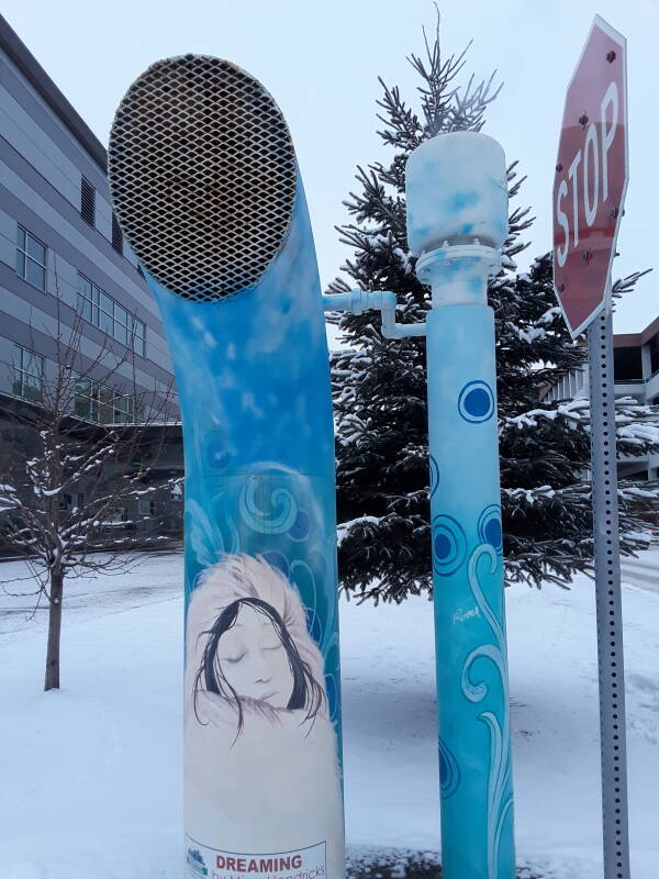
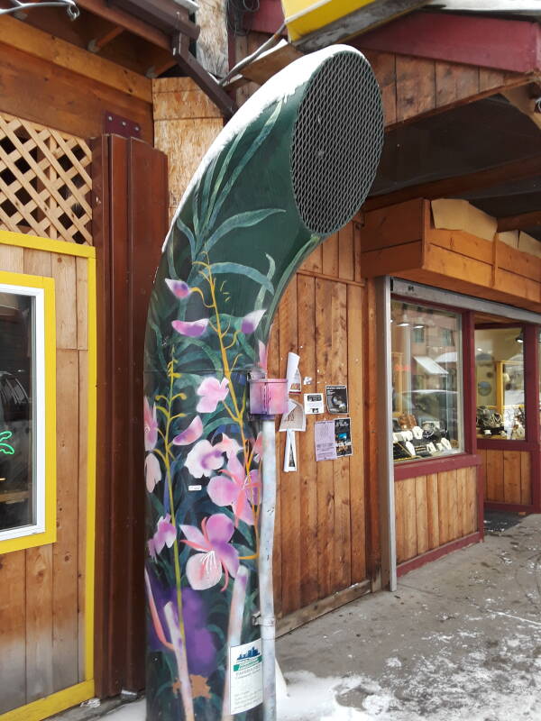
The exhaust vents were initially intended to blend into the background. But later the Downtown Association invited artists to decorate them in various Arctic themes.
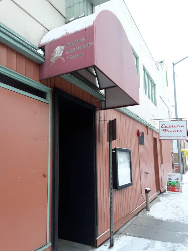
Fairbanks has a Shakespeare Theatre.
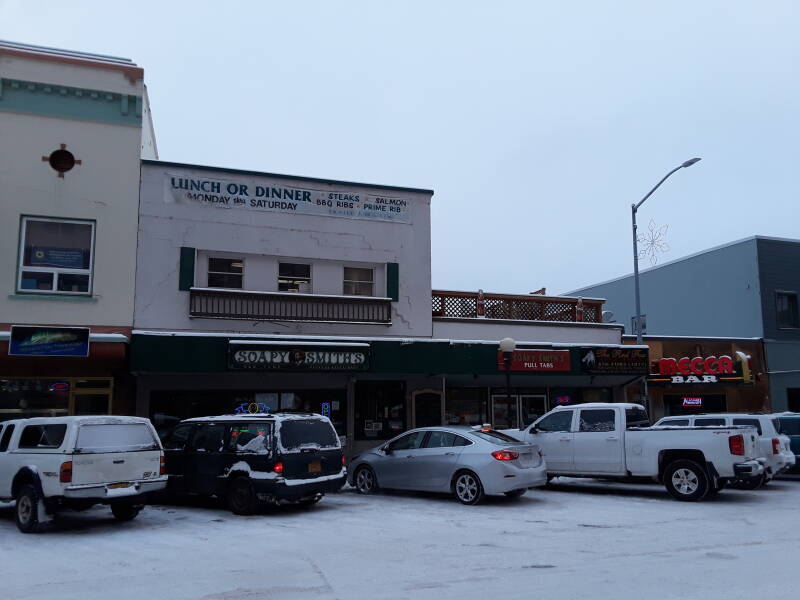
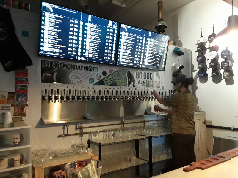
Lavelle's Taphouse is on the left here, with the Polaris Building looming in the background.
They offer a wide rotating range of craft beers.
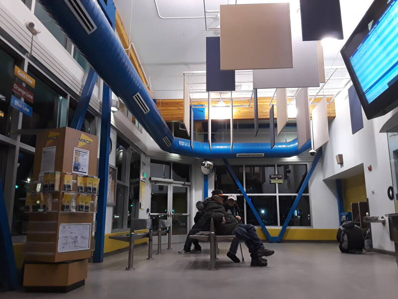
Then, a wait at the main MACS bus station for a ride back to the College area. A $3 pass provided unlimited rides for a day. Wolves had recently been spotted in town. But just a few.
UAF
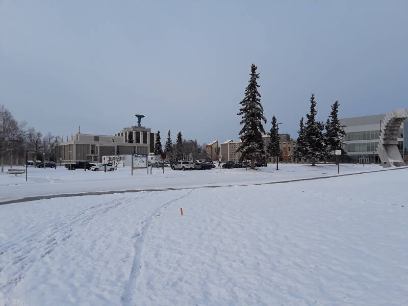
On another day I'll hang out at the University of Alaska Fairbanks campus. The campus on the northwest corner of College, which itself is northwest of central Fairbanks.
The campus is built on a bluff the local Athabaskan people called Troth Yeddha'. It was called College Hill soon after the university was founded, but Troth Yeddha' is coming back into use. A native camp dating back to 3,500 years ago was found on the campus, with older remains at deeper levels. However, it was a seasonal hunting and fishing camp, not a permanent settlement.
From the campus you can look south over the Chena and Tanana rivers, and then the Tanana Flats. That's an area of marsh and bog stretching over 160 kilometers south to the Alaska Range, visible in the distance below the sun.
That picture was taken around noon, about an hour before local solar noon. The sun doesn't get very high at this time of year. At the Winter Solstice, the sun is only 1.7° above the horizon at noon.
Below I'm looking to the northeast, behind the campus. Ranges of hills to the north rise gradually to the White Mountains and the Yukon river.
Many buildings on the campus, such as the Reichardt Building, are designed in an arctic style.
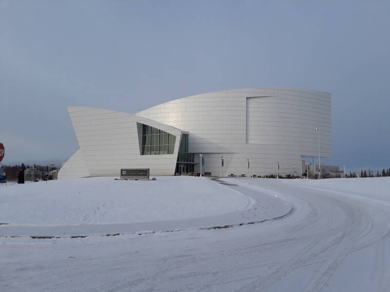
The Museum of the North is very nice. It presents the natural history of all of Alaska, and the recent history of the Fairbanks area.
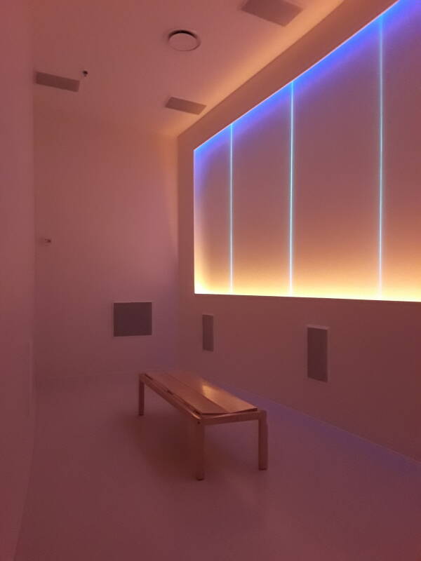
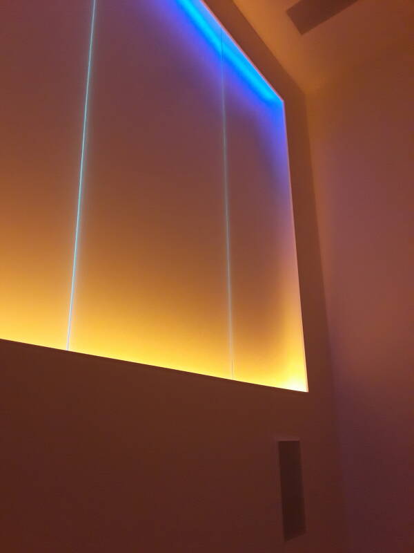
The Place Where You Go To Listen is an immersive multi-sensory presentation of geophysical data.
UAF collects a wide array of data, including:
- Audio from the Arctic Ocean, Bering Sea, and Gulf of Alaska
- Seismic signals, shifted up to audio frequencies.
- Geomagnetic signals, shifted up and down to audio frequencies.
These are then converted and played in the room as audio and light modulated in intensity and frequency or color.
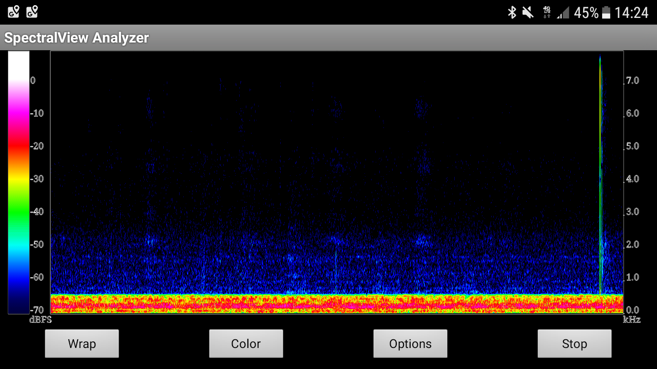
Below is the result of digitizing the audio with the SpectralView Analyzer app on my phone. Scientific data digitized, converted to an audio representation, digitized again, and converted to an audio spectrogram for visualization.
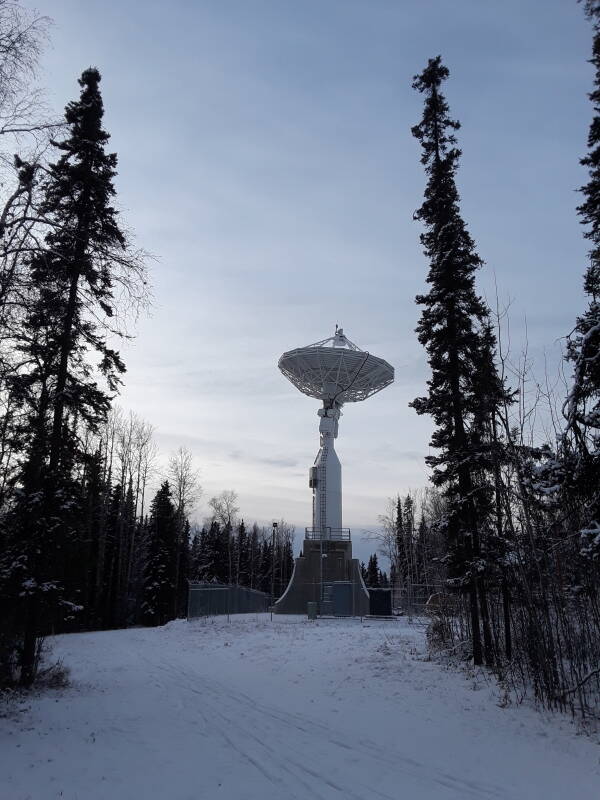
Below, I'm continuing into the research area of the campus and approaching the Geophysical Institute.
When I was here in 2006, the far building was home to the Arctic Region Supercomputing Center, a standalone unit.
Now the high-performance computing organization is the Research Computing Systems unit, part of the Geophysical Institute and supporting its diverse research projects.
There are fiber links to Outside, one running south along the Parks Highway to Anchorage, the other running southeast along the Richardson Highway to Valdez.
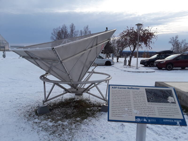
UAF has an array of these corner reflectors at Delta Junction, about 150 km to the southeast. Their locations have been precisely measured with differential GPS.
Radar return signals fall off precipitously,
with the fourth power of range.
The radar equation is:
Pr =
PtGtArσF4/(4π)2R4
where:
Pr = power returned
Pt = transmitter power
Gt = gain of transmitting antenna
Ar = effective aperture of receiving antenna
σ = radar cross-section of the target
F = pattern propagation factor, including path loss
R = range to target
Synthetic aperture radar sensors on satellites or aircraft measure the terrain, including the large return from these targets. The corner reflectors in known positions calibrate the SAR data, providing accurate 3-D location of every measured point.
These calibration targets are made of three perpendicular aluminum screens in sizes much larger than the radar wavelength. That gives them an enormous radar cross-section compared to the natural terrain and foliage.
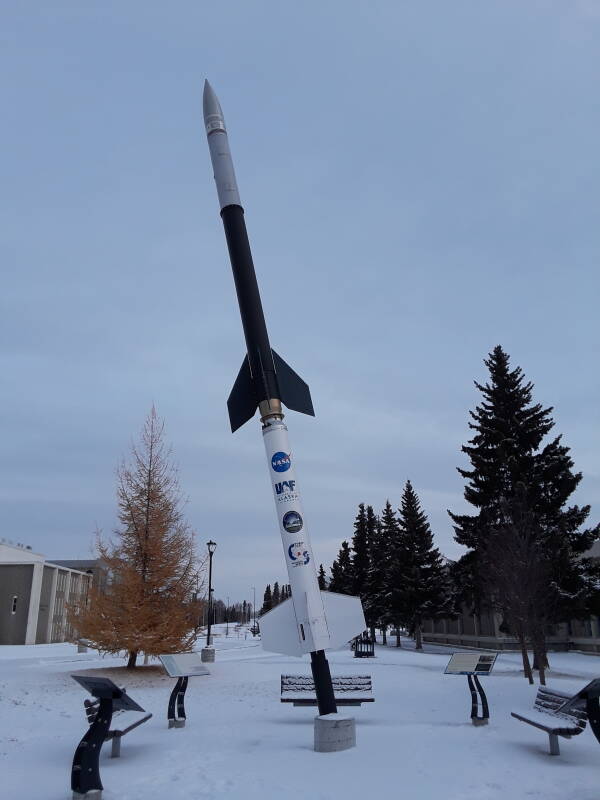
The Poker Flats Research Range is about 50 km northeast of Fairbanks. The Geophysical Institute launches sounding rockets to apogees of up to 1,500 km, studying the upper atmosphere and its interaction with the space environment, including the aurora.
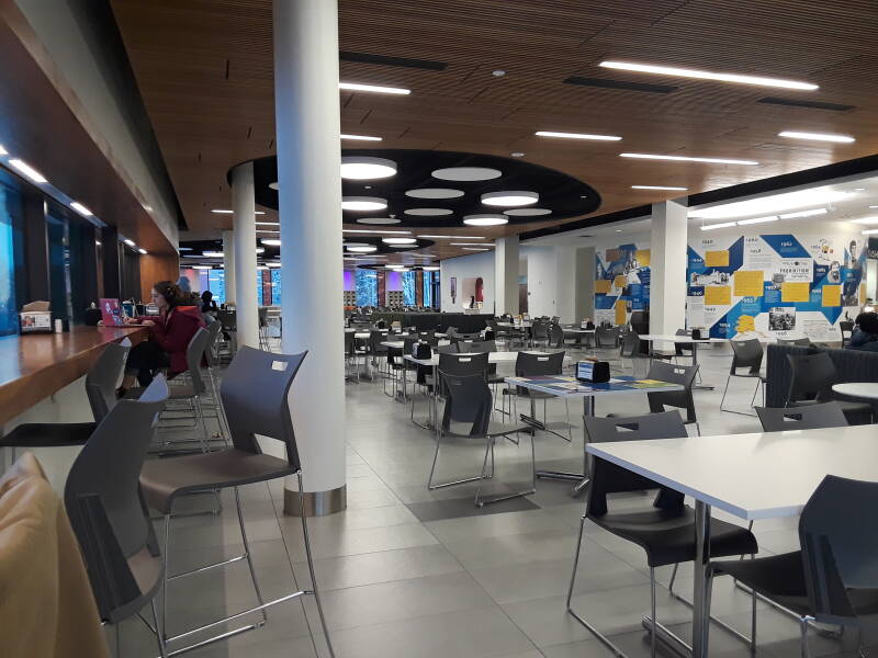
The food court in the Wood Center, the student union building, is a nice place to get lunch and hang out. Get a sushi lunch box and sit at the counter along the windows, looking out across the campus. You can watch flights in and out of the airport.
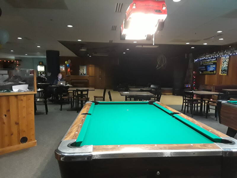
The Pub, downstairs in the Wood Center, is Friday and Saturday afternoons and evenings, and a few other evenings during the week.
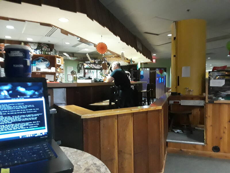
It's pretty quiet soon after opening on Friday afternoon.
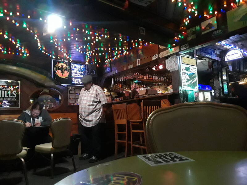
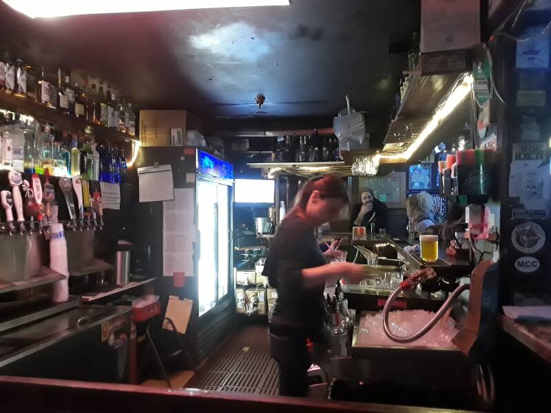
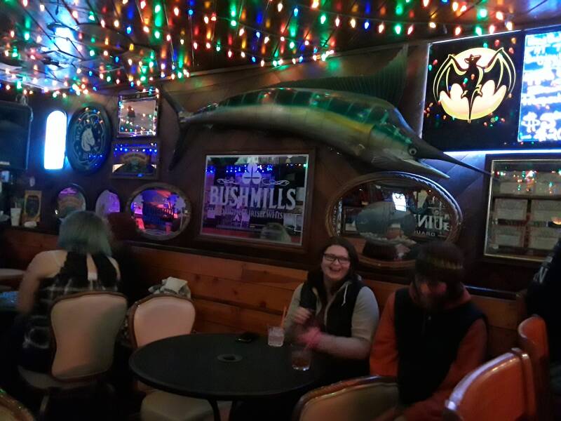
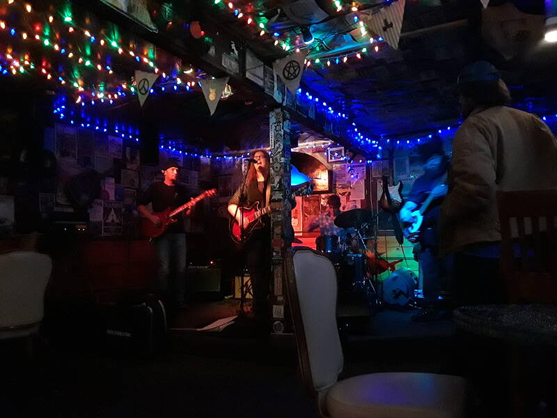
The Marlin
Then, after dinner, probably Thai, The Marlin.
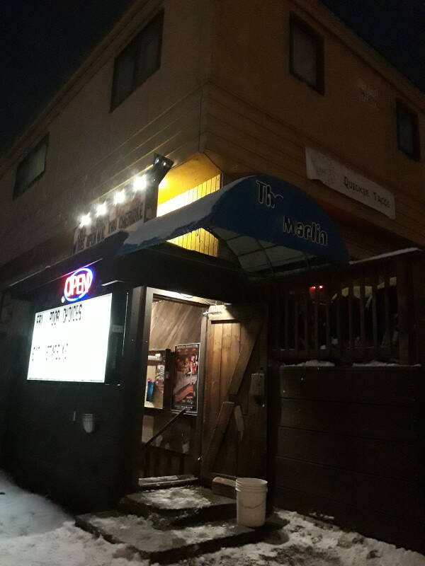
There's live music several nights a week, and some sort of entertainment on some of the other nights.
Returning
Time to head home to Billie's. I've cut off College Road onto the ostentatiously named Mack Boulevard, passing The Watering Hole.
None of Fairbanks' streets were paved until 1940, and World War II interfered with paving anything beyond a few streets.
In 1953 Fairbanks passed 30 blocks of paved streets. During the late 1950s and 1960s the rest of Fairbanks' gravel streets were paved.
With that the Great Paving Project was done. Few streets have been repaved since the 1960s. A 2008 survey determined that the average street in Fairbanks hadn't been repaved for 31 years.
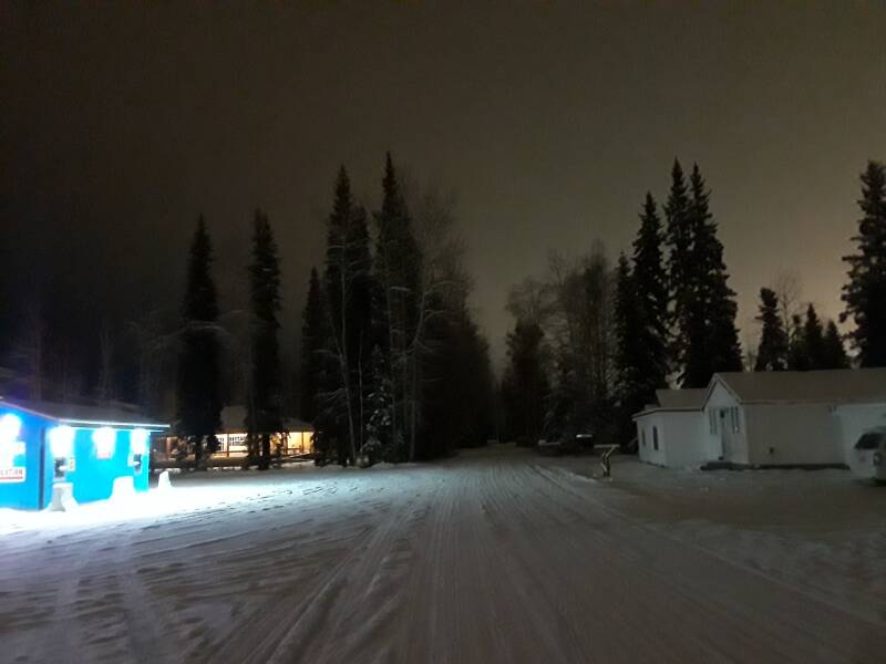
Billie's appears, beneath the skyglow of Fairbanks.
The aurora viewing was very limited on this trip. The night I arrived and the following night were clear, but the aurora was very weak, barely visible on both nights. All the other nights were overcast. Some web sites and smart phone apps are helpful for tracking auroral activity and cloud cover.
Auroral Oval Clear Sky (app) Solar Activity K index (app) SpaceWeatherLive (app)
Also make sure to have NOAA's aurora forecast maps bookmarked: https://www.swpc.noaa.gov/products/aurora-30-minute-forecast

The Delta flights from Seattle arrive at Fairbanks at 0020. They unload, refuel, load up, and depart to return to Seattle at 0130.
On the last day I had stored my pack and spent the day around UAF. One last Thai dinner, one last night of live music at the Marlin, then back to Billie's to summon a ride to the airport.