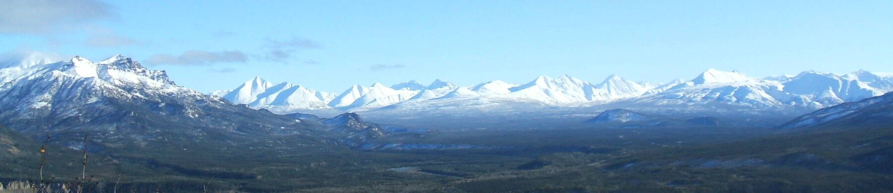
Central Alaska at the Equinox
Going to Alaska
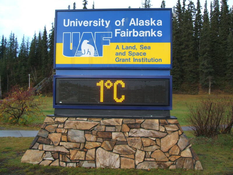
I went to central Alaska to teach a Linux course and a Linux/Unix security course for the Arctic Region Supercomputing Center University of Alaska Fairbanks. But I also got to do some tourism while I was there!
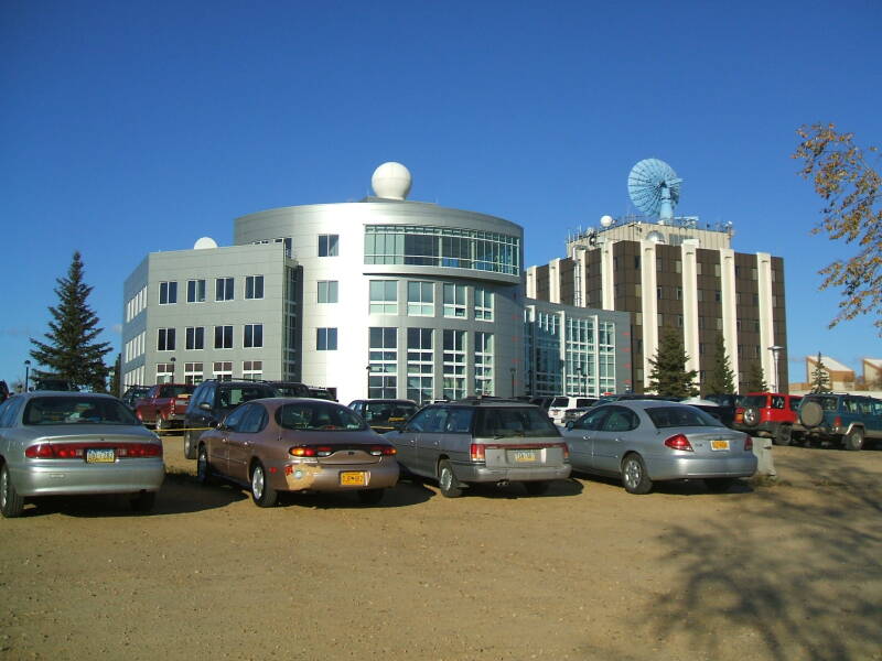
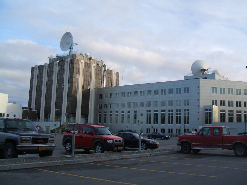
ARSC, the Arctic Region Supercomputing Center, provides high-performance computing and mass storage for the University of Alaska Fairbanks and through UAF to the National Science Foundation, Department of Defense, and other federal government funding agencies interested in various geophysics research projects at which UAF excels. These address research topics including ionospheric modeling, arctic weather modeling, arctic sea ice analysis and tracking, and the forecasting and modeling of volcanic ash plumes and tsunamis.
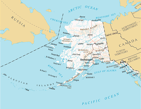
Map of Alaska from nationalatlas.gov

When I was there, ARSC was running a variety of Cray systems
(YMP, T3D, T3E, J90, SX-6, XD1, XT5) and IBM and Sun servers.
Soon after my visit, they deployed a
Linux
cluster
pacman
with 2080 CPUs (soon increased to 3256 CPUs
and a 200 TB file system), two SPARC T5440 file servers
bigdipper
and
wiseman
with 7 petabytes of storage each, a Cray XE6
chugach
with 11,648 CPUs, and a Cray XE6
tana
with 256 CPUs.
Being from Purdue, I was familiar with the concept of the land-grant universities. UAF is a land-grant university, but it is also a sea-grant and space-grant university, and it participates in the sun-grant program through Oregon State University.
The university is just 200 miles south of the Arctic Circle, and it has world renowned research programs in Arctic science. Significant research units in addition to ARSC include the Geophysical Institute, the International Arctic Research Center, the Institute of Northern Engineering, the Institute of Arctic Biology, and the school's leading programs in aboriginal studies.
A federal agricultural experiment station was founded in Fairbanks in 1906. The U.S. Congress approved funds to establish a university there, a federal land grant was issued in 1917, and in 1922 the Alaska Agricultural Collect and School of Mines was established in 1922 with six professors and just six students. In 1935 the Alaska Territorial Legislature changed the name of the school to the University of Alaska. The Alaska Constitutional convention was held on the campus from November 1955 to February 1956, and the state constitution was signed there.
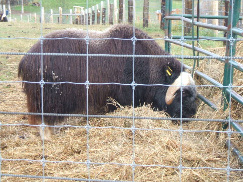
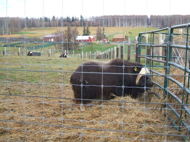
I did see some unusual livestock, as UAF has a musk oxen farm.
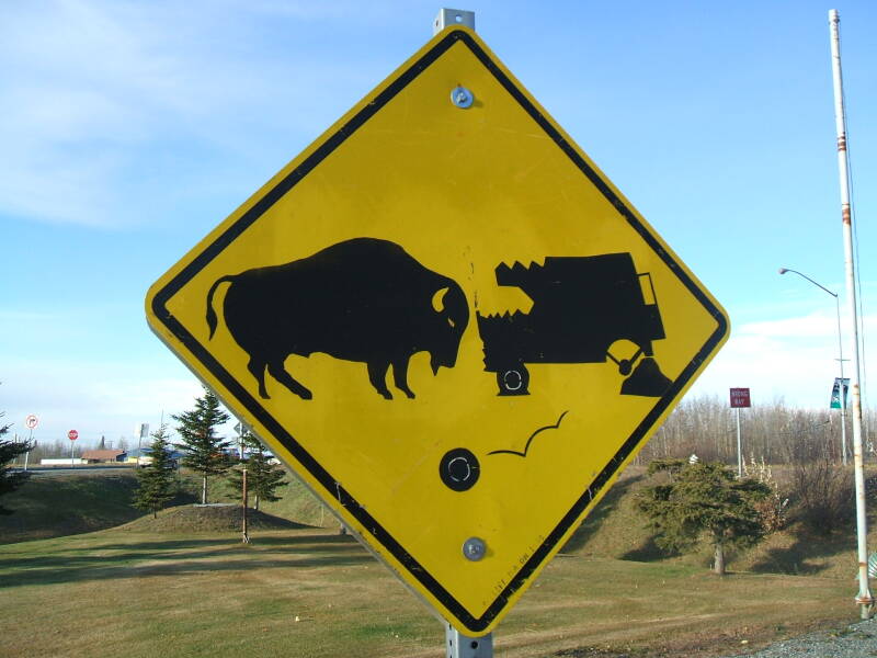
However, the sign I saw along the Alaska Highway south-east of Fairbanks seemed to warn about bison rather than musk oxen attacking your combine harvester.
| BEWARE THE COMBINE-ATTACKING BISON |
The musk ox is believed to have arrived in North America between about 200,000 and 90,000 years ago, during the Pleistocene period. Its contemporary the woolly mammoth died off, but the musk ox seems to have survived the last ice age in some unglaciated areas away from the prehistoric people. The Native Alaskan population of musk ox were wiped out in the late 19th or early 20th century, possibly due to excessive hunting but possibly due to climatic instability. They have since been reintroduced into Alaska.
South to Denali National Park and Mount Healy
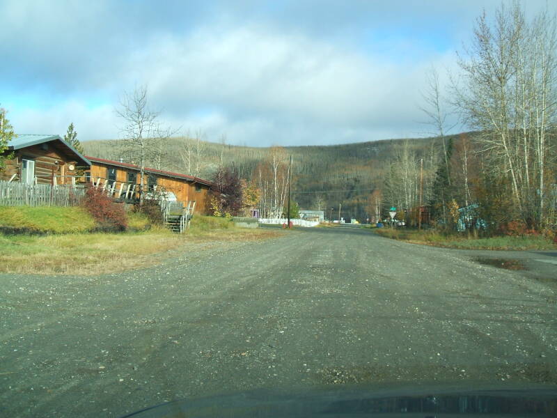
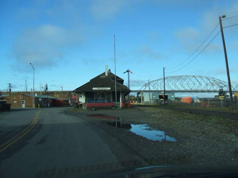
Driving south of Fairbanks toward Denali, I stopped at the town of Nenana (nee-NA-na, like ba-NA-na) on the Tanana (TA-na-na, not like BA-na-na) River. It's the biggest town by far on that 110-mile stretch.
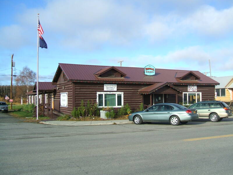
Note the combination district courthouse and barber shop shown above. Very efficient!
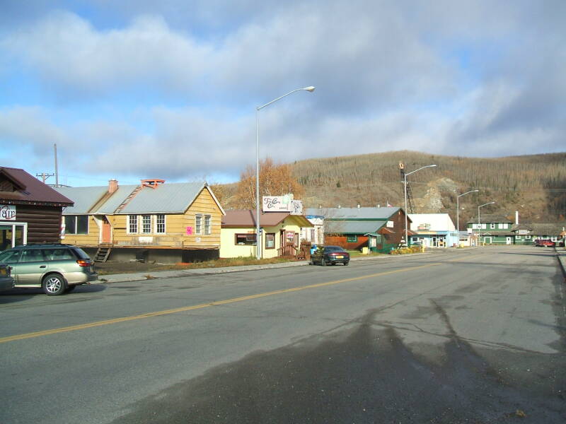
These pictures are from A Street, the main street through Nenana. We're looking toward the main business, along the left side of the street toward the end, and the train station across the street at the very end.
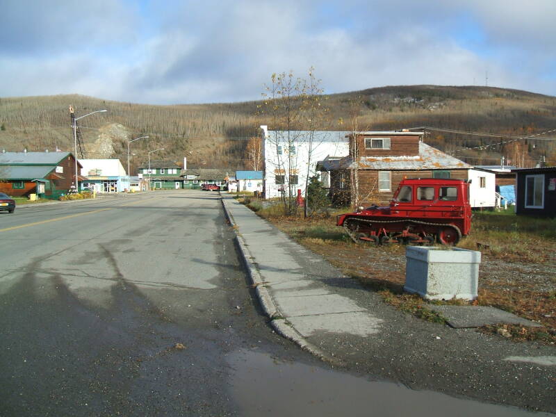
Tracked vehicles like this red one provide transport through snow and the almost endless bogs of central Alaska.
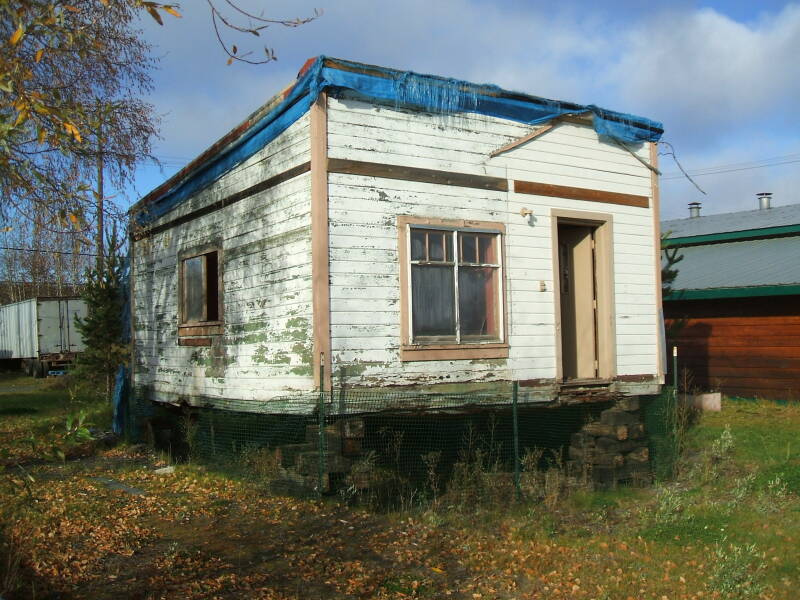
Some buildings are on skids for easy relocation.

Nenana is the biggest town south of Fairbanks, although its population is just barely over 400. Over 40% of the year-round jobs are government-funded. The main non-government business here is its role as the interior's primary rail-to-river-barge transport connection. The Tanana River is shallow, loaded river barges have a maximum draft of 4.5 feet or 1.4 meters.
Seasonal jobs include the employment of almost 100 locals, nearly a quarter of the population, in counting and tabulating the lottery tickets betting on the precise time when the ice breaks up on the Tanana River each spring.
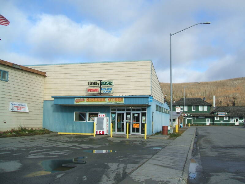
Coghill's General Store with groceries, hardware, and liquor is the largest business in Nenana.
The Alaska Railroad connects the interior to the outside world. It runs north from ports at Seward and Whittier to Fairbanks, continuing through the city to Eielson Air Force Base and Fort Wainwright. Rail barges connect Whittier and Seattle.
They started building a railroad in Alaska in 1903, laying down 51 miles of track by the time the project went broke in 1909. Another company bought it that year and extended the track another 21 miles further north before going broke in 1914.
The U.S. federal government bought the Alaska Northern Railroad in 1914 and moved its headquarters to Ship Creek, little more than a tent city at the time but later known as Anchorage after its incorporation in 1920.
The 700 foot long Mears Memorial Bridge across the Tanana River, seen in the distance here in Nenana, was completed in 1923 as the final link in the Alaska Railroad. At the time it was the second longest single-span steel railroad bridge in the U.S., and it still is the third longest simple truss-type bridge in the U.S. and among the largest of that design in the world.
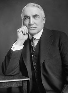
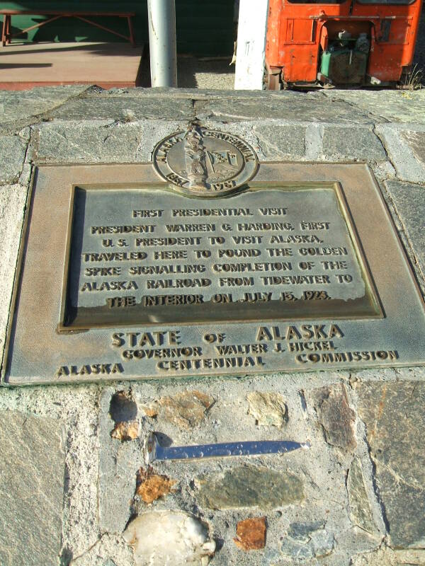
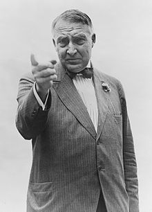
Warren Harding, who until 2017 was the most corrupt U.S. President ever.
U.S. President Warren Harding was anxious to escape the attention focused on the many scandals of his administration. He was also in rapidly declining health. He left Washington in June of 1923 on what he called his Voyage of Understanding, to include 18 speeches and a much larger number of informal talks. He and his physician believed that getting away from Washington would relieve his stress. He was reporting chest pains radiating down his left arm before leaving.
He began to feel better, and being away from the capital allowed him to expand his political views away from the established Republican Party agenda focused at the time on isolationism and defense cuts and against labor. He began promoting world peace and U.S. participation in the World Court, advocating increased spending on national defense, and endorsing labor's right to organize and a 12-hour limit to the length of the work day.
Harding was the first U.S. President to visit Alaska. He encouraged colonization of the enormous and largely uninhabited territory. He hoped that the completed railroad would allow World War I veterans from Alaska to return home, and that it would encourage impoverished workers from the lower 48 states to relocate to Alaska in search of employment.
On July 15, 1923, on the north side of the Mears Memorial Bridge, Harding drove in the golden spike completing the Alaska Railroad.
Harding's party continued to Fairbanks for two days, then returned via the railroad and sailed south. The Presidential cabinet members and other staffers had discovered that agriculture in south central Alaska would only be possible with irrigation due to the low rainfall; that the Alaskan salmon population was disappearing due to overfishing; and that mining coal and transporting it by ship would be prohibitively expensive.
Harding visited Vancouver, British Columbia, on his way back, making him the first U.S. President to visit Canada while in office. He continued by ship by Seattle, then south through Portland to San Francisco by train. In San Francisco he stayed at the Palace Hotel, where he developed a respiratory illness thought to be pneumonia.
Harding died suddenly one evening at the hotel. His widow refused to allow an autopsy, but naval medical consultants who had examined him in San Francisco concluded that it had been a heart attack. Recent attempts to diagnose his problems from the reports of the time have concluded that he had shown symptoms of cardiac insufficiency with congestive heart failure over several preceding weeks, including all of his western trip. But some continue to speculate that he was poisoned, perhaps by his wife in retaliation for his serial infidelity.
His widow returned to Washington and briefly lived in the White House with newly sworn in President Calvin Coolidge and his wife. For a month, Mrs Harding collected and burned most of President Harding's documents and correspondence, both official and unofficial. She explained that this was to protect his legacy. What survived her burning were collected and kept away from public access by the Harding Memorial Association in his hometown of Marion, Ohio.
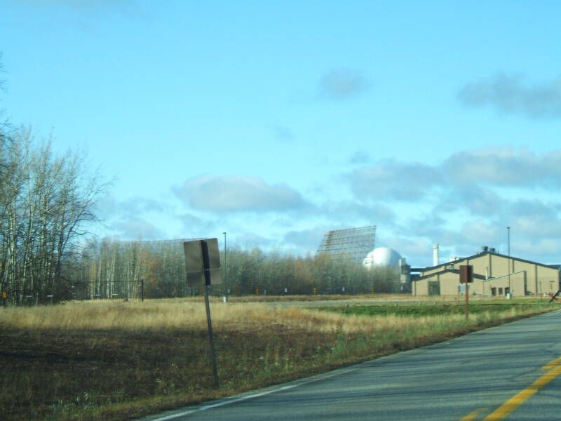
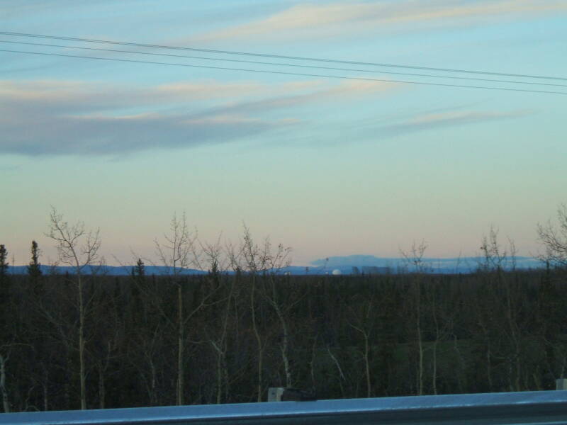
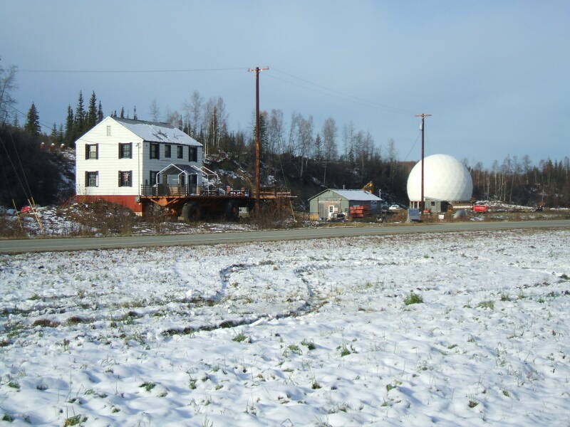
I stopped by Clear Air Force Station to see part of the anti-missile system that is supposed to keep Alaska from being hit by North Korea's longer-range missiles. It's home to the 13th Space Warning Squadron, assigned to the 21st Space Wing. It provides early warning of ICBMs and SLBMs to NORAD, and space surveillance on orbiting objects.
There are distant views of a large radome and a couple of VHF/HF over-the-horizon arrays. Impressive if you're an antenna geek. AN/FPS-120 SSPARS if you're an antenna and radar nomenclature geek.
Otherwise it looks like The World's Largest Golf Ball and The World's Largest Fence.
It's out in the taiga so it seems to be in the middle of Mother Russia. So it's The World's Largest Birch Forest growing out of The World's Largest Swamp.
There's lots of spectacular scenery around here. Or at least I would say so. But then again I've always thought that the Trans-Siberian Railroad would be an interesting train ride. OK, so I have a thing for thousands of miles of swamp and birch and spruce.
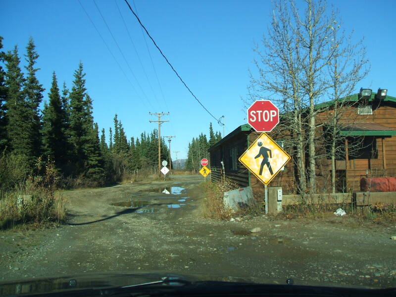
Passing through the village of Healy, a little north of Denali, I encountered what seemed to me to be a very slight over-abundance of road signs. Stop signs at either end of the town hall, complete with pedestrian crossing signs.
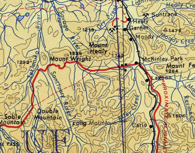
This was the village of Healy, just north of the entrance to Denali National Park. The map below is from before 1980, using the old-timey name of "McKinley Park". The central feature of the park is the mountain properly referred to as Denali. Its summit at 20,320 feet or 6,194 meters above sea level makes it the highest summit in North America. It rises above relatively low surrounding terrain at elevations of 1000-3000 feet or 300-900 meters, making Denali the highest land mountain in the world measured from its base to its peak. Mauna Kea, which lies mostly underwater, has about twice the height from its base to peak, 33,500 feet or 10,200 meters.
Denali was first climbed in June of 1913, after a few false claims. Walter Harper, an Alaskan Native, was the first man to reach the summit. Almost 60% of climbers reach the top these days, but about 100 have died in the attempt.
The Koyukon Athabaskan people who lived around the mountain since long before Europeans arrived called it Denale or Denali, meaning The High One or The Great One. The Dena'ina people in the Susitna River valley to the south called it Dghelay Ka'a, sometimes anglicized as Doleika, meaning The Big Mountain. The Aleut people called it Traleika.
The Russians who settled and controlled Alaska from the 1700s until the Americans bought the place in 1867 literally translated the meaning of the Native names, calling the mountain Большая Гора or Bolshaya Gora, Russian for Great Mountain.
Then a politically motivated gold prospector from Seattle returned to the U.S. and wrote an account that appeared in the New York Sun on January 24, 1897. This included the baldly political claim, "We named our [our??] great peak Mount McKinley, after William McKinley of Ohio, who had been nominated for the Presidency." [and who was U.S. President from 1897 until his assassination in 1901]
In 1975, the Alaska Board of Geographic Names officially changed the mountain's name to Denali, the name used by Alaskan Natives, other Alaskan residents, and mountaineers. At the Alaskan Governor's request, the Alaska Legislature officially requested that the U.S. Board on Geographic Names also change the mountain's name.
However, this was fought continuously from 1975 to 2009 by Ralph Regula, a congressman who was from the same part of Ohio as McKinley and who seems to have had nothing better to do with these 34 years in Congress. Regula finally retired in 2009, at which point two U.S. Representatives from the apparently rather backward state of Ohio, Betty Sutton and Tim Ryan, took over Regula's McKinley obsession.
A McKinley National Park had been created in 1917, when Alaska still had another 42 Territorial years before becoming a U.S. state. In 1980, President Jimmy Carter signed the Alaska National Interest Lands Conservation Act, incorporating the former McKinley National Park into a larger protected area named the Denali National Park and Preserve.
Alaskan Natives, other Alaskan residents, and the Alaskan government all want the name to be corrected. But the cranks in Ohio cling to control.
Meanwhile, the city of Fairbanks was named after Charles W. Fairbanks, a Republican senator from Indiana and later the Vice President of the U.S., serving under Theodore Roosevelt during his second term.
It's not really a great location for a city. In 1901, Captain E. T. Barnette was headed for Tanacross or Tanana Crossing, where the Valdez-Eagle trail crosses the Tanana River. He planned to set up a trading post there. His steamboat ran aground seven miles short of its destination in shallow water in the Chena River before its merger with the Tanana. Barnette and his party were left there on the river bank, and he ended up setting up his trading post right there. The city was repeatedly subjected to disastrous flooding, with its main bridge across the river frequently washed away and the entire town submerged at times. None of the city streets were paved in 1940, the gravel streets were finally paved with asphalt in the late 1950s and 1960s. A massive flood control project after an especially bad flood in 1967 built a dam and spillway that can now divert the Chena River around the city and directly into the Tanana River.
If the native people had cared to name this frequently flooded, swampy, steamboat-grounding spot, I'm sure the people of Indiana would have no complaints about using their name for it.
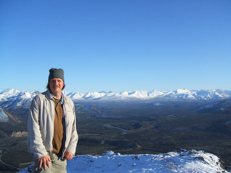
That's me at the summit of the Mount Healy Overlook Trail. The trail is just 3.8 km long with elevation gain of 605 meters. But it's easily accessible, just inside the park entrance and you can drive to the trail head.
To go very far at all into the park, you have to either go on foot or take one of the park buses.
The view behind me looks east-southeast to the Alaska Range, about 60 kilometers away.
North to the End of the Pavement
I drove north out of Fairbanks on the Elliott Highway toward the Dalton Highway. First, though, you have to get to the Elliott Highway.
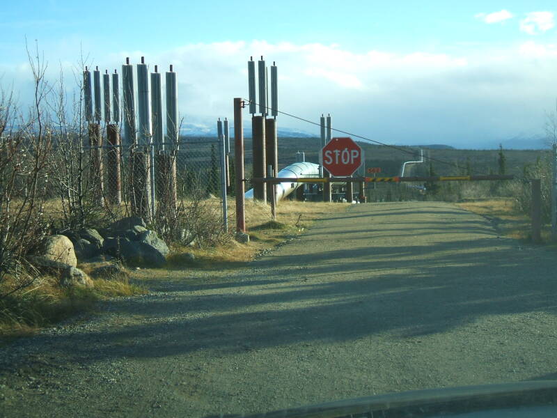
As you head north out of Fairbanks, you pass a park with displays describing the Alaska Pipeline. The official name is really the Alyeska Pipeline, and it's the main component of TAPS or the Trans-Alaska Pipeline System. The 800-mile crude oil pipeline from Prudhoe to Valdez along with the other components of the system are privately owned by the Alyeska Pipeline Service Company.
It's very privately owned. Someone in Fairbanks told me a story about an Argentinian bicyclist:
He went to Tierra del Fuego and took the ferry to the big island just south of that. He rode to the southern tip of that island, then turned around and rode back north. He took the ferry back across the strait, and got back on his bike. He pedaled all the way up South America, and somehow got through the Darian Gap. He pedaled all the way up Central America. Mexico. The lower 48 US. Canada. Alaska. All the way up that 420 miles of really bad gravel of the Dalton Highway.
He arrived at the gate just two or three miles short of the beach. He asked the oil company nicely. He pleaded. Pleaded more. Groveled.
"No", the oil company said. "If we allow ONE Argentinian who pedaled his bicycle all the way from the southern tip of the island south of Tierra del Fuego to come in here and dip their tire in the Arctic Ocean, then we would have to allow in EVERY Argentinian who pedaled his bicycle all the way from the southern tip of the island south of Tierra del Fuego to here, and we clearly CANNOT start doing that! We are very, very, busy!!" And then they sent him home.
Lesson: Ask before you start pedaling.
The pipeline is elevated, as the oil must be kept warm to pump it through the pipeline. The oil comes out of the ground at about 120 °F or 49 °C, and has cooled to about 111 °F or 44 °C by the time it reaches the first pumping station. The pipeline rides on the supports without rigid connection so it can shift as needed with thermal expansion and contraction and during the frequent earthquakes. Heat pipes and finned radiators conduct heat away from the supports so they don't melt the permafrost.
The pipeline's theoretical maximum capacity is 2.14 million barrels or 340,000 cubic meters per day. However, the oil is pumped through the pipeline at a significantly slower rate, about 700 thousand barrels or 110,000 cubic meters per day in 2008, and 600,000 barrels or 94,000 cubic meters per day in 2012.
Lower flow rates lead to higher profits, but also to greater temperature drops. Too much of a drop would solidify the oil. Alyeska is studying how to further decrease the flow in order to increase their profit. One option would be to install heaters at several of the 12 pumping stations along the length of the pipeline. Another would be to replace the 48" pipeline with a 20" pipeline as far as Fairbanks where the oil would be transferred onto trains.
Let me make sure I understand this: We are told that we need to drill new wells in an area frankly of uncertain potential yield in the interest of paying a little less to the terrorist-supporting Saudis. That sounds like it would be a reasonable trade-off if it really worked out that way. But meanwhile the existing pipeline out of northern Alaska is working to figure out how to cut its throughput in order to boost its profits. Along, of course, with the profits of the Saudis and thus the jihadists.

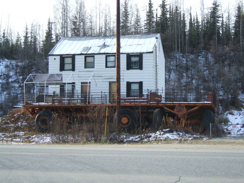
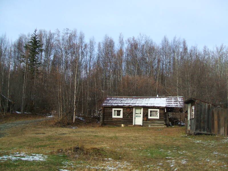
The house across the road intrigued me. It was surrounded by enormous wagons.
The people in the class I was teaching explained it. These are "tundra wagons", pulled by large-wheeled tractors called "tundra buggies", and used to transport large items overland off the very few roads in Alaska.
The guy who lives here bought a couple of tundra wagons and uses them as porches for his house.
He also bought a radome. I asked if the antenna was in there. No, it's just the dome, he has parties inside the dome from time to time.
OK, back on the highway, we have quite a distance to drive. You get to the last major road leading back around and into Fairbanks and then you pass through the very minor settlement of Fox, about 10 miles north of Fairbanks. Fox is not much more than a gas station with ominous signs about it being the last service for something over 200 miles.
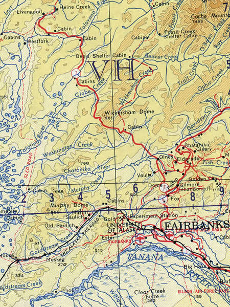
The Elliott Highway starts at Fox and runs a total of 152 miles or 245 kilometers to Manley Hot Springs. It is paved for the first 72 miles 116 kilometers, as far as its junction with the Dalton Highway just past Livengood. It's unpaved for its final 80 miles or 130 kilometers, looping first west and then southwest to end nearly due west of Fairbanks at Manley Hot Springs. The highway was built as far as Livengood in 1951.
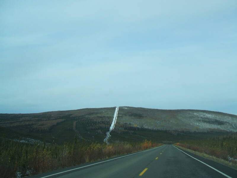
Driving north from Fairbanks, you pass over some hills just getting to the park explaining the pipeline. The terrain rises as you continue north, leading (if you continue far enough) to the White Mountains and the Yukon River, then rising again beyond that to cross the Brooks Range and descend to the Arctic coast.
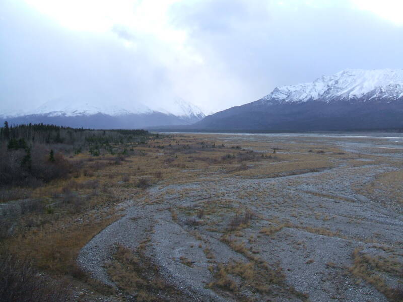
To the south of Fairbanks lies about a hundred miles of marsh and bog.
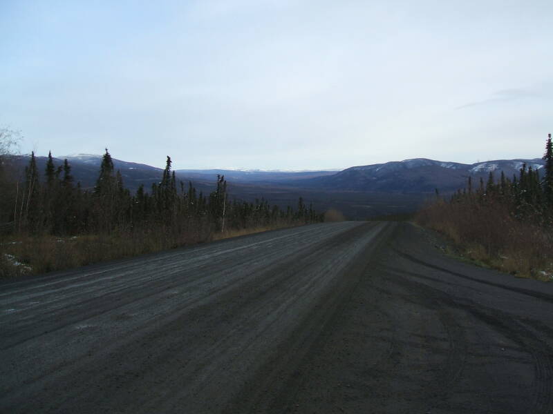
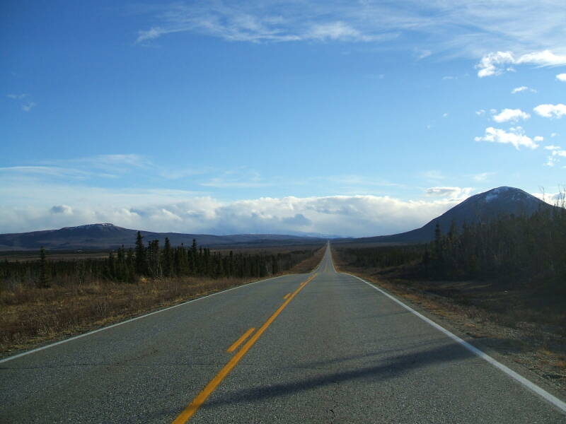
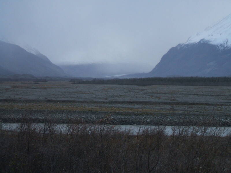
The weather in central Alaska is rather cold at times. These three pictures were taken on October 1st, along the Elliott highway not far north of Fairbanks.
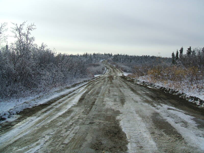
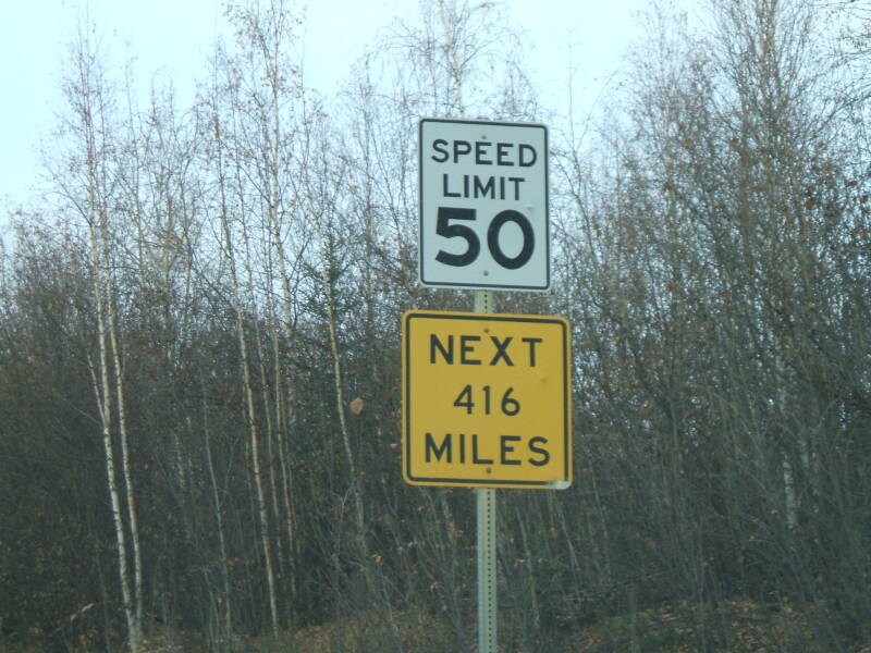
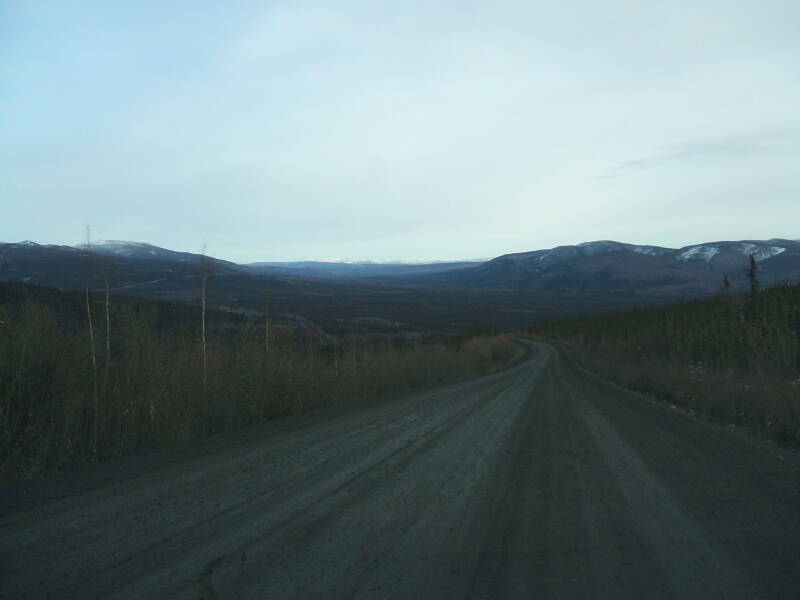
About 80 miles north of Fairbanks you run off The End of The Pavement where the Dalton Highway, aka the "Haul Road", branches north off the Elliott Highway. The Dalton is all gravel-and-mud, most of it very bad, and the Elliott becomes gravel-and-mud as it curves to the west and back around to the south to end at Manley Hot Springs.
The Dalton/Elliott split is the very last pavement in that direction until you're past the pole and well into Siberia, unless the oil companies have paved something in their enclave in the northernmost 10 miles. But then "normals" as they call them can't drive into the last-10-mile ribbon anyway.
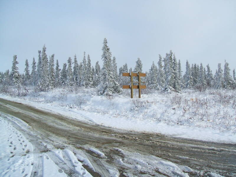
The signs become amusing as they really try to intimidate people out of venturing north unprepared.
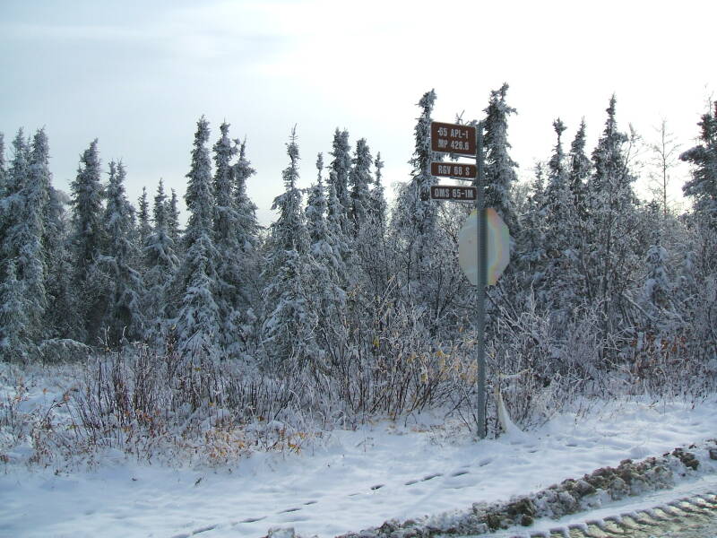
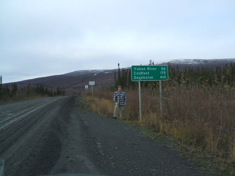
Maximum northness achieved:
65° 30.240' N 148° 44.643' W
That was a few miles north of this sign, up into the hills beyond.
It would have been another 120 miles of bad gravel to the Arctic Circle.
I did not even drive the 56 miles of bad gravel, shared with high-speed semis slithering all over it, to the Yukon Bridge. I figured I would be guaranteed to take a big rock to the windshield or bodywork, or worse.
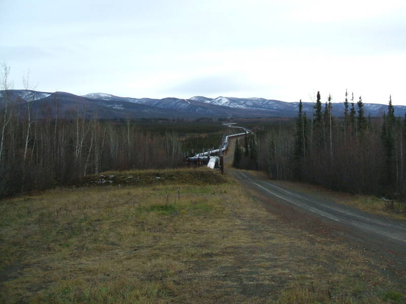
The Alyeska Pipeline disappears into the distance as it heads south from the Elliott/Dalton split.
The Prudhoe Bay oil field had been discovered by following the lead of the Iñupiat people of the North Slope, who for thousands of years had mined oil-saturated peat for a source of heat and light. U.S. President Warren Harding (him again!) had issued an executive order establishing Naval Petroleum Reserves NPR-1 through NPR-4 across the country, including NPR-4 in the far north of the Territory of Alaska, 23 million acres just south of Barrow. The other three were tied up in the Teapot Dome Scandal, just part of the rampant corruption of Harding's presidency.
All of the Naval Petroleum Reserves except for NPR-4 were mired in the corruption of Warren G. Harding's administration and the Teapot Dome Scandal.
NPR-4 somehow avoided involvement in that controversy, and was largely ignored until World War II when the U.S. Navy funded oil exploration in the Brooks Range. The government continued to investigate through 1953, finding several small oil fields but none that would be economical to develop.
In 1957, Richfield Oil Company, later to become Atlantic Richfield and then ARCO, drilled a very successful oil well in the Swanson River Oil Field near Kenai. This was Alaska's first commercially producing oil field, and it led to further commercial exploration and the development of five more oil fields and 11 natural gas fields by 1965. This led to the belief that large amounts of oil and gas must be somewhere north of the Brooks Range.
ARCO began surveying the Prudhoe Bay area in 1967, making significant discoveries in 1968. The new field was the largest in the U.S. and the 18th largest in the world. The problem was its location, how to get the oil out of the remote location. Boeing suggested that they build a fleet of 12-engine tanker aircraft. General Dynamics suggested that they build a fleet of tanker submarines. Boringly level-headed groups suggested extending the Alaska Railroad to the north coast. An ice-breaking oil tanker made an experimental run in which it was broken by the ice before arriving, several of its cargo holds were flooded with seawater, and it was escorted back by a Canadian icebreaker.
The 1973 oil crisis caused a sudden rise in oil prices in the U.S., making further exploration and exploitation economically feasible while driving legislation that removed legal challenges. The Pipeline was built between 1974 and 1977. It was a challenging project because of the enormous scale and the location across rugged and isolated terrain that was partly swampy and partly permafrost.
The pipeline brought enormous economic changes to its path. The Fairbanks police estimated in the mid 1970s that about 1% of the city's population consisted of prostitutes (40 to 175, out of 15,000).
Alaska is startlingly socialistic in its economic policies. Heavy taxation rates were introduced by Sarah Palin in 2007 and passed by the state legislature later that year, before she abandoned the governorship mid-term because it got in the way of appearing in "reality" TV shows. Petroleum businesses are taxed at up to 50% of profits. Plus, the state also claims 12.5% of all oil and then sells that same oil back to the companies that extracted it for additional revenue. If you can manage to get official Alaskan residency, you get a cut of all these seized profits. The state's handout to all residents is an annual check.
Amazon
ASIN: 0061939897
Amazon
ASIN: 1481068717
The government seizes profits from business and redistributes the money to people for doing nothing. Lenin would be proud! Хорошая работа, товарищи!
The large proportion of Alaskans living in nearly inaccessible areas can now order goods to be delivered by air. Regular passenger flights with associated mail and freight service to barely inhabited locations are heavily subsidized by the U.S. Federal Government through the Essential Air Service program. Everyone in the U.S. must keep paying taxes so people out back of nowhere in Alaska can get cheap or even free delivery.
"The needs of the many are greater than the needs of the few." No, wait, that's what Spock said...
"From the Lower 48 according to their ability, to Alaska according to its needs." Yeah, that's how Marx put it, and that pretty well captures the largely socialistic Alaskan economy.
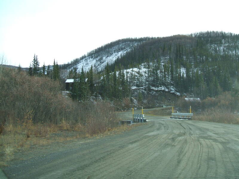
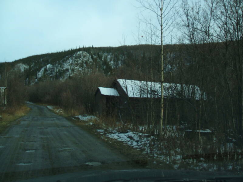
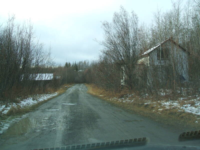
Here is the road off the Elliott Highway from near The End of The Pavement leading to the community of Livengood.
Here's my coffee-table book idea: the variety of borderline paranoid KEEP OUT signage found in Alaska. There's an awful lot of it, given that there is so much uninhabited (and nearly uninhabitable) taiga.
No structures are visible from the last 60 miles of paved road north of Fairbanks, just swampy birch and spruce. But there are a few "lanes", possibly navigable with tracked vehicles after the muskeg freezes and that's about it.
Pretty much all of those lanes have unique signs warning all and sundry to stay far away. Either clusters of store-bought signs, or more demented looking spray-painting on plywood scraps or on piles of barrels, or combinations thereof.
Cue the banjos. Or maybe balalaikas given the latitude and environment.
Here are more views of Livengood, the biggest town for something like 172 miles north from Fox, itself a collection of two saloons and a gas station 10 miles north of Fairbanks.
On the paper of the 2000 census, Livengood had a population of 29 people in 13 households and 6 families. But this "census-designated place" covered a total area of 267.8 square miles or 694 square kilometers, making for a population of 0.1 person per square mile.
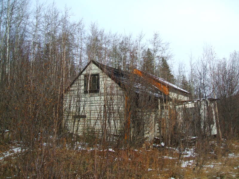
Livengood had 13 households but 31 housing units, meaning that between a half and two-thirds of these housing units weren't households.
In other words, abandoned structures and cabins used from time to time.
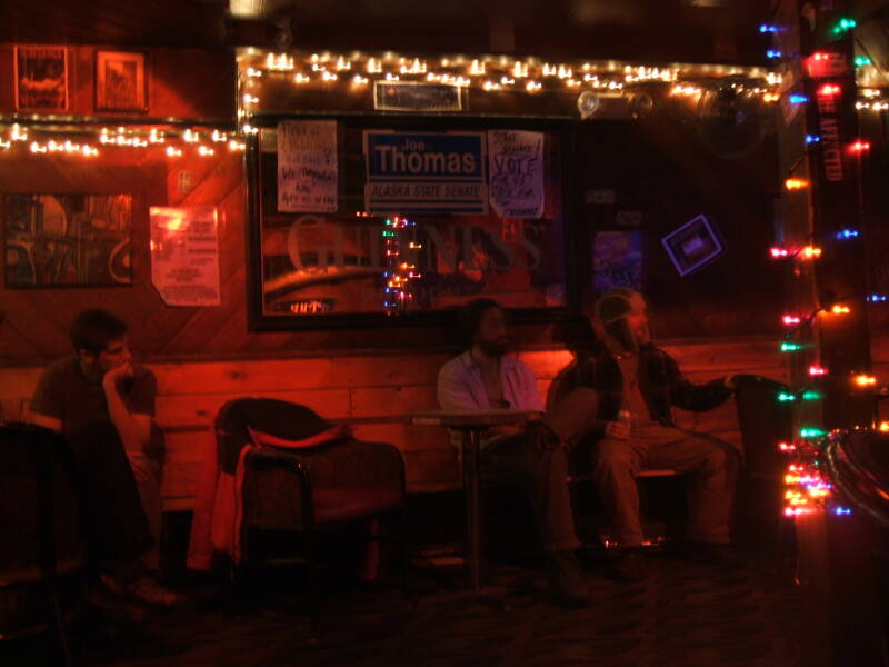
One evening at the Marlin, more on which below, the girl working behind the bar asked me what I had been up to. I told her that I had been up to Livengood, which met with her approval. She asked if I had gone into any of the buildings and rummaged around in the furniture. A couple of the buildings in Livengood were former brothels, with ribbons and bows and such in the cabinets. Others were hunting cabins "owned", or at least claimed, by people who were sometimes violently protective.
Yeah, I think I'll just drive through and look from the road.
Southeast to the Alaska Range and Back
On another free day I got in my rental car and started driving like an uninformed Argentinian might pedal.
The highway led south-east through North Pole, Alaska. It's SO sickeningly cutesy that it makes your pancreas ache, what with all the Santa kitsch. And if they did manage to entice some outsider to stop and visit, then what are they going to patronize, the one Chinese restaurant or the two welding shops?
Give me the scenery! I continued on south-east to Delta Junction, which is strangely more modern and prosperous looking than Fairbanks, probably because the majority of its buildings are NOT disappearing into the muskeg and birch forests. Then it was south and south on the Infinite Highway toward Paxson, crossing the Pipeline again.
The Pipeline crosses 34 major streams and almost 500 minor ones on its 800 mile run to the oil terminal at Veldez.
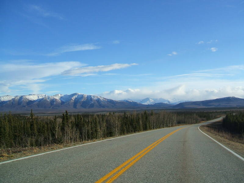
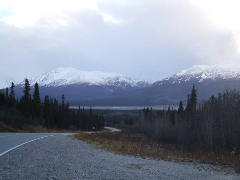
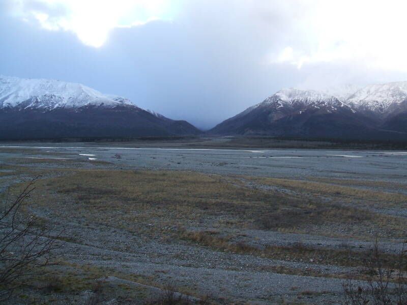
There is about a hundred miles of low-lying marsh and bog beyond the Tanana River south of Fairbanks. But eventually this leads into the Alaska Range and onward into the St Elias Range where there is some spectacular scenery.
I had to finally turn around and pound pavement back toward Fairbanks. Good thing there is effectively no speed limit in Alaska.
c = 300,000,000 meters/second is still a hard limit, but that's really about it.
I stopped for dinner at the roadhouse with the best food between Delta Junction and North Pole. Unfortunately, it is the ONLY roadhouse with food between those points, and only wins "best" by default.
It does, however, double as a helicopter refueling site. And so it features the best food of any combination all-season roadhouse and helicopter refueling site on the road between North Pole AK and Delta Junction AK.
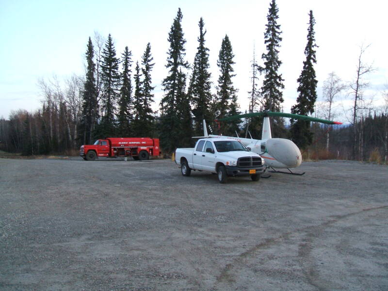
On the way south there was a UH-1 Huey now in commercial service being refueled. It was parked much closer to the trees. Probably no more than five to ten feet from rotor tip to tree. I assume he landed closer to the road and scooted over in an almost-hover, but still quite impressive. I was too startled by the unexpected red-and-white Huey almost in the road to take the requisite snapshot through the windshield on the way south.
On the way back north there was a much smaller helicopter parked there for the night.
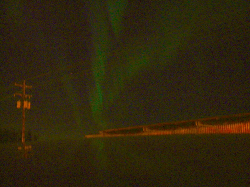
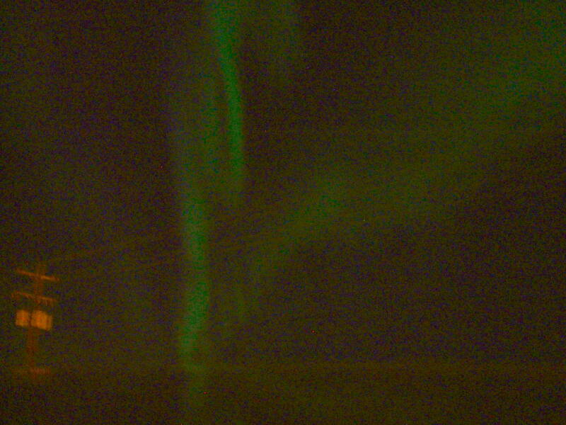
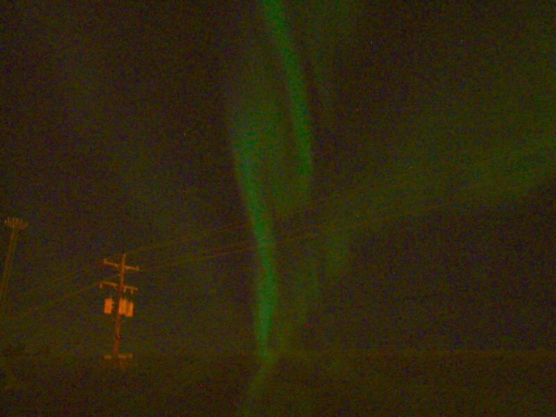
Aurora! And Evenings in Fairbanks
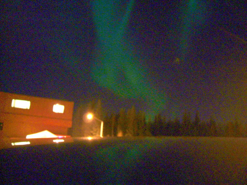
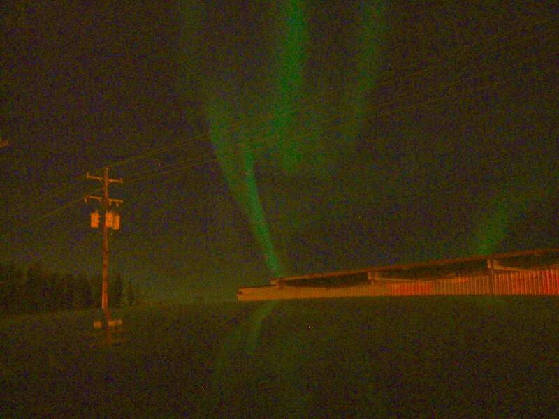
This is the best aurora I saw during the two weeks I was there.
This is on the first night of October, about 2200 local time. The picture was taken within Fairbanks itself.
The aurora was far brighter to the eye than it appears here, although not as green. The intensity and color difference is probably one of those strange tricks of human vision and CCD sensitivity.
The aurora is caused by the charged particles of the solar wind being pulled in by the Earth's magnetic field along a curved funnel shape and ionizing nitrogen and oxygen in the upper atmosphere. Photons are emitted as the ionized oxygen and nitrogen atoms return from their excited state to a ground state. What you see is likely a nearly vertical curving curtain shape, the intersection of the curving funnel of the Earth's magnetic field with the upper atmosphere. As far north as Fairbanks, you are looking up along the curtain. Further south you see it edge-on, if it can be seen at all.
The green color is generated by the emissions from the ionized oxygen. Red colors can result from oxygen emissions at a different energy level, or from nitrogen returning to a ground state.
The aurora is frequently visible above Fairbanks. This far north location is what provides opportunities for UA-Fairbanks to have such an excellent geophysics program.
It's fairly dark in Fairbanks at night, as it isn't a very large city. In 2010, 31,535 people lived in the city itself and 97,581 in the metropolitan area, which covers an awful lot of territory.
The military is a big presence in the area. Ladd Army Airfield was built in 1939. It became Fort Wainwright in 1960, and in the 1980s it was incorporated into the city limits.
Winter lasts from late September or early October into late April or early May. In an average year, the first snowfall appears on September 21st, the first accumulation of an inch of snow on October 8, and solid snowpack is established by October 18th and remains until May. Fairbanks' location down in the Tanana Valley accumulates colder air in and around the city. Average low temperatures in winter range from -15°F or -26°C to -25°F or -32°C, but it can get down to -60°F or -51°C. There are just 3 hours and 43 minutes of sunlight at the winter solstice, although at the summer solstice there are 21 hours and 49 minutes of direct sunlight and it never really gets dark.
Full disclosure: These pictures are the result of the following ImageMagick processing:
convert -contrast-stretch 10 -gamma 1.4 original.jpg new.jpg
So, the intensity range was stretched and shifted but the color saturation was left alone. The aurora really is as green as you see it here.
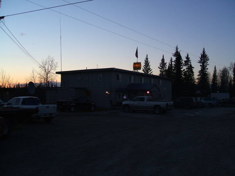
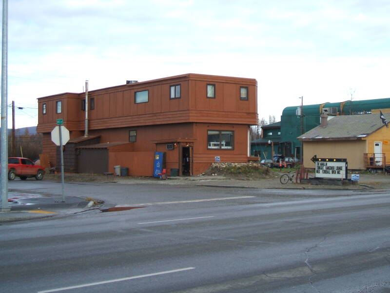
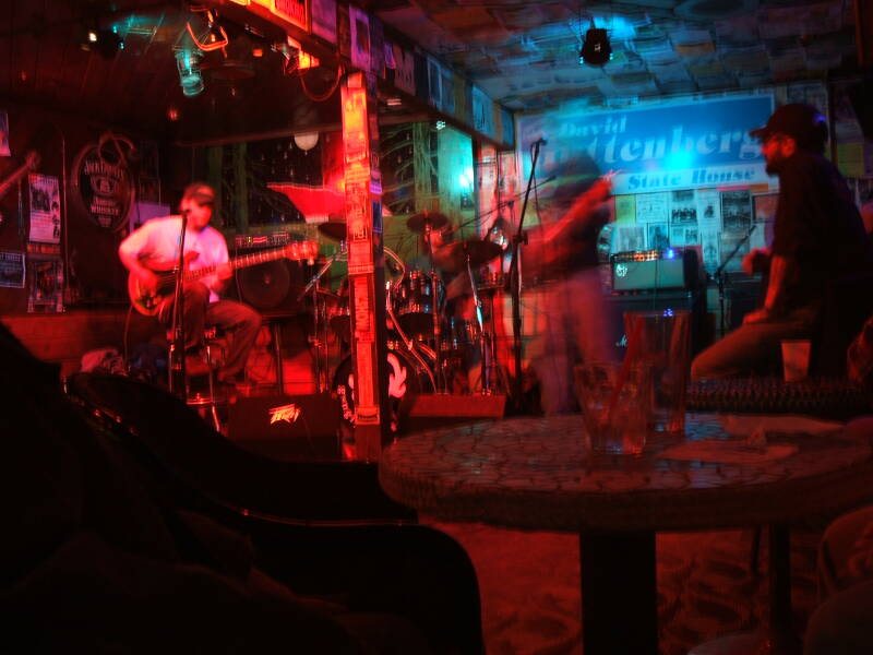
Back in Fairbanks it would be an evening at The Marlin and a set or two by Gangly Moose or another local group.
Fairbanks is not connected to the electrical grid of the lower 48 states, although a transmission line built in 1985 connects Fairbanks to power plants in the coal producing area of Healy and Anchorage. Fairbanks has the Chena power generator with four coal-fueled steam turbines and one oil-fueled generator. It also has the world's largest rechargeable battery, weighing about 1,300 tons and helping to bridge the gaps during frequent power outages by providing power to about 12,000 homes for up to seven minutes.

UA-Fairbanks wisely has its own coal-fired electrical power generating station on campus.
Two fibre lines provide data connections to the outside world, one paralleling the Parks Highway and Alaska Railroad to Anchorage, the other paralleling the Richardson Highway and leading to Valdez. A third spur fibre leads north along the Pipeline to Prudhoe Bay.