
Puerto Natales
Two Nights in Puerto Natales
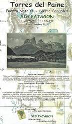
Visiting Torres del Paine
I had been exploring
Torres del Paine,
staying five nights at Cerro Castillo,
half-way from Puerto Natales to the park entrance.
After my last night there, I drove south sixty kilometers
to Puerto Natales.
It was quite the change.
Cerro Castillo had just 160 people,
and is 60 kilometers north of Puerto Natales,
60 kilometers from the park entrance.
Puerto Natales was much larger,
with over one hundred times the population —
18,500 in the town and the surrounding commune.
It's where Última Esperanza Sound
opens into Golfo Almirante Montt,
which connects to the Pacific Ocean
through narrow channels winding to the west.
The region has been known as
Provincia de Última Esperanza.
or "Province of the Last Hope"
since a Spanish navigator and explorer ended up here in 1557
after concluding that this was his last opportunity
for finding the western end of what came to be called
the Strait of Magellan.
It wasn't here.
Europeans lost interest in the area until the 1800s.

1:500,000 aeronautical chart TPC T-18A published in 1987, from the Perry-Castañeda Library Map Collection at the University of Texas at Austin.
Greeted by the Mylodon
I was greeted at the traffic circle at the north edge of Puerto Natales by the Mylodon statue. That's the extinct giant sloth that lived in this area during the Pleistocene epoch. They're often called the "giant ground sloth", I suppose to distinguish these beasts from the less-familiar giant sea sloth and giant flying sloth.

The Mylodon had osteoderms, small bony protective structures beneath the skin of its back. They're analogous to the plates of today's distantly-related armadillos.
In the 1990s, researchers found a collection of carved and polished giant sloth osteoderms at a rock shelter called Santa Elina in central Brazil. The triangular and teardrop-shaped objects had small drilled holes near one end, so they could be worn as personal adornment or possibly as protective amulets. The initial theory was that the people had carved ancient fossils that they found.
Further research within a year of my visit in late 2024 revealed that the Santa Elina rock shelter and its artifacts dated back to 25,000 to 27,000 years ago, based on mineral pigments from the many paintings and remains of fire pits. That's over ten thousand years before what the once-dominant "Clovis-first theory" says was the first peopling of the Americas. It's even before the Last Glacial Maximum of 26-20 kya, and modern Homo sapiens were still interbreeding with Neanderthals in the Levant 49-45 kya. And, the work showed that the osteoderms were carved and polished and drilled when they were still fresh, within a few days to a few years at most after the animals' deaths.
People shared the southern cone of South America with these and other large mammals for thousands of years.
"There was this idea that humans arrived and killed everything off very quickly — what's called 'Pleistocene overkill,'" said Daniel Odess, an archaeologist at White Sands National Park in New Mexico. But new discoveries suggest that "humans were existing alongside these animals for at least 10,000 years, without making them go extinct."
— Phys.org, 20 Dec 2024

The giant sloths were among the largest land creatures in South America — 3–4 meters in length and weighing over 450 kg. They usually walked on all fours, but of course rearing up like this makes for a much better pose for the traffic circle. They used their large, sharp claws to dig tunnels.
Large tunnels have been found to the north of Patagonia, mostly in southern Brazil with a few in northern Argentina. The larger ones are over two meters high and four meters wide, and extend for tens to hundreds of meters beneath the surface. Local legend said they were hiding places where Jesuit missionaries stored gold centuries ago. But since the mid-2010s, scientists have concluded that the tunnels were created millennia ago by large mammals.
The scientists call the tunnels palaeoburrows and ichnofossils or trace fossils. These are the largest such burrows we know of. Most of them are in a specific layer of sandstone dating to over 100 million years ago. The area was a vast desert at the time, and the sand in this region solidified into a sandstone that was soft enough to carve but not so soft that the tunnels collapse. Between 1,500 and 2,000 of these tunnels are known, all in that region of South America and nowhere else in the world.
The larger tunnels were dug and occupied by larger creatures, such as Glossotherium robustum, a giant sloth that lived in South American from 4 million to about 12,500 years ago. It grew up to three meters in length and weighed up to 1,500 kilograms.
La Mano is a statue of giant fingertips near the Mylodon statue. According to the local info:
Crafted by the artist Mario Irarrázabal in 1992, the sculpture features a giant hand emerging from the earth, symbolizing humanity's connection to nature and the landscape surrounding it.


Greeted by the Carabineros
I continued into town to find a place to park near where I would be staying. Within five minutes I ended up nose-to-nose with a Carabinero car in the middle of what I hadn't realized was a one-way street. The national military police car was the vehicle going in the correct direction.
Here's the crucial tip for driving here: Yes, the street signs show you the name of the street, and the street numbers within the next block, along with a silhouette of a friendly Mylodon welcoming you to town.
The street signs also have one-headed or two-headed arrows indicating if it's a one-way or two-way street, and if one-way, the direction in which you must travel. It's not as if the Mylodon has his arms out while saying "Welcome to Puerto Natales, you can go to the left or the right." The arrows restrict direction of traffic, they aren't about finding address numbers along the streets.

I was as embarrassed and apologetic as I could manage in extremely fragmentary Spanish, and got off with a warning. Yo soy El Gringo Sin Lingo. I parked near my accommodations, and didn't drive again until I was leaving town two days later.
Puerto Bories
I left my car safely parked, and walked down to the waterfront. My eventual destination was Puerto Bories, about five kilometers north along the waterfront. There's a broad walking, jogging, and bicycle path along Highway 9 up to the point where it turns inland.

I was soon far enough out of town that the giant mylodon statue wasn't obvious when I looked back.

glacier cruises
A little over half-way to Puerto Bories, I passed the Skorpios Terminal. The M/V Skorpios III runs two three-night cruises each week during the sailing season, which runs October through April. It goes through the many fjords in the archipelago leading toward the open Pacific. The ship approaches many of the glaciers flowing down off the Southern Patagonian Ice Field, the world's second-largest ice field outside polar regions.

The M/V Skorpios III was leaving on a three-night cruise, one of the first of the season.


Portion of 1:1,000,000 aeronautical chart ONC T-18, from the Perry-Castañeda Library Map Collection at the University of Texas at Austin.
I continued north along the shore.

Puerto Bories is the site of the former facility of the Frigorífico Bories industrial complex. It was named for Carlos Bories, Governor of the Magallanes region from 1898 to 1904. And yes, the name also has to do with refrigeration.
The complex was built from 1906 to 1914, and was dedicated to slaughtering, butchering, and exporting sheep to the European mutton and sheepskin market. It was "the Age of White Gold". The land to the north of here, including all of today's Torres del Paine National Park, was divided into large sheep-ranching estancias. The aptly named Sociedad Explotadora de Tierra del Fuego built the facility and operated it until 1973.

Indigenous peoples of southern South America, from Wikipedia
In the late 19th and early 20th centuries, southern Argentina and Chile were one of the most important sheep ranching areas in the world. The focus had been on wool production since the 1870s, but the meat became lucrative with the development of industrial refrigeration. The craze for sheep ranching led to the genocide of the indigenous peoples of southern Patagonia, Tierra del Fuego, and the surrounding archipelago as they were forced off their homelands and killed. The Kawésqar and Tehuelche peoples lived in the islands of the southern Pacific coast from Golfo de Penas to the south; the Selk'nam on the eastern half of Tierra del Fuego; the Haush or Manek'enk at the east tip of Tierra del Fuego; and the Yahgan people along southern Tierra del Fuego and on the islands south of there.
Land around Provincia de Última Esperanza was auctioned beginning in 1905. By September 1906, three companies owned by a total of 18 people owned almost all of the land suitable for sheep farming.
The Puerto Bories facility was a showpiece of late Victorian architecture and industrial equipment. Large steam engines drove the refrigeration units which kept the cold storage areas at -20 °C. Puerto Natales got a movie theater, concert halls, and a heated swimming pool. A short narrow-gauge railroad was built to move product to a 160-meter pier near central Puerto Natales, and to carry workers between Puerto Natales and the plant.
Puerto Bories was a "company town" with housing and facilities for the high-level company employees — the managers, engineers, and accountants. There were 100 permanent staff year-round, with up to 400 workers carried out on the company railway each day from Puerto Natales during the high-production season of January through April. Up to 3,000 sheep were processed daily, totalling 150,000 to 250,000 per year.
Visiting Eugene Debs' HomeFriction between workers and management increased. The company rejected requests for better working conditions and improved life for the workers. On 23 January 1919 an argument between workers and a foreman ended with the foreman pulling out a gun, shooting a worker, and fleeing into the facility. A massacre followed in which six workers and four policemen were killed, and many more workers were wounded. The official story maintained by the company was, of course, that the workers had made excessive demands and then burned down the factory.

Amazon 0679722610
Major Bravo, the subdelegado or deputy delegate of Última Esperanza, went into hiding. Groups of workers patrolled Puerto Natales to maintain order. Days later, military forces arrived from Punta Arenas and took control, and the Major reappeared.
Dashiell Hammett's novel Red Harvest is set in a similar time of violence in a cruelly-run "company town", that one a mining community in Montana. Hammett had been an operative for the Pinkerton Detective Agency, which provided private armed security (and, discretely, assassinations) for corporations. See Toshiro Mifune's wandering samurai in Akira Kurosawa's Yojimbo and Sanjuro and Clint Eastwood as El Hombre sin Nombre in Sergio Leone's A Fistful of Dollars and For a Dollars More for versions of Hammett's story.

Amazon B003152Z4U

Amazon B003EYEF2S
The Panama Canal opened in 1914, and maritime traffic through the Strait of Magellan suddenly decreased. The price of wool dropped in 1920, in the aftermath of World War I and the 1918–1920 influenza pandemic. Mutton was no longer as popular in Europe. Sheep ranches in New Zealand were competing with Patagonia.
The Chilean government saw that such concentrated land ownership was causing social tensions, and an entirely sheep-based economy was unstable. In the 1930s, Chile began redistributing land ownership and diversifying the economy. In the 1950s, petroleum extraction began on both sides of the Strait of Magellan. Black Gold replaced White Gold. Frigorífico Bories shut down in 1973.
The site became a national historic monument in 1996, and in 2011 part of the facility went through major remodeling and re-opened as a luxury hotel called The Singular.

To My Lodging
Guesthouses at Booking.comBy the time I returned to Puerto Natales, it was early afternoon and I could check into Hostal B&B Coastal, just two blocks off the waterfront. That's it on the corner here.
It's a hostal in the Chilean sense, not a hostel. All private rooms, only a few with attached bathroom, with breakfast included.

I had a nice single room with bed and nightstand, outlet and lamp, and two windows overlooking that street corner.

Along the Waterfront
Hotel Costa Australis is the traditionally styled big hotel in town.

Noi Indigo Patagonia is the other big hotel, with a design that resembles a container ship.

The Monumento Alberto de Agostini is along the waterfront between the large hotels and the Mylodon. It depicts the Salesian missionary Father Alberto Maria de Agostini. The Salesians of Don Bosco is a Roman Catholic congregation of men founded in 1859 to help poor and migrant boys during the Industrial Revolution.
Father Alberto arrived in Patagonia in 1910, during the boom in sheep ranching and the extermination of the local indigenous people. He set about documenting those people and their cultures. Between 1913 and 1924 he explored the Darwin mountain range along the southwest coast of Tierra del Fuego; in 1931 he was in the first group to cross the Southern Patagonian Ice Field. This statue of him with a local indigenous man was completed in 2011.

Small ferries cross Golfo Almirante Montt connecting some small settlements to Puerto Natales. The city is largely focused on tourism connected to the nearby Torres del Paine National Park, but fishing and shellfish harvesting are still significant industries.

I think this is a pair of Southern Lapwings.

There were several black-necked swans.


Some had young with them.


Late that afternoon, the season's first Navimag ferry had pulled in. The ferry company's name is a mashup of Naviera de Magallanes. Since 1979, the shipping line has operated a ferry between Puerto Natales and Puerto Montt, about half-way up the Pacific coast to Valparaiso.

It's a three-and-a-half-day trip through the coastal islands and fjords. I had initially hoped to take it from Puerto Montt to Puerto Natales when I was first planning the trip. But the first segment of the trip included Rapa Nui and so it was constrained by the timing of the 2024 annular solar eclipse. I needed to get to Puerto Natales and Torres del Paine a week before the year's first ferry run.
However, things worked out very well for me, as a few days after this I took a ferry from Punta Arenas to Puerto Williams, through the Strait of Magellan and the Beagle Channel to Isla Navarino.
The ship that had arrived was the M/V Esperanza, a ro-ro/passenger ship with an overall length of 150 meters and a beam of 23 meters.

The ferry departs Puerto Montt every Saturday, and departs Puerto Natales every Wednesday, with departures and arrivals not necessarily at convenient hours. These pictures of the ferry are from late afternoon on Tuesday, it was still in the process of tying up. It seemed like a very slow process compared to Greek ferry operations.
The ferry unloaded, and then loaded up well after dark and left in the early hours of Wednesday for the return north to Puerto Montt.


The M/V Esperanza was built in China and entered service in 2020. It carries up 244 passengers along with vehicles at a maximum speed of 13 knots or 24 km/h.

Around Town
Of course there's a central square in Puerto Natales, and of course it's called Plaza de Armas.
In the northwest corner of the square is a steam locomotive. It was built in 1920 by Avonside Engine Company of Bristol, England, and ran on the 1-meter narrow-gauge Ferrocarril de Puerto Bories a Puerto Natales built in 1916 and operated by the Frigorífico Bories.

This locomotive was replaced with a diesel unit that operated until Puertos Bories shut down in 1973.


The city government building is cantilevered out from its base on the northwest corner of the square.

Espacio Cultural Natalis is a former home with various cultural activities. Its tourist information office is open in high season. It's on the south side of the plaza, the post office is the modern-looking building to its right.

The parish church is at the southeast corner of the square.

The area within a few blocks of Plaza de Armas has several restaurants and shops because Puerto Natales is the jumping-off point for Torres del Paine.

Several shops sell maps, warm clothing, and other supplies for Torres del Paine.
Amazon 9563534891
Amazon 1771296135

The wall around the polytechnic high school depicts prehistoric animals and various indigenous peoples who once lived in the area.

The three figures in strange headgear are Yahgan. They lived in southern Tierra del Fuego and the islands south of there, making them the southernmost indigenous people in the world. They mostly went completely naked year-round, smearing seal fat on their bodies provided them with enough warmth.


I returned to my lodging and cleaned up before heading back out for dinner. Two blocks east of my place, I spotted an impressive array of antennas.

Several homes in Puerto Natales had a cupola or look-out room above the highest point of the roof.

But I saw none with a more impressive array of antennas for HF through microwaves.

I got dinner both nights at La Terraza, near the southwest corner of Plaza de Armas.


Grilled salmon, of course, with puré de papas or mashed potatoes.

After two nights in Puerto Natales, I had breakfast at my hostal, re-filled my gas tank, and headed toward Punta Arenas.
Proceedings of the Royal Society
12 July 2023,
DOI: 10.1098/rspb.2023.0316