
Dramatic Light
Day Two — Best Weather Of My Visit
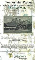
Getting tothe Park
My second day at Torres del Paine had the best weather
and the most spectacular views of my four full days
at the park.
The first day had been very dark and wet.
I handled getting my national park pass,
finding my way to the park,
and learning about checking in with the rangers
and getting their advice.
The many micro-climates meant that one area was closed
with sustained winds over 80 km/h
while nearby areas were sunny with moderate wind.
Plan to visit multiple days,
see and do what you can when it's possible.

Section of Tactical Pilotage Chart TPC 18A (compiled in 1987) from the Perry-Castañeda Library Map Collection at the University of Texas at Austin. Cerro Castillo, where I was staying, is near the Argentine border near the lower right corner. I would enter the park on the road running along the north shore of Lago Sarmiento and continue as far as the south end of Lago de Grey.
Entering the Park
The road through the park entrance at Amarga climbs through a series of switchbacks, quickly gaining about 200 meters in elevation. You soon have a nice view to the west along a series of peaks to the north of Lago Nordenskjöld. On the previous day, my first, you couldn't see much above the snow line.

Lago Nordenskjöld, Cuernos del Paine, and Monte Almirante Nieto
Snow-covered Cerro Ferrier is visible in the distance to the left of center about 28 kilometers beyond Laguna Largo. The peak of Cerro Ferrier is at 1599 meters. This viewpoint is around 300 meters elevation.
75% of way from left to right, mostly obscured by clouds, is Cerro Paine Grande with peaks at 3050, 2750, 2730, and 2600 meters.
At right, with some sunlight hitting it, is Cuernos del Paine.

Turning to the right: At left, mostly behind clouds, is Cerro Paine Grande.
To its right, partially in sunlight, is Cuernos del Paine, with peaks at 2200 to 2600 meters.
Then, from left of center to the right margin, is Monte Almirante Nieto with peaks in the clouds at 2668, 2640, and 2200 meters.

Turning further to the right, beyond the slope of Monte Almirante Nieto is Cerro Paine in the distance at center.

3× zoom shows the complex shape of Cuernos del Paine.

Signs explained how the local terrain was formed by magma intruding under existing sedimentary and granite layers.


3× zoom shows the layers of Monte Almirante Nieto emphasized by the snow.

10× zoom shows sunlight on a large face high on Cuernos del Paine.

Back to 3× zoom shows the clouds moving above and around the peaks, constantly changing where the sunlight hits.

This small lake to the south of the road had been visible the day before, but the mountains in the distance were completely obscured by mist and fog. Now, quite a bit of the sky to the south was clear.

Turning back to the north and looking over Laguna Largo, the clouds had continued to move. More of Monte Almirante Nieto, in the right half of the picture, was now visible. But its highest peaks were still in the clouds.

It's the ideal gas law, pV = nRT.
| p | = | pressure |
| V | = | volume |
| n | = | number of moles of gas |
| R | = | constant to scale as needed for the units used for p and V |
| T | = | temperature in Kelvin |
Air is forced up over the peaks, the elevation increase drops the pressure, the temperature drops proportionally, and water vapor condenses to form clouds.

Further peaks or "horns" became visible at times beyond Cuernos del Paine.

I took French instead of Spanish in high school. So I had naïvely thought that since pain means "bread" in French, maybe "Torres del Paine" had to do with rock towers resembling baguettes of bread stood on end.
No, not at all. Chilean bakeries and bread shops with hand-written HAY PAN signs out front had cured me of that misconception. Bread is pan here.
Torres del ... is Spanish for "Towers of ..." However, paine, pronounced "PIE-nay" or "PIE-knee", means "blue" in the indigenous Tehuelche language, also called Aonikenk, once spoken across southern Patagonia. There were about 5,000 Tehuelche speakers alive in 1900. By 2005 there were only about 20 speakers left, and the last one died in 2019.
So, "Towers of Blue" with the color referring to the patches of clear sky, or to the blue ice in glaciers and high ice packs, or to the lakes with brilliant colors caused by glacial stone powder, or some combination of those. Here's some paine sky visible as I continued west.

Driving a little further, I had a nice view of the paine west end of Lago Sarmiento, with Cerro Ferrier in the distance at right.
Lago Sarmiento extends about 24 kilometers, the Y-150 road leading to the park passes around its eastern end.

My new viewpoint changed what I could see of Cuernos del Paine and the series of peaks to its north, and of Monte Almirante Nieto. The unusually blue Lago Nordenskjöld came into view. More paine.

Compare the pictures above and below, taken about two minutes apart. The clouds were continually moving from over Cuernos del Paine toward this viewpoint, in wind blowing off the Southern Patagonian Ice Field. Peaks are covered and uncovered, patches of sunlight move. It's very nice to just stand and watch.

I was there!

The following two pictures were taken about two and a half minutes apart. Visibility and lighting constantly change.


Zooming in on Monte Almirante Nieto, I could see some paine ice up high, near the cloud base.


Continuing West Toward Salto Grande
The geology is especially evident in several places. The magma intrusions have tilted formerly horizontal sedimentary layers.

I had passed Lagunas Mellizas the day before, when some black and white ducks were out on the water. Now the ducks were taking shelter as the wind drove whitecaps on the small lake.

A little further along I came to Estancia Pudeto, ruins of an early 20th century building.
The indigenous Tehuelche or Aonikenk people had lived here since about 3,500 years ago. European settlers began moving into Última Esperanza around 1870, killing and driving out the indigenous people. Around 1900, the area that today is the national park was subdivided into 12 properties ranging in size from 600 to over 10,000 hectares, and rapidly filled with sheep.
The first protected park area was created in 1959. Parcels were added to the park, which had expanded to close to today's boundaries by 1977.
I turned off past the ruined estancia and continued a short distance to ... boats?
Yes, some small to medium boats have been brought here to provide sight-seeing excursions and connections to some areas that otherwise would require a long trek. "Huh, the M/V Patagonian Sun, that's an optimistic name", I thought. No, Ήλιος is Greek for "Sun", while Hielo Patagonia means "Patagonian Ice."

There's a ranger post here along with a refugio, basic lodging. I had intended to continue on foot to a waterfall and a trail to a nice overlook. However, the area was closed due to sustained winds over 80 km/h Not right here, but a short distance ahead. Micro-climates! The ranger at the gate had told me that this area would probably still be closed when I arrived.

Katabatic wind, from κατάβασις, is the result of a cold and thus high-density air mass flowing down from an elevated area. This day's troublesome wind was coming out of the Valle des Francés between Cerro Paine Grande and Cuernos del Paine.
 style="margin-bottom:0;padding-bottom:0;">
 style="margin-bottom:0;padding-bottom:0;">
I would return the following day to see the waterfall and walk that trail to the overlook. On this day, I visited the small solar-and-wind-powered coffee shop. They also sold maps! I bought a 1:100,000 scale topographic map of the park, and a 1:285,000 scale topographic map of much of Última Experanza Province. And, a hot coffee.

Salto Grande and Beyond
I continued south from Estancia Pudeto. The Salto Grande waterfall is the connection from Lago Nordenskjöld to Lago Pehoe. The road south runs along the northern arm of Lago Pehoe opposite Salto Grande. Cerro Paine Grande is partially visible under clouds in the background.

Rock flour or glacial flour is very fine-grained mineral powder created by glacial erosion mechanically grinding bedrock. It's small enough to remain suspended in the water and turn it blue-green or turquoise like this.

Colloidal silver enthusiast Paul Karason before he died of a heart attack, pneumonia, and a severe stroke.
People sell colloidal minerals, claiming that drinking water with significant amounts of colloidal minerals in suspension cures many ailments. Don't do it. It's dangerous quackery. As WebMD summarizes many medical authorities: "Some products might contain metals such as aluminum, arsenic, lead, barium, nickel, and titanium in potentially harmful amounts. There is also concern that some products might contain radioactive metals." Also, don't make "bread" with glacial flour. And don't formulate your own colloidal ointments and drinks that turn you purple-blue like a Smurf.
Rio Paine joins Lago Pehoe to Lago del Toro. From there, Lago del Toro eventually drains further south into the Última Experanza Sound and thus connects to the Pacific Ocean.

A short distance further, close to the north end of Rio Paine, I stopped and looked back to the north. I was in bright sunshine, but Cerro Paine Grande and Cuernos del Paine were mostly obscured by clouds.

I drove south for a few more minutes, and stopped again to look back. These next two pictures were taken one minute apart. You can see how rapidly the lighting and the overall appearance of the sky changed.


I continued driving south along Rio Paine.


Lago Grey
The road, still Y-150, continues south along Rio Paine to where it empties into Lago del Toro. Then it passes a ranger post, loops west, then runs northwest parallel to Rio Grey to the south end of Lago Grey. That's the western edge of road access in the park.
Park there, and a walk of about a kilometer takes you to Lago Grey. It starts with a footbridge over Rio Avutardas. The new footbridge is a significant upgrade over what remains of the old one.

The lake and, at least when I was there, a vast gravel fan came into visibility.

At times this broad area covered by small gravel is mostly, or entirely, underwater. There's a gravel berm close to the waterline, it might be a long thin jetty that's the only part above water. But when I was there in the middle of October, it was a broad area of gravel to the waterline along the south end of Lago Grey.

Cerro Paine Grande is just east of due north from here. Its highest peak is at 3050 meters; there is a secondary peak north of that at 2750 meters, and peaks at 2730 and 2600 meters to the south.
It was covered during my visit by a lenticular cloud. Such a cloud is formed by moist air being forced up and over a mountain and its immediate downwind eddy of turbulent air. As it rises, moisture condenses out: pV = nRT again. Then after the now-cloudy air moves over the mountain and its turbulence eddy, it descends and the moisture re-vaporizes back into invisible suspension in the air.
The resulting lenticular cloud appears to be stationary. Viewed with magnification, you could see that the cloud formation is nearly motionless but the moist air is constantly motion flowing over the peak. The water condenses out at the cloud's upwind boundary and then re-vaporizes at its downwind boundary.
Here, the wind was coming from the far distance to the left, moving to the right as seen here.

The lenticular cloud had a very sharp base, clear air beneath it gave a clear view of the lower slopes of Cerro Paine Grande.

Yes, the large pieces of blue ice floating at the far waterline are pieces that broke off the glacier and were blown down toward the south end of the lake. You have to walk about half-way across the broad gravel beach before the glacier comes into sight.

There is Glaciar Grey, about 16 kilometers to the north across Lago Grey. A very strong katabatic wind was flowing from the Southern Patagonian Ice Field, down over the glacier and across the lake. I estimated that it was blowing at 50–60 km/h.

The Road Back
It was getting into the late afternoon. I returned by reversing my route, in the below heading north along the east end of Lago Pehoe.


From this distance, the peaks of Monte Almirante Nieto were visible, and much of the mountain was in sunlight. For a minute or so, anyway.

The lighting and background were quite different at Salto Grande compared to how it looked earlier.

I continued east, south of Lago Nordenskjöld.


Wispy tendrils of clouds swirled around the peaks of Cuernos del Paine.
Yes, I realize that's awfully high-flown prose, bordering on purple. But if you couldn't refer to swirling wispy tendrils here, I don't know where those words could ever be used.


I was there!

Monte Almirante Nieto was back into the cloud base.


The underfoot geology lessons continued.

The lighting was dramatic, like the Albert-Bierstadt-on-laudanum effect Ridley Scott was going for in Prometheus when they landed on LV-223.


A better-lit view of paine ice up high on Monte Almirante Nieto.


These next two pictures were taken one minute and forty seconds apart.


Paine patches of sky above paine ice ...

... above paine water.

I would return the next day to see the Salto Grande waterfall and walk the trail to Mirador Cuernos overlooking Lago Nordenskjöld.