Canal du Midi
By Canal Boat Through Languedoc
Join us for a trip in a rented boat along the
Canal du Midi, through the
Languedoc region of southwestern France.
We will be in the boat for a week, starting a little
to the east of Béziers.
From there we will travel west for 157 kilometers,
passing through 62 locks as we gain 168 meters in elevation.
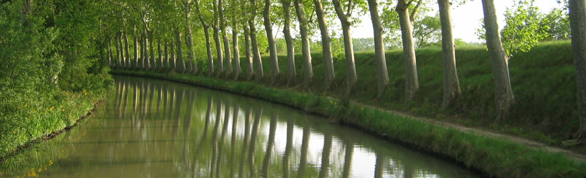
We will motor slowly through beautiful scenery,
stopping for meals and tourism along the way.
Plus simple wine and cheese breaks.
| Earlier trip on the Canal Latéral à la Loire | ||
| Canal | Canal du Midi | Canal Latéral à la Loire |
| Trip length | 157 km | 130 km |
| Locks | 62 | 23 |
| Elevation Gain | 167.6 m | 54.2 m |
Canal du Midi
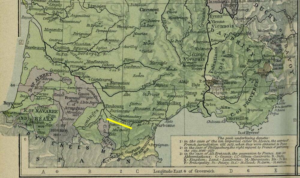
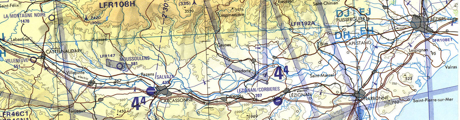
The map below shows the French borders in 1601–1766 along with the Royal Canal in the south. It was originally the Canal Royal en Languedoc until royalty went out of style with the French Revolution. Then it was renamed Canal du Midi, the Southern Canal. The canal was built in 1666–1681, during the reign of Louis XIV, and is one of the oldest European canals still in operation. It was one of the grandest construction projects of the 17th century.
The Garonne river was navigable, with effort and luck, from the Atlantic ocean past Bordeaux as far as Toulouse. Its flow varied widely including violent floods, but at least at times you could move a boat between Toulouse and the Atlantic. The goal was to build a canal east from Toulouse to the Mediterranean. A canal parallel to the Garonne finally opened in 1857, greatly improving the western half of the connection between the Mediterranean and the Atlantic.
This "Canal of the Two Seas" would connect the Mediterranean to the Atlantic across France. Shipping could avoid the long trip around the Iberian Peninsula, through the Strait of Gibraltar into the Atlantic. The Mediterranean and Atlantic journey involved thousands of kilometers of sea travel taking a month or more, exposed to storms and pirates operating out of the North African coast. French canal boats could move freight and passengers through the canal in safety.
The Canal du Midi is a summit-level canal, meaning that it climbs to a peak elevation within its length. In its case, the canal rises to the east from Toulouse, rising 57.2 m along 52 km to a summit altitude of 189.4 m. From there it drops to sea level and the Mediterranean along a distance of another 188 km.
Rulers through the centuries had proposed such a canal. Augustus, Nero, and Charlemagne had all considered the project. François I brought Leonardo da Vinci to France in 1516, commissioning a survey of a canal route that could connect the Garonne at Toulouse to the Aude at Carcassonne. Nothing came of that. Charles IX (ruled 1560–1574) and Henry IV (1589–1610) also looked into a sea-to-sea canal.
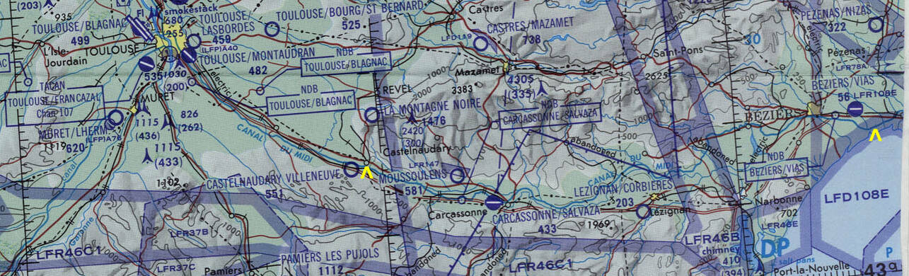
The map below uses yellow arrowheads to show our start point, west of Béziers near the right edge of the map, and our end point at Castelnaudary.
The problem with a summit-level canal is keeping the highest segment (or pound) filled with water. Cycling a lock to bring a boat into or out of that summit pound removes the lock's volume of water. And, lock gates aren't perfectly water-tight. The summit pound continually loses water, more so with traffic.
Pierre-Paul Riquet, a wealthy collector of the salt tax France used to generate revenue, came up with a solution involving water sourced at La Montagne Noire, the Black Mountain, seen north of the canal in the maps above and below. The mountain slopes, at 500–600 meters above sea level, receive about 1400 millimeters of rain per year, twice what falls on the plains. Riquet planned to capture water flowing down from the mountain in reservoirs, routing that water to the canal through specially built channels.
Riquet had no technical training. He relied on observations and experiments, learning on the job. He also surrounded himself with experts in hydraulics, surveying, and cartography.
The Bassin de Saint Ferréol on the river Laudot became the canal's reservoir. It was created with a huge dam, 700 meters long, 120 meters thick at its base, and standing 30 meters above the riverbed. It was the largest civil engineering project in Europe up to that time, and only the second dam built in Europe. A channel over 25 kilometers long carried water from the reservoir to the canal. The canal now requires 900 million cubic meters of water every year.
Canal Travel by Boat
Riquet's project of the 17th century is still in operation. The state maintained the canal after the railroads took away most of the business in the mid 1800s, because it provided water for irrigating farmland. Today's canal traffic is mostly tourism, which started in the 1960s and greatly expanded in the 1980s. There are about 10,000 boat passages per year through Béziers. The canal employs about 1,900 people, and it brings about 122 million Euros of business into the area.
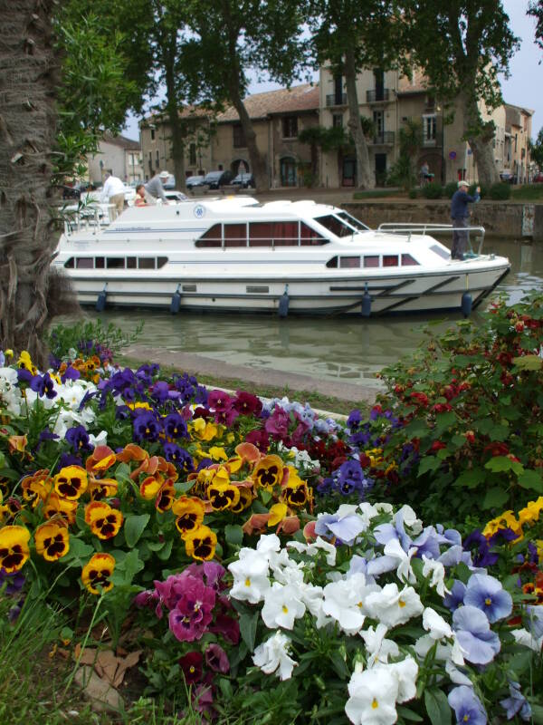
Tour companies operate large barges, which barely fit into the 30-meter-long locks and carry as many people as they can pack into cabins.
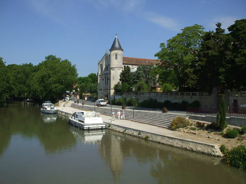
We, however, rented a three-cabin 13-meter boat. You can pilot your own boat, handle your own ropes, and, of course, buy your own wine at shops along the way. It's the superior solution.
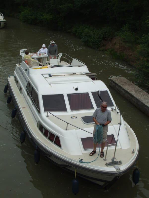
You also make your way through the locks on your own. It's a learning experience.
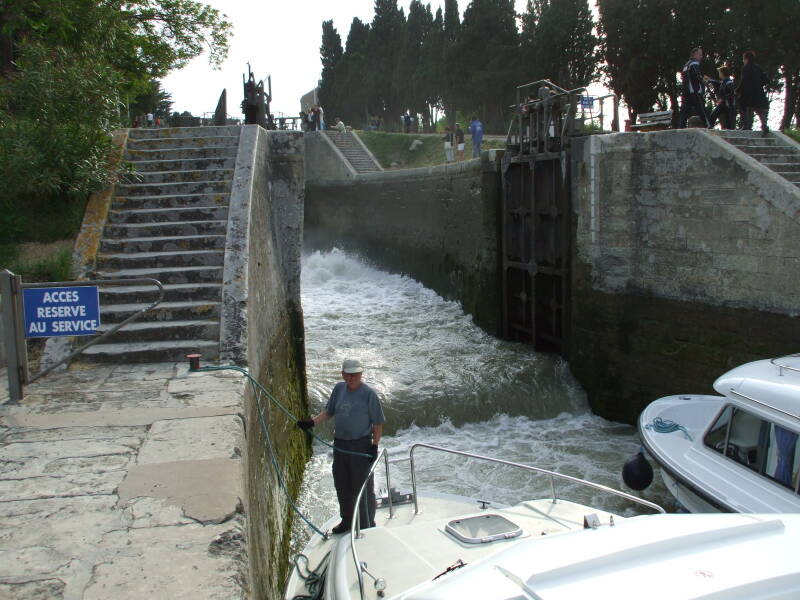
Lock passages can be exciting, especially when several boats are trying to pass through quickly.
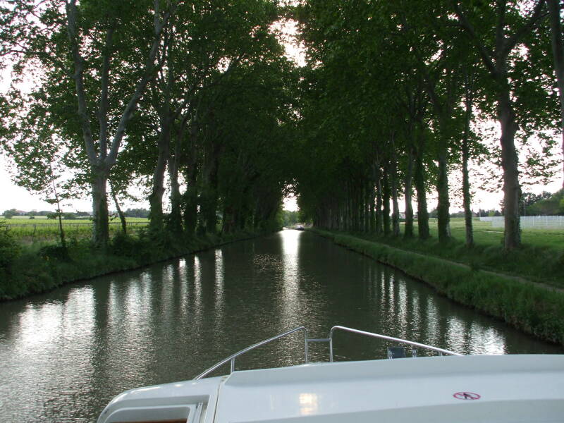
But before long, you're back to peaceful cruising through beautiful scenery.
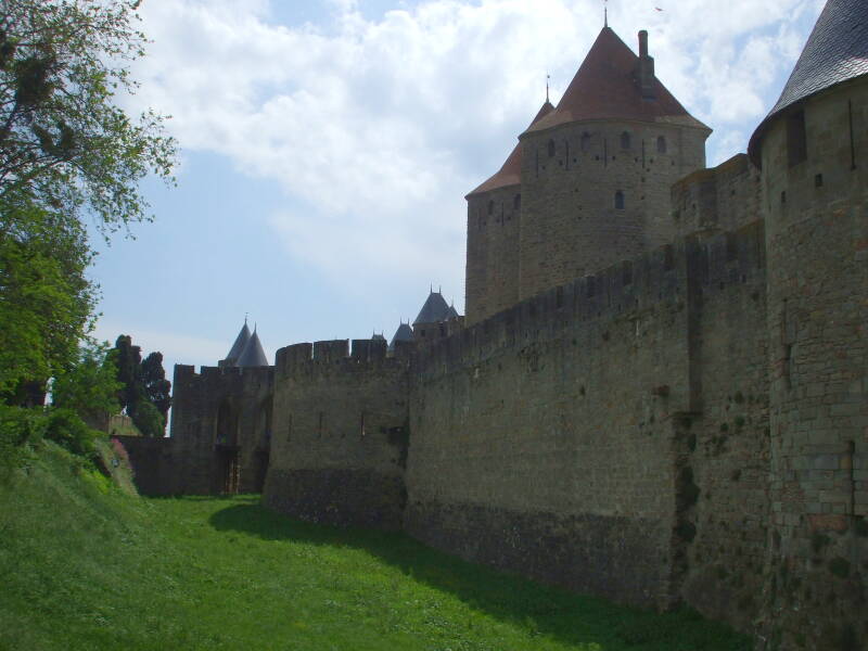
You can stop along the way, to visit places like the fortress city of Carcassonne.
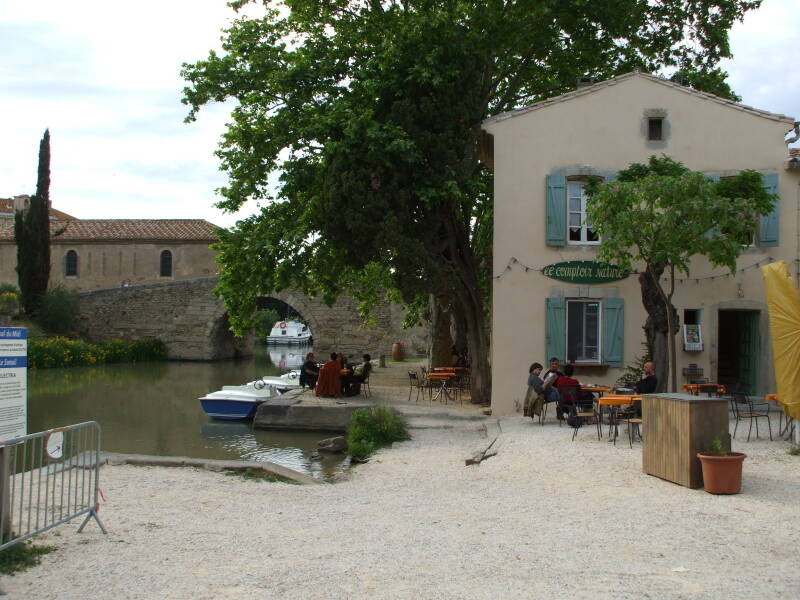
You can tie up at small communities along the way, like Le Somail seen below.
It's France, so there is great food available in restaurants and grocery stores all along the way.
You need to make a certain amount of progress every day, to reach the other end in a week. But there is plenty of time to stop along the way.
Let's start the trip!
Start❯ Arrival in Marseille, then by train to Béziers
Amazon 1852847840
Amazon 1789195721