Lunch in Kitakata
Kitakata, City of Ramen
I was staying in Aizu-Wakamatsu,
a city of prehistory and history.
Now it was time to go to
Kitakata, the City of Ramen.
It has the highest number of ramen shops per inhabitant
in all of Japan,
and is famous for its distinctive style of noodle.
I had purchased a two-day pass for the train and buses
in and around Aizu-Wakamatsu and Mount Bandai when I
had first arrived.
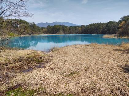
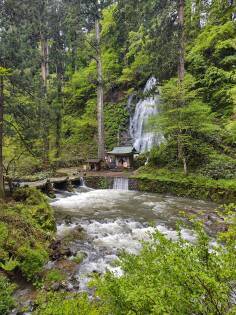
I had used it to visit the Five-Colored Lakes
and the Morohashi Museum of Modern Art
on the north slopes of Bandai-san.
Now, on my second full day, I would go to Kitakata,
stroll around, and have ramen for lunch.
Yes, I was going to take a train to another town
to eat soup for lunch.
In Japan, anything can be an adventure.
Google Maps generates a map when you load the page. If it's between late evening and early morning in Japan, you will probably see a bus route instead of the train.
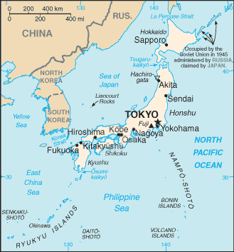
I had taken the high-speed Shinkansen from Tōkyō to Koriyama, near the lower right corner of the below map. I changed there to the Banetsu West Line for the 65 km trip from there around the north side of Lake Inawashiro to Aizu-Wakamatsu.
That line then reverses direction and runs 17 kilometers north to Kitakata. From there it continues another 94 kilometers west to Niitsu and connects to JR's Uetsu Main Line and Shinetsu Main Line, which run along the west coast of Honshū. You can see that Wakamatsu and Kitakata are in a flat basin about 25 km north-south by 15 km east-west. They're at 1000 foot elevation, and the mountains around them rise to 2500 to 6000 feet.
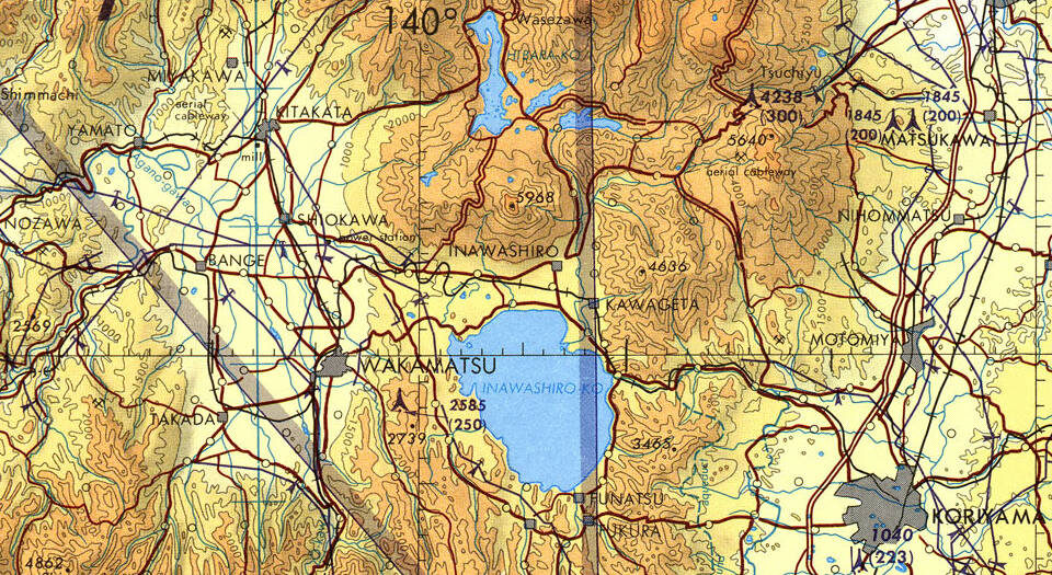
Small portion of 1:500,000 Tactical Pilotage Chart TPC G-11B, from the Perry Castañeda Library Map Collection at the University of Texas. Aizu-Wakamatsu is labeled simply as "Wakamatsu" on this 1963 map. The black tick marks along the lines crossing just east of Wakamatsu show minutes of arc, which would be nautical miles north-south. The UTM grid in blue has tick marks every 10,000 meters.
Salt-rich spring water comes from Mount Iide, a 2,105-meter peak 25 kilometers to the northwest of Kitakata. It is credited with further improvements to the local ramen's taste. That spring water was selected as one of the "100 Famous Waters of the Heisei Period", that being the 1989–2019 reign of Emperor Akihito.
By Train to Kitakata
I showed my two-day pass at the Fare Adjustment window, and would do the same thing when I reached Kitakata. The train was at the platform, ready to depart in 15 minutes.
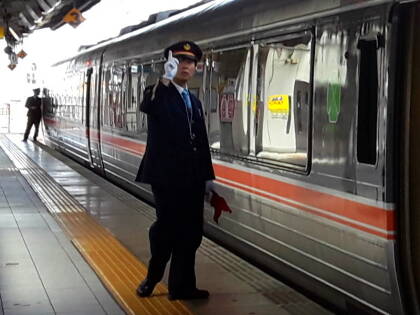
This line mostly uses two-car single-staff trains. Small stations have no staff and no ticket machines or barriers. You get on and off at those stations via the front door, where the engineer also handles ticketing.
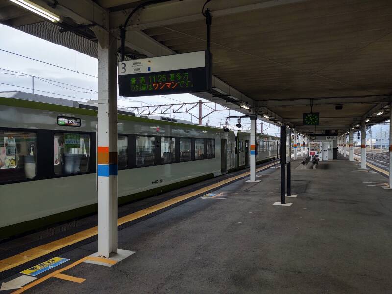
Aizu-Wakamatsu is a switchback station for the Banetsu West Line. That line is in the shape of a Y so a train reverses direction there if it's running end-to-end, between Koriyama and Niitsu. The engineer simply walks down the platform and drives the train from the other end.
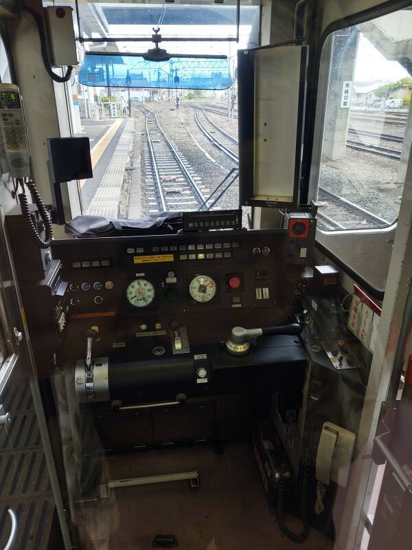
Here is the engineer's compartment used to operate the train from Koriyama to Aizu-Wakamatsu. An identical compartment at the other end will be used to reverse direction and continue to Kitakata. A seat folds down from the rear bulkhead just below the clear panel I'm looking through. Yes, that's narrow gauge track out there, 3 feet 6 inch or 1,067 mm. The Shinkansen runs on 1,435 mm standard gauge track.
We would pass through Dōjima, Oikawa, Shiokawa, Ubadō, and Aizu-Toyokawa stations. It's a single-track line, Shiokawa is the only one of those minor stations at which two trains could pass each other.
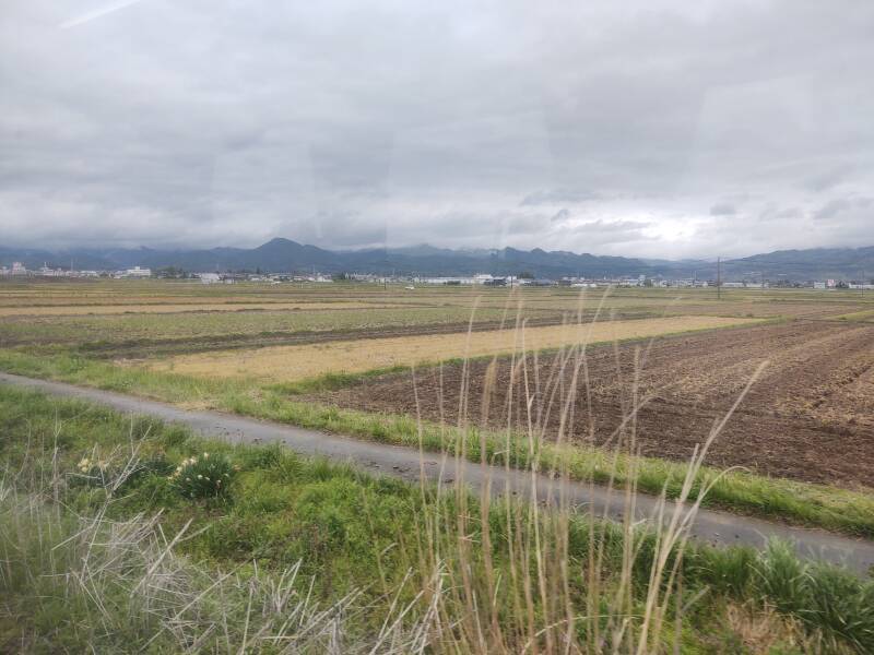
Outside the towns, almost all of the basin is farmland.1 The planted areas go right to the edge, the farms are very efficient.
It was a cool, dark day with low clouds flowing down through the valleys between the mountains. The Japanese archepelago is in the northern Pacific, one end of a cool, mountainous arc extending through Kamchatka, the Aleutian island chain, and down through Alaska, British Columbia, Washington, and into Oregon.
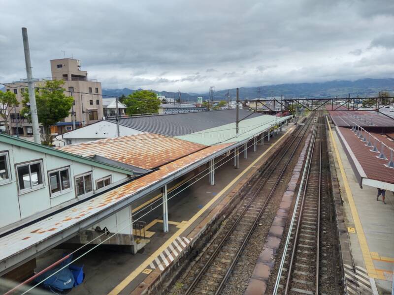
We soon arrived at Kitakana. I climbed up to the pedestrian bridge and crossed over to the station.
This is the end of the electrified section of the Banetsu West Line. Trains continuing to Niitsu would switch to diesel power here. The non-Shinkansen lines in Japan are generally powered by a 1,500 V DC overhead line. This line, however, uses 20 kV AC at 50 Hz. It's powered from the Koriyama end, so my guess is that it uses much higher voltage for lower current and lower resistive losses.
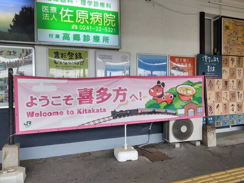
There's just a little bit of English here, and pictures of ramen and the legendary cow Akabeko. The banner says "YO-RA-KO-SO" and then some kanji. Being able to pronounce katakana and hiragana only gets you so far.
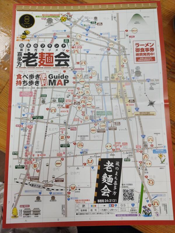
Ramen Kai
There's a small Tourist Information office in this station. It was unstaffed, but open with maps and information laid out. This map is from the Kitakata Old Noodle Association, an alliance of ramen shops in Kitakata. Each is indicated by a small red ramen bowl with a light yellow circle indicating the name. You can download your own ramen map and brochure.
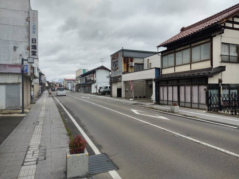
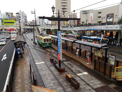
Exploring Kitakata
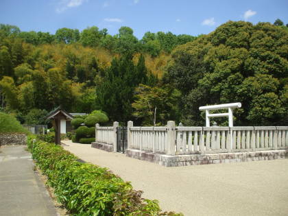
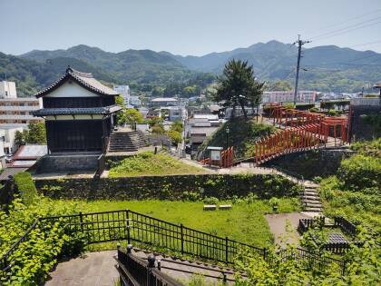
Visiting Tsuruga CastleThe Aizu domain was controlled by a daimyō or warlord based in the Tsuruga castle. Kitakata, always a smaller town, was still a local administrative center and market town.
Breiðdalsvík toSeyðisfjörður
in Iceland
Traditionally, Kitakata was known for producing sake and lacquerware. Now its economy is based on agriculture — rice and hops — plus a nearby aluminum smelter. The smelter must be there because of local hydroelectric power, like how some small towns in Iceland's Eastfjords region are now based entirely on enormous aluminum smelting plants.
Kitakata's population was a little under 45,000 in 2020. It was just over 70,000 in 1960 and has dropped through very decade since then. Aizu-Wakamatsu's has been more stable, in the mid-110,000s in both 1950 and 2020.
Neither was large or important enough to be a bombing target during World War II, so early to mid 20th century commercial architecture survives in both cities.
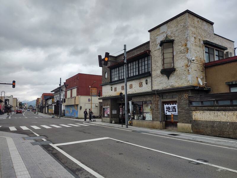
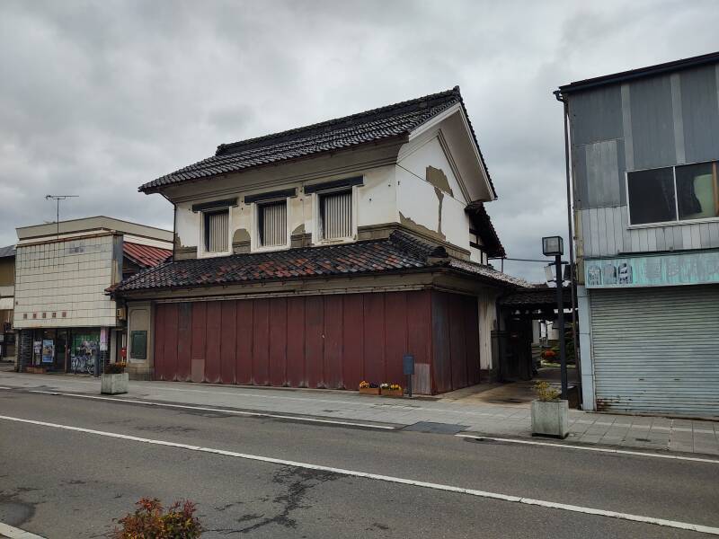
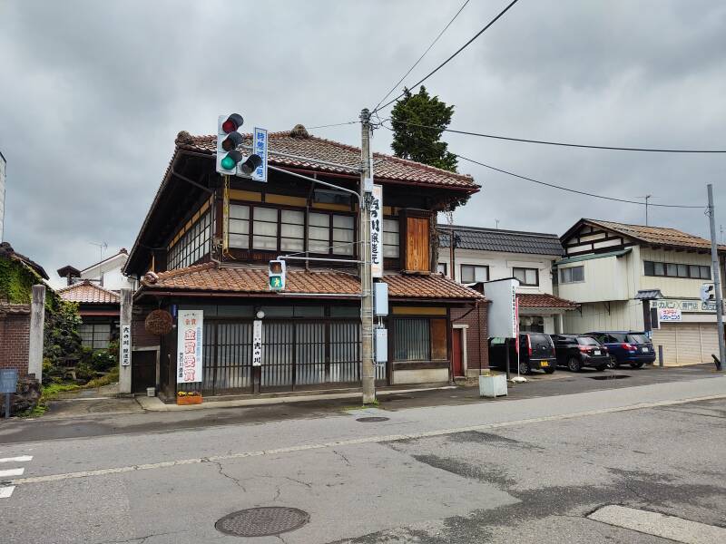
I know Kitakata as Ramen Town. However, some people see it as the Town of Warehouses.
Many sturdy old buildings are still in use as breweries and warehouses. Some brew soybeans to produce miso and soy sauce. Others brew rice to produce sake. Others have been refurbished into shops and cafés.
History
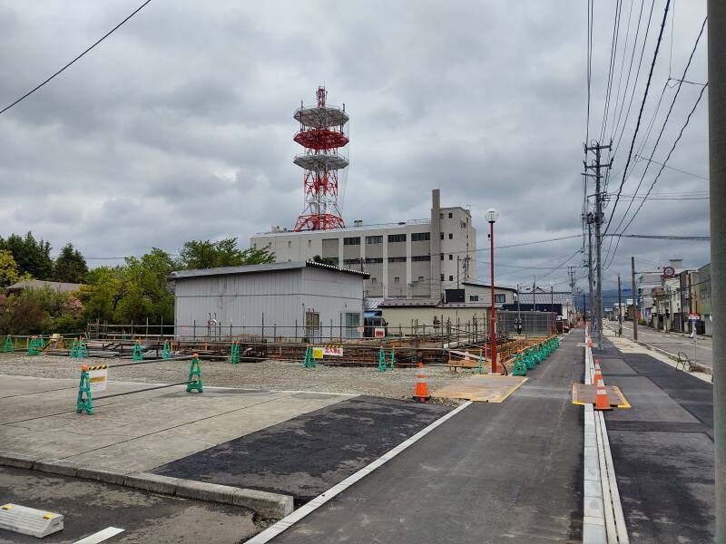
Like most Japanese cities, Kitakata has a multi-level telecommunications tower. As described on an earlier page, decades ago these would have held large horn and dish antennas. Now they support cellular antennas, backhaul links, and various VHF/UHF repeaters.
Japan
The pedestrian walk signal is the older style, with a white(-ish) lamp behind a colored glass plate. Yes, it looks rather blue to me. But as explained on an earlier page, while Japanese people perceive colors the same as anyone else, the Japanese language describes them so that one color name applies to a range of hues that English describes partly as "green" and partly as "blue". Meanwhile, Greek and Russian speakers figure that English speakers are weird for insisting that two obviously distinct colors are somehow both "blue".
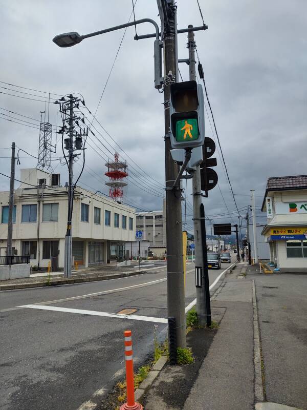
New traffic and pedestrian signals are based on LEDs, narrow-band devices with almost all of their output in the 520–530 nm range. "Green" as seen across most of the international market.
Amazon B003152Z4U
Amazon B003152Z4U
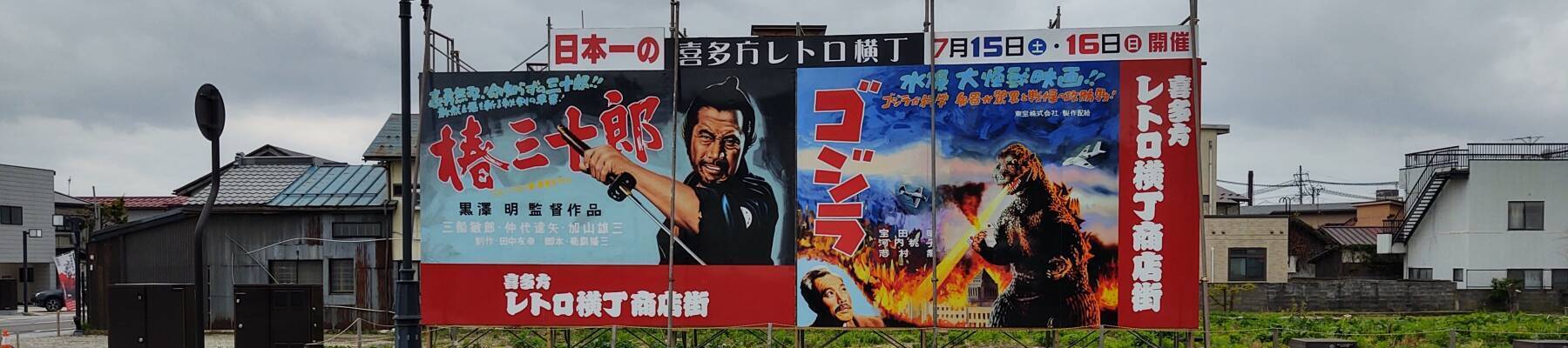
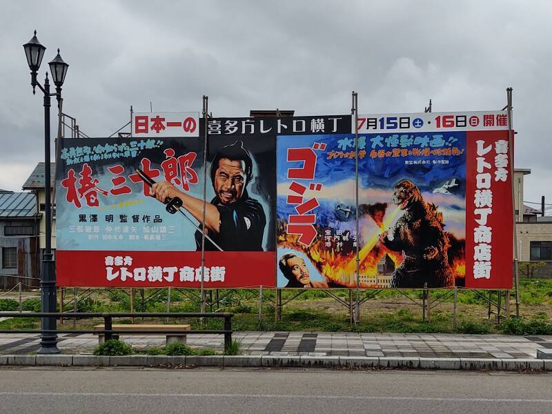
Toshiro Mifune!
Godzilla!
And the poster demonstrates that bold katakana
is the only appropriate way to render the second of those.
ゴジラ
GO-JI-RA

Amazon B000FA4TLQ

Amazon B000BMY2L0
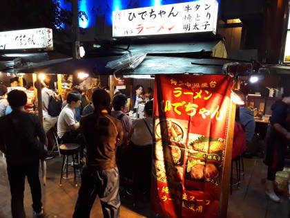
At a Ramen Shop
There were no noodle shops in Kitakana during the early 20th century. Inconceivable!
Han Kinsei was born in Zhejiang, China. He came to Japan in 1925 and worked in the port cities of Nagasaki and Yokahama. Learning of the noodle-based opportunity, Han Kinsei came to Kitakana in 1927 and began selling Chinese soba noodles. One guy with a noodle stand. But after World War II, restaurants and then a noodle factory opened within two years.
I went to this ramen shop along the main north-south street which is also Highway 21.
Ramen is Chinese, and so it's usually spelled out phonetically in katakana characters: ラーメン. There's ramen in red down the right side of the white sign, and vertically on two of the red banners. I assume that the vertical black hiragana くらよし or Kurayoshi must be the name of the place — "Kurayoshi's House of Ramen"
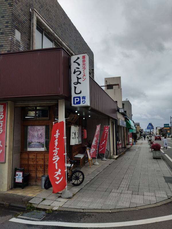
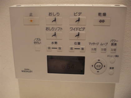
I only know three kanji glyphs: 円 meaning yen, and 大 and 小 meaning large and small, respectively, as seen on toilet flush handles.
Since ramen is actually a Chinese word, it will be spelled phonetically in the katakana script, which is much easier than the more cursive hiragana script used to phonetically spell out Japanese words.
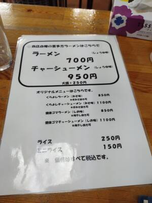
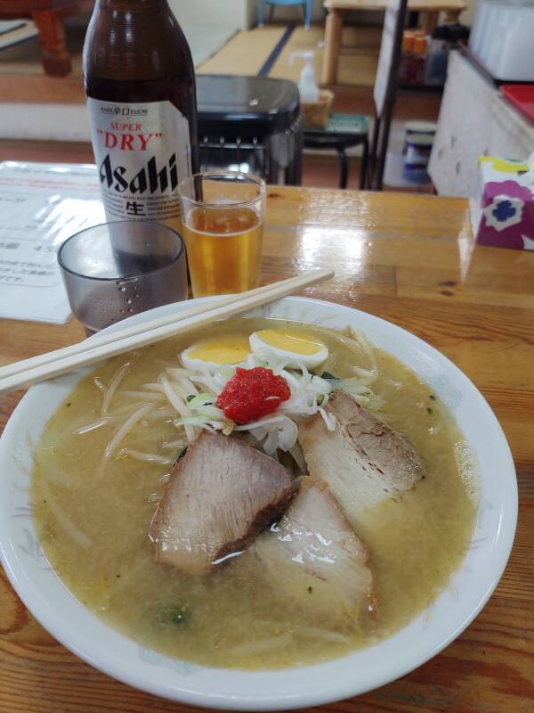
Here's the food side of the menu first — ramen and chāshū-men at the top. Chāshū-men is ramen with Cantonese-style chāshāo or char siu, thinly sliced barbecued pork.
In the middle are specific varieties of ramen and chāshū-men, rice side dishes are at the bottom.
ramen 700 yen
チャーツューメン 950円
chāshū-men 950 yen
ライス 250円
raisu 250 yen
ミニライス 150円
mini raisu 150 yen
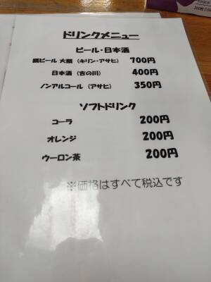
The other side says ドリンクメニュー at the top — dorinku menu. The top category is ビール or biru and some mysterious kanji, and the bottom category is ソフトドリンク or sofuto dorinku.
The first choice under "beer" specifies (キリン・アサヒ) or Kirin ・ Asahi. For 700 yen that will probably be a 500 ml bottle. The third says ノンアルコール (アサヒ) or nonarukoru (Asahi), a non-alcoholic Asahi beer.
Soft drink choices are コーラ or kora (kola), オレンジ or arenji (orange), and ウーロン–kanji or, um, something starting u-ron–.
The proprietor sent out the 12-year-old daughter to take my order. Push the waitress-in-training envelope by dealing with the confused rare foreigner. We managed just fine.
I asked for the house chāshū-men and a Kirin.
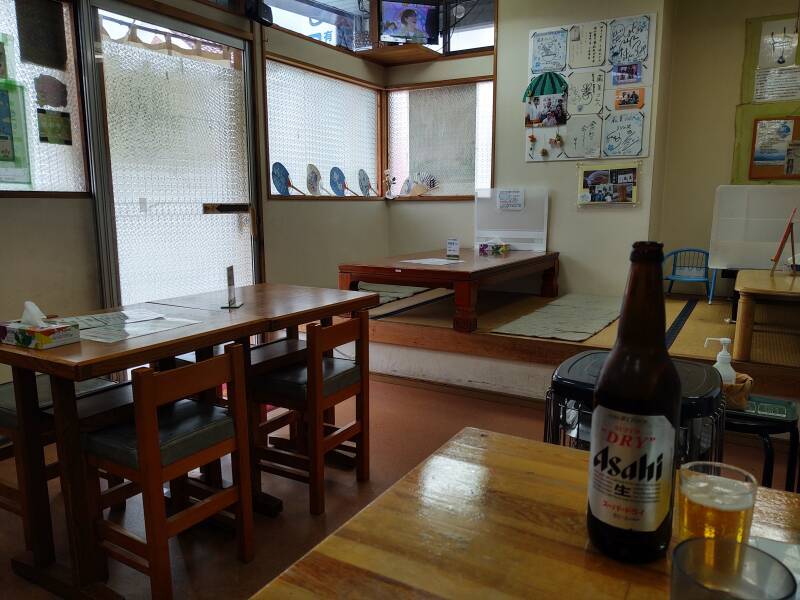
It was very quiet, I was the only patron when I arrived. Soon afterward, three people came in and sat behind me. After my strolling around it was well past lunch time. Plus, in Kitakata, it certainly isn't as if everyone has to crowd into a small number of ramen shops.
The Kitakata ramen is one of Japan's top three regional ramen styles. It's rather thick, flat, and twisted. It's in pork broth made with soy sauce and some, but not much, niboshi or dried sardines and anchovies. It's typically topped with green onions, bamboo shoots, char siu or roasted pork, fish cake, and chili pepper sauce. They added a few slices of boiled egg.
A great lunch, Kitakata is justifiably famous. O-ishi! Delicious!
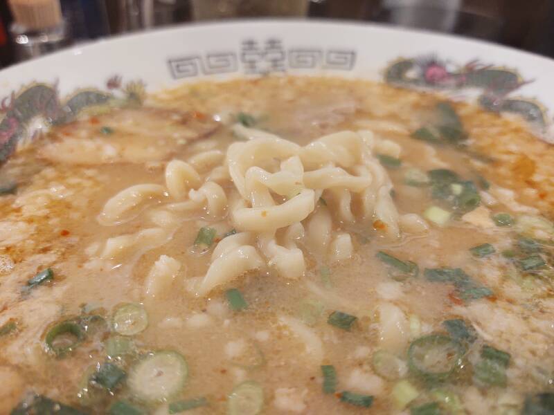
From a different meal, here is a close-up of the thick, twisted Kitakata style noodles.
Other topics in Japan:
Amazon 1839059796
Amazon 1640975438
1: Japanese farmers' ability to get excellent yields out of limited farmland without the use of gigantic pickup trucks is theorized to be due to Japan's lack of American TV advertising.