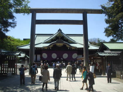
Tōkyō to Aizu-Wakamatsu
From Tōkyō to Aizu-Wakamatsu by Shinkansen and Local Train
I had returned to Japan for my third solo trip.
I had seen a New York Times travel article about
a smaller city in Japan.
It pays to read those articles — I didn't go to the
city it talked about, but it casually mentioned a much smaller
town with a museum housing the world's fourth-largest
collection of Salvador Dalí artwork.
That led me to read about the
Tōhoku region of Honshū,
north of Tōkyō on Japan's largest island.
I learned about several other interesting things to see
and do in southern Tōhoku.
Prehistory,
history including the samurai,
and a national park with some unusual
volcano-formed lakes.
Guidebooks simply don't say very much about the area.
But some research indicated that Aizu-Wakamatsu
might make a good base for a visit.
It certainly was!
I would be flying into Tōkyō and staying there for two nights,
so I started investigating train travel north.
It would be not quite an hour and a half north
from Tōkyō to Kōriyama
on the Shinkansen, the wonderful high-speed train,
and then about an hour west from there on a local train.
Google Maps regenerates a map when you load the page, so this might show the route by train. But if it's between midnight and about 6 AM in Japan, it will show you bus routes.
Preparing to Travel
The first time I went to Japan was in 1992 on a business trip. That trip was unpleasant for several reasons, including it being in August when the weather was very hot and humid.
My second and third visits were also work trips, teaching classes on networking and Linux servers. One was the week before the Thanksgiving U.S. holiday, the other was the week before Christmas, and so in both cases I flew in and set up the class my first day in the country, taught the class for the next five days while slowly recovering from jet lag, and then immediately flew home the next morning because of the holiday. Very frustrating.
Travel scheduling is important.
When I finally got back to Japan on my own, unsupervised and unconstrained, I went for four weeks in late April into May. That worked out much better, and I repeated it on my second independent trip. And so, this would be a third trip spanning mid-April into mid-May.
That has seemed to me to be a pretty good time to visit. The weather is nice. The cherry blossoms earlier in the spring would be nice to see, but everyone knows that and accommodation and train tickets can be tight.
Guesthouses at Booking.comThe risky part of this trip was that I would be arriving on a Wednesday, and the following Friday was the start of Golden Week, Japan's biggest holiday week. I could reserve a bed well in advance on booking.com, but I would have to wait until arrival in Tōkyō to get my train tickets. The Nui Hostel where I would be staying in Tōkyō told me that I shouldn't have any problem arriving late on Wednesday, then buying tickets on Thursday for a trip north on Friday. They were correct!
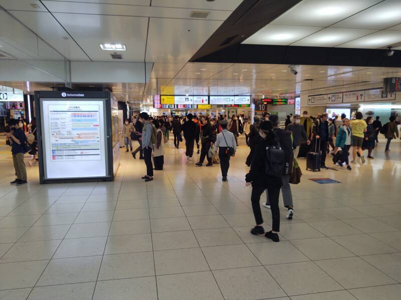
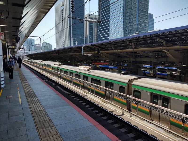
Tōkyō Station is overwhelming! It's the busiest station in Japan. Every day, over 4,000 trains and 500,000 people pass through it.
It handles the high-speed Shinkansen trains running northeast to Hokkaidō and southwest to Kyūshū, JR lines connecting through central Honshū, the JR Yamanote Line running in a loop around central Tōkyō, and the Tōkyō Metro system. Some of the platforms are four stories below ground, hundreds of meters south of the main station building. The station's network of underground passageways connect to surrounding shopping centers and commercial buildings.
It's in Tōkyō, so it has a lot of signage in rōmanji or Japanese written in Roman script, but navigating through it is a challenge.
I had bought my tickets the day before. You get three green slips with magnetic backs for a trip like this:
- The end-to-end ticket, from any JR station in Tōkyō to any JR station in Aizu-Wakamatsu.
- A Shinkansen supplement for that segment of the overall trip — Tōkyō to Kōriyama in this case.
- A receipt showing payment.
You feed the stack of tickets into the barrier when you first enter the overall JR system. So, at the first station, entering the area where you can access the normal non-Shinkansen platforms.
Then you do that again to pass into the Shinkansen area.
I would feed all the tickets into the barrier at Kōriyama, where I would leave the Shinkansen area to find my normal JR train continuing toward Aizu-Wakamatsu. That barrier would retain my Shinkansen ticket.
Then, at the final destination, I would feed all that remained into the barrier to exist that station, and all I would have left would be my receipt.
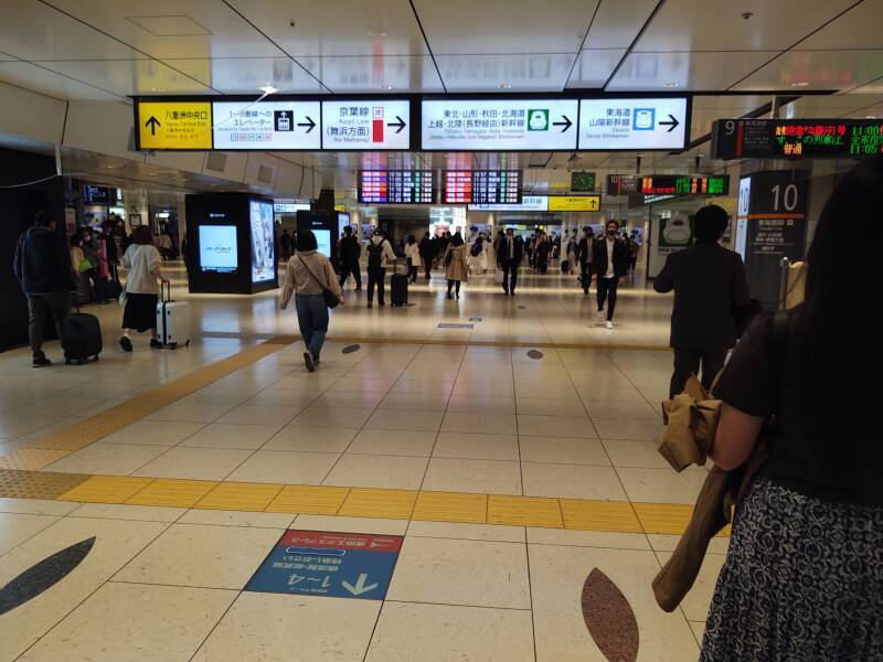
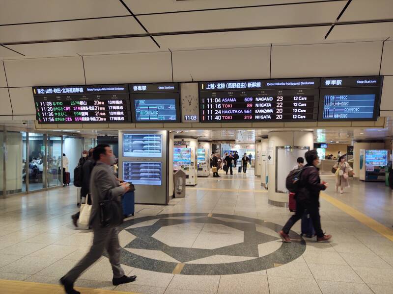
The overhead signs below point to Shinkansen lines in blue and green, in addition to a non-Shinkansen JR line in red.
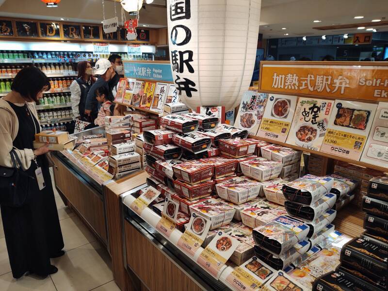
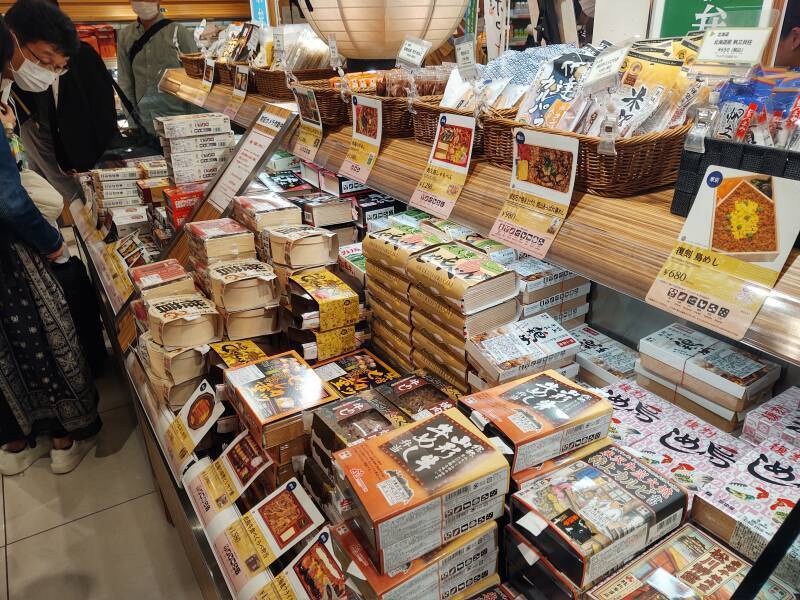
Bentō
Now it was time to purchase bentō, a packaged meal. The concept goes back to the 12th century CE, during the Kamakura Shōgunate, so they have had plenty of time to develop the product.
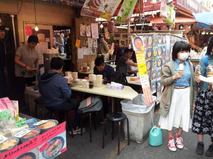
A bentō meal is delicious, beautifully assembled, and economical. At a typical station you will have at least 15 to 20 different choices — much more than that here in Tōkyō Station — typically priced around the equivalent of US$ 5–10.
To the Shinkansen
Shinkansen means "new trunk line" or "new main line". Shin- means "new", you see that as part of several station names. For example, Shin-Osaka Station or Shin-Ōsaka-eki, the new station in the city of Osaka.
The Tōhoku Shinkansen is the component of the high-speed network connecting Tōkyō with Aomori at the northern tip of Honshū. That route covers 675 km, and the line continues from there through a 23.3-km tunnel under the Tsugaru Strait into Hokkaidō.
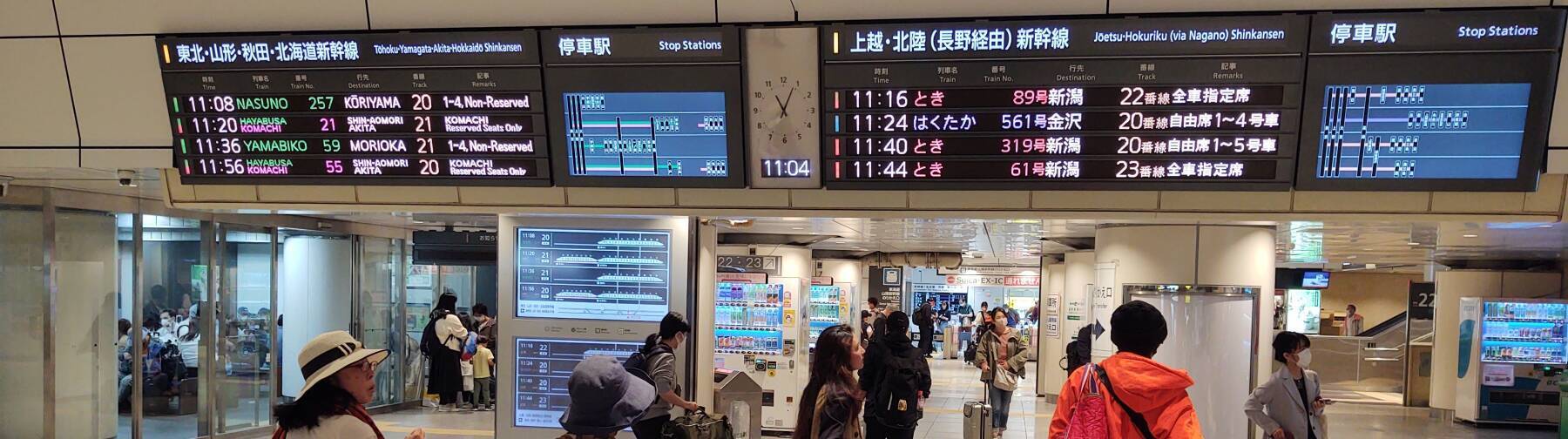
The sign to the left of the clock in the below picture shows trains running north through Tōhoku toward Hokkaido.
The sign to the right shows trains running north, northwest, and west to Niigata, Nagano, and Kanazawa.
The electronic signs cycle through Japanese written in a mix of hiragana and kanji, and then English. It's very helpful if you can pronounce (without actually reading) signs written in the phonetic hiragana script. Although it's rather challenging early in the trip.
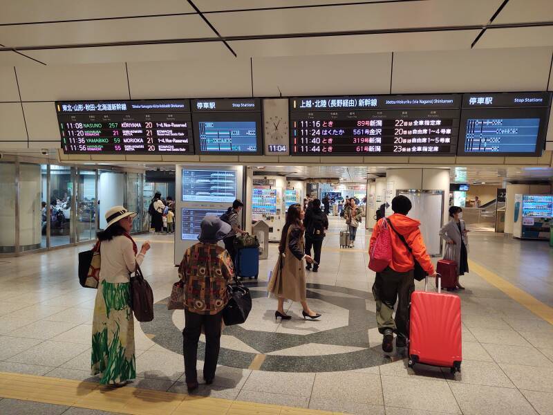
Below we're seeing pure Japanese on the left and Japanese as rōmanji plus some English on the right.
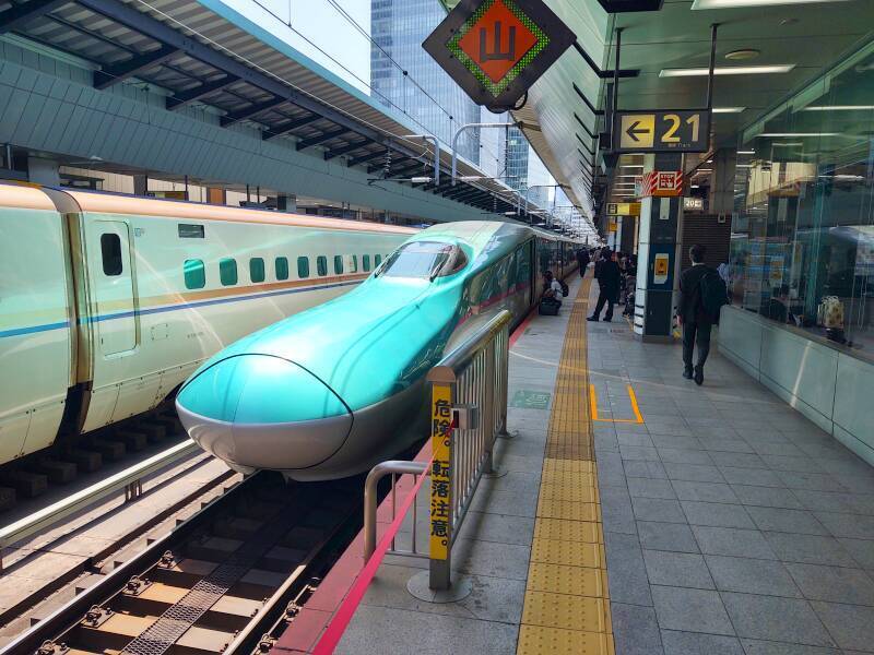
Now the languages have switched places. There's my train #21 as the second in the list on the left, showing that it's Hayabusa service bound for Shim-Aomori at the northern tip and Komachi bound for Akita along the west coast.
So, it will actually be two trains coupled together, splitting at Morioka, well past where I get off, reaching multiple destinations.
Train #21 will be on platform #21, versus train #59 being the next train on platform #21. This can get a little confusing. The good news is that the train will clearly indicate its number identity, and as a general rule you can rely on Japanese trains (and buses) staying within a few seconds of their schedules. It's 11:03–11:04 in the above and below pictures, my train will be the next one on track #21, leaving in 16 minutes.
One of the columns below those overhead signs has an electronic sign showing the consist or makeup of trains leaving soon. Mine is train #21 on platform #21, now at the top of the list of north-bound trains. The sign offers suggestions of which escalator to take up to the platform.
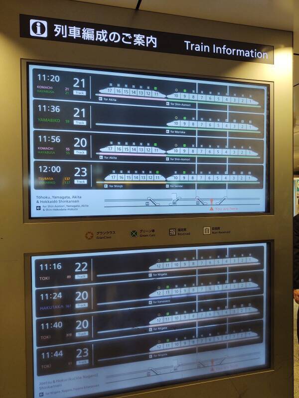
Shinkansen trains run in either direction, they aren't turned around. The seats rotate so direction of travel doesn't matter. Car #1 is always at the Tōkyō or southwestern end, #10 on these 10-car trains at the Aomori or northeastern end.
Once up on the Shinkansen platform I can look down over a Yamanote Line train running on the loop around central Tōkyō. Note to self: remember that it's the Yamanote Line and not the Yamamoto Line if asking for directions. But there are plenty of romanji signs so there's no need for that blunder. Other platforms are beyond and below that one, and also off to my left. Tōkyō Station is huge.
Then my train arrived, apparently from the future.
Train travelin Morocco
I had visited Morocco about six months before this trip. There I saw that Morocco is at least two decades ahead of the U.S. in terms of public transportation.
Japan, however, is on some science-fictional level.
Imperial Japan had made speculative plans for high-speed rail in the 1930s, with thoughts of undersea tunnels to Korea and Vladivostok tying into the Trans-Siberian line to Europe. World War II got in the way of that.
By the mid 1950s the conventional railroads had been rebuilt. The national attitude was that railroads would soon be outdated, replaced by air travel and the multi-lane highways pioneered in Europe and copied in the U.S. However, the president of Japan National Railways, the predecessor to JR, insisted that high-speed rail should be implemented.
At the time of this trip in 2023, 59 years after Japan's first Shinkansen line opened, the fastest train on the Amtrak system in the U.S. could reach 240 km/h on just 80.3 km of its entire network.
The national government agreed, and construction of the first segment of the Tōkaidō Shinkansen from Tōkyō to Osaka began in 1959. It began running in 1964, initially at speeds of 210 km/h.
The Shinkansen routes are built with no road-railway crossings and no intersections with slower, narrow-gauge conventional lines. The oldest Tōkaidō Shinkansen segments still in use have a minimum curve radius of 2,500 meters, but it's 4,000 meters on most of the network. Tunnels and viaducts route the trains through and over obstacles.
Japan is a volcanic archipelago with rugged terrain. Its railroads mostly use 3 foot 6 inch or 1,067 mm narrow-gauge track to better handle the small-radius turns and steep grades that result when lines are built with limited excavation along the surface.
The Shinkansen, however, uses 4 foot 8.5 inch or 1,435 mm standard-gauge track. The rails are continuously welded with expansion joints, and the switches and crossings are designed to eliminate gaps. Viaducts and tunnels are built exclusively with concrete slab beds.
For readers in Myanmar and the U.S.:
110 km/h = 68 miles/h
130 km/h = 81 miles/h
275 km/h = 171 miles/h
320 km/h = 199 miles/h
360 km/h = 224 miles/h
The Shinkansen's maximum speed is 110 km/h through central Tōkyō to Ueno, 130 km/h from Ueno to Ōmiya, 275 km/h from Ōmiya to Utsunomiya, and 320 km/h beyond Utsunomiya. Tōhoku is sparsely populated compared to the rest of Japan, but noise is now the limiting factor. They were working on improvements to noise barriers to extend the 320 km/h zone, and on noise dampening techniques to increase speeds to 360 km/h.
The Shinkansen is powered by a 25 kV AC overhead line, versus the 1,500 V DC power used on most electrified narrow-gauge lines. For historical reasons going back to which regions bought electrical equipment from which suppliers back in the early 1900s, Japan's electrical power runs at 50 Hz northeast of Tōkyō and 60 Hz to the southeast.
The E5 series train, what I'm about to board here, was introduced in March 2011. It has an electric active suspension that slightly tilts the cars when running at maximum speed through curves close to the 4,000 meter radius design limit.
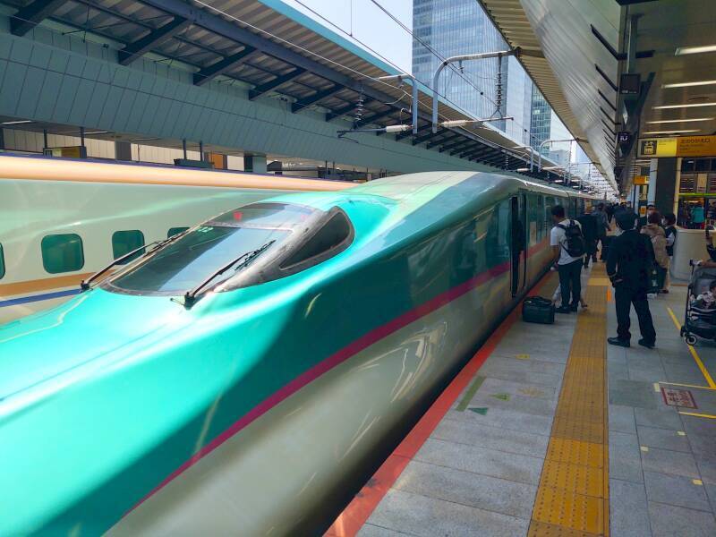
Shinkansen trains have always been what are called EMUs or Electric Multiple Units. Electrical power is distributed from the overhead catenary wire throughout the train. Each car has motors driving its wheels, except the two cars on the ends. That provides faster acceleration and deceleration of the train, and less damage to the track because of the lack of especially heavy locomotives.
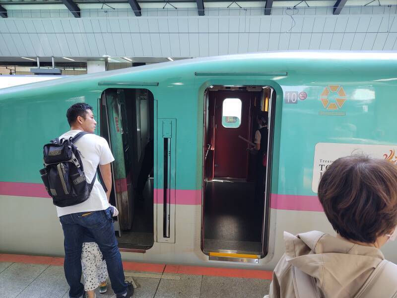
A father is showing his child the crew entrance to the engineer's compartment. This train had a longer pause at the platform at Tōkyō Station to allow cleaning staff time to prepare it for the run north. However, I need to get on board. In about 180 seconds we will fold space for Kōriyama.
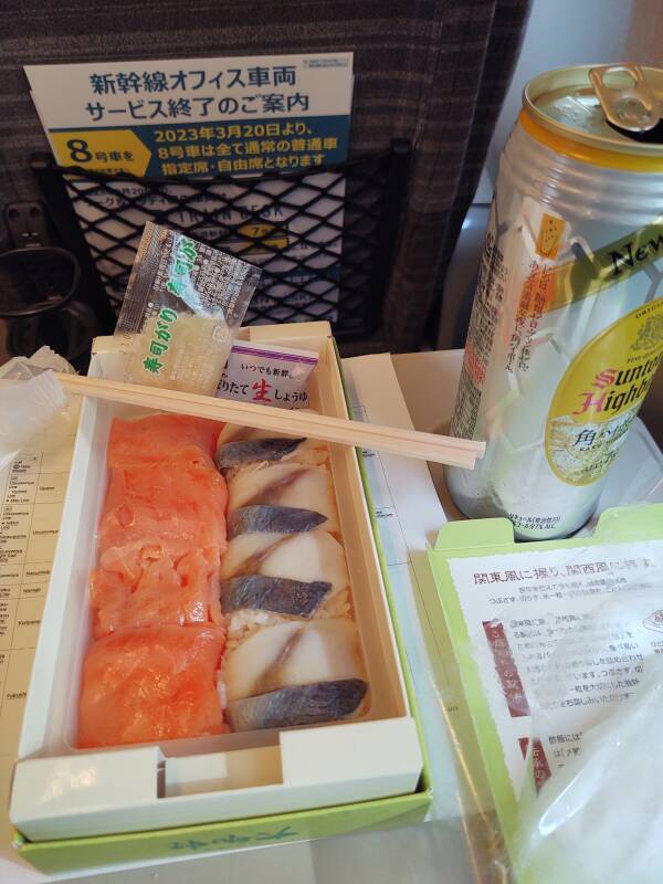
Bentō Lunch While Riding North on the Shinkansen
It's hard to take pictures out the window of a train running at 300 km/h past utility poles. Besides, it's only 214 km from Tōkyō to Kōriyama. Even with three station stops along the way, we'll be there in about an hour and twenty minutes. It's time for lunch while northern Tōkyō and southern Tōhoku stream past my window. So, lunch pictures rather than blurred views.
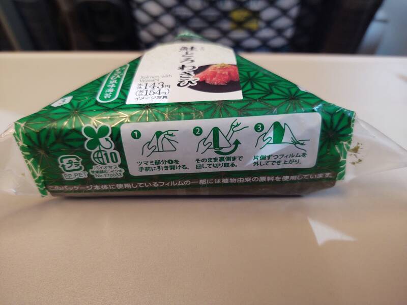
I'll start with onigiri, a rice ball. This one has salmon with wasabi within a triangular rice ball wrapped in nori, a thin sheet of pyropia red algae.
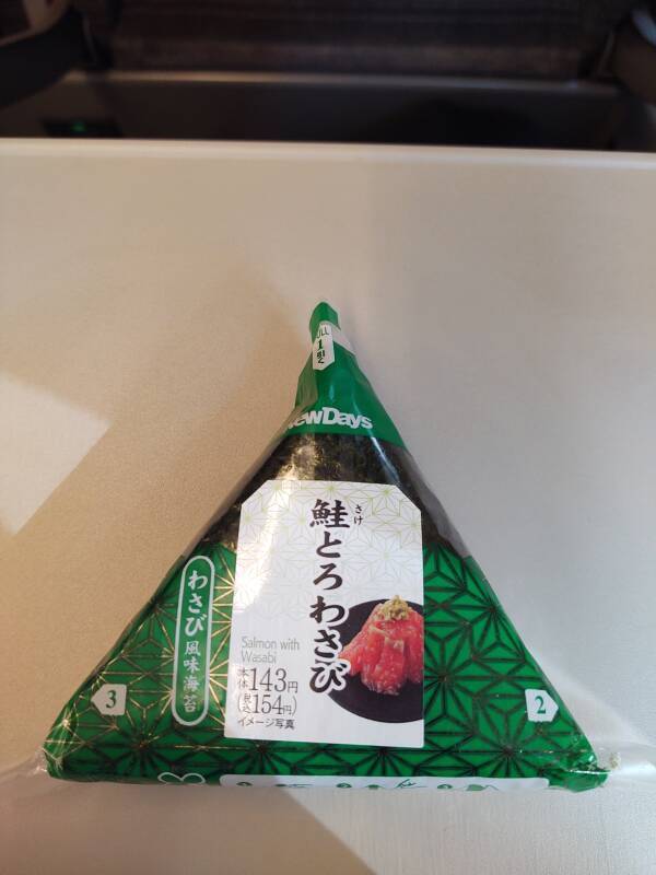
These pictures are from my trip in 2023. I had last been in Japan five years earlier. Back in 2018, of the three dominant mini-mart chains 7-11, Family Mart, and Lawson Station, only one of them had romanji labels indicating the onigiri content. Preferring salmon, I had to look for the katakana サーモン phonetically spelling the foreign sa-mon or the hiragana さけ or しやけ phonetically spelling the Japanese sa-ke or sha-ke. But now my daily onigiri usually had an English label.
As before, it had a graphical explanation of how to get into it.
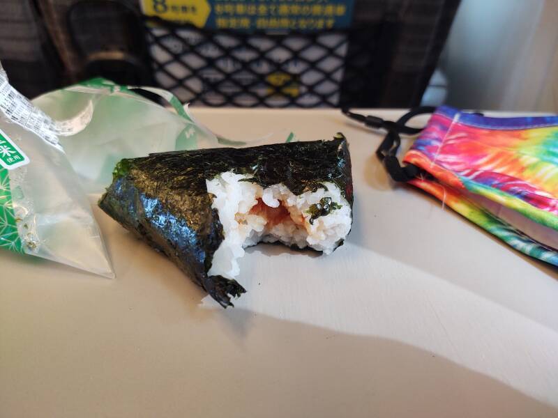
Yes, that's my tie-dyed mask. This trip was in April–May 2023. Japan had largely re-opened for foreign visitors in late 2022 after the worst of the COVID-19 pandemic. However, things I read shortly before the trip indicated people wore masks almost universally in public, certainly within closed public spaces like subways and trains.
Well, kind of.
Compared to Americans in similar settings, a much higher percentage of people in Japan wore masks. But it no longer was effectively 100%. And, despite warnings I had read, I didn't notice anyone giving me a dirty look when I forgot to put mine on in a more crowded setting. Later into the trip I was in the habit of looking at the local people and doing what the majority of them were doing. And so, I only wore my mask some of the time.
I had a selection of brightly colorful tie-dyed cloth masks. If there was a brief but pervasive trend of tie-dyed masks soon afterwards in Japan, I'll happily take credit.
Then, I progressed to the bentō.
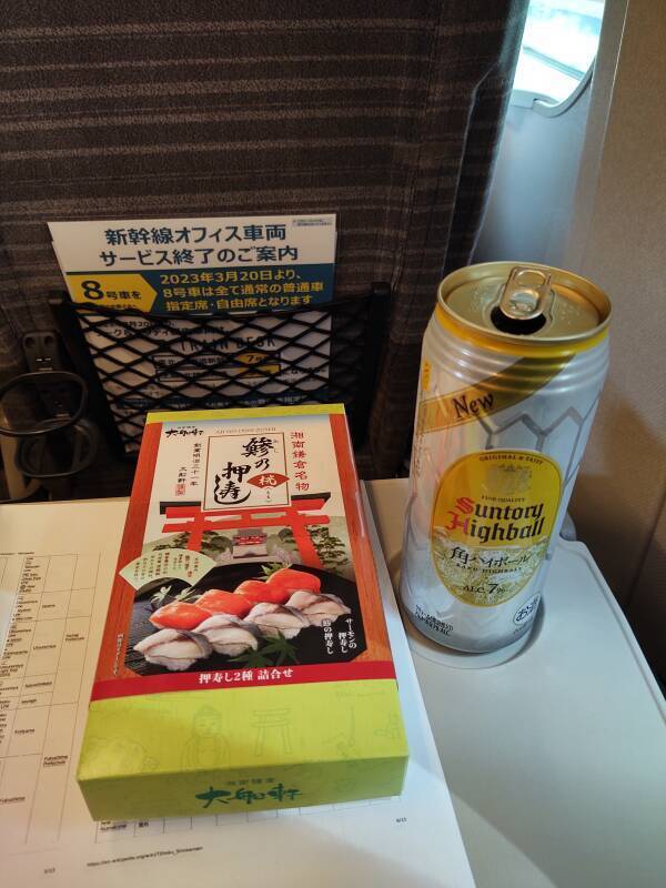
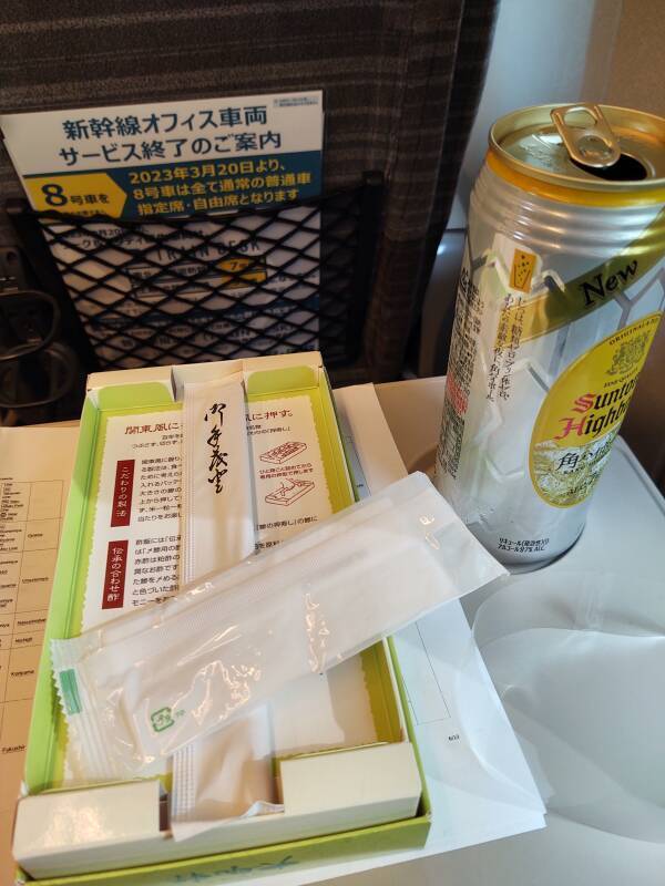
Yes, videos of people opening bentō is a category on YouTube. Here are my carefully curated still photographs.
I had selected sushi — salmon and mackerel. The bentō includes soy sauce and ガリ or gari, pickled ginger. Plus はし or hashi, chopsticks; a toothpick; and a おしぼり or oshibori, a moistened towelette.
Changing Trains at Kōriyama
At Kōriyama I exited the Shinkansen section of the station. The barrier kept my Shinkansen supplement ticket. Now to stay within the station and go to the platform for the conventional JR train to Aizu-Wakamatsu. Platform 1 at 1415 or 1515, according to the panel at left.
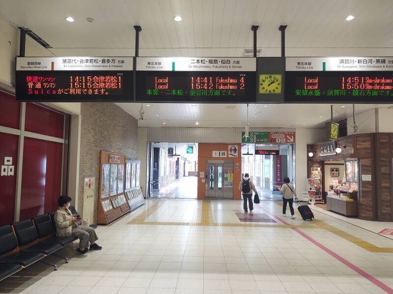
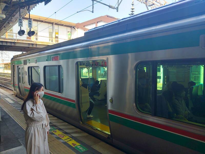
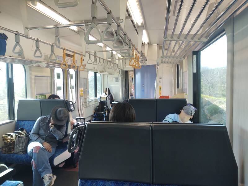
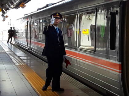
Here's my train. It has just two cars and one staff person. The engineer in a compartment at the front also handles tickets at the smaller unstaffed stations along the way. So, if you're getting on or off at a small station, do so via the front-most door.
As for where I was headed — The settlement was originally a market town and base for regional warlords of the Aizu domain. In the late 19th century after the Meiji Restoration, Wakamatsu Town was created, becoming Wakamatsu City. The name was changed to Aizu-Wakamatsu in 1955. The below U.S. Department of Defense map was created in 1963, using the old name "Wakamatsu".
As for the new name, Japanese writing typically doesn't
indicate all word breaks,
and there is no sense of capital or upper-case
versus minuscule or lower-case glyphs.
It's like classical Greek,
without spaces or punctuation.
I think it's harder to read whentextisruntogether,
it certainly isn't what I'm used to.
So, it might be rendered in rōmanji as
any of:
Aizuwakamatsu
Aizu-Wakamatsu
Aizu Wakamatsu
And, any of those might also be suffixed with
–shi,
meaning "city".
Kōriyama and my Shinkansen-to-local transition is at lower right, the southeast corner of this section from the map. Aizu-wakamatsu is labeled as Wakamatsu. Between the two is Inawashiro-ko, Lake Inawashiro. North of the lake and the town named Inawashiro is Bandai-san or Mount Bandai, labeled with its elevation of 5,968 feet. I would stay in Aizu-wakamatsu and do day trips around Bandai-san and to Kitakata.
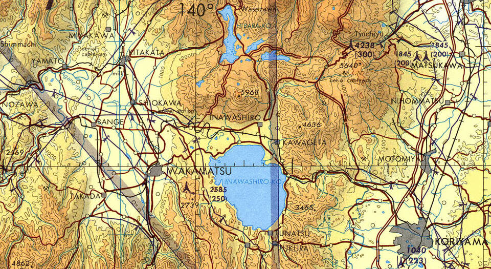
Small portion of 1:500,000 Tactical Pilotage Chart TPC G-11B, from the Perry Castañeda Library Map Collection at the University of Texas. Elevations and tower heights are in feet.
The rail lines are shown as thin black lines with cross marks. The line from Kōriyama to Aizu-Wakamatsu climbs some as it passes between mountains approaching the lake, curves to the north then west around the lake, and then unexpectedly winds through multiple curves in mostly flat land northwest of the lake before turning south to Aizu-Wakamatsu.
On the Banetsu West Line
The Banetsu West Line is named for two ancient provinces here. It's 176 kilometers of narrow-gauge single-track line with a maximum speed of 100 km/h. Trains can only pass each other at some of the stations.
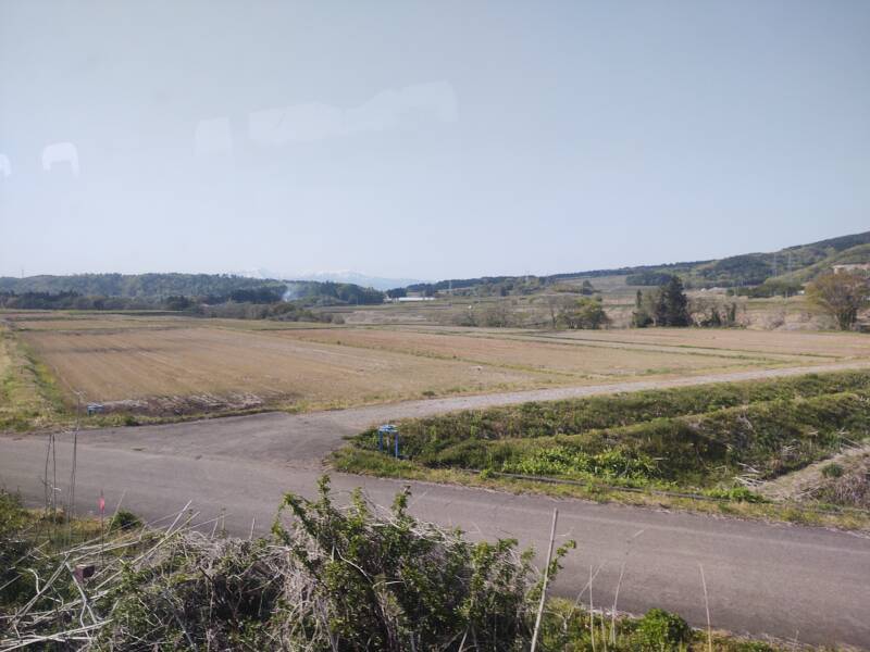
These rice paddies are close to Kōriyama.
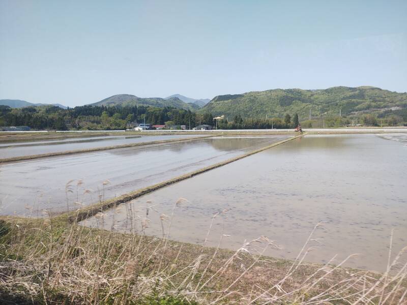
Over the 81 kilometers from Kōriyama to Aizu-Wakamatsu and then north to Kitakata, the overhead catenary supplies 20 kV AC 50 Hz electrical power. The remainder of the line to Niitsu, an outlying part of Niigata, isn't electrified. Most of the non-Shinkansen narrow-gauge lines have 1.5 kV DC power. I don't know, but maybe this line uses the higher voltage because the line runs off through rural territory and gets all its power from the Kōriyama end. Higher voltage thus lower current and resistive power loss.
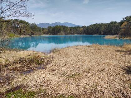
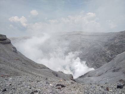
Bandai-san or Mount Bandai is an active stratovolcano, emitting ash and relatively thick lava to build a relatively high and conical peak. Bandai's highest peak is at 1,816 meters, with lower peaks at 1,636 and 1,430 meters. A broad shield volcano emits more liquid lava which spreads further.
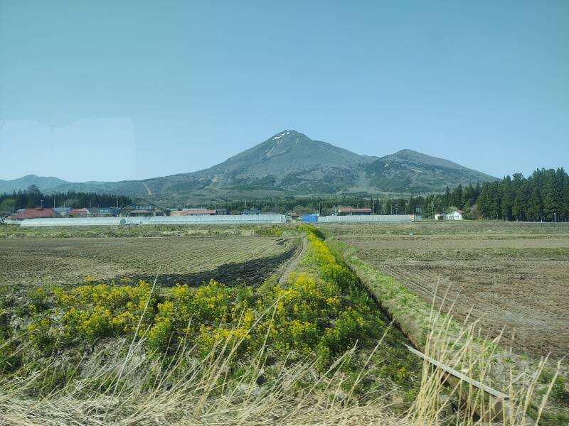
An eruption 30–40,000 years ago dammed water flow and formed Lake Inawashiro, Japan's fourth-largest lake. The water level was significantly lower during the Jōmon period of roughly 14,000–300 BCE, as artifacts have been found in former settlements now submerged in the lake.
Bandai's last lava flow was about 10,000 years ago, it's been steam eruptions and explosions along with some ash emissions since then. One water vapor explosion in 1888 created some colorful lakes that I will visit.
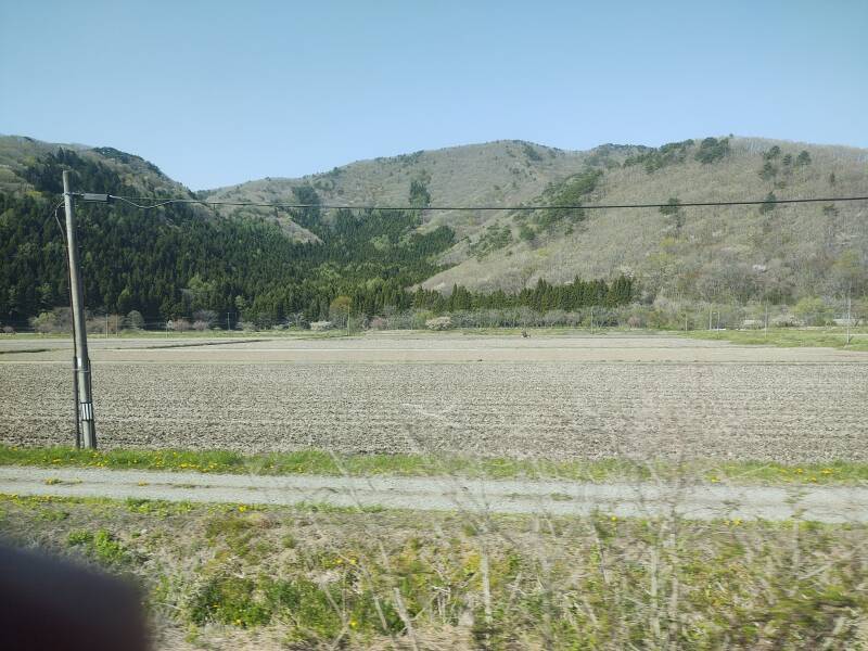
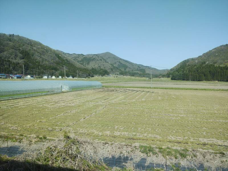
It's 65 km from Kōriyama to Aizu-Wakamatsu. It was all new and exciting for me, so despite my lingering jet lag I stayed awake. For the locals, this is all routine and it's time for a nap.
As we approached Aizu-Wakamatsu, I could see the mountains around the northwest arc of the broad flat basin around the city. Snow still covered the top half of them. This was during the last week of April.
When I arrived at Aizu-Wakamatsu Station I fed my remaining ticket slips into the barrier. It retained the end-to-end ticket from Tōkyō city to Aizu-Wakamatsu city in general, leaving me with just my receipt.
As a staffed station, there was a Ticket Supplement window where I could pay an additional charge if I had ridden farther than my ticket was for, and get help from the staff.
The next page shows what I found at my guesthouse.
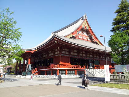
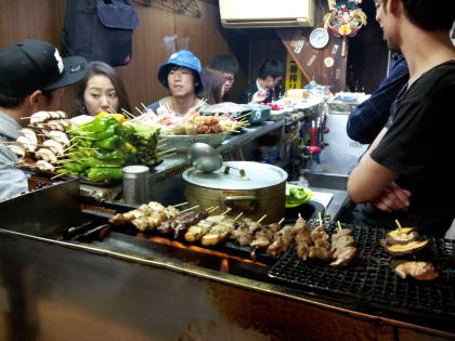
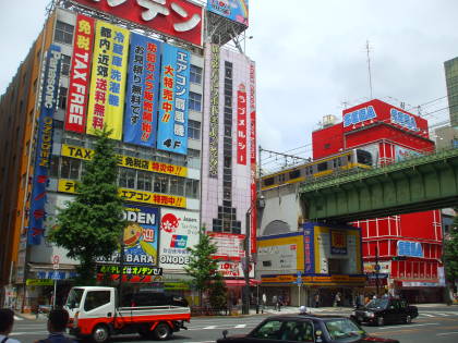
Other topics in Japan:
Amazon 1839059796
Amazon 1640975438

I checked on my way home through Chicago, where Union Station is one of the major passenger rail hubs in the U.S. The station has a McDonald's where a greasy and soggy meal cost US$ 10.69 and up at the time. It also has a Chik-Fil-A restaurant which is closed on the Sabbath and closes early on non-Sabbath evenings.