
Traveling to Torres del Paine
Driving the End of the World Route
I was on my way to Torres del Paine National Park
in Southern Patagonia.
Ferdinand Magellan described the region with the term
patagón
in 1520,
because he and his crew believed that they saw
giant humans, twice the height of normal men.
Later European expeditions reported seeing even larger
giants, with reported heights ranging up to fifteen feet.
Rumors of giants in Patagonia persisted into the early 1800s,
when the reports had become the subject of
satire.
Torres del Paine is in the
Región Magallanes
y la Antártica Chilena,
Chile's southernmost and largest administrative region.
That's all of Chile south of about 48.7°S,
close to where the highway south from Santiago ends
at the small town of Villa O'Higgins.
Within that, the park is in Provincia de Última Esperanza. To a naïve non-Spanish-speaker like me, that looks a little like "the Province of the Ultimate Experience". However, it actually means "Province of the Last Hope", which seems a little more grim.
I would fly from Santiago to Punta Arenas, then pick up a rental car and drive north on the End of the World Route to Last Hope Province, through Puerto Natales to the small town of Cerro Castillo, where I would stay.
A Long Day of Travel
I was visiting Chile for the second time. On my first visit, five years before, I had stayed in Middle Chile, from an area about 40 kilometers north of La Serena in the north to Talca and Constitución in the south.
On this, my second visit, I spent two nights in Santiago and then flew to Rapa Nui for a week. From there I had returned to Santiago for a night in a hotel near the airport. The next morning, I boarded a LATAM flight south to Punta Arenas.
We flew south past the Lake District, over snow-covered volcanic peaks.

Continuing over Northern Patagonia, snow cover increased and we began to see glaciers.

The Southern Patagonian Ice Field extends 350 kilometers north to south, from 48° 15' S to 51° 30' S. It covers about 16,800 square kilometers and feeds dozens of glaciers. Outside the polar regions, only the ice field in southeastern Alaska and northwestern British Columbia covers a larger area.

After a little over three hours, we were approaching Punta Arenas. The body of water along the horizon on the left side of the below picture is the widest part of the Strait of Magellan passing between the island of Tierra del Fuego and the southern tip of the South American mainland. Punta Arenas is visible in the distance in the sunlit area near the center.

Oil extraction dominates the local economy. Punta Arenas, with about 125,000 people, is the big city of southern South America. World-wide, it's the southernmost city of its size. Punta Arenas is at 53.2°S, well to the south of the southern tips of Africa and New Zealand. Traveling north in South America, the first city you reach that's larger than Punta Arenas is Puerto Montt, with about 245,000 people. Puerto Montt is at 41.5°S, 1,300 kilometers north of Punta Arenas.


The Drive
I picked up a rental car at the airport, a small Hyundai with a 6-speed manual transmission. Above is what Google Maps showed for the route north on Highway 9 through Puerto Natales to Cerro Castillo: 284 kilometers, 3 hours and 23 minutes. The first half crosses a wide open and largely flat area, then the second half runs along the Argentine border.
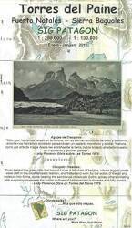
Below is a somewhat detailed map of where I was headed. This U.S. Department of Defense chart uses all white instead of elevation tinting for areas where the elevation data is unreliable. That's most of what you see here. It's high and mountainous terrain, but they couldn't say exactly how high.
I would pass through Puerto Natales, toward the bottom right corner, on my way to Cerro Castillo, to its north. The circle to the right above "CERRO CASTILLO/33'" indicates a minor airstrip with a 3,300-foot runway just outside the small town. The national park is to the town's northwest, around the cluster of large lakes.

1:1,000,000 scale U.S. Department of Defense Operational Navigational Chart ONC T-18 compiled in January 1965 and revised in February 1985, from the Perry-Castañeda Library Map Collection at the University of Texas at Austin.
By late 1987, some of the previously uncertain elevations were better known. But much remains in white on this 1:500,000 map. When I visited in 2024, it was just a few years after they first paved the highway continuing north out of Puerto Natales. The 60 kilometers from Puerto Natales to Cerro Castillo, and the remaining 60 kilometers on to the park entrance, had been entirely gravel.

1:500,000 scale U.S. Department of Defense Tactical Pilotage Chart TPC T-18A compiled in December 1987, from the Perry-Castañeda Library Map Collection at the University of Texas at Austin.
Returning to the start of my drive, the Punta Arenas airport is 18 kilometers north of the city center. I exited the airport and turned left, to the north, away from the city. I would return in a week, leave the car at the airport, and spend two nights in Punta Arenas.
I passed the petroleum facility and several satellite ground station antennas protected in white radomes.

The terrain was flat and desolate.


All of Chile from well north of Torres del Paine National Park south through the islands south of the South American mainland is the Región Magallanes y la Antártica Chilena.
You frequently see the region's flag — yellow mountains, white snow and ice, and the Southern Cross above.
Highway 9 is Ruta del Fin del Mundo, the End of the World Route. It's a Chilean national highway isolated from the main highway system in Chile. To travel by road from central Chile to Southern Patagonia would require crossing into Argentina for much of the route. Ferries are an alternative for about half of the year.
Highway 9 begins 50 kilometers south of Punta Arenas, 28 kilometers from the southernmost tip of the South American mainland. It runs north through Punta Arenas and Puerto Natales, past Cerro Castillo, and on north past the access road into the national park, transitioning to gravel and then to dirt before ending at the Argentina border at Paso Baguales Oriental.

Along the road from Punta Arenas to Puerto Natales you pass through the village of Villa Tehuelches, with 150 people, and a smaller settlement of Primavera at the large rock outcropping called Morro Chico.
Visiting Alaska Visiting IcelandSo, driving in Southern Patagonia is like driving in Alaska and Iceland — always fill your fuel tank when you have the opportunity and try to keep it above half-full. I greatly appreciated how my car's display panel showed fuel use rate averaged over a recent sliding window of time, and the estimated kilometers worth of fuel remaining. That's much more useful than a coarse and non-linear supposed fraction of a tank.

in South America
The six-speed transmission could help with fuel conservation, as long as I was careful. As for radio for music while driving, the long drive from Punta Arenas to Puerto Natales was across wide-open flat terrain, and there were at least one or two FM stations in range for most of that. Continuing north to Cerro Castillo and on to the park, FM quickly dropped out and there was usually just one AM station audible during the day. 620 kHz is LRA18, the 2500-watt Radio Nacional transmitter in Río Turbio, Argentina. That's a town of about 8,800 inhabitants just across the border, 30 kilometers south of Cerro Castillo.

Also as in Iceland and Alaska, take pictures through the windshield as the mountains come into view.

And also as in Iceland, rental car companies in Patagonia warn you to be very careful when exiting your car. Carefully hold onto the interior door handle, don't let the high winds violently pull the door open and break its hinges.
Buses run between Punta Arenas and Puerto Natales, and a few continue on to Cerro Castillo. You pass a nice small bus shelter from time to time.

Punta Arenas is on the east coast, on the Strait of Magellan. The highway running north from there diagonally crosses the peninsula.
When Puerto Natales came into view, I could see that it's on an estuary leading to the west coast. A roundabout route from its port leads to the Pacific.
I made a quick stop at a Shell station on the edge of town, then continued north toward Cerro Castillo.

Highway 9 continuing north from Puerto Natales was all gravel until shortly before my visit. They were still finishing it when I arrived. The 60-kilometer route to Cerro Castillo still had an unfinished stretch of five kilometers. Traffic left the new highway and followed a temporary basic gravel road paralleling it. One day I drove back to Puerto Natales late in the afternoon and took the following pictures.
Most of Highway 9 between Puerto Natales and Cerro Castillo is in better shape than what I'm used to back home. Smooth concrete surface in good shape, with broad, smooth, full-width emergency lanes on either side.

As for the short section they're still finishing, here's the very practical temporary gravel road paralleling the highway. The crew can work on the road without having to work around traffic making its way through while disrupting the construction.

The road between Puerto Natales and Cerro Castillo is a likely place to spot condors.


Sixty kilometers north of Puerto Natales, I reached Cerro Castillo, population about 160. The virtual tour of the town starts with the traffic circle connecting the streets to the highway.

There's a building near the circle that purports to serve breakfast daily and operate a gift shop. Maybe during fishing season, but it was shut down in October.

The one business that was open was the mini-mart at the edge of town where Highway 9 turned. But no fuel — the closest gas stations are 60 kilometers back down the highway in Puerto Natales. Ask your innkeeper about fueling your car. The place where I stayed had a tank that a truck refilled periodically. I drove back to Puerto Natales late one day and filled up, but it's at least 60 kilometers each way to the park entrance and back, and maybe that much more within the park. Before leaving on the last morning I bought 10 liters of gas from my innkeeper.

There's a water tank and mobile phone tower.

There's a plaza where you could stroll and sit.

Across the street from the plaza is the church, dedicated to Our Lady of Southern Patagonia.

Nearby is a historical society building with a museum open a few hours each week during the busy season.

Here's the bus station, where there are four runs a day between here and Puerto Natales. This could be useful for local people going to Puerto Natales for the day, but it's another 60 kilometers onward from Cerro Castillo to the park. You need your own vehicle to visit Torres del Paine National Park, unless you are going to stay at an estancia near the entrance, or the Hotel Las Torres. Or, you're going to trek and camp the entire time from when you step off a bus until you enter a bus to return, which would take quite a bit of preparation and some luck with the weather.

There's a small emergency care medical clinic.

And, an elementary school. For high school, kids would take those daily buses to Puerto Natales and back.

The local government building handles matters for the entire area between Puerto Natales and the Southern Patagonian Ice Field.

It's quiet in town. Sheep and guanaco wander through.

To My Lodging
Guesthouses at Booking.comI stayed at the Riverline Lodge in Cerro Castillo. I stayed here for five nights, and I recommend that you stay at least as long to have a better chance of a pleasant visit to the park. Strong winds blow down off the ice field, the weather changes rapidly and is frequently unpleasant. The park rangers open and close areas through the day as conditions change.

Staying for five nights, I had four full days for visiting the park. No two days were alike, what I could see and do varied.

I had a very nice room!


The heat is largely provided with wood stoves. This one is in the dining room, my room was just off the alcove partially visible to the left. When I returned in the late afternoon, I would open the door to my room and let it warm up, then close it when I got ready for bed. That was usually plenty of heat for the night, but on one especially cold night with high winds I turned on the electric heater in my room.

Breakfast was included, and dinner was available every night.

The lodge welcomes many guests who are there for the fishing. The dining room and shared front room have pictures of guests holding large fish that they caught.


Most streams and estuaries have wild runs of austral king salmon and chinook salmon. There are also large trout that migrate to the ocean and back. The fishing season is from early January through March, summer into fall.

Dinner started with a bowl of soup. The Patagonia Austral brewery uses the ancient creatures of Patagonia as their theme. Their hoppy lager is the Mylodon, the giant sloth whose fossils were first discovered nearby. They lived in this area until around 12,000 to 10,000 years ago.

I always asked for the grilled salmon for dinner. Much of the salmon we get in the U.S. comes from Chile, from farms along the Pacific coast. They select the most symmetric and consistently shaped filets for the export market, so some people in Chile see the locally available non-export salmon as lower quality. Nonsense, it tastes great!
On this evening I got the grilled salmon with salad as my side dish. Beyond the salad is a small bowl of pebre, the Chilean salsa similar to pico de gallo.

The next evening, the salad was a little different. I tried the blond lager with the Ammonite mascot. Those cephalopods lived from about 409 to 65 million years ago, and fossils of large ones are frequently found in Southern Patagonia.

Breakfast each day included sliced meat and cheese, yoghurt, bread with butter and jam, and coffee.

Amazon 9563534891
Amazon 1771296135
There was a framed map of the park in the dining room, the staff would use wax pencils to suggest locations and routes to guests.

A geomagnetic storm occurred while I was in Cerro Castillo. An X1.8 solar flare produced a coronal mass ejection or CME that led to relatively low-latitude visible aurora.
However, it wasn't visible in Patagonia, which is at a southerly latitude but an unfortunate longitude for spotting auroras. South, but on the wrong side.
The geomagnetic poles are offset by about ten degrees from the geophysical axis. As of 2020, the north geomagnetic pole was at 80.7°N 72.7°W, on Canada's Ellesmere Island, and the south geomagnetic pole was at 80.7°S 107.3°E, in Antarctica, south of western Australia. From southern Chile, the center of the auroral circle is all the way to the South Pole and another ten degrees beyond that. Here's the aurora alert for eastern North America and for Southern Patagonia on that night.


In the morning I would have breakfast and then head into the park.
Yo soy El Gringo Sin Lingo