The Yost Woodland Site
Yost Woodland Mounds
This site is on a bluff above the Tippecanoe River just
about 285 meters from that river, and 980 meters from where
it flows into the Wabash river.
The site is between the small town of Battle Ground
and the smaller settlement of Americus,
northeast of Lafayette and West Lafayette, Indiana.
The Yost Woodland complex has been designated as sites
12-T-925, 12-T-1083, and 12-T-1119 in the 2006 report
Archaeological Investigations at Site 12-T-59
and Two Other Locations in Prophetstown State Park,
Tippecanoe County, Indiana.
That was written by Michael Strezewski of the
Indiana University — Purdue University
campus in Fort Wayne.
He's now a faculty member at the University of
Southern Indiana in Evansville.
Amazon 0199765294
Amazon 0939923726
In that paper Strezewski writes:
Materials identified at 12-T-925 were all non-diagnostic prehistoric artifacts, and consisted of seven chert flakes and five pieces of fire-cracked rock. Small quantities of prehistoric, non-diagnostic artifacts were also recovered from sites 12-T-1083 and 12-T-1119.
Was this site abandoned before the first Europeans arrived in the area? Possibly not. The French were active in the area almost a century before the British-derived U.S. forces showed up.
The settlement of Waayaahtanonki was occupied by the Wea tribe. The early French traders spelled it as Ouiatenon. The settlement was on the southeast shore of the Wabash river twenty-nine kilometers downstream of where the Tippecanoe river flowed into the Wabash river, in today's western Tippecanoe County. At the time Europeans considered the area to be New France. The French built a fortified trading post in 1717, Fort Ouiatenon, on the opposite bank of the river. In 1760 the French agreed to withdraw from the Wabash river valley and cede the area to British control.
In 1791 U.S. President George Washington had his Secretary of War issue orders for Brigadier General Charles Scott of Kentucky to lead a mission to kill the Wea people. Scott's force of 33 officers and 760 mounted Kentucky volunteers arrived on June 1, 1791, and killed as many men as they could, taking 41 women and children prisoner. They burned the town and several hundred acres of corn. The Americans had arrived.
Go out Pretty Prairie Road northeast from Battle Ground, pass the golf club and turn into the residential Indian Mount Drive, and continue toward its end.
It ends by splitting into two fairly short driveways. Stop before going that far. Pull off under the trees by the last sharp turn to the right and walk from there. If it hasn't been raining to soften the ground, you can easily and safely pull off there, and then turn around without going to the driveways at the end. The number of "Neighborhood Watch" signs made me think the locals might be rather sensitive about turning around in their driveways.
The mounds will be to your left, to the southeast of the road, between the road and the trees.
There are four mounds along the southeast side of the road, about a meter to a meter and a half tall.
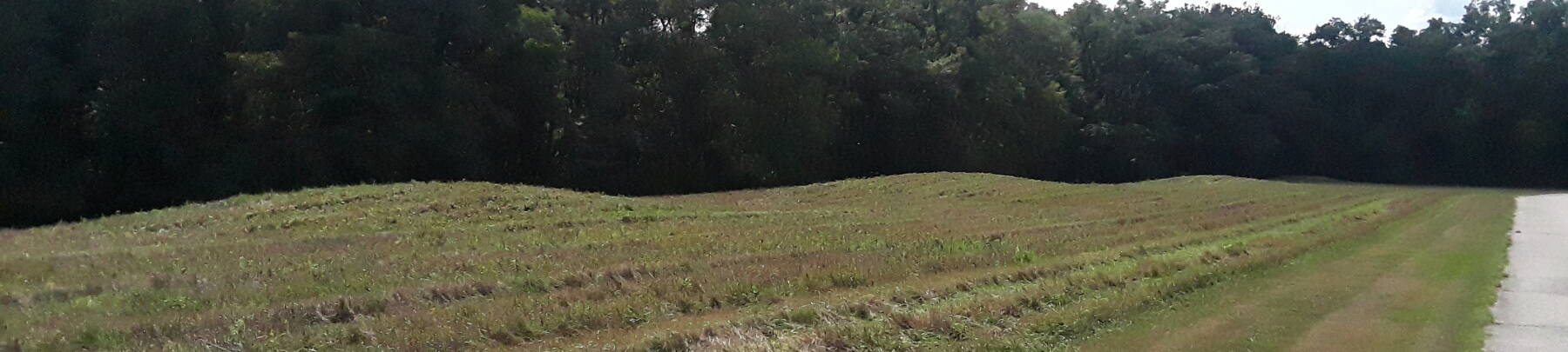
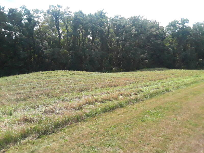
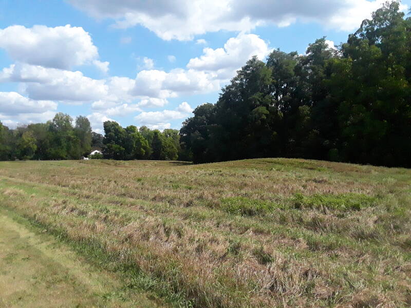
Below is the view from that last turn, looking southwest. There are four obvious mounds. The first three are in the sunlight, the fourth at the far end is in the shadows of the trees. Let's call them #1, #2, #3, and #4 with #1 the closest, at the northeast end, and #4 at the southwest end, farthest from us
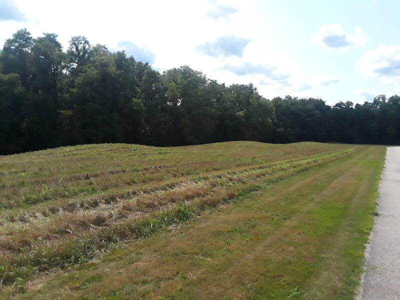
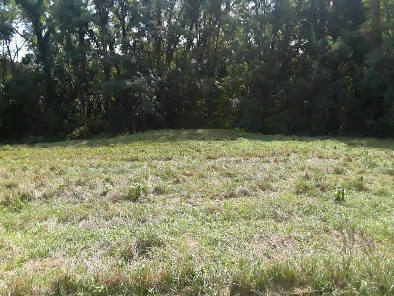
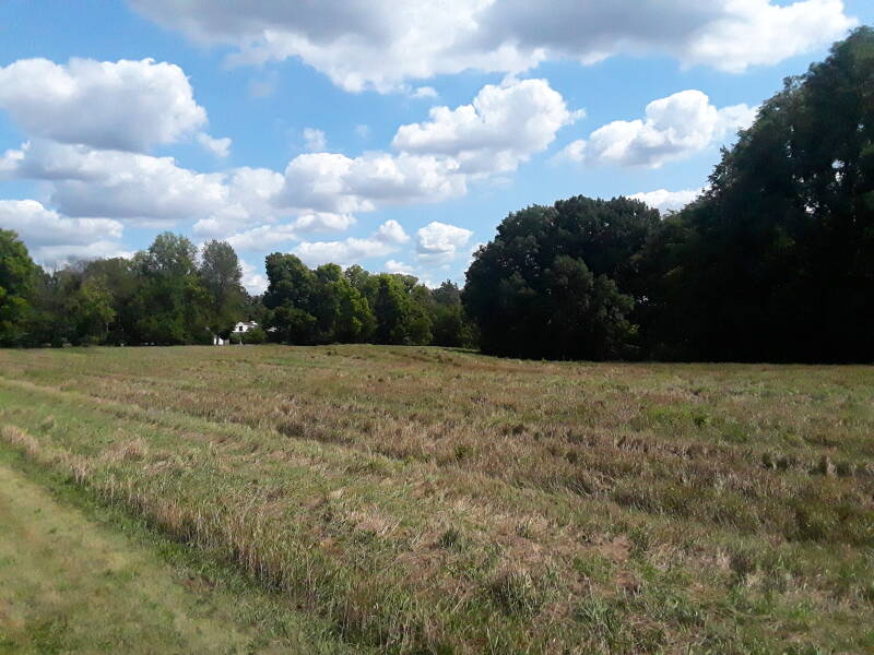
Here are #3 and #4 toward the southwest end, #3 in the sun and #4 mostly shadowed.
Here I'm looking straight southeast from the road to #4.
Turning around and looking northeast, from right to left here are #3, #2, and, barely visible, #1.
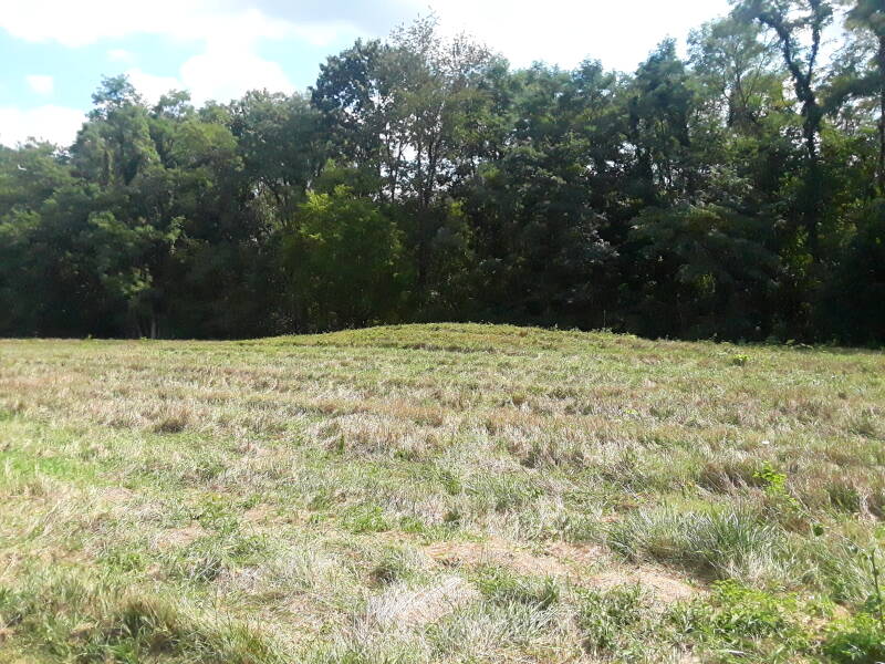
A close-up of just #3.
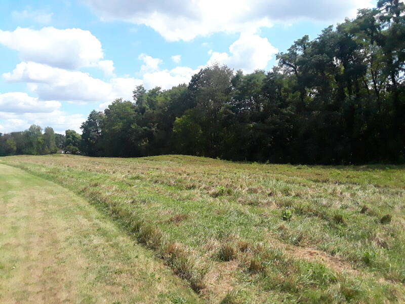
Here are #2 right of center, and #1 left of center directly in front of the white house. Between them, a ravine leads down toward the Tippecanoe River.
Here were can see a little more of the rather subtle #1 and the beginning of the ravine.
Prophet's Rock
Tecumseh or Tecumthé in the traditional pronunciation was born between 1764 and 1771 in today's Ohio. He was born into the Panther clan of the Kispoko division of the Shawnee tribe.
The American Revolutionary War ended in 1783, and the new United States claimed the land north of the Ohio River by right of conquest, thinking that it was theirs because they had defeated the British, who had claimed it while ignoring the people who had been living there for millennia. From then until 1798, Tecumseh moved around along the Ohio River and the areas that became the states of Ohio, Indiana, Kentucky, Missouri, and Tennesee. By 1798 Tecumseh was both civil and military leader of a Kispoko band of about 50 warriors and 250 other people. They settled then along the White River near today's Anderson, Indiana.
The native people in the area were suffering from European diseases, alcoholism, poverty, and the loss of their land and their way of live. Several religious prophets emerged, offering explanations and remedies for the native people's crisis. One of these was Tecumseh's younger brother Lalawéthika. In 1805 he became a healer in their village, and began preaching the ideas espoused by earlier holy men, including the Delaware prophet Neolin.
Lalawéthika urged the native people to reject European influences, stop drinking alcohol, eat only Native food, and wear traditional Shawnee clothing.
Lalawéthika became known as the Shawnee Prophet, and he and Tecumseh founded a new town near the ruins of Fort Greenville in today's Ohio, where a 1795 treaty strongly in favor of the English invaders had been signed. It attracted visitors and converts from several different tribes.
In 1808 Tecumseh and the Prophet established a settlement northeast of today's Lafayette, Indiana. The Prophet, Lalawéthika, had adopted a new name, Tenskwatawa, meaning The Open Door, the door through which followers could achieve salvation. The settlement, which Europeans would call "Prophetstown", attracted followers from several tribes — Shawnee, Potawatomi, Kickapoo, Wyandot, Winnebago, Sauk, Ottawa, Iowa, and others. Up to 6,000 of the Prophet's followers settled in the area, making Prophetstown larger than any European city in the region.
Tecumseh and Tenskwatawa initially tried to maintain a peaceful coexistence with the United States. But in September 1809 William Henry Harrison, the Governor of the Indiana Territory, negotiated the Treaty of Fort Wayne. Europeans paid to purchase 10,000 to 12,000 square kilometers of land in today's Indiana and Illinois. Many native leaders signed the treaties, but others had been intentionally excluded.
Up to this point, Tecumseh was known to Europeans, if he was known at all, as "the Prophet's brother". But the Treaty of Fort Wayne put Tecumseh and his alliance of tribes on the path to war with the United States.
Through 1811 Tecumseh had meetings with Harrison, and traveled widely with meet with other tribal leaders. C1811 F1 or the Great Comet of 1811 and the New Madrid Earthquake of December 1811 before and after the coming battle provided mystical support to Tecumseh's message. The first was a comet visible to the naked eye for around 260 days. The second was an earthquake with a moment magnitude of 7.2 to 8.2, followed the same day by an aftershock with a moment magnitude of 7.4. It was felt strongly throughout the central and eastern United States, and moderately throughout an area of nearly 3 million km2.
Amazon 1469662183
Amazon 022627375X
The tensions led to the Battle of Tippecanoe on November 7, 1811, a genocidal affair in which Harrison achieved his goal of utterly destroying Prophetstown.
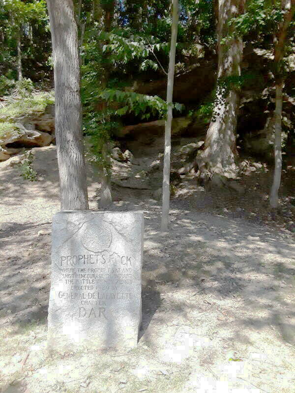
Prophet's Rock is an outcropping where Tenskwatawa, The Prophet, exhorted the community's inhabitants to resist the European forces.
Harrison had sent a series of letters to Tenskwatawa with a number of demands.
Tecumseh was away from Prophetstown recruiting followers from the Muscogee and Choctaw tribes.
Harrison moved his forces north from the southern Indiana territory, camping near Prophetstown on November 6. In a council that night, Tenskwatawa agreed on a pre-emptive strike. He said that he would cast spells to protect his warriors and confuse Harrison's.
Tenskwatawa's warriors surrounded Harrison's camp, and the gunfire started about 4:30 AM. The element of surprise was lost, and the native warriors attacked in a disorganized fashion.
The next day, Harrison sent a group to inspect Prophetstown. They found that it was deserted except for one elderly woman who had been too sick to flee. Harrison issued orders to burn the town, including food stores of 5,000 bushels of corn and beans, and to dig up the town's cemetery and scatter the buried bodies.
The first of the series of severe New Madrid earthquakes struck on December 16. Many tribes interpreted them as a sign of Tenskwatawa's power, as "a call to action". Attacks against European settlers and outposts in the Indiana and Illinois territories increased significantly.
Tecumseh remained a significant military figure on the frontier through the War of 1812 when his confederacy was allied with the British. He was killed the following year in a battle.
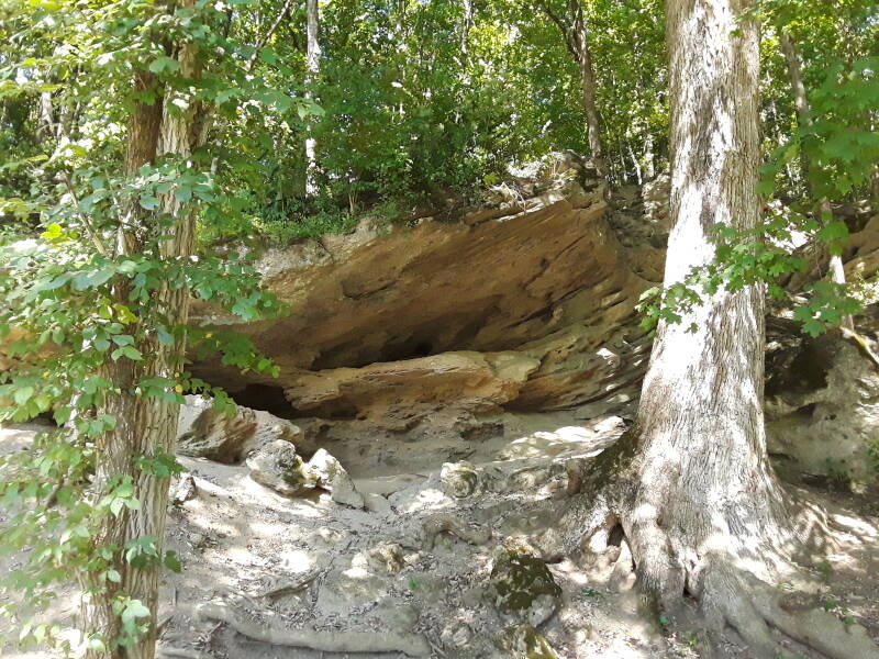
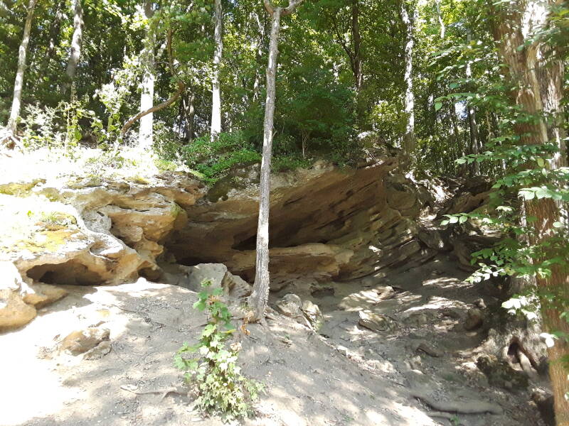
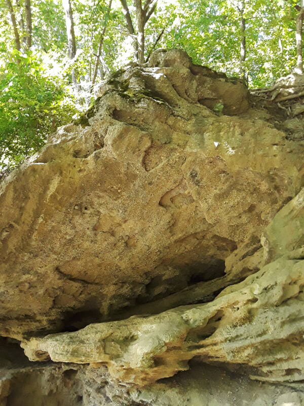
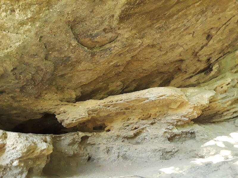
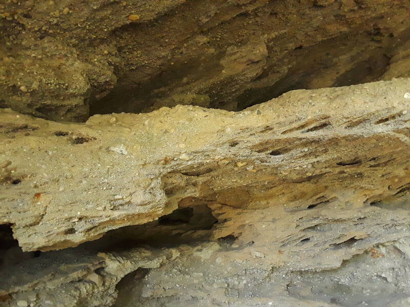
Prophet's Rock isn't a single rock or a formation of several large rocks. It's an outcropping mostly consisting of a conglomerate of small to medium pebbles. I'm sure it has changed significantly since Tenskwatawa's time.
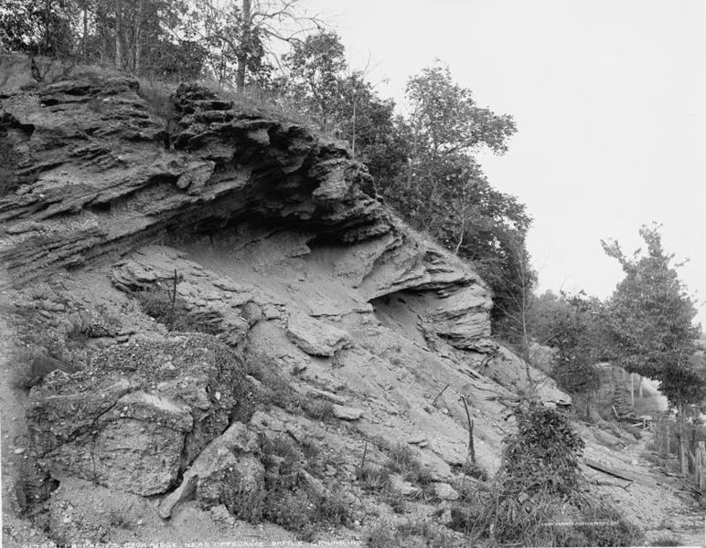
Sure enough, here's what it looked like in 1902. This photograph is in the U.S. Library of Congress collection. The trees have grown over and around Prophet's Rock.
Harrison ran for U.S. President in 1840, winning the election along with his Vice-President John Tyler. His campaign used the slogan "Tippecanoe and Tyler, too".
Harrison only lived for 31 days in office, the shortest U.S. Presidential term so far. His inauguration was on a cold and windy day, and he stood out in the weather to deliver the longest inaugural address to date, some 8,445 words long. He later developed a cold, which worsened into pneumonia, and then he died.