Lower East Side: Stanton Street
Stanton Street across the Lower East Side
Stanton Street runs roughly east-west across the Lower East Side in Manhattan. It is one block south of Houston Street and one block north of Rivington Street. Traffic, not that you will be driving, is one-way from west to east for its entire length.
Starting at Bowery
Stanton's west end is at Bowery. Let's follow the traffic and walk from the west end of Stanton to its east end beyond Pitt Street.

The main grid of Manhattan streets from 1st Street north is laid out according to the Commissioners' Plan of 1811. The nominally east-west streets are rotated 29° from true east and west. Heading nominally east, you are really moving 29° south of true east, at a bearing of 119°, so "west" is 299°. As you can see in the map at the top of this page, the streets south of Houston in the Lower East Side are not aligned to the main grid and are about 7° closer to true east-west, running approximately 112°–292°. The thin black angled lines on that map are a true N-S and E-W grid.

in New York
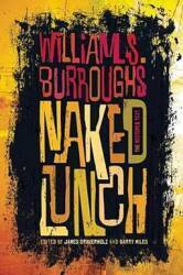
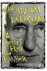
A block or so south on Bowery from Stanton is 222 Bowery, a former YMCA turned into apartments where William S. Burroughs lived from 1974 until 1981. Burroughs' windowless apartment, a former locker room, was known as "The Bunker". The building with "The Bunker" is a little over a block to the south, directly across from the Bowery Mission.
Let's start walking east on Stanton Street from Bowery. Here we are still in the first block.

Soho or SoHo, as in the name of this bodega, is a contraction meaning "South of Houston" and not a reference to the London district of that name.

Soho is pronounced like so-hoe. However, Houston as in the New York street is pronounced HOW-stun and not HUE-stun like the city in Texas.
Chrystie Street
We can cross Chrystie Street on foot behind this bicyclist and keep going. Stanton Street itself, however, is interrupted by Sara Delano Roosevelt Park. Notice the "Do Not Enter" signs flanking the walkway across the park. I'm sure they are frequently violated.
Sara Delano Roosevelt Park is a narrow park stretched from Houston south to Canal Street, with Chrystie and Forsyth Streets forming its long edges. It totals 32,000 square meters or not quite 8 acres.


The City of New York acquired the land in 1929, intending to widen both Chrystie and Forsyth Streets and then build low-cost housing in the remaining strip of land between.
However, the strip was turned into a long park. It was dedicated in 1934 to Sara Delano Roosevelt, the mother of Franklin Delano Roosevelt, who had been elected President two years before.
Just south of here in the block between Stanton and Rivington is the M'Finda Kalunga Garden with a plaque explaining that it commemorates an African-American burying ground that was located there.
Forsyth Street
Traveling byChinatown bus
We cross the narrow park. Forsyth Street forms its east edge.
Here you see the large school on the northeast corner of Stanton and Forsyth. Several blocks south of here on Forsyth are offices for a number of Chinatown buses providing frequent cheap transport to cities all up and down the east coast.

Eldridge Street
Travel inRomania
We pass this artsy place just before reaching Eldridge Street. The culture in this area of the Lower East Side was heavily Jewish in the early 20th Century. Its population was largely made up of recent immigrants, most of them from throughout eastern Europe including many from Romania.

The area later became economically depressed. The gentrification of the East Village spread south in the early 2000s and now the Lower East Side is flourishing, with many art galleries and upscale shops. The process has been described as yuppies moving into the East Village in large numbers and pushing the hipsters south of Houston.
We are approaching Allen Street, a major north-south thoroughfare. It is named "Allen Street" only from Canal Street in Chinatown north to Houston. North of Houston it is First Avenue and continues to run all the way up to 126th Street in East Harlem. South of Canal it is Division Street and Pike Street, running to the East River under the Manhattan Bridge.

This southern section was laid out before 1799 and named Chester Street. The New York Orphan Asylum was opened here in 1806 and the street was renamed Asylum Street. That didn't go over too well with some people, and it was renamed Third Street in 1833, and it eventually was renamed again for Captain William Henry Allen, the youngest man to command a U.S. Navy ship in the War of 1812. He captured the British ship HMS Macedonian, and died in action when he was just 28 years old.
Allen Street
For the extent of its run as Allen Street, it has a broad median down the center with a walking area and numerous benches. There is a protected bicycle lane in each direction.


Above we are looking north, up the southbound side of Allen Street.
Below we have turned to look south down the same side. Notice how the bicycle path at left is well isolated from the driving lanes. Flexible reflective markers project up to keep drivers out of the green painted bicycle-only lane.

Buildings on the east side of Allen Street were demolished in the early 1930s, forming a broad thoroughfare with a central meridian mall. It also brought some light to what had been a very dark street. The original street, after the early 1930s the western half, seen here, had been obscured by the elevated IRT Second Avenue Line since its construction in 1878. The Second Avenue El had blocked almost all the light on what then was a narrow street. This provided a little more light for the side of the street still below the El. The El was torn down in 1942.

We are crossing Allen Street and will continue on Stanton Street, toward the right.
The pictures above and below clearly show that these pictures were taken on two days a few months apart with different weather. Above, it is an overcast but quite warm day in July. No distinct shadows and people in light clothing. Below, a cooler but bright and clear day in early November. Bright sunlight and heavier clothing. However, the New Yorkers are still having Sunday brunch outdoors or in places with wide open windows and doors.


Orchard Street
We are continuing east on Stanton from Allen toward Orchard Street.

The gingko trees are green in the picture above, but their leaves have turned bright yellow in the later pictures below.

Orchard Street is blocked off with a pedestrian mall on Sundays. It lasts all day, from 6 AM until 6 PM, and extends from Delancey to Houston, the next intersection to the north.


Ludlow Street
We will continue east on Stanton Street from Orchard toward Ludlow Street.


Arlene's Grocery probably was a grocery store not that long ago. Now it's a bar where many bands perform.
Stanton Street now has trendy coffee shops and other establishments like this one selling artisanal cheeses.


In the early 1900s this area was filled with brass and copper artisans, most of them Jews from Romania, Greece, Turkey, Syria and Egypt. They fabricated brass and copper objects in basement workshops and sold them in shops at street level.
Most of these shops disappeared after the 1940s, with only a very few lasting into the late 1970s.


Several musical performance venues have been established along Ludlow in the 2000s, including The Living Room, Piano's and Cake Shop along the northernmost couple of blocks.
Mehanata is a Bulgarian nightclub south on Ludlow, just north of Delancey.
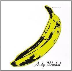
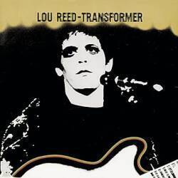
But musicians and artists have been here on Ludlow for quite a while. The Velvet Underground's Lou Reed, John Cale and Sterling Morrison lived and recorded at 56 Ludlow in 1965.
El Sombrero has been there for a long time. It was known as The Hat to the musicians living in the area. We turn back to our route east on Stanton Street, to the right as seen here, and cross Ludlow.


This Greek place Souvlaki.GR is nice, somehow capturing the architecture of the Cycladic islands on the Lower East Side of New York.

Above, it's July. Below, November has come and construction scaffolding has gone up around the coffee shop on the corner.

Essex Street
We have reached Essex Street. This was laid out before the American Revolution by James Delancey as the east side of what was to be "Delancey Square." Bowery was the post road leading north out of the city. Delancey began surveying streets in the south part of his "West Farm", located east of the post road.

Delancey was a Loyalist favoring the English side in the revolution, and he returned to England in 1775. His would-be square was confiscated after the Revolution. It developed as a grid of building lots in place of Delancey's planned aristocratic square, but this street forming its east side remained.
Essex is another long north-south thoroughfare with varying names along its length. It starts at the East River just north of the Manhattan Bridge, and it is named Rutgers Street until it reaches Canal and becomes Essex. North of Houston it is Avenue A and runs as far north as 14th Street where it ends at the massive Stuyvesant Town residential complex.
Norfolk Street
The Lower East Side Preparatory High School it on the southeast corner of Stanton and Norfolk Street. It is described as a "second-chance school" allowing students aged 17 to 21 to obtain high school diplomas. It is bilingual, Chinese and English, with a high proportion of Chinese students.

Suffolk Street
After Norfolk we cross Suffolk Street. Confusingly, this puts Norfolk to the west and Suffolk to the east, as opposed to the English pattern of them being north and south, respectively. Yes, given the slightly less than 29° offset to the street alignment in this area, you go slightly south from Norfolk to Suffolk, but it still seems like they are sideways.

Clinton Street
This new building is on the northeast corner of Stanton Street and Clinton Street.

Here we have turned to look south on Clinton Street from Stanton Street.

Attorney Street
We are nearing the east end of Stanton as we cross Attorney Street.

Ridge Street
Ridge Street has this rather bland apartment building on its northeast corner, and a shared garden on its southeast corner.


Pitt Street
Pitt Street is really the end of Stanton. That construction trailer you see at left is almost at the very end.


We have turned to look south on Pitt Street from Stanton. A few blocks down you see the start of the overpass to the Williamsburg Bridge.
If you were to go south on Pitt and turn left under the overpass, you could continue to the area around where Cherry and Jackson Streets intersect near the FDR Drive. This would put you in the area of Corlaer's Hook. The Lenape native people called the area by a name that the Europeans spelled as Nechtans or Nechtanc. Jacobus van Corlaer was a Dutch schoolteacher who settled on a "plantation" there in 1638. The projection of land into the East River became known as "Corlaer's Hook" and was an important navigational landmark for three centuries.
The city at the time was far to the south separated by what were then considered to be "high, uncultivated and rough hills" The area of Corlaer's Hook was notorious by 1816 for streetwalkers and was referred to as "a resort for the lewd and abandoned of both sexes", and the Christian Herald described it in 1821 as having "streets abounding every night with preconcerted groups of thieves and prostitutes." Hence the origin in the mid-1800s of the word hooker. Really.

This is the east end of Stanton Street just beyond Pitt Street, in the grounds of the New York City Housing Authority's Samuel Gompers Houses.
Back to the International Travel Recommendations


