Furumiya Megalithic Tomb
To the Furumiya Megalithic Tomb
I had already been to three kofun on this day,
three large earth-covered megalithic tombs.
First to the
Tsukiyama kofun beyond the east edge of the city,
and then to
the completely reconstructed Kamezuka kofun
and its accompanying Kokamezuka mini-kofun
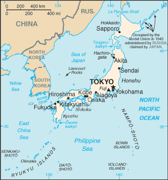
in eastern Ōita.
Now I was headed for that day's
fourth mysterious ancient tomb,
the Furumiya megalithic tomb
in a small park near the city center.
It's at 1 Chome-5-11 Kinosaka
in the Matsubara Dentarukuri Nikku neighborhood,
in the Shiisako area.
Or,
33.226675° N
131.585508° E.
I had walked from the Kamezuka kofun
to the small Sakanoichi Station,
and taken the next train to the central Ōita Station.
It's a walk of a little over two kilometers
from Ōita Station to this tomb.
From the Station to the Tomb
It was about a half-hour walk from Ōita Station to the tomb. Exit the south side of the station and go out across the broad park. When the park bends, head off to the east, jogging south from time to time. The broad road probably shown above in yellow is Highway 210, be careful and cross it at the light.
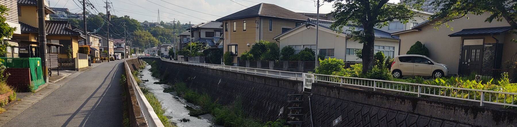
Otherwise, you're on minor streets and alleyways. You quickly enter a residential area, where a lane runs along each side of this canal.
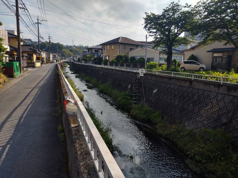
An online mapping service may try to send you up a smooth, nearly vertical concrete retaining wall ten to fifteen meters tall, topped with a chain-link fence and thick bamboo behind that. Don't try that.
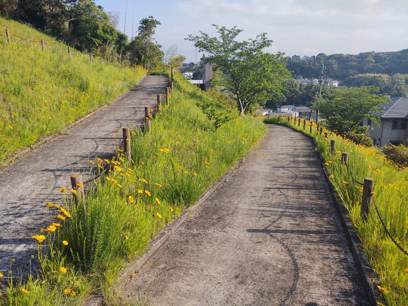
Continue to where the street tees in from your right. Follow it into an S-turn, then step off onto the footpath shown below as a green W. The path leads through more switchbacks than are shown here on its way to a small observation deck at the peak of the hill. On my visit, trees and shrubbery had grown up around the observation platform, obscuring the view in every direction. Continue on from there, then down a staircase to reach the tomb.
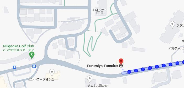
Don't try the impractical ascent on-line maps will suggest! Continue along the street to the west, turn to the north, then go up the switchback path shown as a green "W". Continue from there up over the peak of the hill and down to the tomb.
This is the view looking up the slope over the switchbacks of the path.
Up I went.
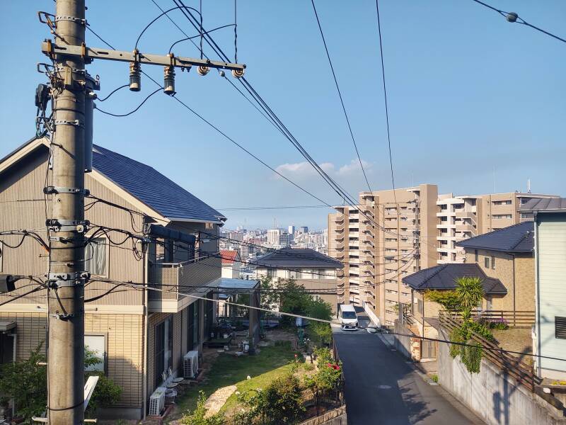
You start to see out over the central city, looking through the ubiquitous meticulously constructed power lines.
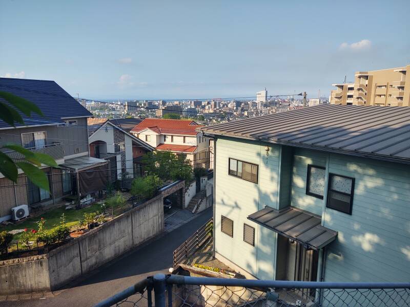
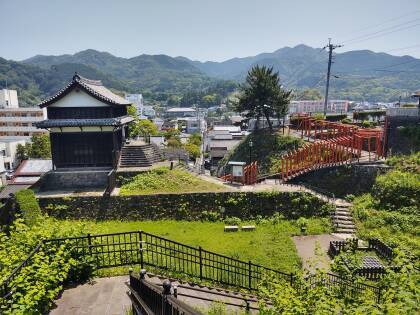
Higher still, the path turned onto stairs through the trees and shrubbery, leading up to the peak of the hill. This was the best view, north over the Hōyo Strait that connects into the Inland Sea.
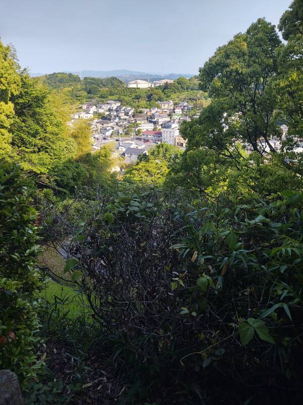
There was a brief glimpse inland. Two large water tanks sit on the next hill.
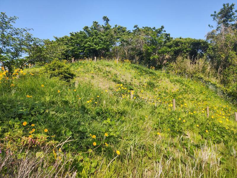
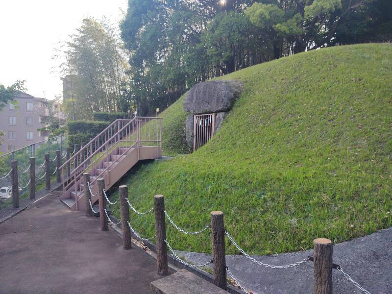
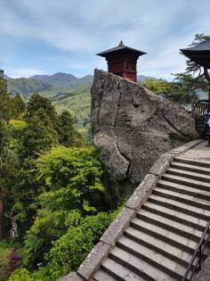
The tomb is on the south slope near the peak of a hill. It faces out to the south over the Bishamon River, a small tributary to the Sumiyoshi River. It looks out over a small river with a mountain or hill behind it, an auspicious arrangement according to Feng Shui.
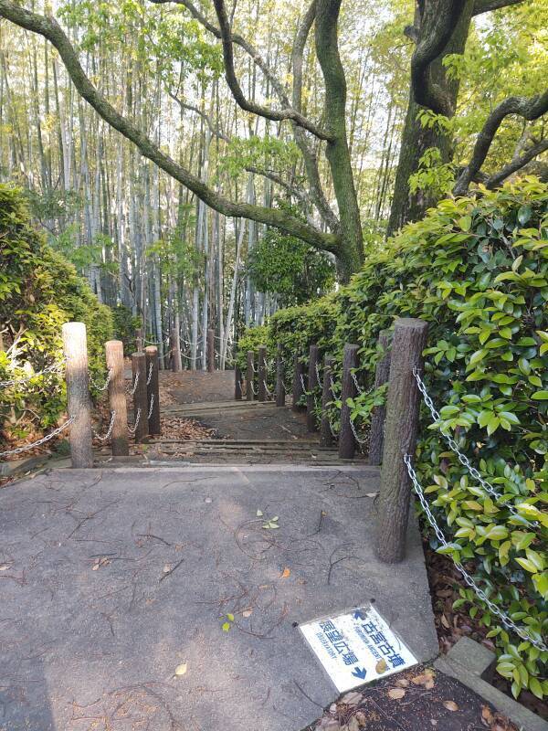
Above are the stairs leading down from the obscured observatory to the tomb.
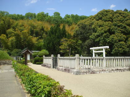
At the Furumiya Tomb
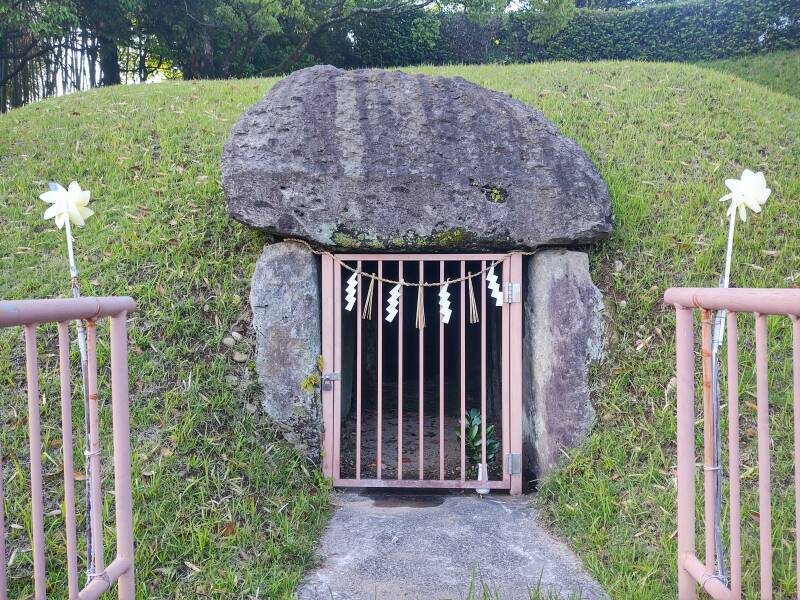
I arrived at the Furumiya megalithic tomb!
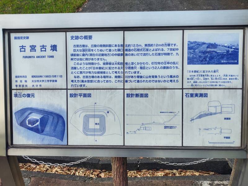
A sign provides background.
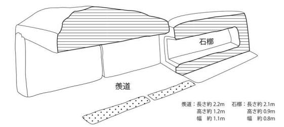
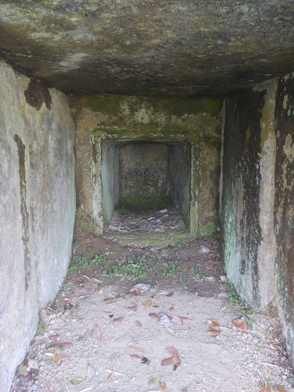
The tomb is constructed as an inner chamber carved from one large block of tuff, compacted volcanic ash. That chamber is accessed through a tunnel or passage made from vertical slabs as side walls holding up a large stone as a roof. Here's a perspective cross-section view from an Ōita city web page, depicting the tomb as cut vertically down the centerline with the entrance at left and the inner chamber at right.
This design was popular in the 7th century CE among aristocrats in the Kinai region around today's city of Nara. That's where the Yamato rulers, predecessors of the Imperial line, were based. This is not a locally popular design. It's the only tumulus in Kyūshū with this design. The design and some grave goods discovered inside lead to the conclusion that this tomb was built in the latter half of the 7th century.
The inner chamber is about 2.15 meters long, 0.9 to 0.95 meters high, and 0.8 meters wide. It's carved into the large tuff block that is about 2.7 meters long, 1.8 meters tall, and maybe 2 meters wide.
The outer passage is about 1.3 meters tall by 1.1 meters wide, and 2.7 meters long. It's formed by two vertical slabs on either side, holding up a large capstone, all of them cut from similar tuff. The vertical slabs on the sides are each about 0.5 meters thick. The capstone is about 2.7 meters long, 1.1 meters thick, and about 2.3 meters wide.
Then that entire megalithic structure is covered with an earthen mound, with just the opening of the outer passage and the outer edges of its stones exposed. The earthen mound is about 12.45 meters north-south, or front-back, and 12.15 meters east-west or side-to-side.
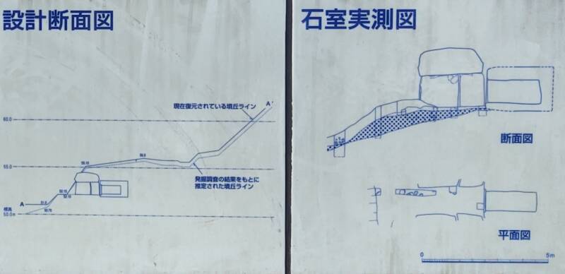
The elevation marks are at 50.0, 55.0, and 60.0 meters. The solid and dotted profiles from A to A' show the currently maintained and earlier ground levels, respectively.
The tomb is closed with a metal gate, on which Shintō shide or paper zig-zags and hemp or rice tassels were hanging.
Inside, you look back through the entry passageway between the vertical slabs on either side, into the inner grave chamber carved into the tuff block.
The grave goods and design of the burial chamber indicate that the person buried here had some connection to the ruling clan in the Kinai region around today's city of Nara. The person would have been a member of the Ōita-no-Kimi clan, who ruled this area at the time.
Historians presume that the person buried here was Ōita no Kimiesaka, who was recorded in the 8th-century Nihon Shoki as an active supporter of Prince Hito, who became Emperor Tenmu in the Jinshin War during the Asuka period of the Yamato state.
The Jinshin War broke out in 672 after the death of Emperor Tenji. He had set up a bureaucracy parallel to that of the Tang Dynasty in China. He was trying to dissolve the power structures of the locally prestigious clans across central Honshū.
Tenji had originally designated his brother, Prince Ōama, as his successor. But later he changed his mind in favor of his son, Prince Ōtomo.
Tenji died, and Prince Ōtomo took the throne. His uncle Ōama pretended to be a monk at a nearby temple while plotting a rebellion against Ōtomo. He collected weapons and organized soldiers for his coup-d'état. In 672 Ōama's forces marched toward Ōtomo's palace in Ōtsu. After a war of about a month, the ruling Emperor Ōtomo escaped the besieged palace and fled to Mount Nagara, where he strangled himself to death. It can't be easy to strangle yourself.
Victorious Ōama burned down Ōtomo's palace, returned to Asuka, assumed the Imperial throne as Emperor Tenmu, built Asuka-Kiyomihara Palace, and married Empress Uno-Sarara.
This is one of the few ancient tombs where the buried person can be potentially identified with reasonable confidence. Ōita no Kimiesaka, supporter of the eventual Emperor Tenmu.
Back to the Station Area
I headed back to the station, then through it and back to my hotel to clean up. I had ridden trains for 32 kilometers, but I had also walked 21 kilometers that day.
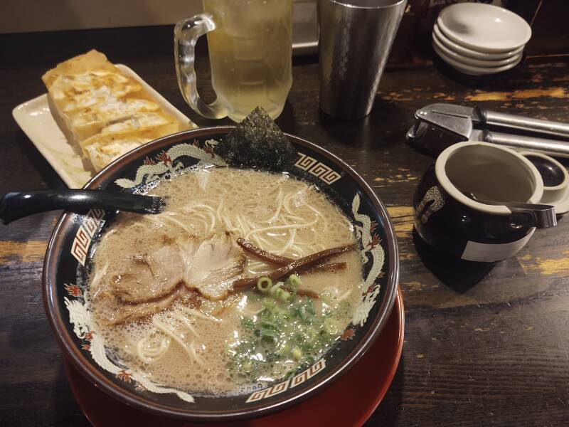
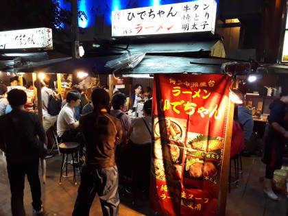
I returned to the station area for dinner — gyoza and ramen.
On the next day I took the train to Usuki and walked south to the stone buddhas, a UNESCO World Heritage Site.
Next❯ To the stone Buddhas of Usuki
Other topics in Japan:
Amazon 1839059796

Amazon 1640975438


A personal pod in a capsuru hoteru like the one I stayed in while in Ōsaka is significantly wider and taller inside. So let's have none of this "a capsule hotel would be like being buried alive!"