Kakinoshima Site
Jōmon Culture on the Coast of Hokkaidō
Sannai Maruyama Site near Aomori Ōfune Site
The first week and a half of this trip focused on
Japanese prehistory.
The first humans to enter Japan crossed overland from the north
around 35,000 years ago,
when the sea level was significantly lower
and Japan was connected to the far northeastern Asian mainland.
They were highly mobile hunter-gatherer people,
moving in small groups
that didn't settle for long in any one place.
Around 14,000 BCE they began to
settle down and form what is called the
Jōmon culture,
building increasingly larger settlements
with a distinctive pit dwelling design.
Their architecture, art, and overall culture
gradually evolved
while the Jōmon culture lasted
until around 500 BCE.
At that point the Yayoi people
were arriving from the Korean peninsula,
bringing a Japonic language,
wet-rice agriculture,
and worship of ancestors and kami or local spirits,
features of what we now consider Japanese culture.
See the pages on my earlier stops at the
Sannai Maruyama Site
near Aomori and the
Ōfune Site
a short distance away for more Jōmon background.
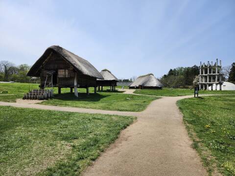
This page is about the Kakinoshima Site,
which is along the Pacific Ocean coast northeast of
Hakodate, part-way from Ōfune to Kakkumi
as seen on this map.
It was occupied approximately 7000–1000 BCE.
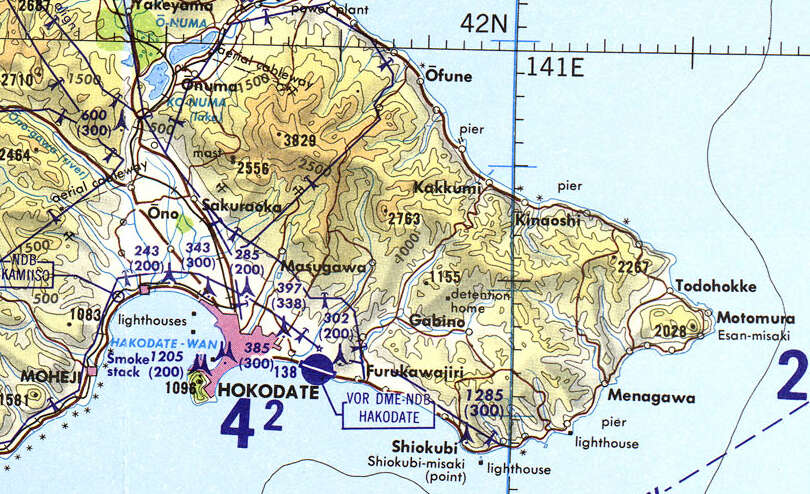
Small section of Tactical Pilotage Chart F10-C from the Perry-Castañeda Library Map Collection at the University of Texas at Austin. This map was compiled in 1964. In the past, Hakodate has also been spelled "Hokodate", "Hakodadi", and who knows what else in romanji, phonetically spelling Japanese with the Latin script. It probably was an Ainu place name in the beginning. The #99 bus runs northeast from Hakodate, over the mountains to Kakkumi on the Pacific coast, then northwest along the coast road past Ōfune.
There and Back
The Tourist Information Office in the JR Station had given me an English-language schedule of the buses to these two Jōmon sites plus some other points of interest along the coast. Here's part of the schedule they gave me in early May 2024. The simple version: I left Hakodate Station at 10:20 and rode to the Ōfune Site. I saw it and walked to the Kakinoshima Site. Then I started back on the bus from there at 15:56 and got back to Hakodate Station at 17:25. In more detail, using bus stop names that you can find on Google Maps, outbound from Hakodate Station to the sites:
| Hakodate Station stand #6 |
Kakinoshima Iseki Shita |
Ōfune Iseki Shita |
| 06:57 | 08:28 | 08:36 |
| 10:20 | 11:50 | 11:58 |
| 12:35 | 14:05 | 14:13 |
Returning from the sites to Hakodate Station:
| Ōfune Iseki Shita |
Kakinoshima Iseki Shita |
Hakodate Station stand #6 |
| 11:19 | 11:27 | 12:56 |
| 13:34 | 13:42 | 15:11 |
| 15:48 | 15:56 | 17:35 |
Both the first outbound and first return trips listed above involve boarding bus #225 and then changing from it to #99 at Minamikayabe Shisho Mae where the buses make a slightly longer stop. Make sure to tell the driver where you want to go, and they will help you make the transfer.
The outbound bus stop, traveling northwest along the coast, is beside the small side road leading up to the site. The bus stop where you board to return to Hakodate Station is about 60 meters southeast of that intersection. Google Maps knows about the bus stops along this route by the names shown on the schedule. Take advantage of that!
Arriving at the Site
Similar to the Ōfune Site, the Kakinoshima Site is on a flat coastal terrace with steep slopes down to the beach and to a river to its right or southeast. It's at an elevation of 32 to 50 meters above today's waterline. The road from the coast highway comes up along the west side of the side, along the left-hand orange boundary on this map.

The U-shaped earthen mound, over 190 meters long, enclosed an area that seems to have been used for ritual activity.
Further inland was a residential area, with many pit dwellings and some middens of refuse that contained remains of fish, shellfish, whales, and seals.
Even further inland was a graveyard. The clear division into everyday living, versus ritual space, versus graves, indicates a high level of cultural development.
Where was the farming area? There wasn't much of an agricultural area. Cultures function in widely varying ways. Archaeology is heavily influenced by models that British and German archaeologists devised for ancient Greece and the lands mentioned in the Bible. They don't necessarily fit other cultures, certainly not the Jōmon.
The Jōmon were similar to cultures of the west coast of the Americas. They developed a complex society and fed it through fishing, hunting, and gathering naturally growing plants. They didn't need much in the way of horticulture. See the paper "Advances in Understanding Early Agriculture in Japan" for more.
The site shown on the above map is within an area of almost 93 square kilometers including surrounding related sites.
This site was occupied from approximately 7000 to 1000 BCE. Distinctive artifacts found here include clay tablets with footprints, Ashigatasuki Doban, that were found in a burial pit. There was jade jewelry, which had to have been brought in through the maritime trading network to which this settlement belonged. There was also red lacquerware dating to the earliest period of occupation. They're the oldest known pieces of lacquerware in the world.

Here's an overview of the site, looking from the museum with the residential area to the right, then the ritual earthworks and the Pacific Ocean beyond. The site was discovered during surveying work in 2000. As of 2019, less than 2% of the site had been excavated.

As described on the page about the Sannai Maruyama Jōmon site near Aomori, from the Meiji Restoration in 1868 through the death of Hirohito in 1989, there was a taboo against historical investigation that could contradict the myths of Japan's origins and the Emperor's descent from the creator gods. Hirohito's successor, Akihito, made it plain that he did not support literal interpretation of the origin myths and the divinity of the Emperor. Before taking the throne, he had published over thirty papers in ichthyology. Some Jōmon sites had been vaguely known, but dismissed as nothing but old pottery. The new Emperor embraced science, and the public has become very interested in the Jōmon.
The pit dwellings were dug deeper at this site, up to two meters, like those at the nearby Ōfune Site. Traces are still visible today at both sites. These are remains of pit dwellings from 7000–1000 BCE.

Below is the view turning 180° and looking from the residential area across the ritual area toward the ocean.

The Ritual Space
The U-shaped earthwork mounds are the largest in Japan, over 190 meters long and 120 meters wide, and over two meters high. The below view is looking from the opening of the "U" across the center. The mounds were built around 2000 BCE, at the beginning of the last millennia of the site's occupation.

A distant white object barely visible above is one of the explanatory signs.
A hillock, a small circular mound, is near the center of the area surrounded by the large earthworks. Graves have been found there, along with stone objects that resemble tools and weapons but which would have been impractical. There were also pieces of pottery from the Tōhoku region of northern Honshū.

The Kakinoshima earthen mounds were probably used as a place for burials and other rituals and ceremonies.
Scientists believe that "sending away" rituals occured here. Object would be broken and buried at the same time as the recently deceased, so the objects' spirits could accompany the person's.
Some of the analysis makes analogies to the "sending away" rites of the Ainu people, performed into the 19th century CE for deceased people and killed bears. Joseph Campbell's Primitive Mythology describes the Ainu beliefs and rites, citing the "Ainus" article in the 1908–1926 Encyclopaedia of Religion and Ethics. (Volume 1, pages 239–252)
A wide shallow trench enters the U-shaped ritual space at its south end, pointing toward the central hillock. Excavation has found that the ground in this trench was intentionally flattened and compacted.

Archaeologists interpret this as a ritual road, the processional entrance into the ceremonial area. Here's a small section of the map, north is toward 11 o'clock. The broad opening of the "U" is to the left, the ritual road is the small passage at lower right. The small yellow circle is the central hillock.

Below is the view from the same point as the previous picture, at the ritual road's entrance into the large ceremonial space, turned 180° and looking toward the central hillock.

The north side of the U around the ceremonial area overlooks the Pacific Ocean.

Turning 180° to look inland, our viewpoint is near the center of the ocean-side mound of the U-shaped enclosure. The ritual road is close to the group of tall trees at the left, the central hillock is toward the right. Beyond it is the inland long mound of the "U", and beyond that the pit dwelling area and the on-site museum.

Returning to Hakodate
I walked down to the coast road and then about 60 meters southeast to the bus stop sign. The 15:56 bus would arrive soon. Yes, I had found the bus stop sign and verified its schedule card before going up to the site.

The schedule on the post showed that 15:56 was not the last bus, but that there would be another at 17:41. However, don't rely on catching the very last bus.

Time for Ramen
I returned to Hakodate on the 15:56 bus which dropped me at Hakodate Station at 17:35. I went to my hotel room, just a block away, and cleaned up.
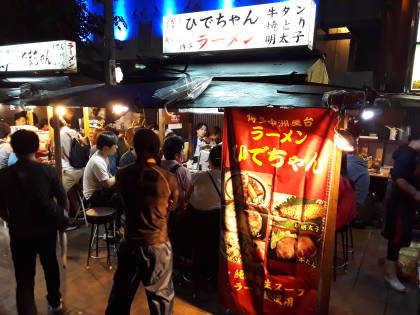
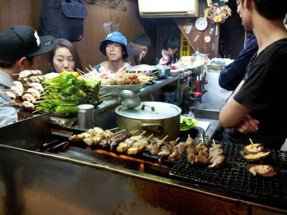
Then I went to my dinner spot in Hakodate, Daimon Yokocho, an H-shaped set of narrow lanes with over twenty small eateries.
A good ramen place was just inside the southwest entrance, on the left as seen here.

The menu takes the form of pictures and paper strips above the cooking area. Here are several ramen choices.

Hiragana
And to the right facing the cooking area, gyoza and other side dishes. This is a case where being able to pronounce what katakana and hiragana are phonetically spelling can be very helpful.

Here's the gyoza.

And the ramen.

On the following day I would explore Hakodate city, with its morning market, waterfront, Museum of Northern Peoples, remnants of Russian influence, and Mount Hakodate.
Other topics in Japan:
