Mount Aso
Visiting Aso-san
Mount Aso or, as it's called locally,
Aso-san,
is Japan's largest active volcano.
The currently active peak is near the center of
a 25×18-km caldera,
one of the world's largest.
Mount Aso is within the Aso Kujū National Park.
A train running between Ōita and Kumamoto
winds into the rugged mountains of Kyūshū
before making its way down to the caldera floor.
Aso Station, marked as Bōchu
just above the "A" in "ASO SAN" in the map below,
has a tourist desk and
it's the lower terminus of the bus up the mountain.
I visited Mount Aso on a long day trip out of Ōita,
where I was staying.
In this map you see the two highest peaks of Aso-san marked
Taka Dake and Neko Dake,
with roads in red looping around the rim
and crossing the center of the caldera.
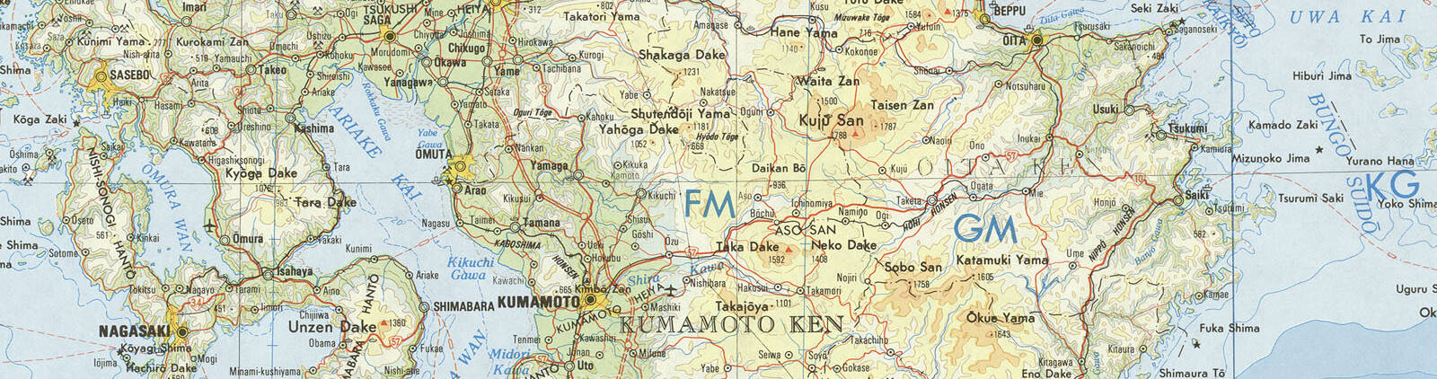
Small portion of 1:1,000,000 map NH 52 from the Perry-Castañeda Library Map Collection at the University of Texas at Austin. I traveled on the rail line, shown in black, from Ōita near the northeast corner of this map, south to Mie then west to the station labeled here as Bōchū.
The Aso Caldera
The Aso volcano system now consists of five major peaks, one of them with a currently active volcanic crater, within a large caldera.
"Caldera" comes from the same root as "cauldron", referring to its appearance like a gigantic cooking pan or pot. A caldera forms when a major eruption empties a lava chamber, and the roof of the chamber collapses. Aso Caldera formed through four gigantic eruptions from around 300,000 to 90,000 years ago. They were pyroclastic flows in which ash and gas are ejected at hundreds of kilometers per hour, at temperatures up to 1000 °C. The resulting caldera is about 25 kilometers from north to south, and 18 kilometers from east to west.
The most recent of those huge eruptions occurred around 90,800 years ago, It was the largest, ejecting an estimated 384 km3 dense-rock-equivalent of ash. Deposits of ash from that eruption more than 15 cm deep have been found on Hokkaidō, about 1,500 km to the northeast.
The ash deposits were, of course, much deeper across Kyūshū. The Stone Buddhas of Usuki were carved into a layer of tuff, volcanic ash compacted into a layer of stone.
Visiting Thira Visiting Milos Sakurajima Valles CalderaIf the initial form of a volcano is an isolated island, as was the case with Thira (or Santorini) and Milos in the Aegean, the sea may flood into the lowered caldera leaving a partial ring of an island.
Or, if the caldera forms at or near the coastline of a larger body of land, as was the case with the multiple calderas near Sakurajima in southern Kyūshū, the sea may flood into the caldera forming a large bay.
Aso-san is like Valles Caldera near Los Alamos, New Mexico, as it is well inland.

Amazon B002ZG4Q5W
Just as several Western movies have been filmed at Valles Caldera, Kurosawa filmed Ran, his remake of King Lear, in the Aso Caldera.
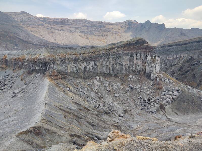
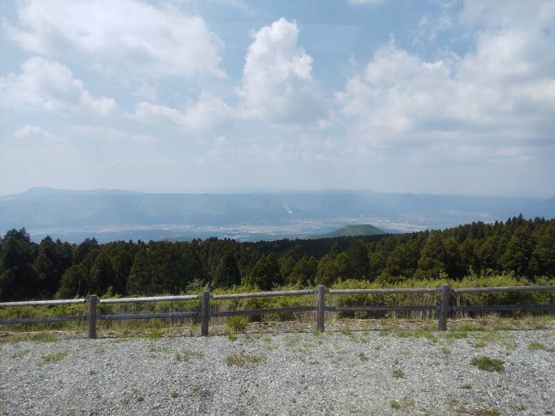
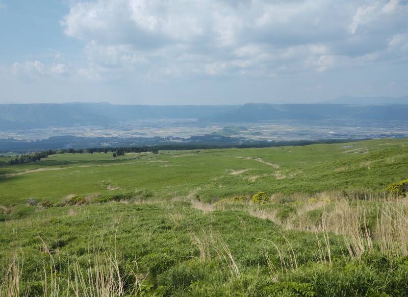
The broad floor of the Aso Caldera is at about 550 meters elevation. The rim of the steeply sloping caldera wall ranges from 800 to 860 meters around the northern half, to about 1,240 meters in the southwest. The central peaks have grown through continuing volcanic activity. The five major peaks are known as Aso Gogaku. The tallest of those, Taka-dake, has its peak at 1592 meters. Naka-dake, at 1,506 meters, is the currently active one, erupting since the 6th century CE. It has multiple craters. The crater at about 1,250 meters was the active one when I was visited.
The below map shows the caldera floor in yellow, at lower elevation, with the rim and the cluster of central peaks in shades of orange and brown. The low caldera floor is in the shape of a C which once was partially filled with water. Now two rivers drain the caldera through a narrow opening to the west. The central peaks that have formed after the caldera collapse have spewed more material toward the east, somewhat joining them to the eastern rim.
The rail line through the caldera was opened in 1918, with a newly-built station named Bōchū. By 1928, the line had been extended to join Kumamoto on Kyūshū's west coast to Ōita on the east coast. In 1961 Bōchū was renamed Aso Station.
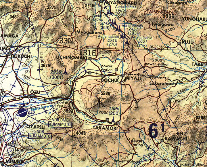
Small portion of 1:500,000 Tactical Pilotage Chart G-11D from the Perry-Castañeda Library Map Collection at the University of Texas at Austin. Map prepared in 1964, updated in 2000, but it still shows the name "Bōchū" for what has been Aso Station since 1961. U.S. map, so elevations and tower heights are in feet.
Zooming in further, this 1:250,000 map shows more detail. A gap in the western caldera allows water to drain out, and roads and rail lines to more easily enter and exit the caldera.
But in the northeast, see how the rail line passes through Namino and then descends into the caldera through two long sloping tunnels.
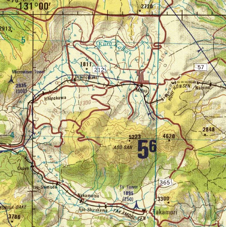
Small portion of 1979 1:250,000 map NI 52-16 from the Perry-Castañeda Library Map Collection at the University of Texas at Austin. U.S. map, so elevations are in feet. Thin blue lines are a 10,000 meter grid. Aso Station is at the small circle where Highway 212 crosses the rail line, and then a twisting road continues generally southward up the steep slopes.
Trans-Kyūshū Limited Express From Ōita to Aso-san
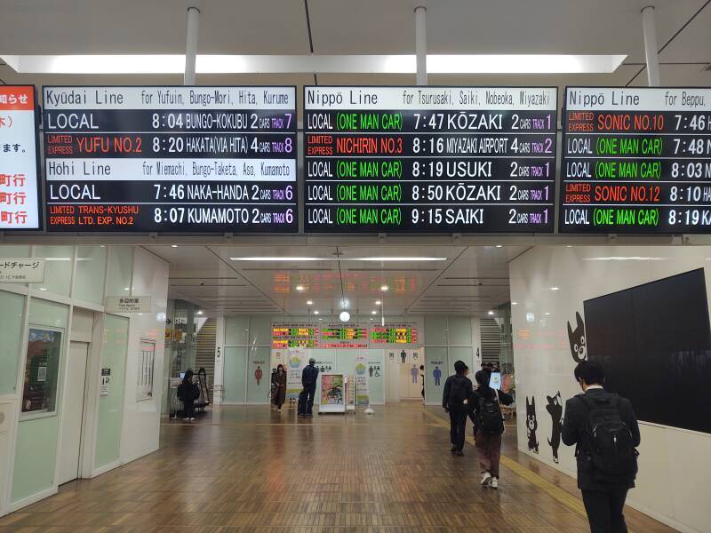
That was my plan, now to carry it out. I had purchased my tickets the night before. I set an alarm to get up in plenty of time to walk to Ōita Station. This is Japan, so many trains depart from this station daily. Fourteen trains left this station within about ninety minutes on this Monday morning.
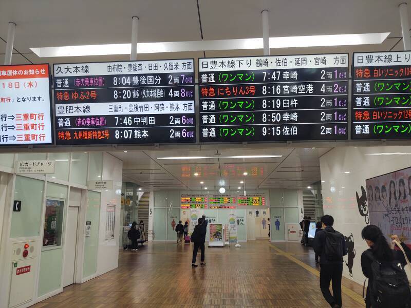
Don't panic, the schedule boards cycle through Japanese and English. However, the English one wasn't up for long, it took me two or three cycles to feel comfortable that I had read the full schedule.
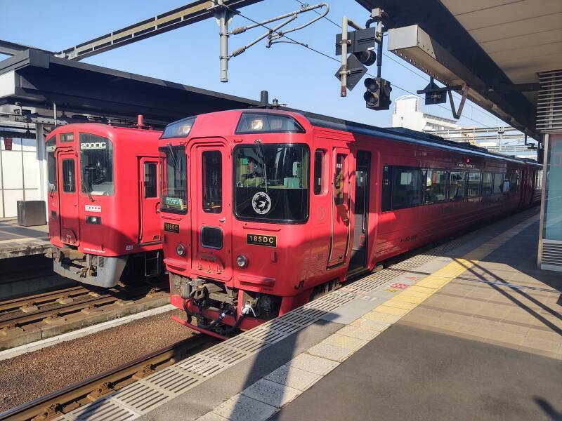
My train is listed at lower left, the two-car Trans-Kyūshū Limited Express bound for Kumamoto on the Hōhi Line, leaving Track 6 at 08:07.
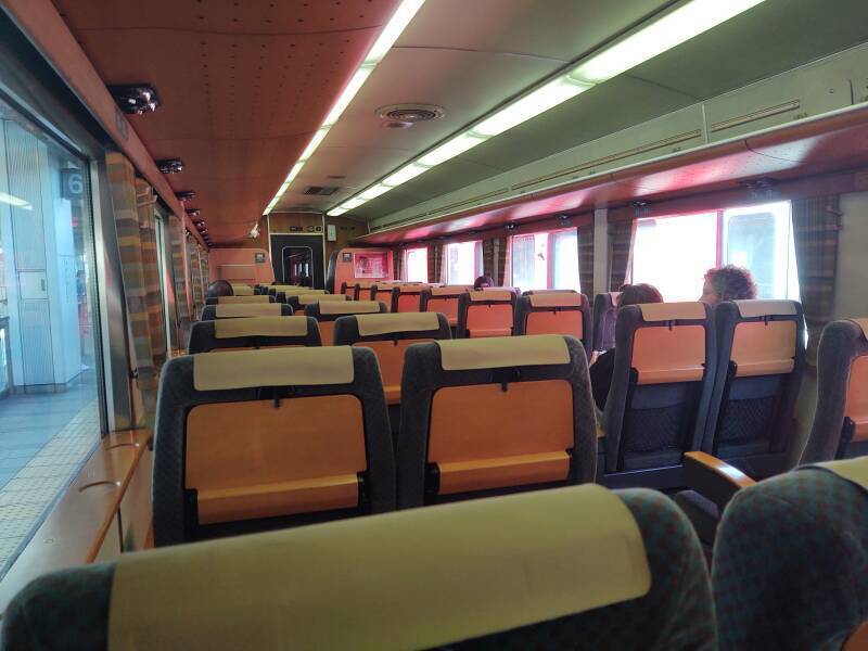
Here's my train, a sharp almost salmon-colored two-car unit.
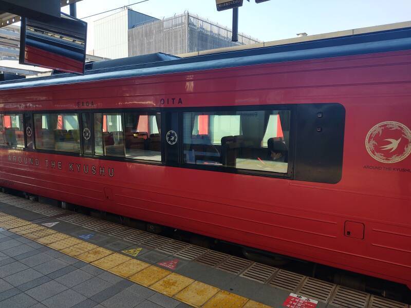
I got on board and found my seat.
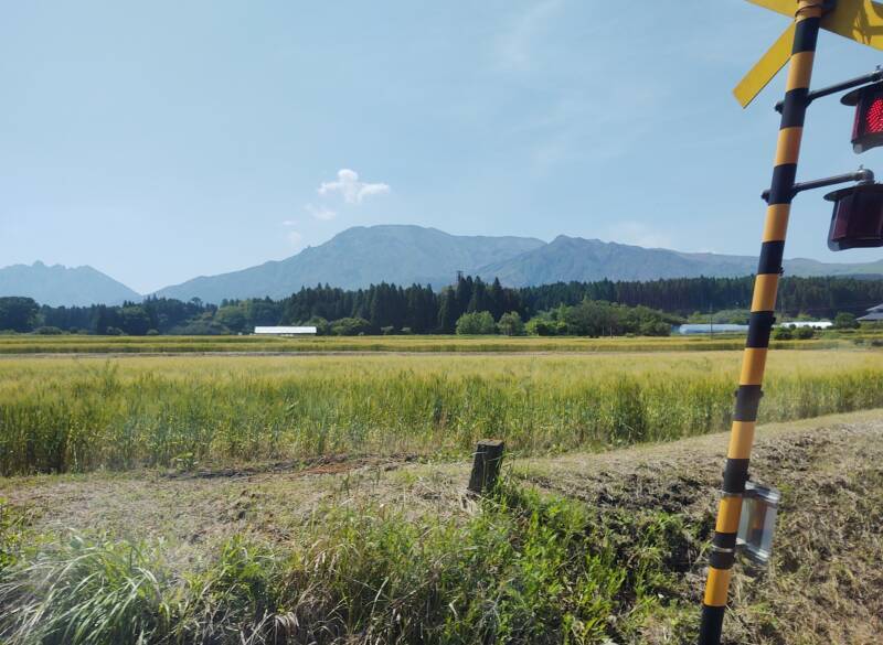
About an hour and forty-five minutes later, we were crossing the Aso Caldera. Beyond that cell tower is the Aso Gogaku, the central cluster of peaks.
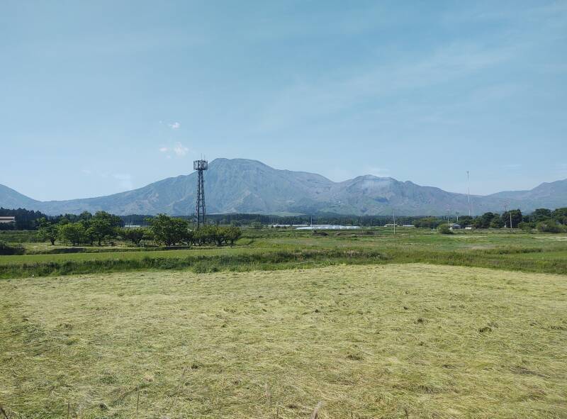
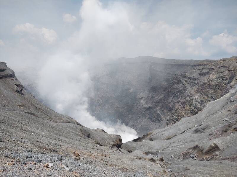
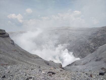
The small white puffs are steam and gas coming out of Naka-dake, the currently active peak.
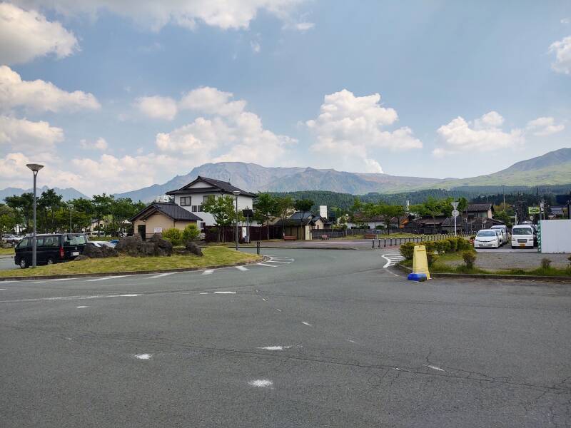
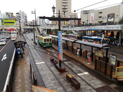
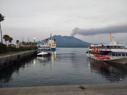
The steam plume out of Naka-dake was visible from Aso Station, in front of the scattered clouds and above the right edge of the traffic circle in this picture.
Mount Aso
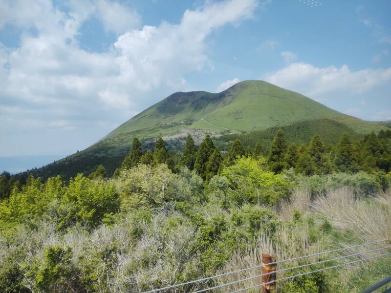
A bus connects Aso Station and what Google Maps shows as Aso Sanjo Public Square. A cable car system ran up Mount Aso from 1958 to 2018, but it was demolished after repeated damage caused by eruptions. Below, I had reached that and was looking back toward Kishima-dake, 1,321 meters elevation at its peak.
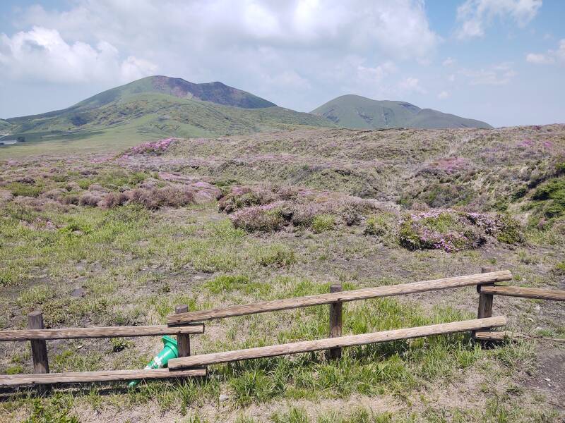
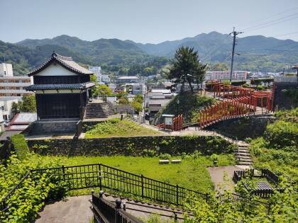
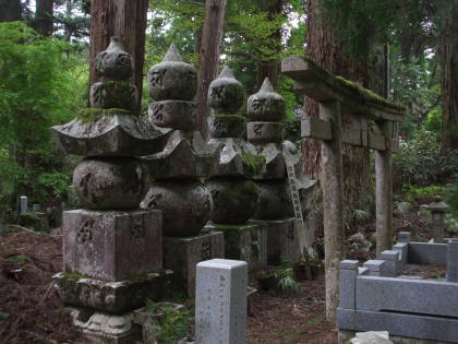
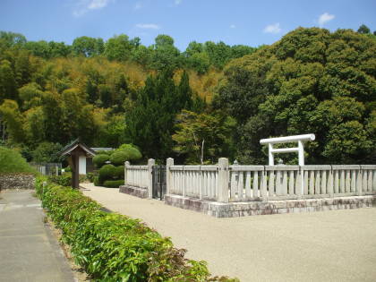
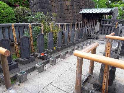
There's a historic site along the road between Kishima-dake and Aso Sanjo. There once were 36 temples and 52 hermitages here. It was destroyed during the Warring States period of the 15th and 16 centuries CE. Now a few grave markers of the Buddhist cemetery remain. The heather was purple during my visit in mid-May.
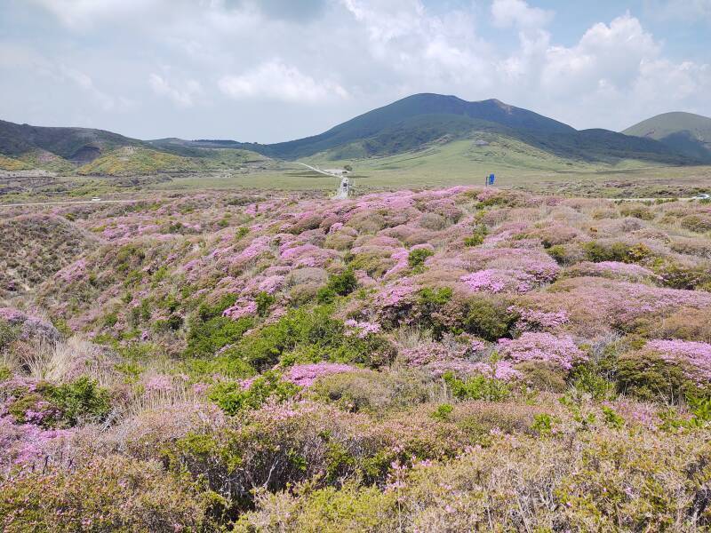
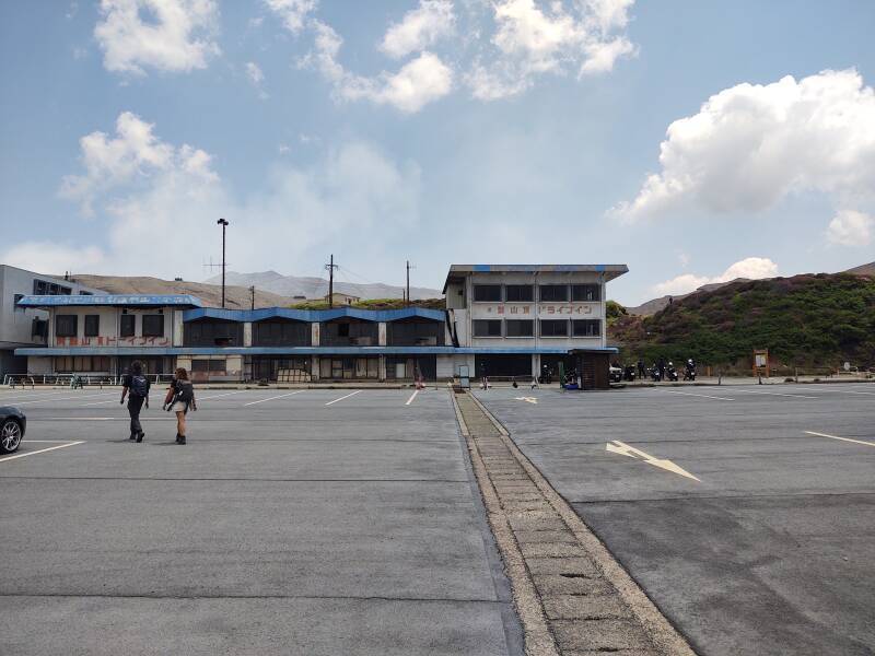
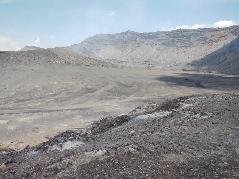
Aso Sanjo Public Square has a rather battered motel and restaurants that were closed when I visited. The active crater is on the horizon at right, just another 1.5 kilometers away. The environment here is harsh, with frequent waves of hazardous gases that react with water vapor to form H2SO4 or sulfuric acid.
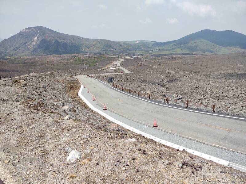
The below view is to the southwest, with the rim of the caldera visible in the distance.
I started walking up the road, the final 1.5 kilometers to the active crater. It's just beyond the structures visible on the skyline in this picture.
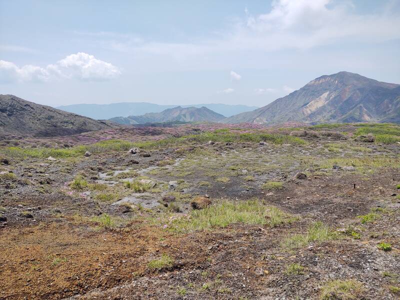
The view to both sides is bleak.
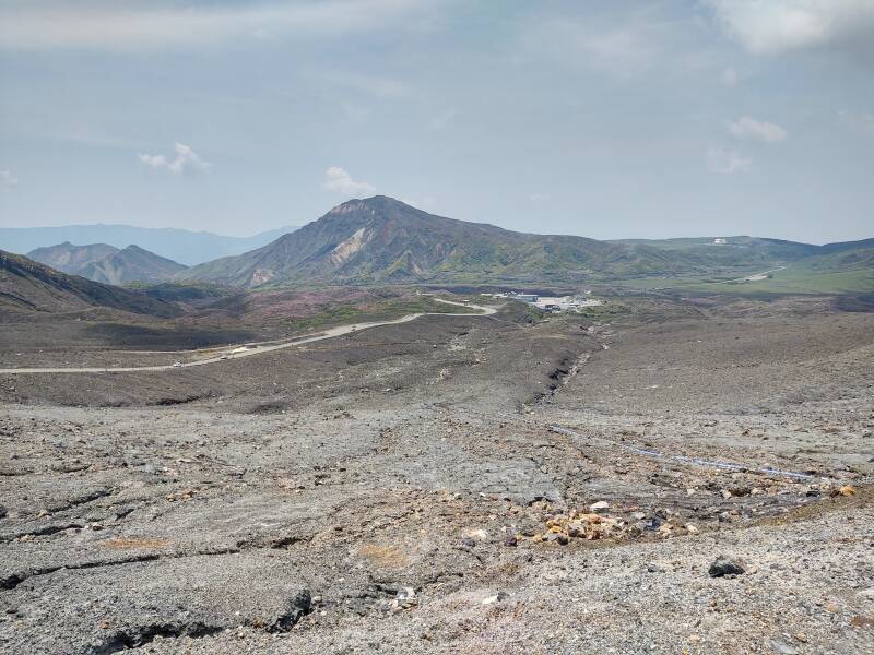
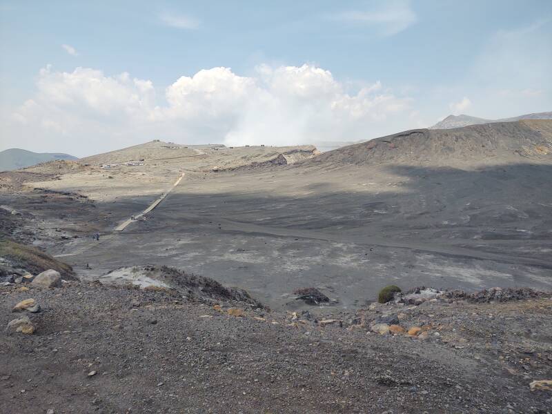
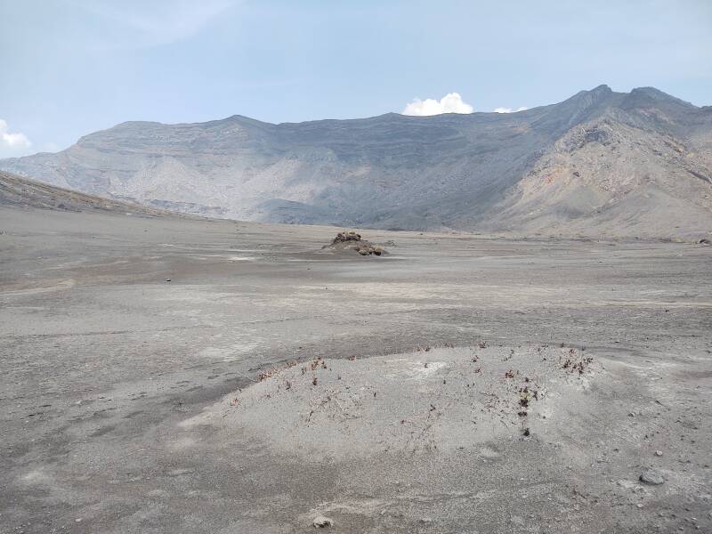
Nearing the summit I turned to look back. Aso Sanjo Public Square is about a kilometer down the road. About two kilometers beyond that are the white multi-story Kusasenri Observatory at center and the Kishima-dake dual peak at right.
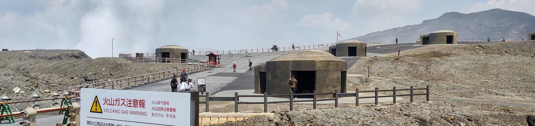
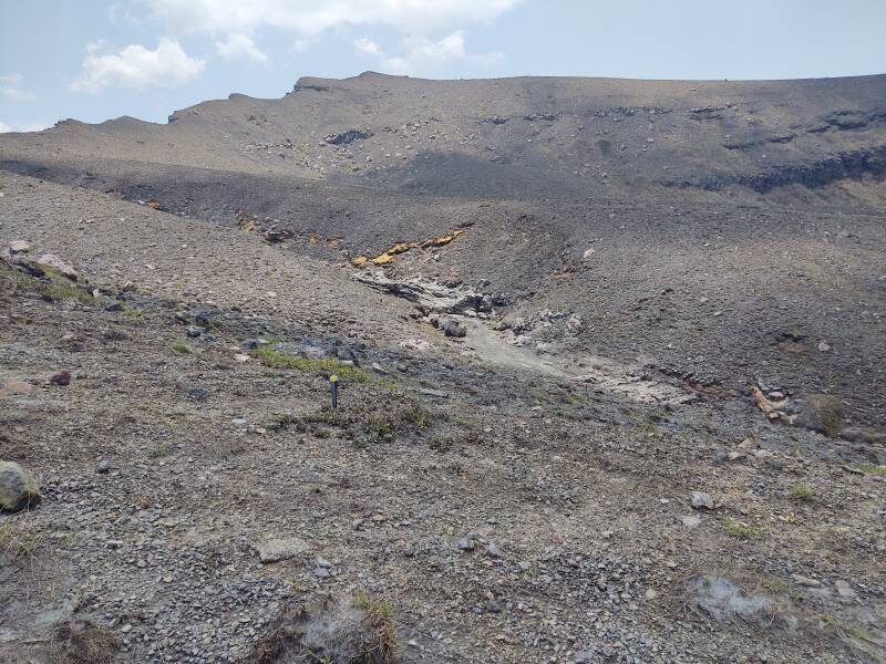
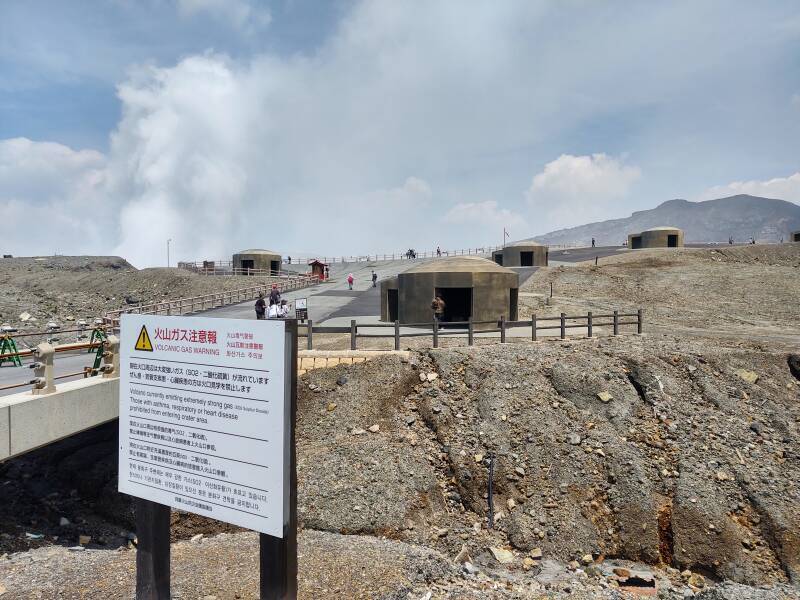
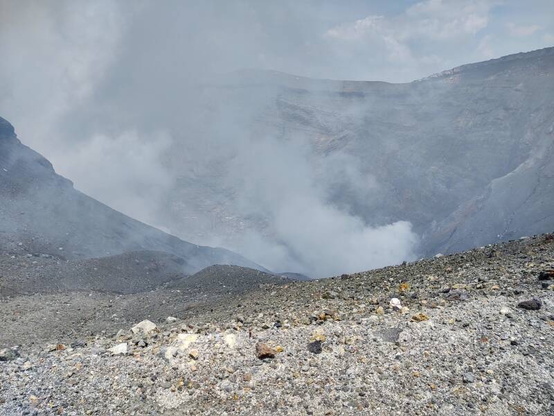
Several concrete shelters stand around the parking lot at the end of the road. They provide shelter when the volcano suddenly starts ejecting rocks or a heavy flow of ash. The output was just white steam during my visit, as seen above the warning sign here. Naka-dame has hydrothermal reservoirs about 1 to 2.5 kilometers below the surface, and below that, a magma reservoir at 6 to 10 kilometers.
Officials change the sign depending on conditions. This one warned of the presence of sulphur dioxide, SO2.
at Aso-san Fatalities by inhalation of volcanic gas at Mount Aso crater
A set of colored beacons indicate the current level of volcanic gases in the air. It was blue on my visit, 0.2 ppm or less.
Asthma, emphysema, and other lung disorders make the patient especially sensitive to air quality issues.
Will you be able to visit Aso-san on an arbitrary day? Maybe, maybe not. It depends on the current conditions.
I was able to go all the way to the crater rim. But sometimes you can go no further than where the bus stops at Aso Sanjo Public Square, and sometimes the bus is not allowed to go that far.
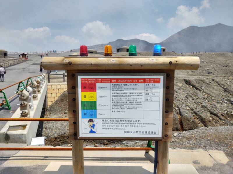
Typically, SO2 is associated with high-temperature volcanic gases, and H2S with low-temperature gases. SO2 smells like burnt matches, H2S like rotten eggs.
I had donned my tie-dye SARS-CoV2 mask for the bus ride. I noticed a higher percentage of people wearing paper and cloth masks at Aso-san, compared to the train or back in the city, so I joined the pattern and left it on. It's not qualified for filtering SO2 or H2S, or high levels of CO2, all of which would require a proper respirator, the first two with full-face cover at higher concentrations.
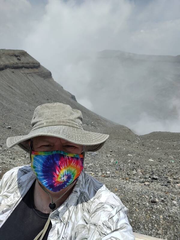
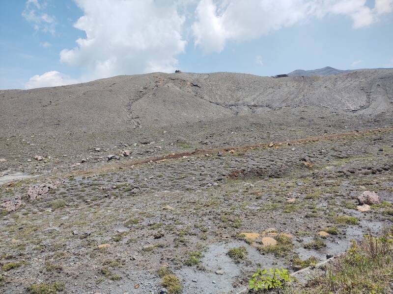
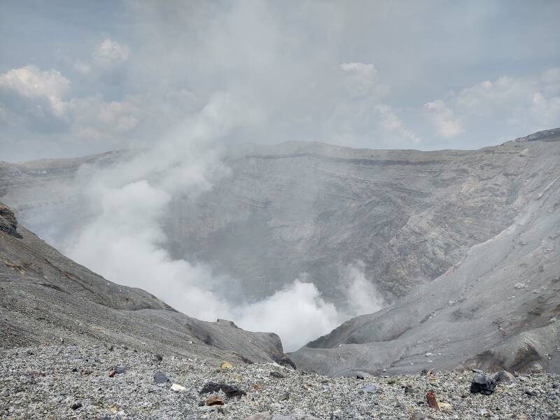
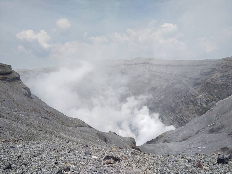
This is Naka-dake crater 1, with its rim at about 1,240 meters elevation. The plume of water vapor continuously changed.
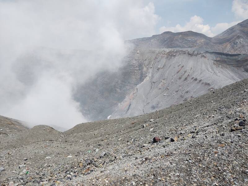
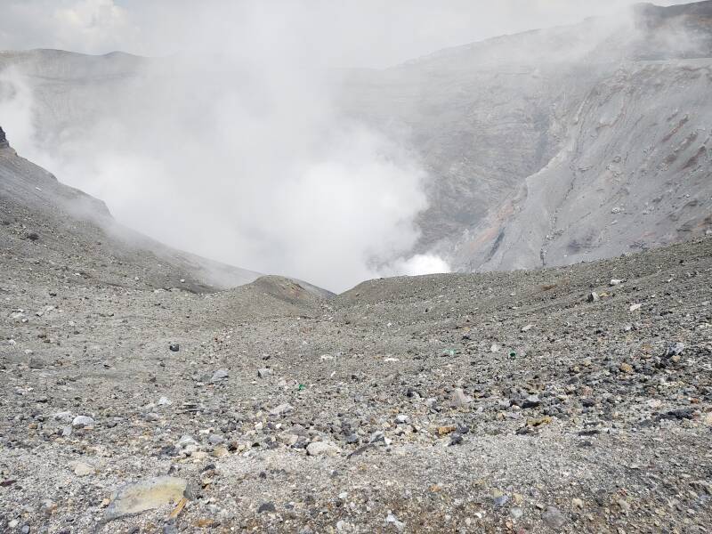
The higher summit of Taka-dake rises to 1,592 meters, about 350 meters higher than Naka-dake crater 1, about 1.8 km to the east.
You can walk about 800 meters south to Sunasenrigahama, where there is a view down over the southern caldera.
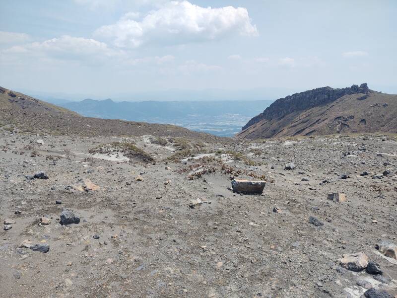
Here's the view back toward the main crater viewing point.
Looking northeast toward the Taka-dake summit.
There are several small cinder cones.
Starting Down From Mount Aso
Aso Caldera is like the rest of Japan. Most of the country is rugged mountains, so any good agricultural land is intensively farmed.
1,321-meter Kishima-dake, also spelled Kijima-dake, is one of the five main peaks of Aso-san.
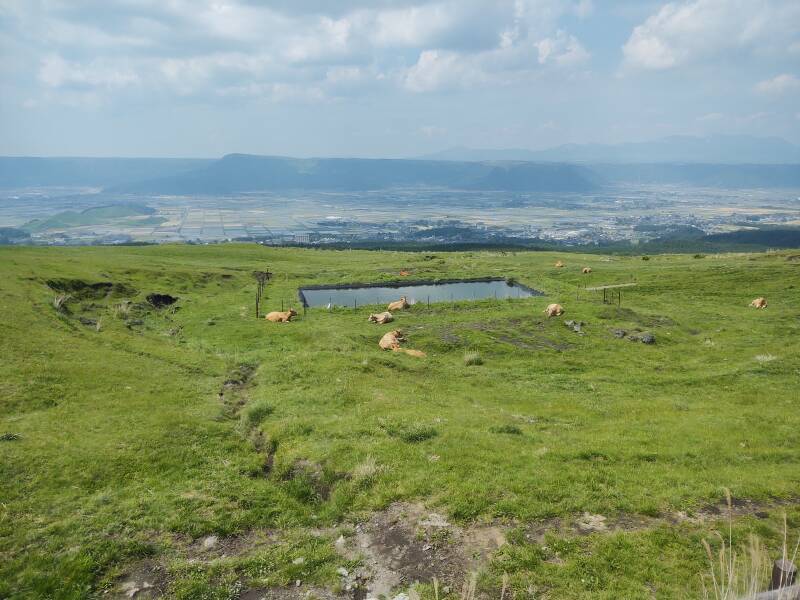
There are small cones on the slopes of the main central peaks, and also out across the caldera.
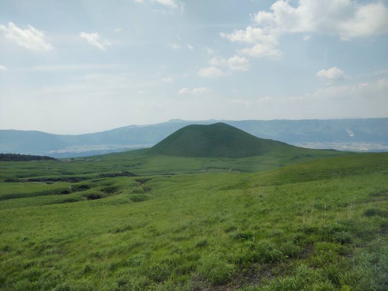
These are aka-ushi, with aka meaning red and ushi meaning cattle. "They're actually brown!", the pedants insist, although brown is nothing but a dark shade of red. The distinctive thing is that they're Volcanic Cattle.
Returning to Ōita
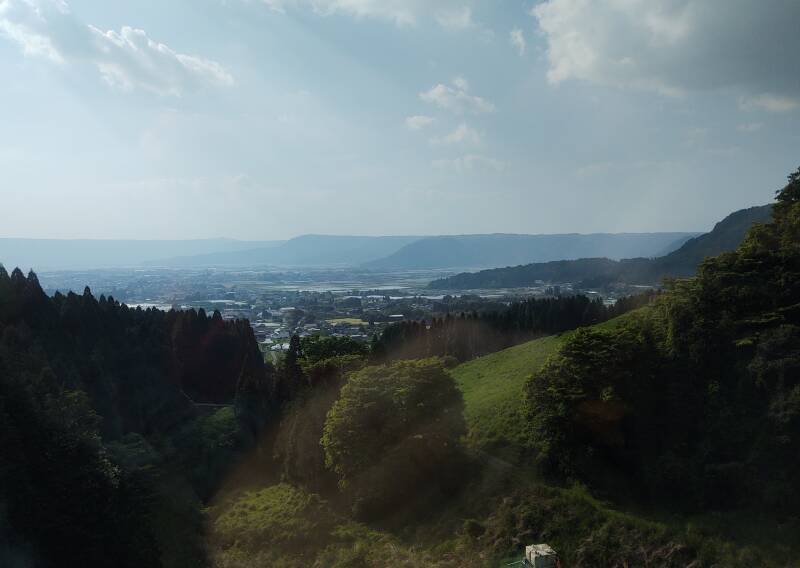
Eventually it was time to catch a train back to Ōita. There was a nice view back over the north half of the Aso Caldera as the train passed between the two long sloping tunnels.
The giant pteradon Rodan inhabits Aso-san in the kaiju films. I did not spot Rodan during this visit.
Other topics in Japan:
Amazon 1839059796
Amazon 1640975438


The Thira explosive eruption of approximately 1600 BCE ejected an estimated 60 km3 DRE. Many still credit that with ending the Minoan civilization, although it caused little direct damage to the main Minoan settlements on Crete. The Minoan civilization continued much the same until the Late Bronze Age Collapse of the 12th century BCE.