
Ōfune Site
Jōmon Culture on the Coast of Hokkaidō
I had seen a major settlement of the prehistoric
Jōmon culture
outside Aomori,
and now I had crossed the Tsugaru Strait to Hokkaidō
to see more.
I was staying in Hakodate.
From there it's an easy bus trip to visit two Jōmon
settlements overlooking the Pacific Ocean.
The first of those was the Ōfune Site,
across the peninsula north of Hakodate.
A bus from Hakodate runs along the coast highway
where they're located.
One site is at Ōfune, shown on this map,
the other is a pleasant four kilometer walk
southeast along the coast road.

Small section of Tactical Pilotage Chart F10-C from the Perry-Castañeda Library Map Collection at the University of Texas at Austin. This map was compiled in 1964. In the past, Hakodate has also been spelled "Hokodate", "Hakodadi", and who knows what else in romanji, phonetically spelling Japanese with the Latin script. It probably was an Ainu place name in the beginning. The #99 bus runs northeast from Hakodate, over the mountains to Kakkumi on the Pacific coast, then northwest along the coast road past Ōfune.
By Bus to the Ōfune Site
You want Bus number 99. Get on it at the beginning of its route, in the large bus lot in front of Hakodate Station.

The Tourist Information Office in the JR Station had given me an English-language schedule of the buses to these two Jōmon sites plus some other points of interest along the coast. Here's part of the schedule they gave me in early May 2024. The simple version: I left Hakodate Station at 10:20 and rode to the Ōfune Site. I saw it and walked to the Kakinoshima Site. Then I started back on the bus from there at 15:56 and got back to Hakodate Station at 17:25. In more detail, using bus stop names that you can find on Google Maps, outbound from Hakodate Station to the sites:
| Hakodate Station stand #6 |
Kakinoshima Iseki Shita |
Ōfune Iseki Shita |
| 06:57 | 08:28 | 08:36 |
| 10:20 | 11:50 | 11:58 |
| 12:35 | 14:05 | 14:13 |
Returning from the sites to Hakodate Station:
| Ōfune Iseki Shita |
Kakinoshima Iseki Shita |
Hakodate Station stand #6 |
| 11:19 | 11:27 | 12:56 |
| 13:34 | 13:42 | 15:11 |
| 15:48 | 15:56 | 17:35 |
Both the first outbound and first return trips listed above involve boarding bus #225 and then changing from it to #99 at Minamikayabe Shisho Mae where the buses make a slightly longer stop. Make sure to tell the driver where you want to go, and they will help you make the transfer.
I had asked them about paying for the bus with my electronic contactless smart card that was good for transportation through much, but not all, of Japan. "IC card" they call them in general, Suica is a popular specific version. Was mine accepted by the Hakodate bus system? Yes!
If you're going to pay with cash, get a paper ticket as you enter the rear door of the bus. The ride was ¥1400 from Hakodate to Ōfune, ¥1270 from Kakinoshima back to Hakodate.
Here comes the bus, exactly on time!

It had the standard system, a panel above the windshield with the list of stop numbers. As the bus progresses along its route, numbers appear below the stop numbers as they're reached. They show the amount you would have to pay if you got on at that stop and got off at the next stop. Since I got on at stop #1, my payment would be in the upper left corner below the "1".


Electrical engineers always have plenty to see in Japan. Power lines are prominent, and microwave and telecommunications towers are painted alternating white and Aviation Orange. And, you will spot multi-band HF antennas used by amateur radio operators.

We wound around the northeastern suburbs of Hakodate for almost forty minutes before leaving the city. Then we were suddenly in forested mountains.


We stopped for a few minutes at Minamikayabe, on the Pacific coast. Then we turned to the northwest on highway 278, running along the coast.
I got off at the Ōfune Iseki-shita bus stop. This was easy, Google Maps seems to know all the bus stops. From there it's about 250 meters to the road leading up the steep slope to the site, about a 35 meter ascent.
Here's the view over the homes along the coast road.

The Ōfune Site
There is a small museum at the site. The below map is near it. The coast road is along the bottom of the map, another road running parallel to the coast arrives at the inland perimeter of the site.
You can see how the site was on a roughly rectangular projection of land, fairly flat on top with steep slopes down on three sides.
The elongated brown and tan areas are earthworks. Yellow ovals are reconstructed pit dwellings, smaller dark yellow ovals are unreconstructed dwellings, and green circles are pit dwelling sites visible today. The road from the coast runs along the red site boundary along the left side of the notch in its side toward the coast.

Where was the farming area? There wasn't much of an agricultural area. Cultures function in widely varying ways. Archaeology is heavily influenced by models that British and German archaeologists devised for ancient Greece and the lands mentioned in the Bible. "Near East", "Bronze Age", and other terms don't apply in general.
The Jōmon were similar to cultures of the west coast of the Americas. They developed a complex society and fed it through fishing, hunting, and gathering naturally growing plants. The adjacent forest had chestnut and walnut trees, and their nuts were used as food. The chestnut trees were also used as building material. They seem to have been brought to Hokkaidō early in the Jōmon period, soon after 14,000 BCE. See the paper "Advances in Understanding Early Agriculture in Japan" for more.
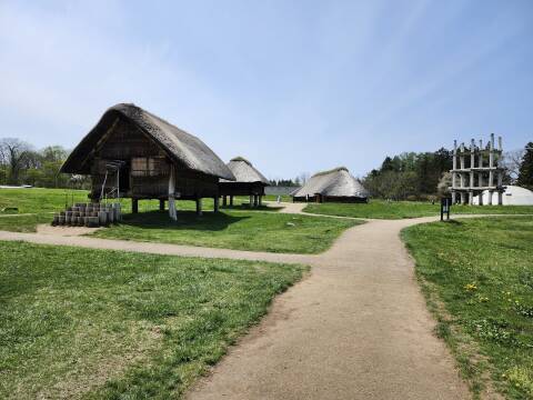
Here's the view as you reach the site. This settlement was inhabited from approximately 3500 to 2000 BCE.

You can read about some details of the archaeology and reconstruction of Jōmon dwellings on the page describing my earlier visit to the Sannai Maruyama Site outside Aomori.
The dwellings here were built over somewhat deeper pits, some of them up to two meters deep. For this reconstruction they preserved the excavated pit and reconstructed a typical framework, leaving it at that stage.

For this dwelling, they have only preserved the excavated pit. You can see the holes for the vertical support posts and remnants of the hearth. Notice how the pit is shaped sort of like an egg, an oval taping toward the far end.

An exhibit in the small but excellent museum at the site explains how the dwelling designs changed over the site's long occupation.
The dwellings can be divided into three categories, I-III, based on the presence and form of a "ritual facility". That's what I would call an altar with a post. It was placed opposite the entrance in the rear of the structure. In category II the post was a thick stone pillar. In category III the post was a thin carved wooden cylinder.
Those altar-based categories can be further subdivided into five subcategories of time period based on pottery type and dwelling design. That's A-E in chronological order as labeled in this exhibit in the small on-site museum.
Some of the dwellings lacked the altar in the earliest stage A, but after that all had an altar of category II or III. The site's development showed a continuous evolution of pottery and dwelling design, showing that the Jōmon people lived in this place for a long time.

This one is a much more complete reconstruction, like most of what you see at the Sannai Maruyama Site outside Aomori. Bundles of thatch were tied together, then lashed to the framework in overlapping rows.

You can't go in, but you can look in.

Eight support posts are visible, plus two more out of the frame on either side of the door, so this is going to be type III-E. There's the hearth lined by stones with a black pot in it. Beyond that, between the two farthest support poles, is the altar. It would have been a later one with a carved wooden stick.

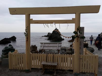
On my second solo trip to Japan, I knew that Shintō was a defining part of Japanese culture. So, I went to Ise.
Shintō is an activity, it doesn't really align with what English speakers mean by the word "religion". But Shintō cosmology says the universe was created near Ise and the creator gods are enshrined there. It is where the Yata no Kagami is kept, a sacred bronze mirror that is the most precious of the Imperial Regalia of Japan. Those are three objects that Amaterasu, the goddess of the sun, gave to her grandson for him to give to his great-grandson, Jimmu, who became the first Emperor around 600 BCE, all of this according to the official mythology.
Relics seem to always turn silly. Depending on which inventory you reference, Medieval Christianity venerated up to eighteen foreskins of Christ.
The other two pieces of the goddess-provided regalia are Kusanagi no Tsurugi, the stone sword kept in Nagoya, and Yasakani no Magatama, the comma-shaped jade bead now kept at the Imperial Palace in Tōkyō. The three are kept hidden away, only seen by the new Emperor and a few top priests during a coronation ceremony. The mirror may have been melted into a lump in a fire in 1040 CE, but whatever remains of it is in Ise. Probably.
There are two primary shrines at Ise, the Outer Shrine and the Inner Shrine, plus 123 other shrines, the whole collection being called the Grand Shrine.
Every individual shrine site at Ise is actually a pair of identical adjacent sites, one with the current shrine. Every twenty years, an identical shrine is built on the adjacent empty site. The enshrined kami is placed in a portable containment device and transferred across to the new structure, and the old shrine is disassembled. Its material is distributed to shrines across Japan to be incorporated into their structures.
So, the shrines of the Grand Shrine of Ise are ancient, literally of prehistoric design, but at the same time they're always new.
Between construction and deconstruction phases, that empty field, the kodenchi, is covered with smooth stones, dark stones along the borders and white stones where the next shrine and its approach will be built.
A small hut, the oi-ya, stands at the center of the empty stone-covered area. It contains a wooden pole called the shin-no-mihashira, no more than two meters tall and always hidden from view. That will be the sacred central pole within the new shrine structure's innermost sanctuary.
The textbook Ise: Prototype of Japanese Architecture says:
The erection of a single post in the center of a sacred area strewn with stones represents the form taken by Japanese places of worship in very ancient times; the shin-no-mihashira would thus be the survival of a symbolism from a very primitive symbolism to the present day.
Maybe so ancient that it comes from a time before the Yayoi people began crossing from the Korean peninsula and arriving in southern Japan around 1000–500 CE. The Yayoi are who we think of as the ancestors of the Yamato, the modern Japanese people. Maybe the hidden sacred pole of Shintō goes all the way back to the Jōmon.

The site overlooks the Pacific Ocean. The people obtained food through fishing and whaling, in addition to hunting and gathering plants and nuts. Salmon swam up the adjacent river in autumn, and there was a wide variety of sea life along the ocean coast. It was a good location.

Over 100 pit dwellings of varying sizes have been discovered here, along with large middens of discarded food byproducts. The pit dwellings here and at the Kakinoshima Site were dug deeper than at other settlements, up to two meters deep. That makes them more evident today.

Pottery from the Tōhoku region of northern Honshū and central Hokkaidō have been found in graves here. The settlement was connected to a broad maritime trading network.

What you see today is just a tiny part of the settlement and its surrounding forest. More graves and storage pits have been found further inland. The full extent of the Ōfune Site and associated settlements covers an area of almost 72 square kilometers.

This site dates from the late development stage of Jōmon sedentism, settling down to form communities in fixed places. This specific site is thought to be a hub settlement, with its large earthen mounds used in rituals by people living here and in surrounding associated settlements.

The middens contain bones of marine mammals including whales and fur seals, and of fish including tuna and salmon, plus shellfish shells and remains of varying nuts.

Walking Along the Coast to the Kakinoshima Site
I had kept my plans open-ended. I had come to the Ōfune Site on my first full day in Hakodate. I might see it and then need to head back to Hakodate, returning to visit the Kakinoshima Site on a second day.
However, I felt that I had taken in as much as I could at the Ōfune Site. I certainly could walk along the coast road to the bus stop below the Kakinoshima Site and be there in time to catch the bus back to Hakodate. Much more time than needed, as it turned out. And so possibly, not necessarily, also see the Kakinoshima Site on this day.
There was plenty for me to see and do in Hakodate on my second day there. Or, if I needed to, I could instead return to the Pacific coast for a second day.
I started down the hill to the coast road. I would see how it worked out.

It's four kilometers along Highway 278, the coast road, from the Ōfune Site to the Kakinoshima Site. Google Maps really doesn't want you to walk that way, ask it for a routing by car if you want to see that it's an almost perfectly level walk of just four kilometers.
Looking to the left, to the northwest, there was the route further up the coast to the northwest. But I needed to go the opposite direction.

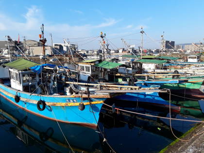
Here was the way I needed to go, southeast along the coast. Wow, look at all the floats! This was a spread-out fishing community all along the coast road. Fascinating stuff for me, completely unlike where I live!

What's this? Some sort of antenna, obviously. But exactly what sort? I don't know...
VHF, from the element length. But navigational? Two-way voice? I don't know...

Looking ahead, there's the point of land immediately behind where the road curves off to the right, another point well beyond that projecting to the left edge of the picture, and in the far distance, a third point that is suggested but not at all visible in this picture.
I would be walking to the second point, the one extended to the left edge of this picture.

This was a working fishing area. Boats needed to be launched and recovered.

Here was something that I don't see every day — racks of drying kelp.

On I went. Look what happens to the road.

I had noticed this on the bus ride to the Ōfune Site, as we had passed through here going northwest.

Yes, it's a tunnel. And yes, there is as sidewalk through the tunnel. I had paid close attention while riding the bus through here earlier. I think Google Maps concludes that walking is impossible along this stretch of road. Ask it for a driving route if you want to learn about the road. But there is a sidewalk, separated from the road by a sturdy railing.

I emerged unscathed from the southeast end of the tunnel. Now my goal was the next point of land ahead.

Why is Japan so very clean, so free of litter? I think that the full explanation is complicated. But part is that people in Japan do many things to better get along in a densely populated environment. And, there are many "nudges" as psychologists call them, not harsh but gently advocating better behavior. For example, this kawaii octopus telling us:

Fishermen lived along here, look at all the floats.

And the stacks of basket-like nets.

And the racks of drying kelp.

I had reached the point along the coast road below the Kakinoshima Site, and I seemed to have plenty of time to explore it and then catch the bus back to Hakodate. See the next page for what I saw there.
Next❯ The Kakinoshima Site, another prehistoric Jōmon settlement
Other topics in Japan:
This was the last trip for my PASMO card, an IC card that I had purchased in 2017, and which was scheduled to be phased out in August 2024.