
By Train to Yamagata
Three Trains from Sapporo to Yamagata
I had been in Japan for about two and a half week
seeing new things —
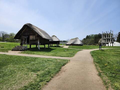
remnants of the prehistoric Jōmon people
around
Aomori
and
Hakodate,
and
Otaru
and Sapporo further north into Hokkaidō.
Now I would travel south to return to two places I had
visited on previous trips.
First, the temple complex of
Yamadera.
After that, the beach town of
Kamakura.
I started by traveling from Sapporo to Yamagata,
the city close to Yamadera.
This would take most of the day,
involving three trains —
a Limited Express to Hakodate,
Shinkansen from there to Sendai,
then a local train through the mountains to Yamagata.
The schedule was:
0843 -- 1219  Sapporo -- Shin-Hakodate-Hokuto
1248 -- 1529  Shin-Hakodate-Hokuto -- Sendai
1545 -- 1714  Sendai -- Yamagata
Google Maps dynamically generates the map when you load this page. Depending on what time it is in Japan, you may see buses by a different route instead of my three-train trip from Sapporo to Yamagata via Shin-Hakodate-Hokuto and Sendai.
Through Pole Town to Sapporo Station
I had been staying on Tanukikoji, a covered shopping street 14 blocks south of Sapporo Station. Because I was carrying my backpack and computer bag, I rode an escalator down to Pole Town, a 1.5-kilometer subterranean passage lined with shops and restaurants. It was early on a Sunday morning so most of the businesses were closed, not so interesting but it was an easy walk without having to cross any streets.

Japanese prehistory had been a taboo topic, as the science would contradict the myth of the divine origin of the Emperors. But after Hirohito's death in 1989, and his son and successor Akihito having repeatedly disparaged the divine myths before ascending to the throne, Japanese prehistory became a topic of broad interest. Jōmon style patterns such as their cord-marked pottery showed up in fashion and art. I think Jōmon cord-marking patterns were incorporated into some of these planters.

I soon reached Sapporo Station. I bought my breakfast at a convenience store down in the passage below the station — onigiri, or a triangular rice ball with fish inside, wrapped in nori algae sheet, plus a bottle of green tea. Then I was ready to pass through the JR Hokkaidō ticket gate.

You get a stack of tickets for a train trip. The entire reverse side of each is a magnetic surface. At the bottom in this picture is the ticket for the overall end-to-end trip from anywhere in Sapporo to anywhere in Sendai.
At the top is the ticket for my reserved seat on the Hokuto Limited Express from Sapporo Station to Shin-Hakodate-Hokuto Station. Train Hokuto 6, car 5, seat 10-D.
In the center is the ticket for my reserved seat on the Shinkansen super express from Shin-Hakodate-Hokuto Station to Sendai Station. Train Hayabusa 28, car 7, seat 7-E.
You feed them into the machine as a stack in any order and any orientation. That opens the barrier, you step through, and pull out what remains.

Hokuto Limited Express
Here's my first train of the day, the Hokuto 6 Limited Express leaving at 08:43.

The engineer's cab is up high for good visibility. This is a KiHa 261 series design, a joint venture with Danish State Railways. There's no separate locomotive, it's a seven-car DMU or Diesel Multiple Unit train. Each car has its own relatively small diesel engine.

Time to get on board. Car 5, seat 10-D. The purple stripe outside and the purple upholstery and overhead inside reference the many purple flowers of Hokkaidō.

We rolled out of Sapporo Station precisely on time.

The route would take me through Chitose, past Sapporo's busy airport. The Sapporo–Tōkyō link is in the world's top ten busiest city-to-city air routes. Yes, I could have flown directly from Sapporo to Sendai, and it would have been a little cheaper than the train. But only very slightly cheaper once you add in the airline fees to check a bag and reserve a specific seat, especially a seat with adequate legroom, and also add the airport-to-city-center transport links at each end.
Besides, train travel is much more pleasant and interesting.
The route continued south to the Pacific coast at Tomakomai, along the Pacific coast to Muroran, counter-clockwise around Uchiura Bay to Mori, then south to Shin-Hakodate-Hokuto.
Google Maps dynamically generates the map when you load this page. Depending on what time it is in Japan, you may see buses by a different route instead of my roughly 3.5 hour trip by Hokuto Limited Express from Sapporo Station to Shin-Hakodate-Hokuto Station.
The Pacific coast was foggy at Muroran. I had asked for a left-hand window seat on this segment so I would have nice views of the coast and a volcano we would pass along the way.


I had seen the inter-modal shipping facility at Muroran on the trip north to Otaru a little over a week before. I'm sure that the containers had been rearranged.

The Limited Express makes several brief stops, but passes straight through many stations without stopping. Higashi-Muroran is one of the stations where we stopped to drop off and pick up passengers.

We passed industry and the large port at Muroran.


Muroran is at the east edge of Uchiura Bay opening into the Pacific.

Someone had their fishing poles set up on the beach.

The smaller communities along the coast are focused on fishing.

We rolled through a level grade crossing at Toyo-Ura, part-way around Uchiura Bay.


We continued along the coast beside the highway, passing Ishikura. Look at all the fishing floats!

We passed through Ishikura approaching Mori, where the rail line turns inland to cross the peninsula to Hakodate. That's the 1,131-meter volcano Hokkaidō-Komaga-Take in the distance.

The rail line turned inland at Mori, taking us past Hokkaidō-Komaga-Take. It's a stratovolcano, the variety with the more viscous lava and thus a greater likelihood of an explosive eruption.
For more about the volcano and more views of the coastline, see the page showing the trip in the opposite direction, north from Hakodate to Otaru.

We passed through farmland and forest, past a chain of lakes, and soon we were descending toward Shin-Hakodate-Hokuto. On the horizon is Mount Hakodate, the volcanic mountain looming above the city of Hakodate. Shin-Hakodate-Hokuto Station is well north of the city, where the current end of the Shinkansen network connects to the conventional Hokkaidō rail lines.

Hokkaidō Shinkansen
The Hokuto Limited Express continued to Hakodate Station. I had to be ready to get off quickly because the station stops are no more than a minute and a half long.
You pass through ticket gates into the Shinkansen section of the station. Because that ended the Hokuto Limited Express portion of the trip, the machine retained that ticket. I passed through the gate and retrieved my end-to-end ticket plus the Shinkansen reservation ticket.
The 10-car H5 Series Shinkansen trains look futuristic to me! I'm accustomed to Amtrak equipment built in the early 1980s. Moroccan trains are futuristic compared to what we have in the U.S. But the Shinkansen is on its own level.

This was the northern end of Shinkansen service in 2024. You can look on north along the track to where it disappears into a tunnel.

They were extending the Shinkansen network to Sapporo, but the announced plan had it being finished in 2030 and almost certainly would take longer. It would be another 211 km of track with 160 km of that in tunnels, one of them 26.5 km long.

There's a convenience store in the station, divided down the middle to serve both the Shinkansen and non-Shinkansen sides of the station. Of course the entire trip had been precisely on time, so I had time during the 29-minute layover to pick up a bentō lunch for the next segment. Now it was time for me to get on board.

From here the route went to the southern tip of Hokkaidō and then through the Seikan Tunnel beneath the strait separating Hokkaidō from Honshū. From there, e through Aomori and Hachinohe and then south to Sendai. Much of the route from the beginning to somewhere south of Hachinohe was through tunnels.
Google Maps dynamically generates the map when you load this page. Depending on what time it is in Japan, you may see buses by a different route instead of my 2.5–3 hour trip by Shinkansen from Shin-Hakodate-Hokuto Station to Sendai Station.
There's my backpack on car 7, above seat 7-E, and my computer bag down on the floor. Yes, there are 100V AC outlets at the seats.
I had asked for a window seat without specifying which side. Mine was on the right side with views to the west once we got out of the mostly-tunnel initial segment.

The train was lightly loaded at the beginning of the trip, people continued to board as we went south.

Through the Seikan Tunnel
Back in the 1910s the Imperial Japanese Army General Staff discussed a railway tunnel connecting Japan to Korea. In the mid to late 1930s, with things going well militarily for Imperial Japan, there was talk of a Greater East Asia Railroad connecting Japan to East Asia and onward through the Soviet Union to Germany, with branches to Southeast Asia, Afghanistan, India, Baghdad, and İstanbul.
A much more modest (and realistic) idea was a tunnel connecting Hokkaidō and Honshū, which returned to consideration in 1946 with initial geological surveys. Five ferries sank in the Tsugaru Strait during Typhoon Marie on 26 September 1954, killing an estimated 1,430 people. That led to Japan's national railroad accelerating the tunnel planning and survey work.
My trip on theAomori—Hakodate
ferry
The booming post-Occupation economy led to increasing cross-strait ferry traffic. From 1955 to 1965 the number of passengers doubled and the amount of freight increased by 70%. The decision to start the tunnel was reached in September 1971, when traffic forecasts predicted growth that would exceed ferry terminal capacities.
The Channel Tunnel joining Britain and France is shorter overall but with a longer undersea segment.
The Seikan Tunnel opened in March 1988. It's 53.85 km long with 23.3 km of that running under the seabed of the Tsugaru Strait. It's the world's longest undersea tunnel in terms of overall length. It runs about 100 meters below the seabed, about 240 meters below sea level, making it the second-deepest undersea tunnel after the Ryfylke Tunnel in Norway.
The Seikan Tunnel was sized to handle Shinkansen trains, but initially only had two narrow-gauge tracks carrying conventional passenger and freight trains. They added third rails so now there are two dual-gauge lines through the tunnel. In March 2016, Shinkansen passenger service began running through the tunnel and conventional narrow-gauge passenger service stopped. Freight train still use the narrow-gauge rails.

Portion of tactical pilotage chart F-10C from the Perry-Castañeda Library Map Collection at the University of Texas at Austin. The chart was compiled in February 1964 and revised in April 1987. The tunnel opened in March 1988.
The Seikan Tunnel can be interesting to read about, but there's nothing to see as you ride through a dark tunnel. It was time for my bentō lunch. Onigiri rice ball as a starter, Hokkaidō crab over rice, and Sapporo.

The onigiri had the salmon mixed into the rice, with the nori wrapping one end.


It came with oshibori or moistened towel and hashi or chopsticks, with a toothpick.
The meal had crab meat and bamboo shoots over rice, with what I think was pickled plum.

By Shinkansen Through Tōhoku
The northernmost segment of the Hokkaidō Shinkansen is on dual-gauge track, which means that a high-speed Shinkansen might pass a narrow-gauge freight train. The problem is that the shock wave from a full-speed Shinkansen passing on an adjacent track might tip over a narrow-gauge train. So, the Shinkansen has been limited to 160 km/h on the dual gauge section.
They started operating at the higher speed of 260 km/h during major holiday periods in 2024. There are plans to run at that speed routinely, either by automatically slowing a Shinkansen to 200 km/h when approaching a narrow-gauge train, or by loading a narrow-gauge train onto special "Train on Train" standard gauge carrier cars.
But, for my trip, we were limited to 160 km/h through the dual-gauge section, which I think extended all the way from Shin-Hakodate-Hokuto Station to Shin-Aomori Station, where we made our first stop.
South from there we were still limited to 250–260 km/h, loafing along by Shinkansen standards (although well over twice the top speed of Amtrak where I live).

We stopped at Hachinohe, near Misawa, then continued south to Morioka.

We made a brief stop in Morioka Station.

Then we continued south, passing rice paddies as we did all along the route between Aomori and Tōkyō.

South of Morioka the Shinkansen can run at full speed. We were moving at 315 km/h soon after starting out of Morioka Station. The Shinkansen doesn't haven't locomotives, every car is powered. That allows for much faster but smooth acceleration and deceleration.


We were soon coming into the north side of Sendai. I had to get my things together and stand close to the door in order to get off during the short station stop.

Local Train Through the Mountains
At Sendai I exited the Shinkansen section of the station, passing through a ticket gate that retained my Shinkansen ticket and leaving me with just the conventional end-to-end ticket.
I went down a level or two or three to the local platforms. I would take a Senzan Line local train west through the mountains to Yamagata.
Google Maps dynamically generates the map when you load this page. Depending on what time it is in Japan, you may see buses by a different route instead of my roughly 90 minute trip by local train from Sendai Station to Yamagata Station.
This aeronautical chart shows roads in dark red and rail lines in black. You can see where the line passes through a long tunnel north of a 4,481-foot mountain peak. The Yamadera temple complex is a short distance to the west of that. Further west the rail line leaves the mountains for the broad valley running north from the city of Yamagata.

Aeronautical chart TPC G-11B from the Perry-Castañeda Library Map Collection at the University of Texas at Austin.
Here's my train at the platform in Sendai Station, the 15:45 for Yamagata.

These trains are fairly open inside with a variety of seating.

Clouds and heavy rain moved in during my brief time in Sendai Station, so the rest of the pictures here are from a few days later when I reversed the trip on a sunny morning.
The Senzan Line was built in the mid 1930s, when steam locomotives were used. It has a 5,361-meter tunnel, which would have subjected passengers and staff to smoke and fumes. So, this line was built with DC electric power and electric locomotives were used from the beginning.
Most of the line is a single track, and it takes about 90 minutes for a train to cover the entire run between Sendai and Yamagata. Meanwhile, trains leave both ends hourly throughout the day. Some east-bound trains hold for a few minutes at the Sakunami Station, waiting for a west-bound train to exit the tunnel. There has been a locomotive depot here since the line was first built. When AC electric power was first coming into use in the 1950s, this line was used to test the new technology. Then this station became a connection point where trains switched between DC and AC power.


We were soon moving through the steep forested terrain.


The train stops at the temple complex of Yamadera, which I would visit in the following days.
It exits the mountains soon after Yamadera, moving into the broad agricultural valley running north from the city of Yamagata.

When I tried to exit through the ticket gate at Yamagata Station, it returned the ticket to me and displayed a message sending me to the Fare Adjustment Window. My end-to-end ticket had been valid to the Sendai City Zone, but Yamagata was outside of that.
No problem, no penalty, this is what everyone does. Have enough of a ticket to start the trip, and pay any additional needed at the destination. I owed another ¥1,170, the equivalent of US$ 7.50.
Other topics in Japan:

If you do the math with the prices on the tickets shown above, the train was a total of ¥24,310. At that day's exchange rate of ¥156/US$, the journey cost US$ 155.83, I thought that was very reasonable. An airline ticket, including fees and taxes and airport transport at both ends, would have been a about US$ 135.