Petroglyphs
Petroglyph National Monument
Petroglyph National Monument
contains a variety of cultural and natural features
along the West Mesa, a volcanic basalt slope
along the west side of Albuquerque.
It contains an estimated 24,000
petroglyph images
created by early Pueblo people through
the early Spanish settlers.
What do the images depict, what do they mean?
We don't know what they mean.
Many are obviously birds or animals or humans.
But other than the religious symbols created by some
of the Spanish,
the rest very likely had very specific meanings
to their creators
but we have no idea what that was.
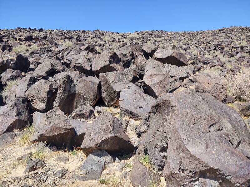
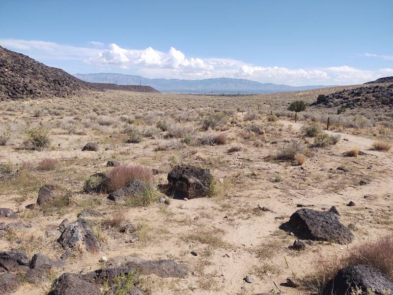
About 200,000 years ago, a series of six volcanic eruptions created a basalt cliff, 27 kilometers long. During those eruptions, labal from 1.5 to 15 meters deep flowed through some old water-eroded valleys, forming basalt channels as the lava flowed around hills. All of those hills have completely eroded away, leaving the basalt channels.
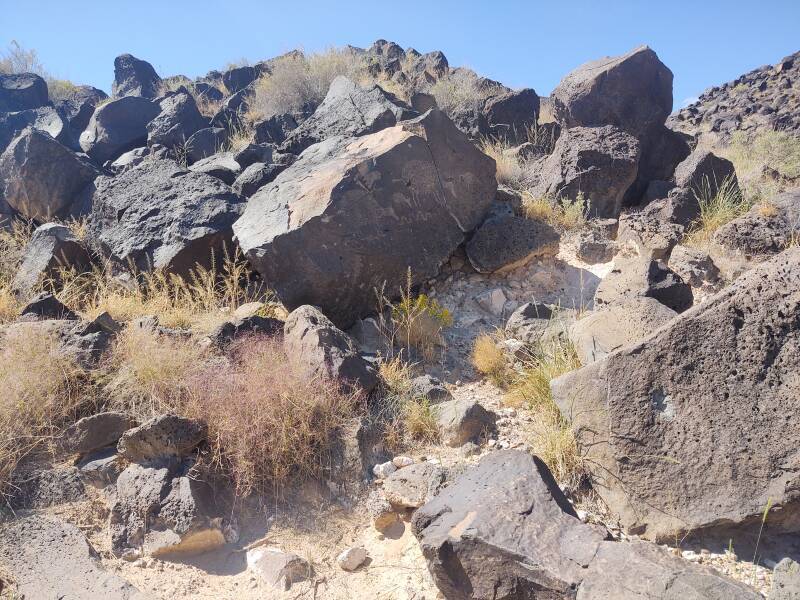
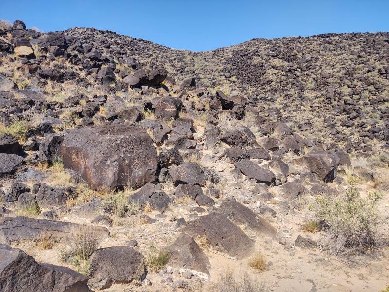
This is the Rinconada Canyon area within the monument. There's a loop trail that leads back to the far end of this canyon, 2 kilometers away
The basalt cracked, forming escarpments and individual boulders.
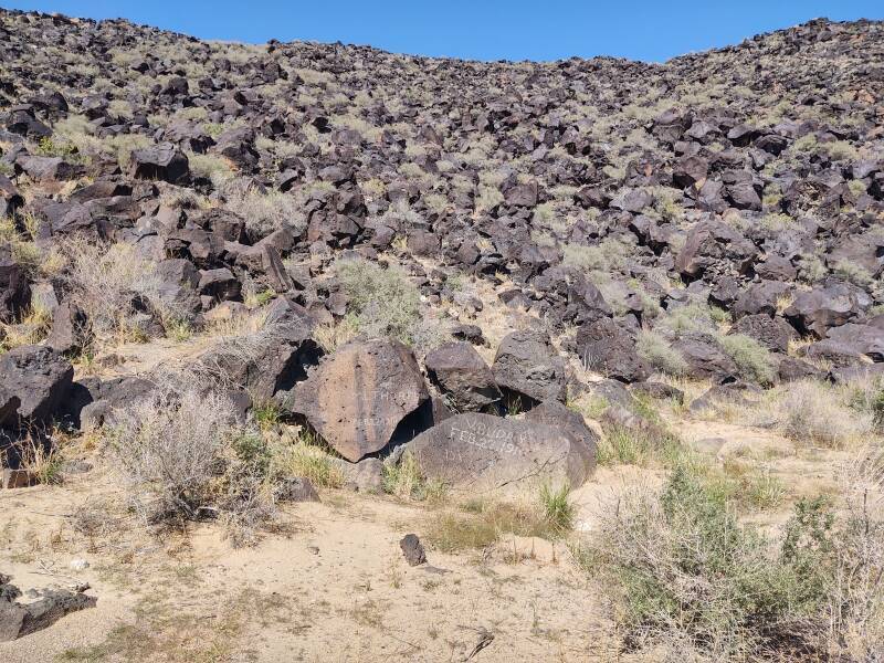
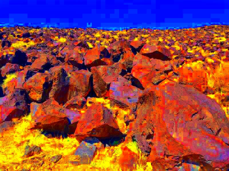
The volcanic basalt contains high concentrations of iron, manganese, and calcium. That forms stone with a grey color. Over thousands of years of exposure, a so-called desert varnish forms on the surface. The "varnish" is caused by the oxidation of the iron and manganese, and is very dark. To the eye in that environment it can look like a slightly purplish shade of dark brown.
Below is the result of greatly increasing the saturation of that image with the ImageMagick package.
$ convert -modulate 75,800,100 \
	petroglyphs-20231010-123705.jpg petroglyphs-20231010-123705.jpg
Yes, oxidized iron and manganese. The sky is blue, the ground and plants are yellow, and the stone is dark red with spots purple ranging into blue. Blue patches on the stones? I took these pictures with my mobile phone, not a lab-grade spectrophotometer.
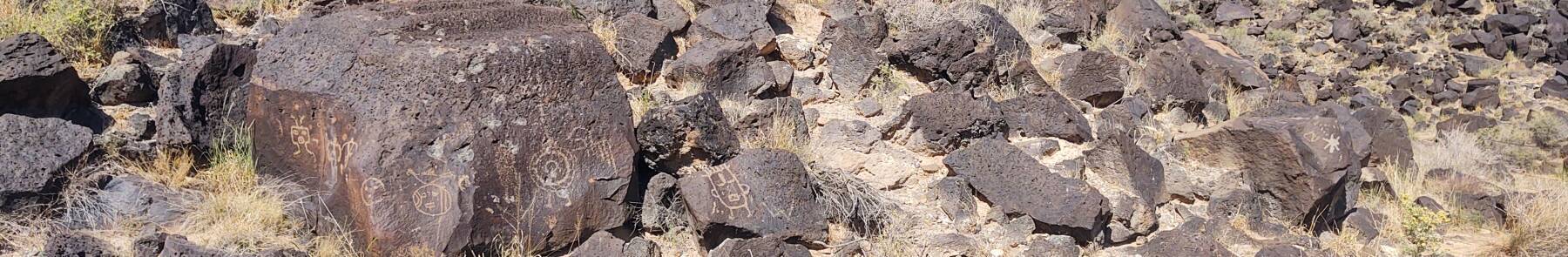
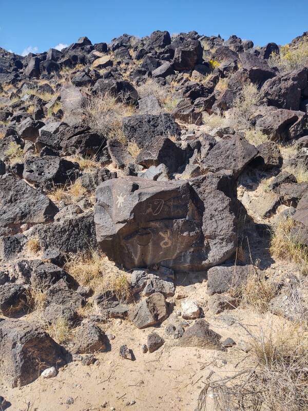
The Native people long ago realized that you could use a hand-held hard pointed rock to "peck" patterns into the desert varnish. Remove the dark outer surface at each impact point, and you expose the lighter grey basalt. It's manual dot-matrix impact printing from millennia ago.
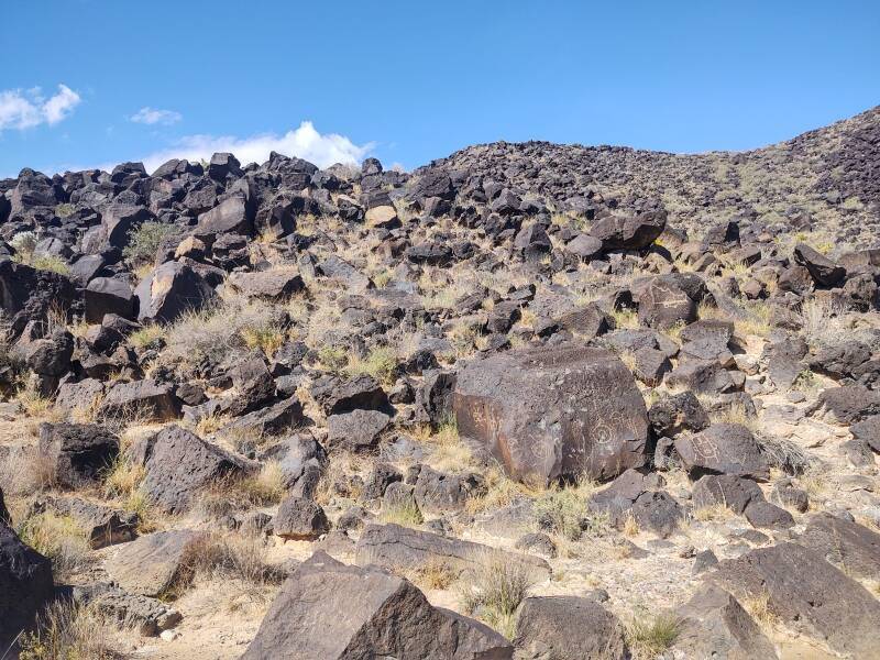
There's a spiral on this rock. Spirals are seen around the world in prehistoric and shamanic art. We have no idea about the precise meaning of this spiral to the artist who created it.
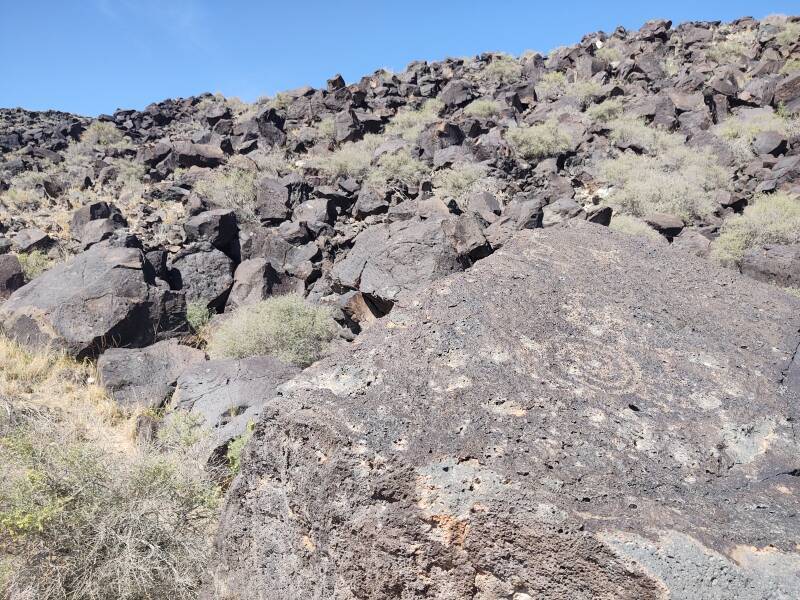
Archaeologists have dated some of the petroglyphs as far back as 3,000 years ago. They base the dating on the extent to which the exposed basalt has re-oxidized, replacing the "desert varnish" and erasing the design.
Here is the same processing applied to the above picture. You can see how the large areas between the viewpoint and the spiral are a bluish grey, while the spiral is more of a yellow to orange shade, oxidizing back to the red "desert varnish" covering most of the surface.
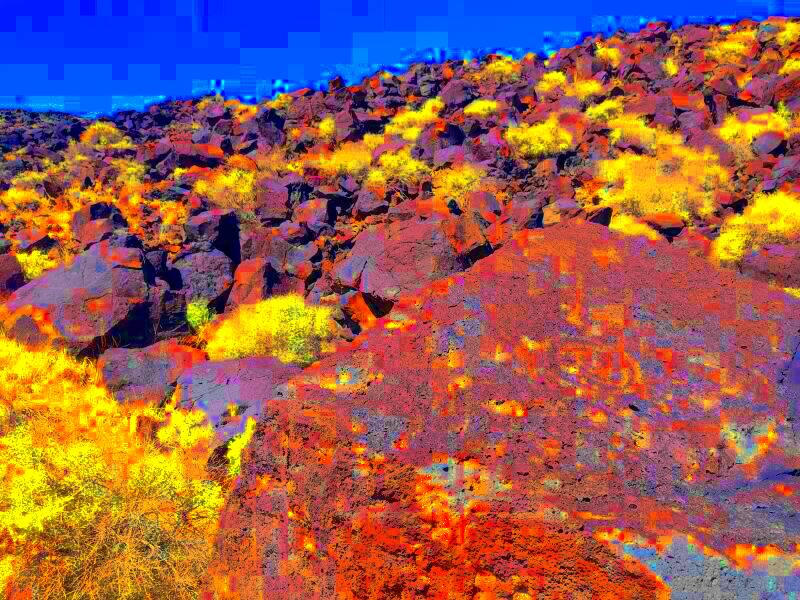
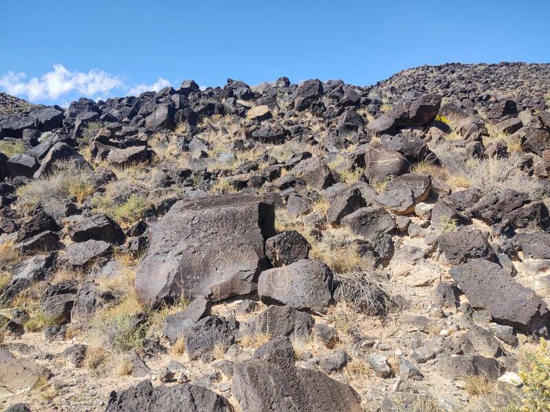
Motifs and styles can suggest which petroglyphs are of roughly equal age. Archaeologists estimate that about 90% of what we see today was created roughly from 1300 to 1700 CE. The bulk of the petroglyphs share a common "Southwestern Style". During that period the Native population was growing rapidly. Pueblo adobe settlements were being built along the nearby Rio Grande channel, and further east at the base of the Sandia Mountains.
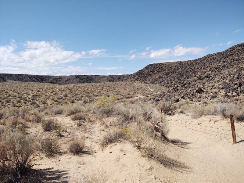
In the below picture I have reached the western end of the 4-km loop trail, I'm looking back out through the canyon to Albuquerque and the Sandia range beyond.
Suburban development threatens the Petroglyph National Monument. The city of Albuquerque has built a 4-lane highway through part of the site, now forming an artificial eastern boundary to it. Suburban housing has been built out to that highway.
About two-thirds of the Monument is on land owned by the city of Albuquerque.
There was an agreement between the National Park Service and the city specifying their respective responsibilities.
However, the city refusts to allow National Park Service rangers to patrol or enforce NPS rules on city-owned land. And meanwhile the city has, of course, severely cut services, including what could have been used to protect the park. Most of the Petroglyph National Monument is left unpatrolled, subject to trash-dumping and vandalism.
I drove south from the millennia-old petroglyphs toward a radio telescope array.