White Sands
White Sands National Park
White Sands is the
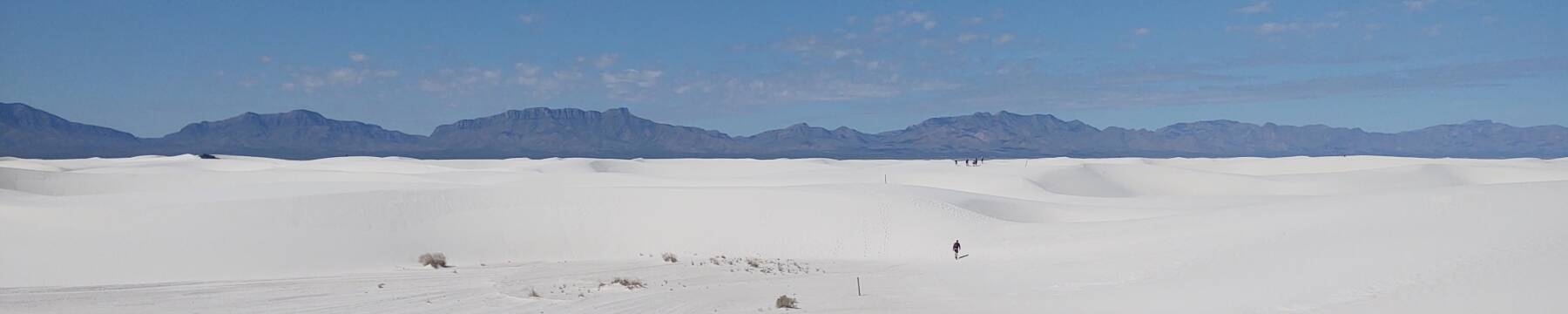
largest area of gypsum sand dunes in the world.
The gypsum sand is about 10 meters deep
with dunes up to 20 meters tall.
Gypsum, the soft calcium sulfate material
CaSO4·2H2O,
is the main component in plaster, drywall,
and blackboard or sidewalk chalk.
Drywall and blackboards are relatively new technologies,
but the Greek referred to plaster as
γύψος
or gypsos over two millennia ago.
White Sands National Park includes almost half of the dunes.
The park is completely surrounded by
the military installations of
White Sands Missile Range and Holloman Air Force Base.
Parts of the National Park are normally off-limits to visitors.
Even park staff and scientists performing research
must receive special permission from the military
to venture into the western half.
The entrance is along U.S. 70
a short distance southwest of Alamogordo.
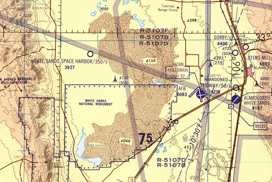
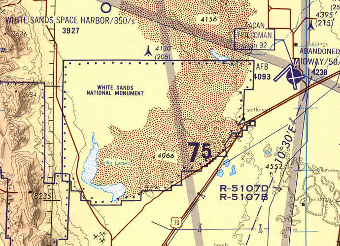
1:500,000 scale Tactical Pilotage Chart TPC G-19C from the Perry-Castañeda Library Map Collection at the University of Texas at Austin. This map is based on data from January 1967. When the map's aeronautical information was revised in 1990, White Sands Space Harbor had been defined. It's a set of three runways on the flat alkali, two of them 35,000 feet long and the other 12,800, used for Space Shuttle training and one operational landing. Rocket launches are nothing new, though. The U.S. Army began launching captured Nazi V-2 missiles from this area immediately after the end of World War II.
During the Permian Period of about 300 to 250 million years ago, shallow seas covered this area. They left behind deposits of gypsum. Tectonic activity lifted those former sea beds to form the San Andres and Sacramento mountain ranges which form the western and eastern boundaries of today's Tularosa Basin.
During the Last Glacial Maximum or LGM, from about 26,000 to 20,000 years ago, lots of water was locked up in thick sheets of ice. Global sea level was about 50 meters lower. A broad strip of dry land called Beringia bridged what today is the Bering Strait, connecting eastern Siberia to Alaska. People and animals could walk from Asia into the Americas.
Over millennia, rain dissolved the water-soluble gypsum and carried it down to the flat basin, which has no outlet to the sea. Around 12,000 years ago, a large lake now called Lake Otero filled part of the basin. The climate was wetter and the temperature more moderate, and vegetation was abundant. Large mammals including ancient camels, Columbian mammoths, and giant ground sloths were attracted to the vegetation. Those in turn attracted predators including the dire wolf and the American lion.
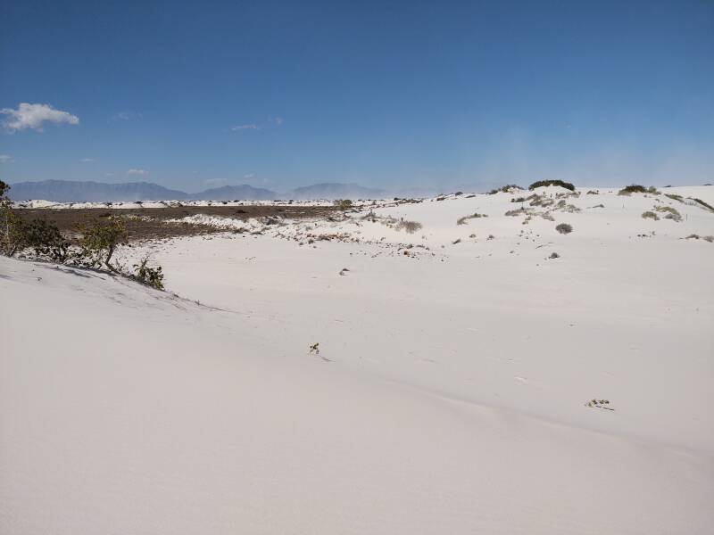
As the water evaporated or sank into the ground, the gypsum remained on the surface in a crystalline form called selenite. Alkali Flat remains as a broad flat selenite surface. The intermittent Lake Lucero is all that remains of the sea-like ice age Lake Otero. Every ten to fifteen years heavy rains partially refill it to about knee to waist deep. That water has washed down from the mountains to the west, containing dissolved gypsum to continue the process.
The crystals are broken up by small particles blown by the strong winds, leading eventually to the fine white sand. Crystals form and break down into sand on the west side, and blow to the east to accumulate as dunes.
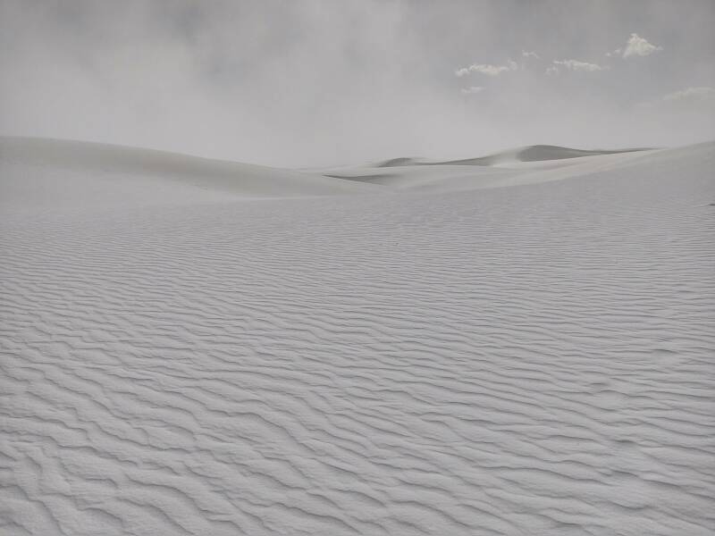
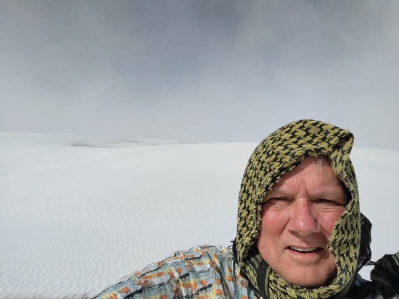
Day One — Into the White-Out
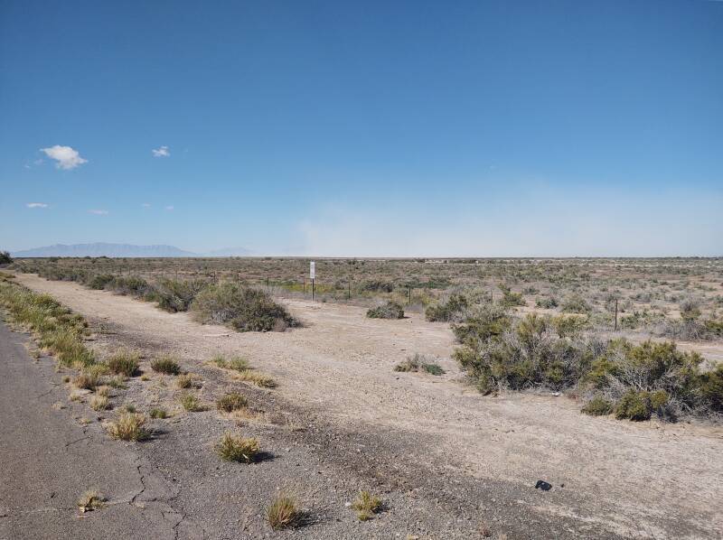
My first day there was windy. Here's the view from where I stopped along Highway 70 on my way to the park entrance. The San Andres mountains are visible in the distance at left. To their right is the dust cloud over the dunes. Fine gypsum particles, basically chalkboard dust, rise hundreds of feet into the air.
The entrance gate and ranger station are along the highway, close to but not within the dune area. The National Park Service provides excellent explanations and suggested itineraries. One of the obvious first stops is at a small playa or dry lake bed.
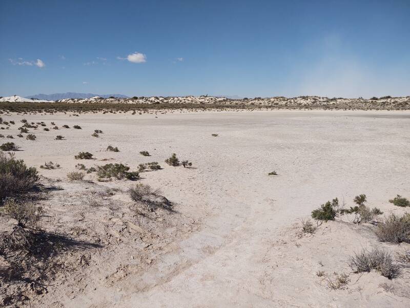
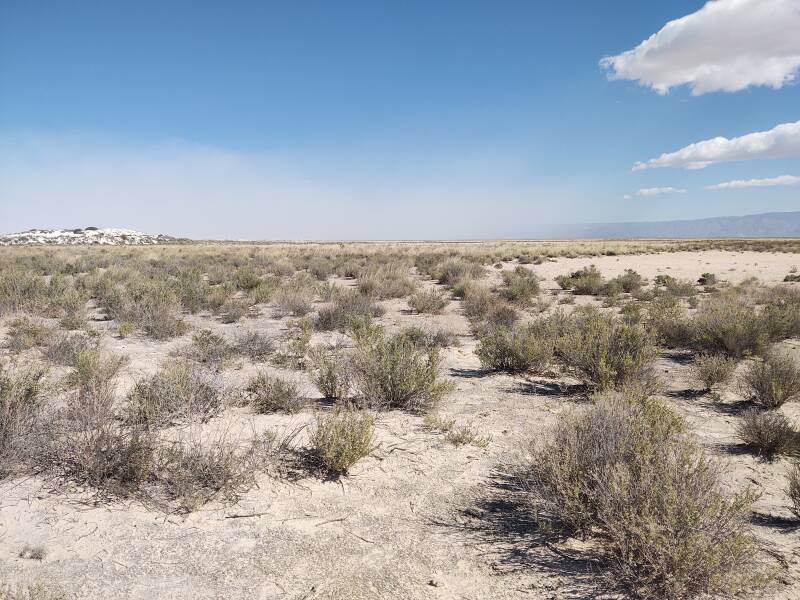
This small playa is just about 200 meters off the road, the first point of interest you reach when driving in from the gate.
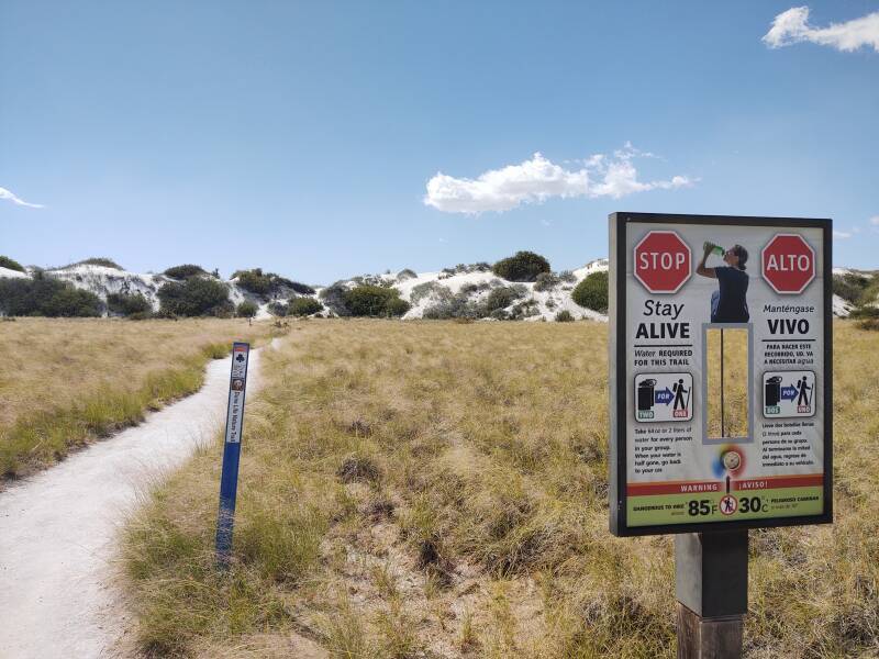
They do what they can to keep visitors alive. Human nature being what it is, people will still manage to get themselves into trouble. But they were warned.
There's a short loop trail across from that small playa. As you walk around the loop you pass several signs explaining, and showing you how to spot and identify, various plant and animal life found here.
Sahara
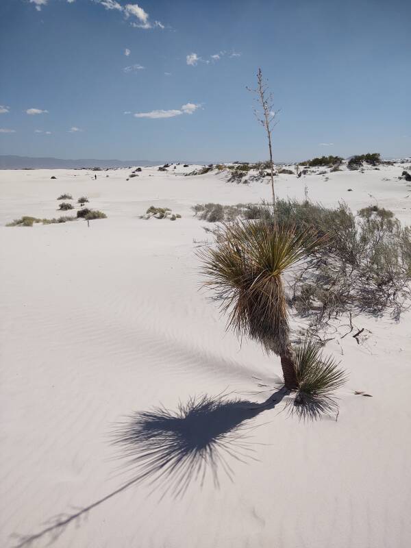
One year before, I had in Morocco and had ventured into the Sahara beyond Mhamid, which is at the end of paved roads. There's a plant there which my innkeeper and desert guide had warned me to never touch, and if I did, to tell him so he could help me clean my hands before I touched my face, because it would quickly blind you. Even the camels won't eat it, which is really saying something. The yucca plants here worried me some, given their slight resemblance to that dangerous plant.
The below segment of a 1:250,000 map is based on data from 1954–1955. It shows the park gate at the highway, then three miles of paved road followed by a slightly longer distance of driveable track with a loop at its end. Those are still there. As for the lead mine and "Walters Ranch", which would have been far more primitive than "ranch" implies, at least to me, those are long gone. The pictures so far have been from either side of the paved road.
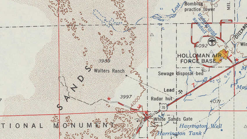
1:250,000 scale Las Cruces NI 13-10 topographic map from the Perry-Castañeda Library Map Collection at the University of Texas at Austin.
White Sands, Holloman, and History
OperationPaperclip
The Trinity test, the first detonation of a nuclear warhead, occurred July 16, 1945, toward the north end of what today is White Sands Missile Range. The missile range gained that name immediately after the end of World War II, when the U.S. brought captured Nazi V-2 missiles, along with captured Nazi scientists and engineers, for test launching in this large and desolate area.
Before long the U.S. Air Force was providing training at Holloman Air Force Base for members of the re-formed German Luftwaffe. That program continued until 2019.
Unit 731If you think the U.S. welcoming Nazi scientists in Operation Paperclip was creepy, wait until you read about Douglas MacArthur letting all the Japanese war criminals involved in Unit 731 go free with no investigation, let alone prosecution, in exchange for the detailed records of their horrific "medical experiments" on Chinese and Russian civilians and military.
Holloman's High Speed Test Track has a rocket-powered sled track that was first used in 1954. It has carried test pilots on open sled runs at speeds up to 632 mph or 1,017 km/hour since later in 1954. In 2002 its main rail system was upgraded to 6,212 meters in length. In 2003 it set the world land speed record for rocket sleds, reaching Mach 6.8, 2,885 meters per second or 6,453.4 miles per hour.
It's a three-rail track, made from heavy-duty crane rail weighing 85 kg per meter. The rail segments are welded, and aligned to within 0.025 inches deviation from perfectly straight lines, making it the straightest system of track ever built.
In August, 1960, Captain Joseph Kittinger stepped out of an open balloon gondola 102,800 feet above the range. It was a test of techniques and technology for extreme high altitude bailout. The jump set four world records: high open gondola balloon flight, highest balloon flight of any type, highest bailout, and longest free fall of 13 minutes, reaching a velocity of 614 mph or 988 km/hour.
In 1992 the first F-117A stealth fighters arrived at Holloman AFB from the Tonopah Test Range in Nevada. They deployed to Italy and Germany in 1999 for war against Serbia, and to Iraq in 2003. The F-117A was removed from service in 2008, and the F-22A was based at Holloman from 2008 to 2014.
Now Holloman AFB is largely used for training pilots and support personnel for the MQ-9 Reaper drone and F-16 fighter.
Into the Dunes
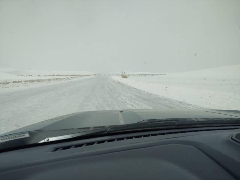
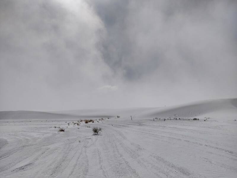
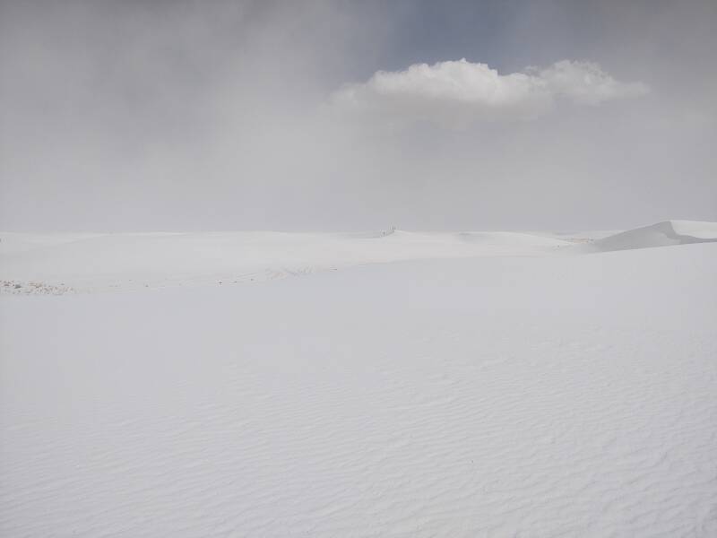
As I said, my first day visiting White Sands was windy. Here's the view a little further along the initial paved section of road. I'm getting into the dusty area and trying to keep it out of my mouth and nose.
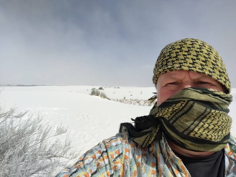
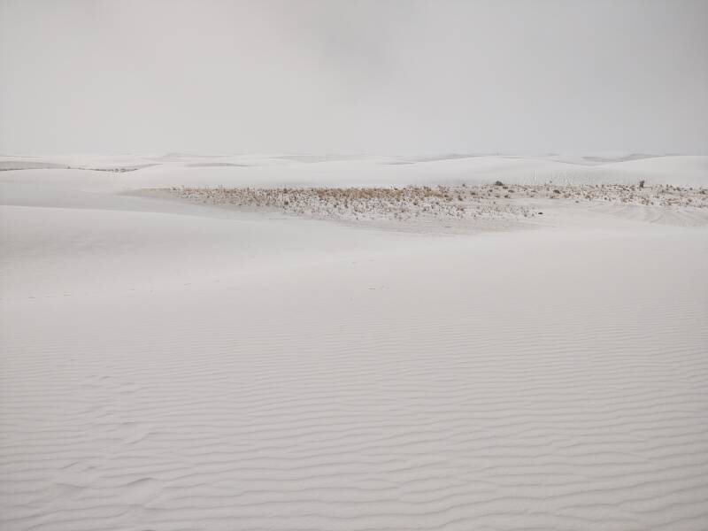
There are patches of hardy vegetation. On a windy day the horizon disappears as it's white powder on the ground below and white powder suspended in the air above.
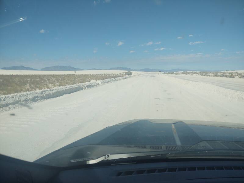
The pavement disappears after the first three miles. The road scraped clear and you're driving on a solidified lower layer of gypsum.
There are multiple places to pull off and park along the unpaved road. This includes a large parking area where you can hike in to your reserved backcountry camping spot.
Near the end of the unpaved road it goes around a loop. At the loop's far end is a large parking area at the trailhead for the Alkali Flat Trail.
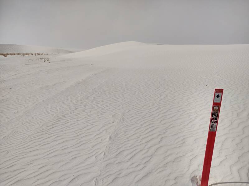
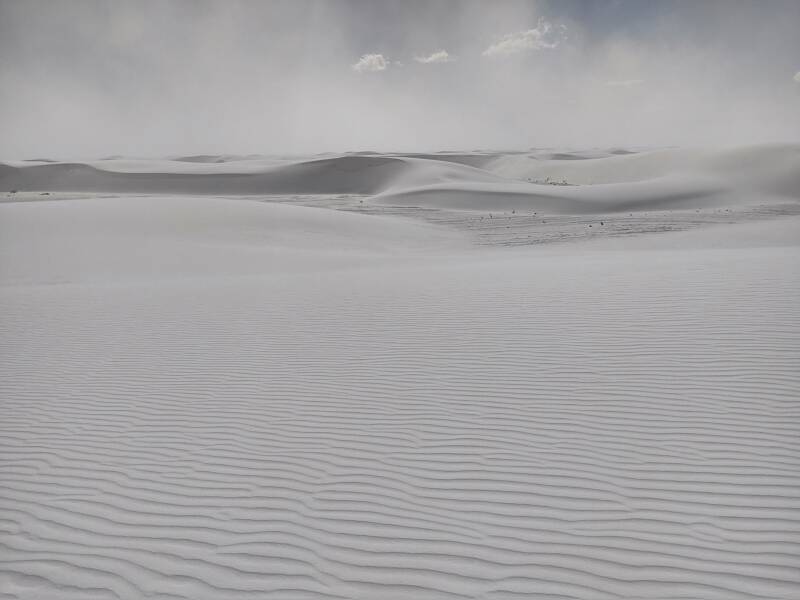
The Alkali Flat Trail is a 5.5 mile narrow loop out and back. It's marked with orange plastic poles or posts like what the New Mexico state highway department puts along mountain roads, such as the route from Los Alamos to Valles Caldera.
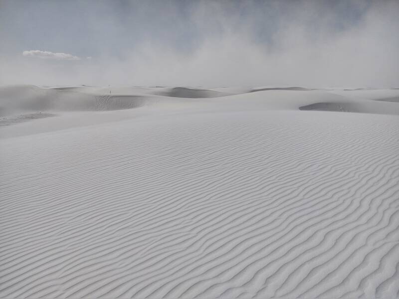
The trails are designated much like ski slopes. The Alkali Flat Trail is marked as a black diamond trail. Overall, you loop out and back with no net change in elevation. But along the trail, it's almost entirely up and down, and it's through very fine, powdery sand. It's very tiring to walk through the dunes, which are up to 20 meters tall. The entire first half of the trail you're headed out, away from any support and any source of water. Other than what you bring with you, the only drinkable water in the park is at the visitor's center at the gate along the highway. Bring plenty of water. Turn back by the time your water is halfway gone.
The gypsum sand dunes are on a base layer of gypsum about 10 meters deep. Gypsum is calcium sulfate, CaSO4·2H2O. It binds with water, so there is actually a fair amount of water locked up in the base layer.
However, the water is chemically locked up in the gypsum crystals. It's not at all as if you can dig down and let water collect for drinking.
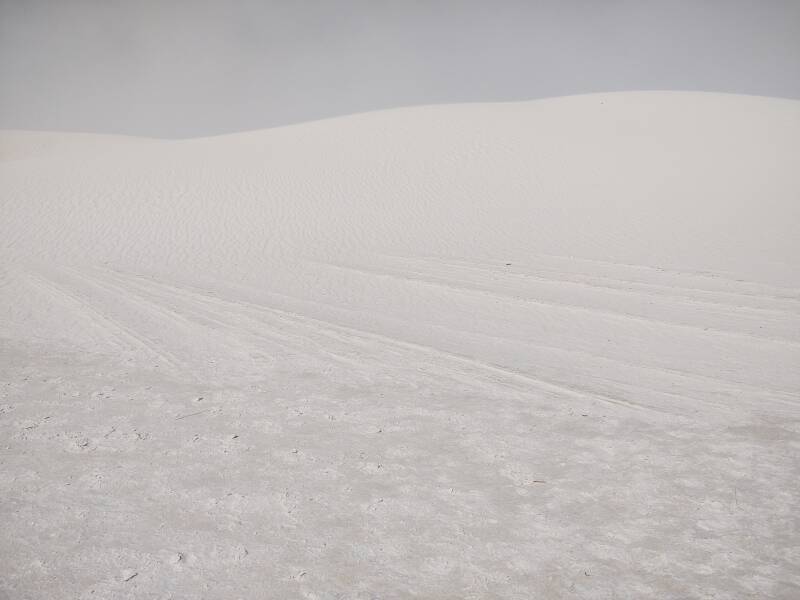
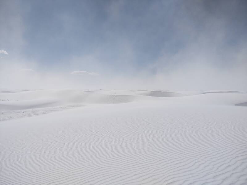
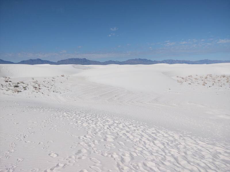
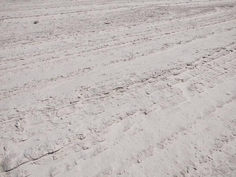
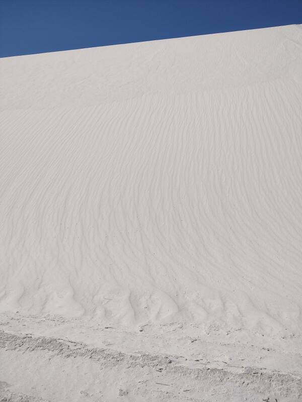
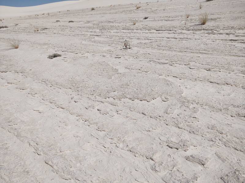
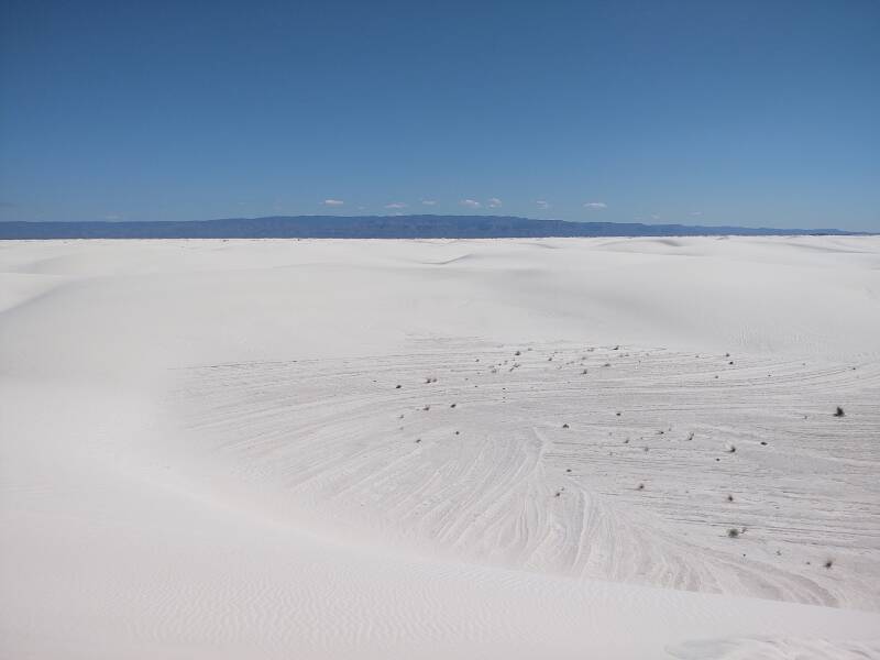
The wind blowing along the hard gypsum base leads to a streaked surface that looks as if the rangers were out here with a piece of equipment scraping the loose sand away. No, this is just what the wind does.
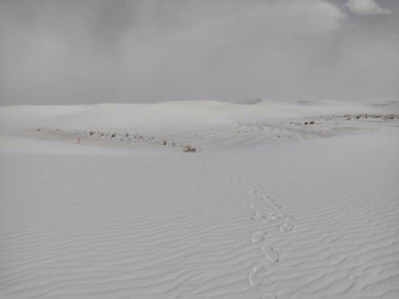
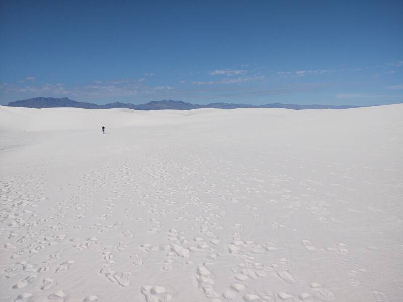
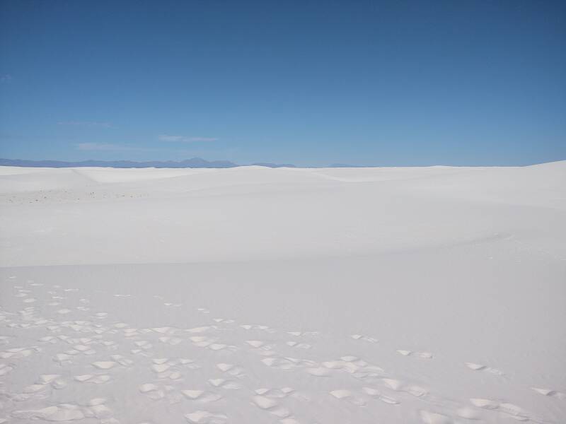
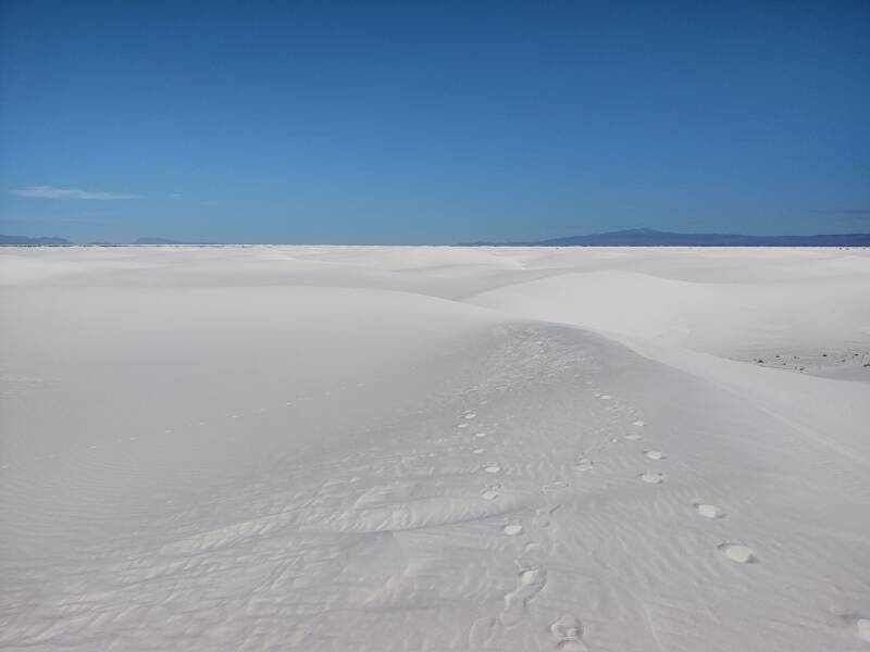
Your footprints disappear quickly on a windy day. Do not rely on being able to follow your footprints back to reverse your path.
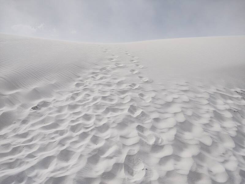
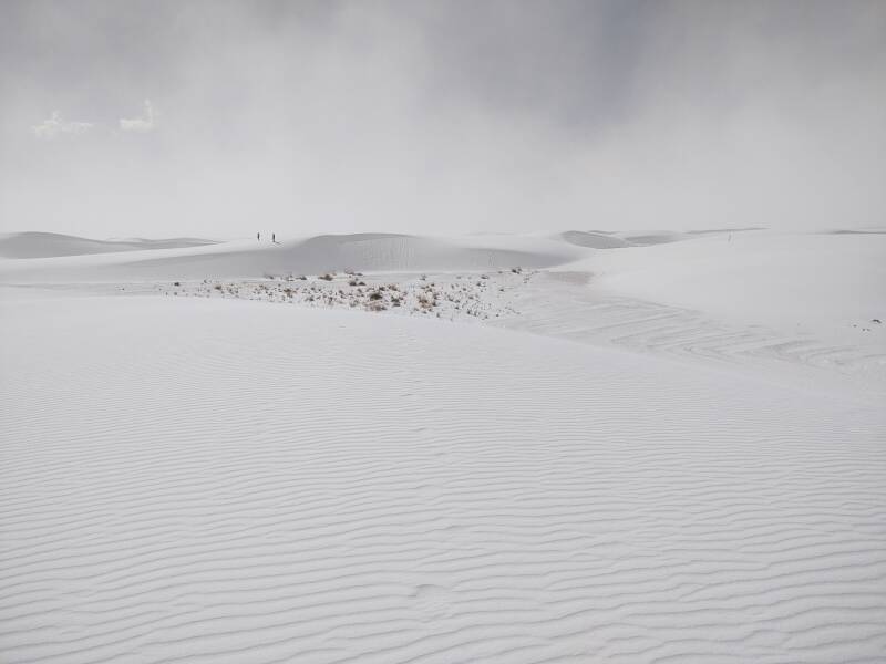
Here's the view looking up a dune where a large number of people have walked recently. Down low, sheltered from much of the wind, footprints remain. But notice how they quickly disappear as you look further up the slope. Out of all the people's footprints, only two sets remain further up, and those become faint and disappear below the top. Those are from people who passed through about five minutes before, and they're already erased by the wind.
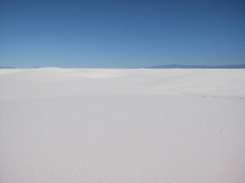
A little further along I paused to rest and drink some water. After about three minutes I looked back the way that I had come. My footprints, along the right margin of the below picture, were almost gone.
Further yet, I looked back and saw two people on the last dune crest I had crossed.
The hard gypsum base between dunes really looks like equipment has been moving around. But it's just wind-blown patterns.
A little further, then looking back.
Looking to the side from the same point.

It was hot, dry, tiring, and honestly, I couldn't see very much because of all the gypsum powder in the air.
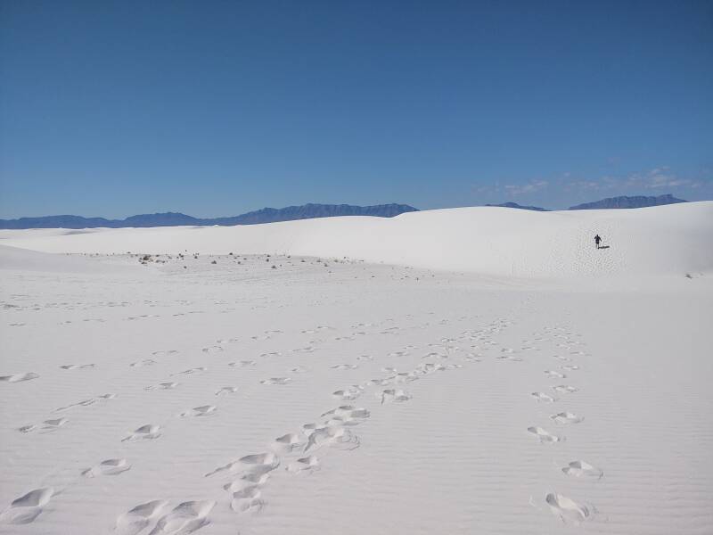
The trail-marking poles are spaced close enough together that even on a day like this you can see at least one pole ahead. The next one is on the horizon near the center of the picture.
From the same viewpoint, looking off to the side.
The next two pictures are from the same viewpoint, looking roughly the same direction. The next marker pole is about 45% of the way from the left edge to the right edge in the first picture, at the top of a steep dune slope.
Yes, they put the trail marker poles on high points. If you walk directly pole to pole to pole, you will be maximizing your up-and-down and you will get tired more quickly. Treat the poles as guidance. Curve around and take the less difficult path up the dune. Don't struggle up the steepest part!
In this second view from that same spot, that pole is about 25% of the way from left to right. Notice that the winds have moved the clouds, and changes in the lofted dust have changed the shadow highlights on the dunes. Navigation would be very challenging without the marker poles.
That was as far as I walked in on the first day. I had gone about three-quarters of a mile, not quite a quarter of the way to the Alkali Flat Trail turnaround point. I felt that I had done plenty for that day. I would come back the next day and see if conditions were better for walking through the dunes.
Search for the First Americans
The inland sea of Lake Otero partially filled the Tularosa Basin during the Ice Age. The climate was far less arid, and grasslands around the lake would have resembled today's Midwestern region.
Plant-eating animals such as ancient camels, Columbian mammoths, and giant ground sloths fed on the grasses and trees. Predators such as the dire wolf and American lion fed on the herbivores. Some of the megafauna footprints were preserved.
Scientists had thought for some time that humans first crossed Beringia from Asia into North America between 13,500 and 16,000 years ago. In the 1920s and 1930, archaeologists had discovered sharp-edged, leaf-shaped stone spear points near Clovis in eastern New Mexico. The points were dated to between 13,000 and 12,700 years ago. They called their creators the "Clovis people".
The theory was that the Clovis people had moved through an ice-free corridor, a gap between ice sheets, to pass south through today's Alaska and Canada. That corridor hadn't fully opened until about 13,800 years ago. The "Clovis First theory" said that every Indigenous person in the Americas could trace their ancestry to a single inland migration shortly before 13,000 years ago.
Genetic studies suggest that early arrivals in North America descend from an ancestral group of Ancient North Siberians and East Asians who mingled around 23,000 to 20,000 years ago and crossed Beringia thousands of years later. That could fit into the Clovis First model.
People might have traveled along the coast, by foot, watercraft, or both. That's quite possible, people had reached Australia by boat by about 50,000 years ago. But sea level was lower, any fossil or archaeological evidence of a coastal route would be deep underwater today.
Lake Lucero is a playa and intermittent shallow lake in the southwest corner of White Sands National Park. The U.S. Military restricts access even to National Park Service personnel most of the time. Scientists can only visit it infrequently.
During a brief period in 2009 when they were permitted access, scientists dug a trench in the gypsum soil near the edge of the lake in the western playa of the park. They found a series of megafauna tracks mixed with sixty-one human footprints. The early human inhabitants seem to have been following, perhaps hunting, the giant extinct mammals.
The sediment layers just above and below the human footprints contained ancient grass seeds. Radiocarbon dating showed that the seeds dated to 22,860 (±320) and 21,130 (±250) years ago.
Evidence of humans in North America during
the Last Glacial Maximum
Science, 23 Sep 2021
Peopling of the Americas as inferred from
ancient genomics
Nature, 16 June 2021
Radiocarbon dating is based on the fact that most carbon is carbon-12 or 12C. Cosmic rays from space can strike nitrogen in the atmosphere, converting some of it to 14C. As a plant or animal continuously takes in carbon, their body's ratio of 14C to 12C remains constant. When the plant or animal dies, the 14C decays with a half-life of about 5,730 years. Measure the fraction of carbon remaining present as 14C, and you can calculate the sample's age back to about 50,000 years ago, beyond which the 14C is almost entirely gone.
The problem, said the "Clovis First" supporters and other skeptics, is the "freshwater reservoir effect". Those grasses could have taken in carbon dissolved in groundwater and stored underground without contact with the atmosphere for thousands of years. Submerged plants would incorporate that ancient carbon in their seeds. Radiocarbon dating would then report that the plant material is thousands of years older than it really is.
In 2023 a new study returned to the same site and obtained both seeds and quartz mineral grains from the layers just above and below the human footprints. They used radiocarbon dating on the organic material, and OSL or optically stimulated luminescence dating on the mineral grains. OSL measures when a mineral grain was last exposed to sunlight.
The 14C and OSL measurements agreed — both seeds and mineral grains in the sediment layers just above and below the human footprints dated to between 21,000 and 23,000 years ago.
Dating the arrival of humans in the Americas
Science, September 2023
Independent age estimates resolve the controversy
of ancient human footprints at White Sands
Science, October 2023
The OSL results supporting the 21,000–23,000 year ages were published in September and early October 2023, just weeks before my visit, and had been reported in the news.
The New York Times
23 Sep 2023
The New York Times
5 Oct 2023
The ancestors of the people who left these footprints must have crossed Beringia and then traveled down the Pacific coastline, stopping at sites now deep under water.
Some archaeological sites suggest that people reached the Americas far earlier yet, by 25,000 or even 31,500 years ago. These results provide some hope for solidly dating some of these proposed earlier sites.
I would return to White Sands the next day. The map below shows the intermittent Lake Lucero at the southwest end of the dune fields. The park entrance is where U.S. 70 turns slightly at the edge of the dunes. I would drive in three miles of paved road, then a little over four on the plowed sand road, and return to the Alkali Flat Trail which leads toward where "White Sands National Monument" appears. Notice the tower just beyond the park's northern boundary — "4130 (205)" means the top is 4130 feet above mean sea level, 205 feet above ground level. That would become visible by the point where I turned around.
1:500,000 scale Tactical Pilotage Chart TPC G-19C from the Perry-Castañeda Library Map Collection at the University of Texas at Austin.
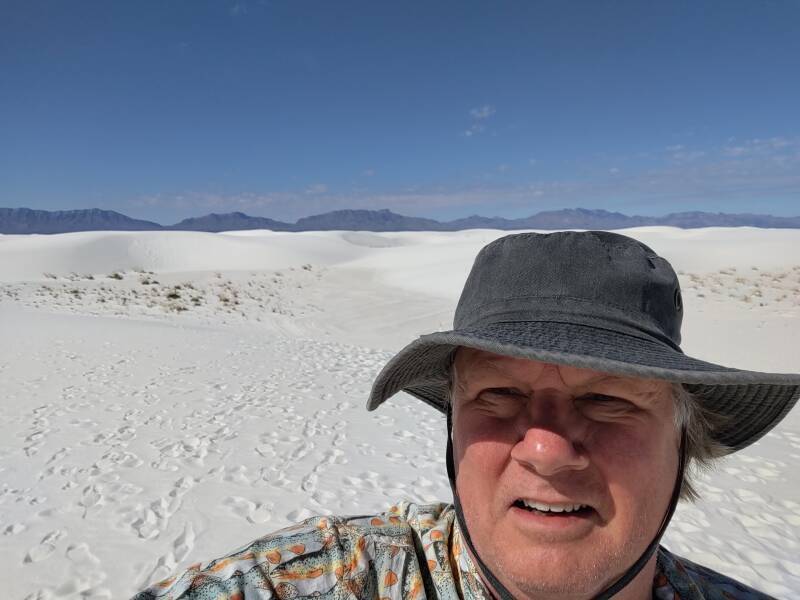
Day Two — Clear Skies
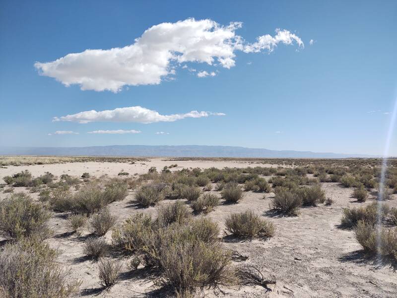
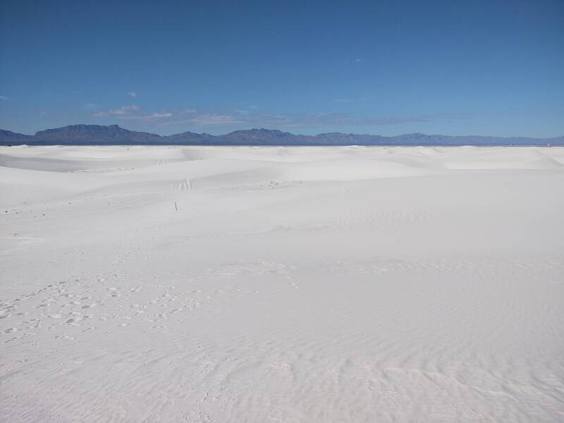
It was far less windy on my second day! I could see the San Andres mountains lining the west edge of the Tularosa Basin as I was driving in.
The paved road from the entrance gate at the highway runs west-northwest, and continues in roughly the same direction after transitioning to the path scraped into the gypsum base. Then it turns to the north-northwest and ends in a loop.
I drove to the parking area at the far end of the loop, and then started into the dunes on the Alkali Flat Trail as I had the day before. That trail continues to the north-northwest off the end of the road. The below picture is looking in the direction of the trail.
Footprints were much more persistent on the second day! But still, don't count on the wind staying gentle and leaving them alone.
Here's someone ahead of me on the trail. He walked directly from one marker to the next. I suppose he enjoyed struggling straight up the steepest dune slopes.
There he goes, right up the steepest part where most everyone else has also walked. When you walk up the steep face of the dune, much of your work goes into rearranging sand. For each step you take up a steep dune face, your foot slides back down about three-quarter of the distance.
A curving path keeping the poles in sight makes far more sense to me. The dunes in this area were slightly crescent shaped. Walk off to the side toward the end of the dune and then go up along its spine. You will be climbing the same height while traveling a longer distance but expending far less energy.
I was taking it easy, not caring that he was passing poles faster than me.
I was also stopping to have a sip of water, look around, and appreciate the view. Below is the view to the northeast, off to the right of the trail.
And, turning further, to the east.
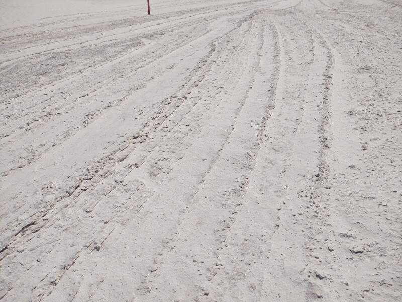
The hard gypsum base forms layers which the wind can strip away at a slight angle, exposing parallel streaks.
This is what can look like vehicle tracks, especially on a day when all the flowing gypsum powder makes everything fuzzy and vague. On this day, I could better see the slightly slanted layers.
Here you can see the hard base at the bottom of a dune and some ripples going up its face. Above those vertical ripples is a smooth surface near the top where the dune face is as steep as it can be before the grains flow as it collapses.
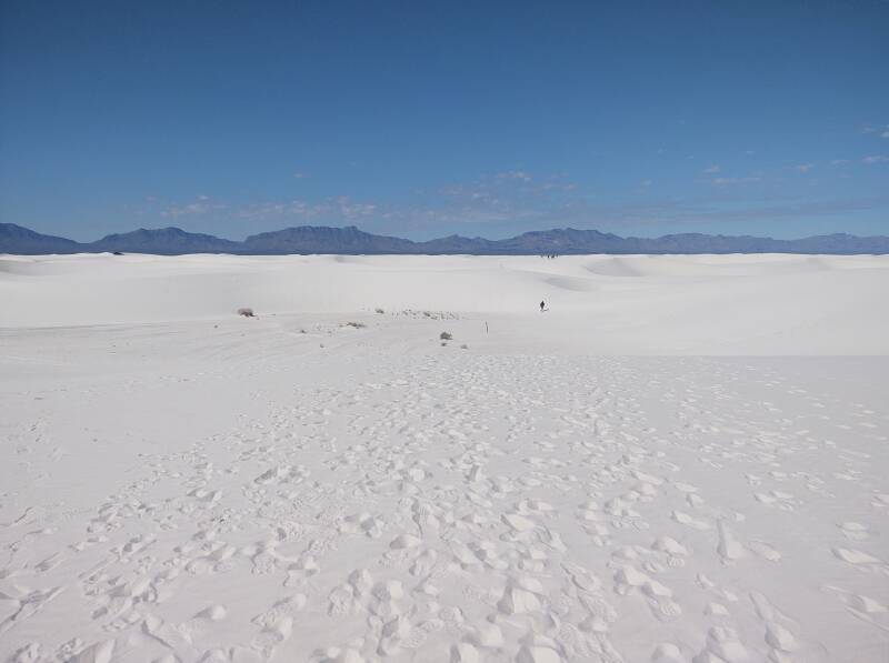
Below is the view forward to the north-northwest from the point where I stopped. I was about a mile and a half into the dunes. I could see the alkali flat, the bare gypsum area, ahead of me. Some of the structures of Holloman AFB were visible, barely visible in this downsampled image near the right margin. Remember that 205 foot tower indicated on one of the maps above.
I could have walked another mile through the dunes and reached their northern edge, but I just wasn't interested enough in doing that. I had done what I set out to do.
Here's the view turned a little toward the northeast from that spot.
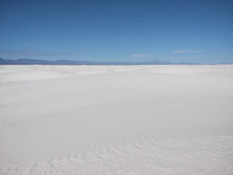
And the view looking northeast. Look at the two sets of fresh footprints coming up from the end of the dune, not having struggled straight up the steepest part. Those are the tracks of me and the other sane person out on the dunes that day.
And, turning to the east and the Sacramento Mountains beyond Alamogordo. From here I headed back to the parking area.
From White Sands I returned to Alamogordo, then crossed the mountains on my way to Roswell. That would be my base for observing the annual solar eclipse.