Socorro to Alamogordo
Dead Man's Journey Past The Trinity Site
Next, I drove from Socorro to Alamogordo.
South on I-25 for a short distance,
then east on U.S. 380 to Carrizozo,
and then south on U.S. 54 to Alamogordo.
That took me across the north end of
Jornada del Muerto
and along the northern edge of the
White Sands Missile Range or WSMR.
Jornada del Muerto or "Dead Man's Journey"
was part of a trail leading north
from colonial New Spain, today's Mexico,
to the northernmost part of its province of
Nuevo México.
WSMR is the largest military installation in the U.S.,
about 160 kilometers north to south and up to
65 kilometers east to west.
Fill your fuel tank,
fill your water bottles,
and use the bathroom
before starting!
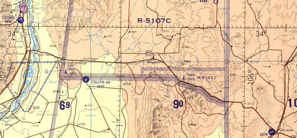
1:500,000 scale Tactical Pilotage Chart TPC G-19C from the Perry Castañeda Library Map Collection at the University of Texas. I traveled south a short distance from Socorro on I-25, then turned east on US 380. San Pedro, near the mostly waterless channels of the Rio Grande, deserves to be called a village. But Carthage, Bingham, and the multiple "ranches" along U.S. 380 are just a building or two. One of the few prominent features along the way is the road turning off to the south to Stallion Army Air Field, and then branching to the east and then south past the Trinity Site, not shown on this 1967 map. U.S. 380 turns southeast and crosses a lava flow before reaching Carrizozo, where I would turn south on U.S. 54 and continue 100 kilometers to Alamogordo.
Spain's conquest of the Aztec Empire in 1519–1521 began the Spanish colonization of the Americas. The Spanish and the indigenous rivals of the Aztecs defeated the Mexica people at their capital of Tenochtitlan. The Spanish built their new colonial capital, eventually called Mexico City, on the ruins of Tenochtitlan.
Spanish control spread north. Santa Fe was founded in 1610 as the capital of Spain's northern province of Nuevo México.
A route called the Camino Real de Tierra Adentro led northwest from Mexico City to Santa Fe. An almost waterless 140-km section of it between Las Cruces and Socorro was known as Jornada del Muerto or the "Dead Man's Journey".
After crossing the Jornada del Muerto, the first Spanish colonists encountered walled villages of the Pueblo people along the Rio Grande. The Spanish called one of the first pueblos they reached Socorro, Spanish for "help" or "assistance".
The northern province of Nuevo México remained in Spanish control until Mexico declared independence in 1821 and it became the federally administered Territory of New Mexico.
The U.S. defeated Mexico in the Mexican–American War of 1846–1848. Mexico ceded northern territories including Texas, New Mexico, Arizona, and California to the U.S.
New Mexico became a U.S. state in 1912. Now Santa Fe is the state capitol, the oldest in the U.S.
U.S. 380
As you approach the northwest corner of White Sands Missile Range, a sun-bleached signs tells you to stay off the air in part of the 70-centimeter band.
AMATEUR RADIO USERS
USE OF FREQUENCY BAND
420–430 MHZ IS
RESTRICTED IN THIS AREA
CALL 678-1208
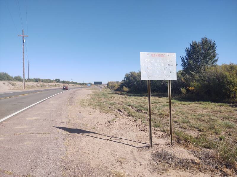
The ITU or International Telecommunications Union globally allocates 430–440 MHz to Amateur Radio. In the U.K., the 70-cm band is simply 430–440 MHz. The U.S. and Trinidad and Tobago are among the countries granting another 10 Mhz at either end of the band: 420–450 MHz. In the U.S., some of the band is shared with government radar. Canada and Australia grant a higher but not lower extension: 430–450 MHz.
The result in the U.S. is that amateur operation on 420–430 MHz is forbidden within about 60 nautical miles of the Canadian border and along the northern side of White Sands Missile Range. Also, transmitted power across the entire band is limited to 50 watts near various U.S. ballistic missile radar facilities and other military installations, including all of New Mexico, Arizona, and Florida.
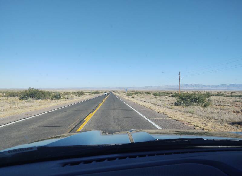
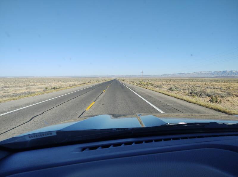
U.S. 380 crosses flat terrain across the north side of White Sands Missile Range. The Oscura mountain range is about 35 kilometers ahead.
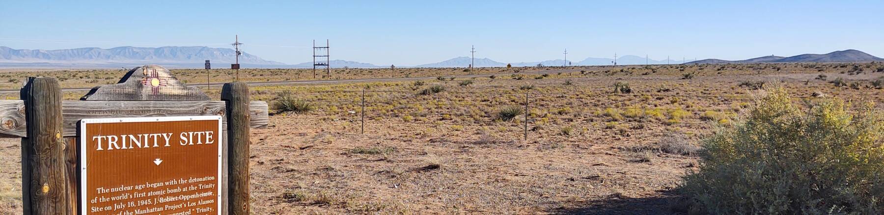
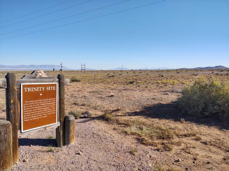
All this land was taken over by the U.S. Army in 1942, to establish the Alamogordo Bombing and Gunnery Range. On 16 July 1945, the first nuclear bomb test occurred at the Trinity Site at 33°40.636'N 106°28.525'W.
New Mexico State Road 525 runs about 8 kilometers south from U.S. 380 to the entrance to Stallion Army Airfield with its single 4,000-foot runway. Several hundred people work at the Stallion Range Center.
After the war, as it transitioned into White Sands Proving Ground and then White Sands Missile Range, a hundred captured German V-2 missiles were brought here for testing. They were accompanied by captured German scientists, many of them former Nazi party members and some of them former leaders, all part of Operation Paperclip.
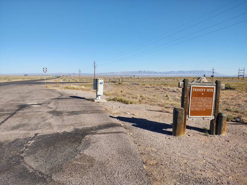
Trinity Site is open to visitors twice a year, usually the first Saturday in April and the third Saturday in October.
Then, back in motion to the east.
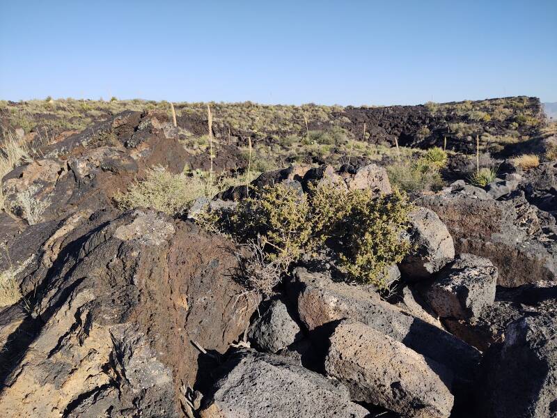
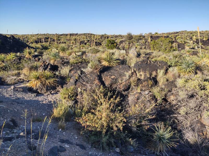
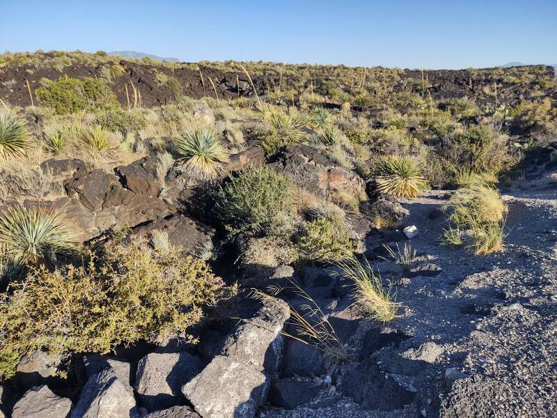
Carrizozo Malpais
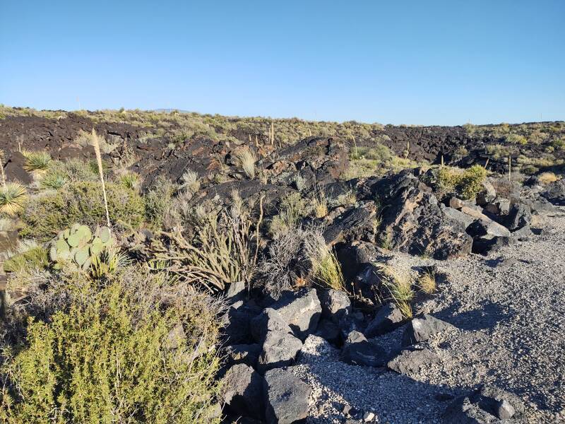
As U.S. 380 approaches Carrizozo, it crosses the Carrizozo Malpais, a 68-kilometer-long lava flow that came from Little Black Peak, to the north. Radioisotope dating has recently shown that the lava flow formed 5,200 ±700 years ago.
Malpaís means "bad land". It's useless for crops, and extremely difficult to cross.

On to Alamogordo and Sindonology
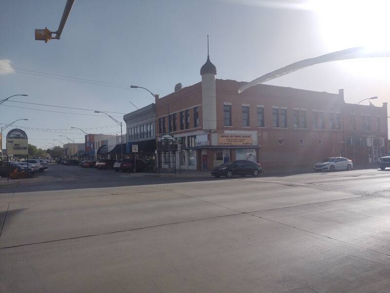
In Corrizozo I turned south on U.S. 54 and drove another hour to Alamogordo. I would stay there while visiting White Sands National Park. I was surprised to find a significant local level of enthusiasm for a purported Biblical relic. Alamogordo is a sindonology hotspot. Sindonology, from the Greek σινδών, the word used in the Gospel of Mark to describe Jesus's burial shroud, is the word used since the early 1960s to describe the study of the shroud.
The Shroud of Turin is a linen cloth that bears a faint image of a man. It has been venerated for centuries, especially by members of the Roman Catholic church, as the actual burial shroud used to wrap the body of Jesus after his crucifixion.

Amazon 1501125761
It was first exhibited in 1354, when it seems to have been owned by the French knight, Geoffroi de Charny. By 1389 the Bishop of Troyes was denouncing it as a forgery. He sent a long letter to Antipope Clement VII (who was recognized as Pope in France during the Western Schism) saying that a previous bishop had known the artist who created it. The bishop said that it had been "artificially painted in an ingenious way." It depicts Jesus as a tall, muscular man of northwestern European appearance.
Antipope Clement VII agreed that it was a forgery. He issued four Papal bulls which allowed its exhibition. However, only with disclaimers that it wasn't the real shroud, but "a painting or panel made to represent or imitate the shroud." But then in 1506 Pope Julius II declared that it was authentic.
The House of Savoy bought the shroud in 1453, put it in a chapel where it was damaged in a fire in 1532, and moved it to the new Savoy capital of Turin in 1578, from which its name is derived.
In 1898 the Turin Cathedral allowed a local lawyer and amateur photographer to photograph the shroud. That happened to be the same year that the city of Alamogordo was founded, near where Roman Catholic Mexican settlers had established a village.
Radiocarbon dating by multiple laboratories have shown that the linen was produced in 1260–1390 CE. Microscopic analysis has shown that the image was painted on with a dilute solution of red ochre in gelatin, and what appear to be bloodstains were painted on with vermilion pigment in gelatin.
The Roman Catholic church today is scrupulously noncommittal about exactly what the purported relic is. The House of Savoy gave the shroud to the Vatican in 1983. After the radiocarbon tests in 1988, the Vatican has allowed no further scientific examination. Speculation continues, including a theory that the Resurrection involved a flood of neutron radiation which modified the shroud's 14C content.
Meanwhile, there are competitors. Four churches in France and three churches in Italy hold what they say are the burial cloths of Jesus.
A conference as part of STURP or the Shroud of Turin Research Project was held in Albuquerque in 1977. The event is proudly described as involving more scientists from New Mexico than from anywhere else. Which is the opposite of how you would describe a major international scientific conference.
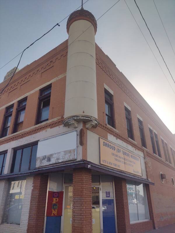
There was a shroud exhibit and museum within the White Sands Mall, along the main business road through Alamogordo. Now it has been moved to a dedicated downtown location.
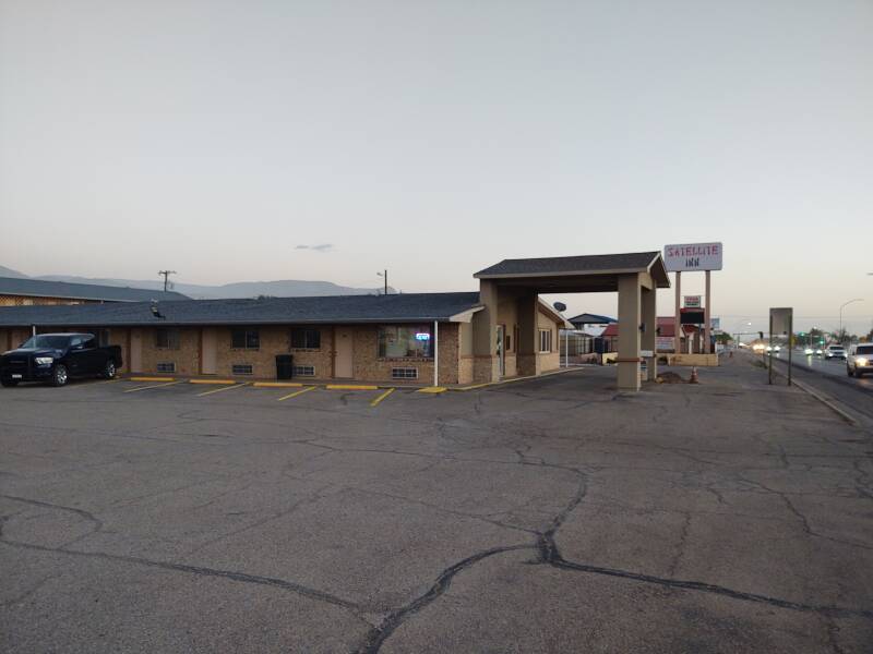
I stayed at the Satellite Inn, along the main business highway through Alamogordo. It was a nice place.
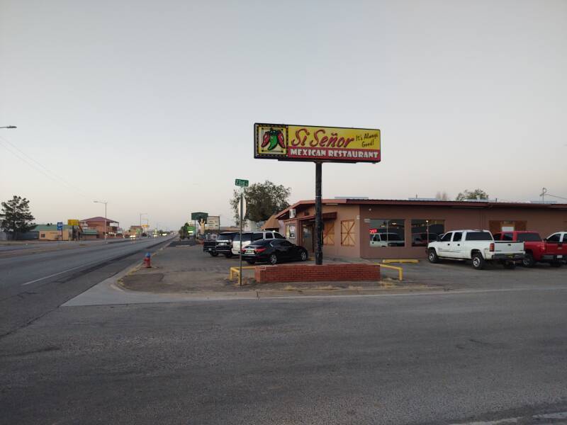
The "Si Señor" restaurant was next door.
I started with my first margarita in I don't know how many years.
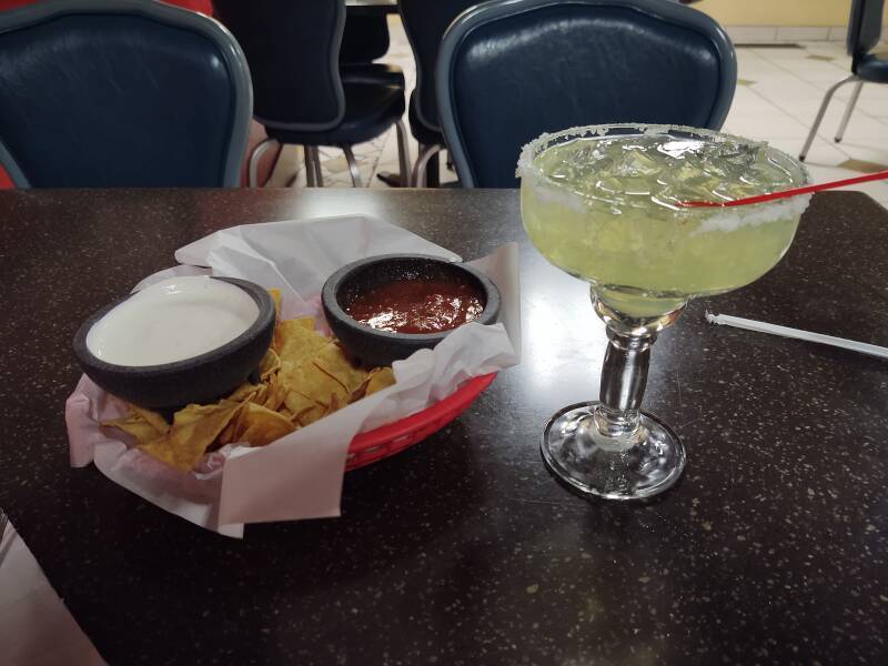
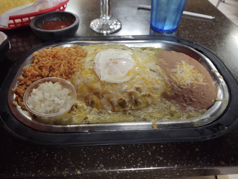
New Mexico style enchiladas — with hot green chili sauce and an over-easy egg.
Alamogordo and the Satellite Inn were a nice base for visiting White Sands National Park.
The designers refer to pure fission warheads as nuclear and to devices with a fusion stage as thermonuclear. The terms "atomic bomb" and "hydrogen bomb" came from media coverage.