1090 MHz ADS-B Antenna for Increased Range Flight Tracking
ADS-B Flight Tracking
|
Aircraft registration
database lookup: Map ICAO hex codes like aa4c3e
to registration
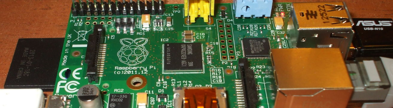
Raspberry Pi
ADS-B SDR tracking
Radio
|
I'm using a small Raspberry Pi Linux single-board computer with a USB-connected Software-Defined Radio to receive and process data broadcast at 1090 MHz by aircraft flying overhead. See my SDR flight tracking page for the details on setting up the software. ADS-B or Automatic Dependent Surveillance — Broadcast collects aircraft data including position from a GPS navigational system, elevation, air speed, and bearing. The data is transmitted as cleartext at 1090 MHz, easily received by simple ground stations. ADS-B is part of the US, Canadian, Australian, and European air traffic control systems.
By 2015, ADS-B was mandatory in parts of Australian airspace and it was being used for air traffic control in Canada. It is part of the Single European Sky ATM Research or SESAR, and the U.S. Next Generation Air Transportation System or NextGen. Position and velocity information is broadcast once per second through what is essentially a modified Mode S radar transponder. In most cases the position information is more accurate than what can be obtained by current air surveillance radar systems.
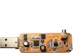
The SDR receivers come with a small antenna that's fine for the intended purpose: receiving television signals within large Asian coastal cities. The antenna supplied with these units is about twice the length of a quarter-wave at 1090 MHz, and it has next to no ground plane.
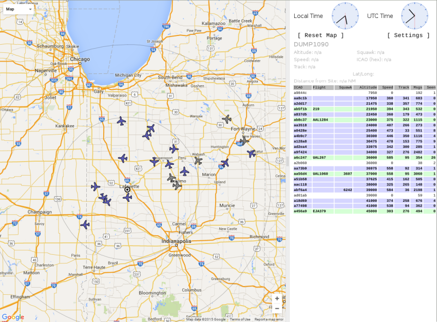
As for receiving ADS-B signals, I was mostly seeing aircraft out to 50-60 nautical miles.
Amazon B09GXP5WSH
Constructing the Antenna
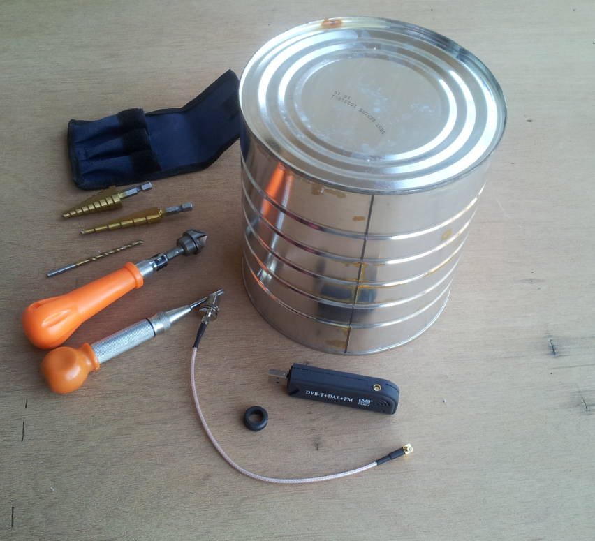
Here is the collection of parts: a large coffee can, the RTL-based SDR unit, a short RG316 cable with female F and male right-angle MCX connectors, and a rubber grommet. Also needed: a short piece of #24 enameled wire and a plastic cable tie.
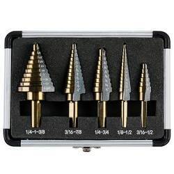
The stepper drill bits make for clean holes in sheet metal, including large coffee cans obtained at the recycling center. An automatic center punch helps to start the holes, and a handheld countersink helps to clean them up.
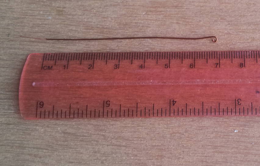
1090 MHz means a wavelength of 27.5 cm, so a quarter-wave whip would be just 6.9 cm long.
It's basic math. The speed of light is 300 million meters per second. So, wavelength in meters is 300 divided by frequency in MHz, "million cycles per second" in the terminology of the Golden Age of Wireless. $$ \begin{aligned} {\lambda}_{meters} &= 300 / f_{MHz} \\ {\lambda}_{mm} &= 300 / f_{GHz} \end{aligned} $$
I made a small safety loop at one end, then cut the wire one centimeter longer. I stripped the enamel off that added centimeter. The bare copper is relatively difficult to see here. The wire is inserted into the female F connector until 69 mm extend as a 1090 MHz quarter-wave.
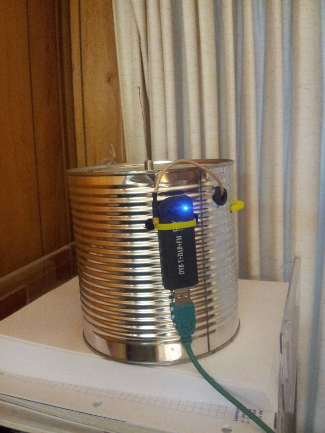
Here is how it went together:
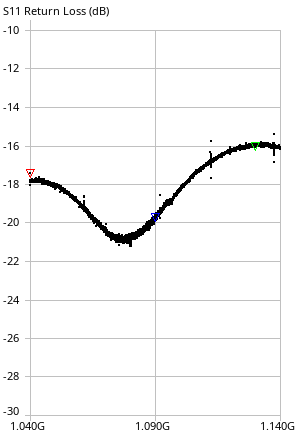
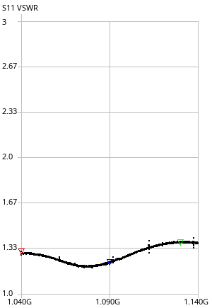
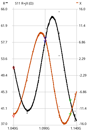
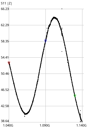
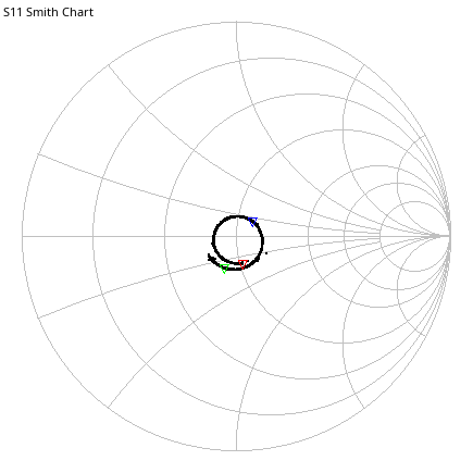
Here are the results as captured and saved with the nanovna-saver package. Sweeping 1040–1140 MHz in 200 segments, blue marker at 1090 MHz. The element is a little long, it looks like it's resonant at about 1077 MHz. But that's within 1.2% of the design frequency.
| Frequency: | 1.09000 GHz |
| Impedance: | 57.8 + j7.91 Ω |
| Series L: | 1.1556 nH |
| Series C: | -18.449 pF |
| Parallel R: | 58.9 Ω |
| Parallel X: | 62.826 nH |
| VSWR: | 1.229:1 |
| Return loss: | -19.752 dB |
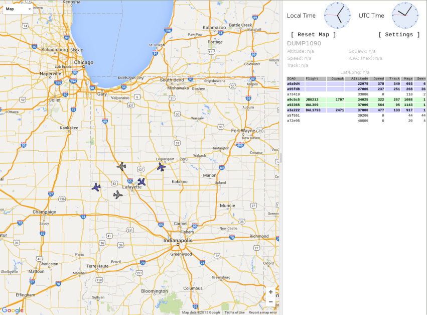
Improved Coverage!
The improved antenna gives me coverage out to
a little beyond 120 nautical miles to my ENE,
beyond Fort Wayne into northwestern Ohio.
In this second screenshot I have enabled range
rings at 50, 100, and 150 nautical miles.
To do that, edit
/usr/share/dump1090/public_html/config.js
and modify the settings of
SiteShow,
SiteLat,
SiteLon,
and
SiteCirclesDistances.
Then restart the dump1090 process.
I live in West Lafayette, in a building of brick over reinforced concrete. The antenna is near a patio door with a clear view from the antenna location from north to east, the remaining 270° is through the building. On top of that I'm in a relatively low area, opening to the east-northeast up the Wabash River valley.
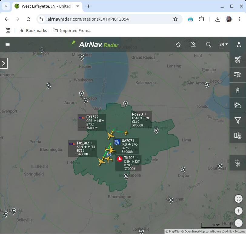
Here's the view of my receiver in the AirNav Radar tracker, which shows recent coverage in green. Yes, very short range to the northwest, southwest, and southeast, but that's due to the building and surrounding topography.
Select a Raspberry Pi topic:
Which model and how much memory?
$ cat /sys/firmware/devicetree/base/model
$ grep MemTotal /proc/meminfo

Amazon B07XTRFD3Z
299,792,458 meters, to be pedantic about the last 0.069%.