Malia
Minoan Palace of Malia
On the
previous page
I drove east out of Heraklion on the old coast road,
visiting a Minoan villa, a Greek temple,
and some interesting modern churches.
Then I continued along the coast road to the Minoan palace of
Malia, shown in detail on this page.
That took me through bustling beach resort towns.
I was visiting during September, one of the so-called
shoulder seasons that are the ideal times for visiting Greece.
In mid-April through May,
and then in September through mid-October,
businesses are open,
ferries are running at or close to their full schedule,
but things aren't so busy and crowded
that a visit becomes a struggle.
In the high season, traffic through this area could be awful.
I noticed several "factory stores" selling fur coats.
Who buys fur coats in Crete?
Vacationing oligarchs.
The advertisements were mostly in Russian.
This map shows the terrain.
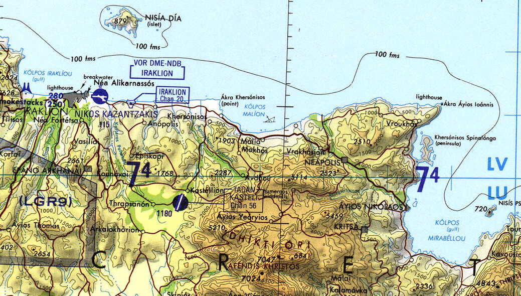
Tactical Pilotage Chart G-3C from the Perry-Castañeda Library Map Collection at the University of Texas at Austin.
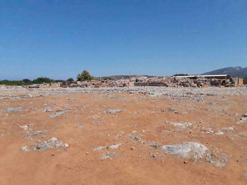
Things look bleak as you first enter the Malia palace site. There's plenty to see here, it just isn't obvious from the entrance area. Make sure that they gave you a small map along with your ticket. The Blue Guide Crete includes a useful overall map of the overall site plus a detailed map of the palace itself.
What Happened to Malia?
Many of the Minoan sites were heavily damaged by fire in 1450–1400 BCE. Crete has severe earthquakes, and earthquakes accompanied by fires had largely destroyed Minoan palaces multiple times in the past. However, they had always been rebuilt and reoccupied. What was it that ended the Minoan civilization?
Visiting Thera,a.k.a. Θήρα,
a.k.a. Santorini
Once we came to appreciate the cataclysmic explosion of Thera or Θήρα, known to foreign tourists as Santorini, it was blamed for wiping out the Minoans.
Thera was a conical volcano forming a roughly circular island 15 to 20 kilometers in diameter. It exploded in one of the largest volcanic events in history. It is now estimated that about 100 cubic kilometers of magma and rock were expelled. [60 cubic kilometers Dense-Rock Estimate (DRE), see: Santorini eruption much larger than originally believed, University of Rhode Island, 23 Aug 2006; Santorini — Eruptive History, Global Volcanism Program, Smithsonian Institution; "Marine Investigations of Greece's Santorini Volcanic Field", H Sigurdsson et al, Eos 87(34): 337-348.]
Scientists have found tephra or volcanic ash from the Thera explosion all around the eastern Mediterranean. Maybe a gigantic tsunami followed by a suffocating layer of ash devastated Crete, destroying the settlements and crippling agriculture. After all, Thera is just 120 kilometers north of Crete. Malia is a short distance inland from the beach, and Amnissos, visited on the previous page, is even closer to the waterline.
Dating theThera Eruption
Well, no. Thera exploded around 1600–1630 BCE, and the Minoan settlements including Malia and Amnissos were occupied for another two centuries.
Knossos is five kilometers inland and over 100 meters above sea level. Phaistos is over the high central range of mountains, near the south coast. It's completely out of danger from tsunamis approaching Crete from the north.
While some pumice has been found here around Malia and also at Amnissos, it seems to have floated in on normal waves. There are no signs of a tsunami striking the north coast of Crete. And, it seems that no more than five millimeters of Thera ash fell anywhere on Crete.
The Minoans were a commercial sea power, involved in trade by ships all around the eastern Mediterranean and with civilizations well inland beyond those shores. Not just with Mesopotamian civilizations like Babylonia, but well beyond that to the tin mines of today's Afghanistan. Cyprus was a rich source of copper, to the point that it's named for the metal, but that's a relatively soft metal unsuited for tools and weapons. You have to mix in about 12–12.5% tin to get bronze.
The Minoan civilization does seem to have diminished somewhat after the Thera explosion, so it was a significant disruption. It may have left the Minoans less prosperous, thus less stable and more susceptible to conquest.
Paper in Nature Overview in NatureThe paper "Severe multi-year drought consistent with Hittite collapse around 1198–1196 BC", published in Nature in February 2023, reported on a study of tree rings at Gordion in central Anatolia. There was a shift to drier, cooler climate conditions around 1200 BCE, but it was very gradual. The new study found "an unusually severe continuous dry period from around 1198 to 1196 (3±) BC". As they describe, argriculture and food storage in that region and era could withstand a year of drought. But two consecutive years would lead to a society's collapse.
Visiting HatuşaşTheir study was at Gordion and Hatuşaş, which had been the capital of the Hittite Empire for centuries. They speculate that this drought could have caused the collapse of the Hittite Empire, and possibly been at least part of the general societal collapse around the eastern Mediterranean.
The Mycenaean Greeks arrived in 1450–1400 BCE and rapidly took over the Minoan sites. They conquered and replaced the original occupants.
Archaeologists have found clay tablets and other objects bearing writing in two related scripts. Stratigraphy shows which version is older. Analysis of the signs shows that the older one involved into the newer.
Other than that, both were a complete mystery. Investigators called the older one Linear A and its derivative Linear B.
In 1952 Michael Ventris showed that Linear B recorded an early form of the Greek language, what the Mycenaean civilization spoke.
The Mycenaeans adopted many Minoan ways, but it was definitely a conquest.
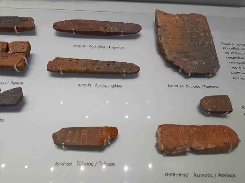
Linear B tablets bearing place names in the Heraklion Archaeological Museum. Notice Amnisos at lower right.
Linear A records a totally different language, whatever it was that the Minoans spoke. We don't even know if the Minoans spoke a single language, maybe they used Linear A to write multiple languages.
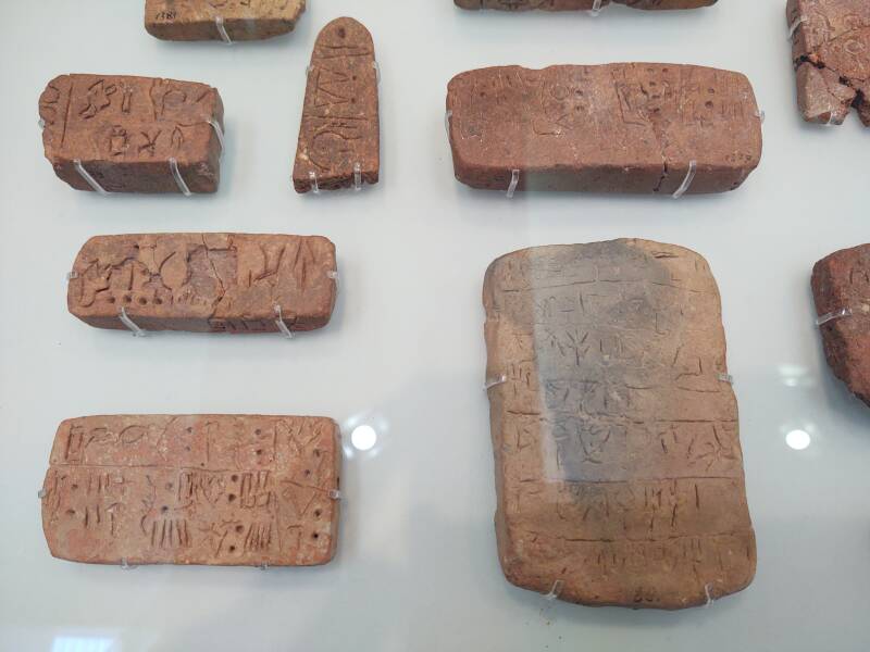
Linear A tablets in the Heraklion Archaeological Museum. We have no idea what these say.
The Main Palace Complex
The Minoan complexes at Knossos, Phaistos, and here at Malia are called "Palaces" because they seem to combine an administrative center and large dwellings.
Arthur Evans and his assumptions, rash conclusions, and inventionsSir Arthur John Evans excavated Knossos from 1900 to 1936 and has had a huge influence over everyone's understanding of the Minoan civilization. This includes the word "Minoan" as Evans almost immediately announced that he had discovered the palace of the mythical King Minos, the disgruntled stepfather of the monstrous Minotaur.
However... Much of what Evans "discovered" were based on his idealized dreams of what could or should have been. He forced what he found into what he wanted to have found. Evans's visions, inventions, and forgeries became the official description of Knossos and the Minoan civilization. The deciphering of Linear B in 1952 led to broad questioning of some of his conclusions, and much more was debunked in the following decades.
To fully embrace the stories, Malia was said to be the palace of the mythical King Sarpedon, brother of the mythical King Minos.
However, the term "palace" makes sense. Large storage facilities at the palaces could hold far more bulk goods than could be used by their occupants. A Minoan palace typically devoted up to a third of its floor space to storage. Malia had even more.
These stone rings are nicknamed kouloures or κουλούρες on plans of the site. That's the name for the sesame-seed-covered bread rings, like Turkish simit. This area is called the Silo Block because these are just the bases for cylindrical storage bins.
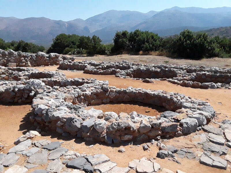
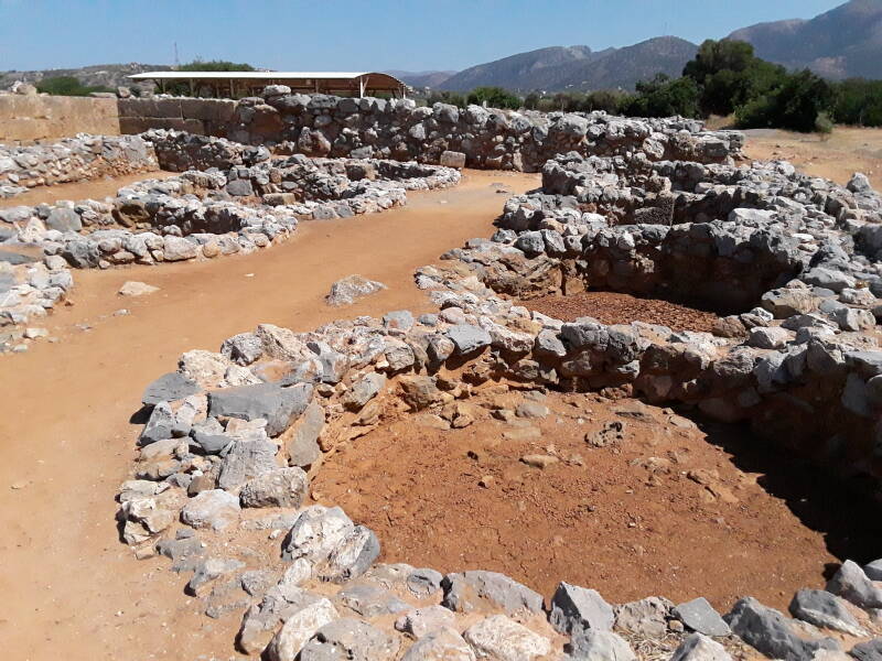
Pithoi or large storage jars held both dry and liquid bulk goods.
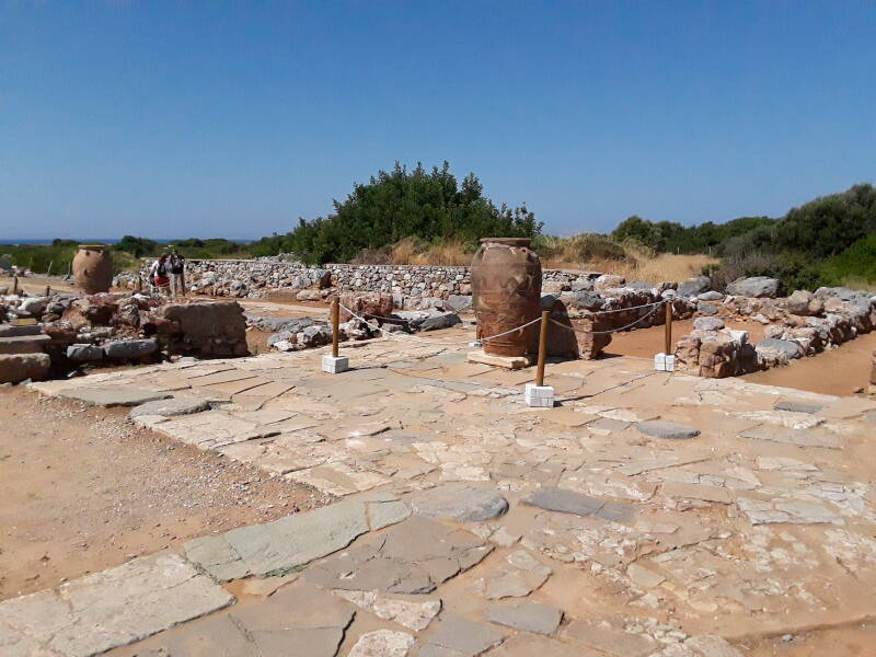
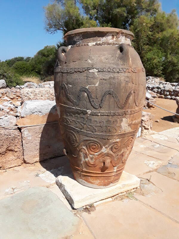
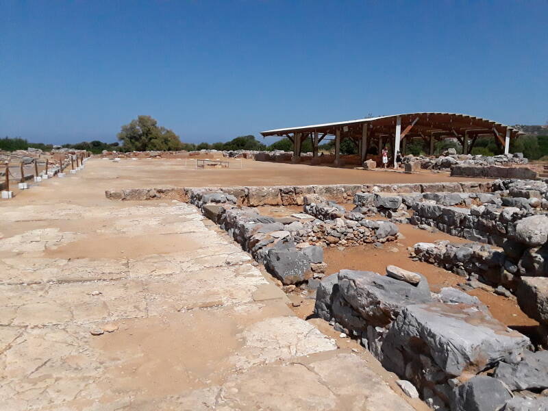
The Central Court is about 50 by 23 meters. Just as at Knossos, it is laid out with its long axis about 20° clockwise from a true north-south alignment. The palace at Phaistos is the exception, with its central court aligned to the cardinal directions.
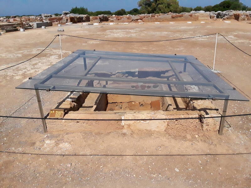
Malia, unlike the other palaces, has a small bothros or altar at the center of its court.
The East Storerooms are under a shelter along the east side of the central court.
Compared to Knossos and Phaistos, Malia used far more mud brick.
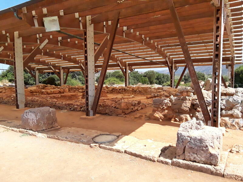
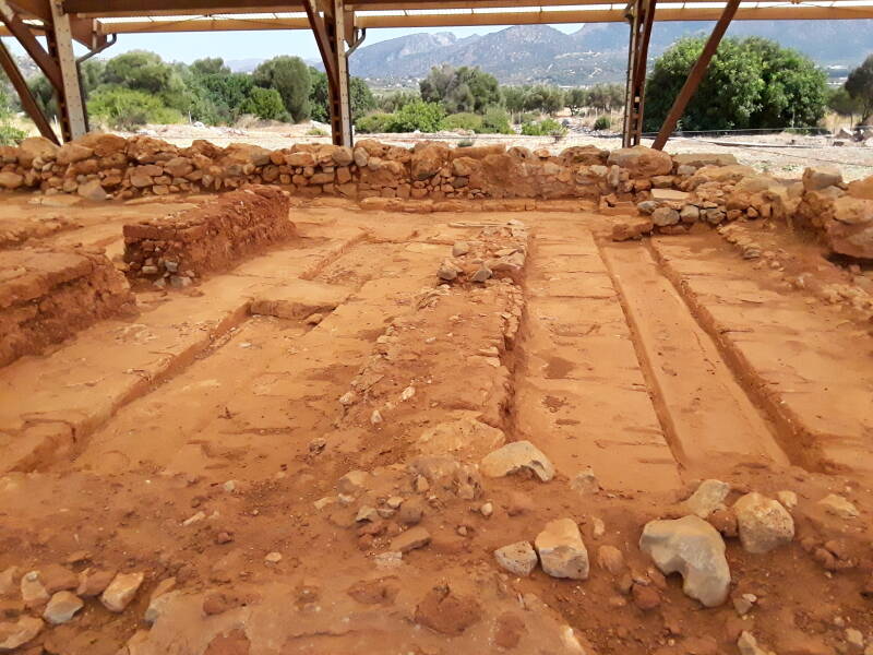
Its walls and floors were plastered, and notice the gutters carved into the floor to capture and collect liquid. We know from the writings of civilizations with whom they traded that the Minoans were esteemed for their valuable fragrances, medicines, ointments, and soaps. This might have been some of that was produced by mixing olive oil with herbs and spices.
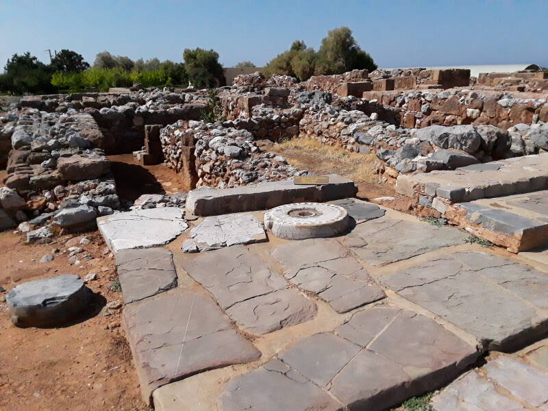
Just off the southwest corner of the Central Court is a mysterious object interpreted as an offering table. It's a form of kernos or κέρνος, a pottery ring or stone tray with several small vessels around its perimeter for holding offerings. This one, however, has only one vessel off to the side, it's otherwise lined with circular markings that might represent other vessels. Maybe it's a Dial-Home Device.
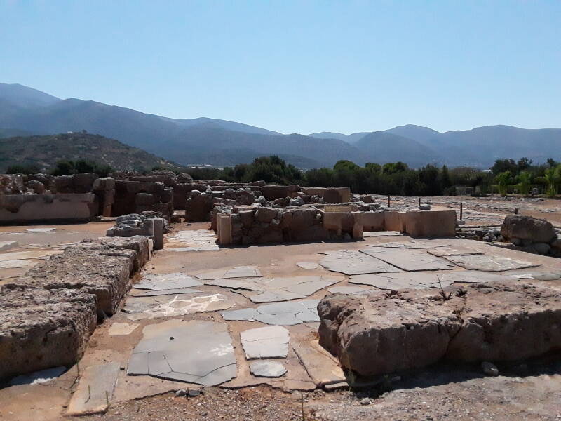
A series of small courtyards and broad staircases fill the rest of the west side of the Central Court.
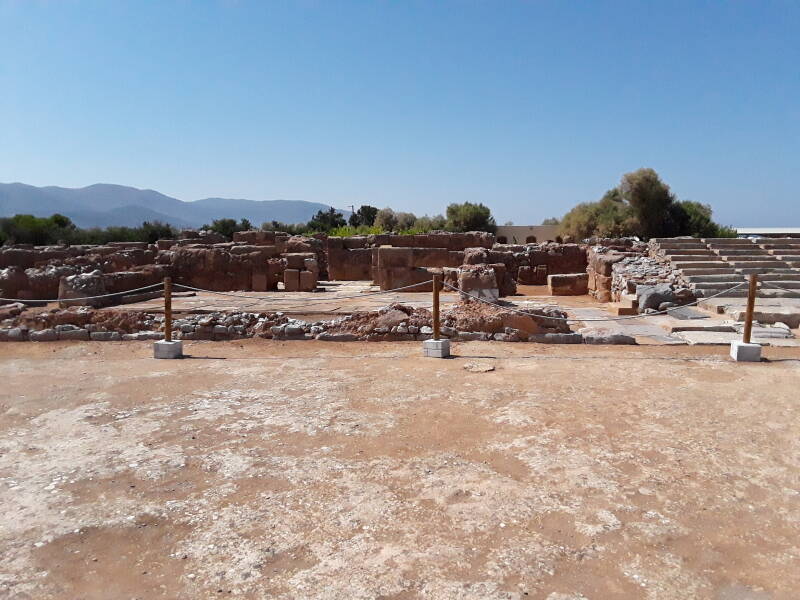
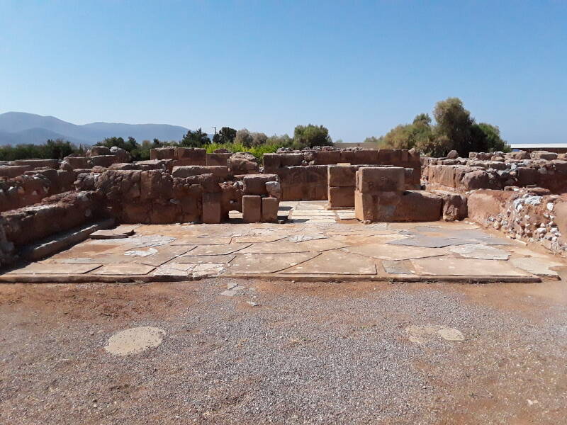
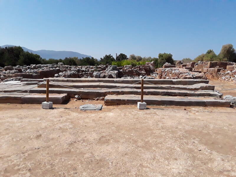
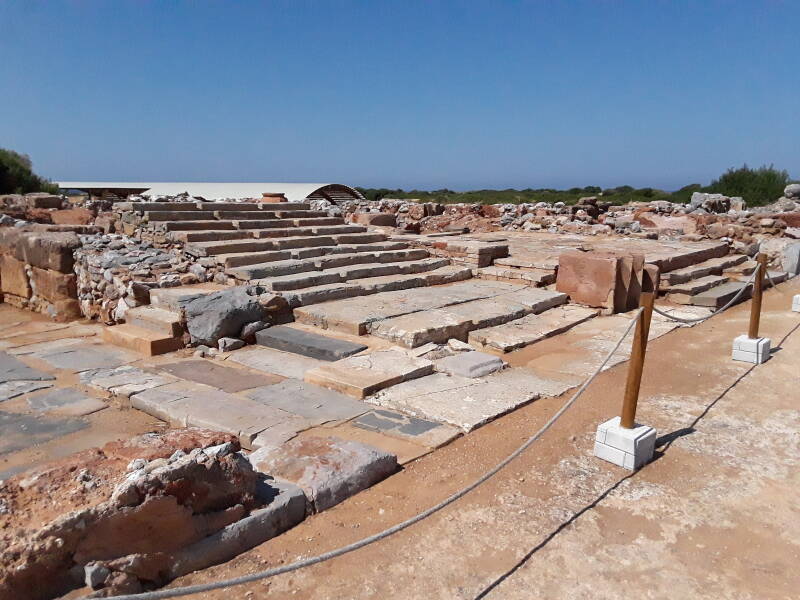
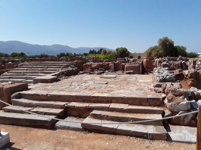
The Minoans were literally pre-historic, leaving no records that we can read beyond a few place names and some numbers in inventory lists. Features get generic names. A hall with large pillars becomes the Pillar Hall.
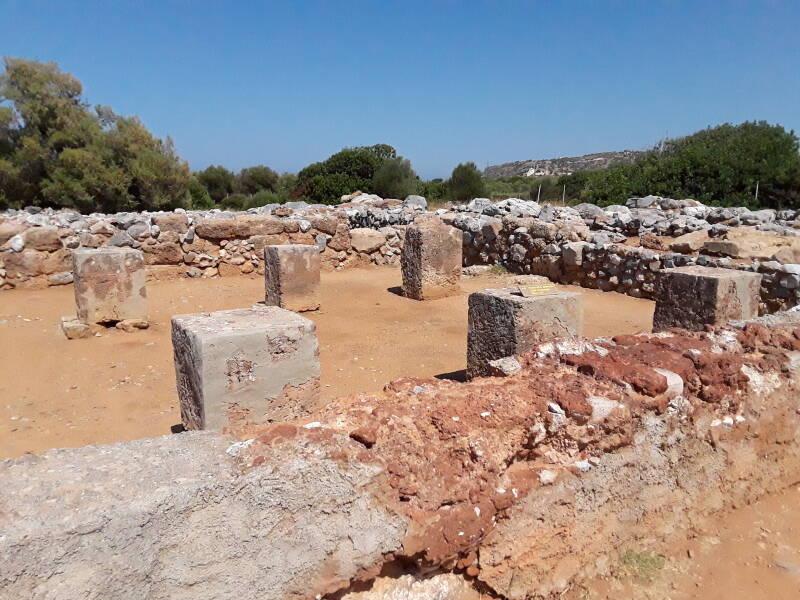
Just like Knossos and Phaistos, Malia had several levels. Unlike Phaistos, Arthur Evans hasn't reconstructed multiple levels out of reinforced concrete, decorating them with paintings for which there is no evidence but which he thought looked like what the Minoans should have created.
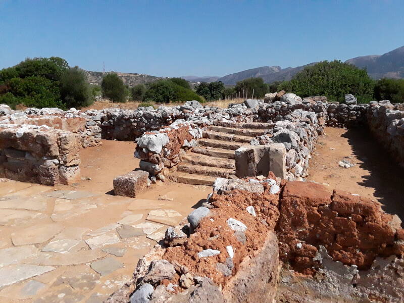
Evans thought that the Minoans surely engaged in lustration or ritual bathing. He applied the name lustral basin to a feature he found at Knossos, and which has been found at most other Minoan sites.
However, they're all extremely ill-suited for bathing. They're lined with water-soluble gypsum and they have no drains. But everyone went along with Evans at first, and so the name stuck and they're labeled as such at sites.
There's one at center here, just off the northeast corner of the West Court, but the surrounding platform is blocked off with ropes.
See my pictures from Agia Triada for a Minoan villa with a well-preserved "lustral basin" that you can see and even enter.
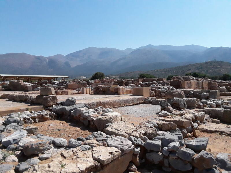
Hypostyle Crypt
What you've seen so far is all that the visiting public could see until some time after 2010. Since then, two large areas have been covered by protective roofs and more fully excavated.
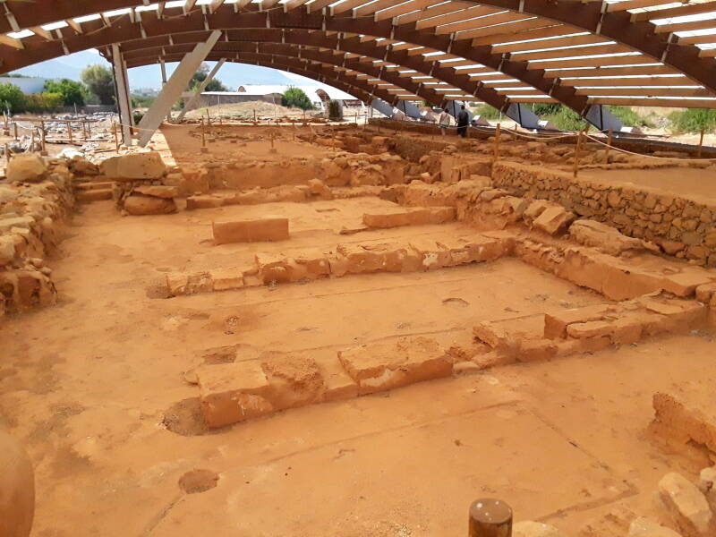
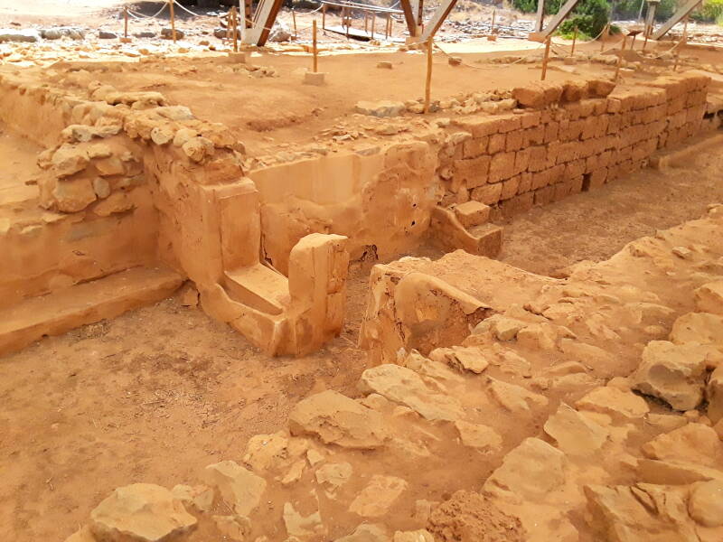
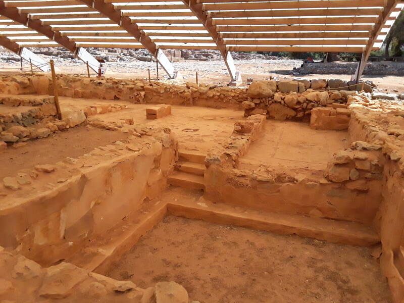
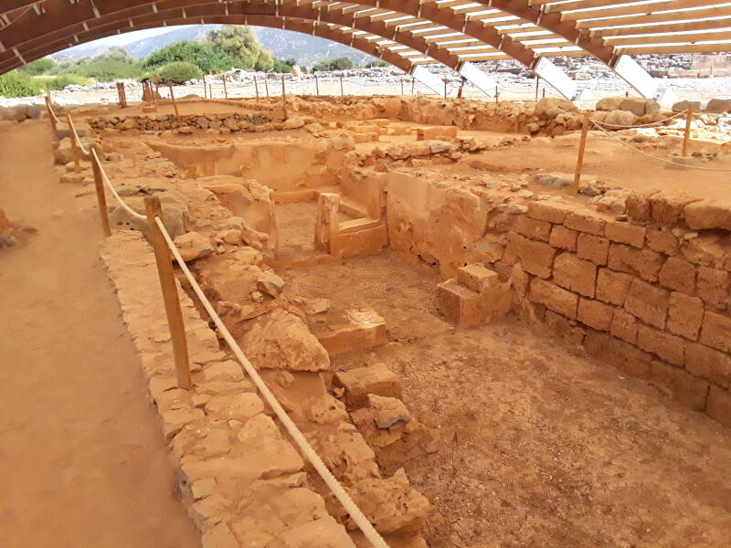
The first is the Hypostyle Crypt or Pillar Crypt. Hypostyle, from υπόστυλος, means it has a roof supported by columns. It's a non-residential area dedicated largely to storage.
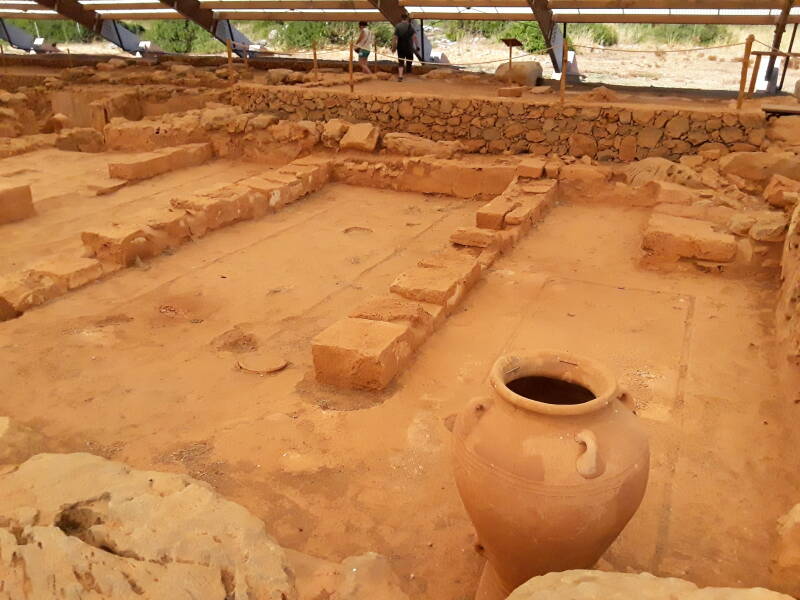
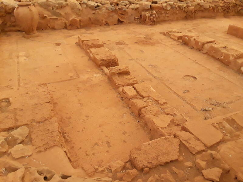
Just like the East Storerooms, the floors were carved with gutters and sumps to collect spilled liquids, and then coated with plaster or stucco.
Quartier Mu
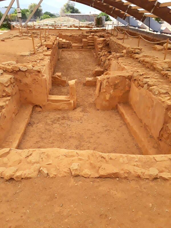
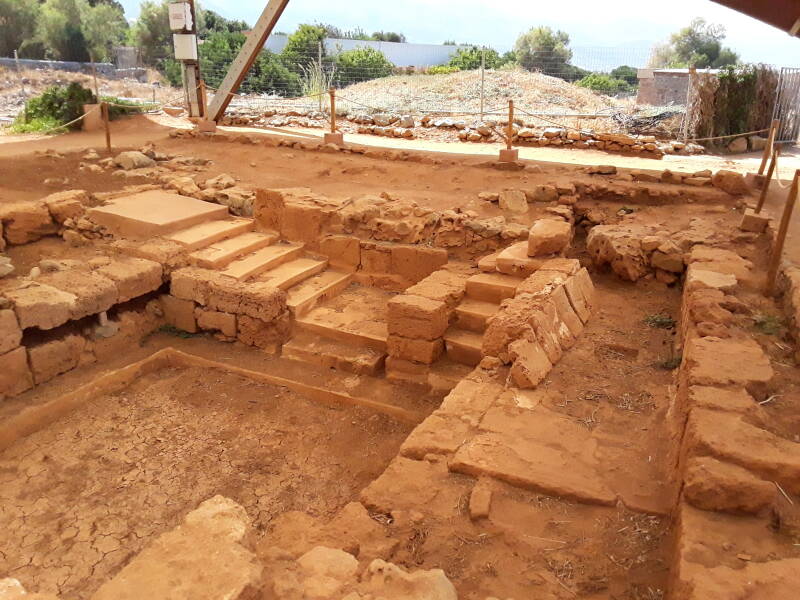
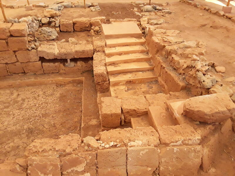
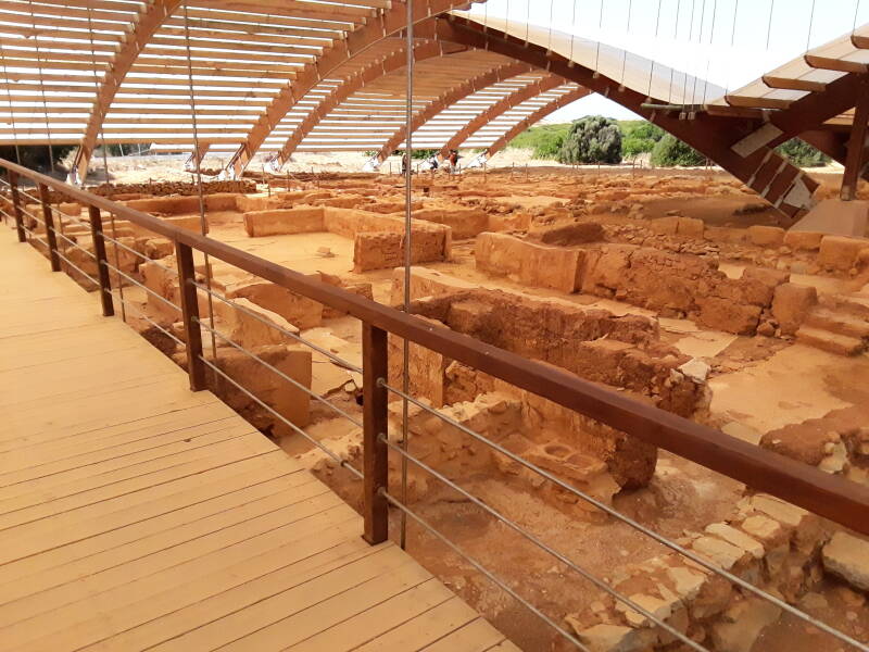
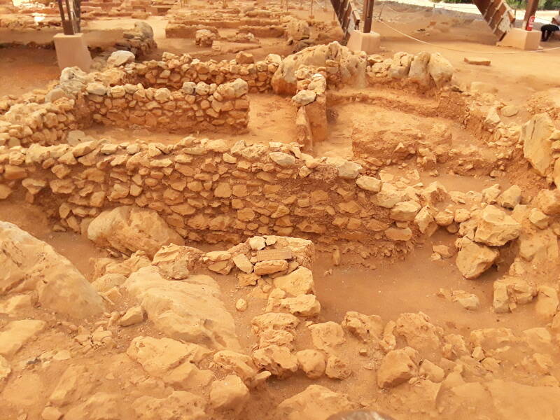
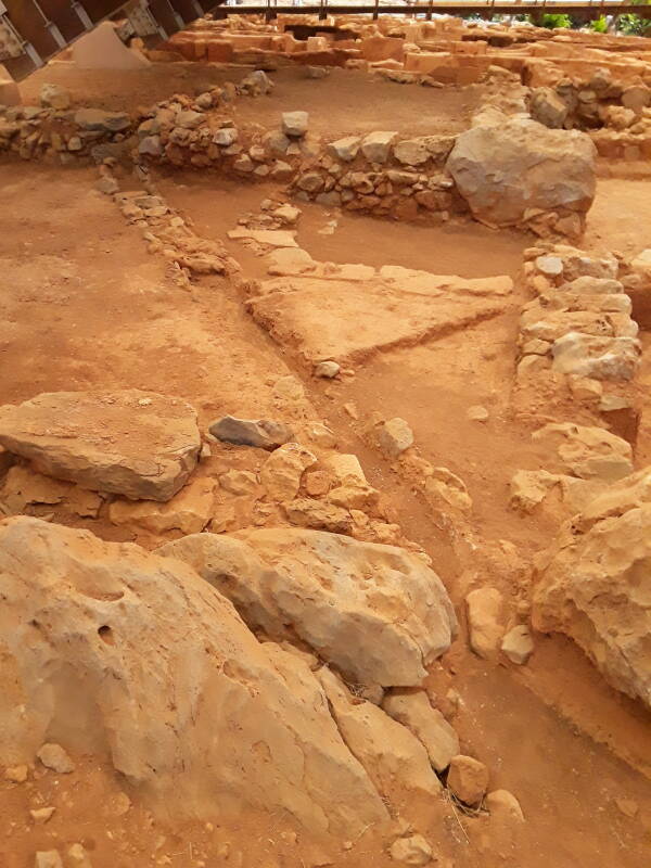
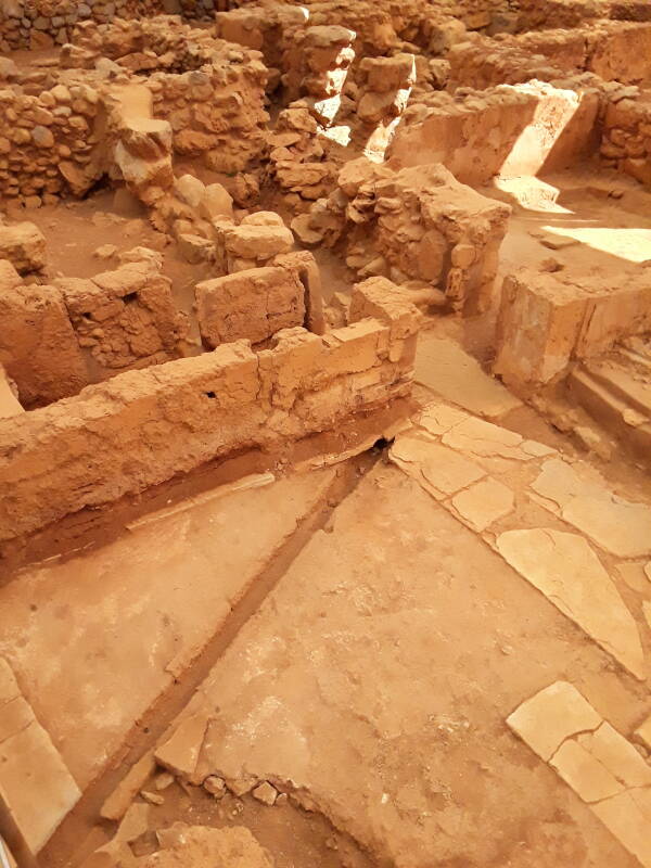
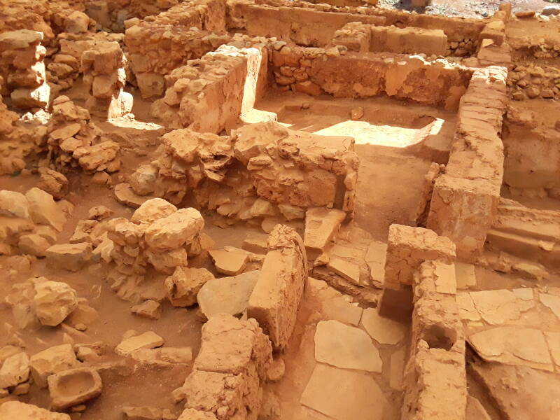
French archaeologists designated various quartiers around the site, include Quartier Mu, which turned out to be a residential area. It's a good-sized town beyond the storage complex of the Hypostyle Crypt.
It has been covered with a protective shelter, and now the public can visit it.
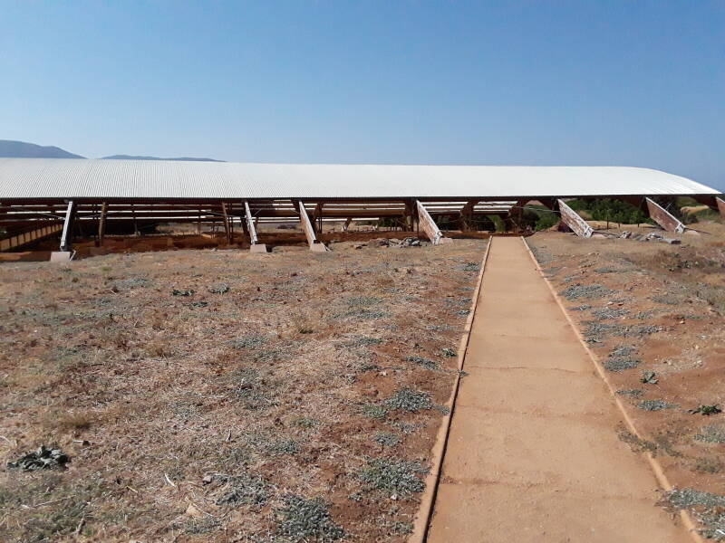
Elevated wooden walkways let you walk around and over the Minoan residences.
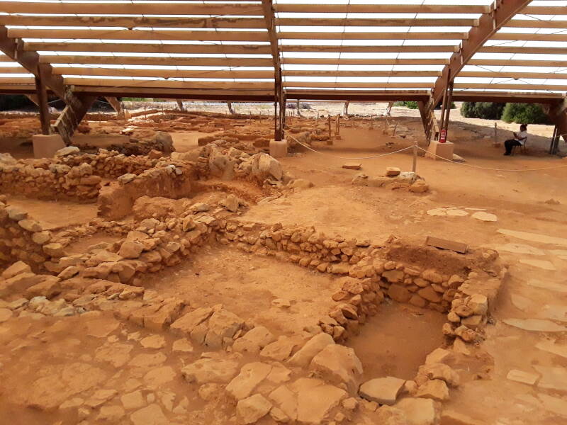
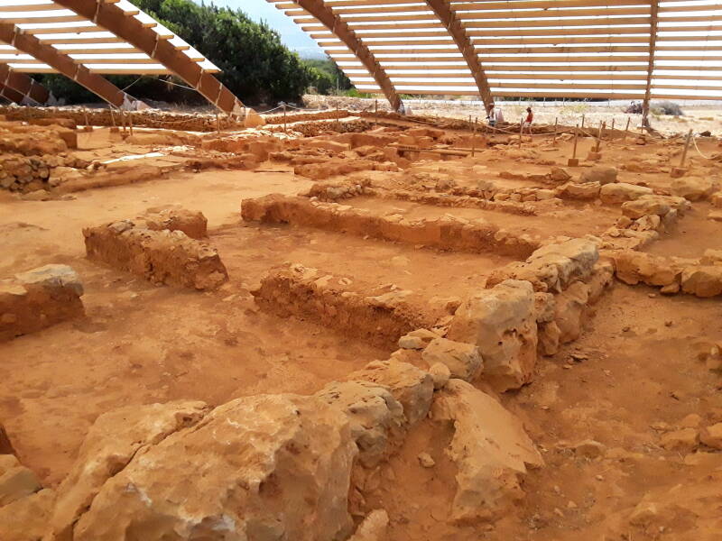
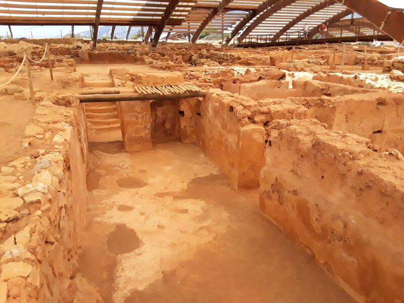
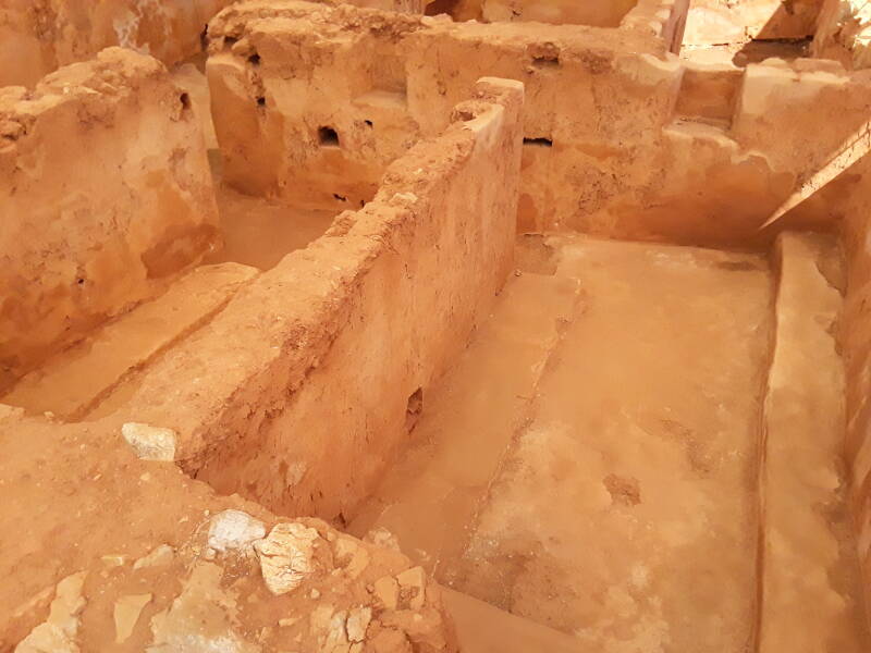
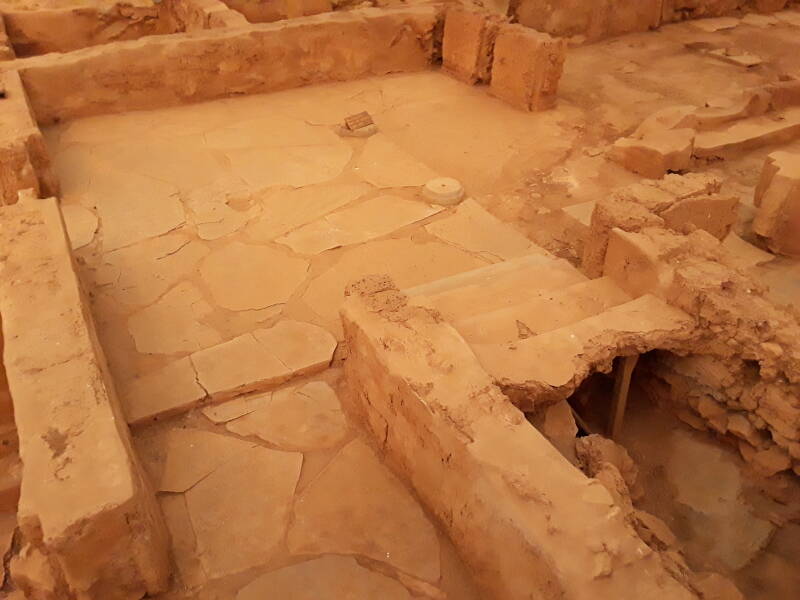
Plumbing
The residences were connected to a sophisticated municipal drain system. As at Knossos and Phaistos, the sewage and rain water drain systems were separated.
Back to Heraklion
European route E 75 is part of the International E-road network in Europe. E 75 is a series of highways running from the Arctic coast of Norway through Greece. It starts at Vardø, by the Barents Sea, runs through Finland and crosses the Baltic Sea to Poland by ferry. Then it continues south to Greece and is linked to western Crete by ferry. Finally it runs the length of Crete parallel to the north coast. Parts of it are marked as E65, A90, and 90 on maps of Crete.
I had instead taken the old highway, the Palea EO Irakliou Agiou Nikolaou which runs from Heraklion to Agios Nikolaos.
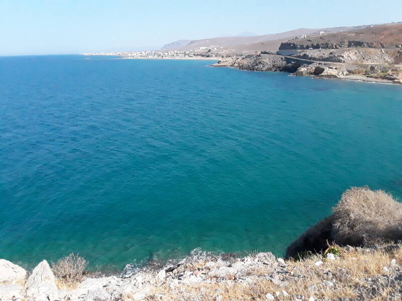
I stopped near the point west of Stavromeno on my way back to Heraklion. There's the old highway in the distance, closest to the water, with the E 75 expressway above it. And in the foreground, a tiny church.
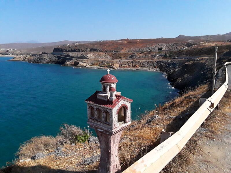
It's a roadside shrine, probably installed in memory of someone who died in a car crash here.
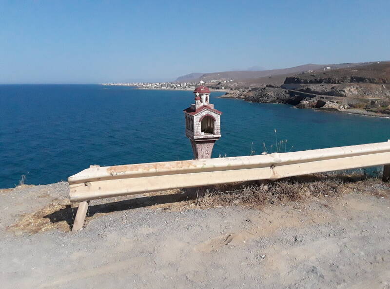
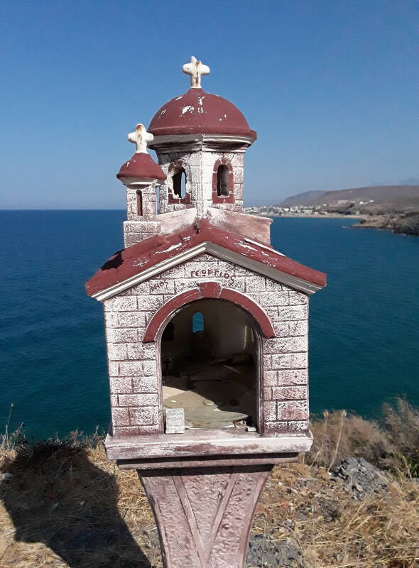
Agios Georgios, it says. Saint George. There are a few small coins and burned-down candles inside.
Or, Continue Through Greece:
Where next?
