Folegandros / Φολέγανδρος
A Few Days on Folegandros
I visited
Φολέγανδρος
or Folegandros as part of a visit to
some of the Cycladic islands,
after a few days on Ios and
before a few more days on Milos.
The Cyclades get their name from the roughly circular
shape of their cluster in the Aegean.
Folegandros is the most lightly populated of these three,
both in absolute count and in population per area.
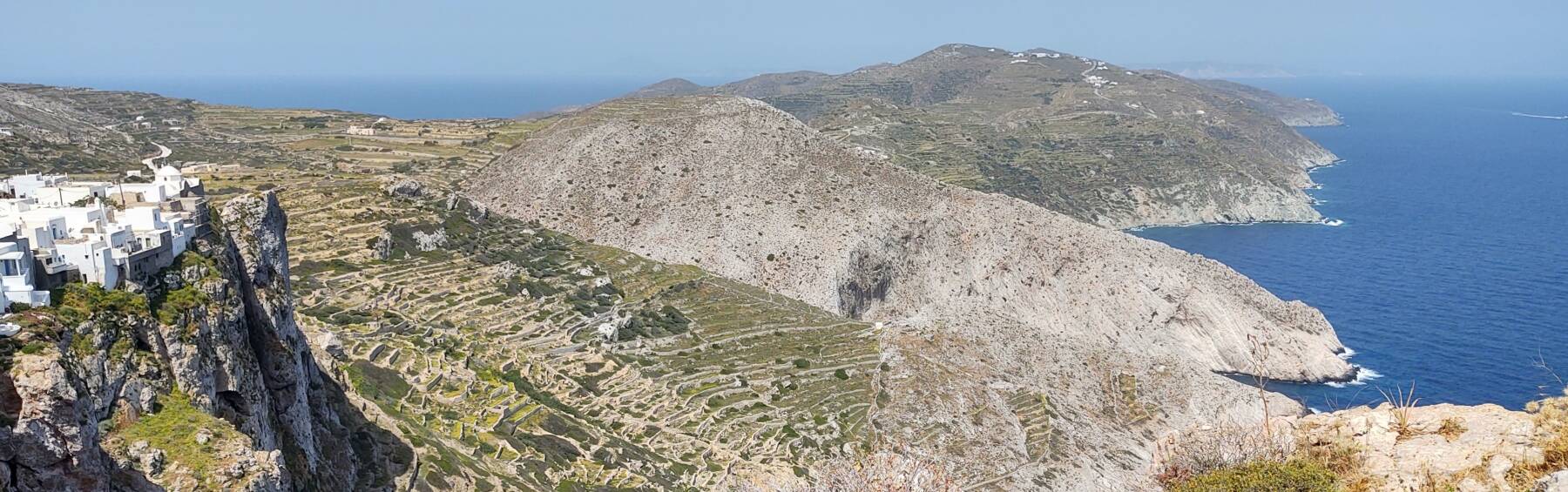
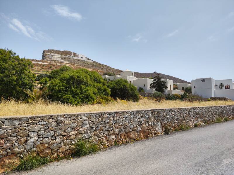
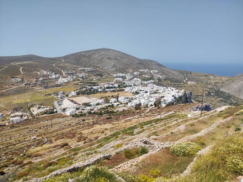
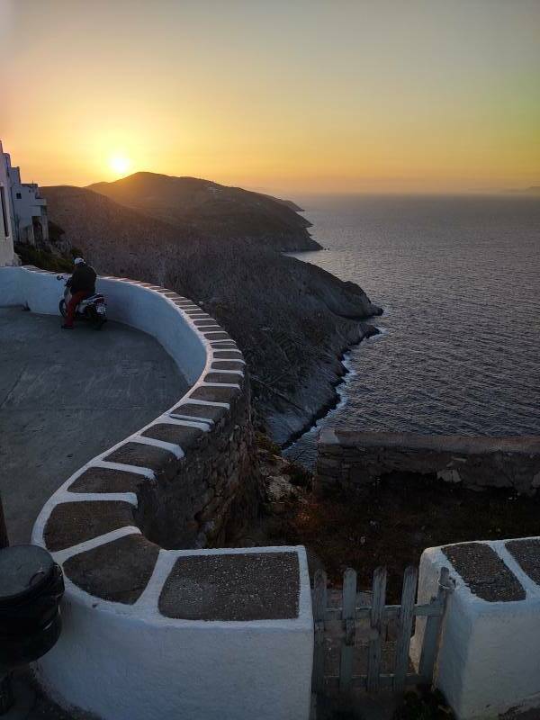
Folegandros has spectacular scenery.
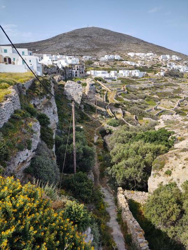
Its Hora or main town is perched at the
edge of a cliff 200 meters above the sea.
It's labeled Kástron
in this map, refering to its
κάστρο
or old fortress dating to the centuries when pirates
roamed the eastern Mediterranean.
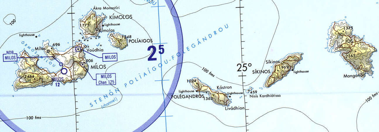
Portion of Tactical Pilotage Chart G-3A from the Perry-Castañeda Library Map Collection at the University of Texas at Austin.
Find Your Lodging
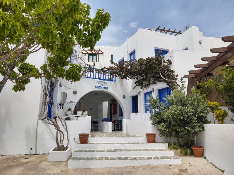
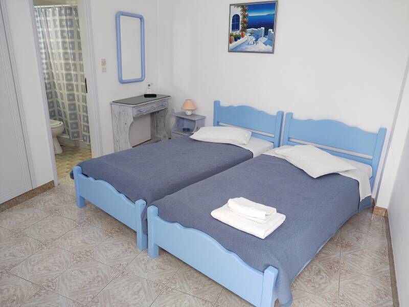
Guesthouses at Booking.comI stayed at the Evgenia guesthouse.
It bills itself as a domatia — that's the traditional term, "rooms (for rent)".
It's in the main town, with the traditional name of Hora, which is Χώρα in Greek. Some times that's transcribed as "Chora", which then needs an explanation that the Greek "Χ" is pronounced like the Scottish loch or German Bach. That seems to prefer a Latin transcription that would be familiar to someone who studied Ancient Greek at an English boys' school in the early 20th century. Or you can simply spell it "Hora" as the Greeks usually do, which any English speaker should pronounce pretty close to how the locals say it.
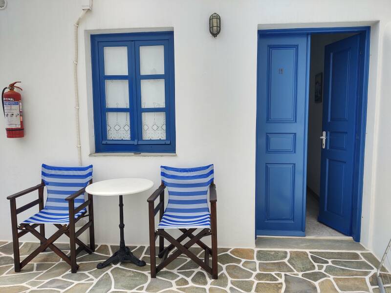
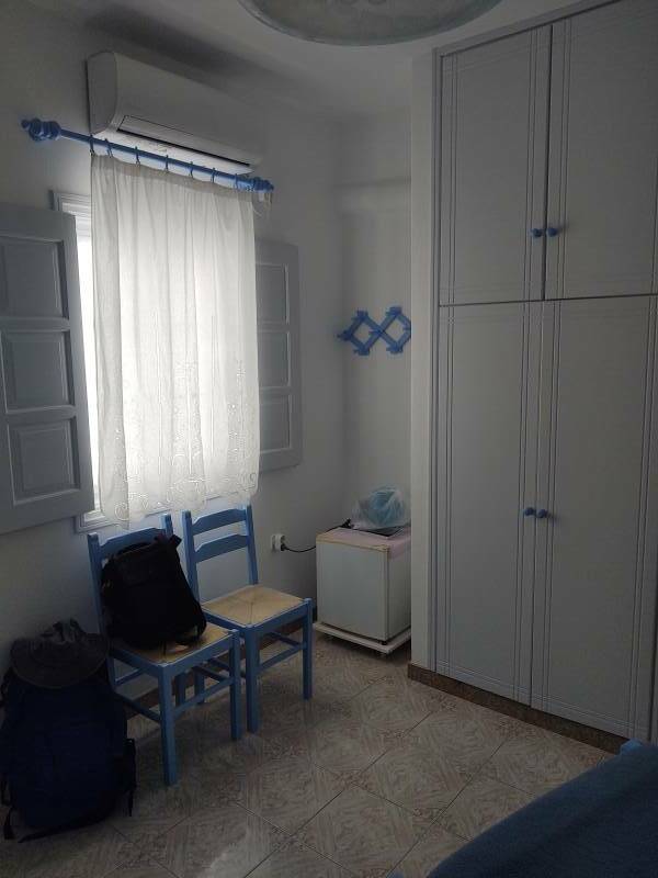
My room:
Evgenia is in a great location. It's very close to the bus station with transport to and from the port.
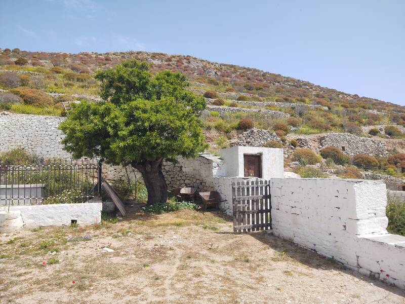
There's a chapel nearby, just past the veterinary office.
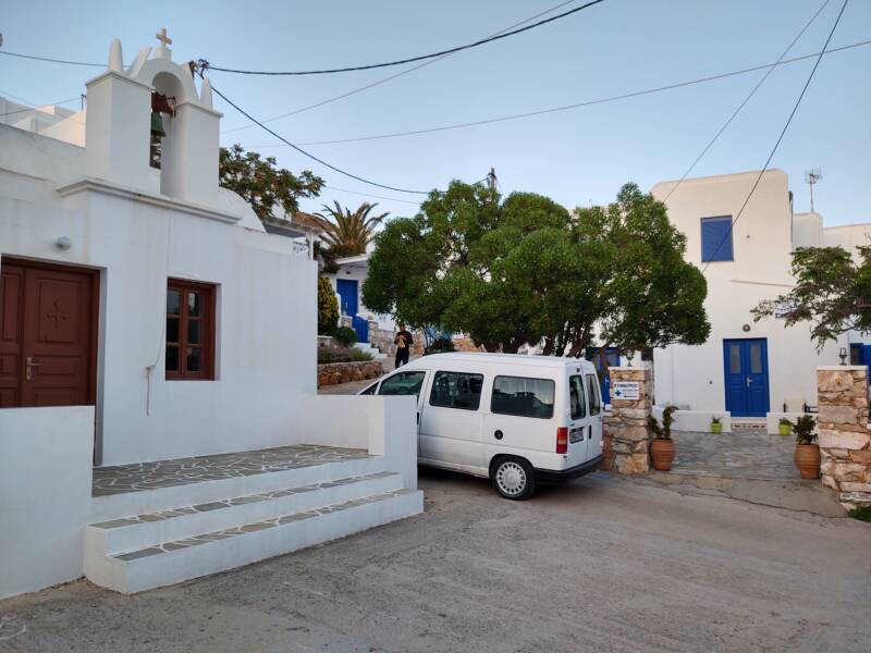
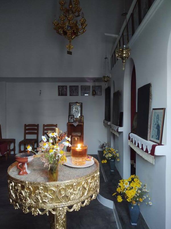
It's a chapel and not a church, but someone may get the key and stop in to light an oil lamp at any time. Looking in through the window, we see one burning.
Starting the Day in Folegandros Hora
It's just a short stroll of about 75 meters from the Evgenia to Plateia Pounda, the main square. The center of the old town is straight ahead, the kastro with fortified homes around a central courtyard is to the right.
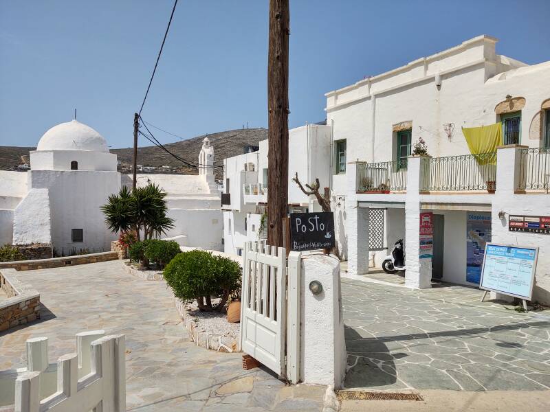
First, breakfast at the cafe at the corner where the road from the port reaches the plateia. I saw ΟΜΕΛΕΤΑ on the menu, so I asked for an omelette. Ah, but what did I want in my omelette? There was a rapid list of choices, I recognized peppers, onions, and bacon, plus something else. Smile, nod, and say Όλα, παρακαλώ, "All of them, please."
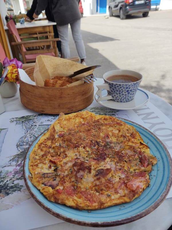
The mystery ingredient turned out to be souroto, the local soft white cheese made from goat's milk and sheep's milk.
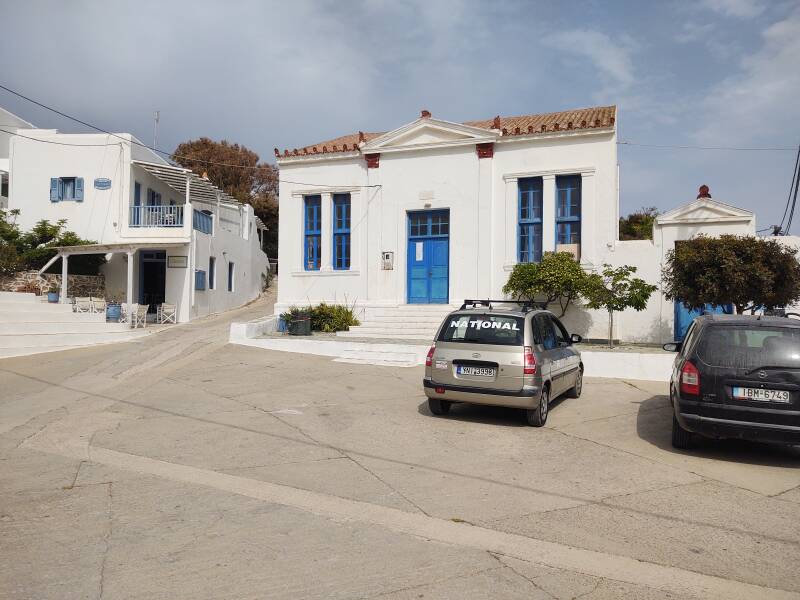
The elementary school is in a 1908 Neoclassical building on the east side of Plateia Pounda. The high school is about 90 meters to the east, along the road to the port just before the bus station and post office at the edge of town.
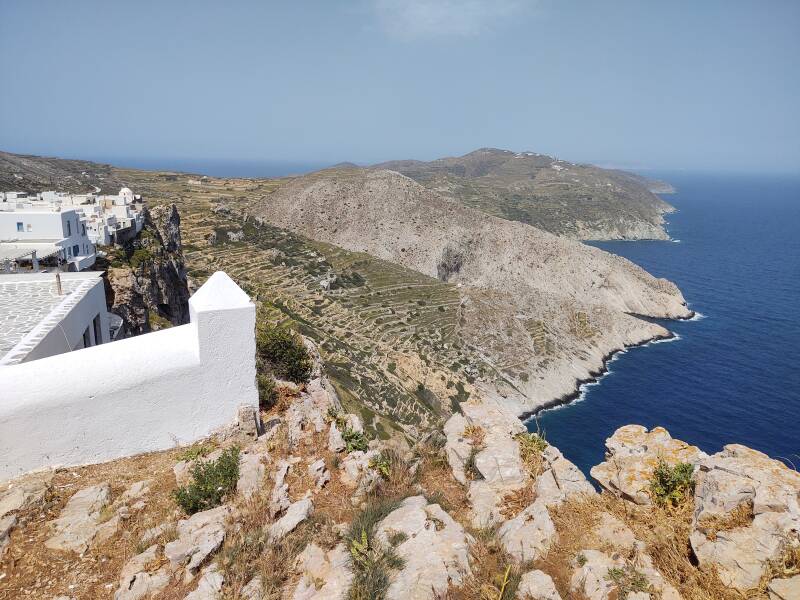
There's a stunning view from the north side of the plateia, 200 meters down the cliff and steep slopes to the north shore of the island. That would slow down those pirates.
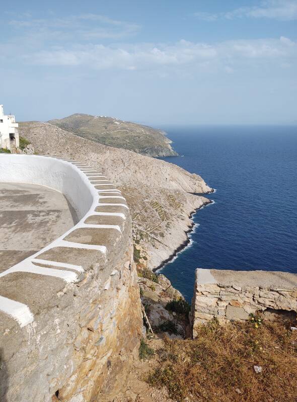
Walk through Hora to its west side, and there are similarly fine views. Sifnos is faintly visible on the horizon here.
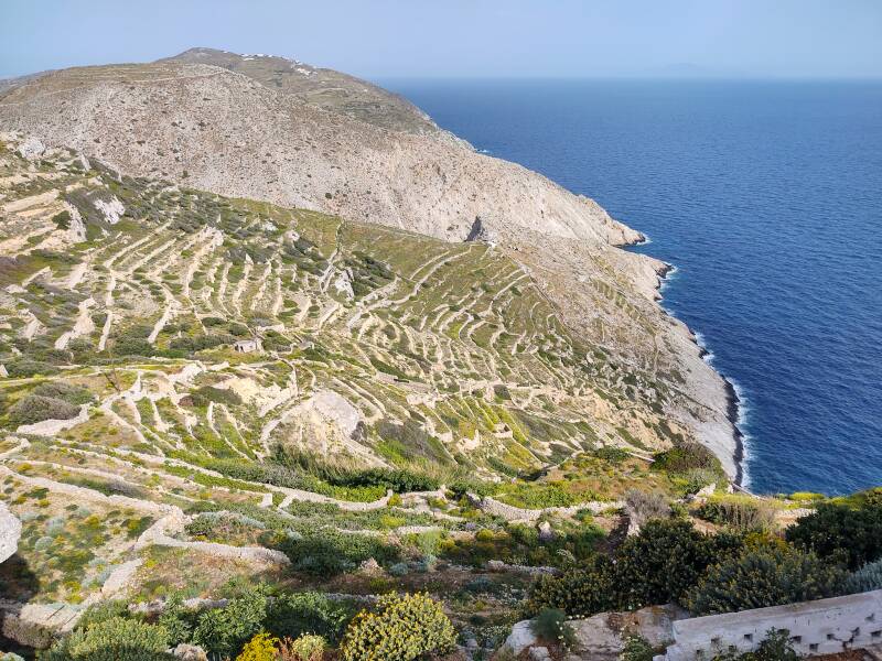
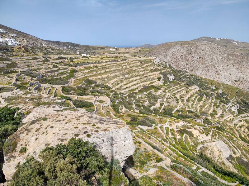
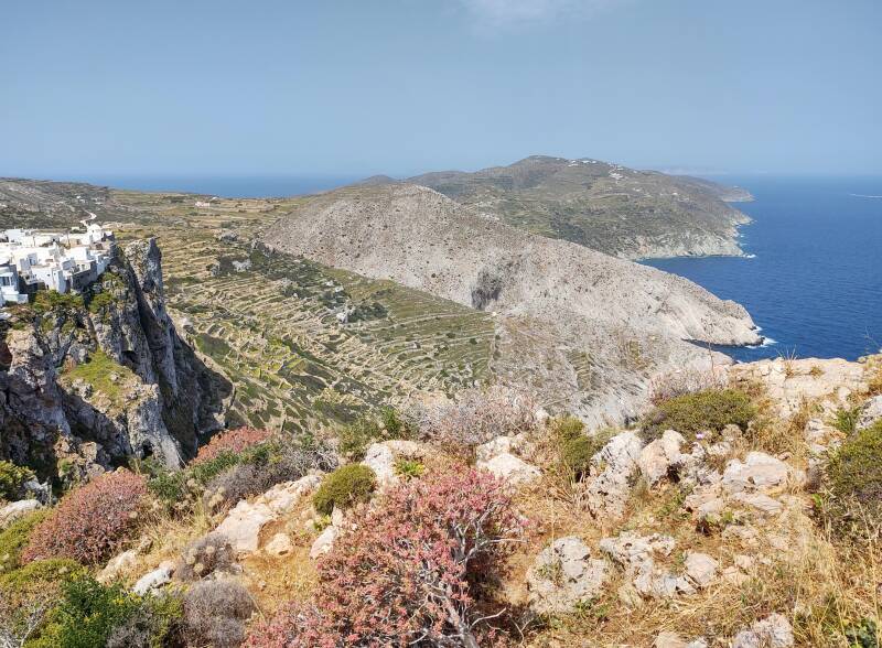
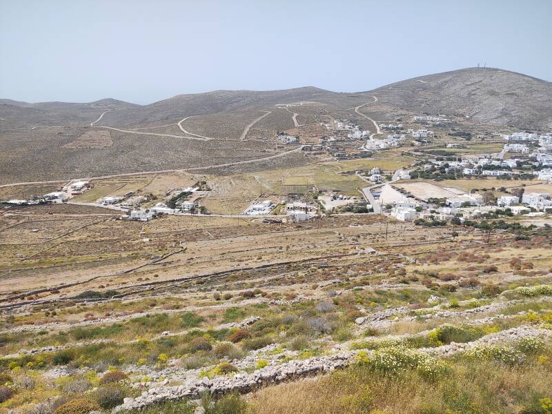
Folegandros has a very dry climate with strongs winds from the north most of the year. The trees that do grow here tend to bend significantly to the south. The farmers built terraces for the crops and circular walls for trees.
Mythology says that Minoans came from Crete to Folegandros. led by Minos Folegandros, the son of the Minoan ruler.
People first settled here in the third millennium BCE. Historians say that it was named by the Phoenicians early in the first millennium BCE. They used it as a station for their trading network through the eastern Mediterranean. They called it Phelekgundari, meaning "rocky land" in Phoenician. That's an appropriate name.
Folegandros is very pleasant today, but like many of the Aegean islands it has served as a place of exile. That started with the Romans. The series of right-wing dictatorships that ruled Greece for much of the period from the 1920s through the early 1970s used several of the islands as places of exile and imprisonment. In 1937 the dictatorial regime designated Folegandros, Sifnos, Anafi, and Agios Efstratios as places of exile for "communists of minor severity".
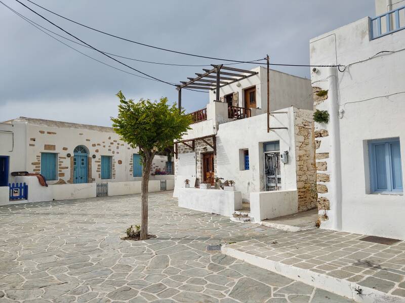
Walking Through Hora
Car and truck traffic stops at Plateia Pounda, as the passageways are narrow.
Plateia Dounavi is the main square within the core of Hora.
Folegandros was controlled by the Italian rulers of the Aegean, first by the Duchy of Naxos starting in 1207, then transferred to the Bolognese rulers on Kythnos in 1336.
The population dropped enough that a visitor around 1417 described the island as "nearly uninhabited". Then it was resettled from Crete in the 16th century.
The Ottomans took possession of Folegandros in 1617. A punitive Turkish raid in 1715 left it almost completely depopulated.
Imperial Russia ruled the Cyclades, including Folegandros, in 1770–1774.
In 1828 Folegandros joined the newly independent nation of Greece.
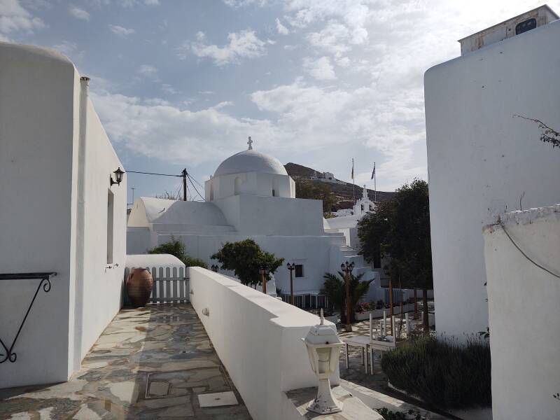
There are several churches in Hora.
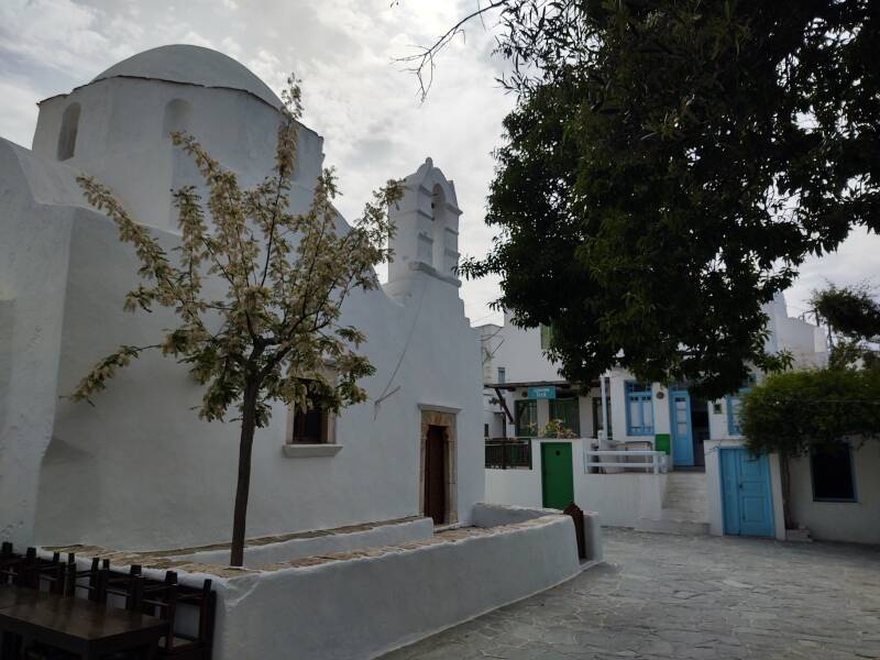
I counted 51 churches and chapels on the map of the island at the plateia. There were 765 inhabitants at the census, with 316 of them living in Hora. That's at least one church or chapel for every 15 people on the island.
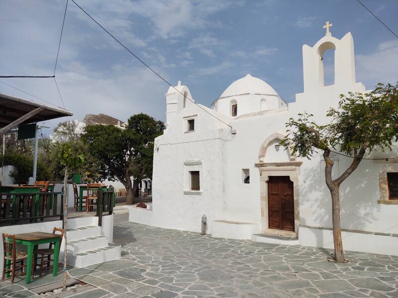
Here are two churches in Hora with the Panagia or All-Holy in the background.
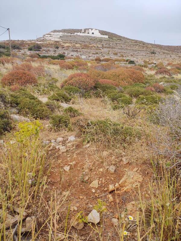
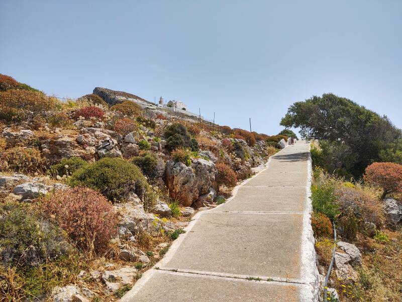
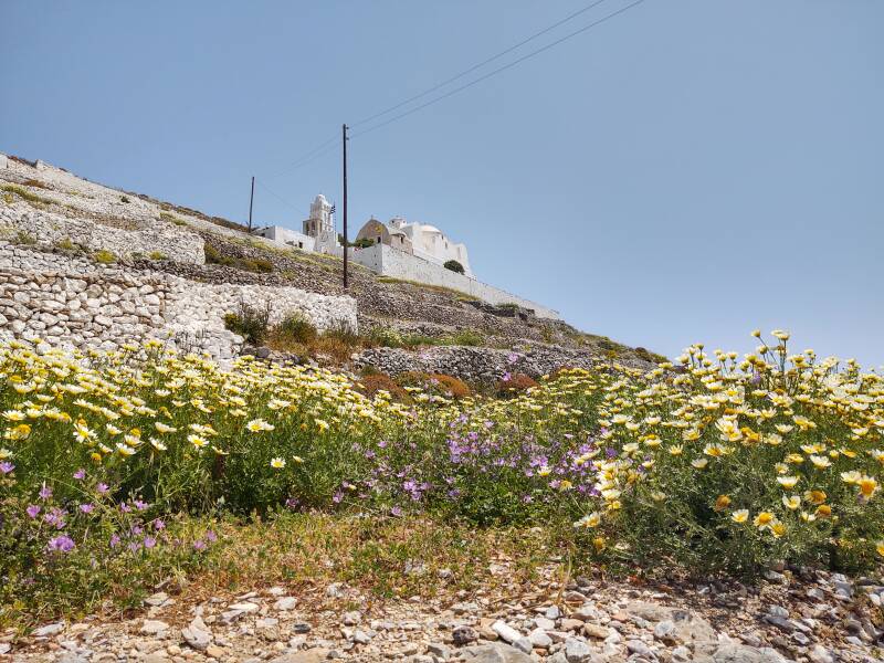
Up to the Panagia
Hora is at 200–220 meters elevation. The Panagia is at 305 meters, so you climb about 100 meters to reach it. The summit beyond it is at 353 meters. It was cloudy on my first day on Folegandros:
The next day had almost no clouds. A nice day to enjoy the views from the Panagia.
The path starts beside the elementary school in the plateia.
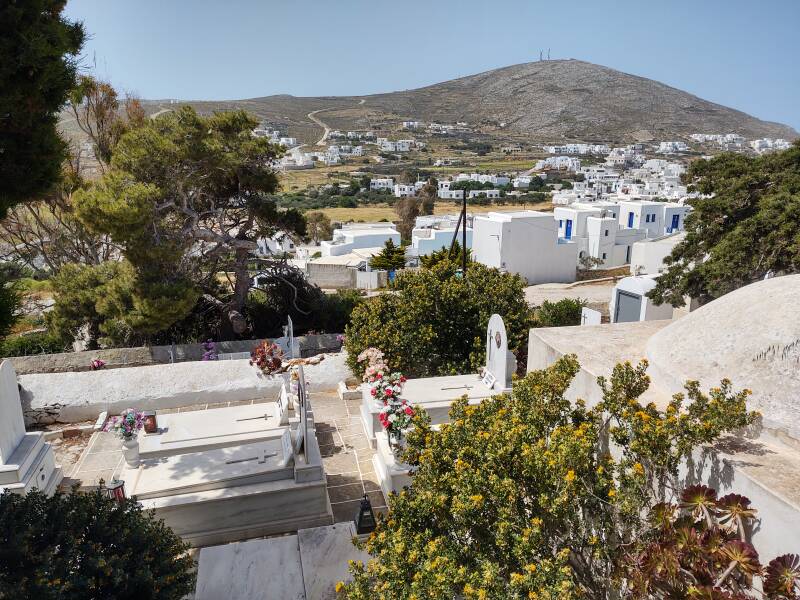
A cemetery and small church are along the path at the upper edge of the Hora.
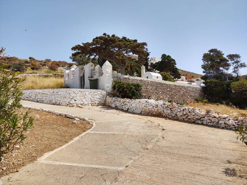
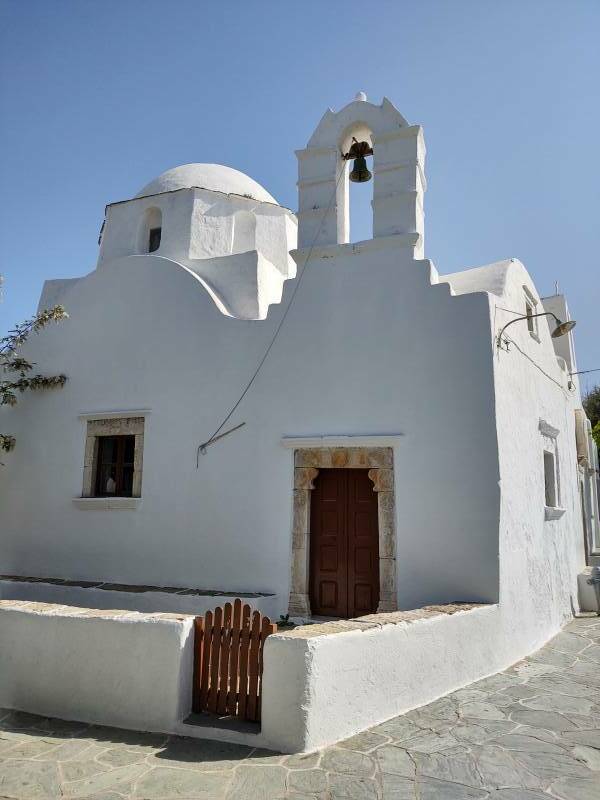
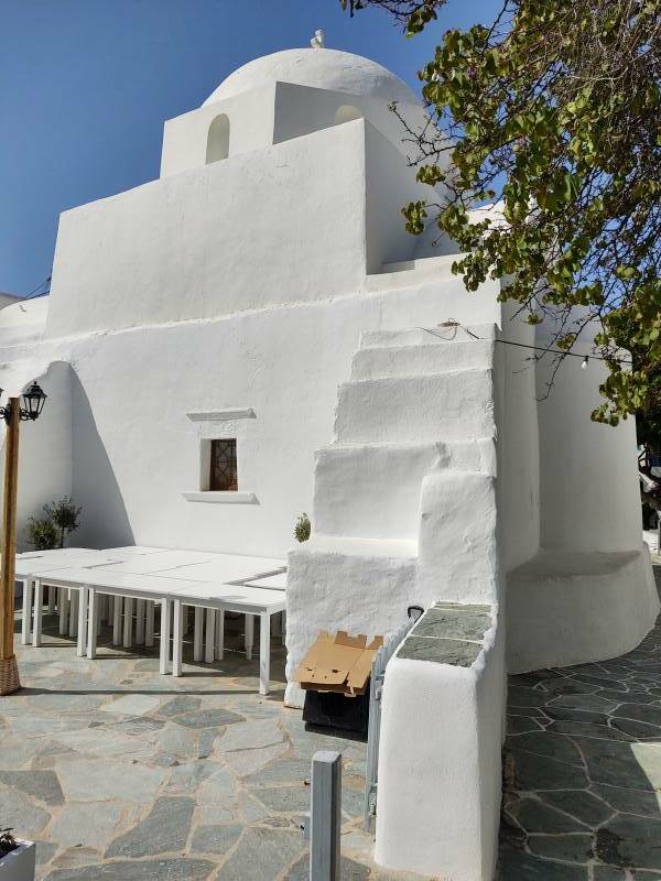
Chapel of Saint John
The Chapel of Saint John is at the upper edge of Hora.
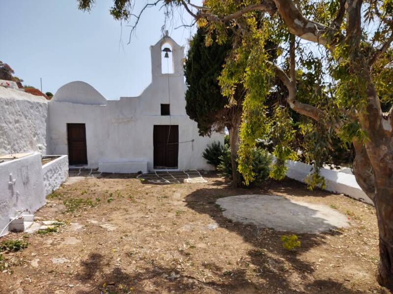
The cemetery is right beside it.
It's a small chapel.
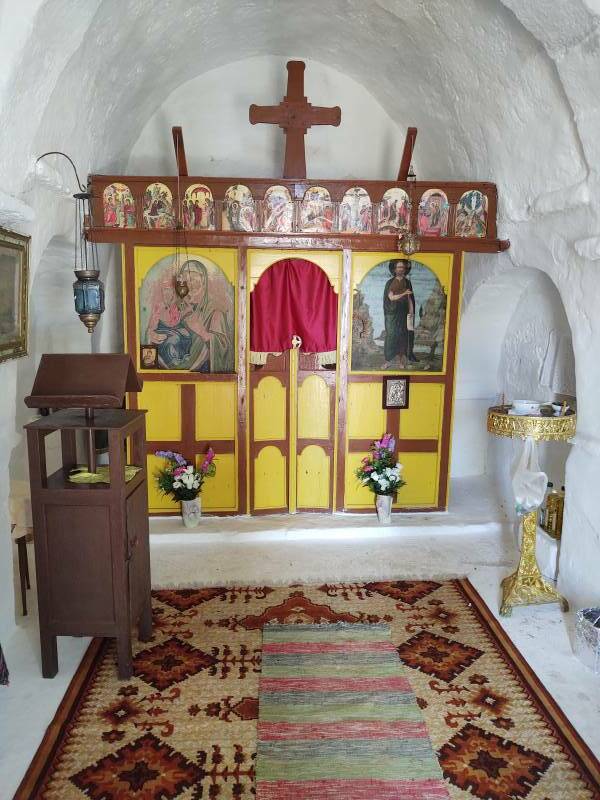
The iconostasis struck me as a little unusual. Normally the two icons at either side of the central doorway are the Panagia and Kristos Pantokrator, so the central door to the altar is flanked by the first and second coming of Christ. The person to whom the church or chapel is dedicated would then be on a third icon on the right side.
Here, however, the main icon to the right of the central door is John. The Baptist, as you can tell from his somewhat shaggy hair and beard, and the river in the background.
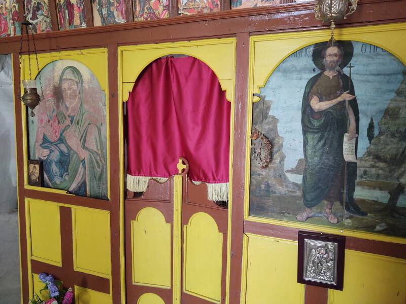
Simply "John" in Greece means John the Baptist, while "John the Theologian" or Ίωάννης ο Θεολόγος means Jesus's disciple, the author of the Gospel of John, the author of the Letters of John in the New Testament, and the author of the Apocalypse, titled Revelation in English. See my pages on Patmos for far more, but scholars today (and yes, including theologians) believe that those four roles of "John the Theologian" probably refer to four separate people, or maybe three people plus a group for the Gospel authorship.
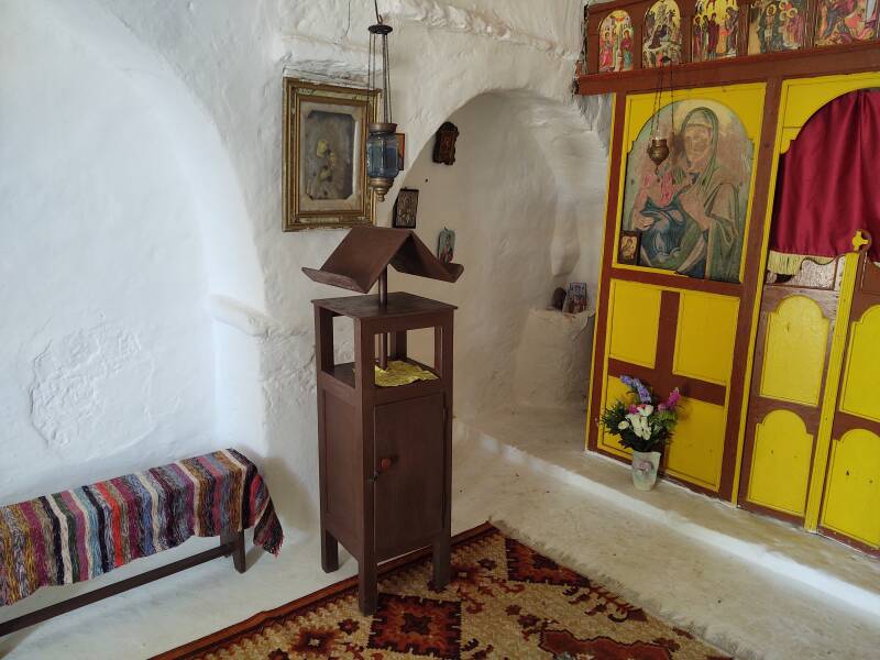
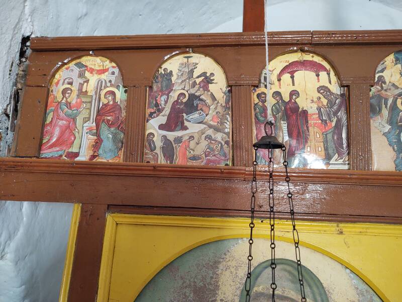
Then there's a standard (iconic, orthodox) array of icons across the top.
The Annunciation, The Nativity, Presentation of Christ in the Temple, ...
... Theophany or baptism by John, Raising of Lazarus, Entry into Jerusalem, Crucifixion, ...
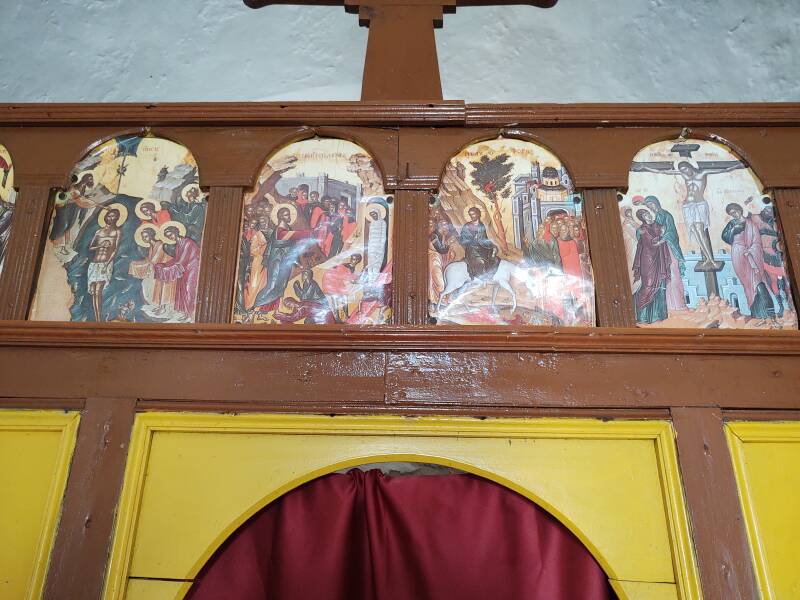
... Anastasis or Resurrection of the Dead, one that I don't recognize, and the Metamorphosis or Transfiguration.

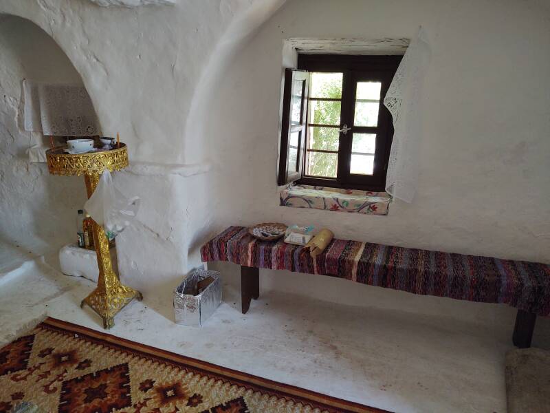
Continuing to the Panagia
The chapel's door hadn't been locked, it was held shut with the bell rope wrapped around the handle.
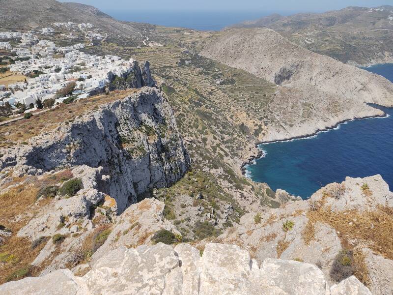
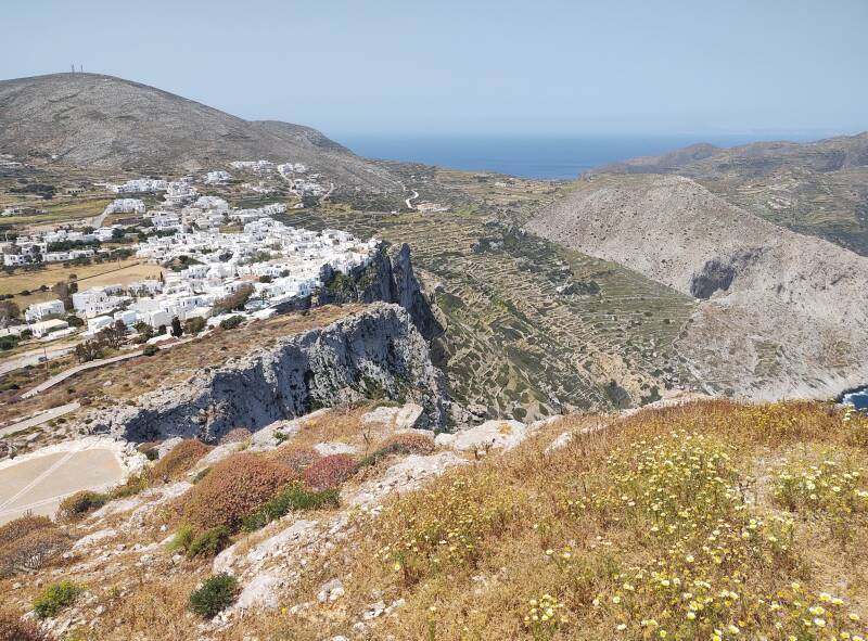
I closed and secured the door and continued up the path. The cliffs at the edge of Hora came into better view. The buildings weren't painted white back during the days of pirate raids. The town blended into the cliff face and would have been very difficult to notice from the sea.
Παναγία or All-Holy is one of the titles of Jesus' mother Mary. Churches dedicated to her are usually called Panagia.
Before long you're above all of Hora.
The path zig-zags back and forth as it climbs.
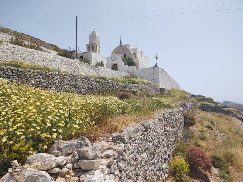
Finally you arrive at the gate into the church compound.
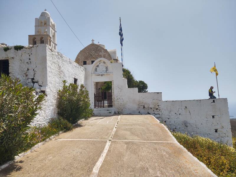
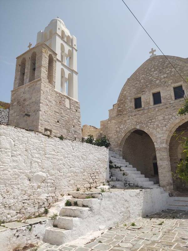
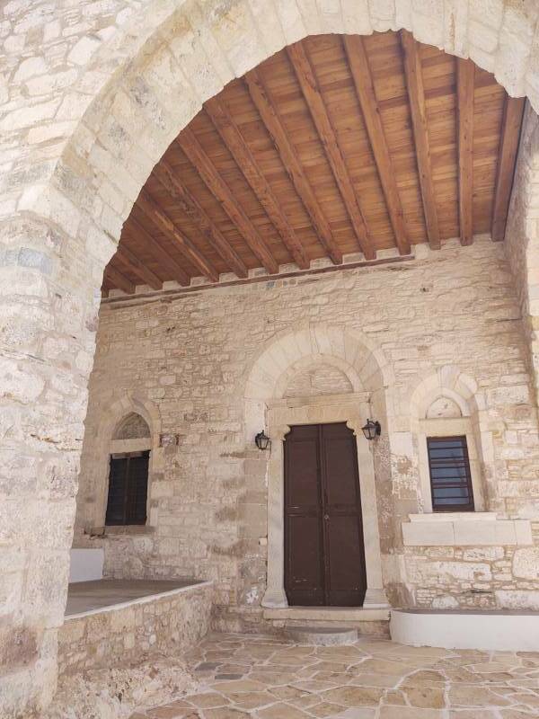
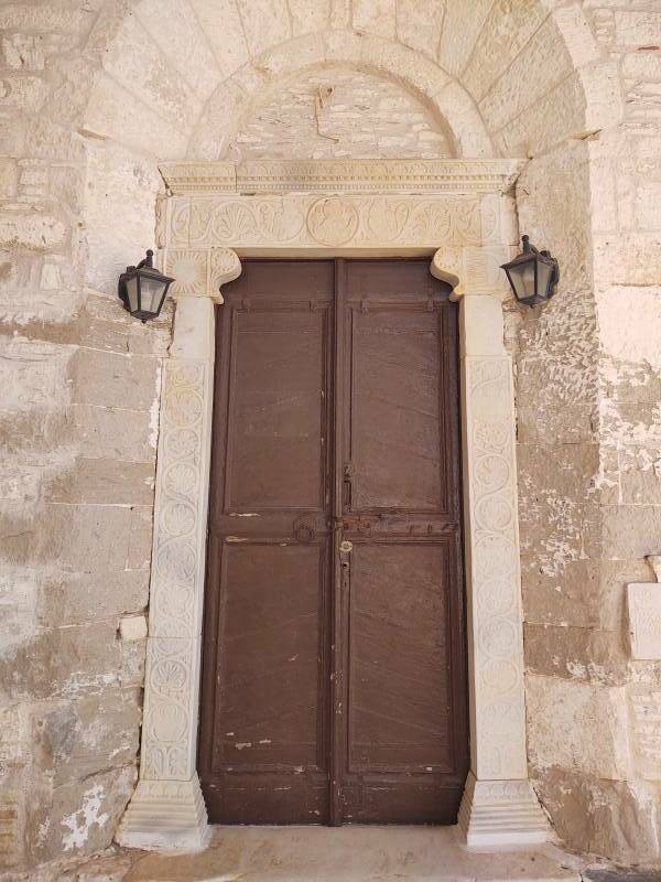
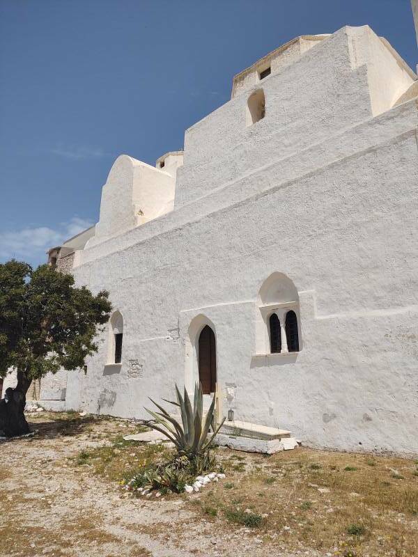
Panagia
The Panagia was built around 1820, shortly before there was an independent Greek state which Folegandros would join. It was built on top of a 17th century predecessor.
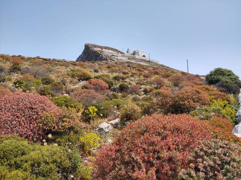
If you're feeling especially energetic, you could exit the church grounds at the rear and continue up the slope to the ancient Palaiokastro.
Another 50 some meters of elevation gain takes you to the summit, where there can find some vague remains of late medieval walls. They surround what was originally the ancient acropolis, and later became a fortress in Byzantine and Venetian times.
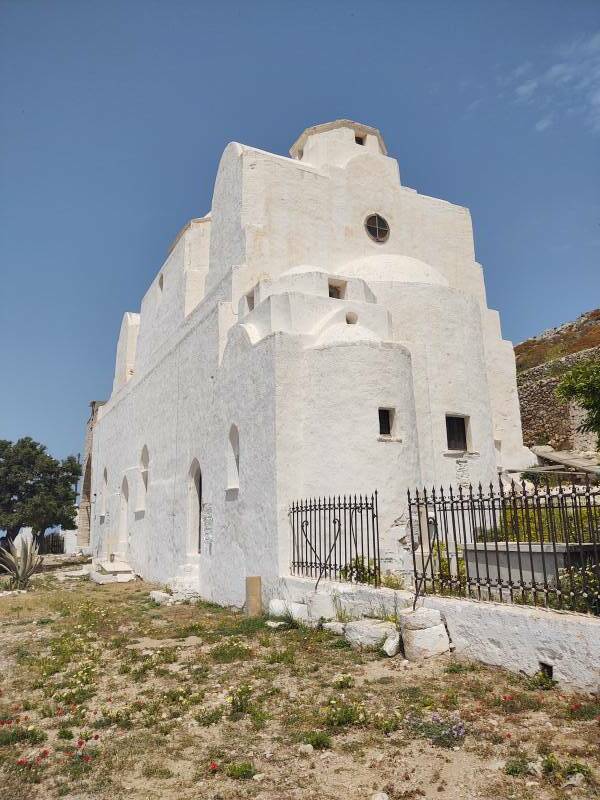
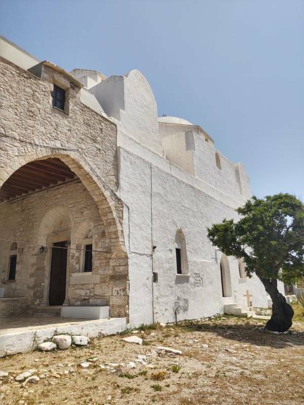
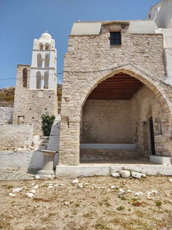
The bell tower includes the torso of a statue.
View from Panagia
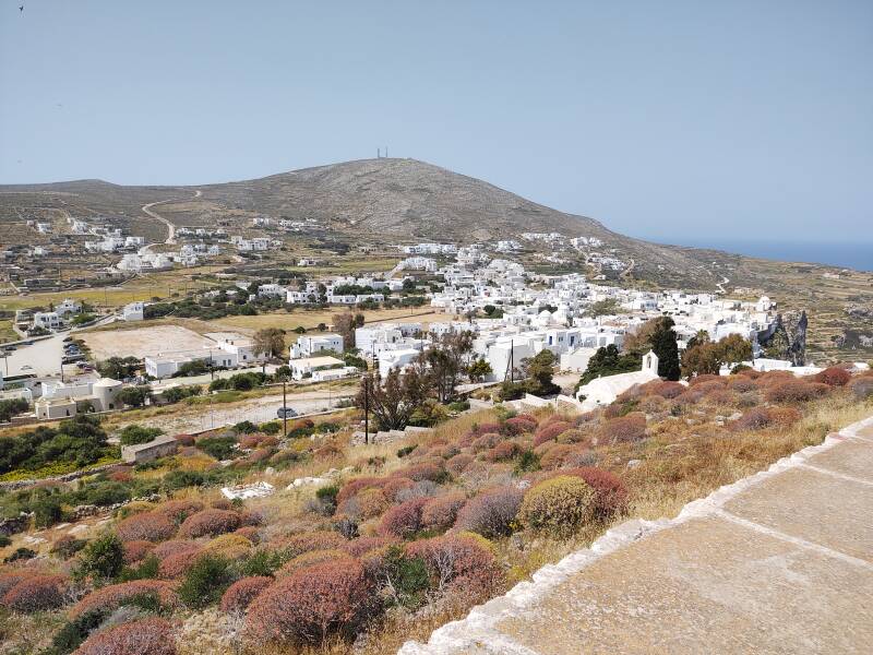
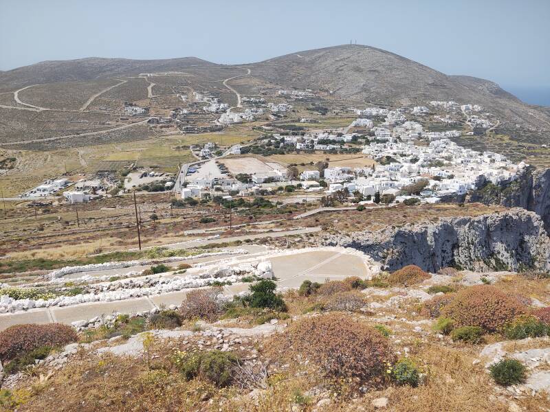
This is the view to the south-east, with the port almost visible.
The port is near the right edge of the picture, the main road from the port crosses left to right in this view toward the south.
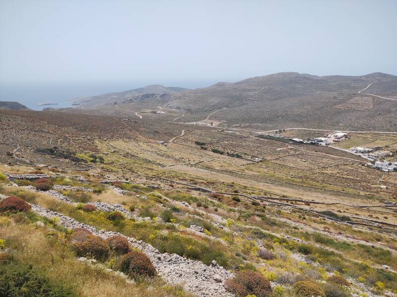
We're well above Hora. The highest point on the island, near center here, is just over 400 meters above sea level, so about 100 meters higher and to the southwest of this vantage point.
The high point has a cellular site and various VHF/UHF and microwave relay links. Just below there is the chapel of Agios Eleftherios.
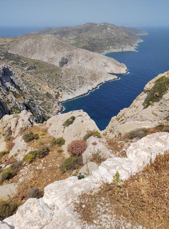
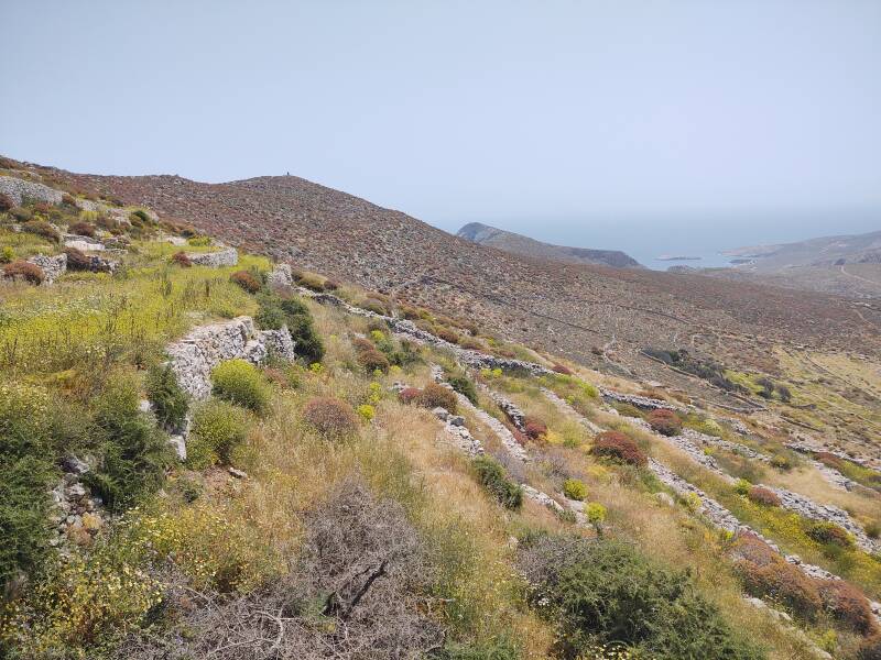
We can get a better appreciation for the defensive location of Hora.
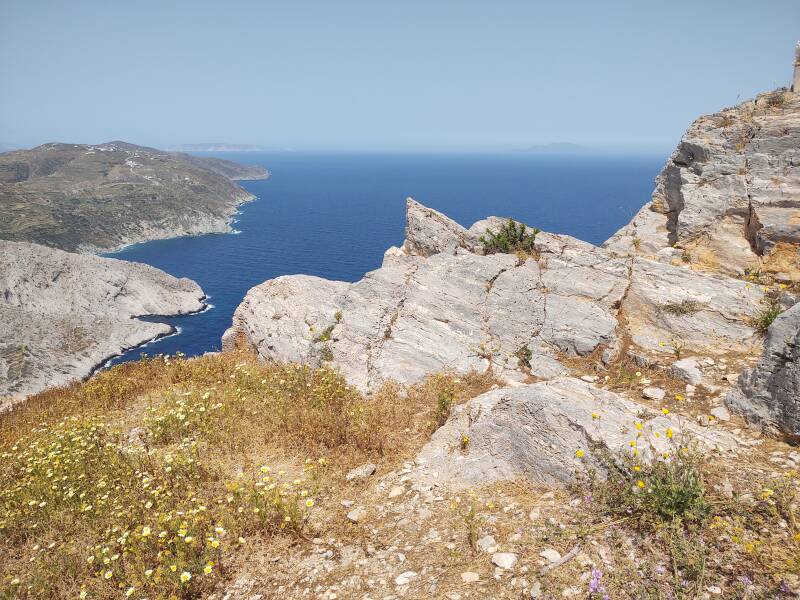
Looking to the northwest, Poliegos is more clearly visible toward the left, and the more distant Sifnos is faintly visible toward the right. Poliegos and Sifnos are about 29 and 40 kilometers away, respectively.
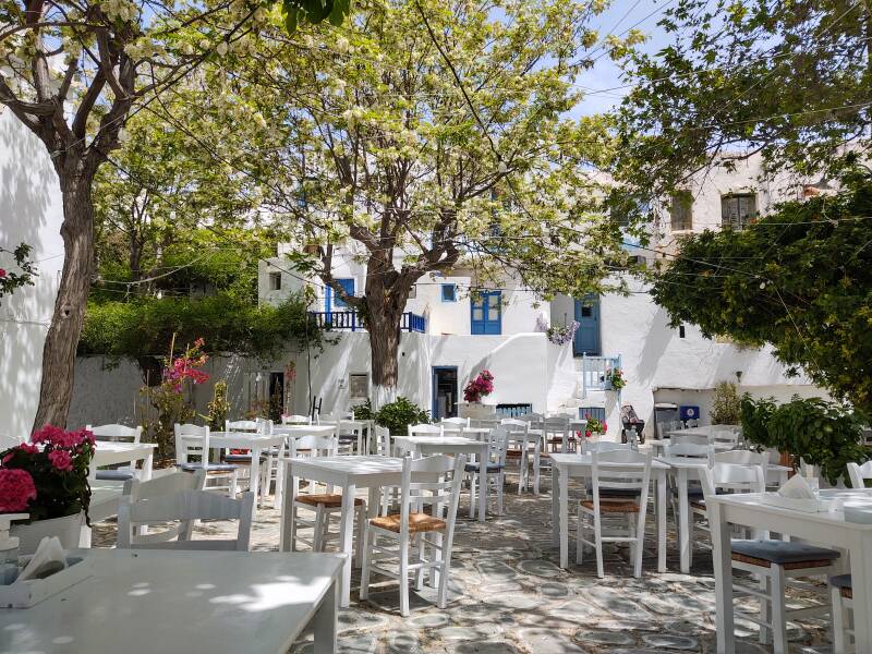
Evening in Folegandros Hora
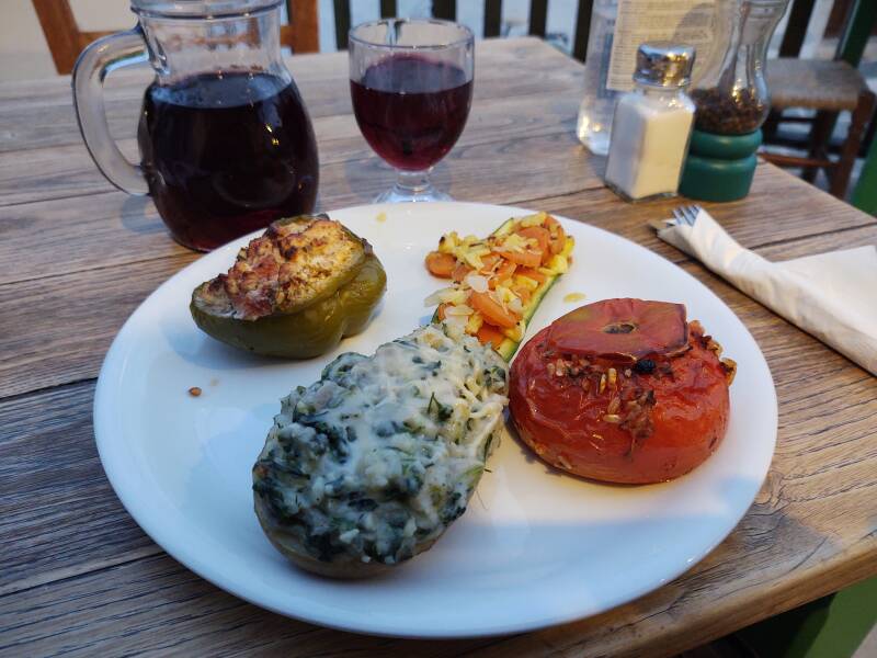
I had four vegetables stuffed four ways at the Sik (or Chic) restaurant in Hora.
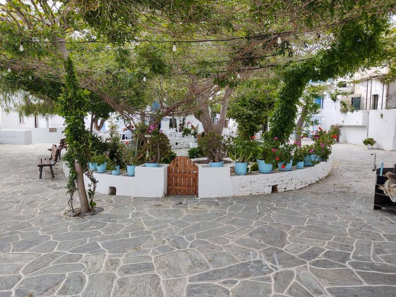
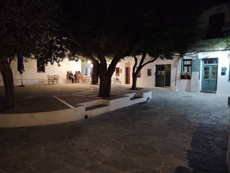
One of the plateias had a shaded raised floor for programs, dancing, or, as on this evening, card games.
Or, Continue Through Greece:
Where next?
The name is Πούντα, and is transcribed both as Pounda and Pounta. The first better represents for English speakers how it's pronounced.