Leros in World War II
History of Leros
Leros has had a complicated history.
The Dodecanese islands were captured and controlled
by Persia in the early 5th century BCE,
absorbed into the Roman Empire which divided and evolved
into the Byzantine Empire,
seized by the city states of Venice and Genoa,
then captured and absorbed into the Ottoman Empire,
captured by the Kingdom of Italy which itself then came to be
controlled by the Fascist regime in 1922,
taken over by Nazi Germany in 1943,
and finally unified with the Republic of Greece in 1948.
I was on my way to see sites from the 1930s and 1940s,
surrounded by signs of the earlier stages of history.
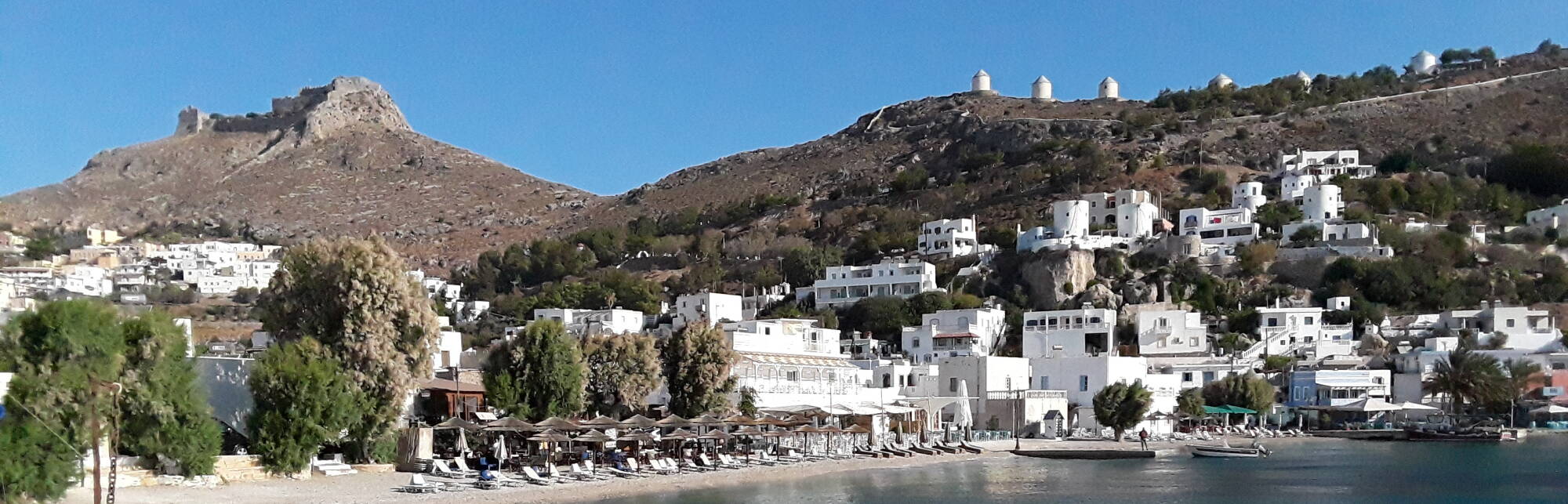
I would walk through most of the main settlement on Leros,
from the tourist area of Alinda
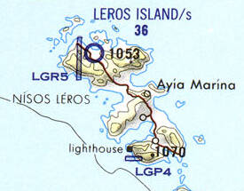
to the east-coast ferry port of Agia Marina,
uphill to the administrative center of
Platanos on a saddle between two bays,
along a ridge above the Pandeli beach area,
and then down to Lakki,
the freshly designed port town built on the west coast
by the Italian occupiers in the 1930s.
The war museum is in Italian tunnels beyond the ferry pier
on the north shore of Lakki bay.
Homer's Iliad and Odyssey were written down in the 8th century BCE. They tell of the Trojan War, now dated to the period of about 1260–1180 BCE. The Iliad includes Leros in its list of Aegean islands that participated with naval forces.
Well, "Homer" in so-called "quotation marks", because most scholars since the early 1930s agree that the Iliad and Odyssey were based on older oral traditions. They differ in language and details of their stories, and weren't produced by the same author or editor. See the article "The Classicist Who Killed Homer" and the book Hearing Homer's Song.
The Dodecanese islands were captured by Persia around 499 BCE. The Athenians defeated Persia in 478 and the islands joined the Delian League, based on Delos at the center of the Cyclades.
Leros supported Athens in the Peloponnesian War against Sparta in 431–404 BCE.
After Alexander the Great died in 323 BCE, the Dodecanese islands were divided among Alexander's generals. That led to them becoming part of the Roman Empire, and then the Eastern or Byzantine Empire.
After the western European armies besieged and looted Constantinople during the Fourth Crusade in 1204 CE, Venice and Genoa seized control of the region.
The Order of the Knights of the Hospital of Saint John of Jerusalem captured Leros in 1309. They built fortifications including expansion of the castle on the peak overlooking the main settlement.
The Ottomans captured Constantinople in 1453, renaming it İstanbul. The Ottoman admiral Kemal Reis sent a fleet of seventeen warships to Leros in 1505 but failed to capture it. In 1508 he tried again with a larger fleet, but that also failed.
The Ottomans captured Rhodes in 1522. Sultan Suleiman and the Grand Lord of the Knights of Saint John signed a treaty in which all of the Order's possessions in the Aegean were turned over to the Ottoman Empire. That began several centuries of Turkish rule. Leros, like several other islands, had a privileged status of partial autonomy.
Italy went to war with the Ottoman Empire in 1911–1912 and occupied all of the Dodecanese.
Things were changing rapidly. The Italo-Turkish of 1911–1912 saw Italy carry out the world's first aerial reconnaissance mission and the first aerial bomb drop. The Turks used rifles to become the first military to shoot down an aircraft. Guglielmo Marconi joined the Italian Corps of Engineers in Libya to establish a network of wireless telegraphy stations.
Italy had agreed to return the Dodecanese to the Ottoman Empire in the 1912 Treaty of Ouchy. However, the treaty was vague, and then the Italo-Turkish War was quickly followed by the Balkan Wars of 1912–1913, and then World War I started in 1914.
The British used Leros as a naval base during World War I, but then Italy resumed control.
World War I was immediately followed by the Greco-Turkish War of 1919–1922. The western Allies, especially the British, had promised large territorial gains to Greece. But they didn't provide support, and the Greek attempt to capture Thrace and western Anatolia failed. The Allies backed out of the 1920 Treaty of Sèvres, and set up the 1923 Treaty of Lausanne. It divided up the Ottoman Empire, although not as harshly for the Republic of Turkey as the 1920 treaty did. It also gave the Dodecanese to Italy.
The Fascist regime that had taken control of the Kingdom of Italy in 1922 set out to force the Dodecanese to become culturally Italian, with limited success.
Italy built a new town and naval base that they named Porto Lago. That bay in southwestern Leros, with a lighthouse marked at the southern point of its opening, is one of the largest deepwater harbors in the Aegean.
By 1936 about 7,500 Italians lived on Leros, making it the only island of the Italian-occupied Dodecanese where the Italian population outnumbered the natives. Mussolini called Leros "the Corregidor of the Mediterranean." He saw Leros as the critical base for Italian control of the eastern Mediterranean, and had a holiday villa built for him near the naval base.
Italy entered World War II on the side of Nazi Germany in 1940. In September 1943 Italy surrendered to the Allies, and Germany took over the Italian possessions in the Aegean. The Allies had captured all of Italy's territory in Africa by that time, including today's Libya, Eritrea, Ethiopia, and Somalia.
Many young men from Leros and other Dodecanese islands escaped by boat to the nearby Turkish coast and then made their way overland to British-controlled Palestine and Egypt to join various Allied units.
The British administered many of the Aegean islands after the war, hoping that no one would notice if they just held on to them and made them part of an expanded British Empire. But in 1948 the Dodecanese islands joined the Republic of Greece.
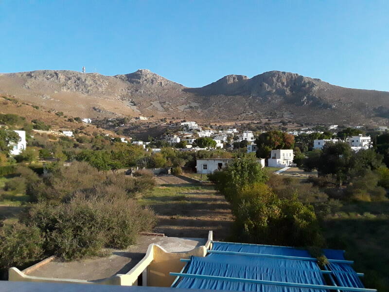
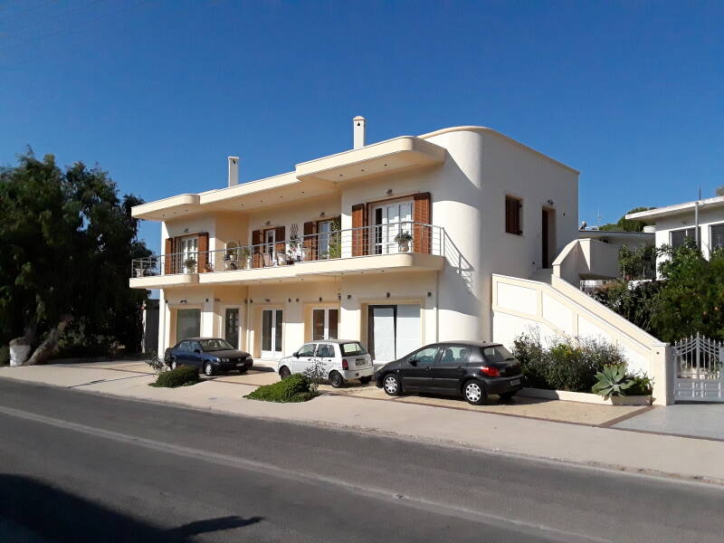
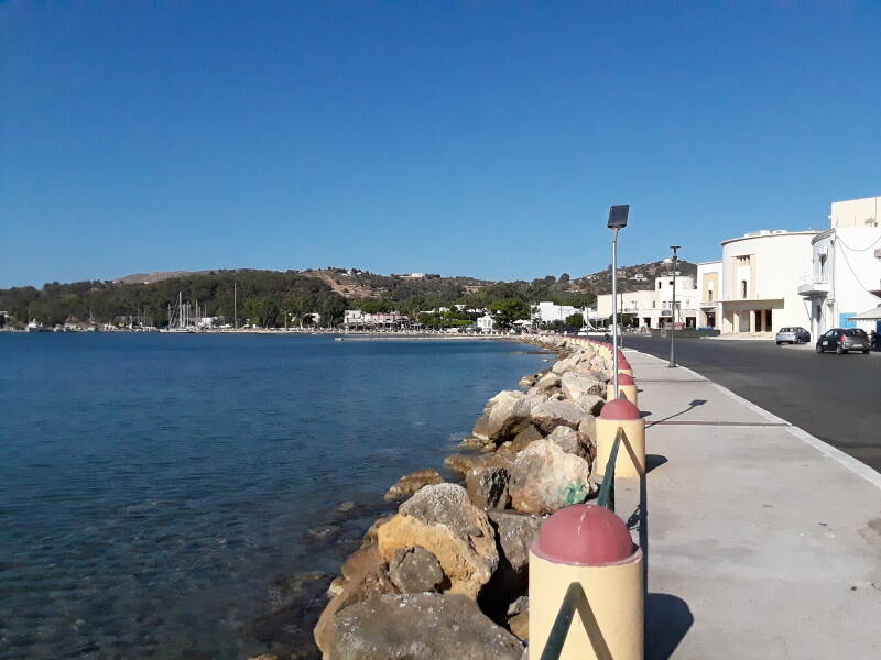
Starting in Alinda
Guesthouses at Booking.comHere is the morning view off my balcony to the 250–300 meter peaks to the north. I was staying at Aparthotel Papafotis in Alinda.
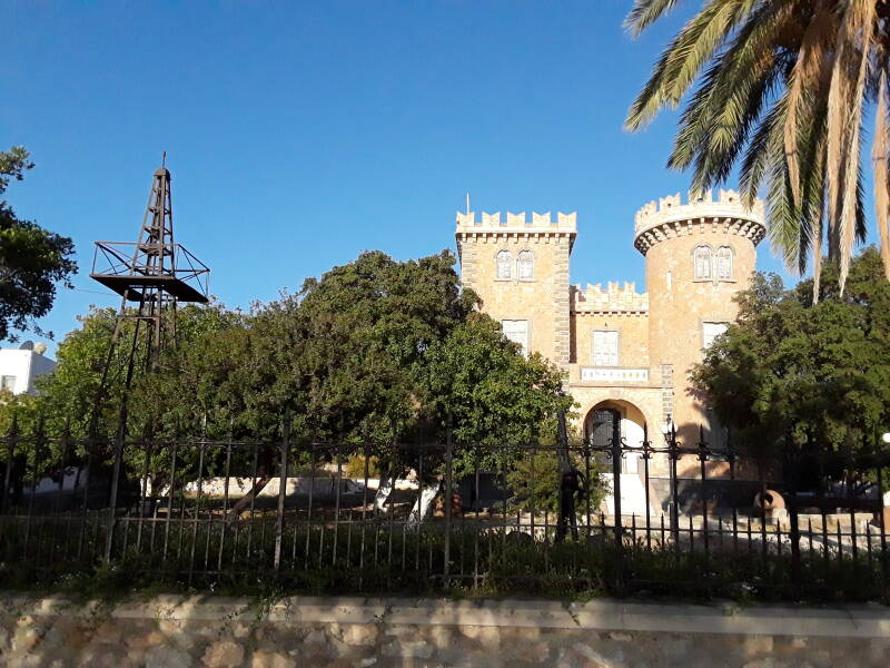
Parisis Belleni built a vacation house in the form of a castle along the waterfront road running around the bay. It's a two-story building with two three-story towers, now called the Belleni Tower.
He only finished building it in 1925, the year that he died. It was transformed into a hospital, and later into a local history museum. Unfortunately the COVID-19 pandemic had it shut down during my visit in early October 2021.
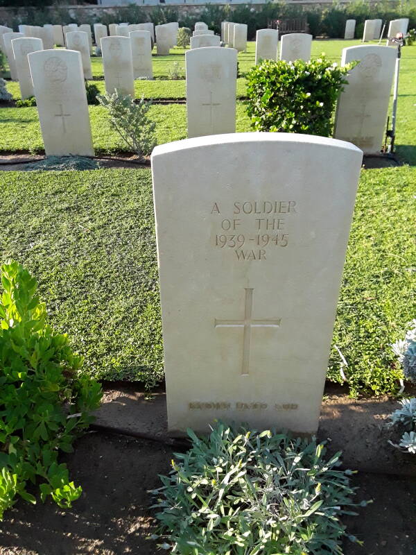
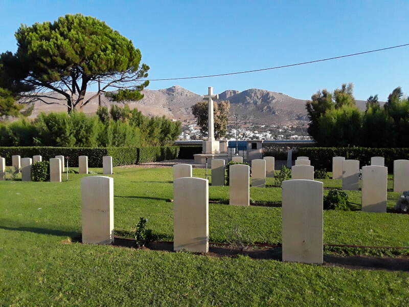
The Leros War Cemetery
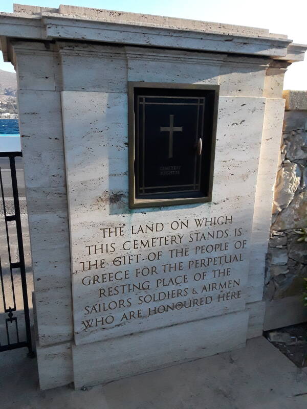
The Leros War Cemetery is along the waterfront road between Alinda and Agia Marina.
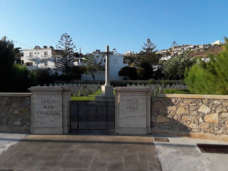
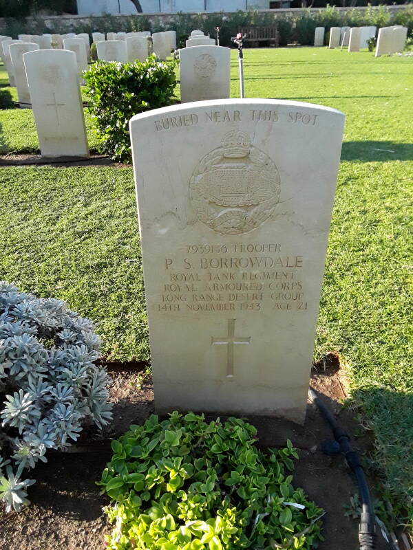
British Commonwealth troops killed during World War II are buried here.
Many of the markers are for men who were in the Long Range Desert Group. That was a British-organized unit active between 1940 and 1943 in the Western Desert, the Sahara in Egypt and Libya. All the members, never more than 350, were volunteers. The majority of the men were from New Zealand, with volunteers from Southern Rhodesia and British forces joining the group later.
The last Axis forces in North Africa surrendered in Tunisia in May 1943. The British military command then reassigned the L.R.D.G. to operations in the Dodecanese island chain, in the Balkans, and in Italy. They were immediately sent to Lebanon to retrain in mountain warfare.
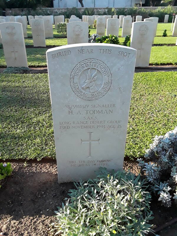
Then the L.R.D.G. was sent to Leros.
Leros, World Wars, and "Churchill's Follies"
Jump ahead if you don't want to read the historical background and are anxious to see the picturesDuring the First World War the Allies wanted to take control of the combined Bosphorus and Dardanelles, two straits joined by the Sea of Marmara to connect the Black Sea to the Mediterranean. Winston Churchill was First Lord of the Admiralty, and he proposed a naval attack on the Dardanelles.

Allied attempts to force their way into and through the Dardanelles strait failed. The Ottomans had mined the straits, and had mobile artillery shelling the Allied mine-sweeping vessels. The Allies sent their fleet of obsolete ships unsuited to face the main German fleet on the open sea. They struck mines and were hit by Ottoman shelling, and the Allies lost several ships.
The Allied plan shifted to capturing the land, especially the narrow peninsula forming the western side of the strait, and then eliminating the Ottoman mobile artillery.
The Allies were overconfident. Who dares challenge the mighty British Empire? On top of that, planning was slipshod. Some of the details were based on Egyptian travel guides.
VisitingGallipoli
I've been to what came to be called "ANZAC Cove" at Gallipoli where the troops from Australia and New Zealand landed. I initially had a hard time figuring out what I was seeing, because it was an absurd place for a landing. It's a very small beach at the base of a high steep slope. I was asking "But where is the beach that the army landed on?" The ANZAC troops took heavy losses.
Meanwhile, Churchill had long-range plans to turn the eastern Mediterranean, Aegean, and Black Sea into British lakes. If the Gallipoli campaign was successful, the British Empire could end up in control of the Dardanelles and Bosphorus after the war. It would be like another Suez Canal but without the hassle of all that digging.
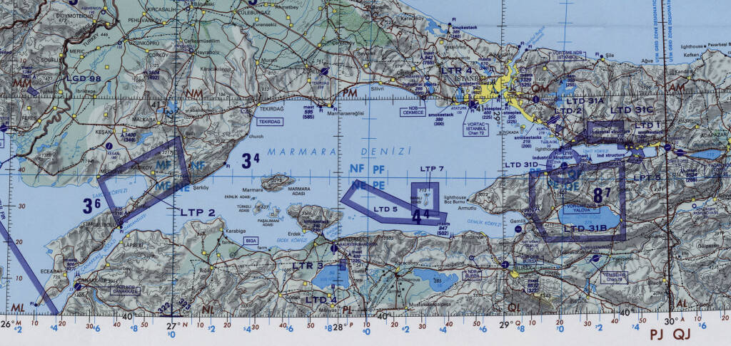
Portion of Operational Navigation Chart F-3 from the Perry-Castañeda Library Map Collection at the University of Texas at Austin. The Dardanelles strait is at lower left, the Gallipoli peninsula is to its north and the ill-fated landing beach is on the northern shore. The Bosphorus is at upper right, running from the Black Sea to the Marmara Sea between the European and Asian sides of İstanbul.
Yes, they really used Egyptian travel brochures:
Churchill's dream didn't come true. Australia and New Zealand now see the episode as when they truly became independent countries. As for Turkey, the war led to the rise of one of its generals who adopted the name Mustafa Kemal Atatürk and went on to form the Turkish Republic.
Jumping from the First to the Second World War...
During the 1930s the Italians installed guns on the mountain peaks and near sea level at the mouths of bays. Many of these were surplus ex-British naval guns, including the 6-inch or 152 mm Armstrong Model 1891, an 152 L/40, with a range of almost six kilometers. "152 L/40" meaning 152 mm bore diameter and 40 caliber, with a barrel length 40 times the bore diameter or just over six meters long.
So, when Italy joined Nazi Germany in 1940, the British Royal Air Force began bombing Leros. These were long-range missions as the nearest Allied air bases were on Cyprus and in north Africa, 330 to 360 nautical miles away.
Then when Italy surrendered in September 1943, British forces arrived in the Dodecanese. Churchill's plan from the First World War had returned and grown. He hoped to make the Aegean, starting with the Dodecanese islands along its eastern edge, a British lake protecting the approach to what would become the British waterway of the Dardanelles and Bosphorus straits. Then Russia could be supplied via that route instead of the Arctic convoys to Murmansk and Arkhangelsk. Then Britain would retain control of all those waterways after the war. Or so Churchill hoped.
However, the Germans rushed forces from mainland Greece to several of the islands, including Rhodes, the main objective for both sides given its size and three military airfields. They forced the Italian forces on Rhodes to surrender to the Germans and not the British on 11 September 1943.
Over the next week the Allies took control of several of the Dodecanese islands from Kos through Samos.
Kos was the only airfield held by the Allies in the islands. The Germans bombed it and other Allied positions on Kos. After about two weeks, German amphibious and airborne landings on 3 October led to a British surrender the next day. In the Massacre of Kos that same day, German troops killed the captured Italian commander of Kos and about 100 of his officers.
Now Germany had a nearby airfield and stepped up their bombing of Leros. Leros quickly became the second-most bombed island in the European theatre, after the enormously larger and more target-rich Crete.
On 26 September, just two and a half weeks after Italy's surrender, German Ju 87 and Ju 88 dive-bombers sank the Greek destroyer Vasilissa Olga and the English destroyer HMS Intrepid in the Italian-built harbor at Porto Lago, now Lakki. The Ju 87 and Ju 88 raids on Leros continued for the next 52 days. They destroyed many of the coastal defense gun positions and port installations.
This was the autumn of 1943. Eisenhower, Marshall, and Roosevelt weren't interested in assisting what they saw as mostly setting up post-war imperial benefits for Britain. Besides, they were in the middle of the Italian campaign, having invaded Sicily in July 1943 and in September advancing onto the Italian peninsula. The Italian Fascist regime had collapsed and Mussolini had been deposed and arrested in late July, but German forces had taken control of central and northern Italy. Churchill was on his own in the Dodecanese.
The British had no air defense as Leros was way beyond Allied fighter range. The long-range P-38 Lightning fighters had been shifted to where they were needed in the Italian theatre. In order to assault German ships or land positions, British attack or bomber aircraft would have to get through or around the German defensive fighters based on Kos.
The Long Range Desert Group was on the islands, especially Leros, where British command was using them as normal infantry.
In September through November 1943, Germany took control of Leros and then held it through the end of the war.
The nominally British forces suffered about 600 killed and 100 wounded, with 3,200 taken prisoner. The Royal Navy lost several ships.
Britain hadn't had a large reverse like this since the summer of 1942. This was the last time that German forces captured and occupied foreign territory. Even so, Germany treated the Dodecanese as a backwater, quickly pulling troops out and replacing them with a garrison of older troops plus former concentration camp and prison guards.
The British assignment of the L.R.D.G. to the Dodecanese Campaign was a breach of agreement with the New Zealand government. Gallipoli had been a formative experience for both New Zealand and Australia, leading to the emergence of unique national identities. Now the New Zealand government informed Britain that it would no longer allow Britain to command its military forces.
The book The Long Range Desert Group in the Aegean details the breach of agreement and the following government confrontation. The book is good, one of the few histories of the Dodecanese Campaign, and exhaustively detailed. How many rounds of .45 ammunition and how many of .303 were taken on each mission, and so on.
It also describes how Churchhill ordered the suppression of all discussion of the campaign in Parliament. From page 153 and following:
A few days after the fall of Leros, the P.M.
recommended that the Foreign Secretary adopt an evasive policy
in Parliament.
[...]
It was not advisable to reflect in detail on such questions
as to why the lessons of Crete in 1941 had not been learned."
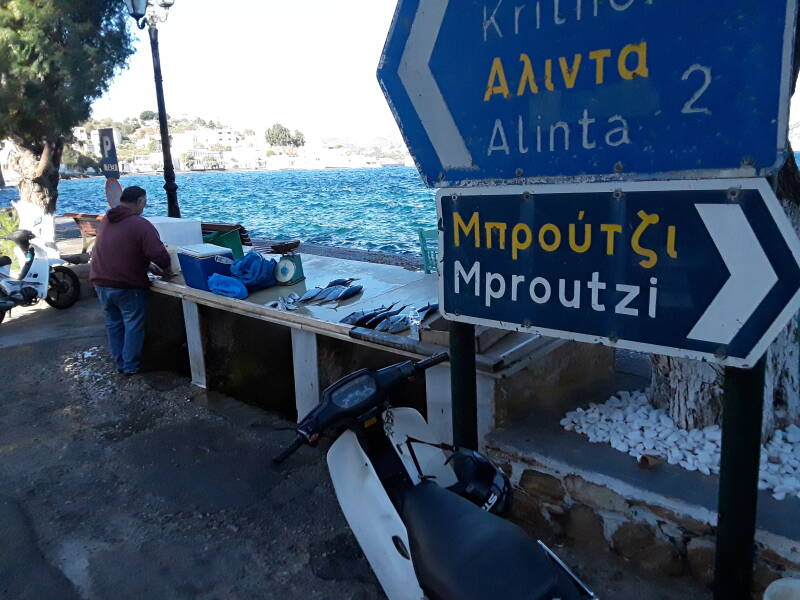
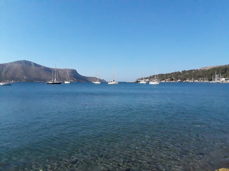
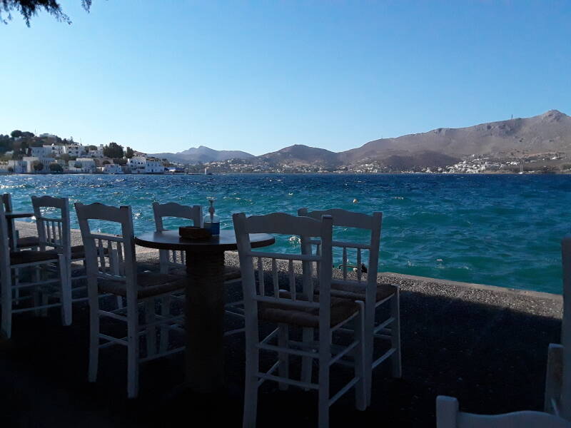
Coffee in Agia Marina
One of the local fishermen still had fish to sell when I arrived at the ferry pier area in Agia Marina. I got coffee and koulouri, a sesame seed bread ring, with a view of the harbor.
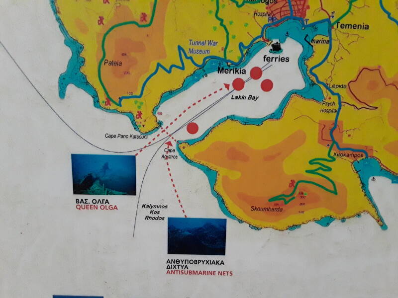
A sign near the pier shows underwater relics of World War II around the Leros coast.
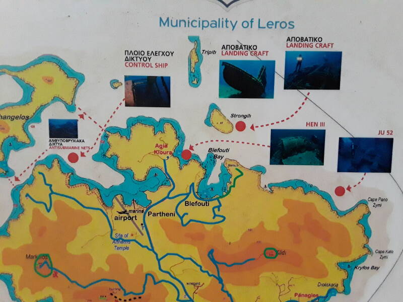
The Βασίλισσα Όλγα or Queen Olga was the Greek destroyer the German air attacks sank in September 1943, with the loss of 72 men. She had been built in Great Britain for the Royal Hellenic Navy before the war, and had assisted in evacuating the government from the mainland to Crete in April 1941, and from Crete to Egypt the following month.
Another of the four marked sunken ships is the British HMS Intrepid.
The Italian naval and seaplane base was headquartered near Lepida, a short distance along the south shore from Porto Lago, now called Lakki.
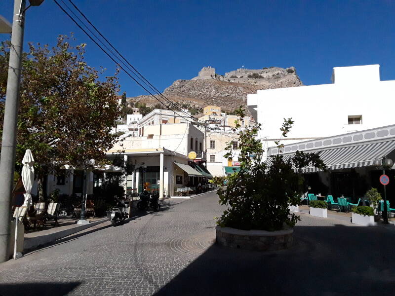
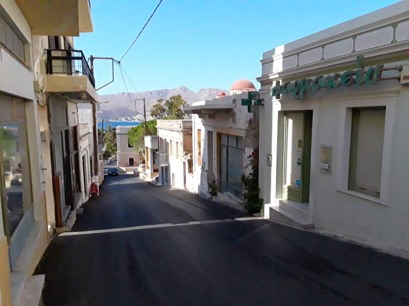
Over the Saddle to Lakki
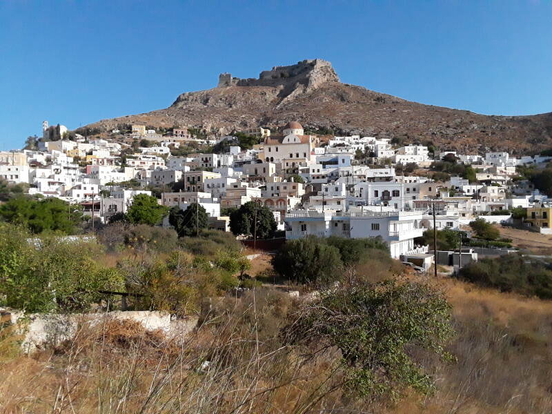
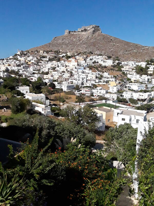
Platanos is the administrative center of Leros. It's on the saddle, the high point between the east and west shores of the main settlement.
The Pandeli castle is on what probably was the main akropolis or high settlement of the island before history was recorded here. It could have been a fortified refuge, and there could have been a sacred site here.
We know that a fortification was built there during Byzantine rule, probably in the 10th or 11th century CE. That small castle lives on as the innermost part of the fortifications.
A second perimeter of defensive walls was added later, greatly extending the enclosed area but not improving much on defensive architecture. That expansion was mentioned in documents of 1087 and 1088 associated with Byzantine Emperor Alexios I granting parts of Leros to the newly-founded Monastery of Saint John the Theologian on Patmos.
After the Fourth Crusade in 1204 broke up the Byzantine Empire, Leros and the castle first fell into the hands of the city-state of Genoa, and then the city-state of Venice.
The Order of the Knights of the Hospital of Saint John of Jerusalem captured Leros in 1309. In the 15th century they further extended the castle with a third layer of walls, with a design more suited to the military technology of the time. By this time there were large underground food storage areas and water tanks to withstand a siege. The greater enclosed area was probably intended to provide refuge for the island's entire population.
The Ottoman admiral Kemal Reis besieged Leros with three galleys and seventeen warships in 1505, but was unable to capture any territory. He returned in 1508 with more ships but was similarly unsuccessful.
Leros stood but Rhodes fell. In 1522 Sultan Suleiman the Magnificent had besieged Rhodes and then forced Philippe Villiers de l'Isle-Adamand, the Grand Lord of the Order of the Knights of the Hospital of Saint John of Jerusalem, to sign a treaty surrendering all the Order's possessions in the Aegean to the Ottomans.
Leros and some other islands had partial autonomy under Ottoman rule. For a brief period during the Cretan War between Venice and the Ottoman Empire in 1645–1669, and for three years after the Greek Revolution of 1821, Leros was temporarily liberated from Ottoman rule.
In 1912 Italy took control of the Dodecanese islands.
To Lakki
The Fascist regime that took control of Italy in 1922 decided to "Italianize" the Dodecanese. The Italian language would be taught in schools, and there would be incentives for acquiring Italian citizenship.
The area at the head of the bay had been a swamp. In the 1930s Italy built the town of Porto Lago there. It was renamed Lakki when Leros and the rest of the Dodecanese were transferred to Greece in 1948.
The architectural craze for 1930s Fascism was Rationalism, and Porto Lago's overall design followed that for public and residential buildings. There never were many examples of Rationalist towns, and Lakki is the best surviving example.
The Italian population of Leros reached about 7,500 in 1936, making it the only majority-Italian island in the Dodecanese.
The two wasn't laid out on a rectangular grid. Streets radiate out from the waterfront, intersecting curving cross streets.
The bay is deep, 3.5 km long, and 1 km wide, making it an excellent location for a naval base. Italy made it the home port for two destroyers, two torpedo boats, and four submarines. It was also a seaplane base.
Submarine nets could close the opening. Anti-ship artillery positions were on the peaks around the bay's opening.
Below is the view from the waterfront at the center of town out through the bay's opening into the Aegean.
Rationalist public buildings line the waterfront.
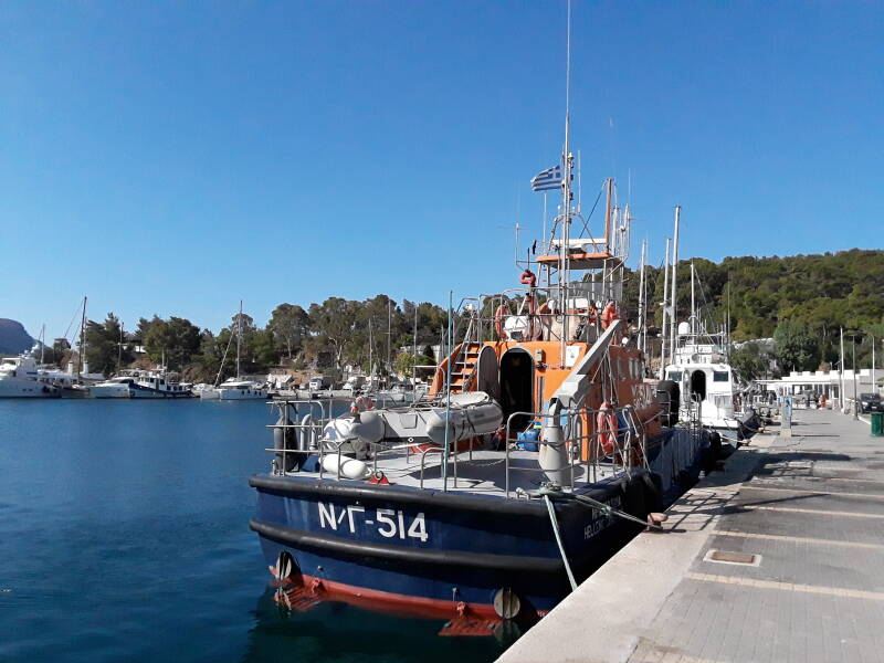
Military use today is limited to Hellenic Coast Guard vessels like this one.
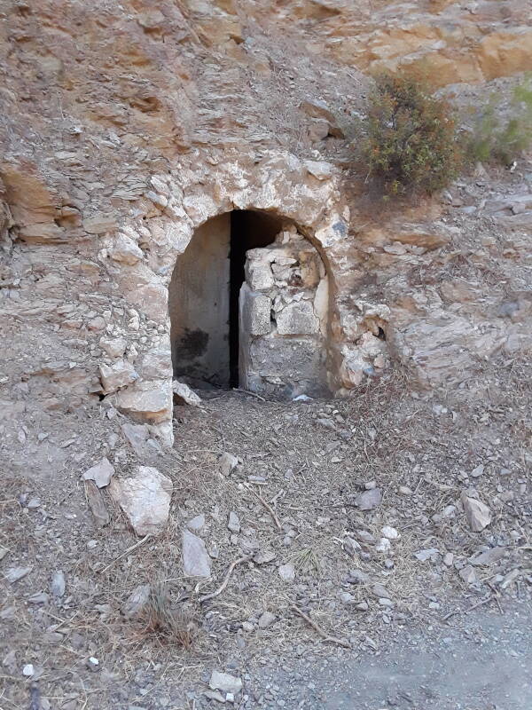
Tunnels
Onward to the tunnels and bunkers!
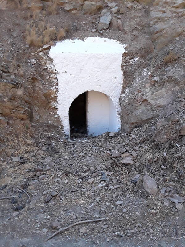
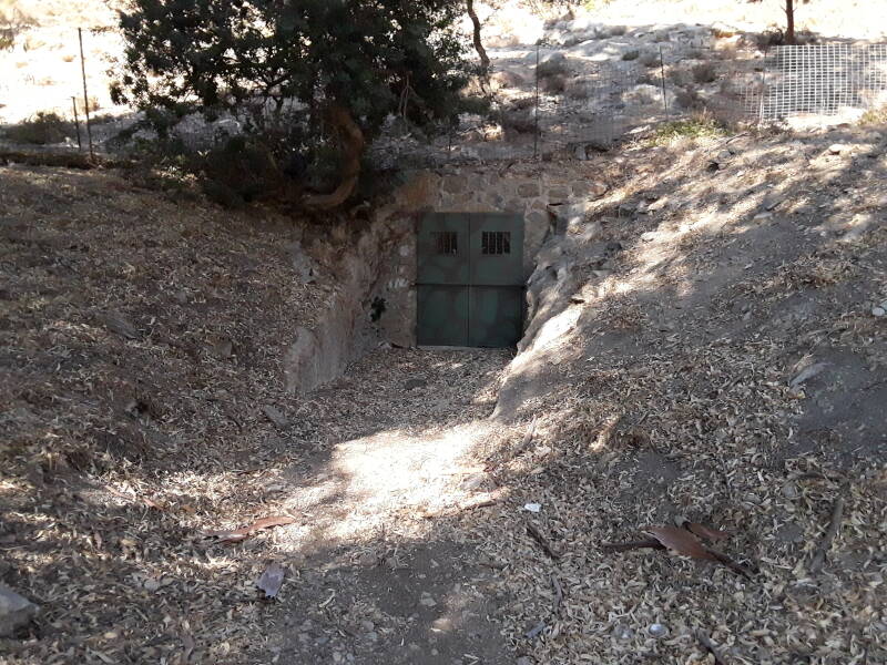
There are bunkers and tunnels underneath many areas of Leros. They are especially numerous around the former naval base. The Merikia area on the north shore of the bay includes a museum in a restored underground complex.
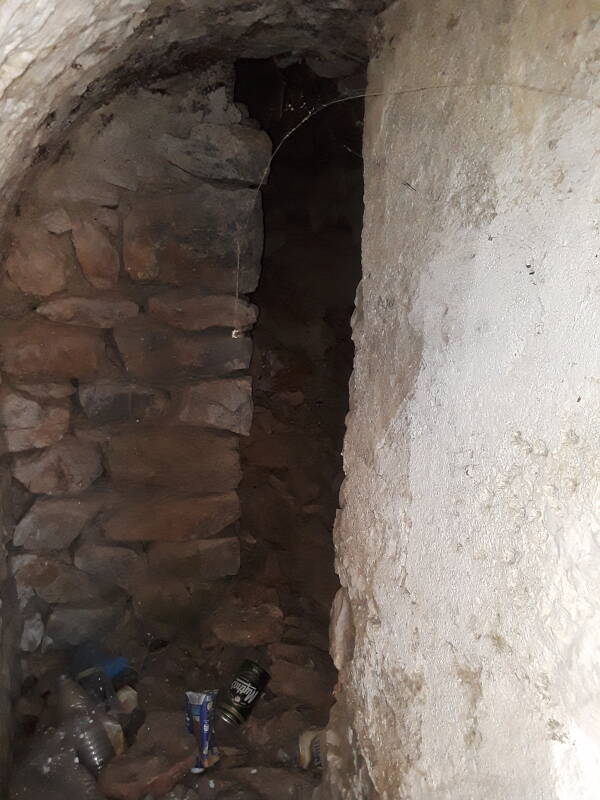
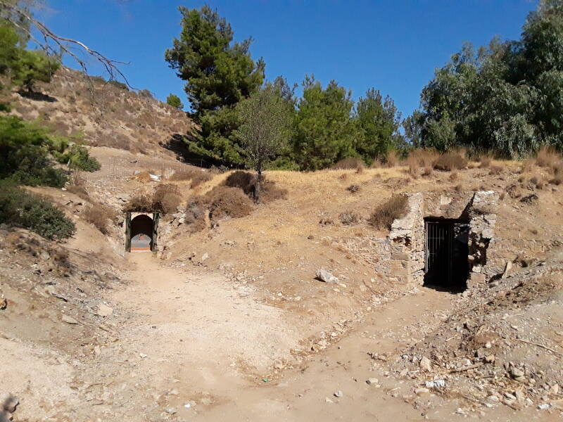
Tunnel openings look like the below, although most aren't painted in high-visibility white. The general design includes two opposing half-width walls. To enter you must go to the left of one and then to the right of the other.
I later asked a girl working at the place where I stayed: Are local people interested in these? Does anyone explore them?
Oh yes. Tunnel exploration is probably a standard rite of passage for high school kids on Leros. As it seems to have been for her.
As she explained, of course you wouldn't build an underground bunker with only one entrance. People would be trapped if the single entrance was covered or destroyed.
So, any tunnel going into a hill connected to at least one tunnel exiting at a distant point.
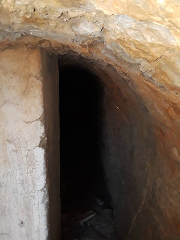
Broken glass and jagged metal lurked inside. Not having brought kneepads and heavy gloves on this trip, I didn't go beyond the two-turn entrances.
Amazon
ASIN: B005I4PT18
Amazon
ASIN: B003TV410W
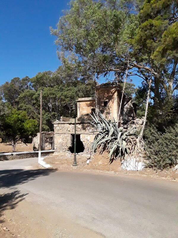
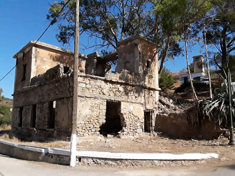
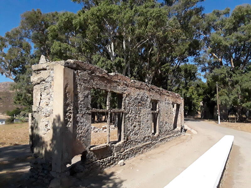
Ruined administration buildings demonstrate why the Italian operations centers were in underground bunkers.
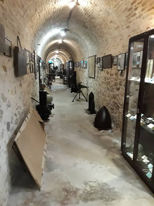
Merikia War Museum
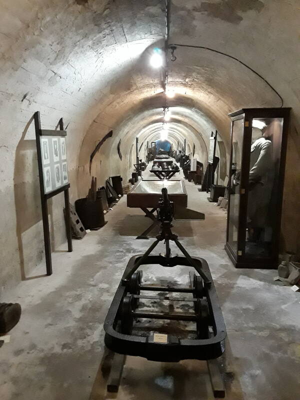
The war museum is back in one of these tunnels closed by a heavy metal door. It's only €3 to visit, and there is a lot to see.
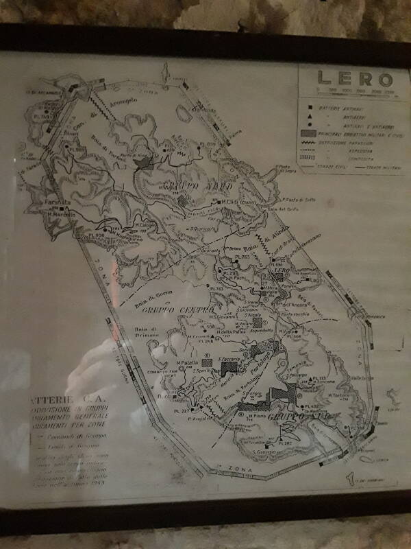
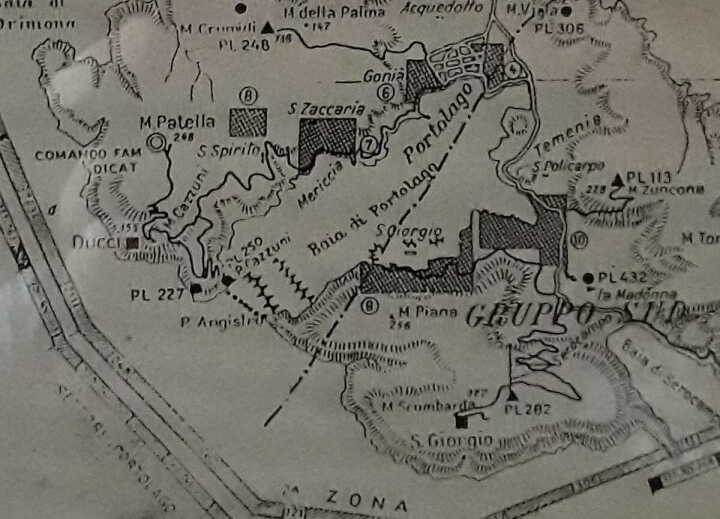
An Italian map is near the start. It shows where a submarine net closed the Alinda bay.
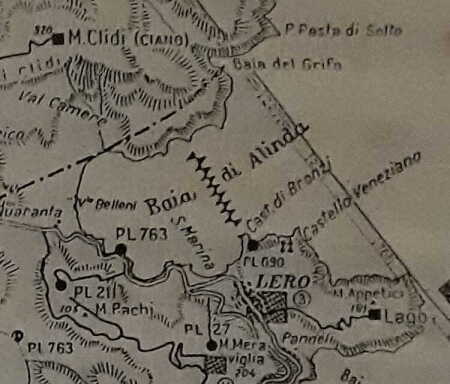
This map indicates gun sites as:
Square = anti-ship battery
Triangle = anti-aircraft battery
Circle = anti-ship and anti-aircraft battery
Today's maps just show what remains today, marking the artillery installations as "ruins". No indications of their specific purpose or other details.
A typical coastal defense battery had three 152mm L/40 and one 102mm L/35 gun.
A typical anti-aircraft battery had six 76mm L/40 guns.
The total for the thirteen coastal batteries was nineteen 152 mm, five 102 mm, and twenty 76 mm guns. The twelve anti-aircraft and dual-purpose batteries had fourteen 102 mm, six 90 mm, and twenty-eight 76 mm guns.
They have a flyer dropped by German planes onto Leros, and its translation into Greek and English.
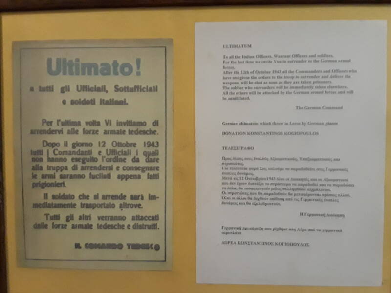
ULTIMATUM
To all the Italian Officers, Warrant Officers, and soldiers.
For the last time we invite you to surrender to the German armed forces.
After the 12th of October 1943 all the Commanders and Officers who have not given the orders to the troops to surrender and deliver the weapons, will be shot as soon as they are taken prisoner.
The soldier who surrenders will be immediately taken elsewhere.
All the others will be attacked by the German armed forces and will be annihilated.
The German Command
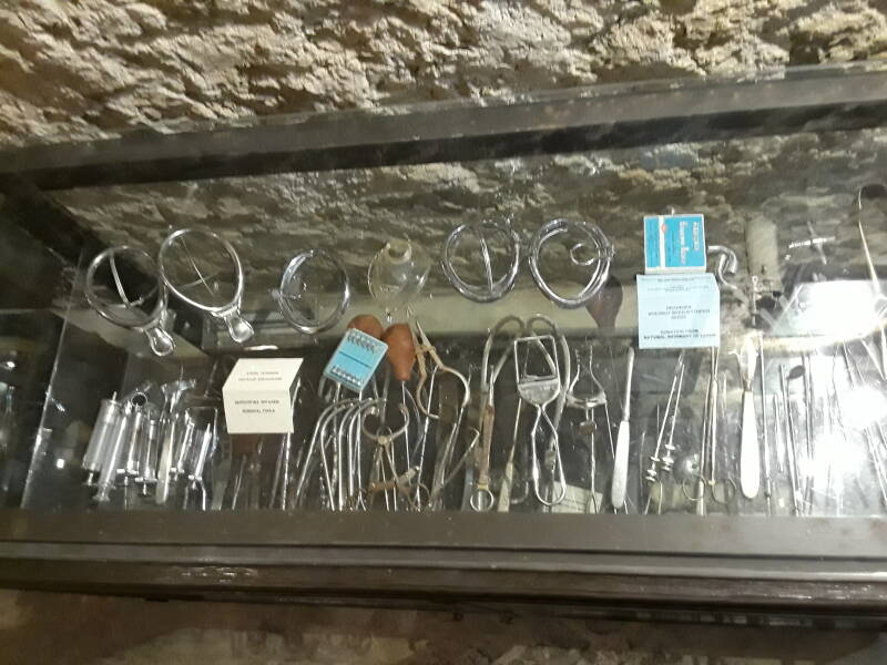
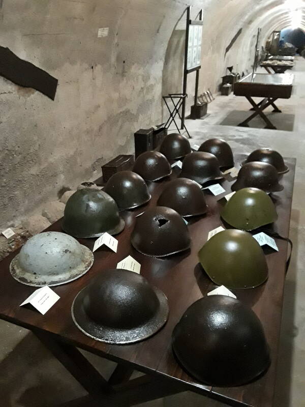
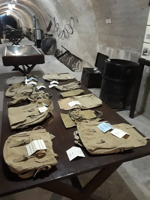
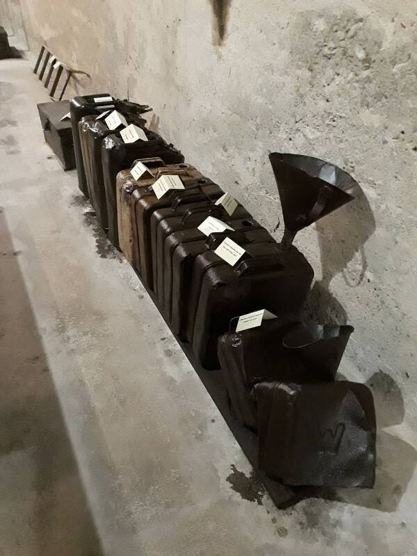
The museum contains a wide range of objects. Some were from the tunnels, possibly these specific tunnels now occupied by the museum. Others came from around the island and the nearby water. This cabinet contains medical instruments.
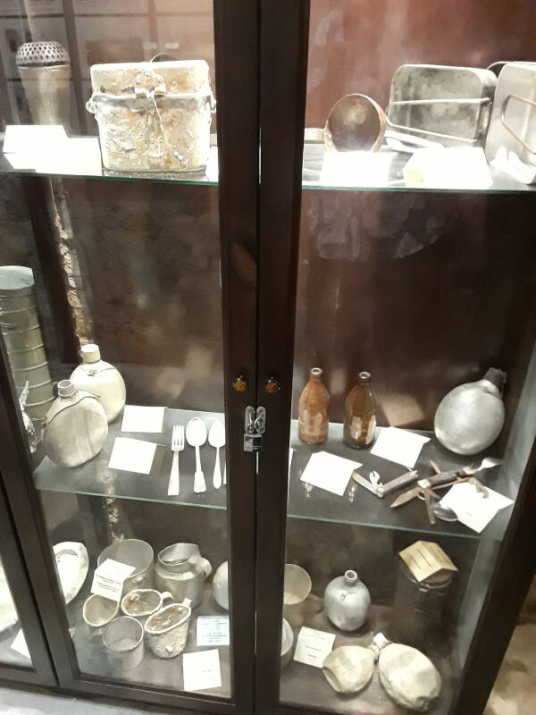
There are plenty of canteens and mess kits.

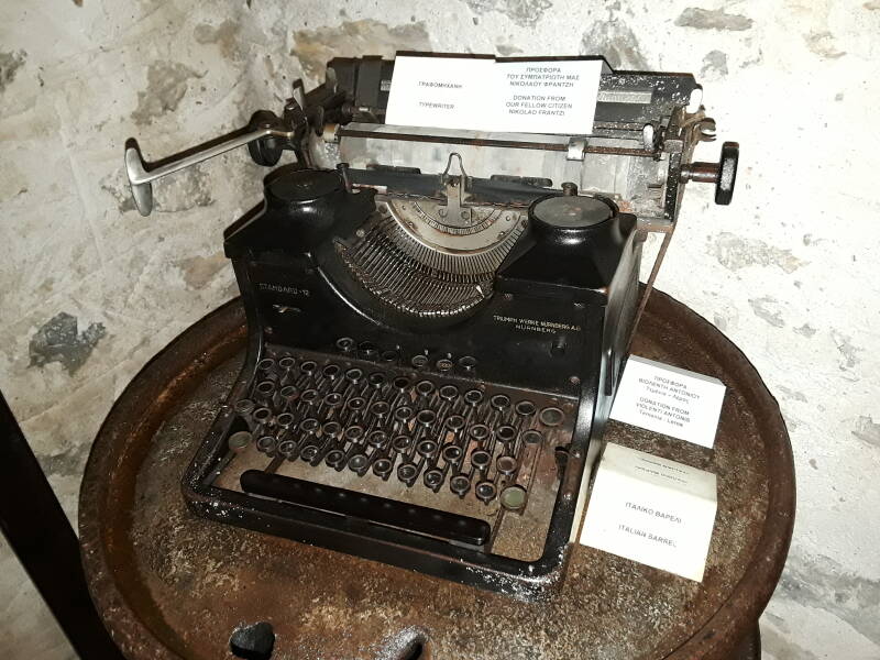
Local people donated objects like this typewriter from Nikolao Frantzi.
Many of the objects aren't locked in glass cases but are simply arranged on tables, like these helmets and knapsacks.
Some of the objects were donated by the Greek military.
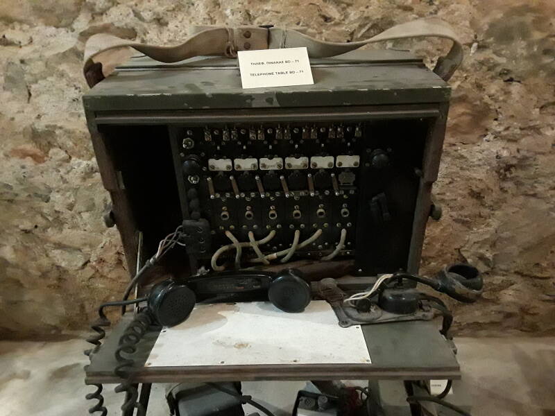
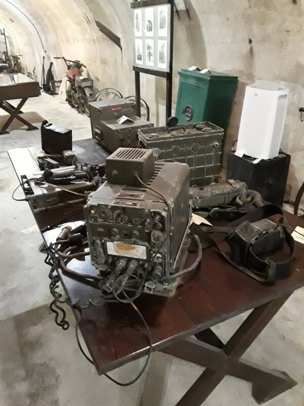
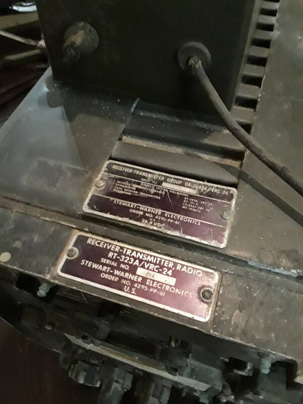
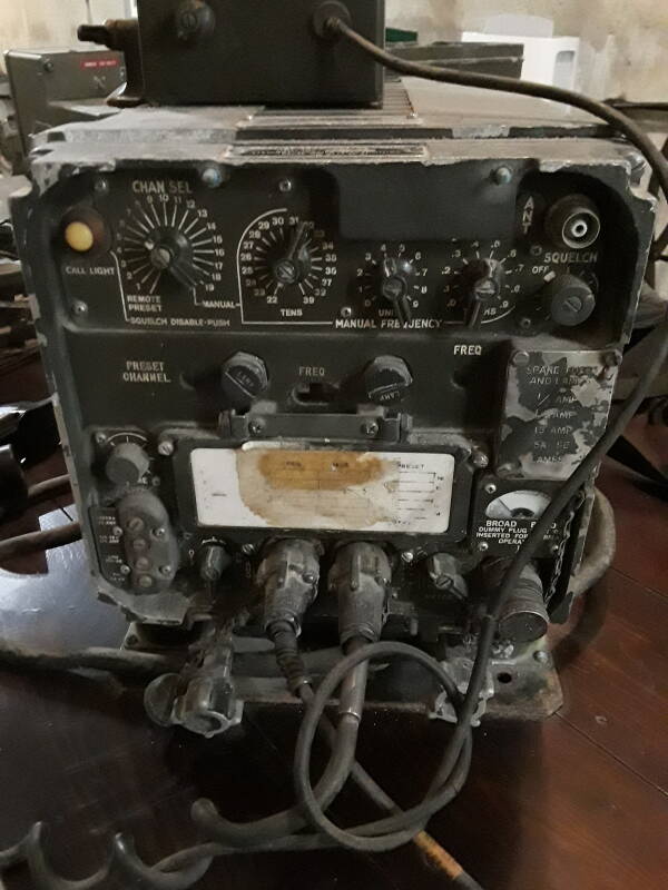
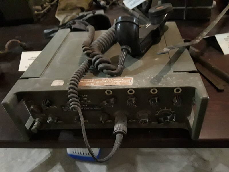
The above telephone set may have been of World War II vintage, but some of the nearby radio gear clearly isn't.
Manual
The RT-323A / VRC-24 was an early 1960s U.S. system for vehicle-based ground-to-air communication. It operates AM voice at 225 to 400 MHz. Its 29-vacuum-tube design required 250 watts of 24 VDC power when receiving, 300 when transmitting.
Manual
The Hughes-built AN/PRC-74 was first delivered for U.S. Army use in 1966. It operates both CW and SSB on 2 through 12 MHz with 12–18 watts of output power. It was initially issued to MACV-SOG, then widely used by U.S. Special Forces in Vietnam.
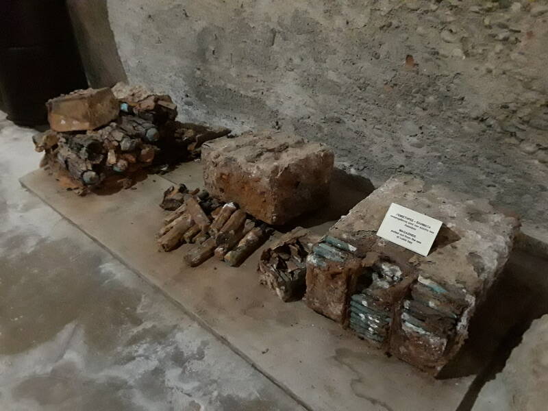
The alarming part was the collection of blocks of corroding ammunition that had been pulled out of the sea. It's probably stable. But I wasn't going to kick it.
And fuel cans and more.
"The Guns of Navarone"
Were Alistair Maclean's novel The Guns of Navarone and the associated movie based on Leros?
Not exactly. "Inspired by" and "set in the context of" the Dodecanese Campaign are reasonable descriptions.
The novel and movie are set in 1943 with 2,000 British soldiers marooned on the island of Kheros, about to be assaulted by an overwhelming German force. The Royal Navy can't evacuate the British troops because of the need to traverse a strait protected by radar-directed large guns on the island of Navarone.
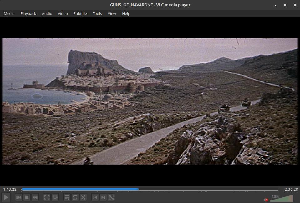
There is an island of Κέρος or Keros, about 60 nautical miles to the west, just southeast of Naxos. But it isn't "just off the Turkish coast", a point crucial to the story, and there is no island of Navarone. There's a brief shot of a map showing the fictional Navarone early in the movie:
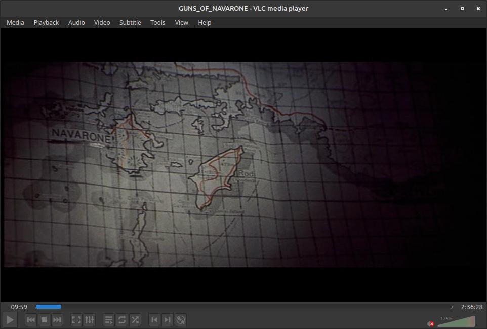
The fictional "Navarone" seems to be about the size of Rhodes, located where Nisiros and Tilos are.
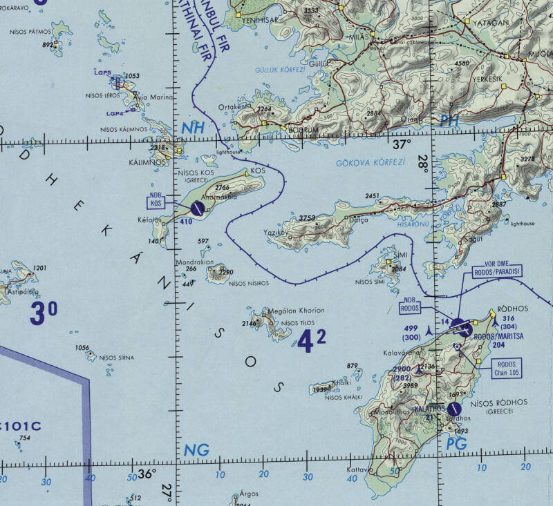
Portion of Operational Navigation Chart G-3 from the Perry-Castañeda Library Map Collection at the University of Texas at Austin.
The movie came out in 1961, during the glory days of matte painting effects in movies.
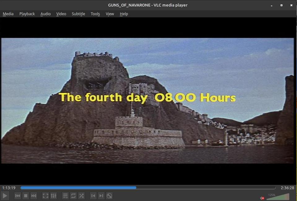
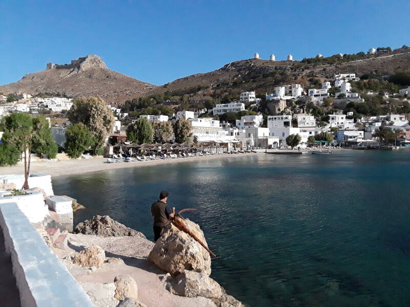
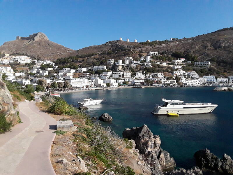
There is at least an "inspired by" resemblance to Agia Marina and the peak with the castle.
Returning to Agia Marina
After the museum and another pass through the Rationalist architecture of Lakki, I headed back toward Agia Marina and Alinda.
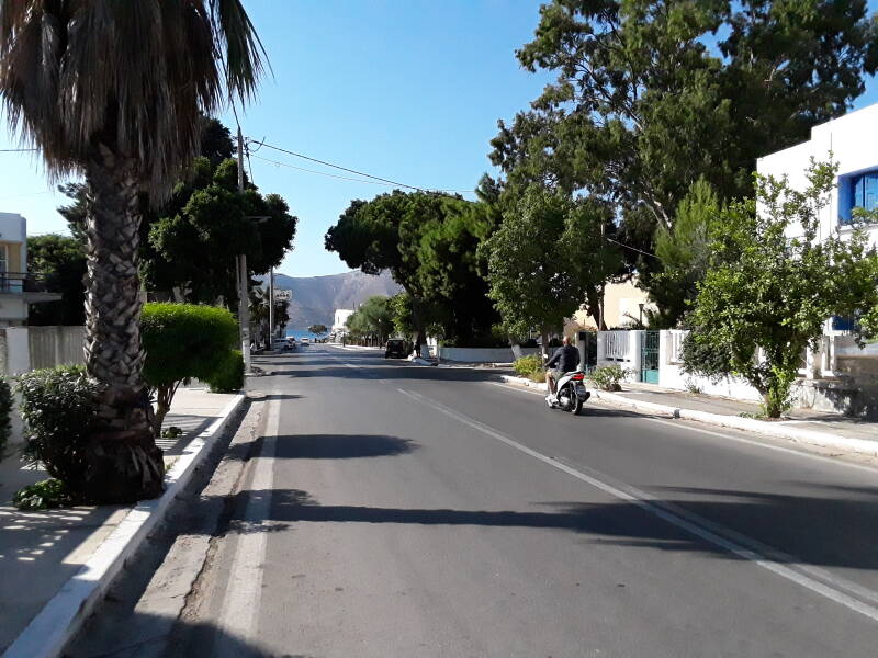
This is the main street heading down to Agia Marina and the Alinda bay.
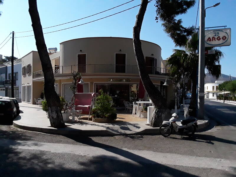
It was an 8.2 kilometer hike in each direction. So I stopped along the waterfront in Agia Marina and had a drink before finishing the return trip.
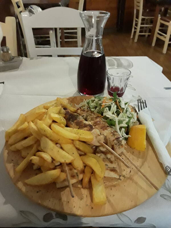
I got dinner that evening at a taverna along the waterfront road near the place I was staying. Chicken souvlaki with salad, pita, and french-fried potatoes, with a half-liter of red wine.
Or, Continue Through Greece: