Into the Desert
By 4x4 from M'Hamid to Erg Chigaga
Sahara DreamsDesert Trips
M'Hamid was the south-easternmost
destination on my trip.
100 kilometers south of Zagora,
it was at the end of the highway and on the edge of the Sahara.
This would be near the end of my trip to Morocco,
and I planned to relax there for a few days.
I had hoped to do an overnight trip into the desert.
I sent email to a few potential places that I might stay.
They had web sites advertising lodging in M'Hamid
and everything from one-day to multi-day trips into the desert.
However, those that responded said that they had nothing
planned and offered little hope for that changing.
Traveling by myself, I had said that I would be happy to
join a group, but all those responding said that they
didn't do that.
Well, I still wanted to go as far as M'Hamid
so I found a place to stay.
And once I arrived,
I found that they could easily set up a desert trip,
using an established camp.
I think that the places advertising with a web site
may operate their own camps,
and very likely limit themselves to group visits organized
out of Marrakech.
We would drive almost due west from Mhamid,
leaving this first map near the
91
mark at its left margin.
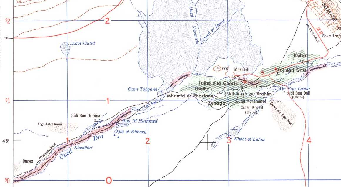
Portion of 1953 U.S. Army 1:250,000 map NH30-5 from the Perry-Castañeda Library Map Collection at the University of Texas at Austin. The black grid is 10×10 km squares.
Our destination was about 45 kilometers to the west of M'Hamid, while the route we took was closer to 60 kilometers. We were headed for the northern perimeter of a dune field about 25×15 kilometers in size.
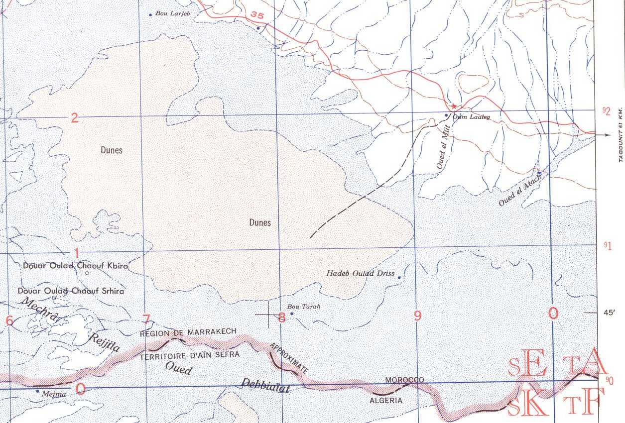
Portion of 1953 U.S. Army 1:250,000 map NH29-12 from the Perry-Castañeda Library Map Collection at the University of Texas at Austin. The black grid is 10×10 km squares. M'Hamid el Ghizlane is simply labeled "Mhamid" here.
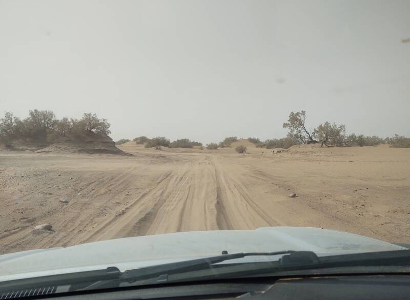
Leaving M'Hamid
The main street through M'Hamid has a chip and seal surface. It ends at the western edge of town, just beyond where a father and son are walking.
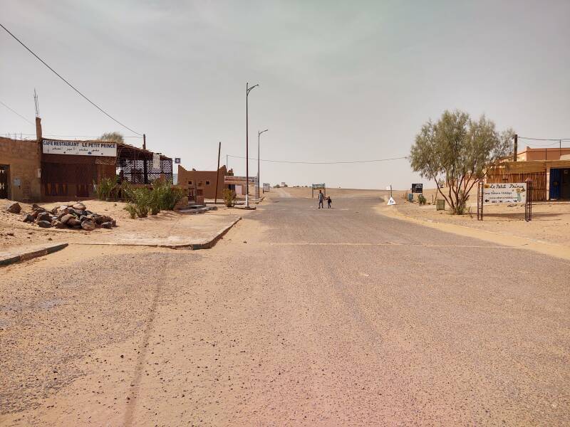
The father was walking his son home from school. The M'Hamid school is at the west edge of town, within a walled complex you see at right. Tracks extend from town past the school into the desert.
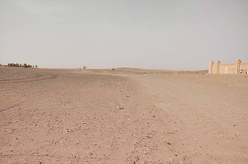
There are homes to either side just outside town.
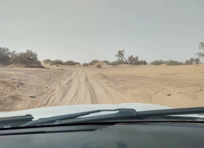
The track is soft sand in places. Four-wheel drive is required to venture outside town.
Alaska
M'Hamid and the desert reminded me of being in Alaska in some ways. For one thing, being a place where you reach the end of the paved roads, like at Livengood north of Fairbanks. But also, for how the local people watch out for others.
We came across a lone German man checking something on his off-road motorcycle. Ibrahim stopped to ask him if everything was all right. Yes, he said he was OK, and his two friends were a short distance ahead.
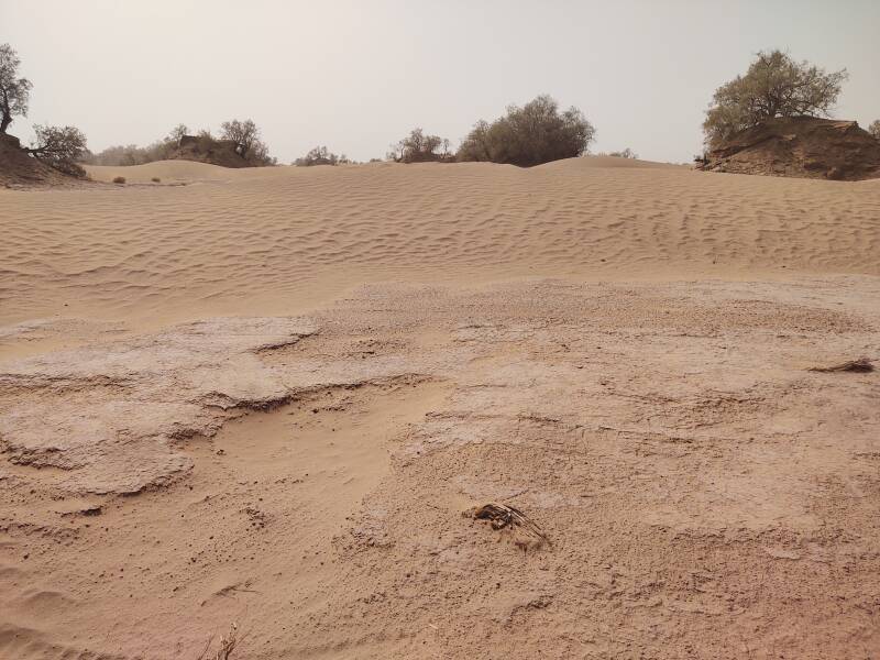
A hard crust forms on top of the sand in places.
Flora
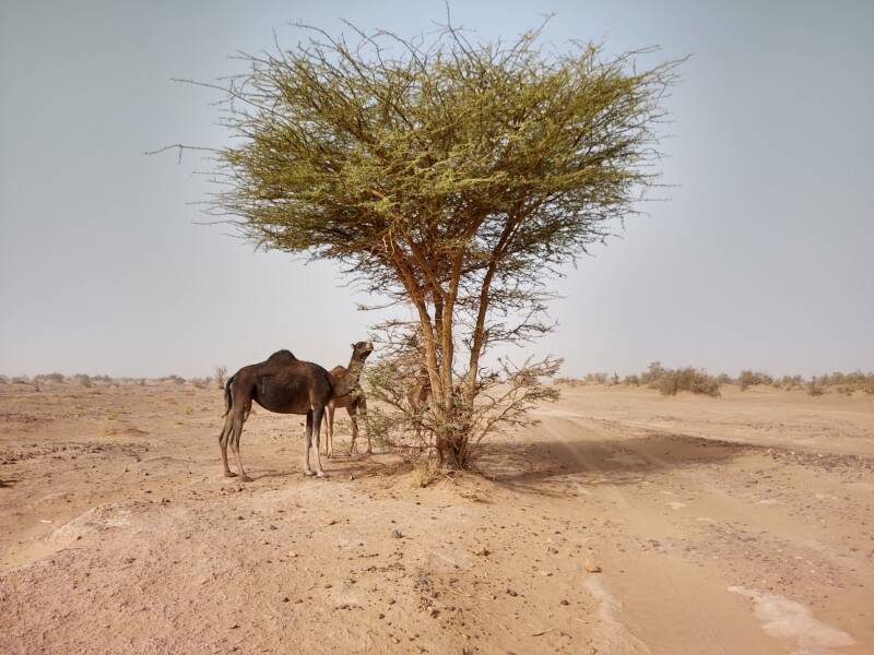
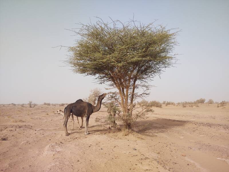
There are acacia trees, generally speaking, in areas of the desert with adequate moisture.
Acacia is an overly broad genus with a name going back to ακακία, assigned by a first century CE Greek botanist-physician on account of its άκις or thorn. Botanists agreed by 2005 that acacia should be split into at least five genera. The trees commonly called "acacia" or "thorn tree" are now, formally, in the Vachellia genus, which contains a wide range of species. However, everyone except for visiting botanists will call these acacia trees.
Gum arabic, the hardened sap of acacia trees, has been collected since Pharaonic Egypt to manufacture medicines, dyes, and paints. It's still used as a stabilizer, emulsifier, and thickener in the food and soft-drink industries.
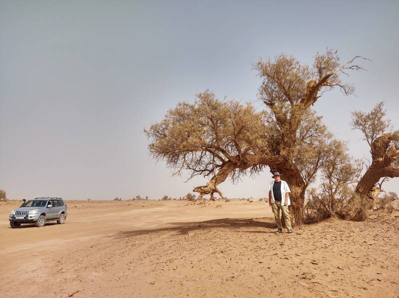
Here's me for size comparison next to an acacia tree.
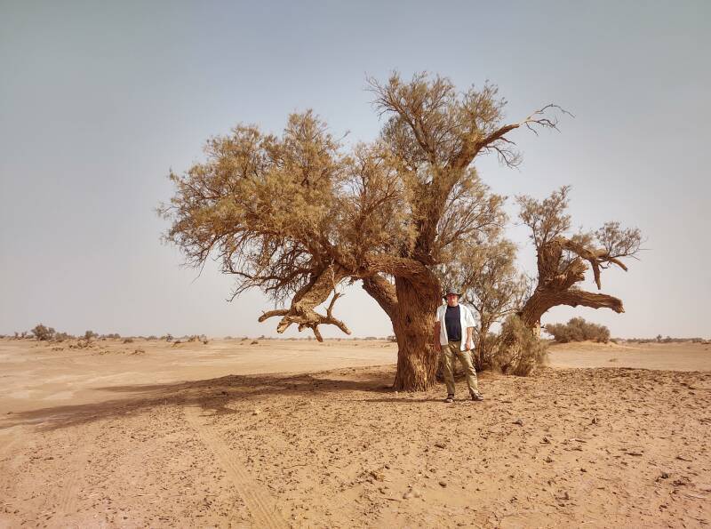
There's Ibrahim's 4×4, it's very typical for the area. It has an external air intake level with its roof, to reduce the amount of sand pulled in.
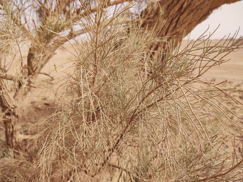
This is an evergreen tree with soft needles.
Fauna
"M'Hamid el Ghizlane" means "plain of gazelles". Gazelles were still common around 1990, but by the early 2020s they had almost entirely disappeared from the area.
Camels remained. These are eating the needles of an acacia.
I saw a few ravens, and out at Erg Chigaga I saw tracks of a desert mouse, a jerboa or similar. Otherwise the fauna was at least as scarce as the flora.
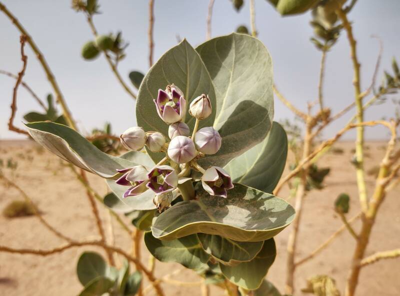
Poisonous Flora
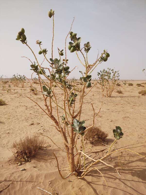
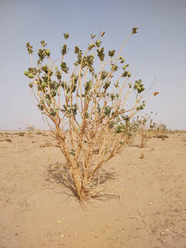
Inventory of Toxic Plants in MoroccoI walked toward some plants and Ibrahim warned me not to touch them. "Dangerous!"
Calotropis procera contains a milky sap that is toxic and corrosive. Touching the plant and then touching around your eyes can blind you. Even the camels stay away from it. It's native across North Africa, tropical Africa, West Asia, South Asia, and Indochina.
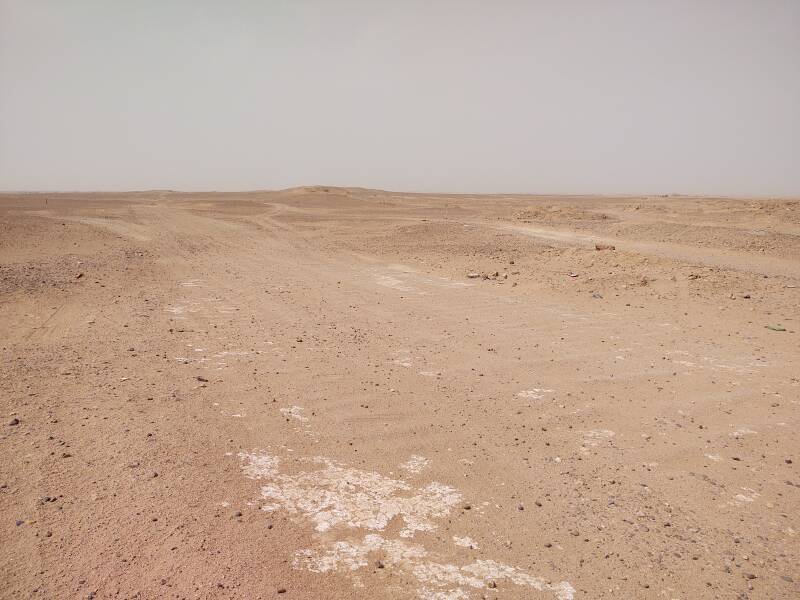
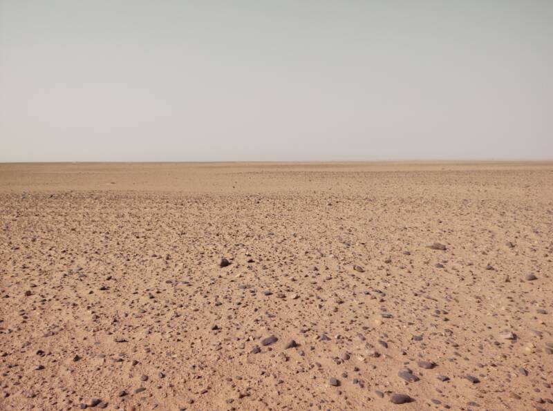
Very Little Flora and Even Less Fauna
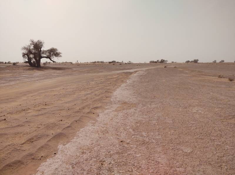
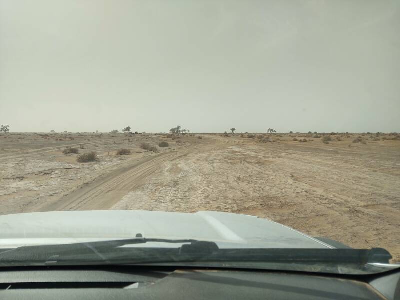
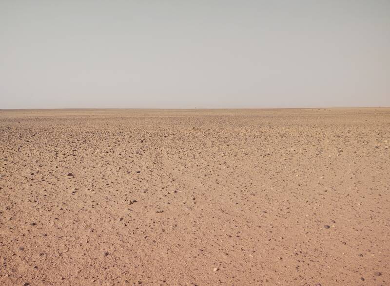
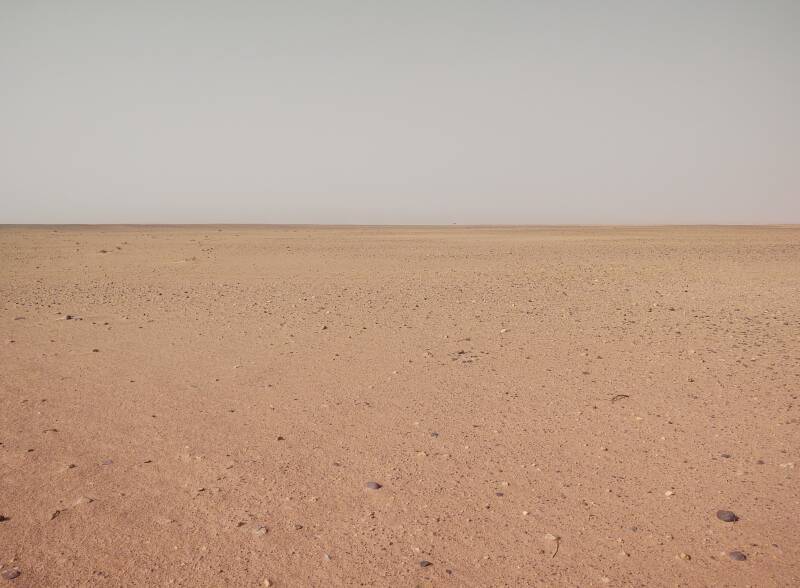
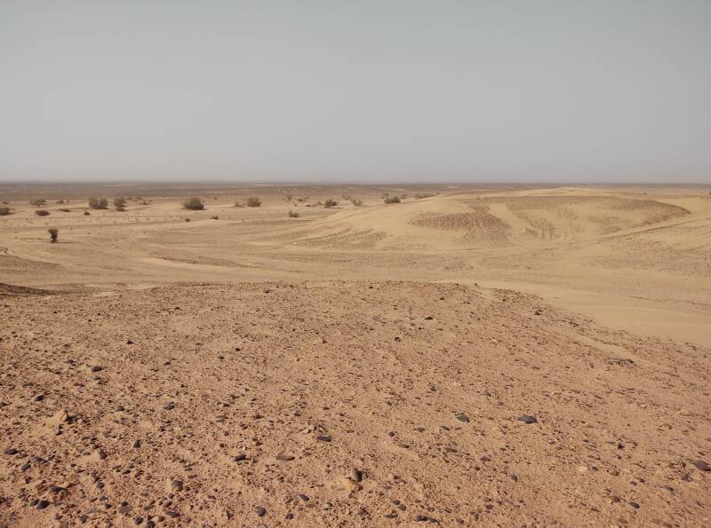
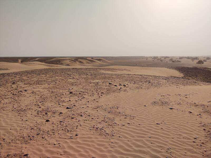
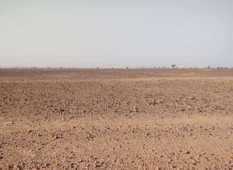
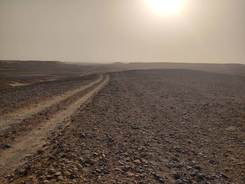
It became drier as we continued west.
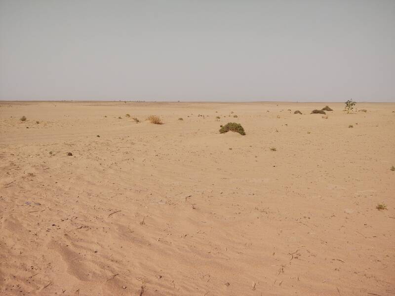
At times no plants were visible.
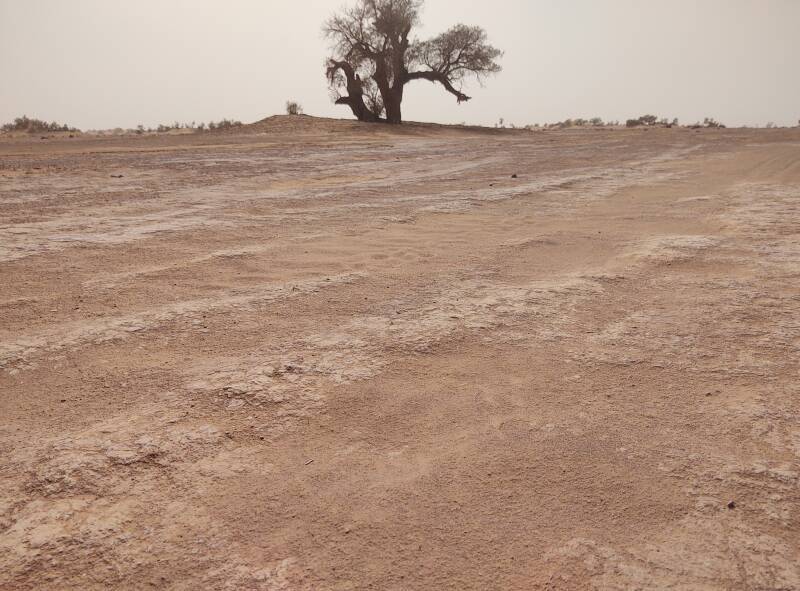
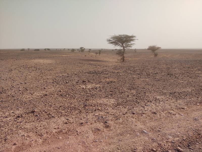
There were isolated acacia trees in places.
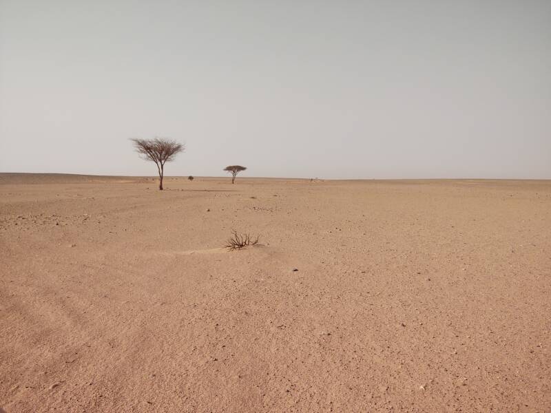
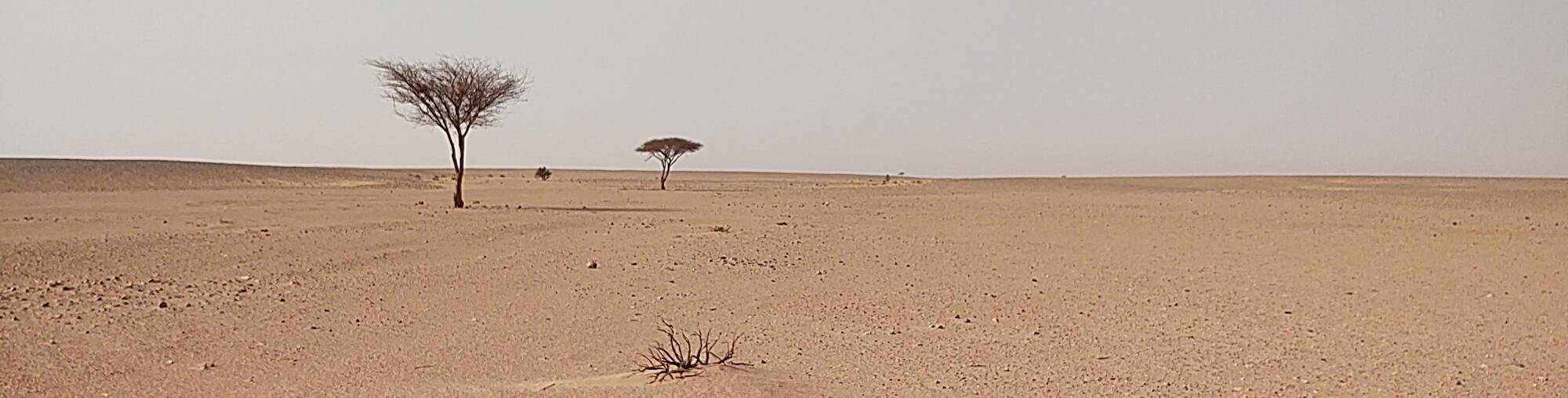
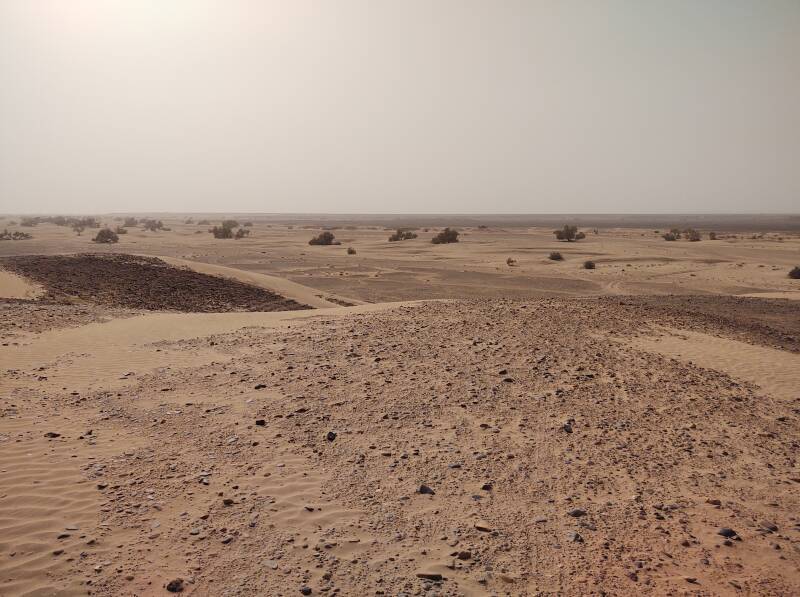
Some times the acacias were very isolated.
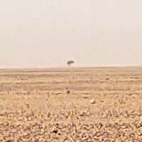
Yes, there is an acacia tree at the center of the below photo.
At right is a 200×200 pixel selection of the original 4000×3000 image.
With the original image reduced in size to 800×600 below, the tree almost entirely disappears.
There's another tiny tree on the horizon in this picture.
You can't say that the view is all sand and rock. But it mostly is.
Well at 29.8461° N 5.9827° W
I'm averaging the GPS data in the EXIF fields and rounding off to the nearest 0.0001° as that gets you within 12 meters.
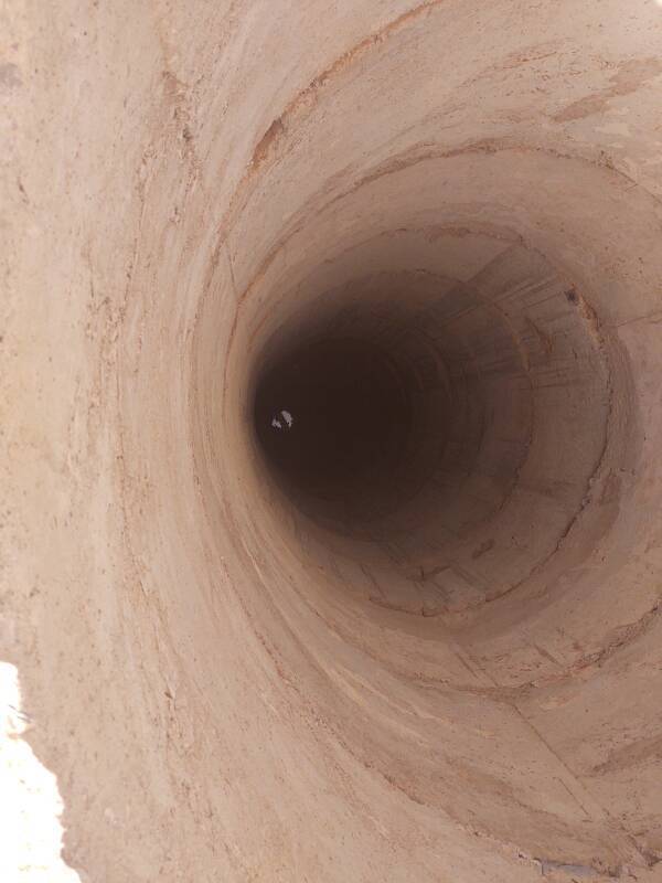
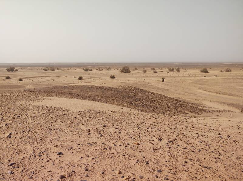
We came to a well about 25 km out of M'Hamid. I thought it was a large well, over 2.5 meters in diameter. Ibrahim provides scale.
The government dug the well, bringing equipment to dig a vertical shaft deep enough to reach water and then line the shaft with concrete. The national government maintains scattered wells in the more arid areas to support the remaining nomadic people.
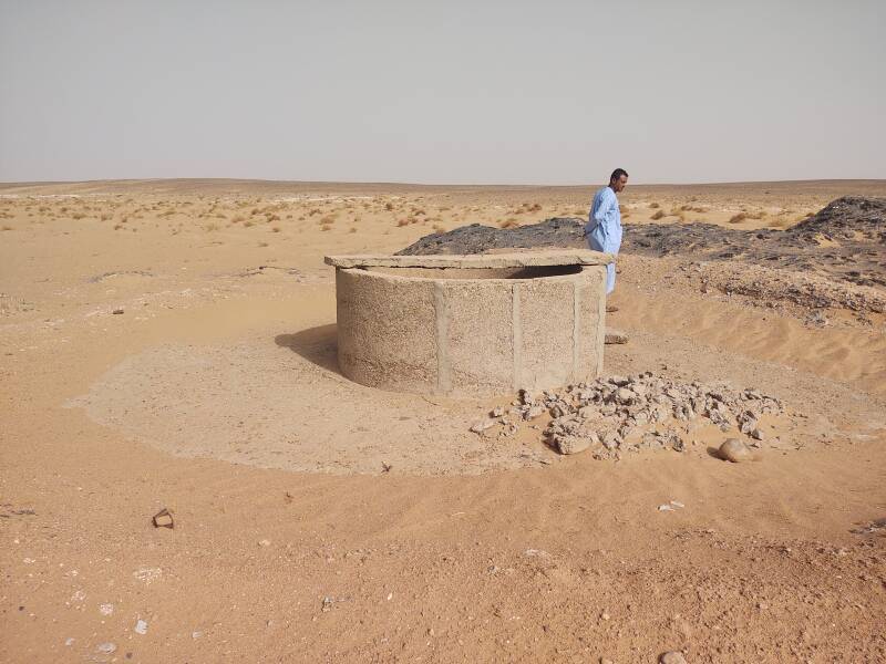
I could see water way down there.
The excavation debris included mica, a silicate mineral whose crystals split into very thin sheets. It's an excellent insulator and dielectric.
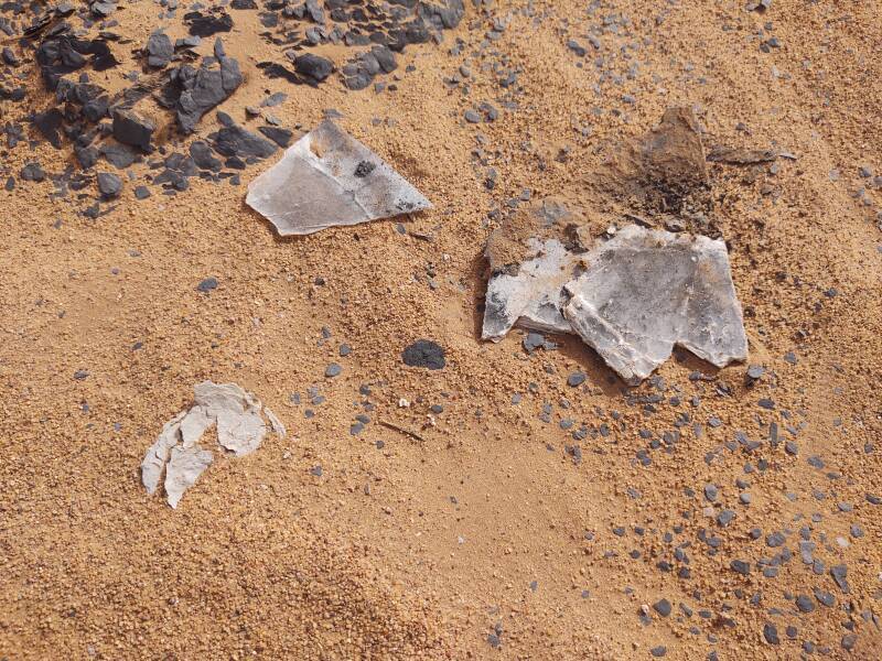
I knew what this was. It's used in electronics.
KC9RGradio
page
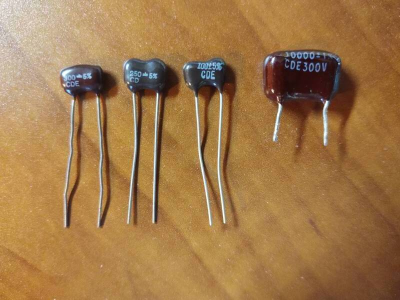
Mica has been used as a capacitor dielectric since the middle of the 19th century. It's less prone than glass to cracking under mechanical shock. Its high permittivity provides a higher capacitance value for a given size, compared to other materials. Mica can also withstand higher voltages. In 1920 William Dubilier developed a capacitor design using a piece of mica sheet coated with silver on both faces.
Epoxy-coated silver mica capacitors like those shown below can be manufactured to highly accurate capacitance values. By the 1950s silver mica capacitors were the best choice for many radio-frequency applications where low loss (or high Q factor) was important.
But then by the late 20th century advances in ceramics led to their replacement of mica in most RF applications. They are still used in designs for high-power applications, because of mica's high breakdown voltage. And, they're now marketed to the often-gullible audiophile community along with gold-plated speaker cables and connectors.
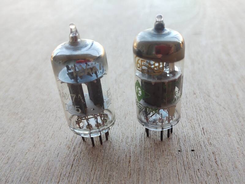
Mica has also been used in vacuum tubes, called thermionic valves in Britain.
The 12AX7A, seen at left, is a medium-gain dual-triode audio amplifier useful to no higher than 30 kHz. It was developed around 1947 and is still used in guitar tube amplifiers.
The 6EA8, at right, combines a triode and pentode inside one envelope. It was used in radio and television receivers where it was notorious for its short lifespan.
The active part of a tube like these is about the middle third, with the triode and pentode units enclosed in black metal plates and held in place by a light grey insulating disk at each end. Some tubes have used mica for those insulating and supporting disks.
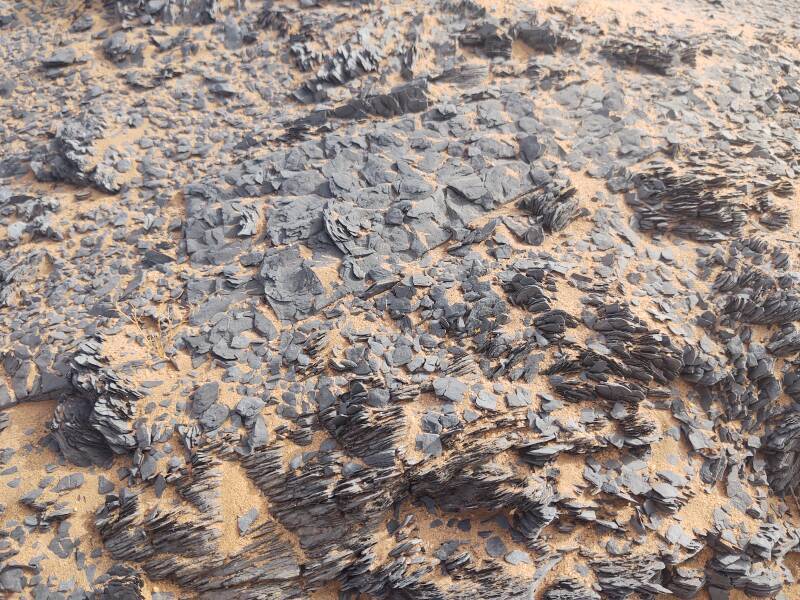
I believe that this is shale. Not so interesting.
Oued el Atach
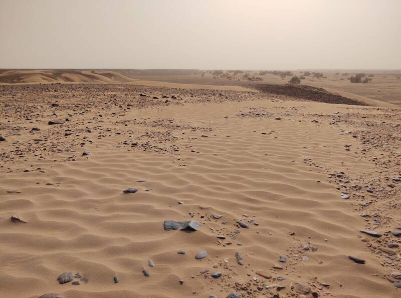
About five kilometers beyond the well we reached the broad el Atach wadi. It runs from north to south to join the Draa.
It's two to three kilometers wide where we crossed, significantly lower than the surrounding terrain. Limited vegetation shows that it carries some moisture, but not much.
We passed another government-maintained well in the center of the wadi.
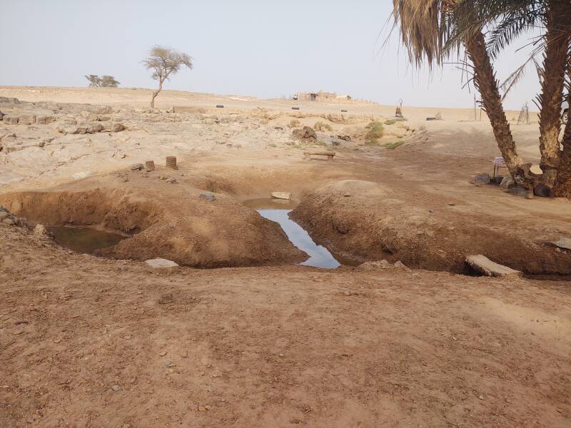
After we had crossed el Atach wadi, acacia trees on the horizon showed another strip of moisture ahead of us.
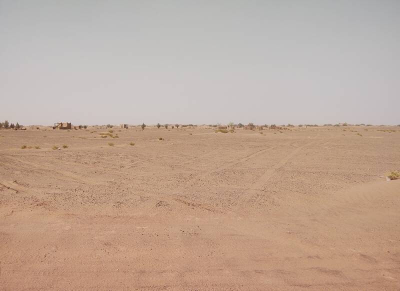
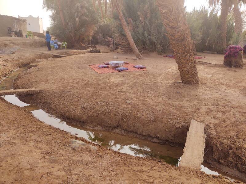
Oum Lâalag
Oum Lâalog is an oasis along the el Miit wadi, at 29.8827° N 6.1184° W. It was a stop on the trans-Saharan caravan route between Zagora and Timbuktu. It has been referred to as "The Sacred Oasis of Oum Lâalog" because the spring provides water, the most precious thing in the desert.
There has been a belief that a fairy or a djinn or some such magical protective being lives here.
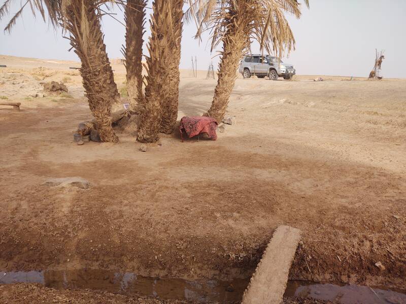
There's an area of about 15 hectares enclosed by walls here. I read somewhere that an entrepreneur once started building a desert resort here, but stopped soon after building the outer wall.
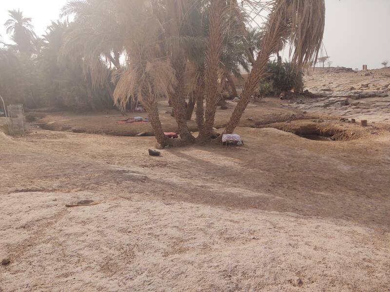
Yes, ripples showed that water was flowing up into this pool.
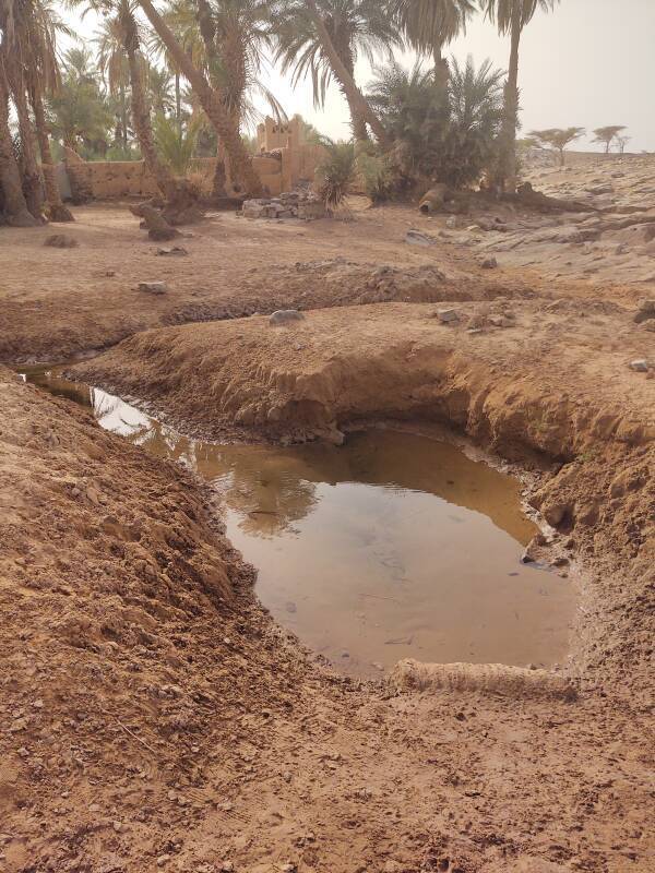
The isolated natural oases are endangered. First, because of increasing aridity due to climate change. Second, because they have been maintained by the nomadic population, and that is rapidly shrinking.
There is a tea house here. We had a glass of tea before continuing. Someone brought a herd of goats to drink at the spring.
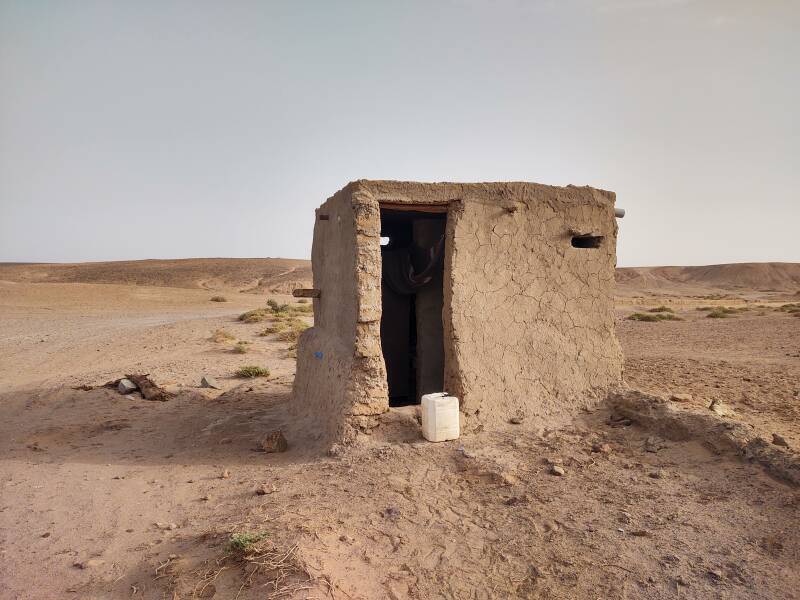
If you need to use the bathroom before leaving, they have one.
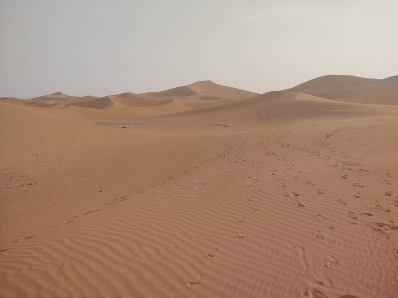
On to Erg Chigaga
From the oasis it's another twelve to fifteen kilometers to Erg Chigaga. The dunes are visible on the horizon ahead of us in this picture.
Finally, we arrived at Erg Chigaga.
The next page shows my visit to Erg Chigaga, the overnight stay, and the trip back to M'Hamid.