The Messara Coast
Exploring the Area around Kalamaki
Kalamaki on the Massara coast makes for a
very nice place to stay while exploring the area.
I had been in
western Crete
visiting Rethymno, Aptera,
and the Minoan tombs at Armeni.
Then I drove south to Kalamaki to use it as a base to
explore south-central Crete.
The Minoan palace of Phaistos,
the Minoan villa of Agia Triada,
the former capital of Crete at Gortyn,
and various Minoan tombs and early churches are
within short drives from Kalamaki.
The Messara coast is the short north-south segment of
the southern coast of Crete, just west of the word
"Phaestus" on this 1926 map of Ancient Greece:
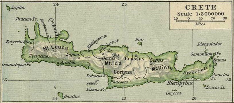
1926 map of Ancient Greece from the Perry-Castañeda Library Map Collection at the University of Texas at Austin. "Hey, you know what would be a great way to write Greek words within English text? Write them in Latin with weird ligatures like 'Æ', the way the Romans did! Then anyone who has studied how the Romans wrote and pronounced Greek would be comfortable!" For those of us who didn't go to an English boys' boarding school with the associated rum, sodomy, and the lash, the pointless Latin spelling is silly and a bother.
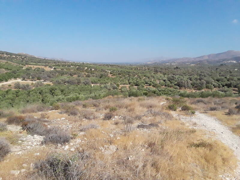
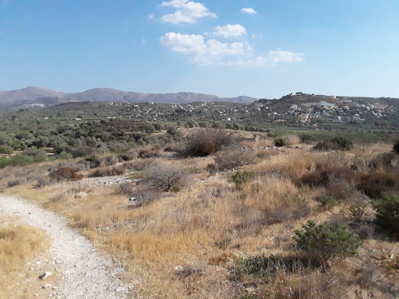
This map shows the topography of the area. The Messara plain is the broad valley leading east from Tympaki. To the north is the Psiloritis massif including Mount Ida, the highest peak in Crete at 2,456 meters or 8,058 feet. To the south is the Asterousa mountain range running parallel to the coast. Kalamaki is on the coast northwest of Pitsídhia. The broad valley leading inland to the east is rich agricultural land inhabited since the Neolithic.
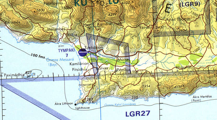
Tactical Pilotage Chart G-3D from the Perry-Castañeda Library Map Collection at the University of Texas at Austin.
Notice that Ormos Kali Limenes is shown along the south coast, in a rather old method of transliterating Greek into Latin script. Καλά λιμάνια or kala limania means "good ports". That's the Bay of Good Ports. The Acts of the Apostles describes the Apostle Paul's trip to Rome to stand trial. The weather was worsening and:
After many days of slow and difficult sailing, we arrived off the coast of Cnidus. The wind wouldn't allow us to go farther, so we sailed under the shelter of Crete off Salmone. We sailed along the coast only with difficulty until we came to a place called Good Harbors, near the city of Lasea.
Cnidus or Knidos is on the Datça peninsula at the southwest extreme of today's Turkey. Lasea or Lassea is near that peak labeled "1283". It's a rugged coast, with a 1,283-foot peak so close to the shoreline.
Finding Your Way
Beware, asking Google Maps to simply show you "Kalamaki" will instead show you the resort town on the island of Zakinthos, off the west coast of the Peloponnese. I'm sure it's nice, but it's about 460 kilometers to the northwest.
The trick is to ask for "Neo Kalamaki", the newer part of town on its south side.
Further confusion comes from Kalamaki being on the beach, with a hilltop of village of Kamilari just two and half kilometers inland. Kalamaki and Kamilari, Καλαμάκι και Καμηλάρι. Calamari or the Italian-named squid dish is not involved unless, of course, you ask for it at one of the many beachfront tavernas. Good luck keeping all that straightened out!
The Roads company makes excellent maps of Greece, buy a map at a service station. Θα ήθελα έναν χάρτη, παρακαλώ — I would like a map, please.
Staying in Kalamaki
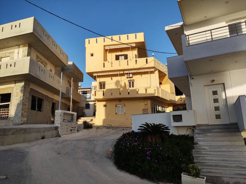
Guesthouses at Booking.comI had a room reserved at the Psiloritis domatia, that being the traditional "rooms for rent" term in Greece. It's the yellowish building at center here. My room was on the top floor, you can see its balcony and door.
That guesthouse is only 30 meters from the beach. Here's the view north along the coast toward Agia Galini.
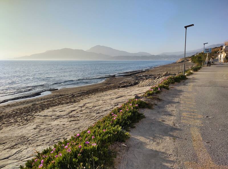
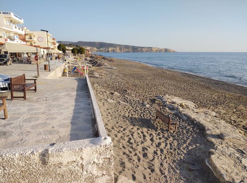
And, the view south along the coast. A broad walkway running south along Kalamaki and Neo Kalamaki is lined with cafes, tavernas, and guesthouses.
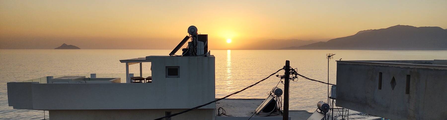
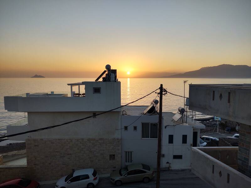
My balcony provided a great view of the sunset over the Messara Bay and the Libyan Sea. It's just over 300 kilometers to the coast of Libya, about 45° to the left of this view.
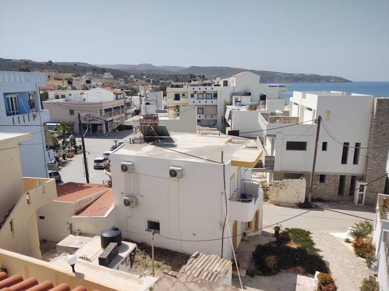
Looking down over the central square of Kalamaki in the morning, you can see the supermarket and other shops just two blocks away.
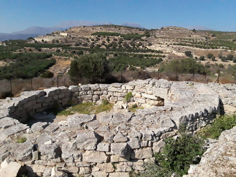
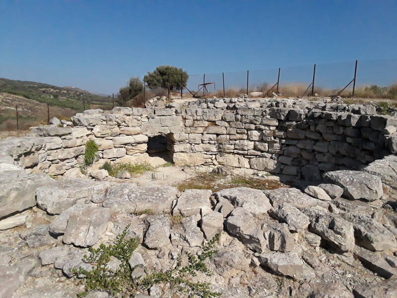
Kamilari Tholos Tomb
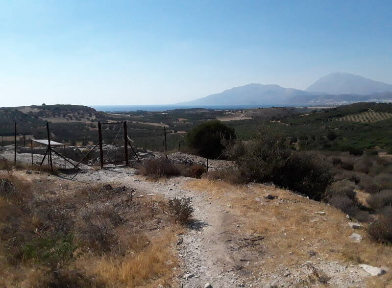
The Kamilari tholos tomb is nearby. Drive to the hilltop village of Kamilari, then go north on some gravel roads running between the farm fields. When you are very close to due east of the site, park and walk the remaining 250 meters on a path running beside and through some orchards.
The tholos tomb is on a low hill. Here's the view back to the east, looking up the valley. The road where you park is visible through the trees.
The hilltop village of Kamilari is on the horizon about 1.4 kilometers to the south.
There's a fence around the site, but you can easily open the gate. There's an explanatory sign in one corner of the fenced area. This view is to the west, to Kalamaki and the coast.
The Italian professor Doro Levi discovered this site in the summer of 1959. She dated its original construction to around 2000 BCE. It was reused later, through 1800–1500 BCE.
The main tholos or circular tomb is large, a little over 10 meters in diameter with thick stone walls. A five-room complex is attached.
Minoan tholos tombs were used by the entire population of a settlement, they weren't reserved for the uppermost strata of society.
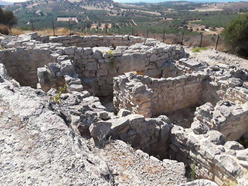
Unlike the later Mycenaean tholos tombs, Minoan ones were built above ground, never covered with earth. Ones less than about 7 meters in diameter had a full vaulted stone roof, but the larger ones did not. They probably had an at least partially wooden covering, possibly a timber-reinforced mudbrick vault.
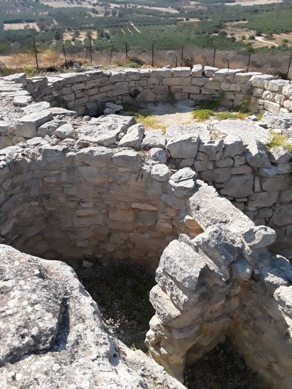
The entrance to the tholos was closed by a square flat stone a little over one meter one a side.
The small doorways of Minoan tholos tombs were almost always on the east or southeast side of the tomb. Unlike the later Mycenaean ones, the entrance was not approached by a passageway or dromos.
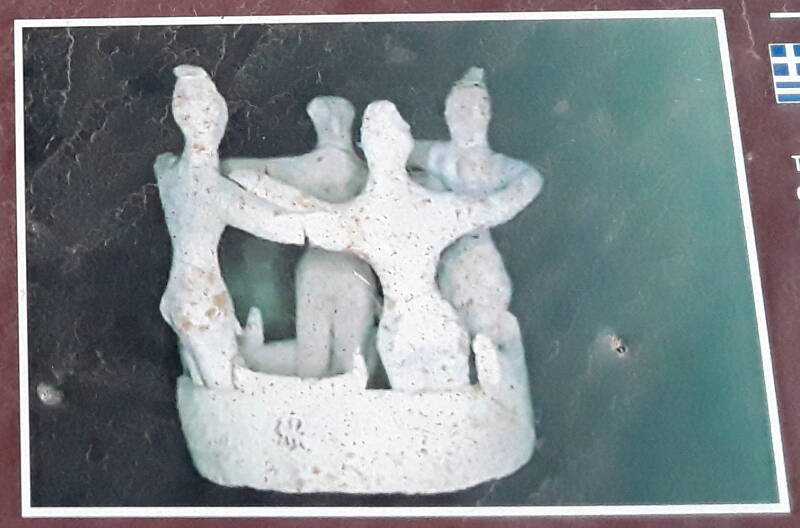
One of the objects found here was a small statue of four dancers in a circle, resembling a modern Cretan dance. But I don't know that any reputable source is seriously suggesting that Minoan traditions survive today.
A Dartmouth University web site has more background on tholos tombs.
Church of Saint Paul
Driving east from the tholos tomb on gravel roads through the farms, you come to the village of Agios Ioannis, Άγιος Ίωάννης on road signs. The village is named for its church, which is turn is named for Saint John.
Patmos andJohn the
Theologian
Simply "John" in Greece means John the Baptist, while "John the Theologian" or Ίωάννης ο Θεολόγος means Jesus's disciple, the author of the Gospel of John, the author of the Letters of John in the New Testament, and the author of the Apocalypse, titled Revelation in English. See my pages on Patmos for far more on this, but scholars today (and yes, including theologians) believe that those four roles of "John the Theologian" probably refer to four separate people, or maybe three people plus a group for the Gospel authorship.
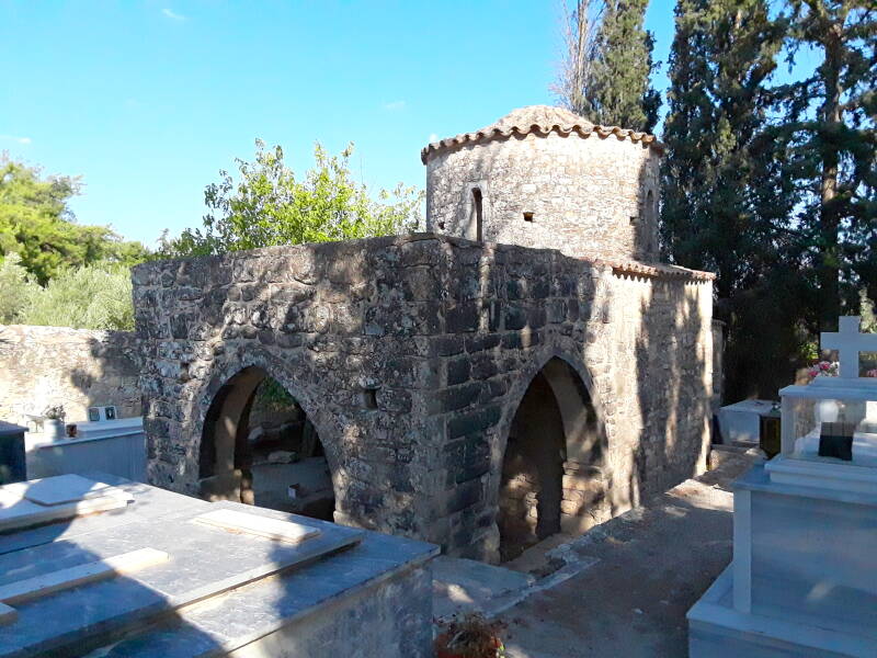
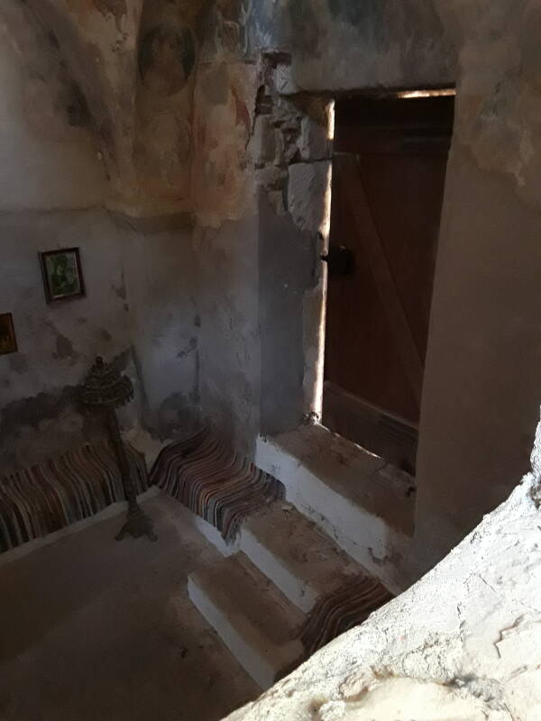
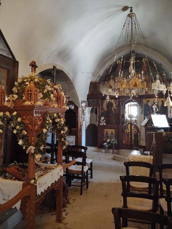
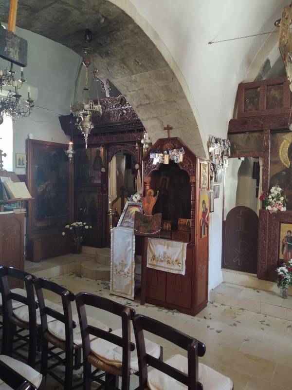
However, the more interesting church here is Εκκλησία Άγιος Παύλος, the Church of Saint Paul.
The original building, the section beyond the open arched narthex, was itself originally a square of four arches on thick piers supporting a cupola. That means that it was probably first built as a late Roman shrine associated with the nearby spring. It came to be used as an Christian baptistry in the 4th to 5th century.
Some time before 1003, the arches were filled in with stone, the cupola removed, and the cylindrical drum and dome were added.
The arched narthex on the near end was added during the time that Venice ruled over Crete, between 1205 and 1669.
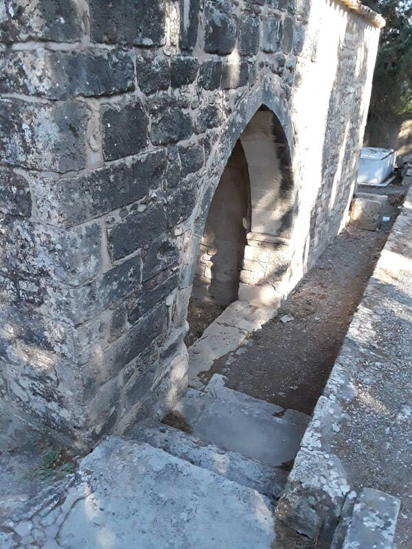
The narthex is a few steps down below ground level.
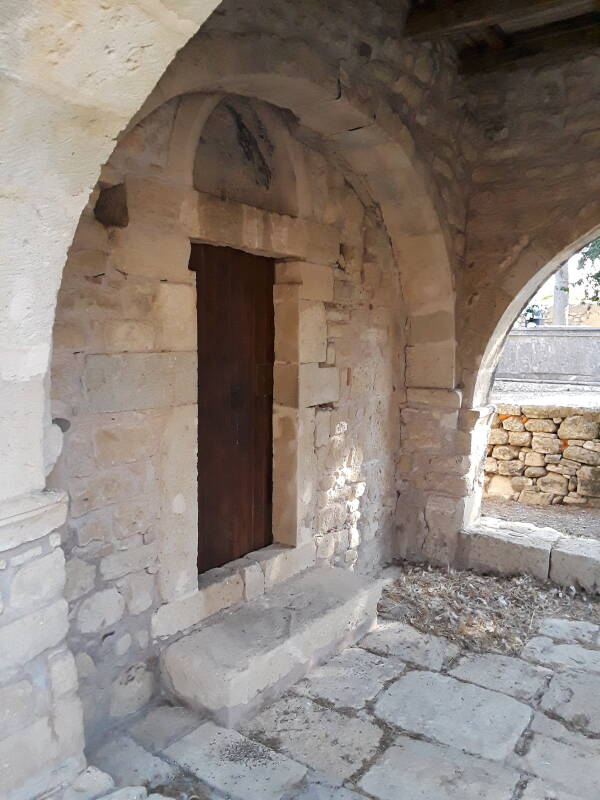
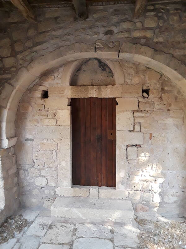
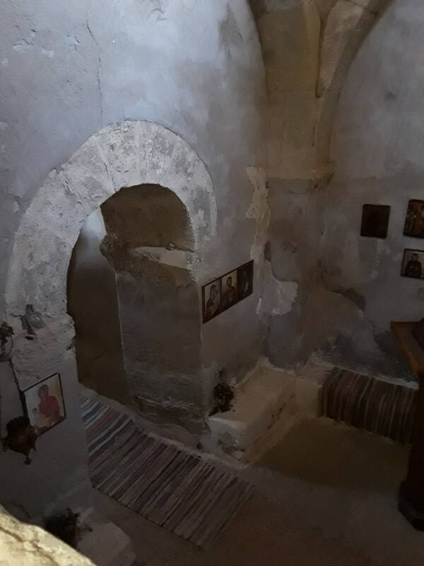
The door was locked. As I was only just a little over one unit into Duolingo's Greek course, I didn't try going around the village asking for the key. But a window on one side of the nave allowed me to peep in. Here is the inside of the entry door. You can see the original arches and their piers in the interior.

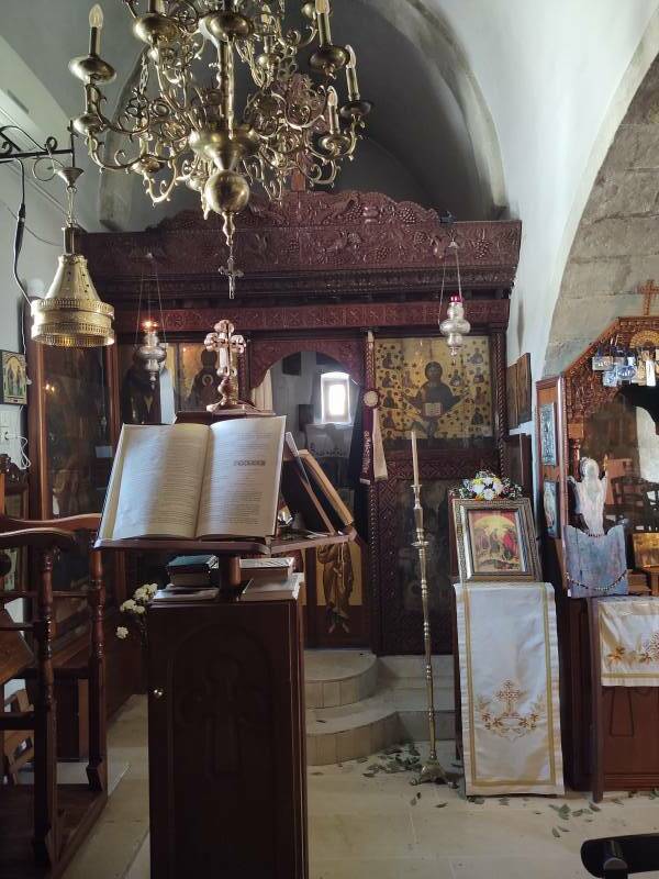
Above is a lectern used to hold liturgical books during a service.
The altar area is through the low arched door.
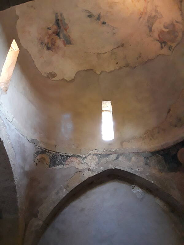
The frieze around the dome, seen above, has a painted inscription dated 1003–1004. It mentions the dedication of the church to the apostle Paul. He wouldn't have come here, but he would have been close. Kala Limania, where his ship stopped briefly, is just 12.5 kilometers south in a straight line.
Another inscription mentions how the church was restored and the surrounding wall built by order of the Byzantine Emperor Andronikos II Paleologus (who ruled 1282–1328), his wife Empress Irene, and their son the co-Emperor Michael.
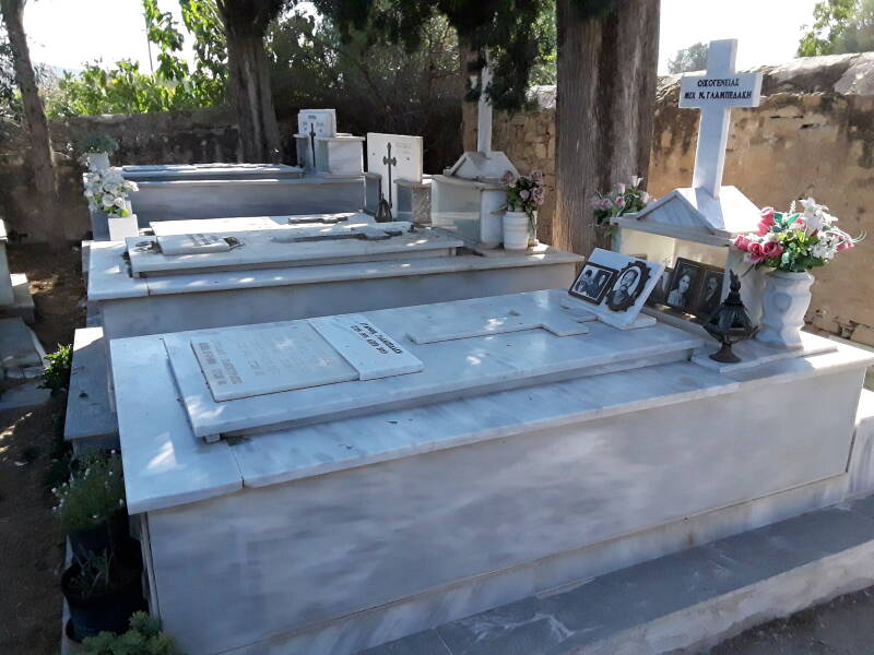
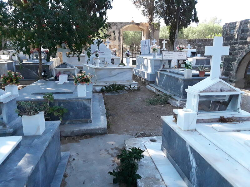
The church is still in use. The surrounding cemetery has recent burials.
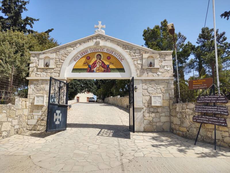
Monastery of the Panagia Odigitria
The Monastery of the Panagia Odigitria or Μονή Παναγίας Οδηγήτριας is on the road south to Kala Limania. The road turns to gravel there and worsens as it continues toward the coast.
The monastery is named in honor of the Panagia Odigitria icon. Panagia or Παναγία, meaning All-Holy, is one of the titles of the Theotokos, the God-Bearer, Jesus's mother Mary. Odigitria comes from οδηγία or odigia, meaning "guidance" or "direction".
The Panagia Odigitria is a standardized depiction of the Theotokos holding baby Jesus and gesturing to indicate that he is the source of salvation for mankind. His hand is usually raised in a blessing gesture. It's a common icon form for the left side of the central door in an iconostasis. Several examples are included in Byzantium: faith and power (1261-1557), published by the Metropolitan Museum of Art in New York.
Constantinople,
now İstanbul
The most venerated example of the Panagia Odigitria icon type is the one thought to be the very first one made. The Monastery of the Panaghia Odigitria in Constantinople was built just to house that icon.
At this point the legends really kick in. The original Panagia Odigitria was said to have been painted by Luke the apostle, and brought back from the Holy Land by Eudocia, the wife of Theodosius II, the Roman Emperor from 401 to 450. It was described as "perhaps the most prominent cult object in Byzantium".
After the Fourth Crusade of 1204–1261, when the western European armies besieged and looted Constantinople instead of continuing on to Jerusalem, the Venetian forces converted the Monastery of the Pantocrator in Constantinople into the Roman Catholic cathedral of the local Venetian see, and moved the Panagia Odigitria there.
The Ottoman Turks captured Constantinople Turks in 1453. That probably would have eventually happened no matter what, but the dismantling of the Byzantine Empire by the Fourth Crusade certainly made things a lot easier for the Turks. When the dust settled after the Fall of Constantinople, the original Panagia Odigitria was gone.
By that time many copies had been made. Being icons, they were very carefully made to be precise replicas. In that time before photography, and even further before digital imaging and near-instantaneous transmission of detailed images, decisions about whether two icons were effectively identical relied on the care and memory of an observer who traveled by foot between distant locations.
Many of the most venerated Russian icons were copies of the Panagia Odigitria. After the Fall of Constantinople, some came to believe that an example in Russia, placed in the Assumption Cathedral in Smolensk, was the actual original that was painted by Luke in the first century.
The Novodevichy Convent was built in Moscow in honor of the icon's subject. The supposed original was brought from Smolensk to Moscow several times with elaborate ceremony. Many churches around Russia are dedicated to the supposed original of Smolensk.
Unfortunately for the legend, art historians dated the Smolensk icon to the 11th century, a millennium after its supposed creation.
Even more unfortunately, it was destroyed by fire in 1941 during the Nazi German occupation of Smolensk.
Then there are several complicated and contradictory Italian legends about the original going to southern Italy, or to Rome, or to southwestern France, with multiple re-paintings and trimming and extensions and mysterious mirror reversals and other modifications along the way.
No one thinks that it's here in southern Crete.
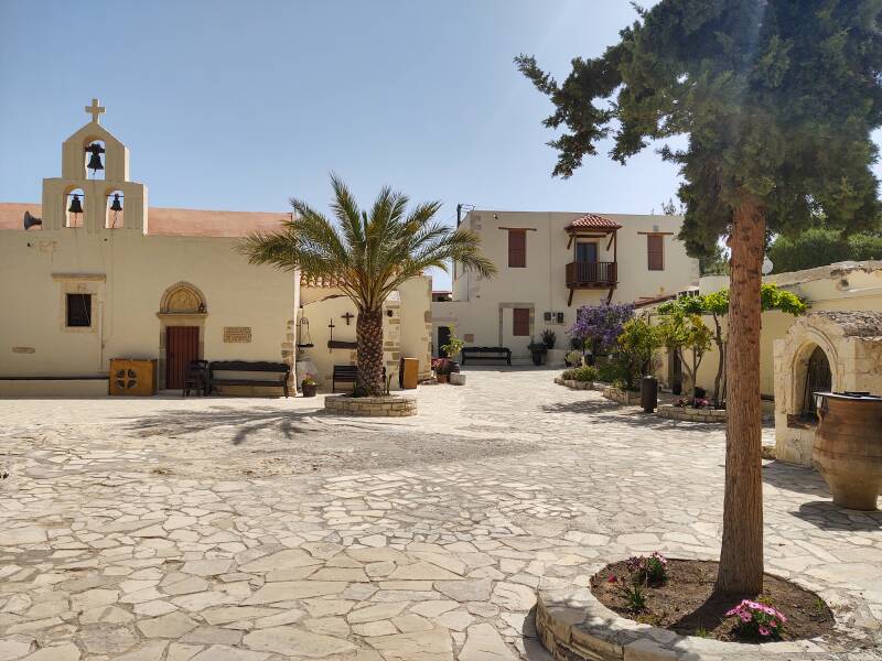
Venetian archives record that there was a monastery here as early as 1393.
The Xopateras or "ex-priest" tower on one of the perimeter buildings is named after a legendary defrocked monk named Ioannis Markakis. He was the chief of a local band of rebels during the 1828 revolt against Ottoman rule. The legend says that the Turks chased him into the tower where he had taken refuge with his family, and that he defended himself by throwing beehives down at the Turks.
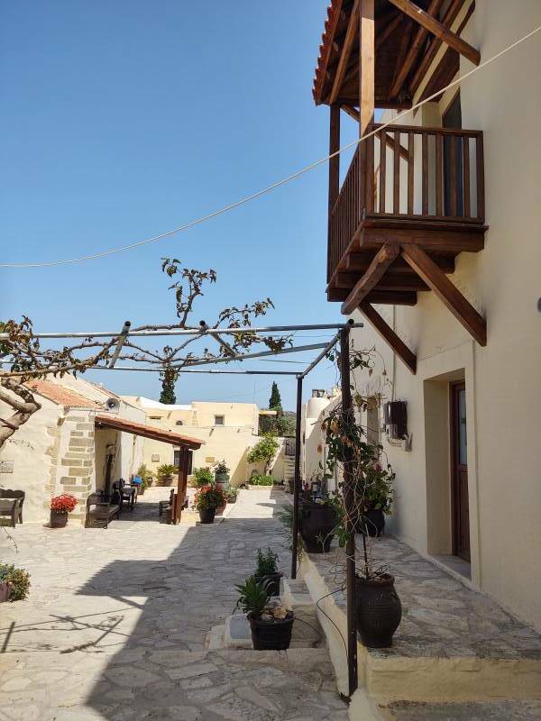
The church in the center of the courtyard has two naves.
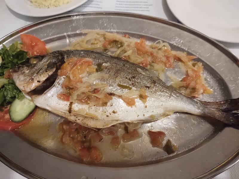
Dinner in Kalamaki
After a busy day, the tavernas along the waterfront in Kalamaki offer great meals. This dorado was caught that morning in Messara Bay.
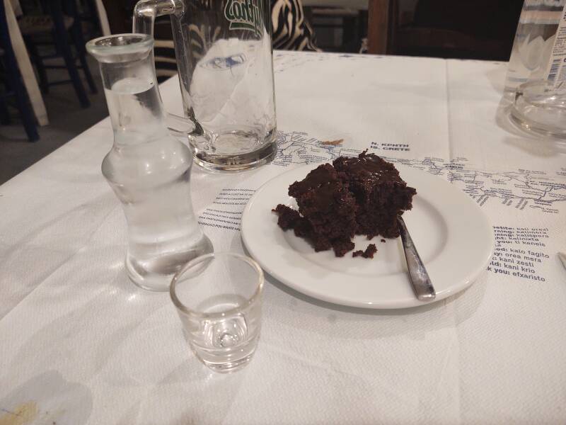
And, as usual after a full meal, they bring an extra treat. In this case, chocolate cake and a digestif of an ampoule of Cretan tsikoudia.
Pomace or marc is the solid remains of grapes left after pressing, containing pulp, skins, seeds, and stems. It can be fermented in a tightly sealed barrel for about six weeks, and then distilled to produce pomace brandy.
The result is popular in Crete, where it is called τσικουδιά or tsikoudia. Confusingly, it also gets called ρακή or raki, although it contains no anise and is nothing like the Turkish rakı or mainland Greek ούζο or ouzo. Beyond being rocket fuel containing 40–65% ethanol by volume.
Or, Continue Through Greece:
Where next?