Phaistos
Phaistos / Φαιστός
Knossos
is the most famous Minoan site,
and it's described as "the palace of King Minos".
But Phaistos or
Φαιστός
is the better site in multiple ways.
It's almost as large as Knossos,
and a visit can be much more rewarding.
The older levels are preserved here better than at
any of the other Minoan palaces around Crete.
They're in good enough shape for scholars to conclude
that the more complete newer levels were built
in a style very similar to the older layers beneath.
Most significantly, Phaistos wasn't subjected to
Sir Authur John Evans's fanciful "reconstructions"
based on his dreams of what should have been.
And if you still want your "history" based on myth,
but without all the reinforced concrete and
Art Deco style that Evans imposed upon Knossos,
Phaistos was said to be the home and throne of
Radamanthis, the mythical brother of the mythical Minos.
Phaistos is labeled as "Phaestus" near the center of the
southern coast of Crete on this map of Ancient Greece.
Knossos is labeled as "Cnossus".
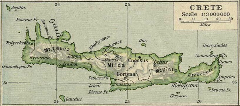
1926 map of Ancient Greece from the Perry-Castañeda Library Map Collection at the University of Texas at Austin. "Hey, you know what would be a great way to write Greek words within English text? Write them in Latin with weird ligatures like 'Æ', the way the Romans did! Then anyone who has studied how the Romans wrote and pronounced Greek would be comfortable!" For those of us who didn't go to an English boys' boarding school with the associated rum, sodomy, and the lash, the pointless Latin spelling is silly and a bother.
Updated to the present and zoomed way in, it looks like this:
Visiting Phaistos
You can visit Phaistos on a day trip out of Heraklion, it's only about an hour's drive on the new highways. The Roads company makes excellent maps of Greece, buy a map at a service station. Θα ήθελα έναν χάρτη, παρακαλώ — I would like a map, please.
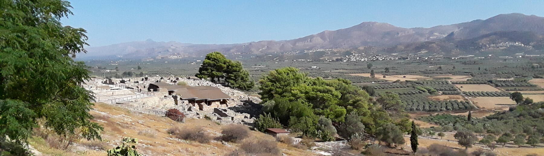
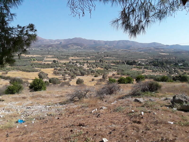
Below is the view showing the side road off the highway climbing up through a series of switchbacks to the site. This view is to the west, down the Messara valley toward the Libyan Sea coast which is just out of sight behind the hill to the left.
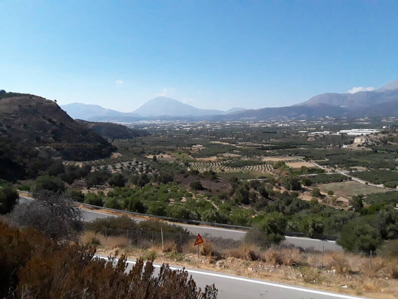
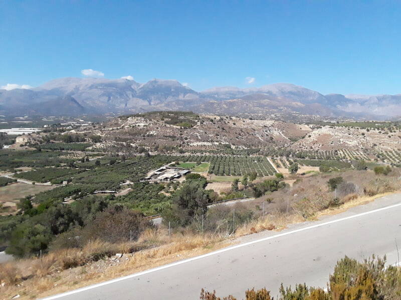
This is the view from the same spot, turned to the right to face north. That's Mount Ida, the highest point in Crete at 2,456 meters or 8,058 feet, and more of the Psiloritis massif.
Phaistos is in the broad valley of the Messara plain, just a little southeast of the Tympaki airport. It's on a small ridge just south of that river. To the south of that valley is the Asterousa mountain range running parallel to the coast. The broad valley is rich agricultural land that has been inhabited since the middle Neolithic age. The ridge where Phaistos is located was inhabited from about 4000 BCE, in the late Neolithic age.
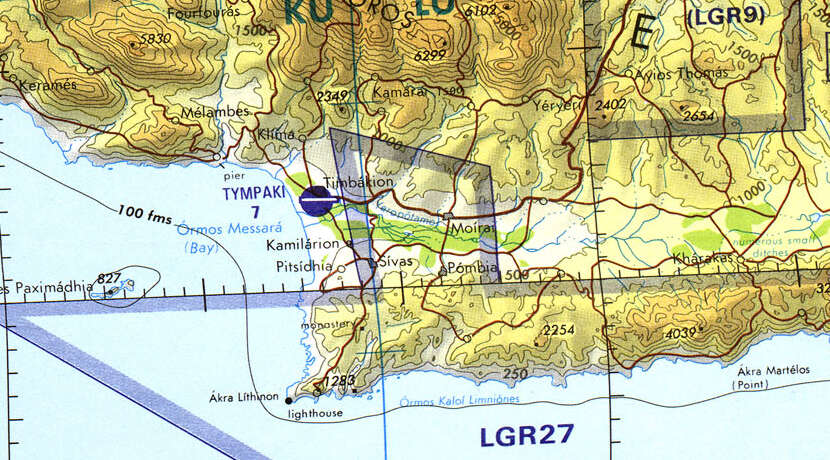
Tactical Pilotage Chart G-3D from the Perry-Castañeda Library Map Collection at the University of Texas at Austin.
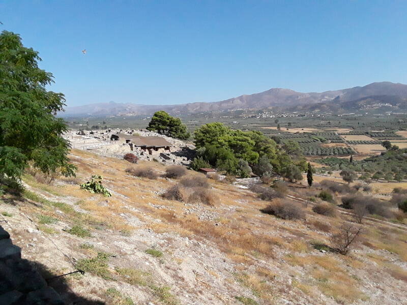
During the Early Bronze Age people began establishing settlements along the lower slopes of the Asterousa range, seen in this view to the south.
And here is the site, at the south end of that ridge in the middle of the valley. Phaistos is sixty to eighty meters above the surrounding valley. The first palace was built here about 2000 BCE.
Thomas Abel Brimage Spratt was the commander of the U.S. Navy paddle steamer Spitfire, taking part in the Mediterranean Survey of 1853. He knew that the Greek geographer and historian Strabo, who lived from 64/63 BCE to around 24 CE, had described Phaistos and how to find its location.
The city was gone in Strabo's time, he wrote that it had been "razed to the ground by the Gortynians". However, he cited earlier references placing Phaistos sixty stadia from Gortyn, twenty stadia from the sea, and forty stadia from Matala.
Strabo was rounding off his distances to multiples of twenty. But it gets worse, the length of stadia weren't consistent.
600 pous or Greek feet made one stade or stadion. A pous was from 296 to 324 millimeters, depending on the time and place, making one stadion from 177.6 to 194.4 meters.
Spratt was a surveyor, he knew how to find the intersection of three circles of rough proportions and imprecisely defined radii. He could certainly ballpark the location from Strabo's imprecise description. And, he could recognize and appreciate a militarily advantageous position. Spratt reported:
But in a journey very recently made from Fair Havens, especially to search for it [Phaistos] and to revisit Gortyna, I came upon an ancient site at a place called Agia Fotia, situated between the village of Debaki and Metropoli or Agious Deka, and agreeing with the distances given by Strabo. I thus found that Phæstus had occupied the extremity of a ridge that divides the maritime plain of Debaki from the plain of the Messara, so as to command the narrow valley of communication between this maritime plain and the inland territory of the Messara, belonging to the Gortynians, and through which the Lethæus flows to the sea.
The river consequently passes close under the north extremity of the ridge, where it rises into an elevated and precipitous termination, and where there are vestiges still of an acropolis, or its enclosing walls, upon the narrow crest, although Strabo records that the town was destroyed. The acropolis-hill is locally called Kastri—an additional indication of the fact of its having been crowned by a fortress or acropolis. Independently of these remains, vestiges of the old city can also be traced in the plain beneath, to the south, in the many fragments of pottery and stones that bestrew the surface of the fields that are now cultivated on the old site, and as far south as the chapel of Agios Joannis, which is nearly a mile from the Kastri hill, thus showing the original extent and importance of this early city of Crete. The miserable and befevered village of Fotia, containing about a dozen houses, stands in about the middle of the site, between the acropolis and the chapel; and it derives its proverbial insalubrity from the stagnation of the Lethæus in a marsh in front of it to the east, just before its escape through the contracted valley passing beneath the acropolis of Phæstus and communicating with the maritime plain of Debaki.
That chapel of Agios Ioannis or Άγιος Ίωάννης, Saint John in English, about a mile to the south, is in the same village as the Church of Saint Paul described and pictured on the previous page.
The site of Phaistos was abandoned for centuries but was re-settled in classical times. It became large enough to mint its own coins, with designs including Europa sitting on a bull, Herakles without a beard and being crowned, and Zeus in the form of a naked youth sitting in a tree.
The next page, about Agia Triada, explains how that nearby settlement had a temple to Welchanos, a Minoan vegetation deity associated with the seasonal cycle of death and rebirth. When the Mycenaean Greeks arrived here around 1400 BCE, they recognized the local Welchanos an analogy to their early form of Zeus.
The Phaistos coins had the city's name as ΦΑΙΣ or ΦΑΙΣΤΙ, written both left-to-right and right-to-left as this was so early that the writing direction wasn't yet well-defined.
Once Michael Ventris deciphered the Linear B script in 1952, determining that it was used to write Mycenaean Greek, scholars realized that many of the Linear B tablets found at Knossos spoke of a place named PA–I–TO, 𐀞𐀂𐀵 in Linear B.
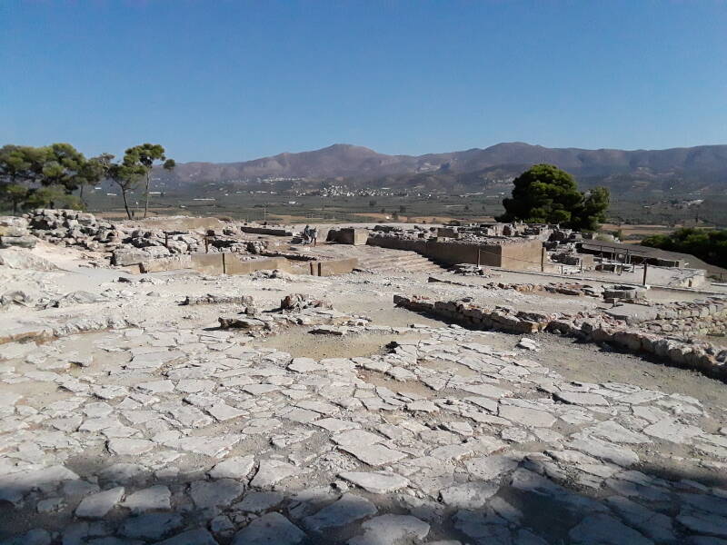
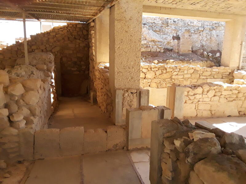
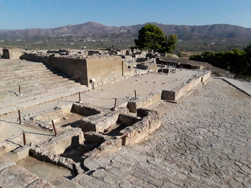
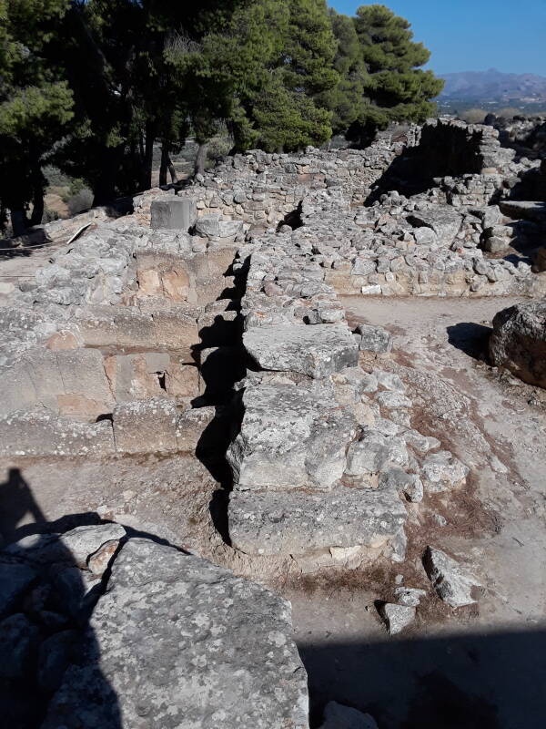
Below is the view as you enter the site of Phaistos. This palace, like the other Minoan palaces of Crete, was destroyed three times before its final reconstruction around 1700 BCE.
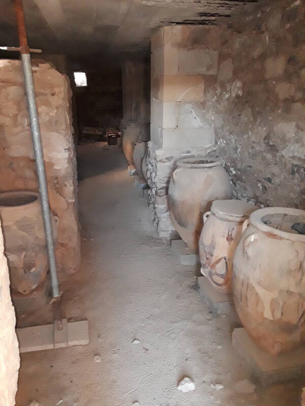
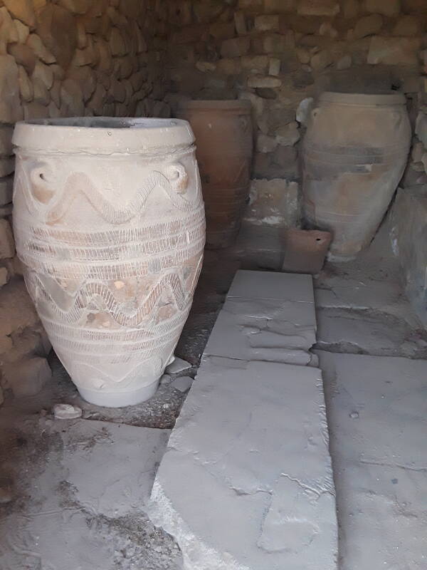
Like Knossos and Malia, Phaistos had large magazines or storage chambers with large pithoi, fired clay storage jars that could hold bulk goods, grain or liquids such as olive oil.
Amazon 0292760914
Amazon 1108440495
The large-scale storage and distribution of bulk goods led to these sites being called palaces. One viewpoint is that "Storage is about controlling the future, and thus authority."
The Minoans had a sophisticated civilization, but they were literally pre-historic as they left no records of their history, religion and mythology, or current events.
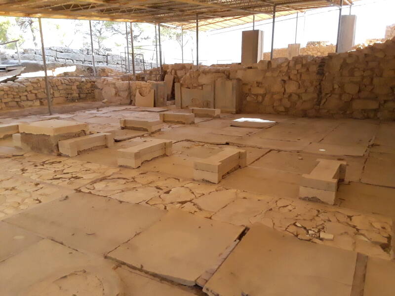
And so a large hall with pillar bases gets a generic name like "North Pillar Hall".
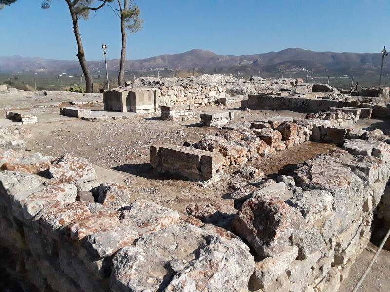
A nearby cluster of rooms may get names like the "King's Apartment" and the "Queen's Megaron", although "Royal Apartments" is a safer label. They were finished with panels of alabaster and other luxury material.
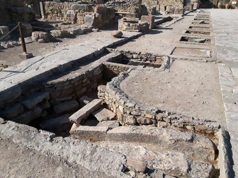
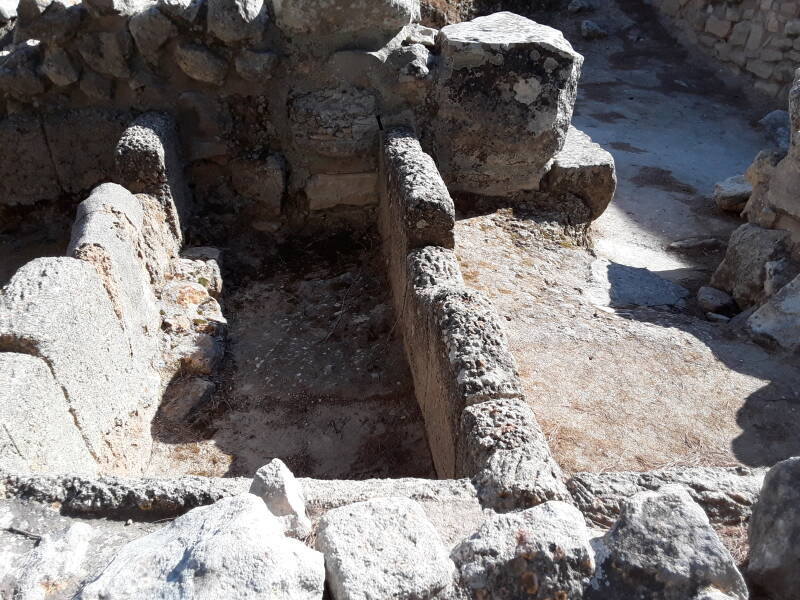
This one has a so-called "lustral basin", seen above at the right rear. That name comes from Arthur Evans, who believed that of course these people must have had rituals involving "lustration" or ritual bathing, and so these must have been the chambers in which that happened.
However, the "lustral basins" were lined with water-soluble gypsum, what today's sheetrock or drywall sheets are made from. And, despite the Minoans' expertise in plumbing, both clean water supply lines and drain lines, neither water supplies nor drains have been found at any of the many "lustral basins" found throughout Crete.
These are built to a common design and must have had a standardized purpose. But it wasn't ritual bathing. Here's a look down into this one.
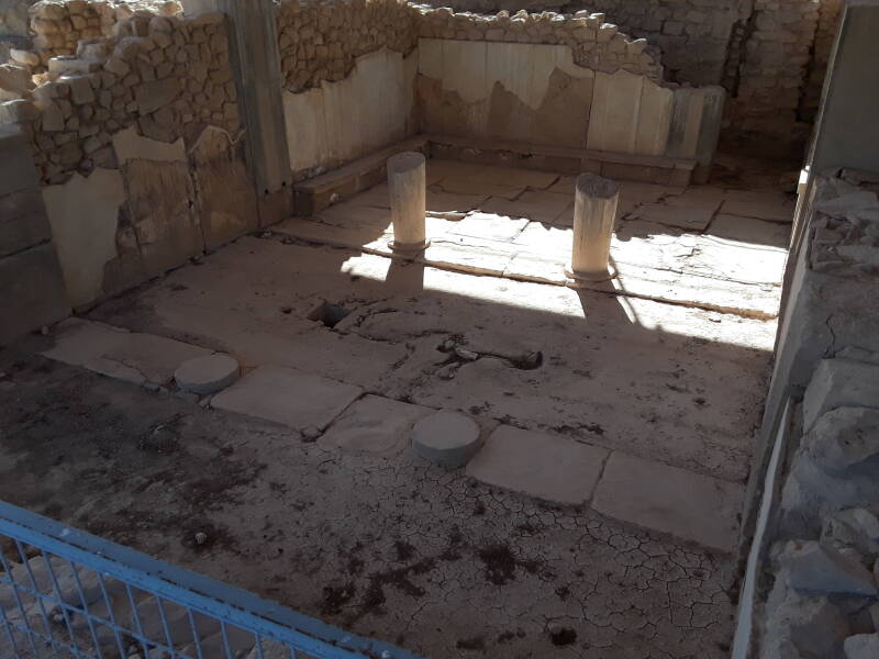
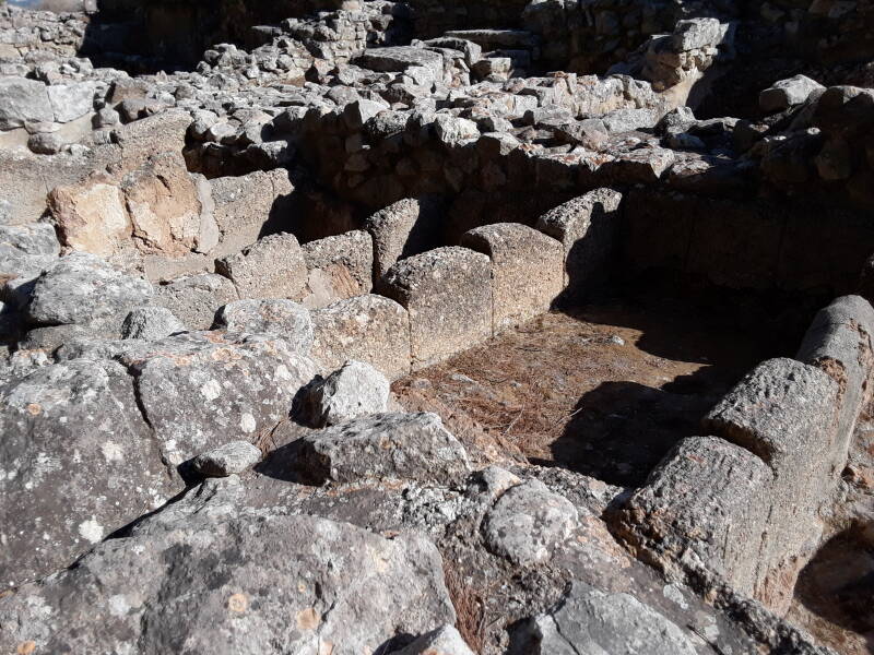
The slightly smaller of the two "apartment" complexes got labeled as the "Queen's Megaron" in early studies. Not because of any physical or written evidence, but simply because of relative sizes.
Megaron is a slightly more recent term, referring to a Mycenaean Greek structure or at least a pair of rooms functioning at times as a temple. This one has two pairs of columns dividing it into three sections. Maybe it was to mark passage into increasingly sacred spaces. Or maybe it was just to support the roof.
The small Ieropotamos river at the base of the hill supplied Phaistos with its water, assisted by some deep wells dug down through the hill from the palace itself.
Recall that Spratt described the "miserable and befevered village of Fotia" standing in the middle of the site in 1853. He wrote that it "derives its proverbial insalubrity from the stagnation of the Lethæus in a marsh in front of it to the east." Things must have been less stagnated, insalubrious, befevered, and miserable when this was a Minoan center of power.
Of course by that time Crete had been through about 650 years of harsh rule by outsiders, the Crusader city-state of Venice from 1205 to 1669, and the Ottoman Empire since then. Mainland Greece had gone through a War of Independence in 1821, but Crete was still under Ottoman control.
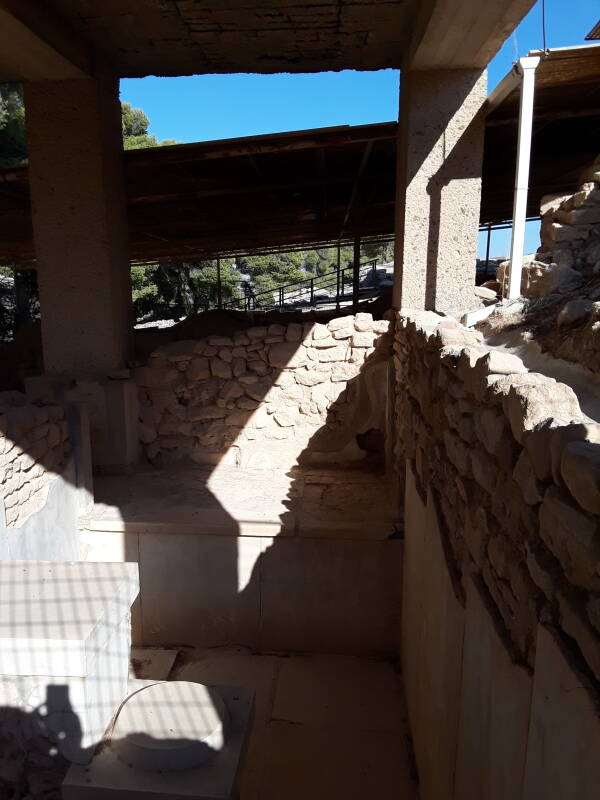
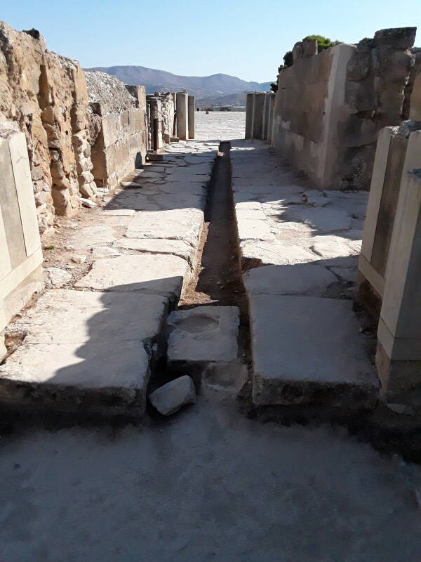
The Minoans were famous for their advanced water supply and drainage systems. Here is a drain leading from the area of the royal apartments to the large Central Court.
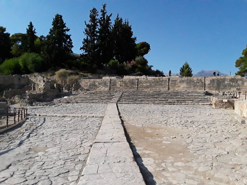
Some scholars have speculated that the large Central Court, at the time enclosed on all sides by various structures, was the site of the "bull-leaping" rites.
Amazon 1608689034
Amazon 1608687295
Others have questioned just how good of an idea it would have been to turn an enraged bull loose on a smooth stone courtyard. Imagine an excited dog on linoleum but far more dangerous.
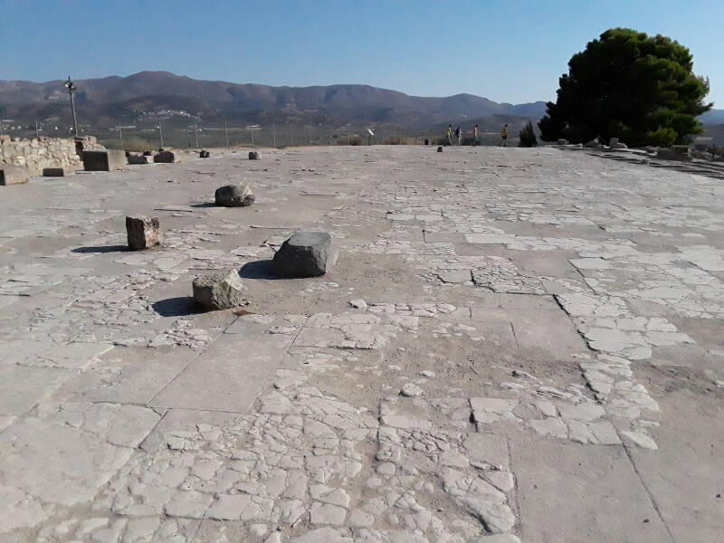
Water drainage features surround the Central Court.
Phaistos Disc Find Site
Scientific excavations in Crete started in 1900, immediately after the final Ottoman departure. There had been sixteen houses in the village when Spratt visited Phaistos in 1853. The village was removed and excavations began.
Scholars soon determined that clay tablets, pithoi and other containers, and other objects found throughout Crete bore writing in two different but related scripts.
Stratigraphy, or the science of figuring out relative ages based on burial layers, showed that one script was older than the other. Scientists called the older one Linear A and the newer one Linear B. Analysis of the signs showed that Linear B had been derived from Linear A.
Michael Ventris figured out that the Linear B writings contain an earlier form of the Greek language, called Mycenaean Greek. As for Linear A, we still haven't really figured out just what language it records. But we do know that it certainly isn't an even earlier form of Greek.
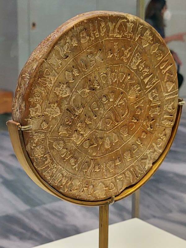
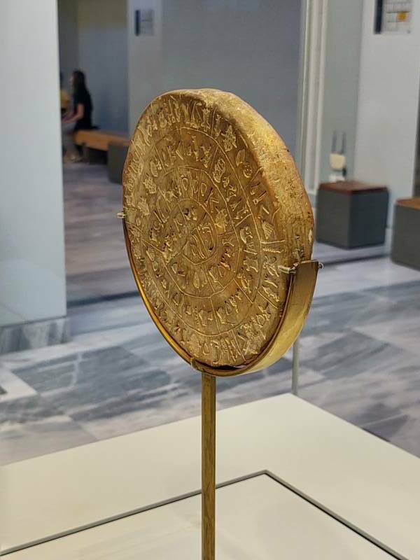
In 1908 an Italian archaeologist working here found a mysterious disc in this set of storage chambers.
The object came to be called the Phaistos Disc because we have no idea what its purpose is, what the writing on it might say, or even what language it might be in.
The Phaistos Disc is about 16.2 cm in diameter and 1.5 cm thick. It has a spiral of pictorial signs on each side.
It was found here, next to a Linear A tablet.
The Phaistos Disc is now in the Heraklion Archaeological Museum.
The messages on the two sides are written with 241 tokens from a set of 45 distinct signs. They were made by pressing hierglyphic seals or stamps into a soft clay disc. Incised lines divide the signs into what are believed to be words.
There was a long debate, but most researchers now agree that the signs are in a clockwise sequence spiraling in toward the center.
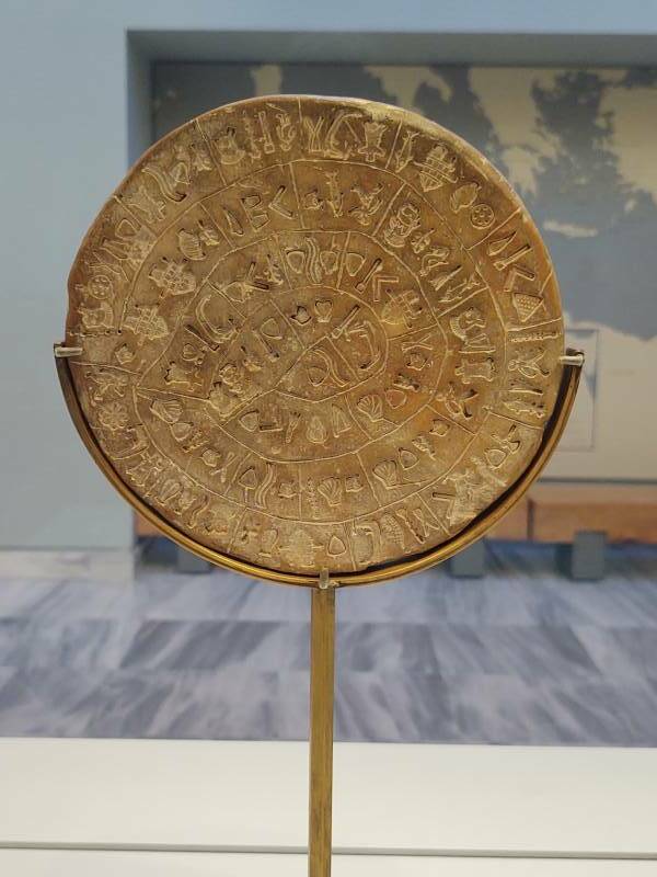
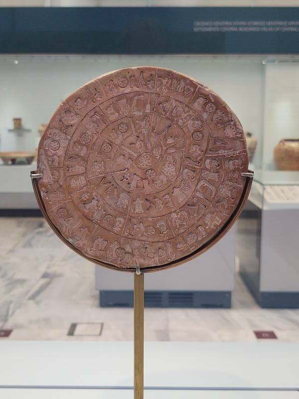
Given the numbers, 45 distinct signs used in a total of 241 tokens, leads most researchers to conclude that it is a syllabary, like Japanese Katakana and Hiragana. 45 is too many for an alphabet, and far too few with far too many closely spaced duplications for a logographic system of one sign per word.
Beyond that, no one really knows. With just this one object bearing an otherwise unknown script, there simply isn't enough information to figure out what it says.
Where Are The Records?
The large storage magazines lined with pithoi show that Phaistos was a distribution center for bulk goods throughout the Minoan era. It was also a religious or at least ceremonial center, with the bull-leaping either on the Central Court or somewhere safer.
However, no objects bearing Linear B have ever been found there, and only a few pieces of the older Linear A, one of which was associated stratigraphically with the Phaistos Disc.
If Phaistos was an administrative center, where are the records?
It seems that Agia Triada was the real administrative center, operating Phaistos's port a few kilometers further west on the Messara coast. More Linear A tablets have been found at Agia Triada than at any other Minoan site.
And Then What Happened?
It seems that the Mycenaeans destroyed Phaistos around 1400 BCE, the same time they destroyed Knossos. Phaistos wasn't rebuilt again, the Mycenaeans seem not to have used the site.
Ancient Yersinia pestis and Salmonella enterica genomes from Bronze Age CreteAncient Greece was aware of Phaistos, there were many references to it. Homer described it as "well populated" in his mentions of Phaistos as a participant in the Trojan War in both his Iliad and Odyssey, apparently written down around the 8th century BCE and describing events of the 12th century BCE when the Late Bronze Age collapse happened.
Phaistos was rebuilt in the 8th century BCE. Aphrodite and Leto, also called Phytia, were worshiped there.
Then the Gortynians destroyed Phaistos around the end of the 3rd century BCE, just as Strabo reported two centuries later.
The Greek historian Diodorus Siculus of the first century BCE wrote that Phaistos, Knossos, and Kydonia were founded by King Minos of Crete.
Continue exploring by moving three kilometers west to Agia Triada.
Or, Continue Through Greece:
Where next?