Plaka and Views Over Milos
Plaka / Πλάκα
Plaka was the high ground
of one of the earliest settlements on Milos.
Then, when Venice seized control of Milos,
they built a fortified castle or Kastro
on its highest point in the 13th century.
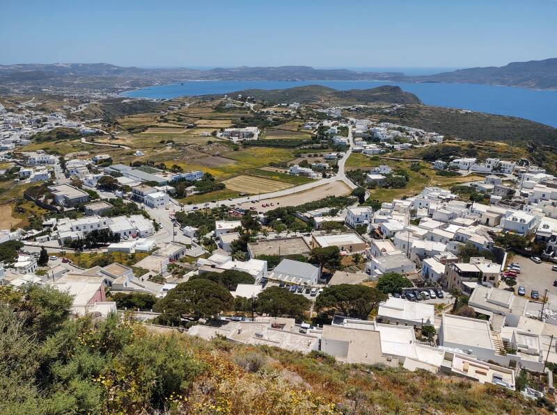
Today Plaka has become the administrative center of Milos.
Most of the public services on the island are based here.
But who cares about that, there's a fantastic 360° view
from the old Kastro where a church now stands.
The Fourth Crusade in 1204 was an even more squalid business than those before. Instead of going all the way to Palestine, they decided that Constantinople was foreign enough and practiced a religion different enough to justify killing them and looting their city. Going all the way to Jerusalem would just be such a bother.
The Crusaders sacked Constantinople brutally. Then they partitioned the Byzantine Empire into a Latin Empire, an Empire of Nicaea, an Empire of Trebizond, a variety of Despotates, Kingdoms, Duchies, and Principalities, plus the independent islands of Rhodes, Crete, Negroponte, Cephalonia, and Corfu.
Marco Sanudo was a nephew of a Venetian doge and and had taken part in the Fourth Crusade. Sanudo organized a fleet soon after the sacking of Constantinople and captured the island of Naxos. That established, in 1205–1207 or a little after 1213–1214 depending on which source you read, the Duchy of the Archipelago. That soon expanded to include Milos.
Sultan Mehmed II, "The Conqueror", captured Constantinople in 1453. The Ottoman Turks might have captured the city anyway, but the sacking of the city by western Crusaders in 1204 and the following poorly coordinated partitioning of the Byzantine Empire certainly eased the way to its capture.
The Venetians controlled their Duchy of Naxos until they surrendered it to the Ottomans in 1566.
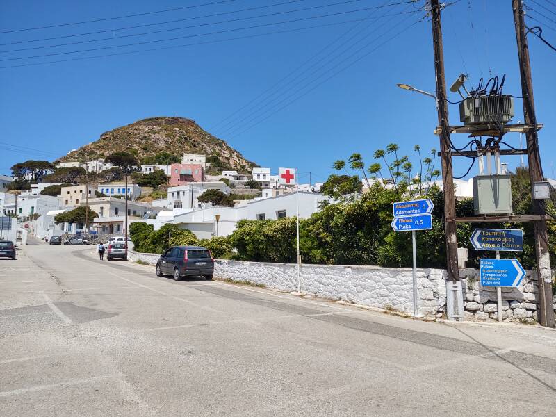
The bus from Adamantas starts at the waterfront and goes through Pera Triovasalos and Plaka on the way to Trypiti, and returns in the reverse order. The bus from Adamantas stops where it turns at the edge of Plaka near the medical clinic. On the way back to Adamantas, it stops right across the road from where you got off. When I was there in early May, the bus left Adamantas at 0730, 0830, 1030, 1230, 1500, 1630, and 1830; and left Trypiti at 0630, 0750, 0950, 1150, 1350, 1550, and 1750.
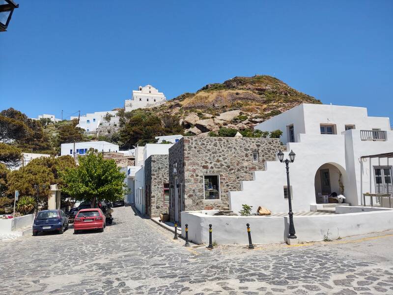
Into Plaka
The Venetians built the Kastro or fortress on the volcanic peak looming above today's town during the 13th century.
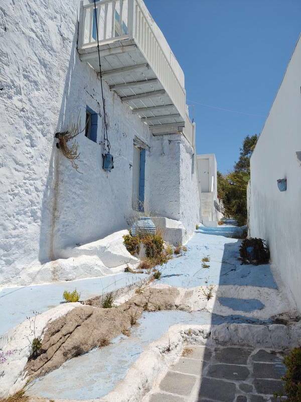
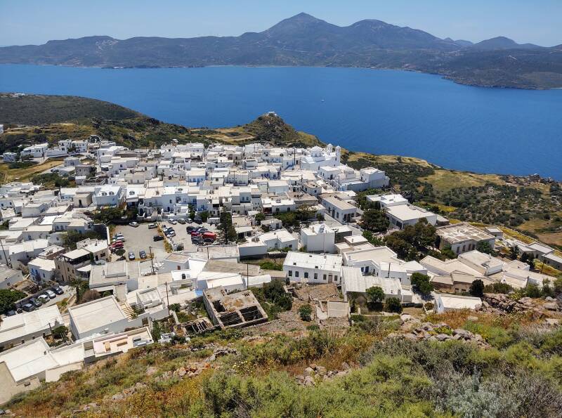
When the population grew too large for the Kastro, the town was founded on the πλάκα or "slab", the relatively flat rocky space below the peak. And so the town was called Plaka.
A capital of the island was established at the village of Zefyria, also called Χώρα or Hora as usual for the primary town on an island. But then in 1767 Zefyria was the site of either a malaria outbreak or a surge in volcanic activity leading to noxious gas emissions. This was during Ottoman times, so records are vague. Zefyria was mostly abandoned and the island's administration moved to Plaka.
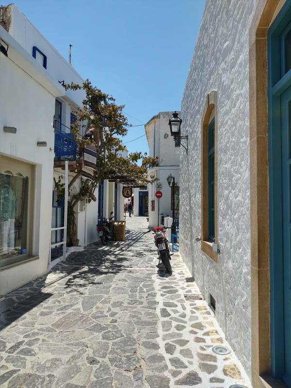
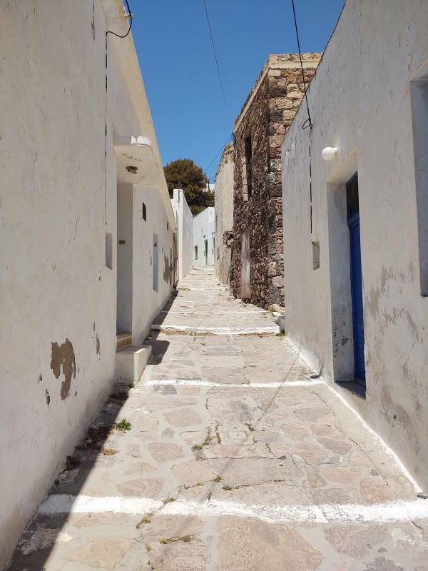
At the 2011 census Plaka had 749 inhabitants out of the total of 4,977 on Milos. Cars can't enter most of Plaka as the passageways are narrow and have stairs in places.
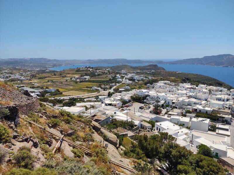
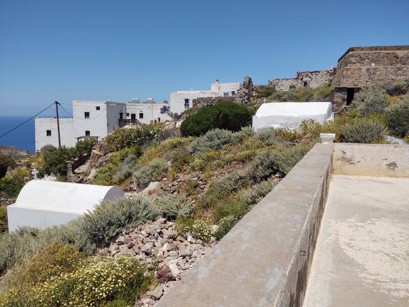
Up to the Kastro
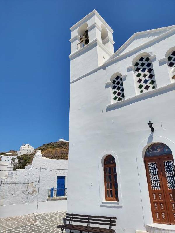
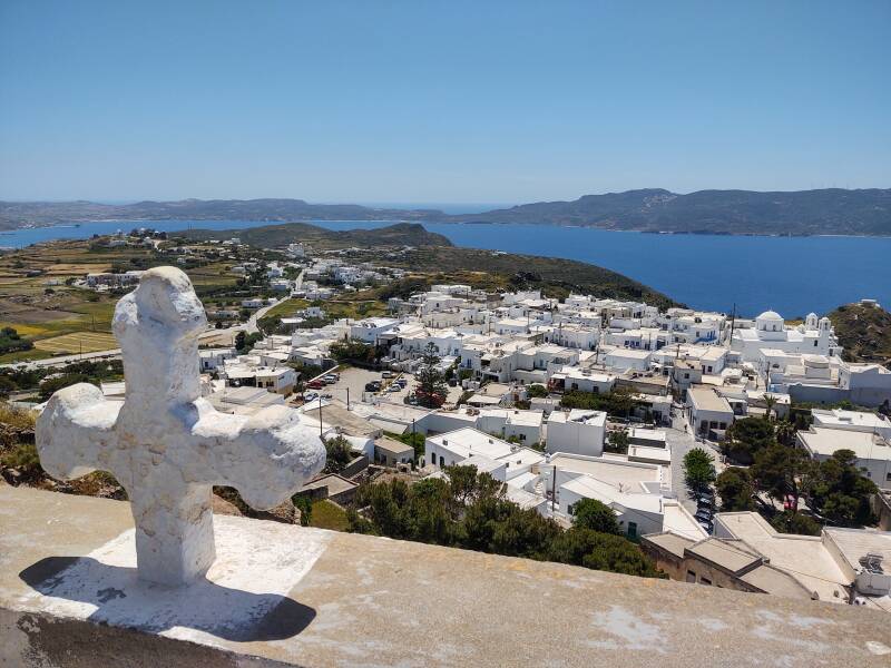
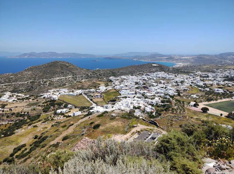
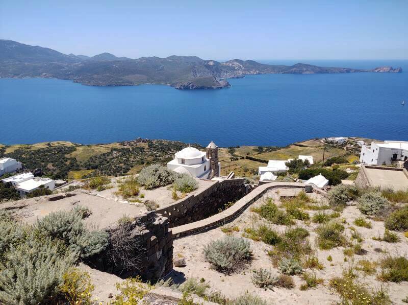
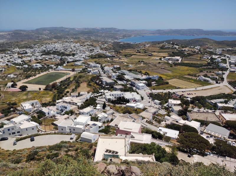
One street leads a short distance into the northern corner of Plaka. I crossed it while heading toward the Kastro. The relatively large church part way up is Panagia Thalassitra. Another church, on the peak, is not visible from here.
Central Plaka is at an elevation around 180 meters. The Kastro peak is at 254 meters.
Once across that street I was back into narrow passages with stairs.
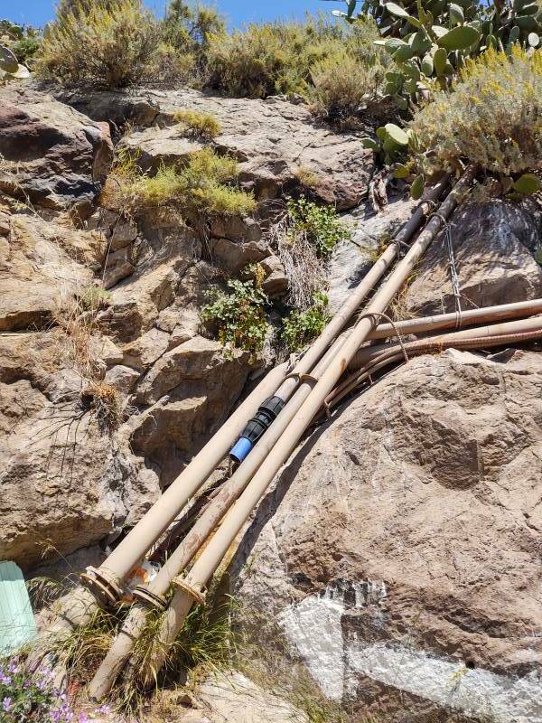
It's all rock underneath. Water lines are run on top.
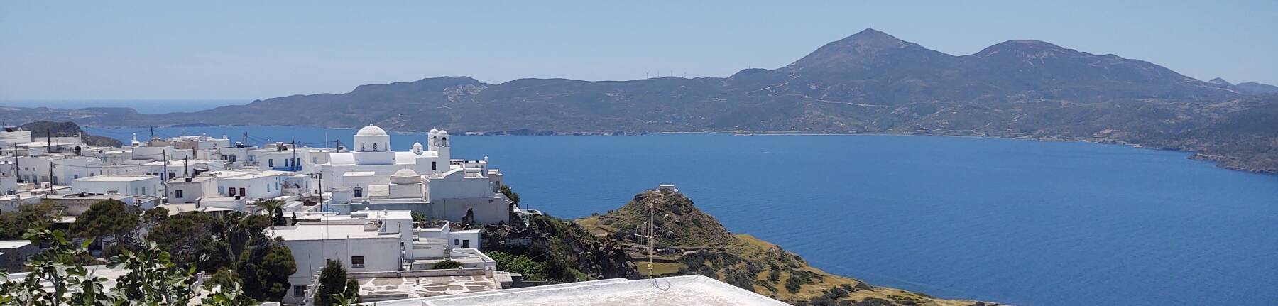
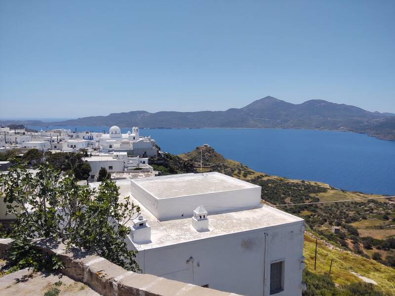
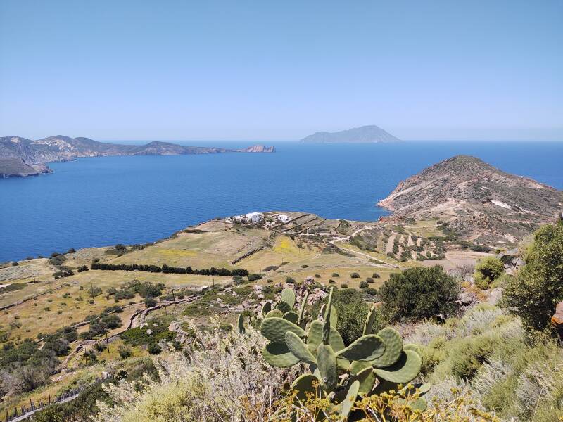
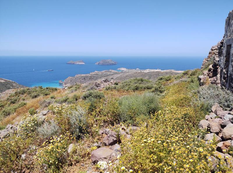
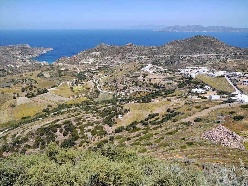
Here's the view as I was starting up. This is looking south to southeast across the opening of the bay of Milos.
And then looking to the northwest, out the bay's opening to the island of Antimilos.
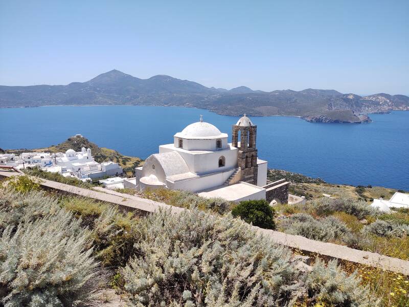
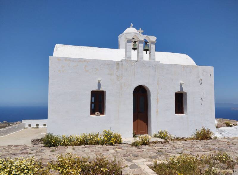
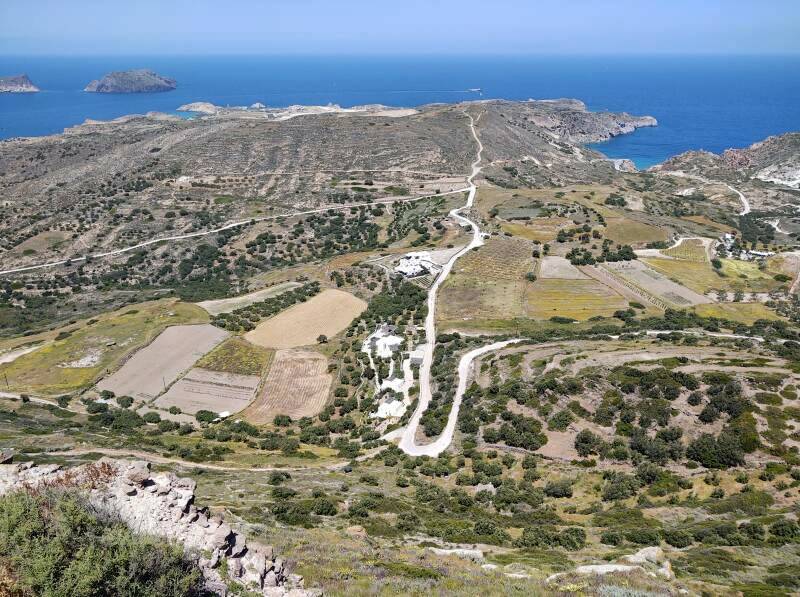
I reached Panagia Thalassitra, the relatively large church overlooking Plaka. It was first built in the 14th century and restored in the 17th. From here you're high enough to see across the narrow isthmus forming the southern part of Milos, with the open Aegean beyond it.
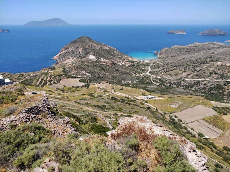
Moving a little higher I could look to the south.
And to the southwest, to the highest point on the island at 730 meters. A high-speed ferry was leaving Milos.
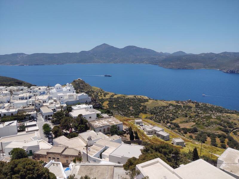
It was soon near the opening of the bay, entering the open Aegean.
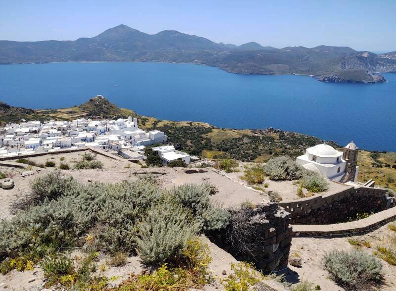
Panagia Thalassitra is the large church you notice from a distance. But it is surrounded by small chapels.
Panagia Thalassitra was closed, but I could see in through the window in the main door.
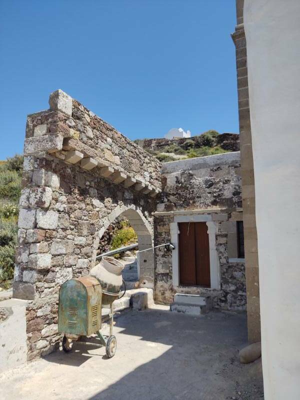
I have further to climb, there's the church at the peak.
Looking back at Panagia Thalassitra.
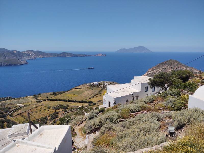
That fast ferry is continuing out of the Milos caldera, past the islets of Akrathi and Arkadi.
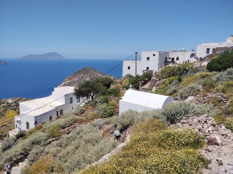
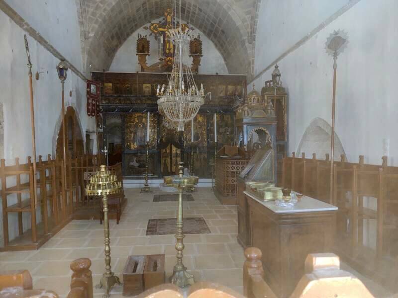
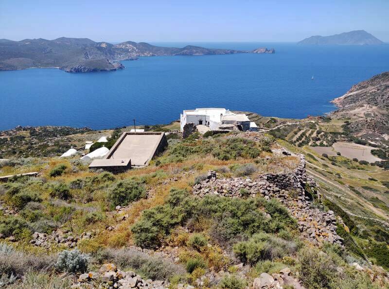
I reached the peak of the volcanic outcropping above Plaka, with the Church of the Assumption of the Virgin.
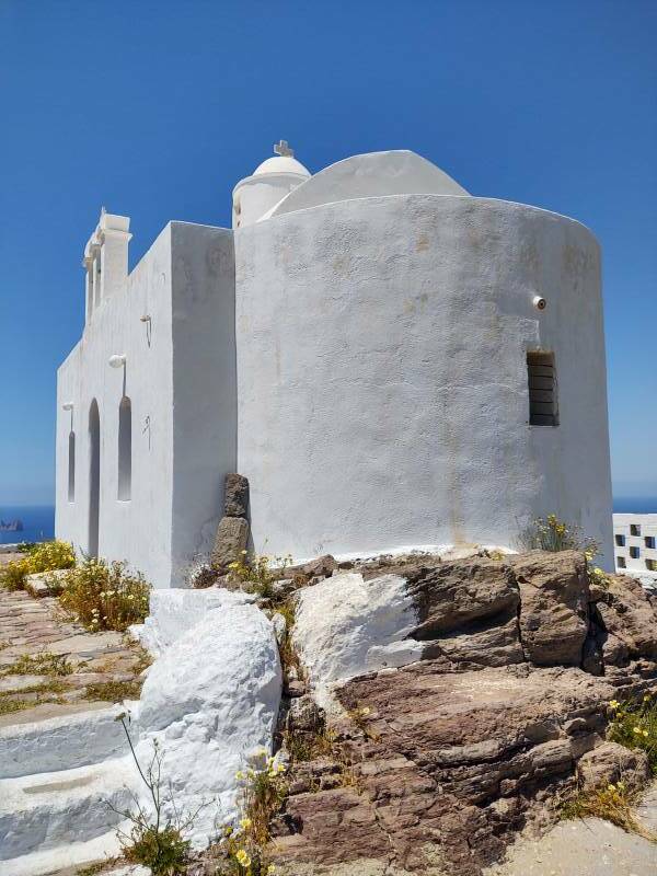
This is obviously a Roman Catholic church as it's named for the Assumption of the Virgin. The idea of the Assumption is a uniquely Roman Catholic teaching of relatively recent vintage.
The Orthodox church teaches of the Dormition of the Theotokos, the Falling-Asleep of the God Bearer. That is, the death of Mary.
A standard icon design depicts the Dormition with Mary lying on a bed surrounded by several saints, and with Jesus holding an infant representing her soul.
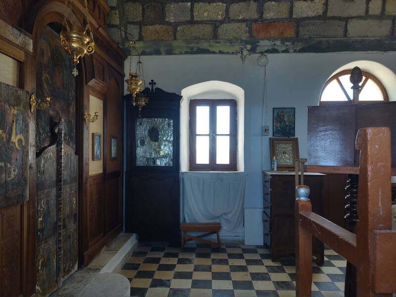
Looking in through the window, I see that while it retains a Roman Catholic name, it has an Orthodox interior.
Once they had formed the Duchy of Naxos in the early 1200s, the Venetians informed everyone that they needed to convert to Roman Catholicism and do their religious services in Latin and their day-to-day life in Italian.
Those demands were mostly ignored. The population remained Greek and Greek Orthodox.
The Italians came back in the 1930s, having seized control of some of the Aegean after the collapse of the Ottoman Empire. They held several of the islands including part of Crete until Italy's surrender in World War II.
Italy again dreamed of a Roman Catholic Latin-Italian empire in the Aegean, and again almost nothing came of it.
As for the uniquely Roman Catholic concept of the Assumption of Mary, the idea is that an assumption and an ascension are quite different. Jesus would be able to ascend on his own, but anyone else would have to be assumed. However, Roman Catholic imagery often depicts Mary apparently rising under her own power.
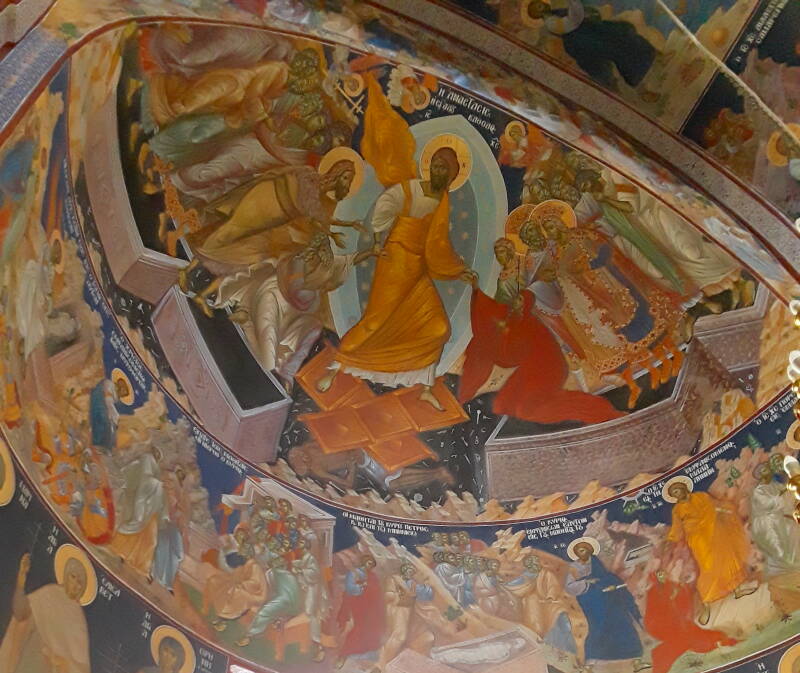
Below is a Greek Orthodox image of the Ανάστασης or Anastasis, the Resurrection, on a semi-dome in a church. Jesus is standing on the doors of Hell, pulling Adam and Eve from their graves.
Both Adam and Eve have reached up, but grasped nothing in their hands. Jesus has taken hold of them by their wrists and is lifting them. They couldn't grab anything to pull themselves up. They must be lifted. Similarly, Mary couldn't ascend, she would have to be assumed.

Amazon B004GDB7OA

Amazon 1137412283
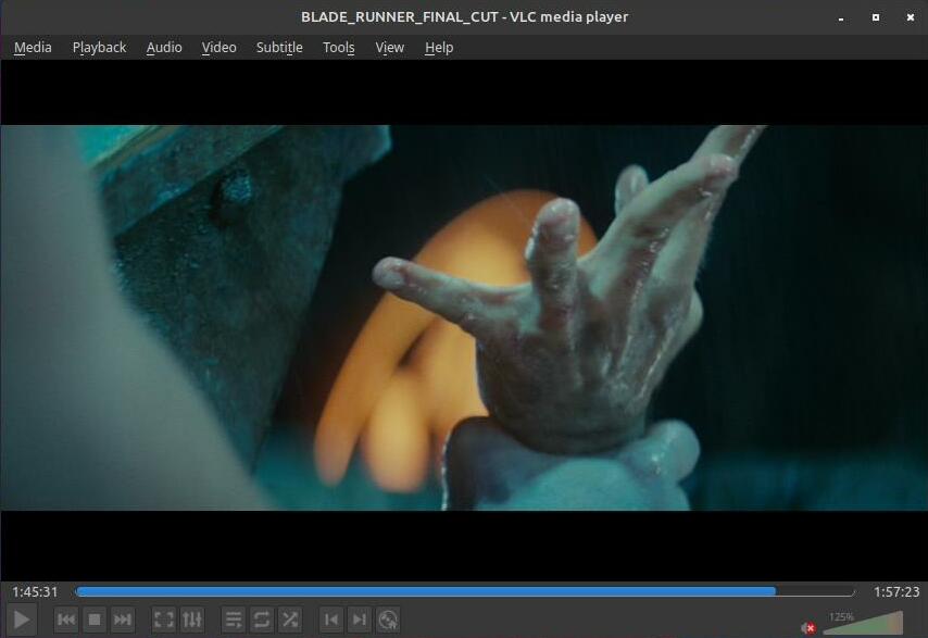
See the reference to this iconography in Blade Runner, where Rick Deckard is about to fall from the roof and the Replicant Roy Batty has just arrived.
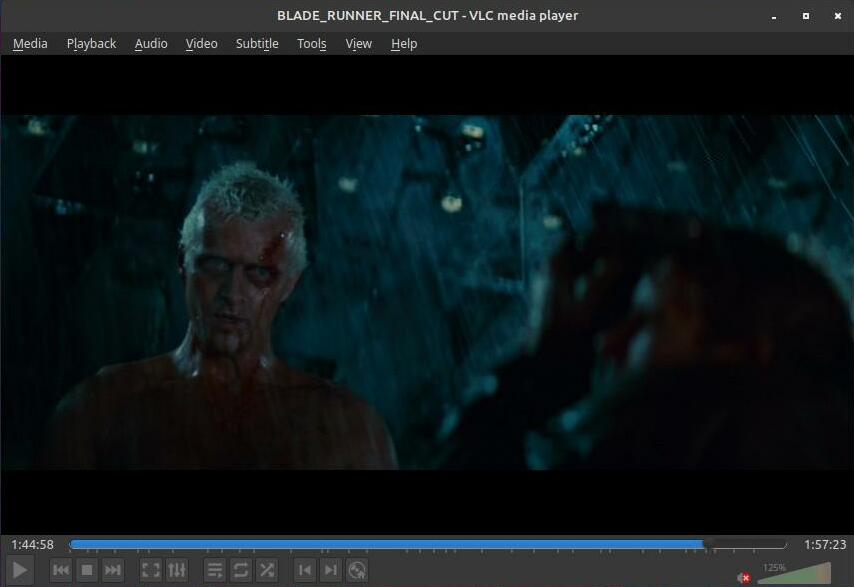

As Deckard falls, Roy grabs him by the wrist. Deckard can no longer save himself, and he didn't grab Roy's hand. Deckard is a totally passive figure in his own rescue.
360° View From Plaka
Here's the view from the peak of the Kastro looking east toward the nearby islands of Kimolos at left and Poliaigos at right. A light area toward the right near the horizon of Milos is a large open bentonite mine. Bentonite is used as drilling mud, as a binding agent, as an absorbent, and for various other industrial purposes. Plus, cat litter.
Looking northeast past Kimolos to the faintly visible Sifnos about 35 kilometers away.
Looking north, over a large open perlite mine near the coast. Greece is one of the leading producers of this amorphous volcanic glass used in construction and manufacturing, water filtration, biotechnology, and agriculture.
Looking northwest, past the islets of Akrathi and Arkadi at right, to Antimilos in the distance, and the far tip of the caldera opening at left.
View to the west past the old manganese mines on the far side of the caldera opening, and Antimilos in the distance at right.
View to the west looking down over Panagia Thalassitra.
View to the southwest. The viewpoint is at 254 meters elevation. Profitis Ilias, the highest point on Milos a little left of center here, is at 750 meters.
Προφήτης Ηλίας or Profitis Ilias, the Prophet Ilias or Elijah, is associated with high points.
View to the south. Plaka is directly below and to our right. Trypiti is straight ahead in the distance. Adamantas is out of sight, below the hills beyond Trypiti. Pera Triovasalos is off to the left.
View to the southeast.
Or, Continue Through Greece: