Driving the Ring Road Around Iceland
Sauðárkrókur to Reykjavík
This would be my last segment of the Ring Road.
Weather had held me up for a couple of days in northern
Iceland, as it will during the winter.
But that led to some nice experiences around
Sauðárkrókur.
I started to the south from Sauðárkrókur
on Highway 76, joining Highway 1 or the Ring Road
at Varmahlið.
On the way to Varmahlið I visited a
very interesting historical site at
Glaumbær.
There would be a mountain pass and a descent to
Blöduós, on the coast,
and then an increasingly smoother and easier path
southwest to Borgarnes.
From there it was a short passage south across the mouths
of two fjords to Rejkjavík,
including the last tunnel of my circuit.
Sauðárkrókur Reopens
I had planned on staying just one night in Sauðárkrókur, making it an overnight stop breaking up the trip from Siglufjörður to Reykjavík. But the winter storm changed that to three nights, an early arrival for New Year's Eve followed by January 1st and 2nd.
Between the sights at Grafarkirkja and Hólar, and the aurora on the last night in Sauðárkrókur, it made for a very nice change to my initial plans.
Everything in northern Iceland shuts down from the morning of December 31 through January 1. This year the shutdown was extended another day, through the 2nd, as it was a Sunday. The only business that had been open on the 2nd was the Hliðarkaup supermarket on the hill overlooking town.
Now, as I was leaving late morning on the 2nd, the Sauðárkróksbakari was finally open. Coffee! Pastry! Interactions with other humans!

I could get a cinnamon roll and a coffee, the first meal not based on grocery store supplies and eaten in my room since the 29th in Akureyri.

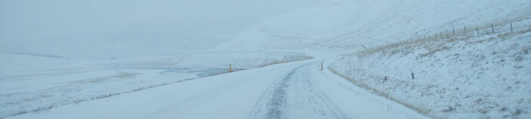
Then I filled my car's gas tank and headed south on Highway 75 through blowing sheets of snow.
You might say, "Gosh, Bob, it looks like you took a lot of pictures through the windshield of your car while driving down the center of the road."
That is correct. In most of Iceland there is very little oncoming traffic.

Glaumbær
Glaumbær has been a farm site since the settlement of Iceland around 874 CE. The turf house seen here today dates back to the mid 18th century, and its newest component was built in 1876–1879. People lived in the turf house until 1947, when it was designated as a protected site. See my earlier visit to Grafarkirkja for my thoughts on the continually rebuilt nature of otherwise ephemeral turf houses and churches. The point is the overall structure and not the specific pieces of turf. For a philosophical argument, see the Ship of Theseus concept which Heraclitus and Plato discussed back in 500–400 BCE, or the Buddhist concept of anattā.

The first church here was built some time before 1090 CE.

The current church building was constructed in 1926.


Snorri Þorfinnsson lived here in the eleventh century with his parents Þorfinnur Karlsefni and Guðriður Þorbjarnadrdóttir. Þorfinnur and Guðriður were explorers. Snorri is thought to be the first child of European descent born in the Americas, outside of Greenland.

Snorri was born between 1004 and 1013 in Vinland, in today's Newfoundland. His parents left Vinland when Snorri was about 3 years old because of hostilities between the Norse explorers and the indigenous Beothuk people, related to the Algonquin, whom the Norse called Skrælingar or "Barbarians". Snorri's family returned from North America to this farm.
Snorri is thought to have built the first church here. He died around 1090.

In 2002 archaeologists discovered the remains of a thousand-year-old longhouse close to this site. The archaeologists described it as "a classic Germanic fortress longhouse like the Great Hall of Beowulf".

Back onto the Ring Road
I continued south on Highway 75 to Varmahlíð, a settlement that's little more than a gas station at a highway intersection. It's where Highway 75 ends at Highway 1, the Ring Road. That's the gas station and intersection ahead of me.

The Ring Road from Varmahlíð to Blönduós took me over the last mountain pass, and the last snow-covered road, of my trip around Iceland.

Conditions became worse along the way. Yes, I had checked both road.is and vedur.is before leaving the bakery where I had breakfast. This is "Slippery" according to road.is: covered with hard ice or snow on more than 20% of the road surface.

Beyond Blönduós I pulled off at a point of interest to have a banana, some water, and some dark-chocolate-covered espresso beans, as my caffeine supply was not yet exhausted.
There was a monument to the missionaries Friðrik the Bishop and his assistant and interpreter Þorvaldur Víðförli. They lived for four winters at Lækjamót in Víðidalur and traveled and preached. Þorvaldur was from the settlement of Stóra-Giljá, very close to this monument. There were rumors that the two were homosexual. Þorvaldur became enraged, and began killing people he suspected of having said that he was homosexual. Just as with Þangbrandr, a missionary who was in Iceland in 997–999 and who killed several popular poets, all the murdering did not lead to great missionary success.

Further along, a roadside stop included a view across a river to the old road joining Reykjavík and Akureyri. It's the single-lane road with the narrow bridge.

I passed through Bifröst, where, unlike in mythology, there was not a prominent rainbow-colored bridge. But there were nice views down the river that the highway was following.

Things changed as I gradually approached the west coast and Reykjavík. Gas stations were no longer an isolated pump under a street light, but had a colorful sign and a grill in a building.

There's a causeway across the fjord at Borganes. Then here, at Hvalfjörður, the Hvalfjörðurgöng is the eponymous tunnel. You go down to 165 meters below sea level while passing through the 5,770 meter long tunnel. It passes through a geothermally active area, which is no surprise because pretty much all of Iceland is a geothermally active area. The air inside the tunnel is significantly warmer near its south end, where the rock it passes through is at 55–60 °C.

Reykjavík
I was dark when I reached Reykjavík, as it was about 16:30. This was amazing — the highway expanded first to two, then three lanes in each direction! There were so many cars! I was driving into the city in traffic far heavier than anything I had seen in Iceland. And in the opposite lanes, the traffic was even worse as people headed home from work.
I had seen Hallgrimskirkja on the skyline for some time. This is the largest church in all of Iceland. Given the surprising pronunciation of -ll- in Icelandic, it's called HAHTL-greems-KEER-kyah. It's on a high point overlooking downtown. I was staying just down the hill near the harbor.
Guðjón Samúelsson was Iceland's most influential architect. He finished his training in 1919, and fully embraced the Functionalist style that developed in the 1920s and 1930s. He was hired as the government's chief architect. Iceland was modernizing, Reykjavík was massively expanding, and plenty of concrete was available. He designed Hallgrimskirkja in the 1930s. Construction began in 1945, and wasn't completed until the 1980s. Meanwhile, Guðjón had also designed several other prominent buildings in Reykjavík.
The statue in front depicts Leifur Eríksson.


Leifur Eríksson's grandfather, Þorvaldur Ásvaldsson, was exiled from Norway for manslaughter and came to Iceland. Then Leifur's father, Eiríkr Þorvaldsson, called "Eiríkr rauði" or or "Erik the Red" (c 950 – c 1003), was exiled from Iceland, also for manslaughter. It was a violent time.
Eiríkr established the first European settlements in Greenland. The sagas say that the Greenland settlements were established in the 980s.
Eiríkr's son Leifur organized a crew and continued the westward exploration. He established a settlement in Vinland, possibly the one at L'Anse aux Meadows in today's Newfoundland. It was a small settlement and didn't last long. Voyages to collect timber probably continued for some time, possibly up to 400 years, and the Norse settlements on Greenland lasted for almost 500 years.
In 1930, to mark the 1,000th anniversary of the Icelandic Alþing, the U.S. government gave the statue to Iceland. The U.S. government was careful to make the plaque credit Leifur as "the discoverer of Vinland" in order to win the votes of Scandinavian-American voters in the Upper Peninsula of Michigan, Minnesota, and the Dakotas, while not losing the votes of Italian-Americans as they would have by crediting him as the first European to discover continental North America. Which he sort of was. First European person we know of who landed and established a settlement, anyway.
VisitingEyrarbakki
Actually the first known European discoverer of America was Bjarni Herjólfsson, who strayed off his planned Iceland — Greenland route and accidentally discovered land west of Greenland. I had learned about Bjarni back at Eyrarbakki, my first overnight stop on this trip.
Meanwhile, Cristoforo Columbo didn't arrive in the Americas until about 500 years later. He thought it would only be 2,400 nautical miles west from the Canary Islands to Japan, while it's actually 10,600 nautical miles. He skirted the coast of South America near Trinidad briefly on his third voyage, and followed the coast of Central America from today's Honduras to Panama on his fourth voyage, and otherwise kept his explorations within the Caribbean islands.
Columbo, or Columbus, never landed on, or even sighted, North America. And, even though his errors kept becoming more and more obvious, he insisted to his death that he had been to Asia.


The Sun Voyager sculpture is down at the waterfront.

The Norse explorers established two major settlement areas in Greenland. The Eastern Settlement was at the southwestern tip of the large island, while the Western Settlement was about 500 kilometers up the west coast, near today's Nuuk. There were between 2,000 and 3,000 people in both settlements, and archaeologists have identified about 400 farms.
Norse Greenland exported walrus ivory, furs, rope, sheep, whale and seal blubber, and narwhal tusks that they marketed as "unicorn horns" to the continental Europeans. The Europeans eagerly bought all the supposed "unicorn horns" the Norse could offer.
The sagas describe three separate areas west of Greenland that the Norse explored. Helluland, the "land of the flat stones", was Baffin Island in today's Nunavut. The Canadian Museum of History in Ottawa has some yarn found in an archaeological dig on Baffin Island that some researchers believe to be evidence of a long-term Norse settlement there. They point to other artifacts including tally sticks, remnants of bronze and iron metallurgy, whetstones for sharpening metal tools, and signs of European styles of turf and masonry construction. Others are unconvinced.
Markland, the "land of forests", was somewhere on the Labrador peninsula. It was of great interest to the Norse, as there was little timber on Iceland and far less on Greenland. Researchers have identified possible Norse sites including Tanfield Valley, Avayalik, in far northern Labrador. The timber was what had the Norse returning for centuries.
Vinland, the "land of wine", was to the south of Markland. It was initially thought to be fictional or fanciful as grapes don't grow in that region. Then further study of the sagas explained what was going on.
Around 1000 CE Leifur spent two winters at a place he called "Leifsbúðir", probably around Cape Bauld at the northern tip of Newfoundland. One day his foster father Tyrker got roaring drunk on what the saga called "wineberries". What did grow there, and become naturally fermented and intoxicating, were gooseberries, cranberries, and squashberries. That was the supposed "wine". L'Anse aux Meadows is the only definite Norse site found in today's Newfoundland. The buildings at L'Anse aux Meadows have been dated by carbon-14 to a period centered on 1014, and by dendrochronology or tree-ring dating to 1021.
Leifur sailed back to Greenland, and about two years later his brother Þorvald Eiríksson organized a crew of 30 men, sailed to Vinland, and spent a winter at Leifur's camp. In the spring they attacked a group of nine native people. The one native survivor escaped, and then led a force back to the Norse camp. Þorvald was killed in the fight, but his group stayed there for another year.
A few years after that, so around 1005–1015, Þorfinn "The Valiant" Karlsefni organized a larger expedition. There were three ships carrying livestock and 160 men and women, or 250 according to another saga. They landed first at what they called Straumfjord, and later moved to the nearby island of Straumsöy. The saga says that the natives attacked the Norse site. The Norsemen retreated, but Leifur Eríksson's stepsister Freydís Eiríksdóttir was pregnant and couldn't keep up with the retreating Norsemen. She yelled at them to stop fleeing from "such pitiful wretches", saying that if she had a weapon she could do better than them. Then she picked up the sword dropped by a man killed by the natives and fought them off. Don't mess with Freydís.
As for the actual location of Straumfjord and Straumsöy, we don't know. It could have been anywhere from Baffin Island south to today's New York Harbor.
Guesthouses at Booking.comI stayed very close to the Sun Voyager, just down the hill from Hallgrimskirkja, at the Kex Hostel. It's in a building that used to be a biscuit factory.


It has a very strong "former boarding house or SRO" vibe.


The rooms are simple but they get the job done. The Kex Hostel offers bunks in a 42-bed room. I can't imagine a peaceful night in such a space. I opted for the 6-bed room.
Mine is at the far end, on the bottom. And yes, the window is open. There was almost always an open window as I traveled through Iceland in December and January. How else will you have fresh air in a bedroom, if you don't have an open window?
There's a cafe and bar on the second floor. Iceland uses the North American convention of designating the first floor as the one at street level, the second floor as one level above that, and so on. As opposed to the European convention of calling the street-level floor the ground floor, designated as "G" or perhaps with a zero on an elevator, and then the 1st, 2nd, and so on floors being 1, 2, and so on levels above the street.

The intriguing but frustratingly incomplete stories of Norse settlements in North American have led to a lot of pseudohistorical nonsense. More prominently, the supposed "Kensington Runestone". Many of these purported "discoveries" were hoaxes created in the 19th and 20th centuries by people anxious to present a story of North America being discovered by northern Europeans. That was often abused further to promote the supposed superiority of white people.
Amazon 0812213122
Amazon 1861898177
In 1965 Yale University announced that it had acquired a map, purportedly drawn around 1440 CE, showing Vinland. Almost immediately, experts doubted its authenticity based on linguistic inconsistencies, cartographic inconsistencies, and chemical analysis of the map's ink. Just three months before my trip, Yale University announced that its "Vinland Map" is a modern forgery. The parchment dates from somewhere between 1423 and 1445, but that was old material used to create a modern forgery. Its inks include anatase, a form of TiO2 or titanium dioxide first used in commercial inks in the 1920s. And, it includes errors that originated in a 1782 engraving.
Borgarnes and the Golden Circle of Þingvellir, Geysir, and Gullfoss
Next: Borgarnes and the Golden CircleI had gone all the way around Iceland, but I had more to see before finishing my trip. The Golden Circle is a set of three sights that can be done in a one-day trip out of Reykjavík. The ancient parliamentary site in the tectonic rift at Þingvellir, the thermal site at Geysir, and the waterfall of Gullfoss (it's more like the Golden Out-and-Back as you can see on the map). I also needed to backtrack to Borganes to visit the Settlement Center and nearby historical sights.
as in this;
Þ/þ is unvoiced,
as in thick.