Driving the Ring Road Around Iceland
Exploring the Eastfjords
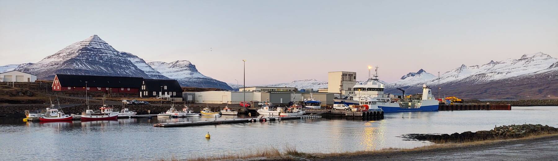
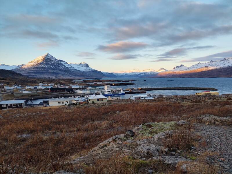
I had made it as far as
Breiðdalsvík
and my lodging as night was falling.
Now I needed to return to places south from there to
Djúpivogur to see some things
I had passed as it was getting dark.
And also, to some art and fascinating history in
Djúpivogur
that the previous evening's reading had revealed.
Day Two in the Eastfjords
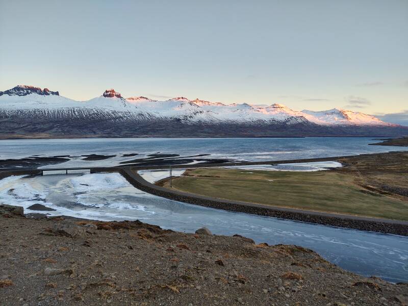
The next morning, I continued the loop where my hotel was located outside Breiðdalsvík. This is what road.is would characterize as between "Spots of ice" and "Slippery". It would be very slippery without studded tires. With studded tires, it's no problem. Although it is quite noisy. The studded tires on the lava-based pavement plus the minimal body insulation of the Dacia Logan kept my speed down. 90 k.p.h. in better road conditions sounded like I was reaching take-off velocity.
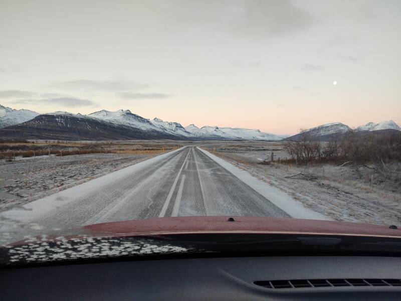
I have completed some of that loop, and I'm nearing the south edge of the broad valley. My hotel is barely visible beyond the church. Breiðdalsvík is near the right edge of the picture.
Many place names are compounds. Breiðdalsvík is something like Breið valley's bay.
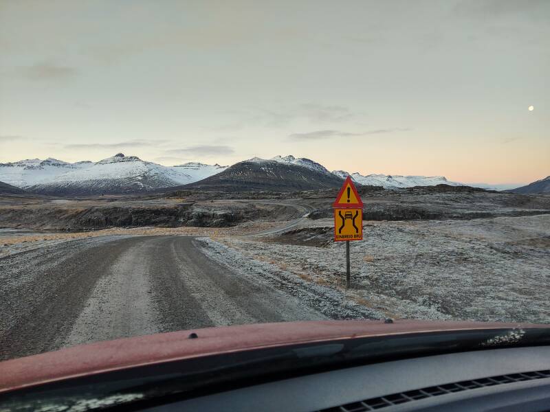
Here comes a one-lane bridge:
EINBREIÐ BRÚ
So maybe
Breiðdalsvík is really something like
Lane valley's bay.
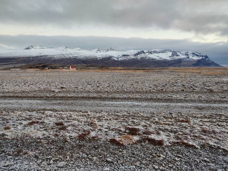
Now I'm returning to the south on Highway 1, through an area that I had come through in near darkness the night before.
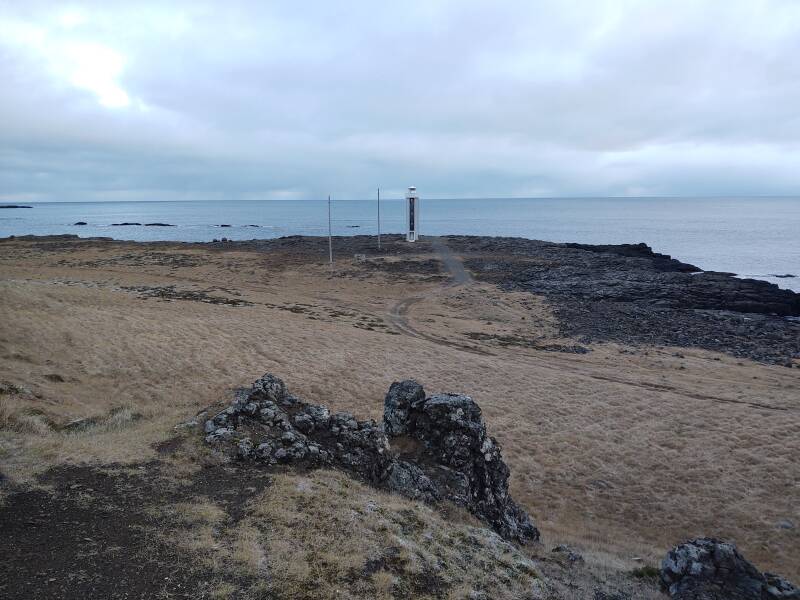
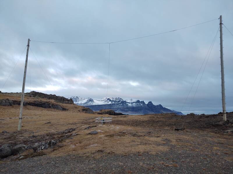
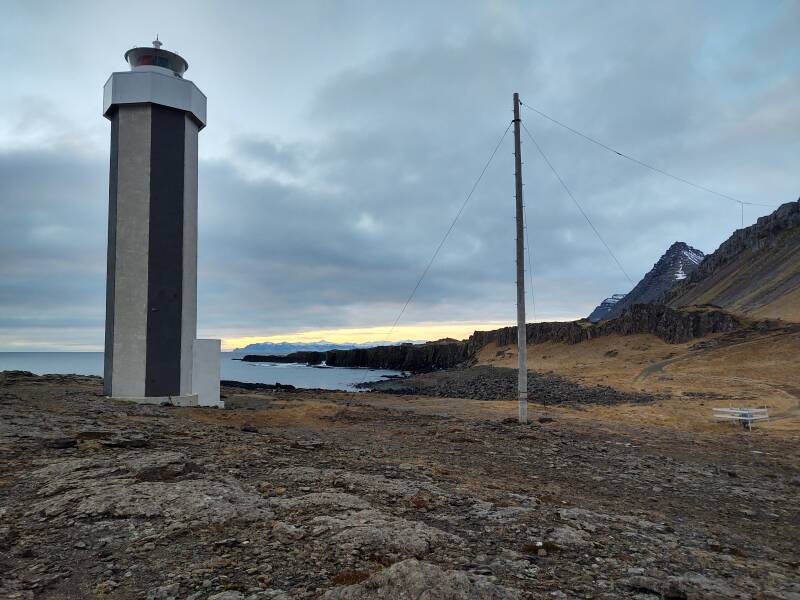
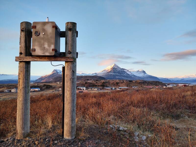
Streitishvarf Lighthouse
Streitishviti is a lighthouse on Streitishvarf point, a short distance south of Breiðdalsvík on Highway 1.
Yes, –viti means "lighthouse".
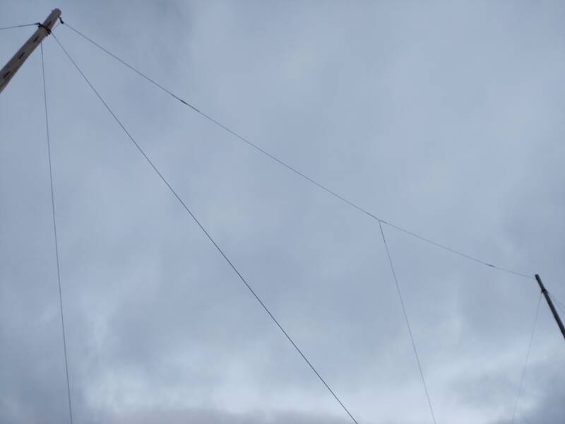
Like the one we saw earlier, this lighthouse also has a sturdy HF antenna. Let's examine this one more carefully.
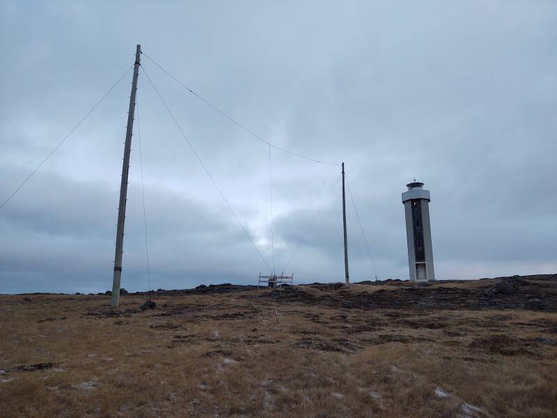
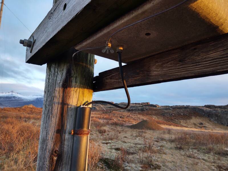
At first it looks like a dipole antenna, but look closer. That's a vertical wire at its center, not a thin coaxial feed line. And, the vertical wire is attached to both horizontal wires. They lead out toward the tops of the wooden poles, where they are connected via insulators to support wires used to hold the antenna aloft.
This is a T antenna, named for its shape. Between the tops of the poles you see a pulley and a support wire, then an insulator, then a horizontal wire, then the Δ-junction at the center of the T, then the other horizontal wire, another insulator, and the other support wire and its pulley.
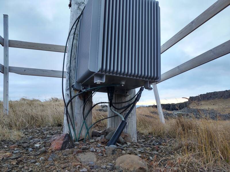
A T antenna is fed at the base of the vertical element. The center conductor of the coaxial feedline is connected, typically via a variable inductor, to the base of the vertical element. The feedline's shield is connected to an array of ground wires.
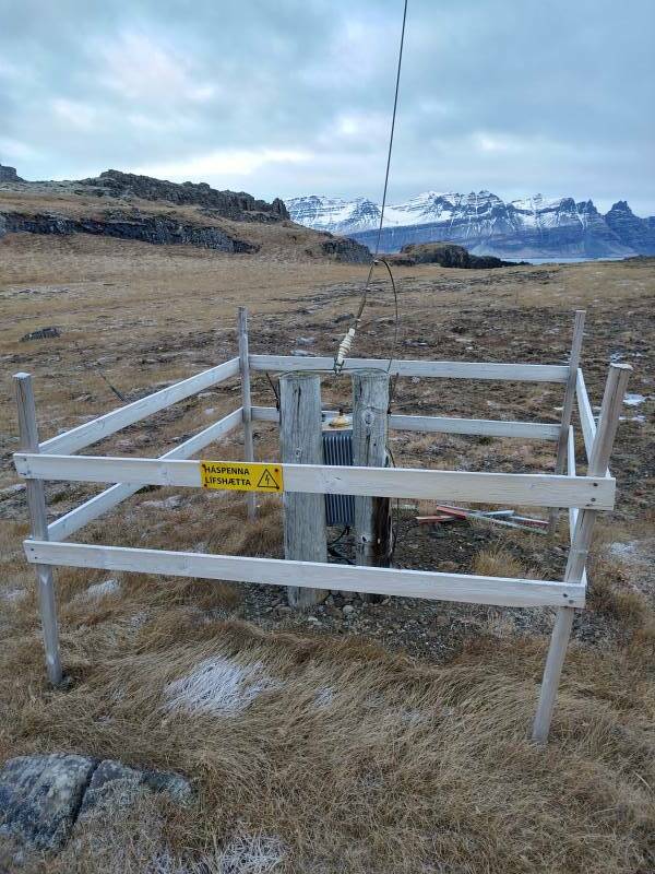
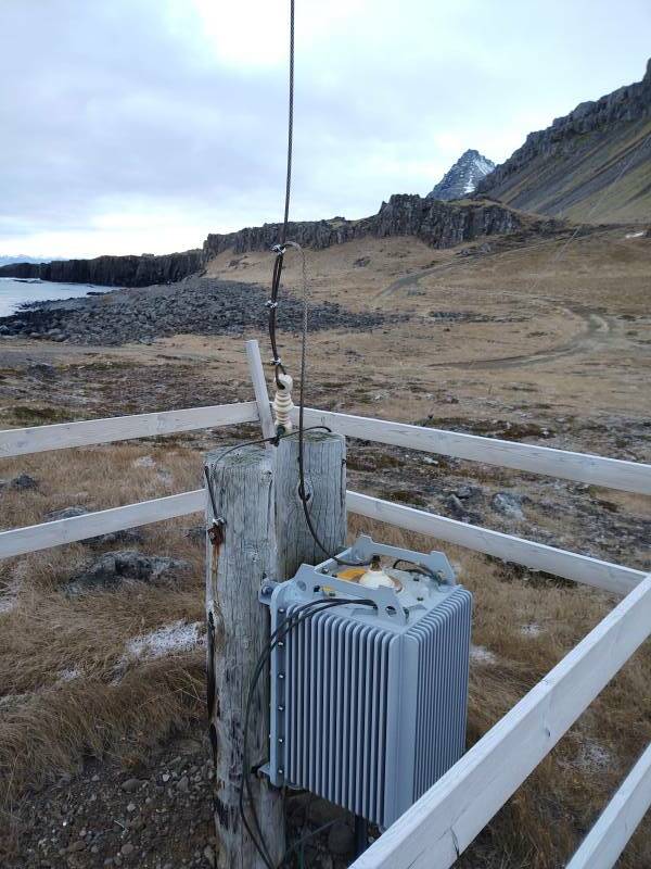
The black cable is the coaxial feed line. The grey cable is the control cable for remotely adjusting the inductance to match the antenna to a changed frequency.
This antenna's vertical element was about 12 meters tall, and the two horizontal arms of the T were each about nine meters long.
Radio
Frequencies
The maritime service has international high-frequency allocations at approximately 2, 4, 6, 8, 13, 17, 19, 20, 23, 25, and 26 MHz. A 12-meter vertical element would be a good quarter-wave antenna for 6.25 MHz. However, the maritime service often uses lower frequencies, meaning longer wavelengths. That 12-meter vertical element is too short for what it is frequently called upon to do, especially down at the the international calling and distress frequency of 2182 kHz or 2.182 MHz with a wavelength of 137 meters.
Considering a T antenna with a 12-meter vertical with two 9-meter tee arms to be like a 21-meter vertical, it would be a decent match for 3.6 MHz
GrindavíkVLF / LW
Transmitters
An electrically short antenna has a capacitive reactance, with shorter lengths leading to higher reactance and a greater proportion of the feed current reflected back toward the transmitter. As I mentioned back on the page about the longwave transmitters at Grindavík, one way to bring the antenna to resonance is to add capacitance to its far end, using what is sometimes called a "capacitance hat".
On these high frequency or shortwave frequencies, all we need is a pair of utility poles tall enough to extend 15 meters or more out of the ground. That is a very practical solution! But you can't do that in the very low frequency or longwave band, as the electrically very short antenna is probably quite tall: over 300 meters in the case of the taller mast at Grindavík. Wooden poles 300 meters tall just aren't a option.
A second part of the solution is to add inductance at the feed point. Those longwave transmitters have large "helix shacks", buildings filled with inductive coils. At these much more convenient frequencies and wavelengths, the inductor fits into a box. Remotely adjusting the inductance, probably with relays tapping a large coil at multiple points, the T antenna could be matched to the transmitter across several maritime HF bands.
Getting back to the lighthouse, the first one was built here in 1922. It operated until 1958, when it was removed because a lighthouse had just been built at Breiðdalsvík. But then this replacement was built here in 1984.
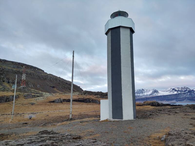
It does a three-flash sequence every 20 seconds, with its light 22 meters above the sea and visible out to 14 nautical miles. It's a "sector light", as colored filters change the light from white to green or red in different directions.
Here's the view to the north:
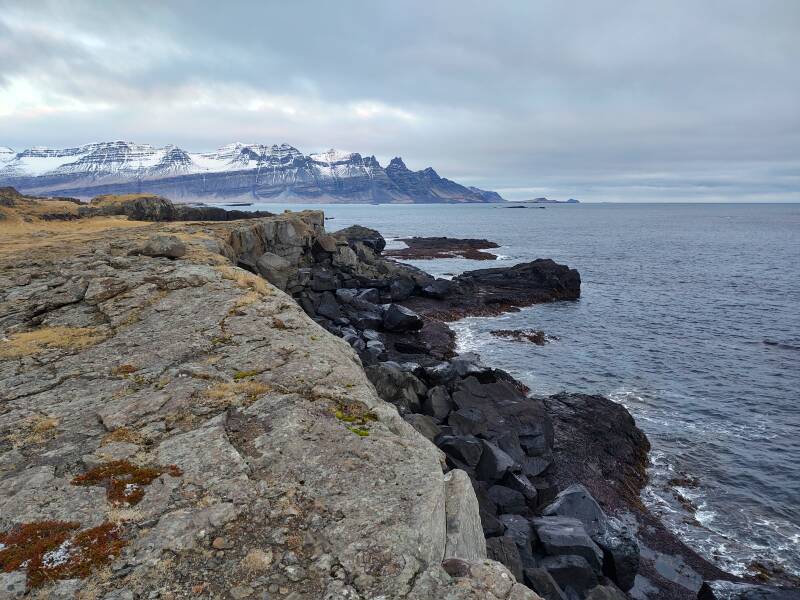
And to the south:
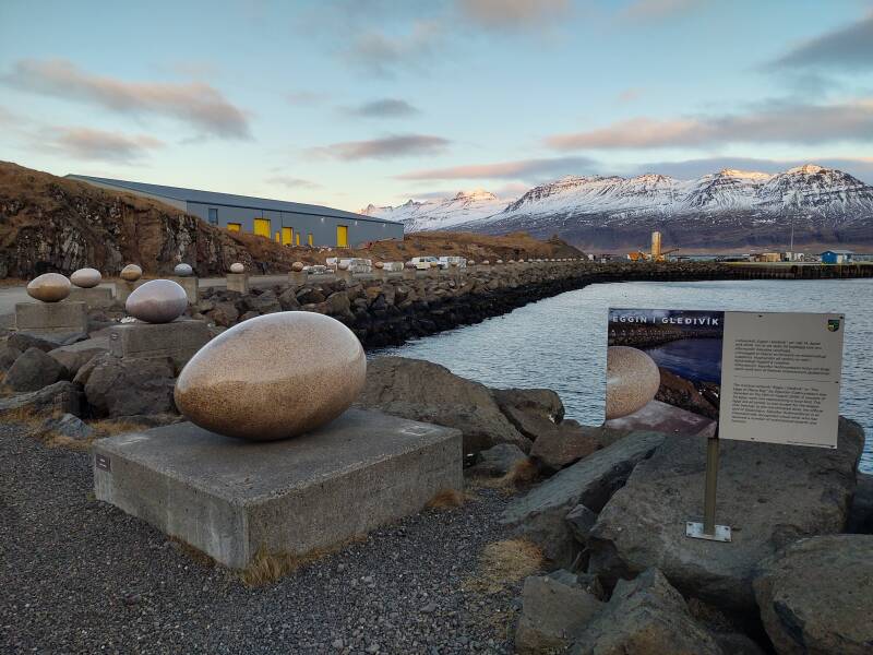
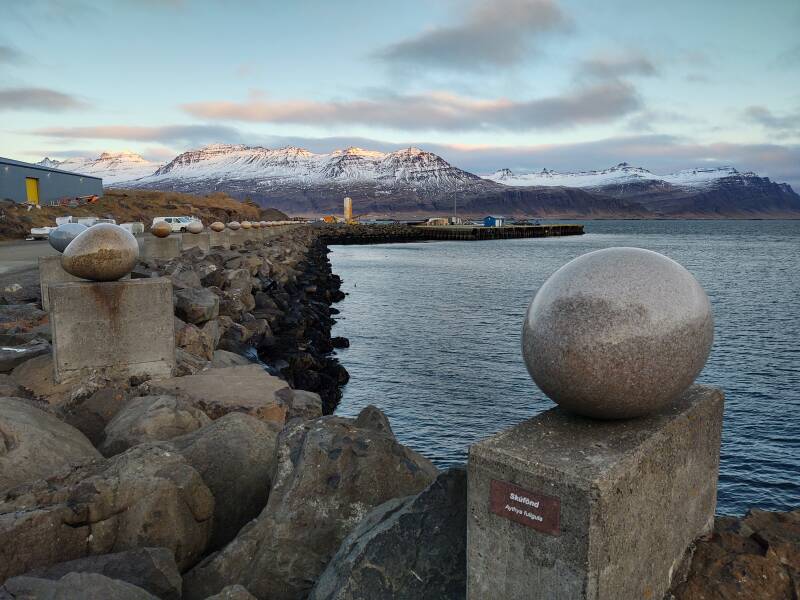
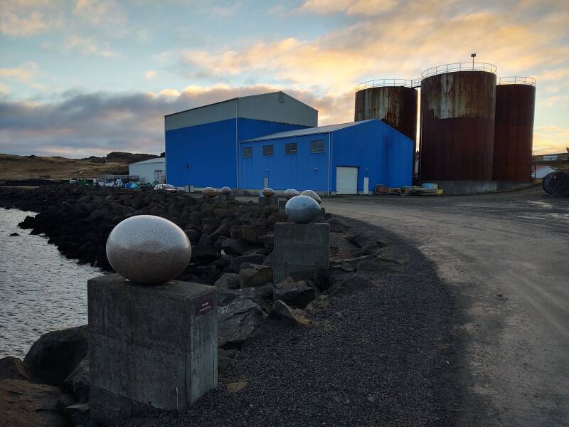
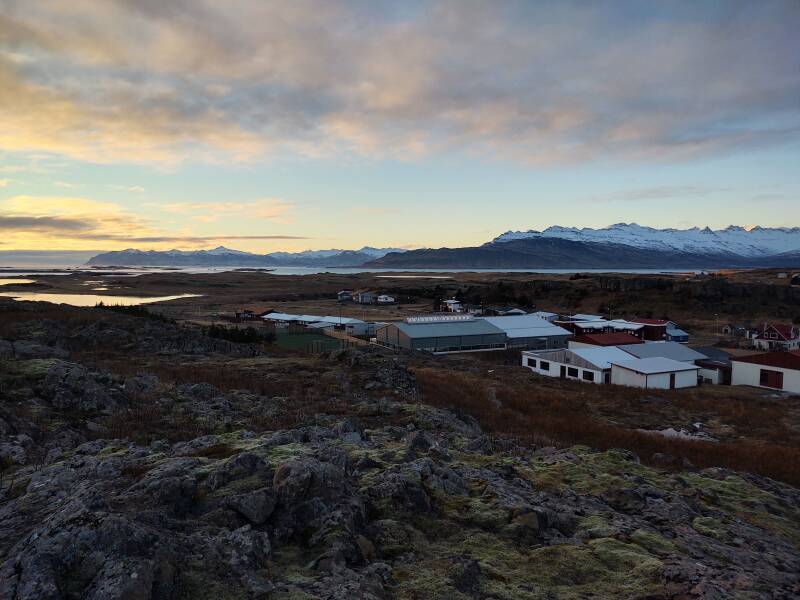
Return to Djúpivogur
Eggin í Gleðivík or The Eggs of Merry Bay is an art installation by Sigurdur Guðmundsson. It's a set of 34 large marble eggs, each one representing a local bird species. They're all similar in size except for the one seen here, the egg of the red-throated diver, the official bird of Djúpivogur. It's the largest.
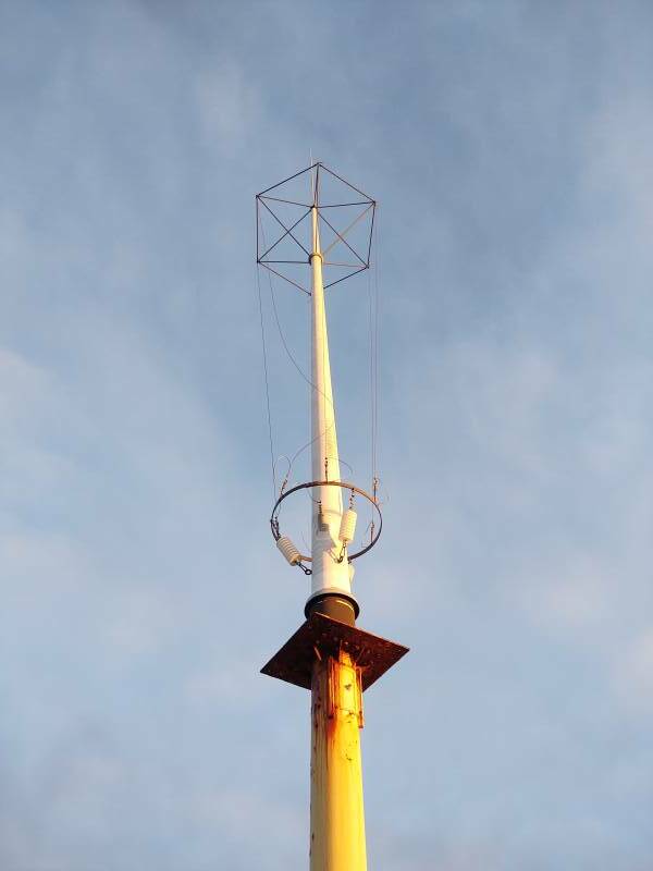
The hilltop overlooking Djúpivogur has some maritime HF antennas, but these are falling apart. Those poles held a larger T antenna, with a vertical element about 14 meters tall and horizontal elements each about 27 meters long.
The vertical antenna coming out of the communications shack is an end-fed cage monopole, a design that provides significantly increased bandwidth.
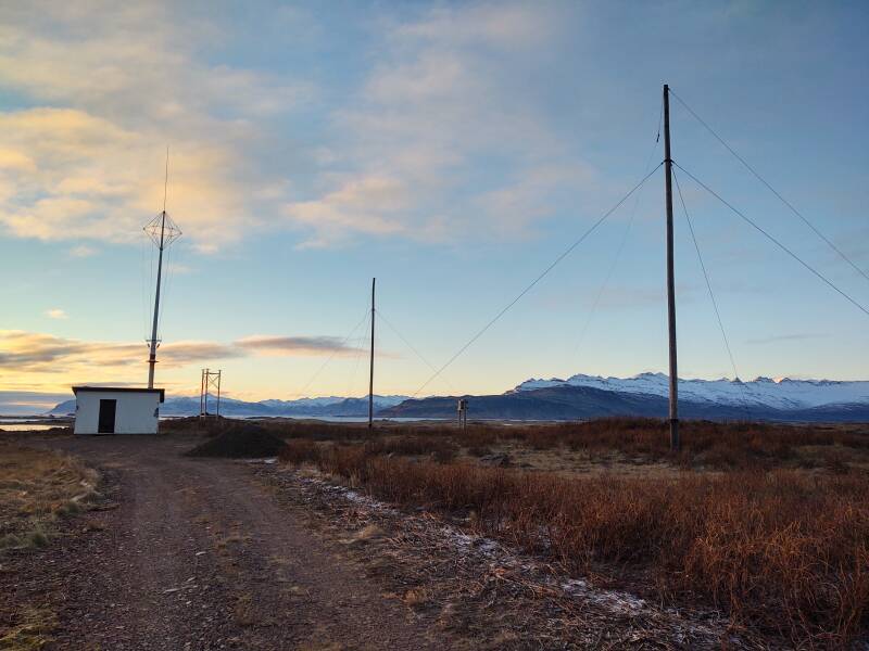
Here's the matching box for the fallen T antenna.
Here's the HF cage monopole.
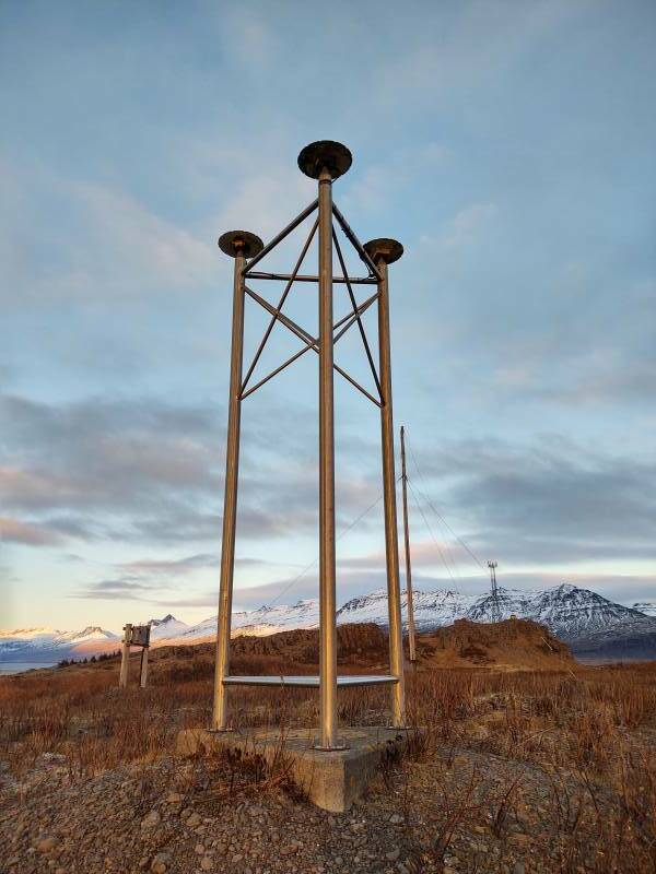
Nearby are what I think are three omnidirectional patch antennas for lower microwaves, maybe a navigational system.
It looks like the end of the day, the setting sun is only lighting part of the mountain slopes on the north side of Berufjörður, beyond Djúpivogur port. But it's just 1300, we're at high latitudes on the day after the winter solstice.
Looking south over the municipal swimming pool we can see the mountains beyond Hamarsfjörður, and further away beyond Álftafjörður.
It's just after 1 PM, I had better get lunch before it gets dark.
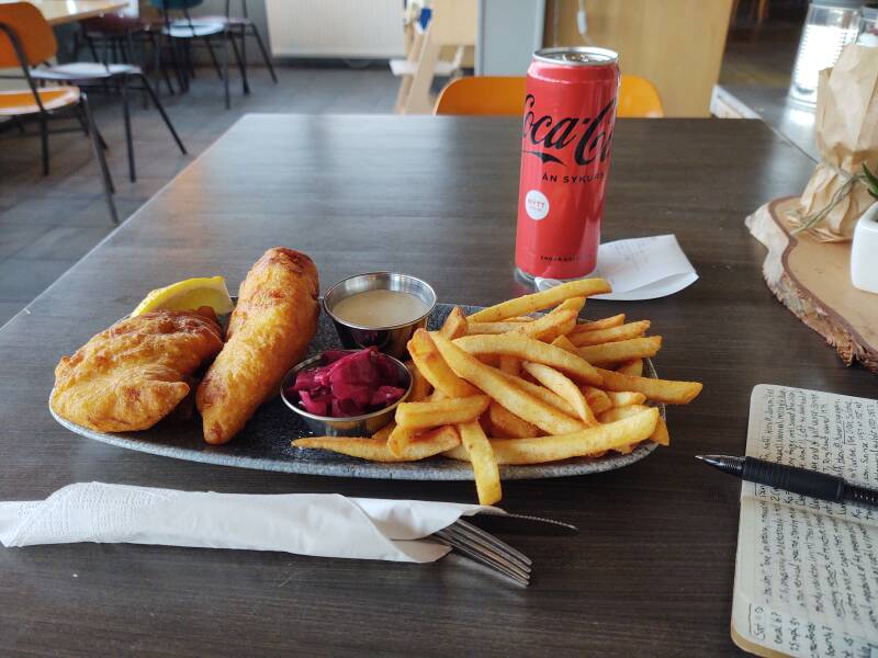
Fish and chips and pickled purple cabbage at Við Voginn, overlooking the port.
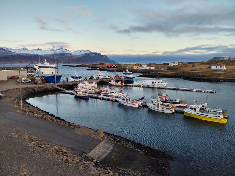
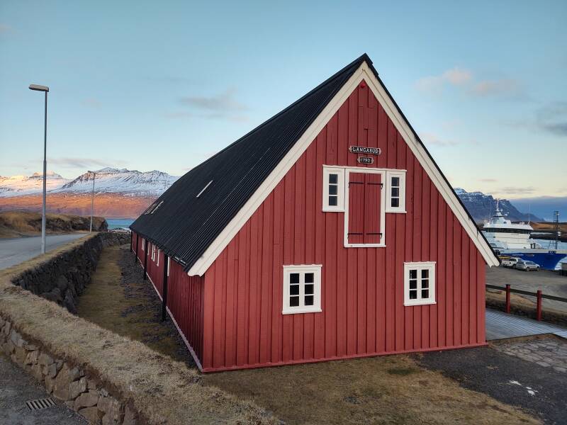
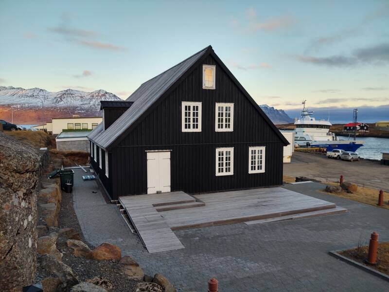
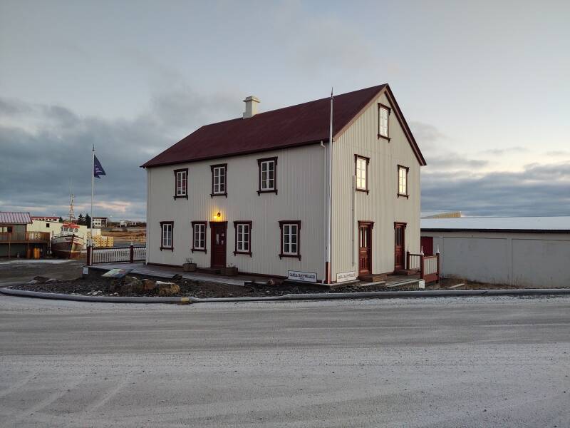
Two historic buildings at the port have been put back into use by the local tourism commission.
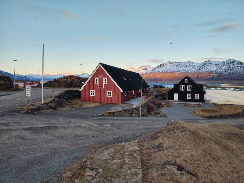
Langabúð is one of the oldest commercial buildings in Iceland. The south end, what we're looking at, dates back to 1790.
Hans Jonatan was born into slavery in 1784 on the island of Saint Croix in the Caribbean, a colony that France had recently sold to the Danish West India Company. He and his mother were owned by a Danish merchant and his wife.
The Danes moved to Copenhagen in 1789, taking their slaves with them. Hans escaped and joined the Danish Navy, serving with distinction in a battle against the British in 1801. The Danish crown prince Frederick granted Jon his freedom as his reward.
The Danish merchant's widow had Hans arrested, claiming that he was still her property and she had intended to sell him in the West Indies. But, she just never got around to it, you know how that goes.
The case went to court, where Hans and his lawyer argued that while slavery was still legal in the Danish West Indies, it was illegal in Denmark, where the Danes had brought their slaves, and where Hans and his purported owner had both been located for two years. However, the judge sentenced Hans to be returned to the West Indies, where slavery was still legal.
So, Hans escaped again, and now the Danish authorities had no idea where he had gone.
In the 1990s the story of Hans Jonatan finally came together when historians were re-reading the local records. Hans had arrived in Djúpivogur in 1802, when Iceland was still controlled by Denmark. He was the first Icelander of African descent.
Hans was the agent at the trading post by 1812, and he took over the trading post operation in 1819. It was in the red building seen above, the Langabúð. Next to it is the associated Faktorshúsið.
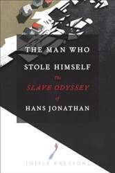
Amazon 022631328X
By 1820 Hans had married a local girl, and they had three children. And they had children, and the Icelanders kept track of everyone's ancestry, as they do.
In 2018, scientists managed to reconstruct part of Hans Jonatan's genome using only samples from his descendants, with no access to his physical remains. This was possible because of the extreme rarity of African heritage in Iceland, the genetic homogeneity of the population, and Iceland's comprehensive genealogical databases. They were able to recreate about 38% of his mother's genetic profile, and thus about 19% of his. They were able to tell that his mother had come from the region now including Nigeria, Benin, and Cameroon.
Hans' story is amazing! Just don't try to discuss it with the Danish government. They're still a little sore about it.
Back to Breiðdalsvík
I started back toward Breiðdalsvík, but...
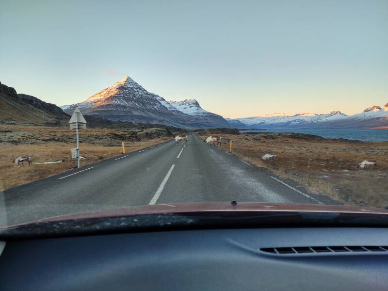
A reindeer herd was slowly crossing the highway.
Let's go, move it along.
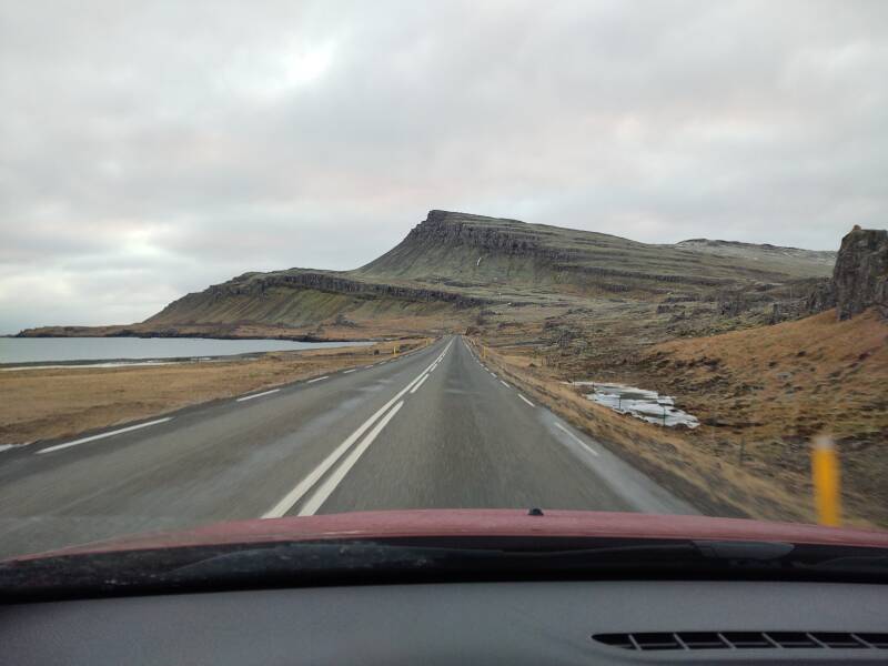
They took their time strolling across the highway. Then I could get moving past the immense layers of basalt.
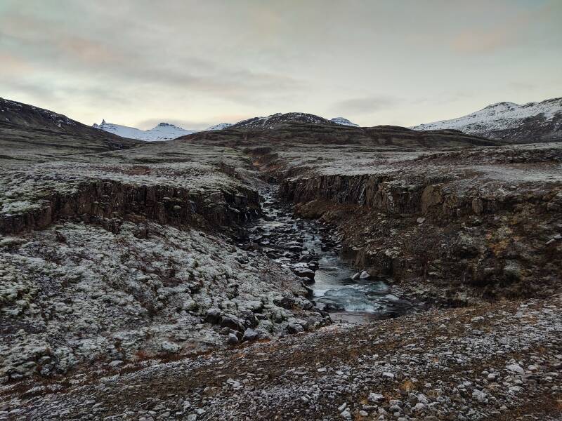
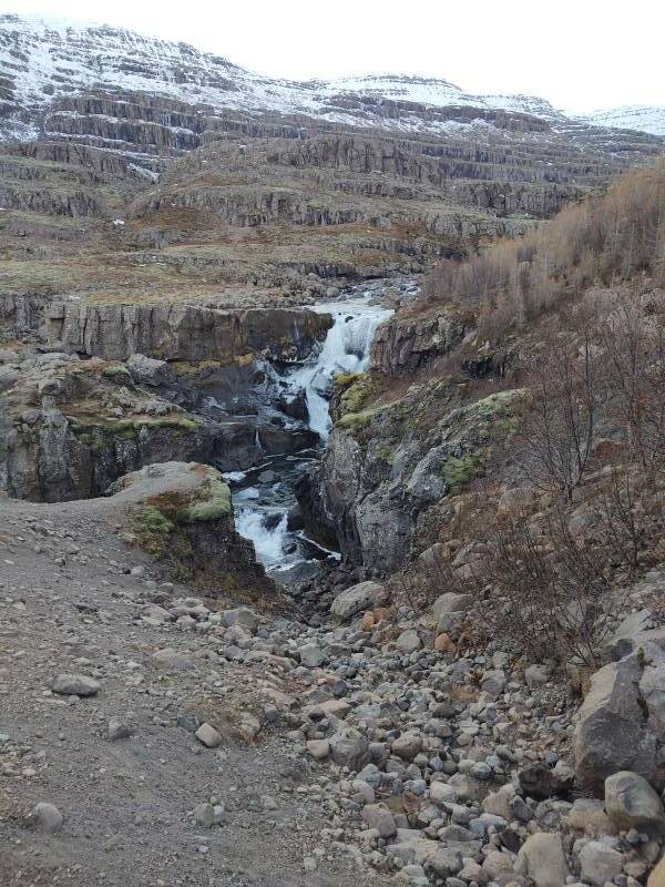
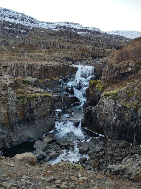
I pulled off to see Fossá, near the west end of Brufjörður.
Runoff from an area of 113 square kilometers drains into one river with about 30 waterfalls. Further upstream the river passes through a hydroelectric plant. That plant now generates about 30 kW of electrical power, enough to meet the valley's requirements. Only 0.1% of Iceland's electrical power comes from fossil fuels. Down close to the fjord, there are still dramatic waterfalls.
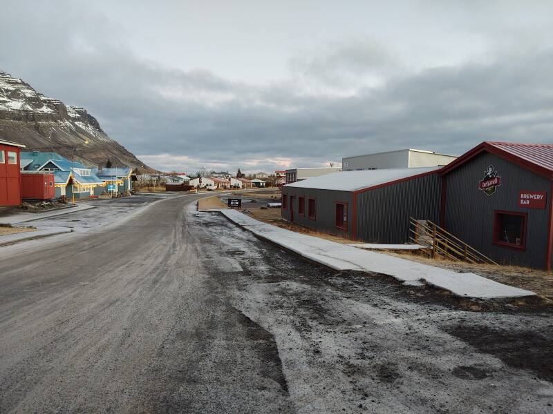
I was back in Breiðdalsvík by shortly after 1500, with plenty of time to look around downtown before it got dark.

However, the University of Iceland geological center was closed. They have a small public exhibit, nominally open 1400-1600 Tuesday through Thursday in the winter. But not on this particular Wednesday.
Even though (or perhaps because) it was Wednesday, the day of Oðinn the all-father, the exhibit was closed.
The English week is largely Old English derived from Old Norse. The Old English names of the four Old Norse days are:
Tuesday = Tiwesdæg, the day of Tiw or Týr, the Norse god of single combat, law, and justice.
Wednesday = Wōdnesdæg, the day of Wodin or Odin or Oðinn, the Norse all-father.
Thursday = Þunresdæg, the day of Thor, the Norse god of thunder.
Friday = Frīġedæġ, the day of Frig, the Norse goddess of marriage, prophecy, clairvoyance, and motherhood.
Onward to Seyðisfjörður
Next: On to SeyðisfjörðurMy next overnight stop would be further north along the east coast around three fjords to Reyðarfjörður, north into the interior to Egilsstaðir, and then over a snowy pass to Seyðisfjörður for a three-night stay over Christmas.
as in this;
Þ/þ is unvoiced,
as in thick.