Driving the Ring Road Around Iceland
Akureyri to Siglufjörður
This segment of my Ring Road circuit took me part-way around
the Tröllaskagi peninsula
in northern Iceland.
For centuries that trip required a boat.
Then, for several decades, it could be done with
an airplane with floats for water landings.
Now, a series of tunnels lets you make the trip
easily by car.
With the degree of ease depending on the weather, of course!
I would leave Akureyri,
Iceland's "second city" in the north, and drive north
along the shore of its large
Eyjafjörður fjord
to the port town of Darvík.
From there, pass through a single-lane tunnel to
Ólafsfjörður
on its fjord of the same name.
Then through a pair of tunnels, briefly surfacing to cross the
Héðinsfjörður fjord
and then returning underground to surface near
Siglufjörður on its own fjord.
I would see fantastic scenery, and visit fishing towns dealing
in very different ways with the decline of fish populations.
Akureyri to Dalvík
About 45 cm of snow had fallen in a period of a day and a half. A construction crew was working on a project next to my guesthouse in Akureyri. They loaned me a shovel, and I excavated my rental car.
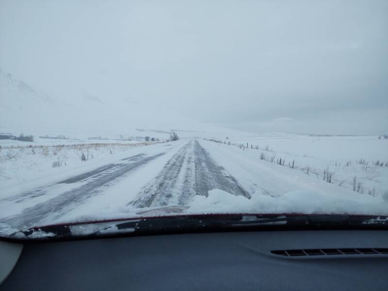
The essential road.is showed that conditions were OK, and vedur.is showed that the weather wouldn't make things much worse. I moved on to the north!
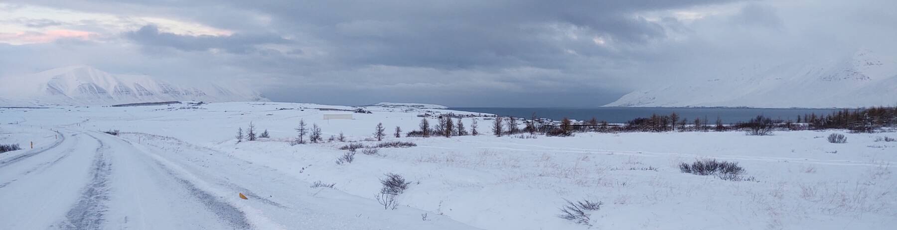
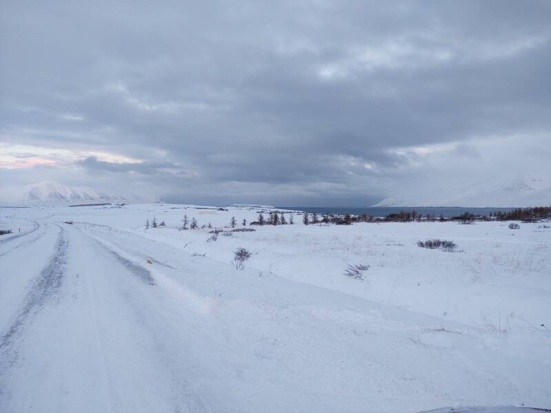
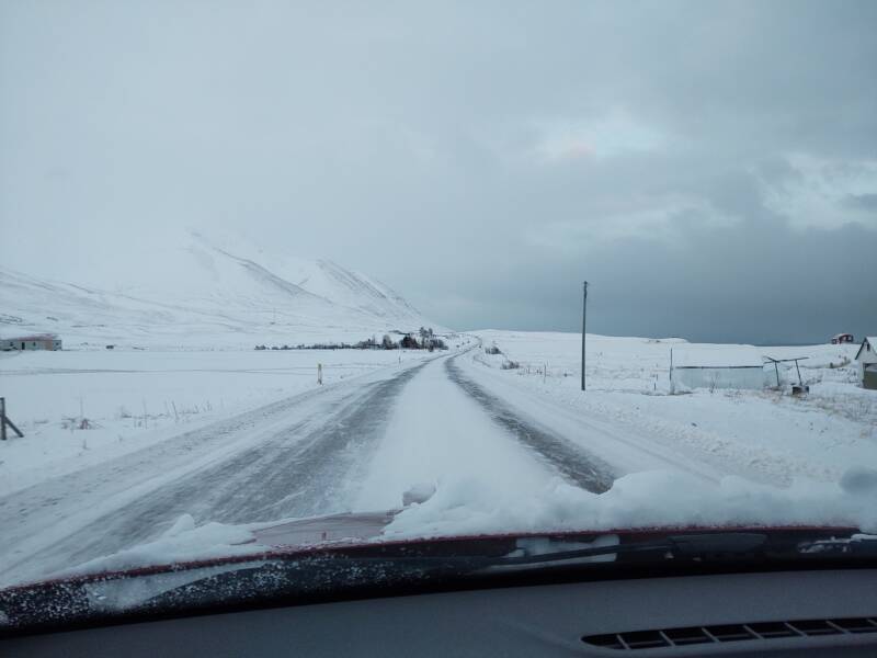
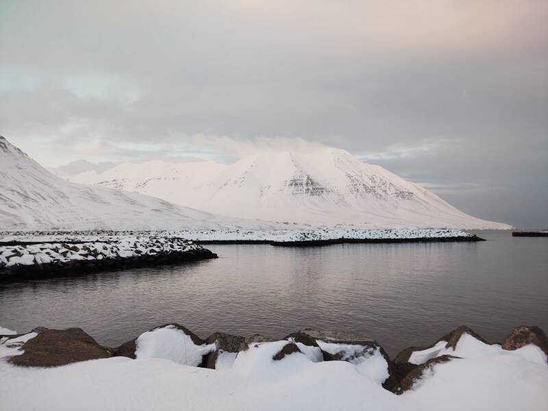
I was taking Road 82 north from Akureyri. It curves inland in places, but it's never far from the Eyjafjörður fjord. It's one of the largest fjords in Iceland, 60 kilometers long.
Yes, that's redundant, Eyjafjörður means "Eyja fjord", and so Eyjafjörður fjord means "Eyja fjord fjord". But if you're reading these pages I assume you read English rather than Icelandic or the very similar Old Norse. Maps will show the name as "Eyjafjörður", so you need that name to know which geographical feature I'm going on about.
I assume you have some idea that a fjord is a narrow steep-sided valley opening to the sea.
But I don't assume that you know what a fjörður is.
So, it's "Whatever-fjörður fjord" in these pages.
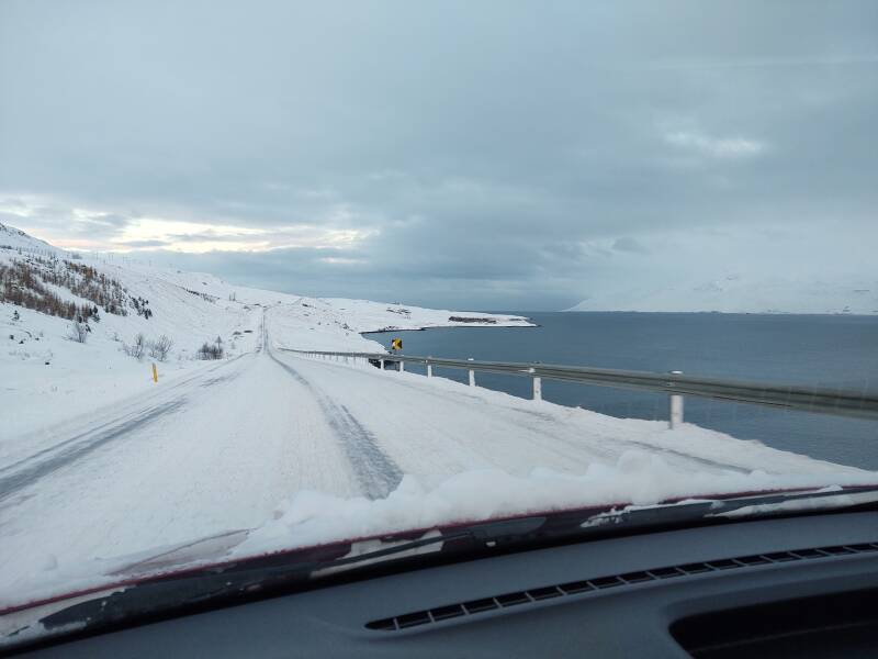
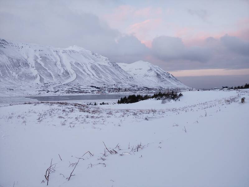
I stopped where the road cuts further inland to take a series of pictures, looking first south:
Then west:
Then northwest:
Then north:
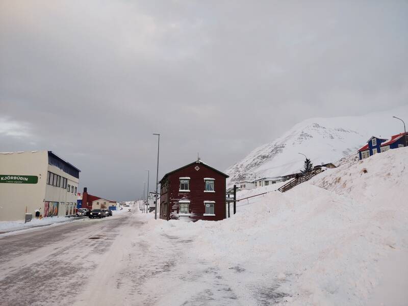
I was getting close to Dalvík. The large island in the fjord near Dalvík is Hrísey. 210 people live on it, plus it's Iceland's quarantine station for pets and livestock.
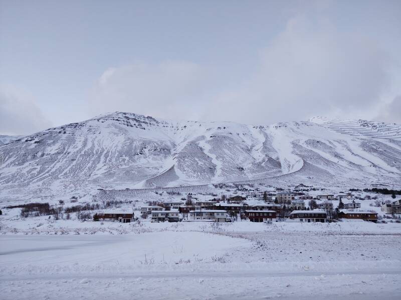
Dalvík
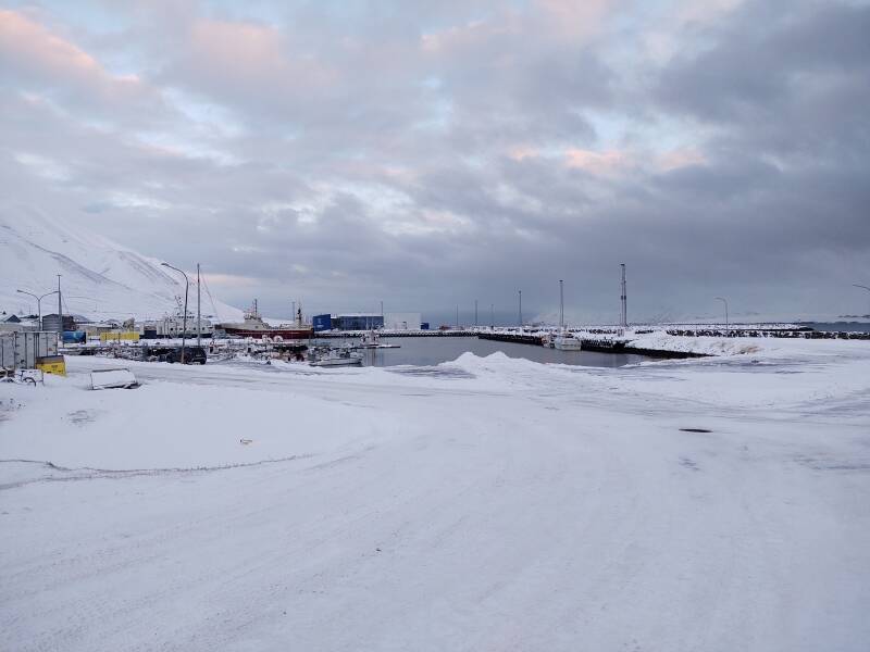
Dalík is a commercial port for cargo, fishing, and ferry service to Grimsey, a small island to the north on the Arctic Circle.
The local economy is based on its port activities. But fishing along the north coast has declined from what it once was.
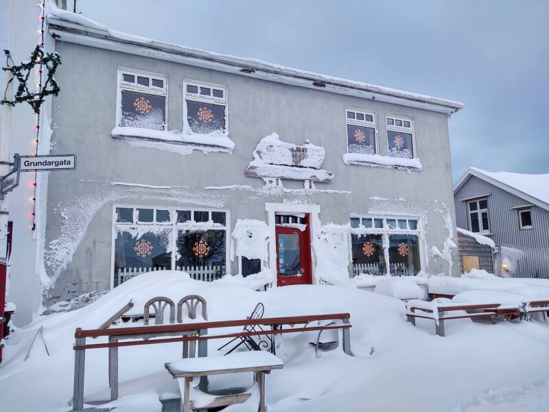
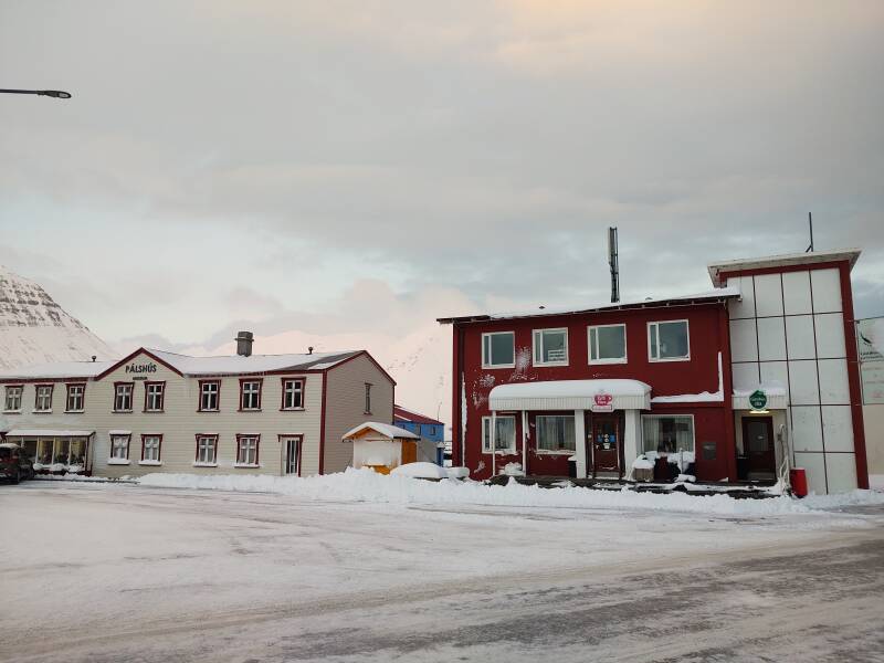
Dalvík is getting more involved in tourism. There's a popular café where the highway makes a sharp bend as it passes through town. Rick Steves and other guidebooks recommend it. But it's not open in the week between Christmas and New Years.
I don't know if it's open in the winter at all. But it might be, because skiing is a growing part of the Dalvík economy.
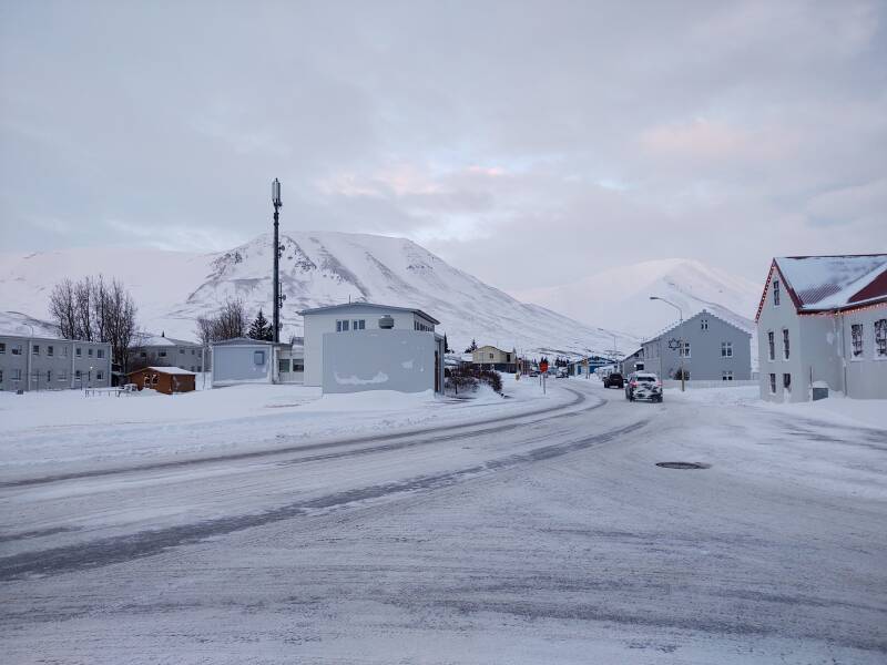
Dalvík isn't large, its population is about 1,400.
The ferry Sæfari sails between Dalvík and Grimsey, on the Arctic Circle. That's it at right in this view of the port.
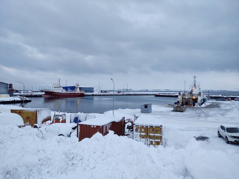
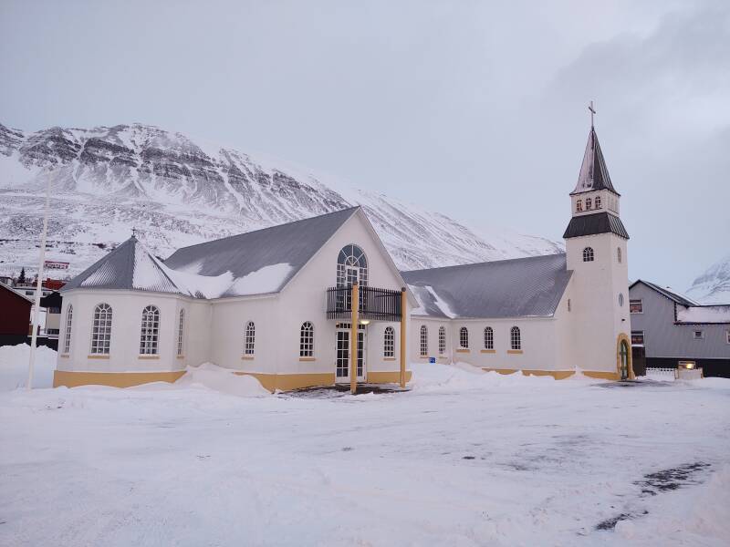
The prominent church overlooks the town.
The town's name was strangely familiar to me. That's because the Android operating system used to include a major component named "Dalvik".
My old pages on installing and running CyanogenmodWhen Android first came out, many coders saw it as a very promising yet still incomplete and somewhat disappointing operating system. "Custom ROMs" were quite popular for a while. These were custom firmware images containing community-written Android replacements, or re-implementations, or improvements, or however you thought of them. I used Cyanogenmod, which I think was the most popular one.
There was something called "Dalvik" and its "Dalvik cache" which you needed to wipe for reinstallation, but that's about all you needed to know. That's why "Dalvík" sounded vaguely familiar.
Dalvik was a process virtual machine, a "sandbox" in which applications ran. The Java virtual machine, WINE, and Microsoft's App-V are analogous.
A programmer named Dan Bornstein designed and wrote the Dalvik virtual machine, naming it for the home of an ancestor.
bytecode
documentation
Dalvik was used in Android 4.4 and earlier. It was replaced with Android Runtime or ART, which can use the same bytecode and file formats. ART was included in Android 4.4 as a technology preview. Android 5.0, which released in November 2014, was the first version in which Dalvik was not included.
Custom firmware like Cyanogenmod largely disappeared. Android had improved to the point that there was no longer motivation for the programming community to maintain parallel versions.
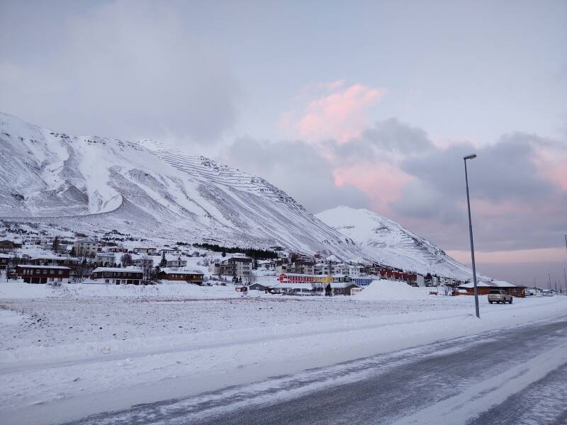
Dalvík to Ólafsfjörður
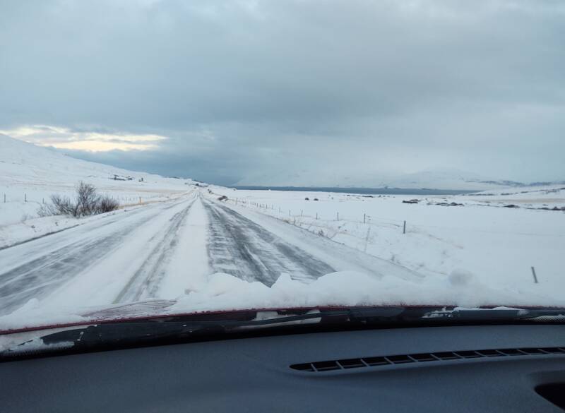
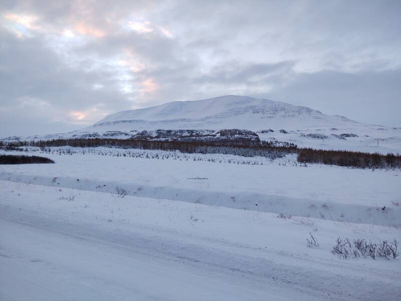
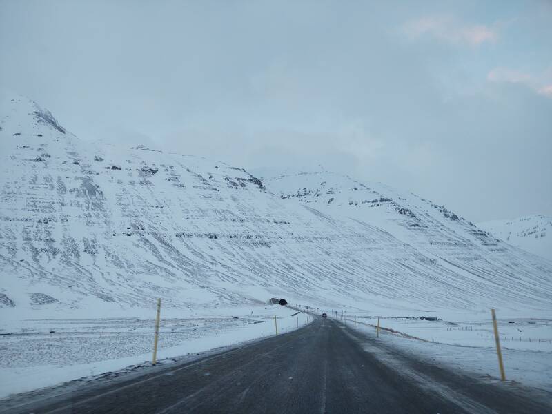
Out of the free and open-source operating system details, and back on the road! I continued north from Dalvík on Road 82.
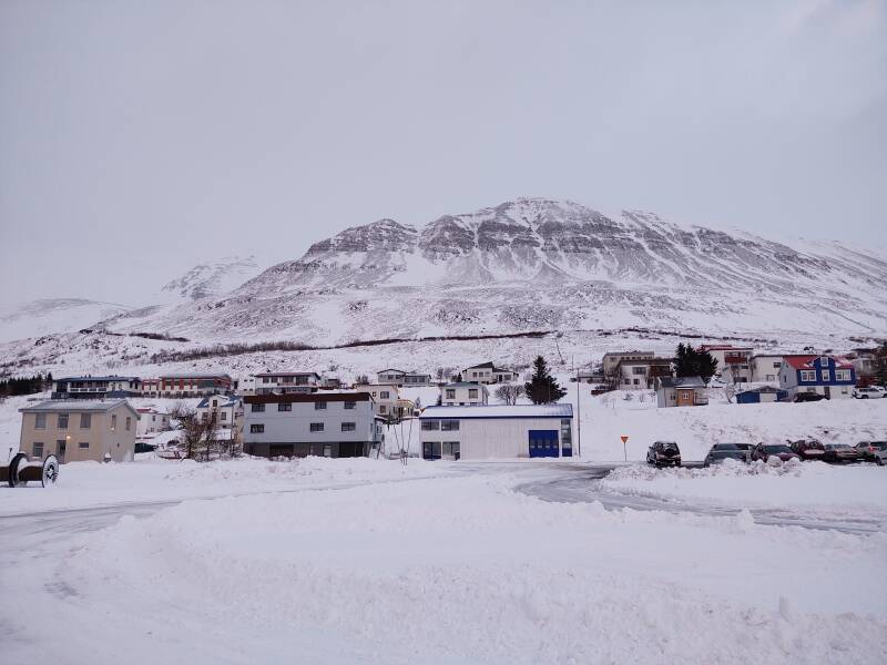
Tröllaskagi is a broad peninsula on the Greenland Sea, between the fjords of Eyjafjðrður where Akureyri is located, and the much broader Skagafjörður to its west. At this point in the saga, I'm traveling up the eastern shore of Tröllaskagi.
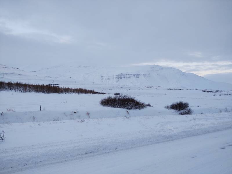
Tröllaskagi is mountainous, with several peaks over 1,000 meters and the tallest above 1,500. There are several deep valleys cut by glaciers during the last ice age and further eroded by rivers. People only live in the lowlands along the coast and in some of the valleys.
Transportation between coast settlements was initially only by ship. Some tracks were established that could be used on foot or by horse during a very limited period of the year. Some of those tracks are passable by specially equipped 4-wheel-drive vehicles for two or three months in the summer, but there were no roads as we typically think of them.
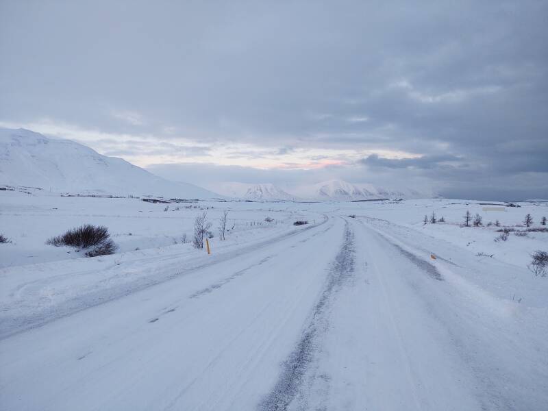
The horse trail through Lágheiði to Ólafsfjörður was improved enough in 1940 for motorized vehicles to make it.
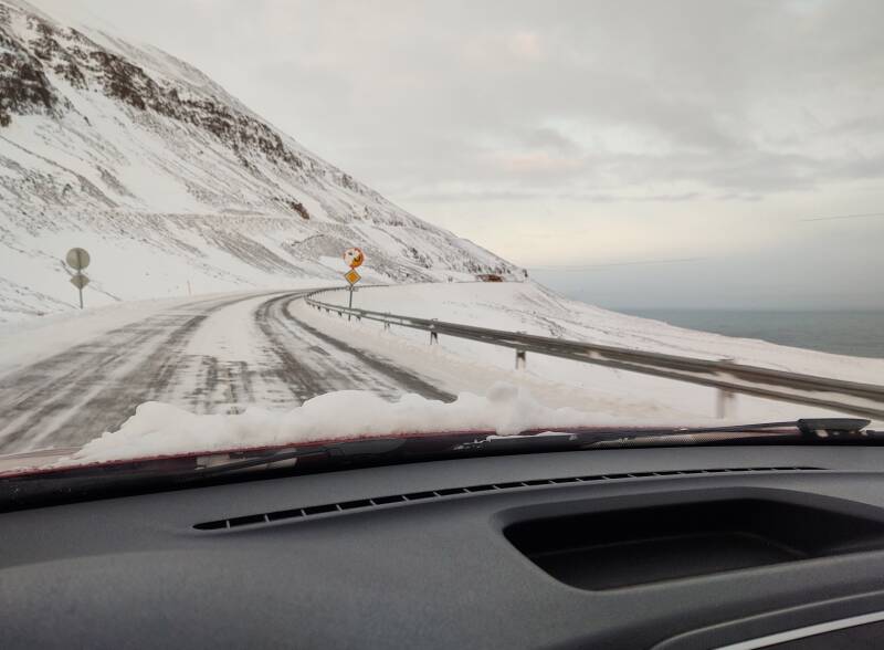
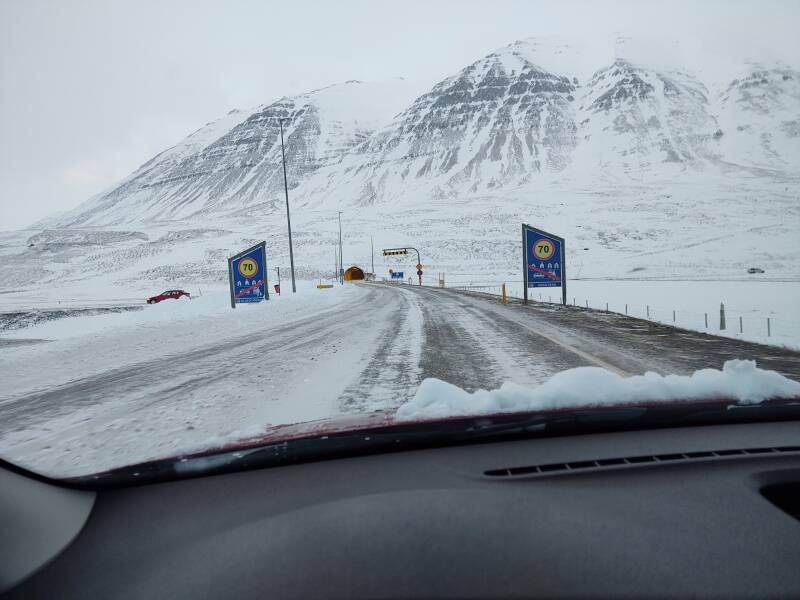
As you continue north from Dalvík, you begin to think that this road is going to have to end soon.
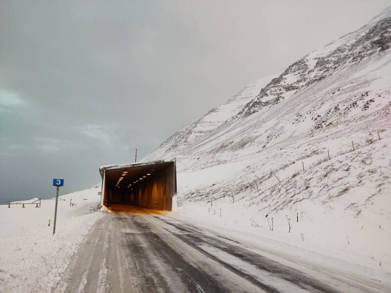
Then you come to the Múlagöng or Múla tunnel.
Múlagöng opened in March 1991. It's 3,400 meters long and it provided the first road link between Dalvík and Ólafsfjörður.
It was a huge project with a great result. But don't assume too much and drive right into the tunnel without understanding what's going on.
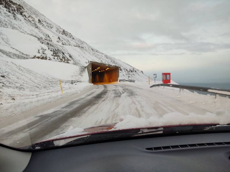
Múlagöng is a single-lane tunnel. It's not the only such tunnel in Iceland, and I'll go through another on the next segment.
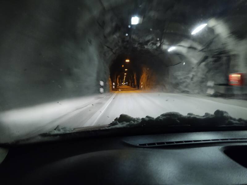
How does it work?
Signs tell you, entirely in Icelandic, that it's a single-lane tunnel. The key is to spot the sign with two arrows, one pointing up (your direction) and the other down (the traffic coming at you). The black one has right of way, the red one doesn't.
I saw something like this: ↓↑
So, the oncoming traffic had the right of way. I did not.
Every so often there's a niche in which you can pull off and let oncoming traffic pass. You have to watch ahead for the lighted signs for the niches, and of course watch for oncoming vehicles.
Someone's coming, so I have pulled off to let them pass.
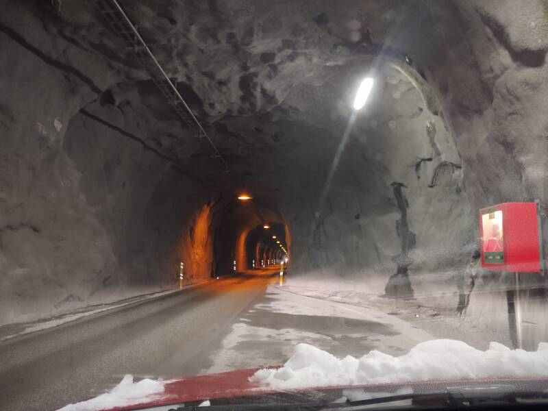
I can't see anyone behind them yet, so when they're past I can pull out and continue.
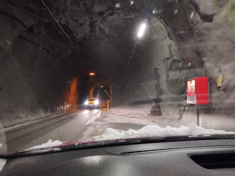
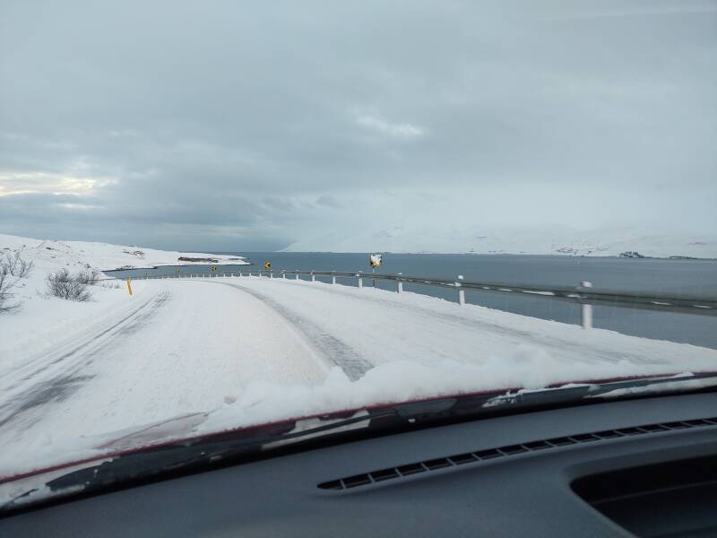
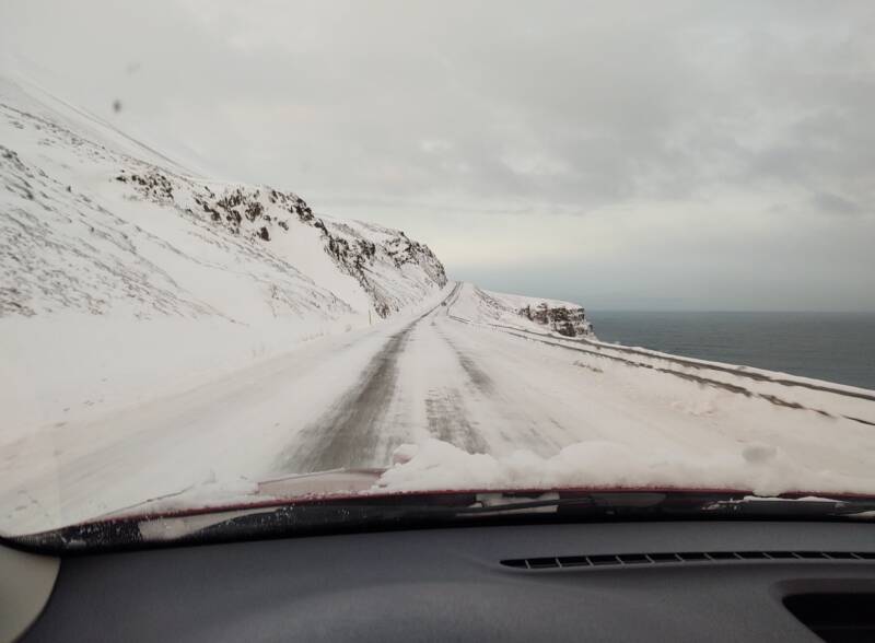
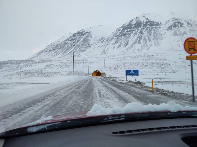
And, 3.4 kilometers later, having had to pull off twice, I emerged from the tunnel.
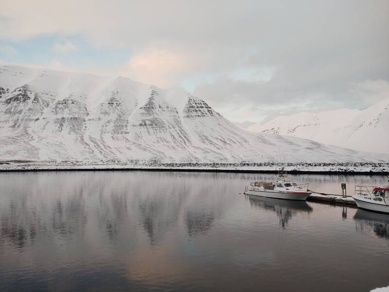
I was at the mouth of the Ólafsfjörður fjord, looking north into the Greenland sea.
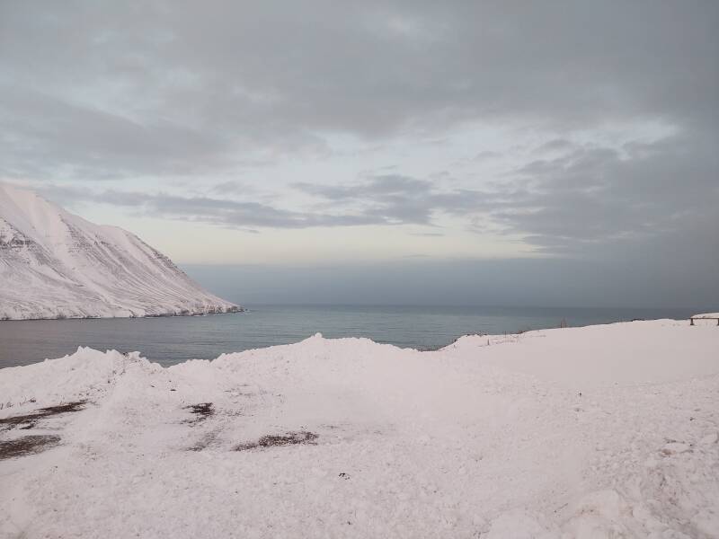
Across the fjord:
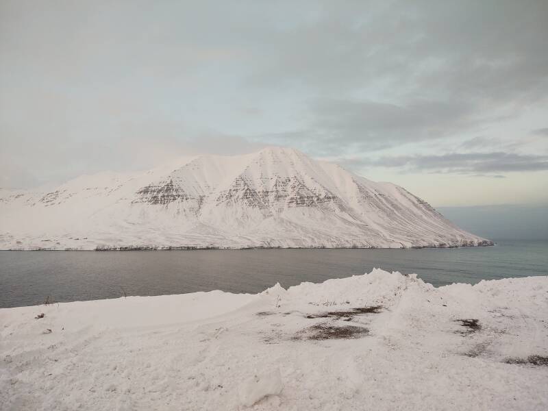
And south to the town of Ólafsfjörður.
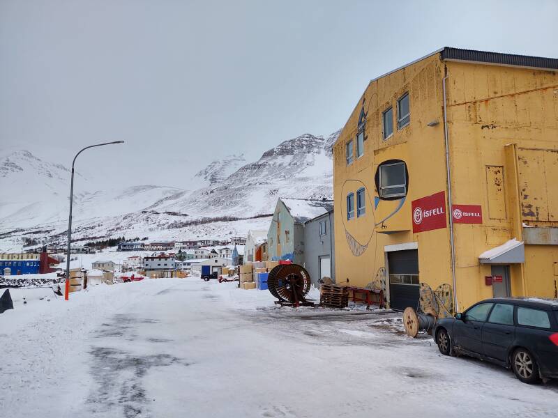
Ólafsfjörður
The town of Ólafsfjörður grew with the herring industry, which peaked in the 1940s into the 1950s. However, the herring are now almost completely gone from Icelandic waters.
The first settlement here was established in the late 1800s. 192 people lived here in 1910. That grew to 336 in 1920, 559 in 1930, 736 in 1940, and 947 in 1950. The population continued to grow slowly after the herring fishing collapsed. By 1989, 1,191 people lived here.
But then the population of Ólafsfjörður shrank to about 785 by 2019.
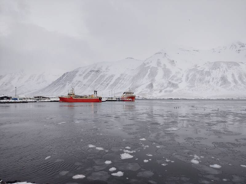
Several fishing trawlers are still based here.
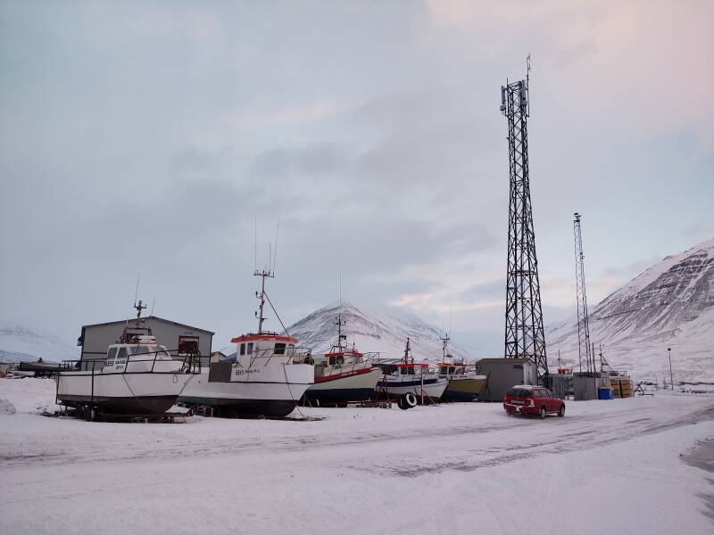
Tourism is growing, and there is some agriculture up the fjord's valley, but the town still relies heavily on fishing.
One firm dries fish here and exports them to Nigeria.
Ólafsfjörður to Siglufjörður
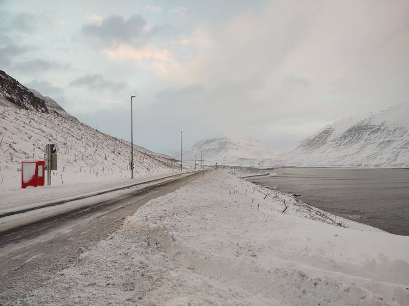
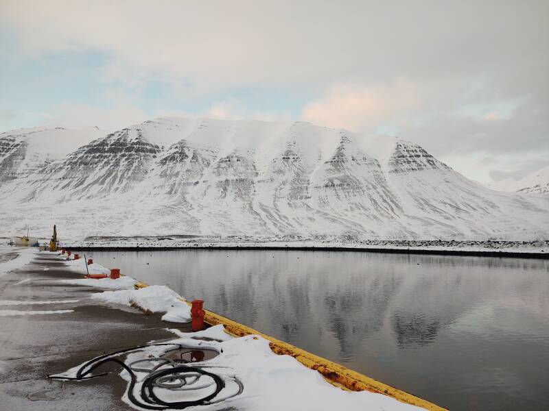
From Ólafsfjörður I took Road 76 toward Siglufjörður. Right at the edge of town the road enters Héðinsfjarðargöng, a pair of road tunnels.
The first tunnel, the southern one, is 6.9 kilometers long. These tunnels have two lanes, no one has to pull off to let oncoming traffic pass.
After almost seven kilometers of tunnel you briefly exit in Héðinsfjörður fjord. About 650 meters later the road enters the northern tunnel, 3.7 kilometers long.
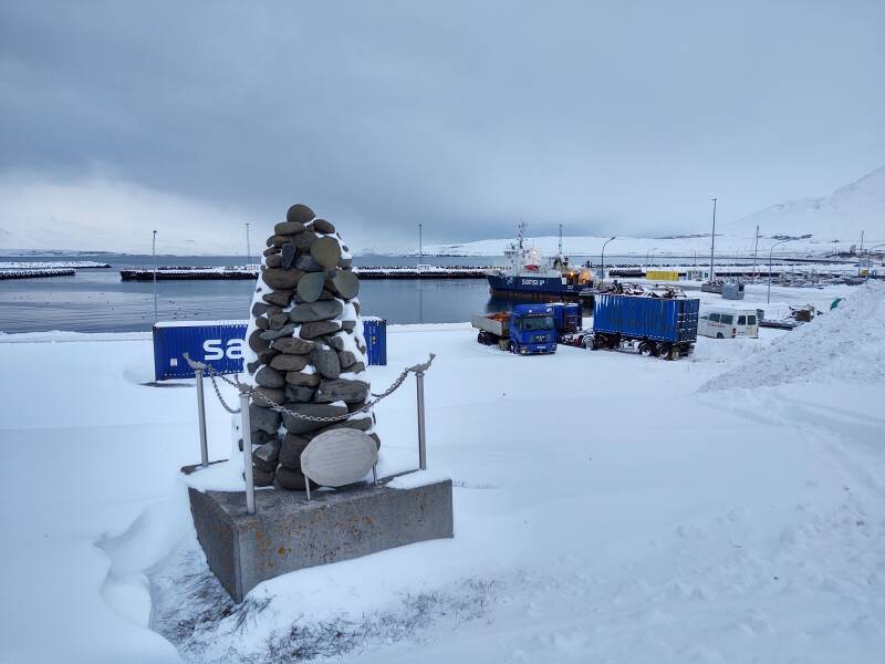
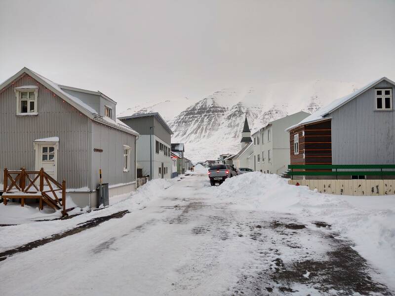
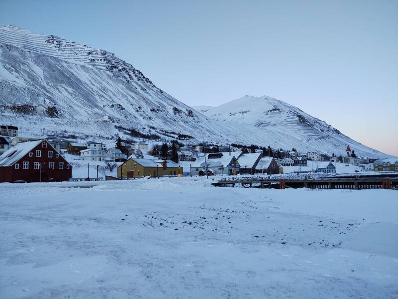
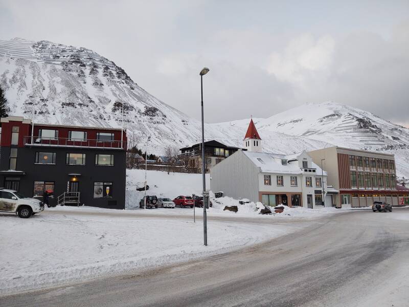
Siglufjörður
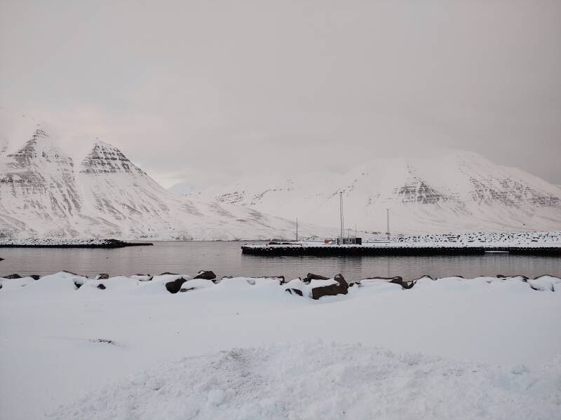
You exit that tunnel in the Siglufjörður fjord.
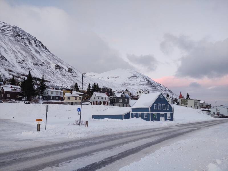
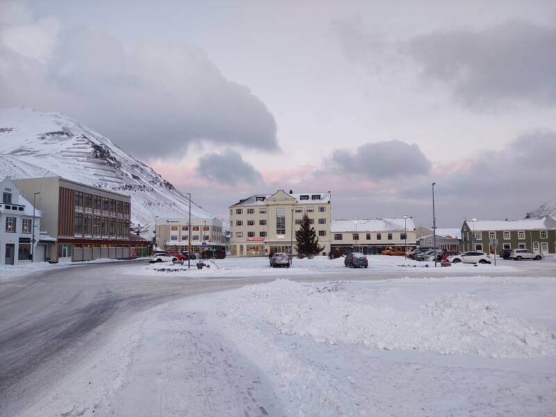
The town of Siglufjörður is a short distance away.
This really was the town that herring built. The first Icelandic Municipal Savings Bank was founded here in 1873.
The town grew through the 20th century, peaking with the herring fishing industry in the early 1950s. In some years, the value of herring from Siglufjörður accounted for over 20% of all exports from Iceland.
The number of herring taken from the surrounding waters peaked around 1950, and then dramatically dropped due to over-fishing by Iceland, Norway, and Russia. People started leaving the area.
Herring fishing continued here with greatly decreased yields until around 1970. You can send ships out, but if there aren't many fish they won't bring much back. Then the fishing work largely dropped off with an associated further drop in population.
The town's population had reached its peak of 3,000 by the early 1950s. It has been shrinking since then, and was just 1,206 in 2011.
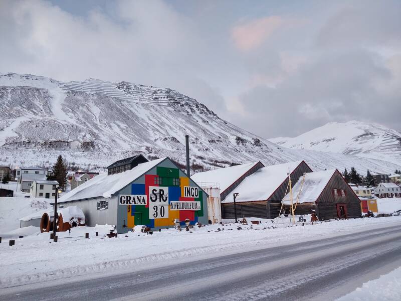
The Herring Museum is based in a series of herring industry buildings. They face the port south of the center of town. After the herring boom was over, fill was used to build the highway between them and the port. Back in the day, they connected to wharves extending into the port.
The grey building at left was the freezing plant, and the multi-story dark red building was the salting station.
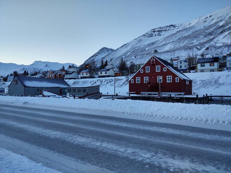
The multicolored building was the factory, and the dark brown building was the boathouse.
Transportation to Siglufjörður was originally limited to boats. There were high and steep mountain paths to Fljóti to the west and Héðinsfjörður to the east, but they were only practical during better weather.
The horse trail through Siglufjarðarskarð was improved in 1940, enabling some motor vehicles to get through. Then, in 1946, a 15-kilometer road was built over the 600-meter pass at Siglufjarðarskarϰ. It was a great improvement, but still it was only open for a few months each year.
In 1967, the Strákagöng tunnel was dug through the steep mountain forming the nearly vertical tip of the peninsula. It was the first year-round land connection to the town. I would pass through it soon.
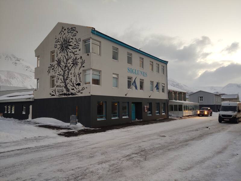
I stayed at the Siglunes Guesthouse just a block from the center.
Nes is Old Norse for "point". Many places in Orkney include "nes" or "ness" in their name.
This would be my northernmost overnight stop, at 66° 9' 5.64" N. Sunrise on December 30th at 11:50 at a bearing of 160°, sunset at 14:46 at a bearing of 200°. That's rise and set at an ideal horizon, over an ocean. The sun wouldn't get nearly high enough to appear over the mountains surrounding Siglufjörður.
My room was very nice. They have decorated the entire guesthouse, including the guest rooms, with items from antique stores.
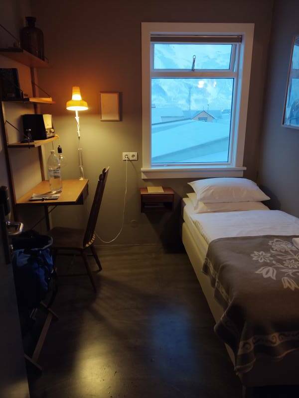
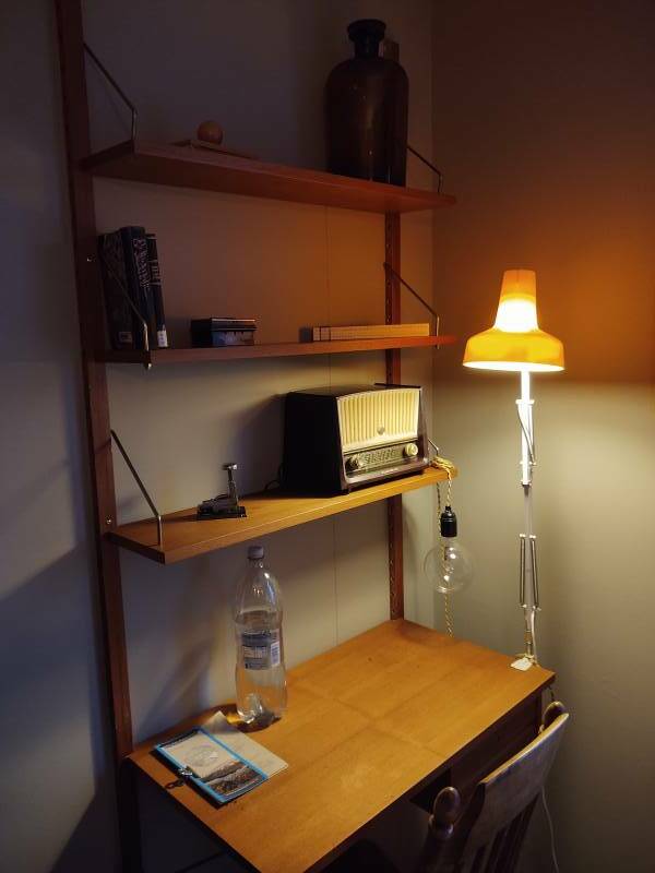
I had a sink, the toilet and shower were in the next room down the hall.
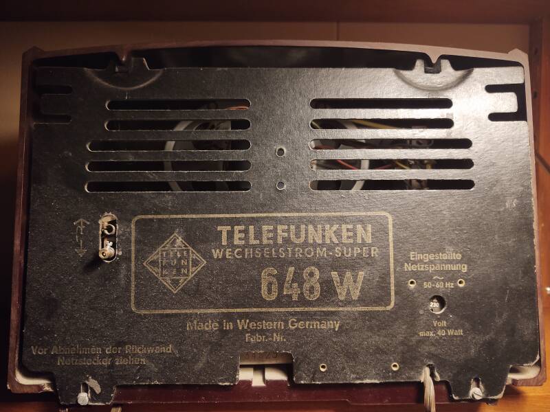
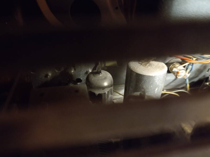
There was an old radio on the shelves above the desk. It was a Telefunken Wechselstrom-Super 648W. That model came out in 1957.
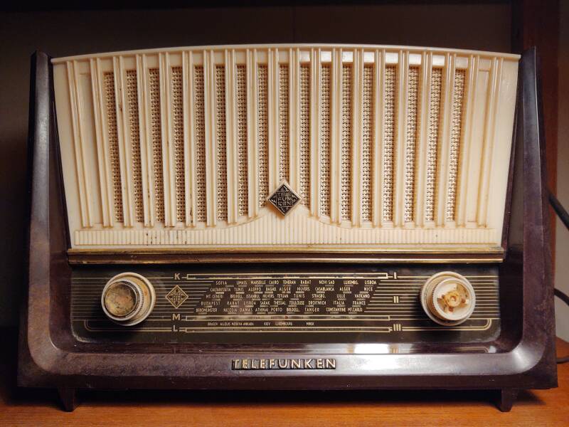
It had selectable AC supply voltage: 100, 118, 150, 200, and 230 VAC.
It used four vacuum tubes for Americans, or thermionic valves for Brits: ECH81, EBF89, ECL82, and EZ80. It used a superheterodyne circuit with a 460 kHz IF.
You can easily find pictures of the model's interior. Peeping through the back cover, this one is dusty. Those 65-year-old capacitors probably lost their electrolytic decades ago.
The "K" stands for Kurzwellenrundfunk, German for "shortwave".
"M" and "L" stand for "MW" and "LW", or "Medium Wave" and "Long Wave". In the US and Canada, most people refer to the MW broadcast band as "AM".
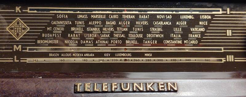
The "K" scale shows the shortwave broadcast bands. I could read the markings, but they just wouldn't show up in a picture. They're listed by wavelength in meters: "49m" at the left end, "45" over "SOFIA", "41m" over "LIMASS.", "35" over "Marseille", "31m" over "CAIRO", "28" over "TEHERAN", "25m" over "RABAT", "22" over the left end of "NOVI SAD", "19m" between there and "LUXEMBG.", "18" over "LUXEMBG.", and "16m" over "LISBOA".
| λ | kHz |
| 120m | 2300 – 2495 |
| 90m | 3200 – 3400 |
| 75m | 3900 – 4000 |
| 60m | 4750 – 5060 |
| 49m | 5900 – 6200 |
| 41m | 7200 – 7450 |
| 31m | 9400 – 9900 |
| λ | kHz |
| 25m | 11600 – 12100 |
| 22m | 13570 – 13870 |
| 19m | 15100 – 15800 |
| 16m | 17480 – 17900 |
| 13m | 21450 – 21850 |
| 11m | 25670 – 26100 |
The 120 through 60 meter bands are called the "tropical bands", mainly used by broadcasters in those regions. The two at highest frequencies, 13 and 11 meters, haven't been used much as they're of little use outside the short periods of high solar activity within each 11-year cycle. This radio's coverage of the 49 through 16 meter bands is standard.
The "M" scale has 515 at left, 1600 at right, with "kc/s" at the right end. That's kilocycles per second, now called kilohertz or abbreviated kHz.
Grindavík VLFTransmitter
The "L" scale has 145 at left and 360 at right, also with "kc/s" at its right end.
So, a receiver for those VLF signals I've seen several references to on this trip.
Staying in Siglufjörður
Next: Exploring Siglufjörður Skipping ahead: On to SauðarkrókurNow I would explore Siglufjörður.
Or, if you want to skip ahead, my next overnight stop would be on around the Tröllaskagi peninsular in Sauðarkrókur.
as in this;
Þ/þ is unvoiced,
as in thick.