Driving the Ring Road Around Iceland
Arriving in Iceland
Keflavík to Eyrarbakki
I was on my way to visit Iceland in winter,
flying into Keflavík
because that's where all major international flights land.
Keflavík was a major Allied air base during
World War II and then housed a major U.S. base during the
Cold War.
But once the Soviet Union was dissolved, the U.S. base
began to dwindle.
On September 30, 2006, the last 30 U.S. military
personnel left Keflavík.
Now it's just a commercial airport.
My rental car would be waiting for me, and I hoped to make
the complete circuit of the Ring Road,
Iceland's highway #1 circling the island.
The first segment, described on this page, takes me to the
Mid-Atlantic Ridge, a dangerous hot spring,
geothermal power stations,
a spectacular sea coast,
enormous antennas,
Iceland's recent celebrity volcano,
and a small town with a large role in the history of both
Iceland and the European discovery of North America.
Before First Light on the Mid-Atlantic Ridge
My Iceland Air flight out of Chicago arrived right on time, putting me in Keflavík at 6:30 in the morning on December 13. That meant that it would remain pitch dark for quite a while.
My first action was to get lost looking for the rental car agency.
I had reserved a car from the IceRental 4x4 agency, as they offered the best deal I found on Kayak.com. So, out of the terminal into the dark to find the shuttle bus to the rental cars. IceRental was the third stop.
But they had no record of my reservation. And with all the urgent paperwork required to travel during the COVID-19 pandemic, the car reservation was the one thing I didn't have printed out. I needed proof of full vaccination, proof of a booster shot, proof of a negative test within 72 hours of departure, various forms from the Icelandic government about my identity and health status, and so on.
And, being an American, the "proof" was a vaccination record that appears to be a hand-written library card from 1920, which anyone outside the U.S. rightly sees as primitive. The "proof" of a negative test was a print-out of a PDF file that had some simple wording, entirely in English, with no bar code or other machine-readable features. If you're not familiar with U.S. pharmacy chains, "What is this 'CVS'?", it's pretty mysterious and unauthoritative.
Meanwhile, my car reservation was a PDF file safely saved on my desktop computer at home. I hadn't brought along the printed version, and I had neglected to copy that one document to my laptop. It was the one detail that I hadn't set up through Booking.com, so I couldn't look it up with the app on my phone.
Eventually I happened to mention that when I had reserved it, Kayak.com sent me to the VIP Cars site, which then sent me into a section for IceRental 4x4.
"Oh, you said 'IceRental 4x4?"
Everyone wants "Ice" in their name. While their logos are very similar, it seems that IceRental and IceRental 4x4 are totally separate. Competitors, even. And not at all related to the various Ice-This, Ice-That, and Ice-The-Other companies. It's hard to sort this out when I'm groggy from the overnight flight.
OK, wait a while for the next circuit of the shuttle bus, take it back to the terminal, and wait for the person to appear carrying a sign for the small van going far off airport property to IceRental 4x4.
A friend of mine who is a patent lawyer had visited Iceland just a month before I did. By the end of the trip he was looking into attending the University of Iceland to get a specialty degree in environmental law. While geothermal energy and Iceland's near-zero use of fossil fuels for heating and electricity make that an attractive field, I think there may also be a need for intellectual property law in Iceland. At least in the area of car rental names and logos.
The woman at IceRental 4x4 showed me their diagram of damages the car had suffered so far. It was a somewhat surprising amount. She suggested that I take pictures before I drove away, but then I should do that again once it got light. She glanced outside at 9:00 AM and said "That won't be for another two hours at least." There was more, about sandstorms and forest roads and undercarriage damage, but I'll get to all that in the Vík–Hali segment of the trip.
I drove off into complete darkness and rain, strung out from having slept very little on the overnight flight, trying to figure out exactly where I was, and trying to decide what to do with two more hours to kill until it started to get light.
I made my way toward some lights, and found the main road joining Keflavík and Reykjavík, Iceland's capital. Two-thirds of Iceland's entire population of about 372,000 lives in the metropolitan Reykjavík area. Iceland is lightly populated. So, I would have no problem with social distancing for the pandemic.
I went into a supermarket and bought a can of tuna possibly for the evening's meal, an apple for the next morning's breakfast, and a bottle of water to have in the car. By the time I came out and wandered around a little, I thought that maybe there was a little light in the east.
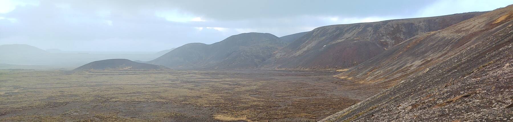
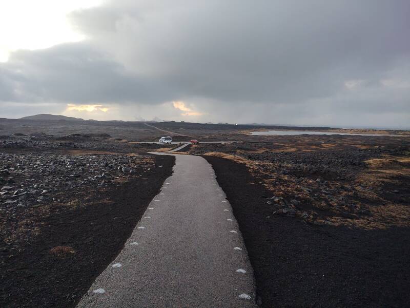
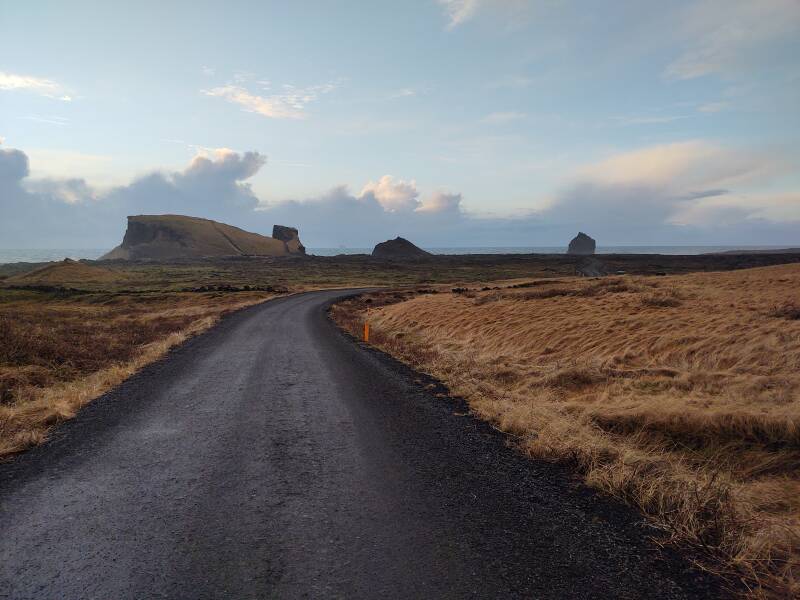
I started south toward the tip of the Reykjanes Peninsula, the southwestern extreme point of Iceland. After a while I stopped near the Hafnarberg sea cliffs and Sandvík beach. It was getting light enough that I thought I could see what I was driving through, but I wasn't sure.
I was right. Much of the peninsula is lava fields.
My phone's camera has very good low-light performance. Things didn't look nearly as well lit as the above picture suggests. I could see that I was looking toward the coast with a thin strip of ocean visible, and that there were broken clouds overhead. But I could not perceive any blue color in the sky, just a different shade of dark grey.
A little further along I came to my first sign with what I thought was the Apple Command Key symbol. No, "⌘" already meant something else. Apple chose the symbol that was already used in Nordic countries to indicate a place of interest or culture. Ah, here is a Nordic place of interest for me to visit:
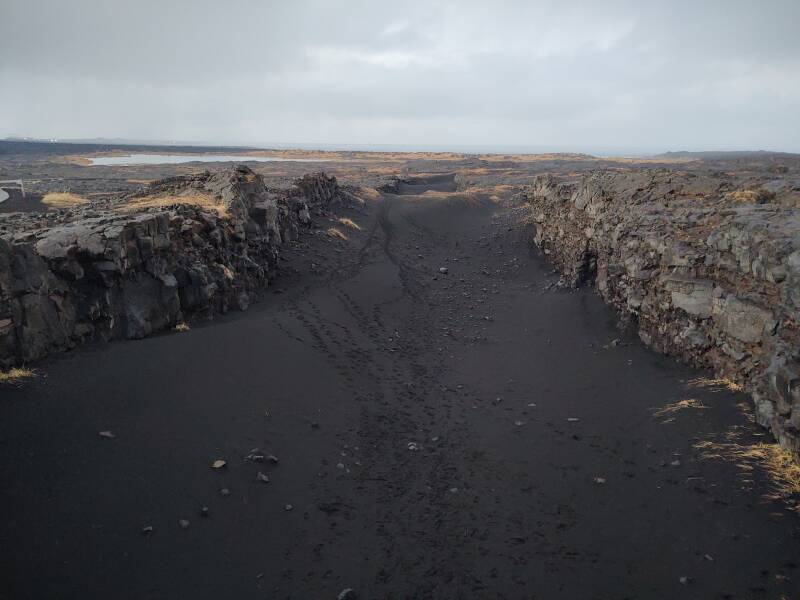
This one is kind of silly, the "Bridge Between Continents". The rift line of the Mid-Atlantic Ridge crosses Iceland diagonally from northeast to southwest. This is where the North American Plate and the Eurasian Plate are spreading apart about 2.5 cm every year. And what fills the gap? Lava.
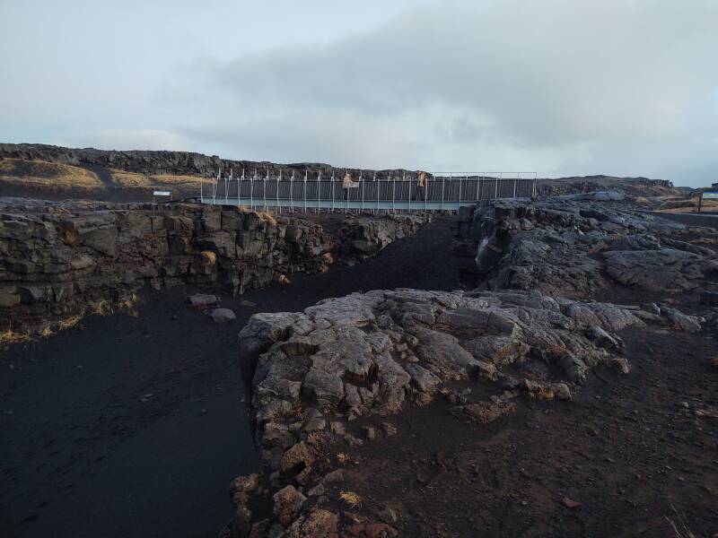
The tourist department erected this footbridge across the spreading gap. Let's go up on the bridge and look southwest along the rift zone with the Atlantic ocean in the distance. That's the Eurasian plate on the left, and the North American plate on the right.
Well, that got me out of the car and visiting a marked point of interest, instead of just stumbling in a lava field near a pull-off point. The rift is striking, and the site has nice diagrams showing the Earth's tectonic plates, centered on Iceland.
Back to my car and onward to the south, the direction we're looking in the below picture. It's a little after 10:30, the sky is getting lighter. By about 11:00 the sun may start hitting the higher clouds.
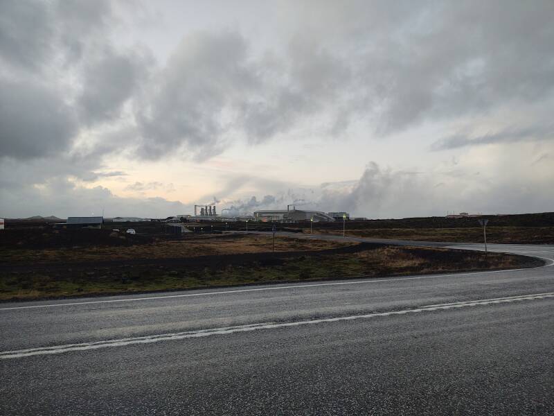
Now I can notice large plumes of steam in the distance.
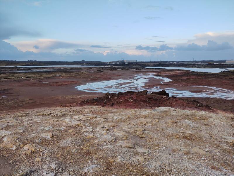
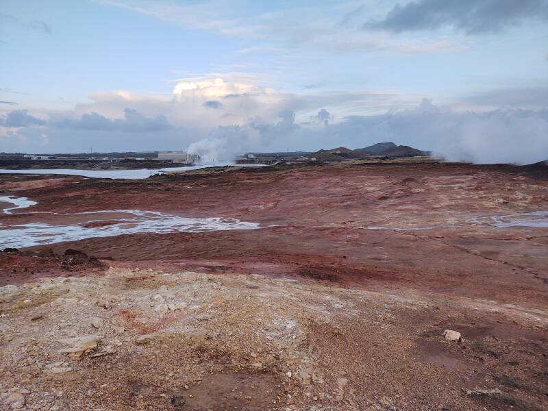
I'm looking toward the Gunnuhver hot springs and a major geothermal power plant.
Gunnuhver Hot Springs
The story of the Gunnuhver Hot Springs has to do with the ghost of a woman, Guðrún Önundardótter, who was nicknamed Gunna. She was mentioned in Árni Magnússon's census of 1703.
Icelanders use patronymics instead of family names. You are known by your given name, son-of- or daughter-of- your father. Guðrún Önundardótter was the daughter of a man named Önundar. If his father was named Þor (which we English speakers spell "Thor"), he would have been Önundarþorsson. And so on, back and back, –son and –dottir endlessly, in a land immersed in genealogy.
In the picture below you can see the Reykjanes Power Station in the distance, beyond the colored clay formed by the hot spring. More on that in a bit. But first, this spring and its ghost.
Gunna was a crofter near Kirkjuból, in Sandgeröi, living on land owned by the lawyer Vilhjálmur Jónsson. Gunna failed to pay the rent one month, and Jónsson took away her cooking pot, her only property.
Another part of the geothermal and electrical power station complex is visible below.
Gunna became furious, refused to drink holy water blessed by the priest, and soon died suddenly. The legend is that the men carrying Gunna's coffin to the cemetery thought it was suspiciously light, and they and other people heard someone saying "No need deep to dig, no plans long to lie."
The next morning the lawyer–landlord–pot-confiscator Vilhjálmur Jónsson was found lying dead on the heath, with many bones broken and his body turned blue. The locals called in Eiríkur of Vogsósar, a well-known priest-sorcerer. He gave a ball of yarn to the local men and told them to tempt Gunna into starting to unwind it and chasing after it. The ball would then roll into a place where she could not get out and do harm, which turned out to be this spring.
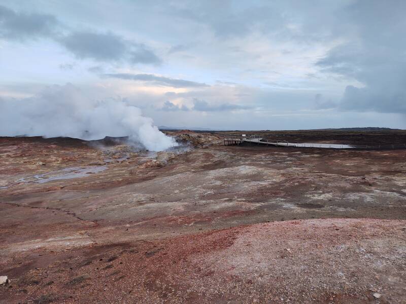
Let's go up onto the wooden walkway to where these people are.
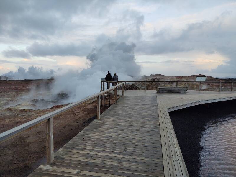
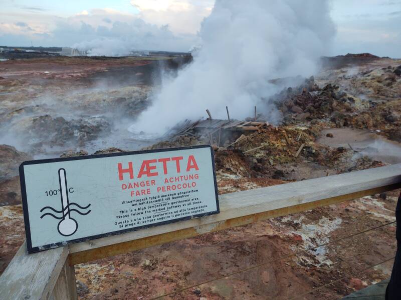
Heed the sign, the water is boiling violently. Yes, Iceland has many "hot pots" as they call them, places you can bathe in warm spring water. This is not one.
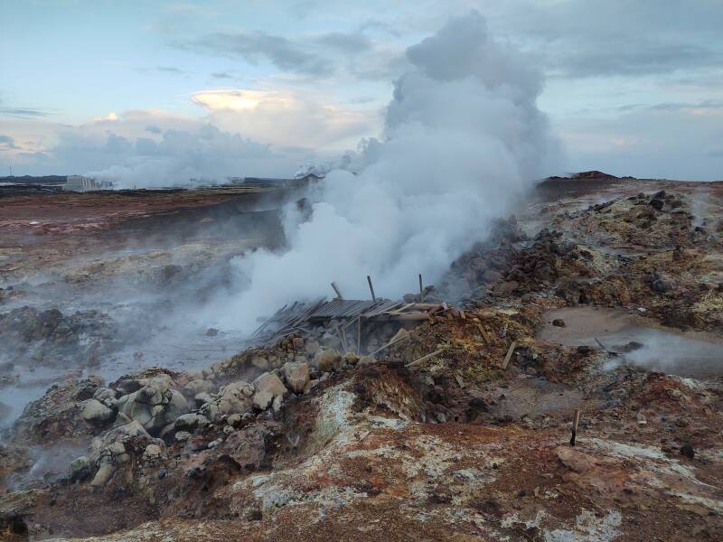
The constantly boiling water erupting out of the mud has taken the former walkway. This isn't a periodic eruption like a geyser, this water is boiling furiously all the time.
Who knows how many people have been boiled like lobsters for the sake of epic social media posts. Hopefully their estates received many "likes" and "shares".
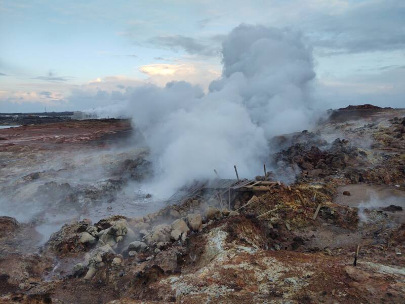
Other areas haven't opened up into vigorous eruption, not yet, but steam is coming out from many places in the mud. One thing about steaming ground and recent lava flows is that you have no idea how sturdy the surface really is. You might break through here into a large chamber of boiling water. Or, on a cool and hard and safe-looking lava surface, into a chamber of 2000 °C magma. Stay within the marked safe path.
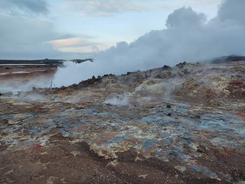
Here's a video. Downwind, you smell sulphur. And you get sprayed with boiling-hot water. Pay attention to the wind direction.
Reykjanes Power Station
With hot springs like this, plus volcanoes, you can see why Iceland is a leader in geothermal power. Nearly 20% of the country's electricity plus nearly 90% of domestic heating and hot water requirements are provided by geothermal power. I found that hot water in the shower may smell slightly of sulphur.
Almost all of the rest of electrical power and heating comes from hydroelectric generation. Less than 0.1% of Iceland's power comes from fossil fuels. My guess is that the 0.1% is for people who live in remote areas and use a generator.
Reykjanesvirkjun or the Reykjanes Power Station generates 100 MW of electricity. Below is part of the overall facility, just north of the Gunnuhver hot spring.

This is the main electrical power generating complex. It taps an underground reservoir of salty water around 290–320 °C. Twelve wells from 2,000 to 3,000 meters deep tap that reservoir, feeding the high-temperature steam with high salinity and high mineral content into the turbines. That requires special metallurgy.
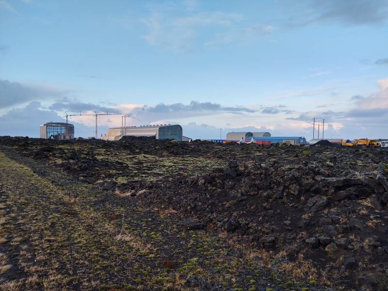
The first two 50-MW turbines in this facility went into operation in 2006, and during this visit in December 2021 they seemed to be building another generator hall.
There are also plans to drill wells from 4 to 5 km deep to reach temperatures from 400 to 600 °C.

They extract 4,000 liters of cool sea water per second from shallow wells near the shoreline. Both steam and cooling water are routed to the other facility near the natural hot springs.
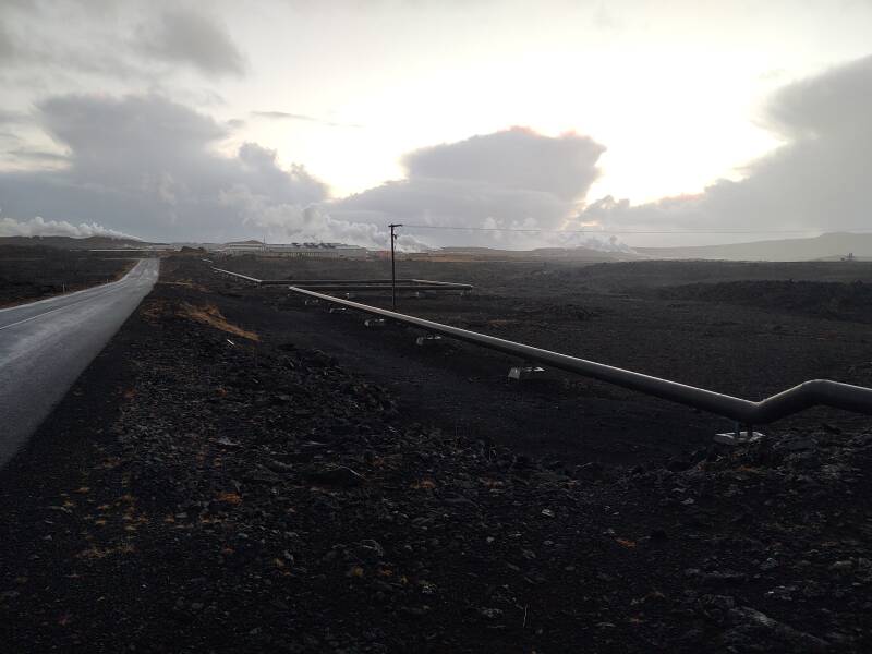
Steam and cooling water are distributed around the complex by large pipes, and hot water is sent off to heat homes. Click on the below map to see what's what.
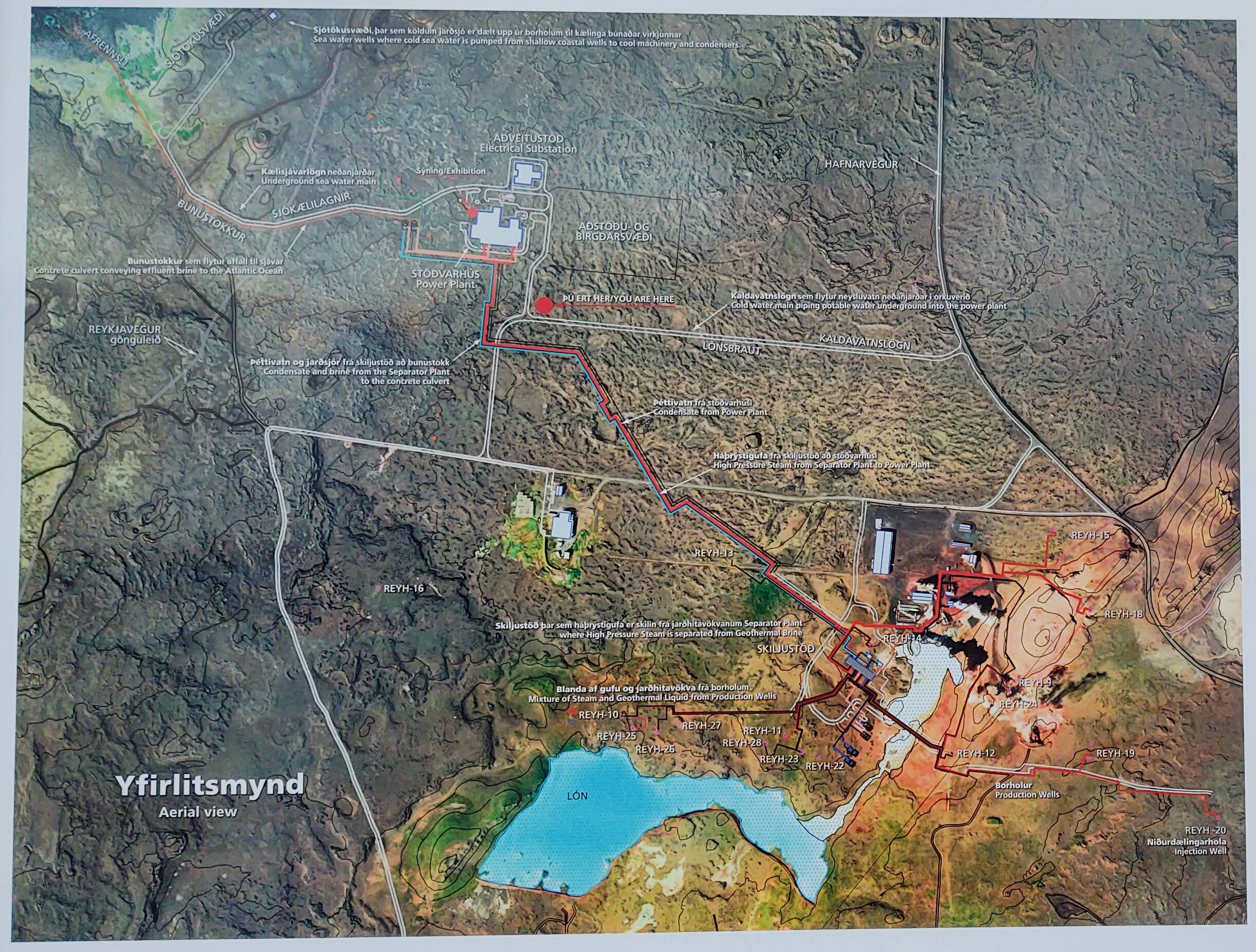
The result is that the overall plant generates 100 MW of electrical power, and 150 MW of thermal power to heat homes and water for the district.
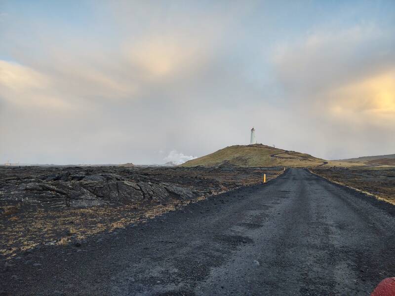
Reykjanes Lighthouse and the Reykjanestá Point
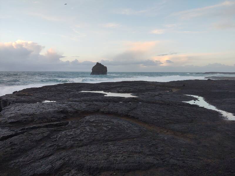
The lighthouse is at Reykjanestá, the tip of the peninsula.

The tip of the peninsula is made up of partially submarine volcanoes. Oh my, what could have torn asunder those large formations made of lava?
Ah, the raging sea. Given enough time, that will destroy anything.
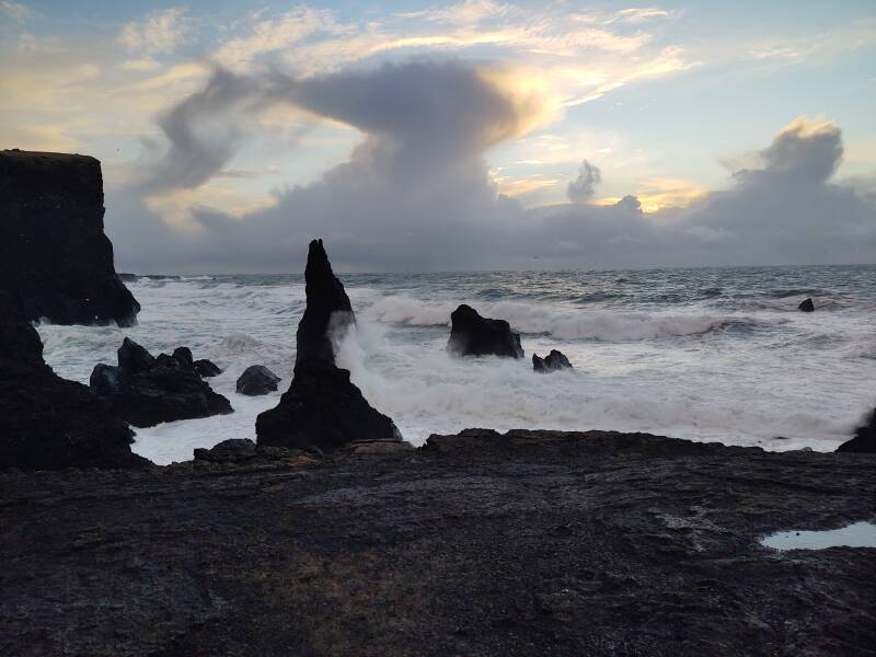
The large cliff is Valahnúkur. It and the waves are larger than they may seem at first.
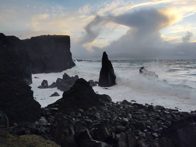
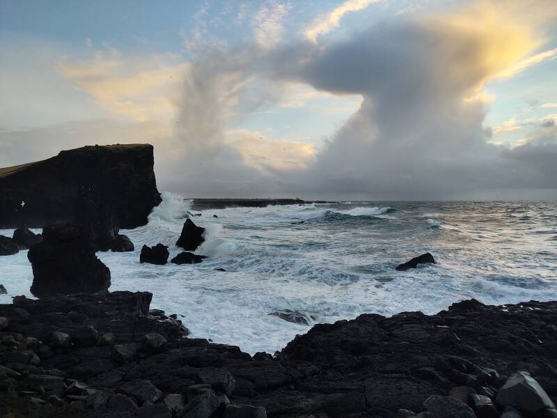
The island out there is Eldey, another mostly submerged volcano fragment.
Let's see it in motion! Turn up the audio for the full effect.
Note that this video is not in slow motion. This is normal speed video. It's hard to grasp the scale along the coast. The spray is very likely rising much higher than you think and then falling back down. You see it here flying up and falling down at normal speed. But it's rising and falling a greater distance, taking longer to do so. Big waves at normal speed.
I had already noticed the timing effect while driving along the coast. I would see shoreline in the distance and think, "Oh, it's just waves."
Then it would occur to me that they were moving at a strangely slow speed. Only then did I realize that what I was seeing was much further away than I thought.
Let's see one more video of the waves crashing into the coast, from a viewpoint a little further out along the point.
Grindavík
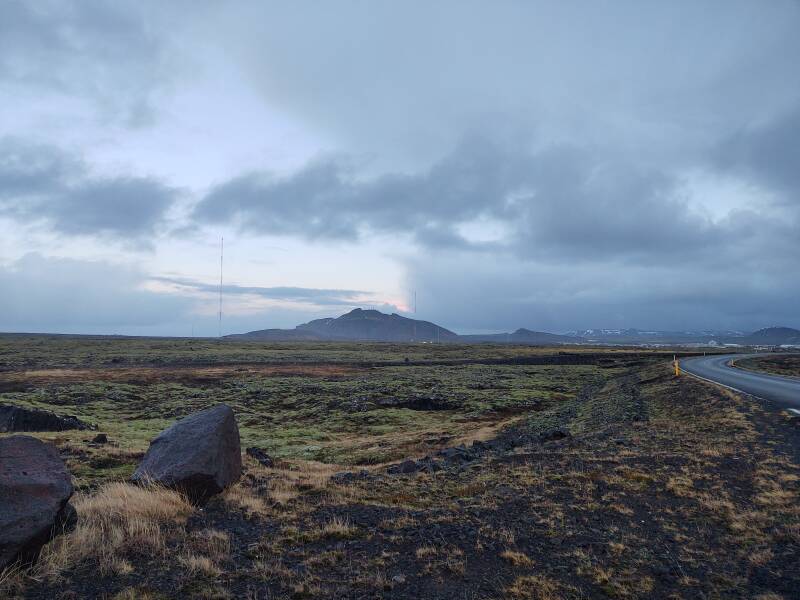
I continued counter-clockwise around the peninsula, following the south coast. Before long I was approaching Grindavík.
That's Mount Þorbjörn in the distance, and the town of Grindavík to the right. The "Blue Lagoon" thermal spa is around Þorbjörn to the left.
If by some odd chance you aren't interested in longwave radio propagation and large antennas, then by all means simply continue reading this page.
Longwave Radio at High LatitudesBut if you are interested, take a short detour because we're about to pass the Naval Radio Transmitter Facility Grindavík. Learn how a gigantic antenna can be electrically tiny.
There is more than one major geothermal plant on the small peninsula. Below is the Svartsengi power plant, a short distance north of Grindavík near the "Blue Lagoon" thermal spa. It generates 75 MW of electrical power and sends 150 MW of thermal power to more than 21,000 homes. It was the world's first geothermal power plant to produce both electricity and heated water for residents.
Another spin-off of this plant is a company that has developed a technology to produce renewable liquid transport fuel products from carbon dioxide, water, and electricity from a geothermal source. Carbon Recycling International plans to produce methanol from carbon dioxide plus hydrogen obtained from electrically-powered water electrolysis. The methanol would then be sold for use in internal combustion engines for ships, trucks, and light vehicles, or in methanol-powered fuel cells. A separate plant near this power station can produce 5 million liters of methanol per year.
Fagradalsfjall
Fagradalsfjall is a specific volcano within an area of lava fields and eruptive fissues that is also called Fagradalsfjall. The Fagradalsfjall volcano had been dormant for over 6,000 years. That changed in 2021.
A swarm of earthquakes in the region began in December, 2019, and continued into March, 2021. Two reached magnitude MW5.6. Something signficant was probably developing.
An effusive eruption, one in which lava steadily flows out, began on the evening of March 19th, 2021. A fissure vent from 600 to 700 meters long had opened and begun ejecting lava. More fissures opened in the following months.
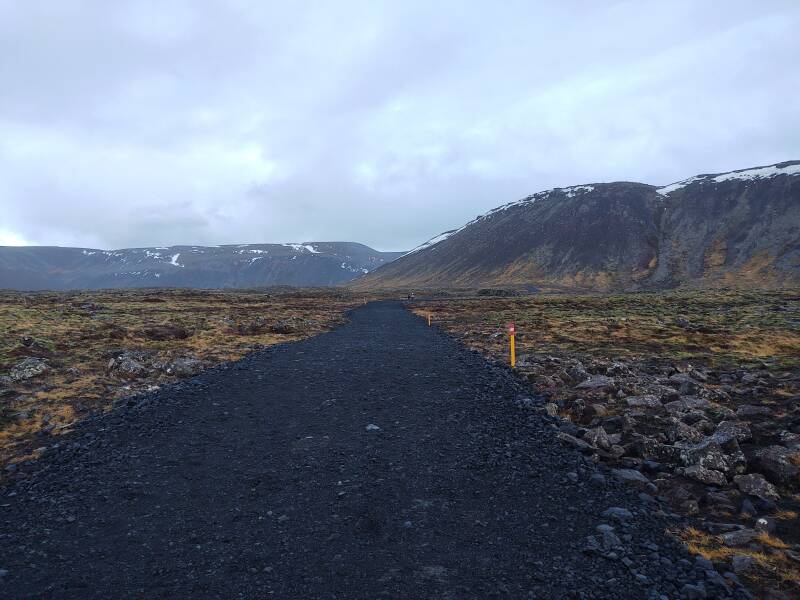
The volcano is east of Grindavík, and the erupting fissures are a short distance north of the #427 road. That road runs along the coast toward Eyrarbakki, which I would stay for the first three nights. There soon were multiple parking lots for the people driving down from Reykjavík to see up close what they could, at times, see from home.
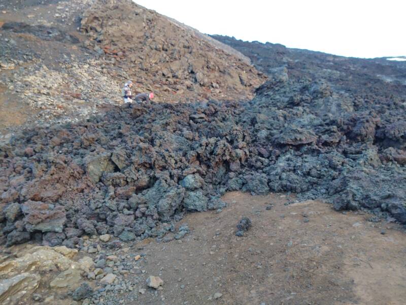
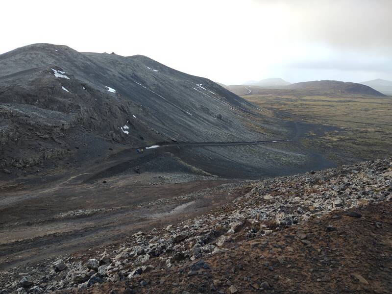
I have stopped and started walking to the viewing area. Looking straight ahead in this view, the ridge in the right half of the picture extends beyond the more distant ridge. The plan is that you walk back through the flat valley from the parking area, around the left end of the nearer ridge, and then follow that around to ascend to the notch just above the end of the near ridge.
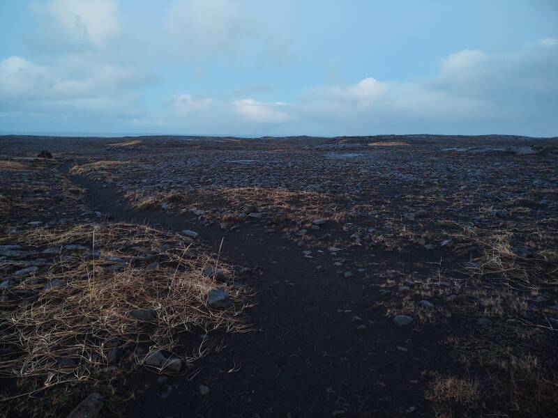
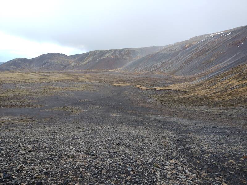
This area of Iceland is largely lava fields, so there's little harm using the abundant black lava gravel to make a new parking lot or foot path.
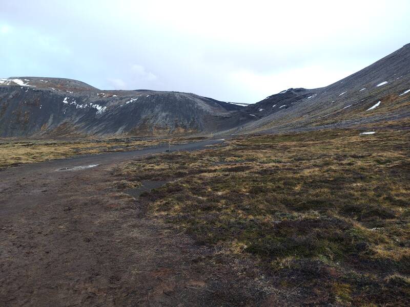
In the picture below I have gone around the end of the ridge closer to the road. Anyone's immediate goal is that lowest dip in the far ridge. That's about a 45-minute walk from the road.
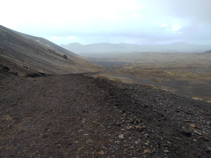
From there, if you want, a path goes up a series of switchbacks to the high point at the dip's left side, and then beyond that to the highest point toward the left edge of the picture. From that point you could see most all of the Fagradalsfjall complex.
I am continuing up the path toward that dip.
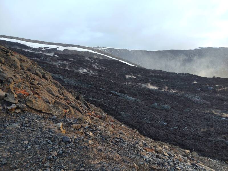
And now I have reached the edge of the lava flow! It didn't quite flow through that dip and down into the broad valley, but it came very close to that.
Climbing one or two of the switchbacks takes me to where I can see more of the lava flow. It is still hot underneath. The many steam vents show it's at least hot enough to boil water. But a cooled lava surface is a good insulator, and molten magma may not be far below.
Remember the danger of breaking through into a steam chamber at 100–150 °C, and consider how much worse 2000 °C magma would be. Don't do it unless your heirs really need the social media points.
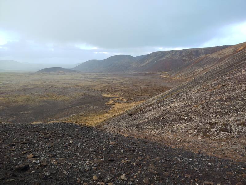
Another switchback lets me look down at where I took the first new-lava picture, that extension to the lower right. The sun is just barely above the distant ridge, I took this picture when the sun was about as high as it gets all day.
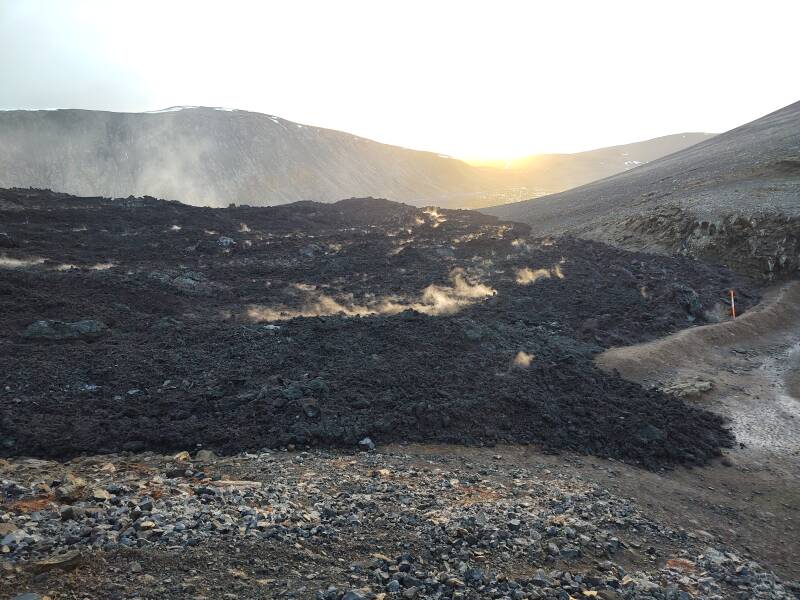
Iceland's time zone is UTC, although the country extends from about 14° to 23° west latitude. So, solar noon, midway between sunrise and sunset when the sun is at maximum elevation, will happen around 1300 local time in Iceland's far east to around 1330 in the west, where we are here. I took the above and below pictures at 1251 and 1253. It's pretty much mid-day at Fagradalsfjall.
Below, we can see some of the large lava flow in the valley beyond.
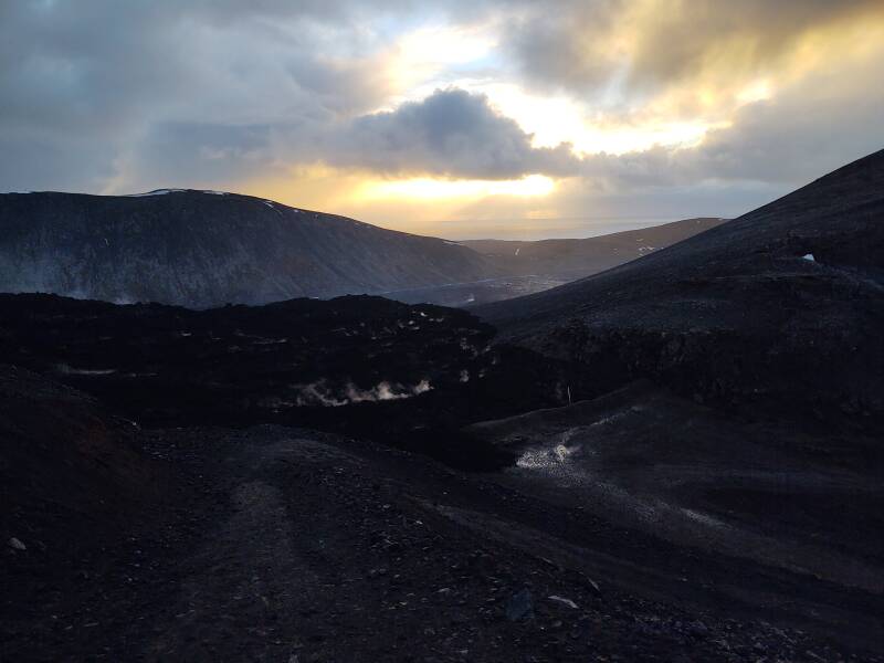
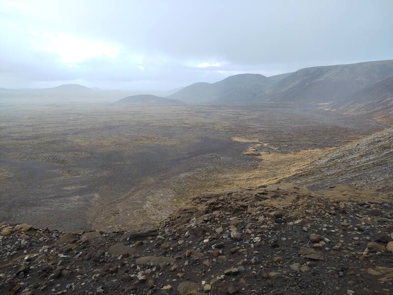
I was doing this in the early afternoon of the day that I had arrived on the overnight flight. I was getting very tired at this point, and started back down. That's OK, I can come back here at the end of the trip.
Having descended one of the switchbacks, I can see the path back down and to the road in the distance.
Descending from the edge of the furthest (at least so far...) lava flow.
I had plenty of driving to do in order to reach Eyrarbakki, where I would check into a guesthouse.
Visiting Eyrarbakki Before Continuing to Vík
So far I had covered a path of 117 kilometers, from Keflavík Airport via the southwest tip of the Keykjanes Peninsula and continuing to Eyrarbakki, where I stayed for three nights. But I had covered at least three times that distance during my three days. That trend would continue through the trip.
Next: Visiting Eyrarbakki Skipping ahead: On to VíkThe next page explores Eyrarbakki, a town much more involved in the Norse discovery of North America than most North Americans, certainly including me, realize.
My next overnight stop would be further east along the south coast in Vík. If you're anxious to jump ahead, you can.
as in this;
Þ/þ is unvoiced,
as in thick.